Basic concepts and terms on the topic: economic and social geography of the world, geographic information system, geographic map, cartographic generalization, statistics, GPS (Global Positional System).
Study plan of the topic(list of questions required for study):
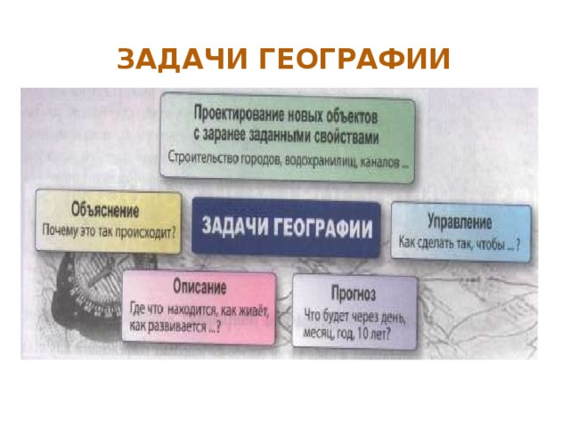
1. Geography as a science.
2. Traditional and new methods geographic research.
3. A geographic map is a special source of geographic
information.
4. Statistical materials as a source of geographic
information.
5. Other methods and forms of obtaining geographic information.
Geographic information systems.
Brief summary of theoretical questions:
1. Geography is a spatial discipline. This means that geographers are interested not only in the objects themselves, but also in how, where, and why these objects are placed in space. Economic and social geography of the world Is a social geography that studies territorial organization human society.
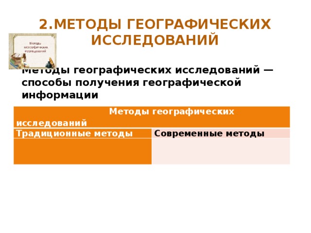
2. Obtaining geographic information has real practical value. The world around us today is permeated with a huge amount of information, transport, social and economic ties ignorance of which inevitably leads to your own isolation. Modern young professionals, getting into the global political or economic environment, must have a set of knowledge about the countries of the world, their culture and way of life. Geography uses different research methods: traditional- cartographic, sociological, statistical, mathematical, historical, comparative, modern- aerospace, geographic information, geographical forecast, etc.
3. Maps are the geographer's main toolkit. Maps exist for every type of information related to our planet (and not only). Geographic map (first city to. was established in Ancient Greece about 2500 years ago by the scientist Anaximander) - reduced mathematically defined, generalized, figurative-symbolic image of the Earth's surface on a plane, showing the location, state and
the relationship of natural and social phenomena. When decreasing
scale, there is a generalization of the objects on the map, their qualitative and quantitative characteristics. It helps here cartographic generalization- selection and generalization of objects and phenomena depicted on the map according to the purpose and scale of the map. To depict various objects on the map, a wide variety of cartographic image methods are used: methods of high-quality background, areas, movement signs, isolines, localized diagrams, icons, point. By content, the cards are divided into: general geographic and thematic... The first include topographic maps (M 1: 200,000 and larger), survey-topographic (M from 1: 200000 to 1: 1,000,000), survey (M smaller than 1: 1,000,000). All elements of topographic content ( settlements, individual buildings, roads, industrial, agricultural and socio-cultural objects, hydrography, relief, vegetation, etc..), i.e. everything that "lies" on the ground and can serve as a reference point. Unlike general geographic maps, thematic maps usually reveal one plot (soil, geological structure population, vegetation, etc.). All thematic maps are divided into two sections - maps of nature (physical-geographical, geological, climatic, etc.) and maps of social phenomena (political, population, historical, economic, etc.).
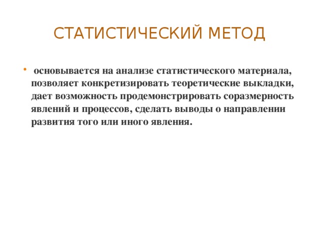
4. Statistical materials are one of the main sources of geographic information. Statistics Is a science that studies various phenomena and processes in order to take into account and identify the patterns of their development using statistical indicators. In the course of geographical research, statistics solves the following scientific tasks: collecting statistical data, processing the collected information, analyzing and interpreting data, presenting statistical information in text, tabular, graphical or cartographic form. Statistical information includes absolute and relative values, as well as various coefficients.
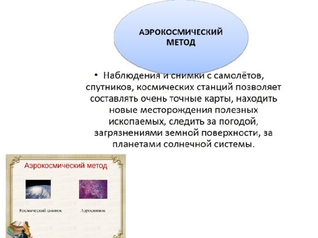
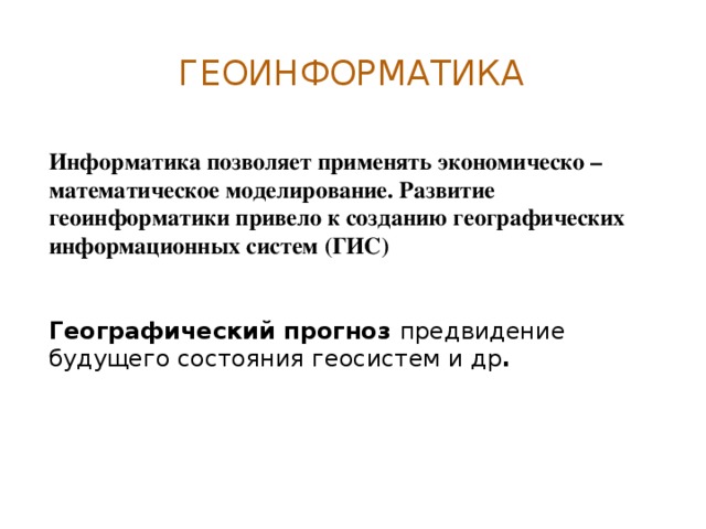
5. Modern sources of geographic information also include aerospace and geoinformation sources: aerial photography, space imagery, remote sensing, satellite monitoring. Modern satellite system for high-precision determination of the coordinates of static and moving objects is called GPS (Global Positional System). It is developed by the US Department of Defense. The project started in 1978 and the GPS was finally commissioned in 1995. A fundamentally new approach to working with spatial data is associated with the emergence Geographic Information Systems
10 (GIS) Is a hardware system for collecting, storing and processing spatial data. We can say that GIS is a complex computer program. GIS capabilities: quick search for necessary information, cartographic ability of GIS, the ability to model phenomena on earth surface.
Practical lesson not provided.
Questions for self-control
GEOGRAPHICAL LOCATION OF UKRAINE. SOURCES OF GEOGRAPHIC INFORMATION. GEOGRAPHICAL RESEARCH IN THE TERRITORY OF UKRAINE
Sources of geographical knowledge. Geographic Maps.
Geographic knowledge can be obtained from many sources. These are primarily geographical maps and printed publications (textbooks, manuals, reference books, encyclopedias, magazines and even fiction), multimedia sources (television and radio broadcasts, video films, computer media), museum exhibitions, personal observations, etc.
The most important source of geographical knowledge is the map.
Geographic maps give an idea of the earth's surface as a whole or its individual parts. Using maps, they solve scientific and practical tasks during geological and geographical research, planning and design of construction, in sea and air navigation, space flights, military affairs and many other areas of human life. Different types of maps have a certain feature, depending on the generalization - an unequal degree of image detail the globe... Electronic maps and atlases contain a very large amount of various information and allow you to visually compare it - these are maps that now help to develop geographical science. Currently, an electronic version of the atlas "A Look at Ukraine" (Institute of Advanced Technologies), an electronic series of maps "Human Development in Ukraine" (Institute of Geography of the National Academy of Sciences of Ukraine) have already been created, there are computer versions of textbooks on physical geography of Ukraine for high school and etc.
Topographic maps
Geographic maps that depict areas of the surface in detail are called topographic.
topographic maps are general geographic, and they are used to study a certain area, which they reflect with great accuracy. topographic maps are compiled in the conformal transverse-cylindrical Gaussian projection, calculated by the elements of the Krasovsky ellipsoid, and in the Baltic system of heights.
On the topographic maps ah displays the territory of the earth's surface, which is bounded in the west and east by meridians, in the north and south by parallels with known longitude and latitude. If the territory is large, the cards have a large number of letters (they are called bagato-arkushny); each of them reflects a small area of this territory, bounded by meridians and parallels. For example, a sheet of a topographic map at a scale of 1: 1,000,000 is limited by meridians, the distance between which is 6 °, and by parallels, the distance between which is 4 °. Thus, the surface of the globe is, as it were, dissected into a trapezoid with a base of 6 ° and a lateral edge of 4 °. In large-scale maps, the trapezoid sizes are smaller:
Scale 1: 100,000 is limited to 30 "in longitude and 20" in latitude;
The scale of 1: 25,000 is limited to 7 "30" in longitude and 5 "in latitude.
To determine the position of an object from a topographic map, you need to determine its latitude and longitude in the geographic coordinate system, as well as rectangular coordinates.
On the northern and southern reference frames of the trapezoid, minute divisions are plotted in longitude, and on the western and eastern sides - in latitude in the form of black and white segments,
which alternate. Each minute of longitude and latitude is divided by points into six parts, the distance between which corresponds to 10 "". Geographic coordinates on topographic map sheets are indicated in the corners of the frame.
The rectangular coordinate system on the topographic map is depicted by the lines of the kilometer grid. The horizontal grid lines are parallel to the projection of the equator on horizontal plane axes, and vertical lines parallel to the axial meridian are the x-axis. The outputs of the lines of the coordinate grid are written between the inner and min frames, which allows you to determine the rectangular coordinates of the points.
To determine directions, you need to remember the concept of azimuth. If the azimuth is measured with a compass on the ground, then it is the angle between the direction of the magnetic needle to the magnetic north pole and the object. This azimuth is called magnetic (A m). Since the magnetic needle of the compass does not point exactly to the geographic pole, an angle is formed between the meridian line and the direction of the magnetic needle, called magnetic declination (8). Each sheet of the topographic map shows the magnetic declination angle and its direction (west or east).
However, it is not possible to directly measure the magnetic azimuths behind the map, because it does not show which direction the magnetic compass needle will be on the imaging terrain. However, on the map, you can measure the angle between the geographical meridian and the direction to the terrain object. Angle measured from north direction the geographic meridian to the right before the direction to the local object is called the geographic, or true (real) azimuth (A). To measure the true azimuth, an additional meridian is drawn through the starting point of the direction that is determined. Next, a line is drawn directed to the object, and with the help of a protractor, its true azimuth is established.
The relationship between the true and magnetic azimuth is affected by the formula.
Directions are also determined using directional angles.
Directional (D) are the angles formed between the north direction of the vertical grid line and the direction to the object.
The length of the lines between two points on the map can be determined with varying accuracy using numerical, linear scales and using a curvimeter. Numerical and linear scales are used to measure distances along a straight line or along line segments. To measure distances along curved lines, it is more convenient to use a curvimeter.
The altitude position of points on the earth's surface is reflected by contours, which are drawn through the corresponding section height, depending on the scale of the map and the nature of the terrain, and additionally by the absolute marks of the points. If the point whose height you want to determine is located on the horizontal, its absolute height is equal to the value of this horizontal. If the point is between the contours, then its height value is determined approximately by drawing up the corresponding projection.
1 ... Geographic research methods and main sources of geographic information.
Geography is an ancient science that originated at the dawn of the development of human society. The first geographical representations were based on the simplest method still in use today - the method visual observations.
In the process of development of geographical science, many types of observations were formed: route and area, continuous and periodic, stationary and remote, etc.
These methods allow you to obtain important information about geographic objects, their properties, changes under the influence of various factors.
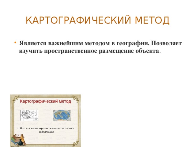
The main language of geography, the source of geographic information has been and remains geographic maps The role of maps and cartographic method in the knowledge of the world it is difficult to overestimate.
The cartographic method makes it possible to study the patterns of spatial distribution and development of territorial complexes by compiling and using geographical maps.
The development of geography has fundamentally changed the appearance of the map. The oldest board cards were replaced by images on skins, wood, and clay products. Then came handwritten paper maps, later printed engravings, and now electronic video images and their color copies. The emergence and development of electronic technology made it possible to create geographic information systems.
Such systems use extensive statistical material, receive data from satellites and numerous weather stations. Geographic information systems include databanks containing reports on the results of the work of many research teams.
In the 20th century, geography began to play an important role aerospace techniques. They make it possible to explore and map the earth's surface using aircraft or spacecraft. Aerospace methods include photographic, electronic, geophysical and visual methods.
A special method of geographical research is modeling, that is, the study of the development of geographical objects, processes and phenomena by creating their models. Modeling is subdivided into graphic, mathematical and machine.
When using all methods of geographical research important point is the application of a historical approach. Studying the past states of the object and comparing them with current state allow to explain its specific properties.
Conducting geographical research may also require comparing the state and properties of various geographical objects, identifying the similarities and differences in geographic envelope processes. The comparative approach makes it possible to draw up classifications of processes and objects and make a forecast of their changes.
The main sources of geographic information for schoolchildren are geography textbooks, geographic atlases and maps, dictionaries, and encyclopedias. Additional information can be obtained using geographical descriptions contained in books, magazines, films and videos.
2. Scientists claim that Antarctica is rich in minerals, however natural features this continent make it difficult to develop. What are these features? How does the level of development of science and technology affect the possibilities of using the wealth of Antarctica?
Antarctica is covered with a thick layer of continental glaciers. The average thickness of the ice sheet is 2 km. Most of Antarctica lies below sea level. Extremely harsh climatic conditions: very coldy, strong winds carrying hard snow, polar night and polar day. Ice shelves give birth to icebergs that are dangerous to ships. According to the international agreement, the minerals of Antarctica are not subject to exploitation. But the main wealth of Antarctica is huge reserves of fresh water of excellent quality. There are projects for transporting icebergs to the shores of the arid countries of Asia using tugs. It is assumed that the iceberg will be covered with a special film that prevents intense melting and, despite significant losses of the original volume, the iceberg delivered to the site will melt for a whole year, giving fresh water.
3. Identify the factors that influenced the location of ferrous metallurgy enterprises on the map (at the teacher's choice). Including the Vologda region.
When placing a metallurgical plant in Cherepovets, the following were taken into account:
1) position on freight traffic iron ore(from Karelia and the Murmansk region) and coking coal (from the Pechora basin)
2) proximity of the consumer - metal-intensive production facilities in St. Petersburg, Moscow, cities - centers of the automotive industry on the Volga
3) convenient transport position: Railway, highway, Volga-Baltic waterway
4) the presence of a water source - Rybinsk reservoir
5) skills of the population: the production of cast iron from bog iron ore (Ustyuzhna Zhelezopolskaya - residents of Ustyuzhna mined bog ore and smelted cast iron from it)
Lesson number 1
Topic: Introduction. Sources of geographic information.
Study Questions
1. Economic and social geography as a science.
2. Traditional and new methods of geographical research.
3. Types of geographic information, its role and use in people's lives.
5. Geographic map is a special source of information about reality. Statistical materials. Other ways and forms of obtaining geographic information: the use of space images, modeling.
1. Economic and social geography as a science, its place in the system of geographical sciences.
Geography is one of the oldest sciences on Earth and occupies an honorable place among the favorite school disciplines. The course of economic and social geography of the world is the final stage in the study of geography in the framework of the school curriculum. The subject of the study of economic and social geography is the study economic development and population distribution in the world as a whole, in certain regions and countries. Economic geography combines elements of geography, economics and sociology; it widely uses not only economic, but also sociological research methods. You know that sociology is the science of society and human behavior, and economic and social inequality are closely related, so you cannot consider an economy without people - the main productive force, without the human factor. Thus, putting the person in the spotlight, economical geography intermarried with social geography. The main direction of the current stage of development is the strengthening of the social, political, environmental orientation of the study. The main direction is the rational use and transformation of the natural environment. Long-term development of geography has led to the deepening of its internal differentiation. In economic geography: the geography of the population, agricultural industry, transport, services and services. Nowadays, geography from a descriptive and cognitive science has turned into a science of a constructive nature.
V modern geography various methods of geographical research are known. The most popular are traditional geographical research methods:
I. Traditional methods -
a) descriptive - the study and description of any territory is carried out according to a specific plan. The description can be either single-element (when only one component is considered, for example, a hydrological network, relief, landscapes), or complex (when territorial complex completely: nature - population - economy).
b) comparative- comparative analysis is often used in the study of various territories and geographic objects. Research objects can be located close to each other (for example, the coast of the Black and Azov seas) or be deleted (for example, mountain systems areas of Cenozoic folding in South America and Europe) and similar features are analyzed. As a result, elements of similarity and difference are highlighted and appropriate conclusions are drawn.
c) cartographic- for the study area, special maps or series of thematic maps are created in order to understand any phenomenon. With the help of pre-developed certain conventional signs, certain elements of the territory under consideration (relief, climate elements, landscapes, etc.) are applied to the cartographic basis. The cartographic method is usually used with other research methods: interpretation of aerial photographs, mathematical, etc.
d) retrospective (historical approach). The study of any geographical object, territory: its landscapes, its individual components, natural and social phenomena - is considered in time, which allows us to make a forecast for the future.
e) typological - According to the selected criteria, reference sites (key) in the study area are allocated in order to further disseminate the findings to other areas.
II.Modern methods of geographical research:
a) Geographic forecast- foreseeing the future state of geosystems. b) Geoinformatics. We live in an era of "information explosion", when the volume scientific knowledge and the number of sources of information is growing very quickly. Informatics allows the use of economic and mathematical modeling. The development of geoinformatics has led to the creation Geo-Information Systems (GIS). GIS is an information system that provides collection, storage, processing, analysis and display of spatial data and related nonspatial data, as well as obtaining information and knowledge about geographic space on their basis.
Geographic or spatial data are believed to account for more than half of all circulating information used by organizations involved in different kinds activities in which it is necessary to take into account the spatial distribution of objects. GIS is focused on ensuring the possibility of making optimal management decisions based on the analysis of spatial data.
The introduction of GIS technologies into geography has affected many industries, primarily pictography. (Example: world electronic maps have already been created, differing in nature and language. National electronic atlases: USA, Canada, Japan, Sweden, China, etc.)
c) Space research methods our planet, these are climatic and space resources- resources of the future.
Types of geographic information
Geographic information (GI) includes any information related to objects, phenomena and processes localized in a geographic space. A significant proportion of geographic information is found in sources that are not maps. Examples of this are addresses in phone books, road kilometer signs in incident reports, names of places in gazetteer, internet portals. The completeness of the information presented in cartographic works is determined by the totality of map sheets with relatively simple themes - thematic cartographic layers tied to one base map. For the depiction of various objects, there is a special system of geographic symbols. Let's consider the most used ones:
Linear signs- borders, roads, rivers, etc. ... Isolines- connection of points with the same parameters (isobars - Atmosphere pressure, isotherms t 0 of air) Areals- Areas of occurrence of certain phenomena. Traffic signs- these are traffic flows, sea currents, winds, etc. Quality background- used to display national and religious composition (no quantitative indicators) Cartogram- different intensity of phenomena within territorial units. Cartodiagram- a map with a certain territorial division and diagrammatic figures corresponding to these divisions. Schematic map- a schematic map that does not have an exact basis (route map for travel, etc.) Data for mapping is currently obtained via satellites. Thus, there is a real opportunity to present geographic information of any volume and complexity, and for the life of people, the role of the GI is enormous. This is the most accurate and prompt receipt of information about the weather forecast, the degree of development of various emergencies, as well as obtaining special information, for example, the thickness of the snow cover (this is important for agriculture), the degree of coverage of cereal crops by insect pests, the degree of aridity of the region, the degree of deforestation. plantings, etc.
Sources of geographic information.
1. Maps, atlases, topographic plans.
2. Geographic descriptions different territories.
3. Encyclopedias, reference books, statistical materials, etc.
4. Space and aerial photographs.
5. Geographic information systems (GIS). At present, all the listed sources of information can be digitized and converted from paper to electronic form, an example of GIS.
A geographic map is a special source of information about reality.
General geographic maps display various elements of the earth's surface - relief, vegetation, rivers, settlements, transport networks, etc.
Thematic maps characterize geographic objects and phenomena on a specific topic: vegetation, relief, industry.
For example, a political map will first of all give an idea of the location of countries, their borders, etc.
Home assignment:
1. Show on a contour map parts of the world and continents.
2. Indicate the role of economic and social geography as a science, its place in the system of geographical sciences.
3. Define the types of geographic information, its role and use in people's lives.
4. Geographic information systems as a means of obtaining, processing and presenting spatially coordinated geographic data.
5. Study the geographic map as a special source of information about reality and statistics. Explore the features of the legend (legend) at political map the world. Indicate other ways and forms of obtaining geographic information: the use of space images, modeling.
Independent work
Lesson number 2 A political map of the World
Study Questions
1. Countries on the modern political map of the world. Their grouping by area, population, elements of the political map of the world.
2. Quantitative and qualitative changes on the world map.
3. The main periods of the formation of the political map of the world.
4. Typology of the countries of the world. Political system... Forms of government.
The political map of the world is a geographical map that reflects country the world , as well as form of government andstate structure. The political map of the world reflects the main political and geographical changes: the formation of new independent states, a change in their status, the merger and division of states, the loss or acquisition of sovereignty, a change in the area of states, the replacement of their capitals, a change in the name of states and capitals, a change in the forms of government and the form of state devices. The political map of the world has characteristic elements by which it can be determined, this is
State borders
Territories with international regime
Mixed territories
Sovereign states
Non-Self-Governing Territories
Forms of government
What is customary to designate in the economic geography of the world by the terms: State, Country, Territory? The concept of the state means primarily political system power established in a certain territory, while the concept of a country rather refers to cultural, general geographic (community of territory) and other factors. The concept of a country is less formal than that of a state. Territory or Trust Territories- dependent territories included as a result of the Second World War in the UN International Trusteeship System. These are mainly colonies of Germany and its allies in Africa (Cameroon, Rwanda, Burundi, Somalia, Tanzania, South-West Africa) and islands in Pacific(Western Samoa, Nauru, New Guinea, Mariana, Marshall and Caroline) with a population of about 20 million people. They were managed by the former colonial powers - Great Britain, Belgium, France, by agreement with the UN and under the control of its Trusteeship Council. By 1997, almost all territories had become independent states. Before modern states were formed on the planet, there was a long period of formation of the political map of the world.
The main periods of the formation of the political map of the world
1. Ancient period (up to the 5th century AD)
2. Medieval period (V-XV centuries)
3. New period (the turn of the XV-XVI centuries - 1914)
4. The newest period (from 1914 to the present)
First stage (from 1914 to 1945)
Second stage (1945-1990)
Third stage (from 1990 to the present)
According to various sources (November 2015), there are 230 territories in the world, including:
193 independent states (recognized by the UN)
14 unrecognized states
3 territories with undefined status
1 quasi-state formation Order of Malta - has observer status at the UN.)
62 dependent territories
The process of birth and disappearance of states is endless, this process is called changes on the political map of the world. Changes on the political map are quantitative(the accession of newly discovered lands to the state, territorial gains and losses after wars, the unification or disintegration of states, the exchange of land by states, etc.) and quality(the acquisition of sovereignty, a change in the form of government and state structure, the formation of interstate unions, etc.). At present, quantitative changes are decreasing and mainly qualitative changes are taking place on the political map of the world.
Currently, taking into account the level and nature of the socio-economic and political development, allocate the following groups of countries in the world:
Countries of the world are grouped according to different criteria
... For example, sovereign, independent countries and dependent countries and territories are distinguished. Dependent countries and territories can have different names: possessions - the term "colonies" has not been used since 1971 (there are very few of them left), overseas departments and territories, self-governing territories. Thus, Gibraltar is a British possession; Guiana country in South America- Department of France; the island country of Puerto Rico has been declared a "freely acceding state to the United States."
Grouping of countries by territory size:
VERY LARGE COUNTRIES: (territory over 3 million sq. km): Russia (17.1 million sq. km), Canada (10 million sq. km), China (9.6 million sq. km), USA (9.4 million sq. km), Brazil (8.5 million sq. km), Australia (7.7 million sq. km), India (3.3 million sq. km)
MICROSTATE: Andorra, Liechtenstein, Monaco, San Marino, Vatican. These also include Singapore and island states Caribbean and Oceania.
COUNTRIES BY POPULATION:
In terms of population, the 10 largest countries of the world are distinguished: China (1318 million people), India (1132 million people), USA (302 million people), Indonesia (232 million people), Brazil (189 million people). people), Pakistan (169 million people), Bangladesh (149 million people), Russia (146 million people from the Crimea River Nigeria (144 million people), Japan (128 million people) (data for 2014-2015)
THE SMALLEST IN POPULATION IN THE COUNTRY - microstates. The Vatican, for example, has a population of 1,000.
ECONOMICALLY HIGHLY DEVELOPED STATES A are distinguished by a mature level of development of market relations. Their role is great in world politics and economy; they have a powerful scientific and technological potential. They differ from each other in the scale and level of economic development, in the size of the population. USA, UK, Japan, etc.
POOR COUNTRIES - Primarily former colonies, who, having received political independence, fell into economic dependence on their former metropolises. These are most of the countries of sub-Saharan Africa, countries such as Angola, Ghana, Zambia, as well as the Asian countries of Afghanistan, Bangladesh, etc. They are very far behind the developed world in all major socio-economic indicators. (see the list at the end of the topic)
State forms of government.
The form of government characterizes the organization of government, the system of higher government bodies. There are two forms of government: republican and monarchist – a form of government in which the highest legislative power belongs to an elected representative body, parliament, and executive power belongs to the government. Republics are subdivided into parliamentary and presidential. V presidential republics, the president is endowed with very large rights, he himself heads the government. (USA, Iran, Argentina, etc.) V parliamentary the main figure is the head of government. (Germany, Italy, Israel, etc.) Monarchical form of government - power under which the head of state is the monarch. This supreme power is inherited. Monarchies are subdivided into absolute, constitutional, theocratic .
Absolute monarchy - the power of the monarch is practically not limited (Bhutan, Oman, UAE, Qatar, Bahrain, Kuwait, etc.)
Theocratic monarchy - the monarch simultaneously represents secular and spiritual power. (Vatican, Saudi Arabia, Bahrain).
A constitutional monarchy - the power of the monarch is limited by parliament. On the modern political map, 30 countries of the world have a monarchical form of government.
Forms of administrative-territorial structure
Countries subdivided to unitary (under which there is a single legislative and executive branch in the country ). Federated - in which, along with uniform laws, there are separate self-governing territorial units with their own legislative, executive and judicial authorities.
Home assignment:
1.Give brief description states (of their own choice in any form).
2. Using reference materials, maps, fill in the table, marking the countries
the world with a federal administrative-territorial structure. Explain what
is the difference between unitary and federal forms of administrative
territorial structure.
Lesson number 3
Topic: Typology of the countries of the world. Political system. Forms of government.
Study Questions
1.Country differences modern world by the size of the territory, population size, characteristics of the population, peculiarities of geographic location.
2.Types of countries. Economically developed and developing countries (main; highly developed countries Western Europe; countries of resettlement type; key countries; countries of outwardly oriented development; new industrial countries and other groups).
3. UN and its main structural units
The political map of the world is represented by individual countries and regions. For a complete study of the country, it is customary to consider it from different points of view: by the size of the territory, geographic location, the nature of the social system, the level of socio-economic development, historical and geographical areas, etc. GDP is used to rank countries by socio-economic development. Gross Domestic Product is one of the great inventions of the twentieth century, almost equal in value to the automobile. GDP is the sum of all benefits produced on the territory of a given country for a year, and GROSS NATIONAL PRODUCT (GNP) is the volume of benefits produced according to the national principle: GDP minus profits of foreign companies transferred abroad and wages foreign workers, plus similar income from abroad. Countries around the world use different methods for calculating GDP and GNP, therefore, the data provided by national statistics and international ones are almost always different. In order to ensure the possibility of cross-country comparisons, in international statistics, data on GDP is given in a single monetary measurement - US dollars. They are calculated by UN experts using special methods - at official exchange rates or at purchasing power parities. Therefore, these data, depending on the calculation method, differ significantly from each other.
There is a classification adopted by the UN - the division of the countries of the world into "industrialized", "developing" and countries with a "centralized planned economy". But at the same time, this division unites into one group extremely different countries... It is obvious that such countries as, for example, the USA and Switzerland, classified as "economically developed countries", or Kuwait and Papua New Guinea (included in the developing group) have, of course, common features, but even more differences between them. The group of industrialized countries includes about 30 countries. They are distinguished by a high level of economic development, the predominance of manufacturing and service industries in GDP, high quality and the standard of living of the population. These countries create the bulk of the world's industrial production... They account for more than 70% of the world foreign trade turnover, including about 90% of exports of machinery and equipment.
The economically developed countries include about 60 countries in Europe, Asia, North America, Australia and Oceania. All of them are characterized by more high level economic and social development and, accordingly, GDP per capita. However, this group of countries is characterized by rather significant internal heterogeneity and four subgroups can be distinguished in its composition.
G7 countries "Big Seven" (GDP per capita 20-30 thousand dollars) - Japan, USA, Germany, France, Great Britain, Italy, Canada.
Privileged highly developed countries of Western Europe: Belgium, Switzerland, Austria, Sweden, Norway, etc.
Countries of "resettlement" capitalism: Canada, Australia, New Zealand, South Africa, Israel.
Countries Nafta USA, Canada, Mexico.
"IMF" among the developed countries includes Western Europe, including the EU. The unification of the EU raises a lot of controversy, the second and third wave of countries that joined the EU gives rise to a lot of doubts. Simply put, all countries in the European Union, although they are independent, are subject to the same rules: they have the same rules for education, medical care, pension, judicial system, etc. In a word, the laws of the European Union apply in all countries of the European Union.
For 2013:, there are 28 countries in the European Union.
- Austria (1995)
- Belgium (1957)
- Bulgaria (2007)
- UK (1973)
- Hungary (2004)
- Germany (1957)
- Greece (1981)
- Denmark (1973)
- Ireland (1973)
- Spain (1986)
- Italy (1957)
- Cyprus (2004)
- Latvia (2004)
- Lithuania (2004)
- Luxembourg (1957)
- Malta (2004)
- Netherlands (1957)
- Poland (2004)
- Slovakia (2004)
- Slovenia (2004)
- Portugal (1986)
- Romania (2007)
- Finland (1995)
- France (1957)
- Croatia (2013)
- Czech Republic (2004)
- Sweden (1995)
- Estonia (2004)
Iceland candidates
- Macedonia
- Serbia
- Turkey
- Montenegro
All of them are members of the Organization for Economic Cooperation and Development (OECD).
The developing country group includes the largest number of states in the world (about 150). These countries are extremely different - this group includes Brazil and Tuvalu, India and South Korea, Somalia and Burkina Faso, etc. However, they all share such common features of socio-economic development as: the colonial past, which predetermined territorial structure and mainly agricultural and raw material specialization of the economy.
Features of participation in international division labor; unequal position in the world economy, dependence on foreign capital; huge external debt; the presence of the most acute problems - demographic, environmental and food, as well as the low standard of living of most of the population and others. Nevertheless, among the developing countries there are countries and territories that, in terms of socio-economic development, have already approached the level of industrialized ones. Let's take a closer look at large economic associations:
1. Countries with economies in transition (post-socialist) and socialist countries. This group includes the countries Center, and Vost. Europe (including all republics the former USSR) and Mongolia are "countries with economies in transition"; as well as socialist countries - Cuba, China,
2. Key countries: Mexico, Argentina, India, China, Brazil
3. " Newly industrialized countries or "Yellow Tigers": Singapore, Taiwan and the Republic of Korea, as well as R / V "second wave" - Malaysia, Thailand, Indonesia, Xianggang, Taiwan. Their economic indicators basically correspond to the indicators of industrialized countries, but there are also features inherent in all developing countries.
4. " Oil exporting countries» or OPEC ( Saudi Arabia, Kuwait, UAE Algeria, Venezuela, Gabon, Indonesia, Iraq, Iran, Qatar, Libya, Nigeria, Ecuador)
5. The BRICS countries Brazil, Russia, India, China, South Africa.
6. SCO Shanghai Cooperation Organization
SCO member states
Kazakhstan
Kyrgyzstan
Tajikistan
Uzbekistan
Poor countries- Mostly former colonies, which, having received political independence, fell into economic dependence on their former metropolises. These are most of the countries in sub-Saharan Africa, countries such as Angola, Ghana, Zambia. As well as the Asian countries Afghanistan, Bangladesh, etc. They are very far behind the developed world in all major socio-economic indicators.
Poor country GDP per capita (2015 data)
1 Malawi $ 226.50
2 Burundi $ 267.10
3 Central African Republic $ 333.20
4 Niger $ 415.40
5 Liberia $ 454.30
6 Madagascar $ 463.00
7 Congo $ 484.20
8 Gambia $ 488.60
9 Ethiopia $ 505.00
10 Guinea $ 523.10
UN structure.
For self-study:
World typology:
“Typology of countries is the identification of groups of countries of the world that are similar in level, nature and type of socio-economic and historical development.
The first step in any typology is classification of countries by a set of demographic, economic, social and other indicators of development.
Second phase identification of typological characteristics of countries with a similar level of development and their grouping. The typologies of developing countries are widely known: Bolotin B.M., Sheinis V.L., Velsky V.V., Mashbitsky Y. G. and other geographers and economists http://rgo.ru/geography/econom_geography/slovar/tipols1.
Country, state - the main object of the political map of the world. The total number of countries on this map during the XX century. increased markedly. Firstly, as a result of changes associated with the results of the First World War. Secondly, as a result of the changes that followed the Second World War, which resulted in the collapse of colonial system imperialism, when during 1945 - 1993. 102 countries achieved political independence. Third, at the beginning of the 90s. as a result of the decay Soviet Union, Yugoslavia, Czechoslovakia. There are about 230 countries on the modern political map. This quantitative growth is followed by important qualitative shifts. This is manifested in the fact that out of 230 states, 193 are sovereign states. The rest falls on the so-called Non-Self-Governing Territories.
With such a large number of countries, it becomes necessary to group them, which is carried out primarily on the basis of different quantitative criteria. The most common grouping of countries according to the size of their territory and population. The grouping of countries according to the peculiarities of their geographic location is often used. Grouping of countries by size of territory - the most big countries(territory more than 3 million km 2) These include states different regions... Half of the dozen participants, delegated New World, four countries are located in Eurasia, one in Africa. Moreover, only Russia can be considered a European country. 2. Grouping by the prevalence of the means of communication. The most spoken language in largest countries world - English. It is spoken in the USA, Canada, Australia and a little in India. The Russian language is widely used in Russia and Kazakhstan. The top ten is dominated by multinational countries. The country with the most variegated ethnic composition- India. More than 500 peoples, nationalities and tribes live here. Many ethnic groups live on the territory of Sudan, Russia, Canada, Kazakhstan, China, and the USA. But the populations of Argentina, Brazil and Australia mostly belong to the same ethnic group. 2. Grouping according to the state system, forms of government and the administrative-territorial structure of the countries of the world. The countries of the world also differ in forms of government and in the forms of territorial-state structure. Allocate two main forms government: a republic where the legislature usually belongs to parliament and the executive to the government. Another form is the monarchy, where power belongs to the monarch and is inherited. Most countries in the world have a republican form of government. In the republics, the highest state power belongs to an elected representative body; the head of state is elected by the population of the country. There are presidential republics, where the president heads the government and has great powers (USA, Guinea, Argentina, etc.) and parliamentary republics, where the role of the president is less, and the head of the executive branch is the prime minister appointed by the president. There are currently 30 monarchies. Among the monarchies are constitutional and absolute. Under a constitutional monarchy, the power of the monarch is limited by the constitution and the activities of the parliament: the real legislative power usually belongs to the parliament, and the executive power belongs to the government. At the same time, the monarch “reigns, but does not rule,” although his political influence is quite large. Such monarchies include Great Britain, the Netherlands, Spain, Japan, etc. Under an absolute monarchy, the ruler's power is not limited by anything. There are only six states with this form of government in the world now: Brunei, Qatar, Oman, Saudi Arabia, the United Arab Emirates, the Vatican. The so-called theocratic monarchies are especially distinguished, that is, countries where the head of state is at the same time its religious head (Vatican and Saudi Arabia). There are countries that have a specific form of government. These include the states that are part of the so-called Commonwealth (until 1947 it was called " British Commonwealth nations "). The Commonwealth is an association of countries that includes Great Britain and many of its former colonies, dominions and dependent territories (50 states in total). It was originally created by Great Britain to preserve its economic and military-political positions in the territories and countries that previously belonged to. In 16 countries of the Commonwealth, the head of state is formally considered the British queen. "The largest of them are Canada, Australia, New Zealand. In them, the head of state is the Queen of Great Britain, represented by the governor-general, and the legislature is parliament. 3. By the forms of government distinguish between unitary and federal countries. unitary state there is a single constitution, a single executive and legislative branch, and the administrative-territorial units are endowed with minor powers and are directly subordinate to the central government (France, Hungary). In a federal state, along with uniform laws and authorities, there are other state formations - republics, states, provinces, etc., in which their own laws are adopted, they have their own authorities, that is, the members of the federation have a certain political and economic independence. But their activities should not contradict federal laws (India, Russia, USA). Most of the countries of the world are unitary, there are now a little more than 20 federal states in the world. The federal form of the state is characteristic both for multinational (Pakistan, Russia) countries, and for countries with a relatively homogeneous national composition population (Germany). 4. By the world's population by population China, India, USA, Indonesia, Brazil, and Pakistan Russia.
4. By geographic location.
Seaside countries;
Peninsular;
Island;
Archipelagic countries;
Inland countries. In other words, when countries are grouped by geographic location, landlocked countries (Chad, Mongolia, Kyrgyzstan, Slovakia, etc. - only 42 countries in the world) and coastal (India, Colombia) are usually distinguished. Among the coastal ones, there are island (Sri Lanka), peninsular (Spain) and archipelagic countries (Japan, Indonesia) "about the grouping of countries into subgroups and by their role in the world economy.
Until the early 90s. all countries of the world were subdivided into three types: socialist, developed capitalist and developing. After the actual collapse of the world socialist system, this typology was replaced by others. One of them, also three-member, divides all countries of the world into economically developed, developing and countries with economies in transition, i.e. carrying out the transition from a centrally planned to a market economy. A two-term typology is widely used with the division of all countries into economically developed and developing ones. The main criterion for this typology is the level of socio-economic development of the state, expressed through the indicator of gross domestic product per capita.
Lesson number 4
Questions for preparation:
1. What is customary to designate in the economic geography of the world by the terms: State, Country, Territory?
2. Countries on the modern political map of the world.
3. To orientate yourself and know the main periods of the formation of the political map of the world
4. Know the number of countries on the political map of the world.
5. Quantitative and qualitative changes on the world map.
6. Grouping of countries according to various characteristics and characteristics.
7. Typology of the countries of the world. Political system. Forms of government.
8. Forms of administrative-territorial structure
9.Historical and geographical regions of the world
10. Understand the abbreviation of GDP and CWP
11.Ument to find economically developed countries on the map.
12. Know the states that are members of the European Union
13. Know the states included in the G7 Political Club, Privileged highly developed countries of Western Europe, Countries of "resettlement" capitalism,
Geography as a Science. Its role and significance in the system of sciences. The goals and objectives of geography in the acquisition of open source software. Geographic research methods. Sources of geographic information.
"Initial testing on the economic and social geography of Russia"
Initial testing in the economic geography of Russia
| Countries with land borders with Russia: | 1.Sweden. 2 Norway 3 Lithuania 4 Mongolia 5 Finland 6 Armenia 7 China 8 Belarus 9 Turkmenistan |
|
| A city of Russia with a population of over 1 million people: | 1.Murmansk 2 Nizhny Novgorod 3 Magadan 4 Sochi 5 Serpukhov 6 Kiev 7 Orel 8 Yuzhno-Sakhalinsk 9 Minsk |
|
| The largest basin in terms of volumes of coking coal in Russia: | 1Kansko-Achinsky 2 Kuznetsky 3 Moscow Region 4 Donetsk |
|
| Ferrous metallurgy center full cycle in Russia: | 1Murmansk 2 Saint Petersburg 3 Moscow 4 Magnitogorsk |
|
| Fine-fleece and semi-fine-fleece sheep breeding is most developed in the economic region: | 1.North 2 North Caucasian 3 Central 4 Central Black Earth |
|
| The Trans-Siberian Railway runs through the territory economic regions Russia: | 1 North Caucasian 2 Ural 3 Far East 4 North |
|
| Arrange the stages of textile production in a technological order - from raw materials to the production of finished fabric | 1 Finishing 2 Severe production 3 Fiber production 4 Yarn production |
|
| Three centers of the oil refining industry located on the Volga: | 1 Moscow 2 Saratov 3 Perm 4 Yaroslavl 5 Smolensk 6 Khabarovsk 7 Volgograd 8 Ryazan 9 Arkhangelsk |
|
| Identify the subject of the Russian Federation by its short description: “This subject is located in the eastern part of the country, its territory is not washed by the waters of the World Ocean. One of the following flows through its territory. largest rivers Russia with its largest inflow. There are no hydroelectric power stations on these rivers. The subject is missing nuclear power plants, but powerful thermal power plants operate on fuel produced in the same entity " | 1.Primorsky Krai 2 Murmansk region 3 Irkutsk Region 4 Khanty-Mansi Autonomous Okrug |
Answers: 1-2,3,4,5,7,8; 2-2; 3-2; 4-4, 5-2, 6-2.3; 7 8 - 2.4.7; 9 -4
Evaluation criteria: 0 errors - "5", 1-3 errors - "4", 4-5 errors - "3", 6 and more - "2".
View document content
"Lesson topic Print"
Lesson topic. .
Goals: create conditions for the presentation of geography and in the system of sciences; to acquaint with the structure of the textbook, methods of geographical research and sources of geographical information, to acquaint with the search for information using GIS.
Tasks:
Subject: show the special position of geography in the system of sciences; to acquaint with the structure of the textbook, methods of geographical research and sources of geographical information, to acquaint with the search for information using GIS.
Metasubject: improving educational and informational skills: selecting the necessary sources of information, assessing and analyzing their features and significance, working with various sources of information.
Equipment: atlas, notebook, textbook.
Lesson type: learning new material.
| Teacher activities | Student activities | ||
| Org moment. | the beginning of the lesson, checking students against the list. | Notebook, textbook, atlas. | |
| II. Knowledge update. It will be very difficult for us to master new knowledge without knowledge, requirements for a geography lesson. A student is ready for a lesson if he has a textbook, an atlas, contour maps and a notebook. Homework cannot be completed without an atlas. Further, the requirements for working with the atlas are given. and a textbook. | get acquainted with the atlas, textbook and contour maps. | ||
| Goal setting | Lesson topic"Introduction. Sources of geographic information " What is the purpose of the lesson? We write down the topic and purpose of the lesson. Introduction. Sources of geographic information. | Suggested suggestions: familiarity with the discipline, with the sources of geographic information. | |
| Motivation | “How much use of geography is for the human race, about that anyone who has an idea can judge” Mikhail Vasilyevich Lomonosov. Do you agree with this statement. | Suggested suggestions: | |
| Learning new material: 1st stage | 1 G eography as a science, its role and significance in the system of sciences. Geography - Economic geography is included in the system of geographical sciences and is associated with many sciences: first of all, with physical geography, ecology, history, demography, ethnography, economic cartography. Goals and objectives of geography in the development of vocational education specialties . formation of a holistic view of modern geographical science, its participation in solving the most important problems of mankind; - possession of the skills of observing individual geographic objects, processes and phenomena, their changes as a result of natural and anthropogenic influences; - possession of the ability to use maps of different content to obtain new geographical knowledge about natural socio-economic and ecological processes and phenomena; - possession of skills to apply geographic knowledge to explain and evaluate a variety of phenomena and processes, self-assess the level of safety environment, adaptation to changes in its conditions The main tasks from temporal geography are to know, preserve and increase the wealth of our planet in order to pass them on to future generations. | Writing in a notebook:Economic and social geography is a geographical science about the laws of development and distribution of nature, population and economy. | |
| 2. . There are many methods in geography that make it possible to carry out a complex research works... What research methods do you know? Descriptive method used to describe objects (like a river, landforms, natural areas). Observation method- observation of natural phenomena, the weather was predicted. leading method in geography . When teaching, the card performs a number of functions: a source of information, teaching aids, teaching method. Statistical method-based on the analysis of statistical material, allows concretizing theoretical calculations, makes it possible to demonstrate the proportionality of phenomena and processes, to draw conclusions about the direction of development of a particular phenomenon. -geography examines changes over time, for example, Allowed to identify the dynamics of the world economy and the position of individual countries on the timeline of development. Examine the essence of what is happening by comparing the past and the present . Geographic forecast... Geoinformatics - Informatics allows the use of economic-mathematical modeling . The development of geoinformatics has led to the creation of geographic information systems (GIS) Aerospace method - method of studying the Earth with aircraft–Air and space. This method can be called remote control, which includes aero or space images and decryption of the resulting images. Decryption is the processing of aerial and space data to determine images. For example, in the image of forest fires, to increase the contrast of the image, green is replaced with red. .Sources of geographic information. | Answer: cartographic, etc. Familiarize yourself with the methods and fill out the table. Writing in a notebook: geographical maps, reference books, textbooks, encyclopedias, television, the Internet, etc. | ||
| Fizminutka | Familiarity with the structure of the tutorial | ||
| .Practical work " Exercise 1 Task 2. Answer the questions: | |||
| Testing in the geography of Russia. | |||
| Homework | Independent work: | ||
| Relaxation | Did you enjoy the lesson? What new have you learned in the lesson? |
Frontal poll.
List the traditional methods of geographical research known to you.
Does the cartographic method belong to traditional methods and what is its role in the knowledge of the world around us?
Answer: Yes, this is the leading method in geography, with the help of maps we can get a lot of different information.
What role do space research methods play in modern geographic research?
Answer: Space research methods are used to monitor and study economic components in the world, to predict their changes.
List the modern methods of geographical research known to you.
Answer: - experimental - modeling - remote (aerospace) - geographic forecast - geographic information systems
Does the geographical forecast relate to modern methods of geographical research and what is the purpose of its implementation:
Answer: Yes, foreseeing the future state of geosystems.
Using the SEARCH input line, you can search for objects of the most different types located in the capital: streets and houses, institutions, theaters and museums, educational institutions, hotels, metro stations and much more. GIS will help you find a place on the map, suggest the address and give a lot of additional useful information... Practical work: work on the Internet "Search for cities on the electronic map of Russia", "Sights of Russian cities" (optional). You can use the map in the Google Browser (see instructions)
Exercise 1.
) study table 14 on page 388 of the Appendix of the tutorial
2) determine what information is reflected in it
3) establish how the data is ranked
4) in what units of measurement the data is presented
5) formulate possible conclusions to this table
Task 2.
1) consider Figure 10 on page 62 of the tutorial (graph)
2) determine what information is reflected in it
3) determine what data is plotted along the OX, OY axis, in what units
4) establish how the indicator changes, what are the rates of change at different time intervals
5) what conclusion can be drawn by examining this figure
Task 3.
1) consider Figure 14 on page 63 of the tutorial (bar chart)
2) determine what information is reflected in it, what it is about
3) name the chart view
4) how the information is presented in the diagram
5) formulate possible conclusions to the figure
Introspection lesson.
Introduction. 1 hour.
The topic is “Geography as a Science. Geographic research methods. Sources of Geographic Information ".
| (leading meaningful ideas) | The unique role of geography as a science in the formation of ideas about the interaction of nature, man and society, images of specific territories. Geographic system scientific knowledge and characteristic methods of geographical research. Integrated use various sources of geographic information - educational, reference, popular science, Internet resources, etc. |
| Lesson Objectives | Subject - deepening understanding of doctrines, theories, laws and patterns, hypotheses of modern geographical science. Expansion and deepening of understanding of the methods of geographical research and sources of geographical information. Metasubject : improving educational and information skills: select the right sources of information, evaluate and analyze their features and significance, work with a variety of sources of information. |
| Basic requirements for preparing students | Give examples of modern geographical research and assess their value. Prove with facts the interconnection of geographical sciences. Give examples of laws, theories, concepts or terms from different courses in school geography, explain their features and differences. Assess various sources of geographic knowledge. Be able to work with various sources of geographic knowledge. Name typical geographic research methods. Express your arguments briefly and conclusively, express yourself in the logic of the question posed. |
During the classes.
Organization of the class.
Homework check.
(frontal conversation)
What does the economic and social geography of the world study?
What sciences does socio-economic geography combine?
What is the main direction of the current stage of development of social and economic geography?
What issues do geographers take part in?
3. Studying a new topic.
Modern methods of geographical research.
What is a "method"?
(student answers)
Writing in a notebook: A method is a way to achieve a goal, to solve a specific problem; a set of techniques for cognizing reality.
In geography, universal and special research methods are used.
What research methods do you know?
(student answers)
Writing in a notebook:
Traditional methods:
Cartographic is the leading method in geography (different types of maps, different ways of analyzing maps). When teaching, the card performs a number of functions: a source of information, teaching aids, teaching method.
Work on atlas maps:
-Using the "Political Map of the World", name the leading states by area; dwarf states, island states: archipelagic states, coastal states, landlocked states.
-According to the map"Placement of the world's population" name the regions of the world with high density population with low population density?
-According to the map "Environmental problems of the world", name the regions of the world where radioactive pollution, degradation of pastures, and soil erosion prevail.
Statistical - processing of various digital data, their comparison and analysis.
Working with tables in the tutorial appendix.
-Name the countries in the world with the largest reserves of oil, natural gas, coal, identify the regions of the world with poor arable land, name the most and least wooded countries in the world.
Historical - a method of studying the history of geographical objects from the moment of their formation to the present.
For example Russian Federation trace the changes taking place from the territory of the country.
Mathematical methods allow you to go to mathematical modeling of physical and economic-geographical phenomena and processes.
- If the area of the Sahara Desert annually increases by 13 thousand square kilometers, how much will the area of the desert increase in 5, 10 years?
Modern methods:
Geographic forecast - foreseeing the future state of geosystems, etc.
-If you do not cut the felling equatorial forests in South America, what could be the consequences?
-If the amount of carbon dioxide does not decrease, what can be the consequences of the greenhouse effect?
2. Geoinformatics has led to the creation of geographic information systems, which are engaged in the creation of electronic maps that differ in language, national electronic atlases: USA, Canada, Japan, Sweden and other countries of the world.
3. Space research methods - satellite and navigation systems with which you can determine your location and choose the shortest route.
Sources of geographic information.
What are the sources of geographic information known to you?
(students' answers)
Writing in a notebook:
The main sources of geographic information: visual observations, eyewitness accounts, geographical maps, reference books, textbooks, encyclopedias, special computer programs, television, radio, the Internet, etc.
(give examples)
Lesson summary.
- What two groups are all research methods divided into?
List the traditional research methods.
Modern research methods.
What are the most accessible sources of geographic information and what information can be obtained from them?
Estimates. House. exercise: study the outline of the lesson.
View document content
"Lesson plan Print"
Lesson topic:« Introduction. Sources of geographic information»
Goals: create conditions for the presentation of geography and in the system of sciences; to acquaint with the structure of the textbook, methods of geographical research and sources of geographical information, to acquaint with the search for information using GIS
1. Geography as a science, its role and significance in the system of sciences. Goals and objectives of geography in the development of vocational education specialties.
Economic and social geography is a geographical science about the laws of development and distribution of nature, population and economy.
2Geographic research methods
Exercise: Write out traditional and modern research methods from the text.
| Geographic research methods |
|
| Traditional methods | Modern methods |
The main methods of geographical research are: Description Method one of the main methods of geography. All descriptions of the territory were based on observation method.
The map, according to the figurative expression of one of the founders of Russian economic geography - Nikolai Nikolaevich Baransky - is the second language of geography. The map is a unique source of information! It gives an idea of the mutual arrangement of objects, their size, the extent of the spread of this or that phenomenon, and much more. Everything on Earth develops historically, therefore, to understand modern geography, knowledge of history is necessary: the history of the development of the Earth, the history of mankind. Statistical method... It is impossible to talk about countries, peoples, natural sites without using statistical data: what is the height or depth, the area of the territory, reserves natural resources, population size, demographic indicators, absolute and relative indicators of production, etc. Mathematical... If there are numbers, then there are calculations: calculations of population density, fertility, mortality and natural growth population, migration balance, resource availability, GDP per capita, etc. Modern aerial and space photography- great assistants in the study of geography, in the creation of geographical maps, in the development National economy and nature protection, in solving many problems of mankind. Geographic forecast... Modern geographical science should not only describe the objects and phenomena under study, but also predict the consequences to which mankind may come in the course of its development. Geographic forecast helps to avoid many undesirable phenomena, to reduce the negative impact of activities on nature, to use resources rationally, to solve global problems.
Geographic information systems.Modern research cannot be imagined without information technology. GIS - Geographic information systems are a computer base that stores geo-information in the form of maps of various contents, digital and textual information on objects on these maps. Information can be presented on the monitor screen and in the form of printouts of any scale, tables, graphs, diagrams for any of their information blocks.
GIS is a special system capable of collecting, organizing, storing, processing, evaluating, displaying and distributing at a new technical level. data and obtaining on this basis new geographic information.
3. Sources of geographic information. Geographic map, Statistical materials, Geographic information systems. http://maps.yandex.ru http: // maps.google . com / http: // maps.google . com /
4. Practical work Familiarization with geographical maps various topics.
Exercise 1 ... To complete the assignment, study the table of contents of the geographic atlas for grade 10. 1.1. Divide all maps of the atlas into world and regional. Which of these groups is represented in the atlas by a large number of maps? 1.2. Divide all maps of the atlas into physical and thematic. Which of these groups is represented in the atlas by a large number of maps? For what purpose are included in this atlas physical cards?
Task 2. Take a close look at the "Political Map of the World" in the geographic atlas. Answer the questions: 2.1. What is the purpose of the background coloring on this map? 2.2. What geographic objects must be indicated both on the physical and on the political map of the world? 2.3. What information is included in the legend of the political map of the world? Why?
Homework : Independent work of students Drawing up maps (schematic maps), reflecting various geographical phenomena and processes.
Use various sources of geographic information to complete the assignment. 1.1. Insert the missing names of some new countries (or their capitals) that appeared on the political map of the world in the late XX - early XXI century. as a result of the division of the larger federal states.
The states that emerged on the territory of the former Soviet Union and their capitals: Russia - Moscow; Ukraine, Kiev; Belarus - Minsk; … - Chisinau; Georgia - ...; ... - Baku; Armenia - ...; Kazakhstan - …; … - Bishkek; Turkmenistan - Ashgabat; Tajikistan - ...; ... - Tashkent; Estonia - ...; … - Riga; … - Vilnius.
1.2. Make a schematic map of the pre-existing federal states, showing the boundaries former federations and newly formed countries. Sign the names of these countries and their capitals. Enter the designations used in drawing up the schematic maps in the legend. 1.3. Analyze the factors and reasons that led to the emergence of new states on the political map of the world at the turn of the 20th and 21st centuries. Write down your findings.
We are closely connected with geography - the nature that surrounds us, rest, travel to different places planets.
Geography still opens wonderful world:
introduces the customs and traditions of different nations,
deep-sea vehicles descend to the bottom of the seas and oceans,
the ice of Antarctica hide unique lakes from the eyes of scientists,
scientists are discovering new species of animals and plants in the Amazon forests, as well as researching climate warming and environmental pollution.
LESSON 1. INTRODUCTION Sources of geographic information
PURPOSE: to form an understanding of the science of geography.
TASKS:
PLANNED RESULT
Students should: know / understand the tasks and subject of study of geography, the definition of "geography"; be able to call the differences in the study of the Earth geography in comparison with other sciences; provide examples of geographic features; to determine the differences between natural and anthropogenic objects; explain why they study geography.
BASIC TERMS AND CONCEPTS: methods of geographic information.
MAIN CONTENT
Geography as a science, methods of geographic information. Rules for working with teaching materials.
PRACTICAL WORK: training in the techniques of keeping a diary of observations of the weather and phenological phenomena.
RESOURCES
Textbook p. 5-6
Atlas
The first lesson of the course should form students' understanding of the science of geography,
Familiarity requires considerable attention
When working with a textbook, it is important to teach how to use text and non-text components correctly (orientation apparatus, illustrations: drawings, schematic maps, photographs; questions and tasks, etc.). See page 6 of the tutorial for instructions. Together with the students, it is necessary to clearly work out all the instructions, to make the necessary accents. Students of this age tend to retell the text of the textbook verbatim. From the point of view of the task of developing students' speech, its correctness, consistency, completeness and consistency of presentation, the teacher needs special attention to work on the word, to teaching students to explain logically, prove their point of view, compose descriptions, express the content of the topic in their own words, etc. ... At the same time, one must constantly remember that the speech of students is highly dependent on how consciously they have mastered the content of concepts, the methods of their application.
Acquaintance with the structure of the textbook and methods of working with it, a geographical atlas, a exercise book can be carried out using the example of the formation of the concept of "geography".
Working with the atlas in the first lesson is not planned in the content of the lesson, but it is important to provide for its application. For this, during the lesson, the basic nomenclature units are introduced, which are already known to students from the discipline "Natural Science".
Practical work is done in the lesson. Familiarization
View presentation content
"Presentation1"
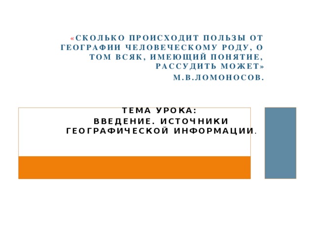
« How much is the benefit of geography to the human race, about which anyone who has an idea can judge "
M.V. Lomonosov.
Lesson topic:
Introduction. Sources of geographic information .
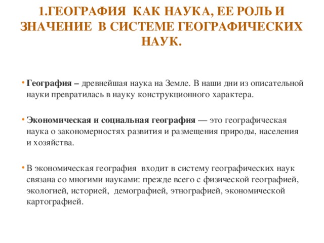
- Geography - oldest science on the ground. Nowadays, from a descriptive science has turned into a science of a constructional nature.
- Economic and social geography is a geographical science about the laws of development and distribution of nature, population and economy.
- In economic geography is included in the system of geographical sciences is associated with many sciences: primarily with physical geography, ecology, history, demography, ethnography, economic cartography.
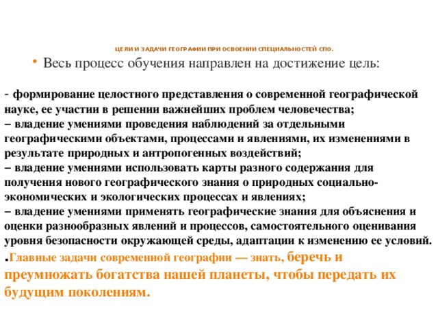
Goals and objectives of geography in the development of vocational education specialties.
- The entire learning process is aimed at achieving the goal:
Formation of a holistic view of modern geographical science, its participation in solving the most important problems of mankind;
− possession of the skills of observing individual geographic objects, processes and phenomena, their changes as a result of natural and anthropogenic influences;
− possession of the ability to use maps of different content to obtain new geographical knowledge about natural socio-economic and ecological processes and phenomena;
− possession of the ability to apply geographic knowledge to explain and evaluate various phenomena and processes, self-assessment of the level of environmental safety, adaptation to changes in its conditions.
. The main tasks of modern geography is to know to preserve and increase the wealth of our planet in order to pass it on to future generations.
2. Methods of geographical research
Geographic research methods - methods of obtaining geographic information
Geographic research methods
Traditional methods
Modern methods
- These are various types of observations that make it possible to obtain primary information about objects and phenomena.
- It is the most important method in geography. Allows you to explore the spatial placement of an object .
Statistical method
- is based on the analysis of statistical material, allows concretizing theoretical calculations, makes it possible to demonstrate the proportionality of phenomena and processes, to draw conclusions about the direction of development of a particular phenomenon.
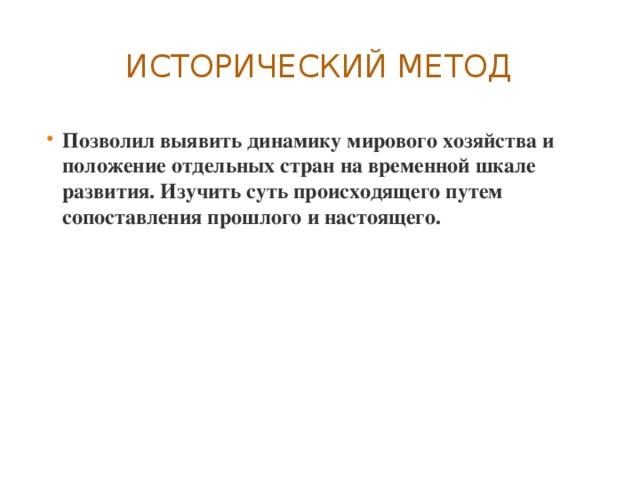
- Allowed to identify the dynamics of the world economy and the position of individual countries on the timeline of development. Examine the essence of what is happening by comparing the past and the present.
Geoinformatics
Informatics allows the use of economic and mathematical modeling. The development of geoinformatics has led to the creation of geographic information systems (GIS)
Geographic forecast foreseeing the future state of geosystems, etc. .


4. Practical work " Acquaintance with geographical maps of various subjects "
- Exercise 1... To complete the assignment, study the table of contents of the geographic atlas for grade 10.
- 1.1. Divide all maps of the atlas into world and regional. Which of these groups is represented in the atlas by a large number of maps?
- 1.2. Divide all maps of the atlas into physical and thematic. Which of these groups is represented in the atlas by a large number of maps?
- For what purpose are physical maps included in this atlas?
Task 2.
Take a close look at the "Political Map of the World" in the geographic atlas.
Answer the questions :
2.1. What is the purpose of the background coloring on this map?
2.2. What geographic objects must be indicated both on the physical and on the political map of the world? 2.3. What information is included in the legend of the political map of the world? Why?
Homework Independent work :
« Drawing up maps (schematic maps), reflecting various geographic phenomena and processes. "
Use various sources of geographic information to complete the assignment. 1.1. Insert the missing names of some new countries (or their capitals) that appeared on the political map of the world in the late XX - early XXI century. as a result of the division of the larger federal states.
- The states that emerged on the territory of the former Socialist Federal Republic of Yugoslavia (SFRY), and their capitals: Serbia - Belgrade; Croatia -…; Montenegro - ...; … - Skopje; … - Ljubljana; Bosnia and Herzegovina - … .
- The states that emerged on the territory of the former Czechoslovak Socialist Republic (Czechoslovakia), and their capitals: Czech Republic -…; … - Bratislava.
- 1.2. Draw up schematic maps of pre-existing federal states, showing the boundaries of former federations and newly formed countries. Sign the names of these countries and their capitals. Enter the designations used in drawing up the schematic maps in the legend. 1.3. Analyze the factors and reasons that led to the emergence of new states on the political map of the world at the turn of the 20th and 21st centuries. Write down your findings. .

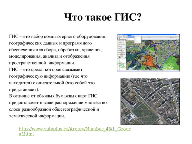
What is GIS?
GIS is a collection of computer hardware, geographic data and software for collecting, processing, storing, modeling, analyzing and displaying spatial information.
GIS is a medium that links geographic information (where what is) with descriptive information (what it is).
Unlike conventional paper maps, GIS provides you with many layers of diverse geographic and thematic information.
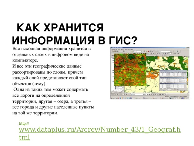
How is information stored in a GIS?
All original information is stored in separate layers in digital form on a computer.
And all of this geographic data is sorted into layers, with each layer representing its own type of feature (theme).
One of these topics may contain all roads in a certain area, another - lakes, and the third - all cities and other settlements in the same area.
- http: // www.dataplus.ru/Arcrev/Number_43/1_Geograf.html
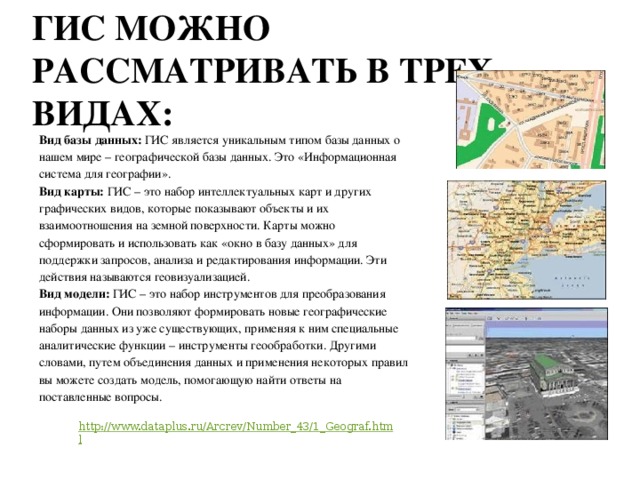
GIS can be viewed in three ways:
Database type: GIS is a unique type of database about our world - geographical base data. This is the "Information System for Geography".
Map type: GIS is a collection of smart maps and other graphical views that show objects and their relationships on the earth's surface. Maps can be generated and used as a "window to the database" to support queries, analysis and editing of information. These actions are called geovisualization.
Model type: GIS is a set of tools for transforming information. They allow you to form new geographic datasets from existing ones, applying special analytical functions to them - geoprocessing tools. In other words, by combining data and applying some rules, you can create a model that helps you find answers to the questions posed.
- http://www.dataplus.ru/Arcrev/Number_43/1_Geograf.html
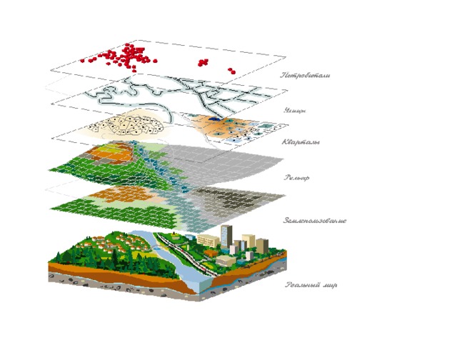
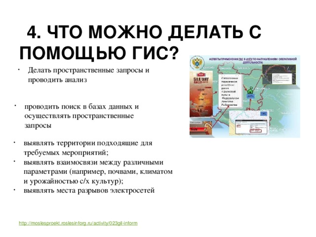
4. What can you do with GIS?
- Make spatial queries and analyze
- search databases and perform spatial queries
- identify areas suitable for the required activities;
- identify relationships between different parameters (for example, soils, climate and crop yields);
- identify places of power grids
http://moslesproekt.roslesinforg.ru/activity/023gil-inform
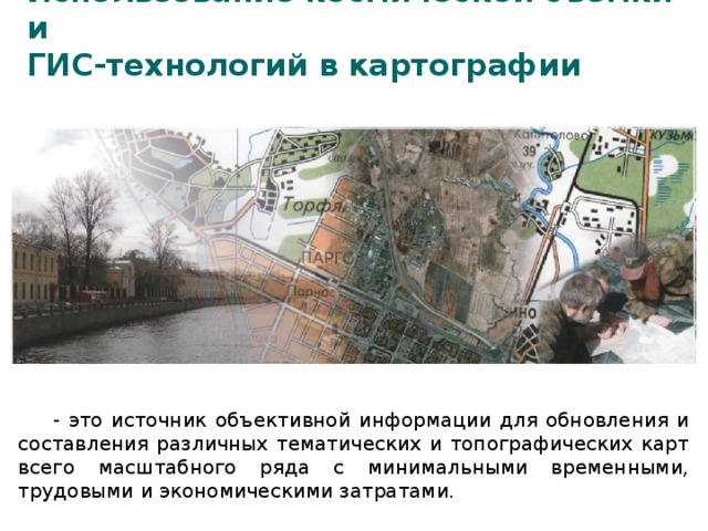
GIS technologies in cartography
It is a source of objective information for updating and compiling various thematic and topographic maps of the entire scale series with minimal time, labor and economic costs.
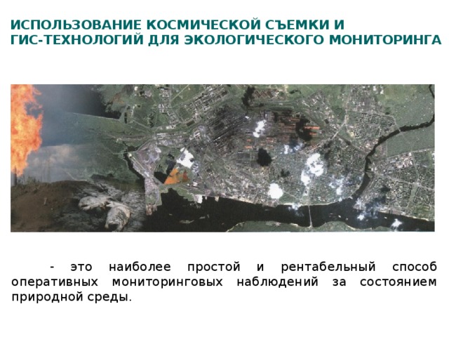
Use of space imagery and GIS technologies for environmental monitoring
This is the simplest and most cost-effective way of operational monitoring observations of the state of the natural environment.
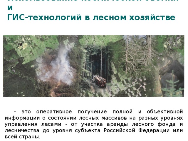
Use of space imagery and GIS technologies in forestry
This is the prompt receipt of complete and objective information about the state of forest areas at different levels of forest management - from the lease area of the forest fund and forestry to the level of a constituent entity of the Russian Federation or the entire country.
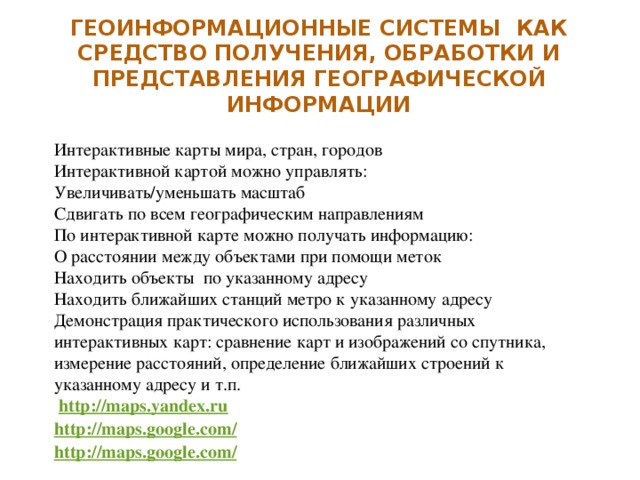
Interactive maps of the world, countries, cities
The interactive map can be controlled:
Zoom in / out
Shift in all geographic directions
On the interactive map you can get information:
About distance between objects using marks
Find objects at a specified address
Find the nearest metro stations to the specified address
Demonstration of the practical use of various interactive maps: comparing maps and satellite images, measuring distances, determining the nearest buildings to a specified address, etc.
http://maps.yandex.ru
http: // maps. google . com /
http: // maps. google . com /
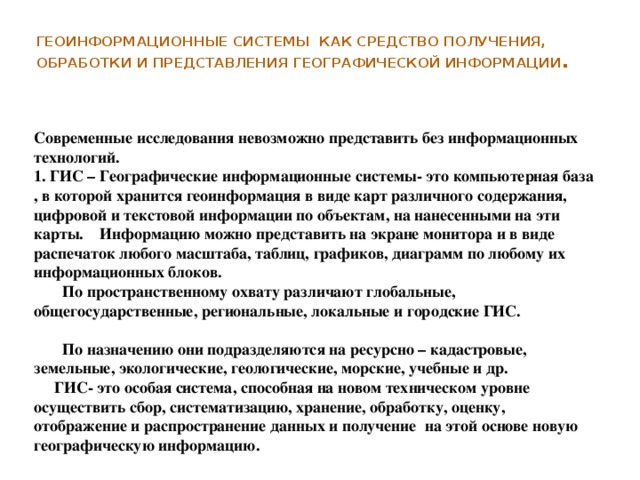
Geographic information systems as a means of obtaining, processing and presenting geographic information .
Modern research cannot be imagined without information technology.
1. GIS - Geographic Information Systems is a computer base that stores geo-information in the form of maps of various content, digital and textual information on objects on these maps. Information can be presented on the monitor screen and in the form of printouts of any scale, tables, graphs, diagrams for any of their information blocks.
In terms of spatial coverage, global, national, regional, local and urban GIS are distinguished.
According to their purpose, they are subdivided into resource - cadastral, land, environmental, geological, marine, educational, etc.
GIS is a special system capable of collecting, organizing, storing, processing, evaluating, displaying and disseminating data at a new technical level and obtaining new geographic information on this basis.
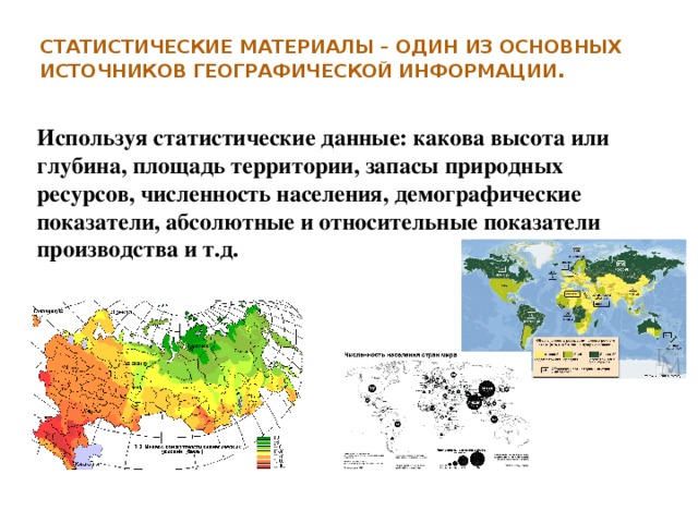
Statistical materials are one of the main sources of geographic information .
Using statistical data: what is the height or depth, area of the territory, reserves of natural resources, population, demographic indicators, absolute and relative indicators of production, etc.
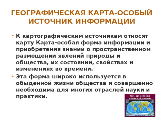
- Cartographic sources include a map. A map is a special form of information and the acquisition of knowledge about the spatial distribution of natural and social phenomena, their state, properties and changes in time.
- This form is widely used in everyday life of society and is absolutely necessary for many branches of science and practice.