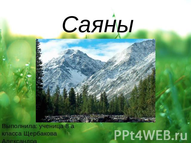
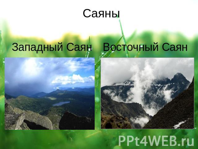
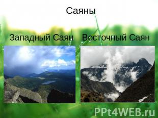
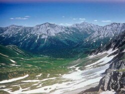
Sayan is a common name for two mountain systems in the south of Siberia. Distinguish the Western Sayan (length 600 km, the height of the ridges up to 4000 meters), consisting of leveled and peaked ridges, separated by intermontane basins, and the Eastern Sayan (length about 1000 km, height up to 3500 meters) with typical mid-mountain ridges carrying modern glaciers. The highest peak of the Western Sayan is Mongun-Taiga (3,975 meters), highest peak Eastern Sayan - Munku-Sardyk (3491 meters)
The western Sayan is bordered by the Altai in its southwestern part. The main ridge of the Western Sayan Mountains is the Dividing Sayan Range with the highest point - Mount Kyzyl-Taiga (3121 meters). The ridges of the Western Sayan are characterized by steep slopes, rugged relief, and vast areas of stone placers. The height of the ridges in the west does not exceed 2500-3000 meters, in the east it decreases to 2000 meters.
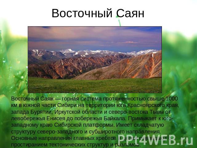
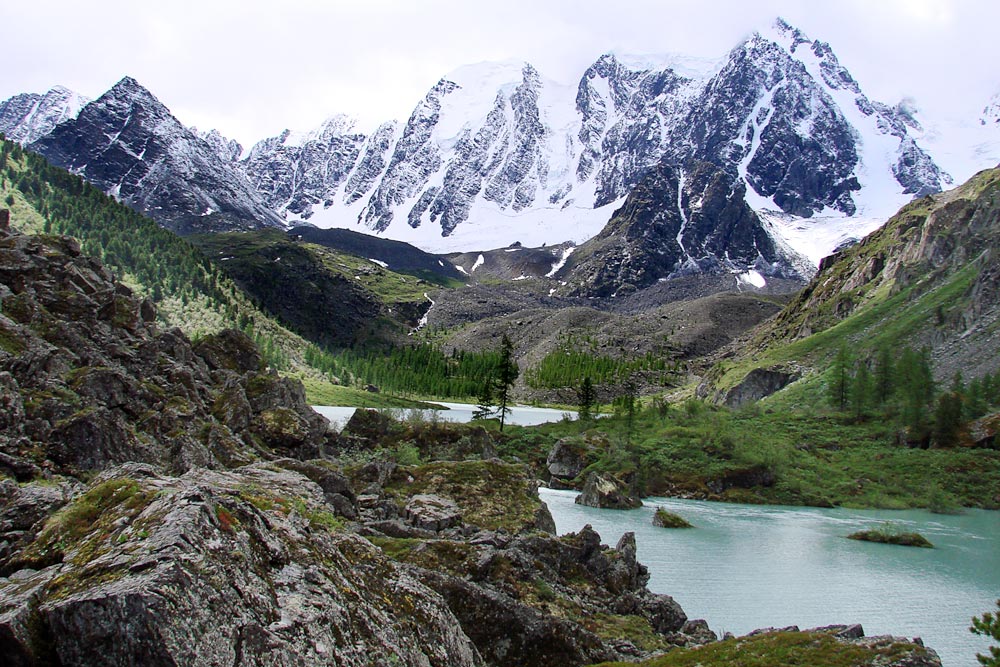
The Eastern Sayan stretches almost at right angles to the Western Sayan. The ranges of the Eastern Sayan mountains form a system of "white mountains" (Manskoye, Kanskoye) and "proteins", which got their name from the snow that does not melt all year round on the peaks. In the central part, in the upper reaches of the Kazyr and Kizir rivers, several ridges form a "knot" with the highest point - the Grandiozny peak (2982 meters). In the southeast, there are the highest and most inaccessible ridges - Bolshoi Sayan, Tunkinskie Goltsy, Kitoiskie Goltsy. The highest point of the Eastern Sayan - Mount Munku-Sardyk (3491 m.) Is located in the Big Sayan ridge. Between the ranges of the Eastern Sayan Mountains there are more than a dozen depressions of various sizes and depths, the most famous of which is the Abakan-Minusinsk depression, famous for its archaeological monuments. It is worth noting the large number of waterfalls.
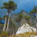
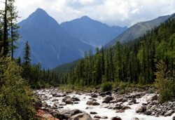
Almost everywhere in the Sayan Mountains, dark coniferous taiga spruce-cedar-fir forests prevail, rising in the western and central parts up to heights of 1500-1800 m and more; light deciduous-cedar forests form the upper border of the forest at altitudes of 2000-2500 m. High-mountain landscapes located above the border of the forest are distinguished by severe and long winters, short and cool summers, strong winds... It is dominated by both a sharply indented, isolated relief, and leveled watershed areas covered with shrub and moss-lichen tundra, alternating with extensive stone placers with almost no vegetation. In more humid areas, subalpine shrubs and meadows are developed, in places high-grass. Red and black currants, blueberries, lingonberries, wild strawberries, blueberries, and raspberries grow from berries along the river valleys.
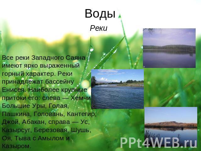
Animal world as rich as vegetable. There are numerous animal paths. In the taiga and mountains, you can see maral, elk, musk deer, squirrel, chipmunk, hare. Of the birds, the most numerous are nutcrackers, jays, woodpeckers, crossbills, pike-perch, wood grouse, partridge, hazel grouse are often heard. Siberian grayling, lenok, a lot of taimen are found in the rivers. Typical representatives of bloodsucking - mosquitoes, midges, gadflies - are few here, but they are absent in well-blown river valleys. The Sayan rivers have a mixed snow and rain supply; they are available for rafting from June to September. All rivers belong to the Yenisei basin. The sources of the Yenisei are mountain rivers Big Yenisei (Biy-Khem) and Small Yenisei (Ka-Khem). Biy-Khem is considered the main source of the Yenisei. It starts in the Eastern Sayan, not far from the Topographers' peak. The river is very beautiful and passes through practically uninhabited places in Eastern Siberia. Its length is 600 km. The second source of the Yenisei - Ka-Khem has a length of about 500 km, and originates in Mongolia. The taiga landscape, an abundance of mountain streams, waterfalls, lakes and places striking in their beauty, almost untouched wildlife, the relative simplicity of tourist routes - these reasons attract the attention of an increasing number of fans to the Sayan Mountains. active rest... There are two unique wildlife reserves in the Sayan Mountains: Sayano-Shushensky in the Western Sayan and Pillars in the Eastern Sayan.
Presentation on the topic: Sayan Mountains
1 of 15
Presentation on the topic: Sayan
Slide No. 1

Slide Description:
Slide No. 2
Slide Description:
Slide No. 3
Slide Description:
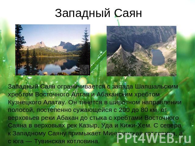
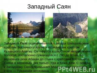
Western Sayan Western Sayan is limited from the west by the Shapshal ridge of Eastern Altai and the Abakan ridge Kuznetsk Alatau... It stretches in a latitudinal direction in a strip, gradually narrowing from 200 to 80 km, from the upper reaches of the Abakan River to the junction with the Eastern Sayan ridges in the upper reaches of the Kazyr, Uda and Kizhi-Khem rivers. The Minusinsk Basin adjoins the Western Sayan from the north, and the Tuva Basin from the south. The total length of the system is 650 km.
Slide No. 4
Slide Description:
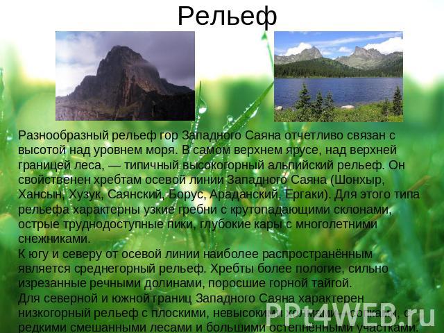
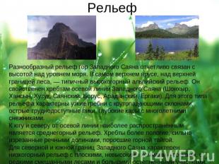
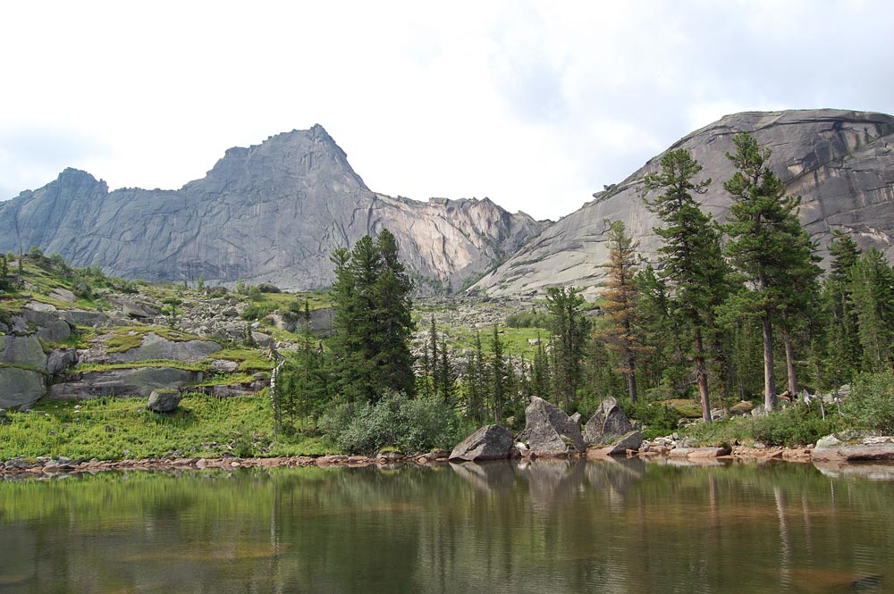
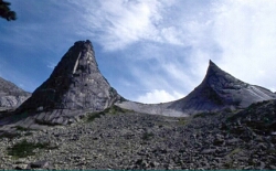
Relief The varied relief of the Western Sayan mountains is clearly associated with the height above sea level. In the uppermost tier, above the upper border of the forest, there is a typical alpine relief. It is characteristic of the ridges of the axial line of the Western Sayan (Shonkhyr, Khansyn, Khuzuk, Sayan, Borus, Aradansky, Ergaki). This type of relief is characterized by narrow ridges with steeply dipping slopes, sharp, inaccessible peaks, deep kars with perennial snowfields. To the south and north of the centerline, the most common is the mid-mountainous relief. The ridges are flatter, heavily indented by river valleys, overgrown with mountain taiga. For northern and southern borders The Western Sayan is characterized by a low-mountainous relief with flat, low hills, hills, with rare mixed forests and large steppe areas.
Slide No. 5
Slide Description:
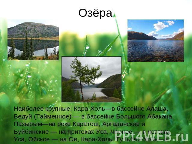
Lakes The largest: Kara-Khol-in the Alash basin, Beduy (Taimennoe) - in the basin of Bolshoy Abakan, Pazyrym-on the Karatosh river, Argadansky and Buibinsky - on the tributaries of the Usa, Chernoe - in the sources of the Usa, Oyskoye - on the Oe, Kara-Khol , Tulber-Khol-in the sources of Chavash and others.
Slide No. 8

Slide Description:
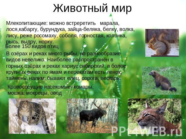
Fauna Mammals: you can see the deer, elk, musk deer, chipmunk, white hare, squirrel, wolf, fox, less often wolverine, sable, ermine, Siberian weasel, lynx, otter, mink. There are many fish in lakes and rivers, but the diversity of species is small. Siberian grayling is most widespread in mountain lakes and rivers; in larger rivers, along pits and rifts, there is lenok, taimen, and burbot; there are dace, soroga, gudgeon. Blood-sucking insects - mosquitoes, midges, biting midges, gadfly
Slide Description:
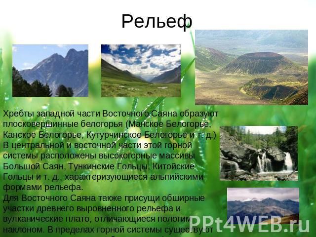
Relief The ridges of the western part of the Eastern Sayan form flat-topped white mountains (Manskoe Belogorye, Kanskoe Belogorye, Kuturchinskoe Belogorye, etc.) In the central and eastern part of this mountain system, there are high-mountain massifs Bolshoy Sayan, Tunkinskie Goltsy, Kitoiskie Goltsy characterized, etc. alpine landforms. The Eastern Sayan is also characterized by extensive areas of ancient flat relief and volcanic plateaus, which are characterized by a gentle slope. Within the mountain system, there are young volcanic formations (volcanoes Kropotkin, Peretolchin, etc.).
Slide No. 11
Slide Description:
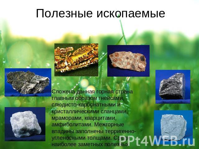
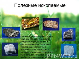
Minerals Stacked Mountain country mainly gneisses, micaceous-carbonate and crystalline schists, marbles, quartzites, amphibolites. Intermontane depressions are filled with terrigenous-coal-bearing strata. Among the most notable minerals are gold, graphite, bauxite, asbestos, phosphorites.
Slide No. 12
![]()
Slide Description:
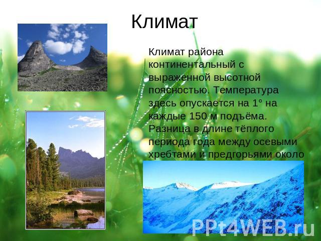
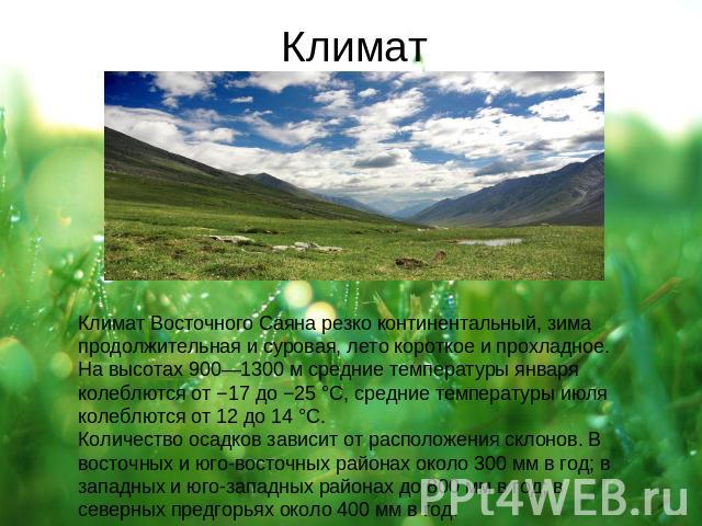
Climate The climate of the Eastern Sayan is sharply continental, winters are long and severe, summers are short and cool. At altitudes of 900-1300 m, average January temperatures range from -17 to -25 ° C, average July temperatures range from 12 to 14 ° C. The amount of precipitation depends on the location of the slopes. In the eastern and southeastern regions, about 300 mm per year; in the western and southwestern regions up to 800 mm per year; in the northern foothills about 400 mm per year.
Slide No. 15
Slide Description:
Many people live inside "their" world, but maybe it is worth looking around? How many mysteries and secrets does our planet keep? It is not always possible to understand the nature of what we see.
Within the territory of Russian Federation there is a huge mountain system of Siberia - the Western Sayan Mountains. It is in this place on the territory of the Krasnoyarsk Territory that there is a mountain range called Erdan. Historians claim that this remote place holds many secrets about ancient civilization alien origin.
A huge dam has been created in these places. Who, and most importantly, how did they manage to build it? Platinum was erected several thousand years ago from giant stones. Even today, the construction of such a structure in such hard-to-reach places is almost impossible to carry out.
In the vicinity of mysterious ancient structures, one can feel the flow of powerful energy flows. There people die and vice versa fully restore their health. Can people use this energy for their own good?
Locals claim that you shouldn't be frivolous about traveling in these places, otherwise you may simply die. It is worth saying that a large number of people really died in these lands. Someone blames the weather for everything, which can change very strongly and dramatically, and someone else is the hostility of the mountains.
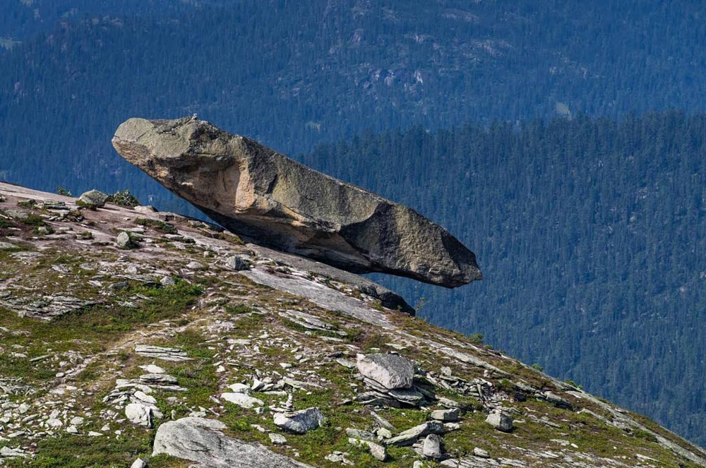 A huge stone "hung" on the platinum. According to the prophecy, as long as this stone is in its place, humanity will prosper and develop, but what happens if this block of stone falls? What force is keeping him in such a precarious position?
On the vast territory of the Western Sayan Mountains there is a unique nature Park... In the mountains of the park there is stone city that was built. These buildings are amazing, but in order to see them it is necessary to do a dangerous and difficult path... The ancient city is the most unusual mystery of this area.
At the beginning of the path lies the "sleeping man" - the stone Sayan. The shape of this mountain very much resembles the figure of a sleeping person. This huge "Giant" made of stone looks into the sky at the planet Mars.
Further, of great interest are the perfectly flat landing sites for helicopters. However, at the time when landing sites appeared, people could only dream of flying in the skies. Who created these perfectly flat surfaces? People, nature or alien civilization? Perhaps, these sites were created for aircraft unknown to people?
One of the local residents even managed to film a mysterious aircraft hovering directly over one of the landing sites. Upon closer examination of the photograph, there is no doubt that this is indeed a flying saucer!
Currently, it is very difficult to deliver even a large group of people to the mysterious city. Then how, and with the help of what technique, were the materials delivered for the construction of such monumental structures as a dam? Continuous riddles and not a single unambiguous answer ...
The ancient alien city is located in a valley that is completely surrounded by mountains. Scientists believe that people simply could not create these ancient structures. In addition, absolutely everyone who often visits these places feels the flow of energy and sometimes it is healing, and sometimes deadly. It is also strange that in the vicinity ancient city there are no insects.
Perhaps, if we learned to use energy correctly, our civilization would rise to a new, unattainable level of development.
Everyone who happened to see the mysterious buildings with their own eyes began to believe in ancient legends and prophecies.
Sayans on the map of Baikal
You like?
yes | No
If you find a typo, mistake or inaccuracy, let us know - select it and press Ctrl + Enter
The name comes from the name of the Turkic-speaking tribe living in the upper reaches of the rivers of Siberia - the Yenisei and Oka - the Sayans, which, having mixed with other tribes, became part of the people of the Republic of Tyva. For the first time, the Cossacks Tyumenets and Petrov, who visited the patrimony of Altyn-Khan in 1615, reported about the Sayan tribe. The Sayan tribe ethnically belonged to the Samoyed tribes, and the Sayans themselves called the mountains on whose territory they lived "Kogmen", and the Buryats called the mountains "Sardyk". The name Sayany first appeared in the notes of Russian travelers in, and later they came into use, and the name - Sayany appeared.
The Sayan mountain range stretches between 91 ° and 111 ° east longitude and is a continuation of the Altai mountain system, it serves as the border between the Chinese and Russian possessions.
Stretch along the southern part of the Yenisei, southwestern part of the Trans-Baikal region and. The Sayan Mountains are a series of parallel mountain ranges that are linked by high mountain nodes. The Sayany mountain range is connected with the Altai mountain system by a high mountain knot, which is known as Shabin-Davana, some of its hills lie in the snow for 10.5 months a year.
From the Shabin-Davan mountain knot, not far from the sources of the Chakhana River, a mountain spur known as the Kaltanovskiy ridge departs to the north and northwest. At the beginning, the Kaltanovsky ridge is high, but the further to the Sayan mountains, the more it goes down, and then abuts against the Itemsky ridge, which stretches from east to south-west from the left bank of the Yenisei. The Itemsky ridge got its name from the high hill Item, it runs between the Uy and Dzhaya rivers.
 Further to the south, the Kaltanovsky ridge converges with the rocky spur of Omaitura. From Shabin-Davan the Sayans have an eastern direction, here the Sayan mountain range is divided into two parallel chains. The northern Sayan mountains are called Kur-Taiga by local residents, and the southern Sayans are called Tuna-Taiga. From the northern Sayans, near the sources of the Sosnovka and Kyzyn-su rivers, there is a low mountain spur, which serves as a watershed for the Kantegir and Yenisei rivers.
Crossing the Yenisei, the Sayan mountain range stretches in several chains to the northeast, the main chain bears different names - Tarhokshan, from the right bank of the Yenisei to the sources of the Uk and Ergik-shan rivers from the Yenisei to the sources of the Kayarta river - a tributary of the Us river. From the tributary of the Us River to the source of the Tikhaya River, further from Mount Kenjin-Davan, to mountain range Munku-Sardyk Sayan is called Ergik-Tarhok-taiti, which means wooded, toothed ridge.
The majestic Yenisei, passing down from the Kemchik-bom tract, goes through a series of parallel mountain ranges that form numerous rapids. The mountains of the ridge from the main chain almost imperceptibly converge with the steppes of the Minusinsky district, which are located on the right side of the Yenisei. These parallel Sayan ridges, the height of which is mostly determined, bear different names.
So, the Kyzyrsuk ridge, coming close to the Yenisei, creates an unusually narrow gorge that compresses the river and forms a huge waterfall in its bed, called the Big Rapid. Further, between the sources of the Kyzyr-Suka and Bolshoi Oi rivers, it goes to the right bank of the Yenisei, here the Biryusinskaya chain drops to 4000, 3000 and at the end passes to an altitude of no more than 1600 feet. In addition to these two mountain spurs, a mountain ridge departs from the Sayan, which serves as a watershed for the Kizir and Kazyra rivers. Then the Agul mountain spur, passes to the north and north-west, and serves as a watershed between the Tagul and Agul rivers, their height at first reaches 5600 feet, then drops to 3800 and 2700 feet.
According to the first explorer of the Sayan Mountains in Siberia, the border commissar E. Pesterev, not far from the sources of the Kazyra River there is a pillar-like Mount Epie, whose height is 1800 meters. Further from this mountain knot, the direction of the Sayan Mountains becomes more and more southeast to the sources of the Sentsa River, while along its entire length it is the main chain. Here are located mountain passes: Saltysty-art 7070 feet high, Toros-davan in the upper reaches of the Bidikema river - 6980 feet, Mustag from the headwaters of the Dzhelomalgo river to the source of the Khamsara river, 6940 feet high, Mongol-davan - in the upper reaches of the Tissa river, 1941 meters high. The peaks of this part Sayan are over 8,400 feet high.
Slightly away from the main Sayan chain, between the upper reaches of the Sentsa and Tisza rivers, there are loaches such as Middendorf and Khara-khardyk, which, according to Siberian explorer Yachevsky, are over 11,000 feet high. These chars are covered with eternal snow, glaciers lie on their surface, one of which descends from the Middendorf chalk from its northern slope - called the Middendorf glacier.
 From the Seigen-davan mountains, the main Sayan boundary chain goes southeast again to the Munku-Sardyk mountain range, where the Vostochny or Tengiz pass, 6730 feet high, and the Uryuk-davan pass, 6700 feet, are located. The last part of the Sayan ridge with the name Nukhitu-davana is located here; it goes from the Uryuk pass to the beginning of the Oka River. In this part of the Sayan Mountains there are several difficult passes - Gargan in the upper reaches of the Khare River, with a height of 7680 feet and the Yangit-davan pass of 6980 feet.
Starting from the top of the Taezhnaya River, the main Sayan chain goes to Mongolia up to Kosogola Lake, where the border between Russia and China is located. The highest point and the Sayan Mountains are located here - Mount Munku-Sardyk, the northern part of which is located on the territory of Russia.
Munku-Sardyk Peak rises 11,452 feet and is covered with eternal snow, several glaciers descend from it, from the south the base of the glacier is at an altitude of 10,400 feet, and from the north the base of the glacier begins at an altitude of 6,900 feet. From the top of Munku-Sardyk to Sayan Two rivers originate, which are tributaries of the Irkut, Obogol, Khairmen, Khairem, Bogute, Zhekha, Khare and Oka rivers. In their upper reaches, they represent waterfalls and cascades that carry down boulders and boulders from rocks. During his travels, the explorer of Siberia Yachevsky in the Munku-Sardyk region saw three more snow loaches, which were not much inferior in height to the Munku-Sardyk peak.
Relief mountain range The Sayan Mountains are quite complex; there are numerous mountain spurs on it, which are separated from the main chain of mountains in the north, north-west and north-east, gradually dropping to the left bank of the Angara River, then dividing into secondary branches. The largest in length and height are the Kuytun-Khardyksky, Kitoisky and Idinsky ranges. In the southeast of the Munku-Sardyk summit, the Sayans are divided by the Irkut river valley into two parallel mountain ranges, the northeastern one is called the Tunkinsky ridge, and the southern one is called Gurbi-davan. The direction of this southern branch of the Sayan goes up to the Tunkinsky boundary mark, along its entire length it also retains a complex relief, branching into mountain spurs and numerous secondary branches.
Frontier Commissar E. Pesterov in 1778-1780 made trips to the mountains of Siberia - to explore the border zone and check the border posts. His Sayan studies are known only from his brief extracts. Geologists, naturalists, topographers and other scientists only started to truly scientific research of the ridge in the 19th century, these are Shmit, Meglitsky, Radde, Kryzhin, Chekanovsky, Yachevsky, Polyakov, Bobyr, Andreyanov and Krylov.
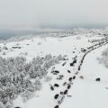
The climate of the Sayan ridge is sharply continental, with an average annual temperature of minus 22-25 degrees, while the cold and harsh winter lasts here from November to March, on some days the temperature reaches minus 52 degrees. In winter, a lot of snow falls in the Sayan Mountains (up to 1200 mm per year), with a snow cover height of 1.5 meters. Most of the snow falls on the northern slopes of the ridge, and many parts of the Sayan Mountains are very avalanche dangerous. Spring is dry, frequent changes in weather, average temperatures + 15-18 degrees. Summer is rainy and cool, with temperatures up to + 38 degrees. Autumn is cold and comes early.
 The flora and fauna of the Sayan Mountains is unusually rich and diverse; such rare species of animals as the snow leopard (irbis), red wolf, mountain sheep (argali or argali), reindeer and Tuvan beaver have been preserved here. This became possible because this part of Siberia is isolated and sparsely populated.
Eastern in Siberia are not only an interesting zoological, geological and botanical object, but also a historical and spiritual cultural object. local population... In the mythology of the peoples of the Eastern Sayan, the Sayan is the habitat of heroes and gods, one of which is Geser-Khan, so in the heroic epic of the peoples of Asia "Geser-Khan" we are talking about the petrified warriors-heroes of Geser - the mountains of the Sayan ridge.
Many peaks of the Sayan Mountains are covered with legends, some bear ancient names, some of which are already forgotten. Very often, on the tops of such mountains, in the places indicated by the shamans of Siberia and Buddhist lamas, from ancient times they put "" - cult and religious buildings in the form of stacked stones and poles, where they pray and leave offerings or sacrifices to the gods, the owners of the area. The custom of putting o came from Tibet itself.
Tourism Sayan is well developed; over time, some areas have already received new names from tourists. In general, the Sayan Mountains are very well suited for the development of all types of tourism and recreation; a large number of ascents and hikes, different in complexity and types of tourism, are held here every year. Most of the tourists go hiking in the summer, but in winter it is quite common to meet a tourist in the Sayan Mountains. In the Sayan Mountains, there are many popular hiking trails and routes, most of them are classified, like many passes. Sayans are great for rock climbing, mountaineering and other extreme types of tourism and sports.
Based on materials from the Great Encyclopedia of Russia
SAYANA is a mountainous country located on the territory in the south eastern Siberia(see map). It is part of the Altai-Sayan folded region. Sayans are divided into two mountain systems: Western Sayan and Eastern Sayan.
The Western Sayan Mountains are a mountain system in the south of the Krasnoyarsk Territory and the north of the Tuva ACCP, stretching for 600 km from the headwaters of the Maly Abakan River in the west to the junction with the Eastern Sayan in the sources of the Kazyr and Uda rivers in the east. In the north, the Western Sayan, along a rather steep ledge, borders on the Minusinsk Basin, in the south it relatively smoothly passes into the Tuva Basin. The Western Sayan is a system of ridges elongated in the northeastern direction, separated by river valleys. The deeply incised valley of the Yenisei River divides it into western and eastern parts. The watershed ridge of the Western Sayan Mountains in the western part has a typical alpine relief with an altitude of 2800-3000 m; his highest point- Kyzyl-Taiga city (3121 m). To the east of the river valley. The Yenisei relief acquires a mid-mountainous character, dropping to almost 2000 m, although some ridges (Oyskiy, Aradansky, Ergaki) still have a high-mountainous relief; to the east, the heights of the watershed ridge increase, reaching 2875 m at the junction with the Eastern Sayan (Grandiozny peak). The Usinskaya and Turano-Uyuk basins are located on the southern slope of the Western Sayan Mountains. Most large rivers- Abakan, Kantegir, Alash, Ak-Sug, Us, Uyuk, Amyl and others belong to the Yenisei basin. The rivers are rapids and have large reserves of hydropower. The climate is sharply continental, with long and cold winters, short and cool summers. The average January temperature is from - 20-25 ° С (in the mountains) to - 30 ° С (in intermontane basins); average temperature July from 10-12 ° С to 20 ° С, respectively. The amount of precipitation is 300-350 mm per year in intermontane basins, 400-500 mm in the northern foothills and on the southern slopes of the mountains, and 1000-1200 mm on the northern slopes of the mountains. Many snowfields persist throughout the summer; firn strata occupy significant areas in some places. In the Western Sayan, landscape zoning is clearly expressed: mountain-taiga landscapes are developed on the northern slopes and the upper part of the southern slopes, mountain forest-steppe landscapes are most typical for the southern slopes, and high-mountain landscapes (mainly stony mountain tundra and to a lesser extent alpine meadows).
Geological structure ... The folded structure of the Western Sayan is part of the Caledonian zone of the Altai-Sayan folded region. In plan it has the shape of an ellipse elongated from the southwest to the northeast, bounded on all sides by faults. Internal structure The Western Sayan Mountains are complex and to a large extent determined by the intrinsic nappe-nautical nature of the structure. Traditionally, the Western Sayan is divided into the North Sayan, Central Sayan, Borusskaya and Kurtushibinskaya tectonic zones, elongated according to the general strike of the system. The North Sayan zone is composed of variegated volcano-sedimentary Vendian deposits with a total thickness of more than 7-8 km, among which ophiolite association rocks are noted in the melange zones. In the Kurtushibinskaya and Borovskaya zones, mainly the Lower Paleozoic diabases, quartzites, argillaceous-siliceous shales, and hyperbasites are developed. These rocks form a complex tectonic-sedimentary mixture with extensive development of melange-olistostrome formations and tectonic nappes, incl. ophiolite. The Central Sayan zone (Late Caledonides) is composed of the most powerful (according to some estimates, up to 20 km) complex of volcanogenic-flyschoid deposits of the Early Paleozoic, broken by numerous granite intrusions. The zone is characterized by intense tectonic crowding and uneven metamorphism. Sometimes the Dzhebash zone along the northern edge of the Western Sayan Mountains is distinguished as an independent and more ancient (Riphean) in age; within its limits, metamorphosed volcanogenic-flysch deposits are developed.
Mineral resources of the Western Sayan Mountains... Deposits of other ores are associated with the Lower Paleozoic (Caledonian) structures; with the Vendian-Cambrian - iron, copper ores, gold, chrysotile-asbestos, etc. The main resources are iron ores and chrysotile-asbestos. Iron ores of the hydrothermal-metasomatic type are associated with gabbroids and granitoids of increased basicity (Abakanskoe deposit, Anzasskoe, Malokarbayskoe, Volkovskoe and other deposits); chrysotile asbestos - with the Lower Cambrian hyperbasites (Sayanskoe, Bulantashskoe, Aktovrakskoe deposits).
The Eastern Sayan Mountains are a mountain system in the south of the Krasnoyarsk Territory of the RSFSR, in the Irkutsk Region of the RSFSR, in the west of the Buryat ACCP and in the northeast of the Tuva ACCP. It stretches for more than 1000 km from the left bank of the river. Yenisei (southwest of Krasnoyarsk) in a southeast direction almost to the southern tip of Lake Baikal. In the western part of the Eastern Sayan, flat-topped ridges (the so-called white mountains) prevail - Manskoye, Kanskoye, Idarskoye, etc .; in the southeast direction the ridges gradually rise, and in the middle part of the Eastern Sayan Mountains, where the Western Sayan Mountains approach from the south-west (at the sources of the Kizir, Kazyr, Uda rivers), the ridges form the largest alpine knot with an altitude of up to 3000 m. Further to the south - in the east, the ridges are predominantly sharply dissected (Udinsky ridge, Bolshoi Sayan ridge) and here they reach the highest altitude for the Eastern Sayan mountains (Munku-Sardyk, 3491 m). To the north and east of this height, there are high (more than 3000 m) Kitoiskie and Tunkinskiy loaches, separated from the watershed ridge of the Tunkinskaya depression. At the foot of the southern slope of the Eastern Sayan Mountains there is the Todzha depression with well-preserved relief and large lakes (Todzha, Many-Khol, Kadysh-Khol, etc.). The modern mountainous appearance of the Eastern and Western Sayan mountains was created in the Neogene - the beginning of the Anthropogen as a result of uplift accompanied by differentiated block movements, and in the eastern part of the Eastern Sayan mountains - abundant outpourings of basalts.
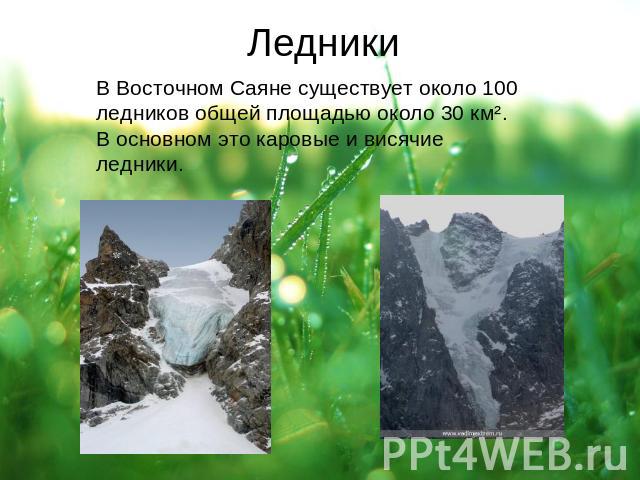
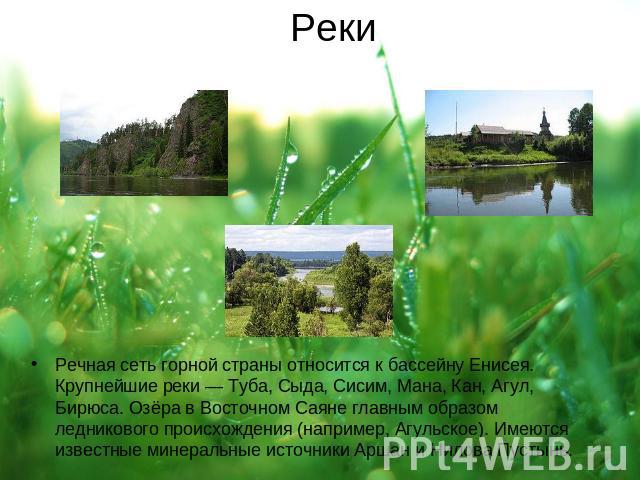
 The Eastern Sayan river network belongs to the Yenisei River basin. The Bolshoi Yenisei and large rivers - Kham-Syra, Kazyr and Kizir, Syda, Sisim - begin on the southern slopes; in the north the rivers Mana, Kan, Agul and tributaries of the Angara (Biryusa, Uda, Oka, Irkut) flow. All major rivers have large reserves of hydropower. The climate is sharply continental. Continentality increases from west to east. The average January temperature is from -17 to -25 ° С (at an altitude of 900-1300 m), the average July temperature is 12-14 ° С. On the western and south-western slopes, up to 800 mm of precipitation falls per year, in the northern foothills up to 400 mm, and in the eastern and southeastern regions no more than 300 mm. Permafrost strata are widely developed in the eastern part. In the highest massifs, about 190 small glaciers with a total area of about 30 km 2 are known.
More than 50% of the Eastern Sayan area is occupied by mountain-taiga landscapes with dark coniferous spruce-cedar-fir or light larch-cedar forests. The upper border of the forest rises to a height of 1500-1800 m in the west and in the central part and up to 2000-2200 m in the east. Above these marks, alpine landscapes with shrub or moss-lichen vegetation are widespread. The peaks and slopes of the mountains are often rocky tundra with widely developed kurums.
Geological structure... The Eastern Sayan Mountains are part of the Altai-Sayan folded region. The general northwest strike of the largest ranges of the Eastern Sayan Mountains corresponds to the strike of the main tectonic structures. According to the age of the folded structures, the Eastern Sayans are divided into the northeastern, more ancient (Precambrian) part, adjacent from the southwest to the Siberian platform, and the southwestern, younger (Caledonian) part. The northeastern part is composed of variously metamorphosed Precambrian rocks. The most ancient of them are various ophiolites, and Early Paleozoic and Devonian granitoid intrusions. Large nappes are installed here. In the Middle - Late Paleozoic, starting from the Devonian, in the north and west of the Eastern Sayan, orogenic depressions (Rybinsk, Agul, Minusinsk) are formed, filled with volcanic and red-colored, mainly terrigenous rocks.
 Minerals... In the Eastern Sayan Mountains, deposits of iron, titanium, aluminum, lead-zinc ores, gold, rare and rare earth metals, mica, phosphorites, magnesites, graphite, etc. are known. Iron ore deposits are represented by Precambrian ferruginous quartzites (Pine Bayts), Cambrian volcanogenic and sedimentary hematite hematite-magnetite (Belokitatskoe and others). and contact-metasomatic magnetite ores (Single, Ore Cascade, Irbinskoe, Tabratskoe, etc.). Large titanomagnetite deposits (Lysanskoe, Kedranskoe) are associated with the Upper Proterozoic mafic rocks. Aluminum ores are represented by bauxite of the geosynclinal type (Boksonskoe deposit), urtites associated with alkaline intrusion of Paleozoic activation of Precambrian structures (Botogolskoe deposit), and sillimanite-bearing shales of the Proterozoic (Bazybaiskoe, Kitoiskoe deposits). Agro-ores are represented by secondary phosphorites (Seibinskoe, Telekskoe). In the Archean-Early Proterozoic structures, there are small deposits of muscovite of the pegmatite type (Gutarskoye, Nedey, etc.) and contact-metasomatic phlogopite (Karaganskoye, Razmanovskoye, etc.). Deposits of quartz (Belokamenskoe), graphite (Botogolskoe, etc.), chrysotile asbestos (Ilchirskoe), jade (Botogolskoe, Ospinskoe, etc.), flux limestones (Kuturchinskoe), magnesites (Onotskoe) and numerous deposits of building materials ( Kuraginskoe, Khobokskoe, etc.).
Development history mineral resources ... The beginning of the use of various types of stone, mainly flint, in the Sayan Mountains dates back to the Upper Paleolithic (about 40-35 thousand years ago), when stone tools found in various settlements of this time (Afontova Gora, etc.) appear. From the Neolithic era and all subsequent times, clays have been widely used for the manufacture of ceramic dishes and other products. From the end of the 3rd millennium BC. in the Sayan Mountains, the first copper items appear (mainly jewelry). copper has not been identified, but it is likely that some deposits of the Minusinsk region will be used. Around the middle of the 2nd millennium BC in the Sayan Mountains, a rather powerful mining and metallurgical center for the extraction and smelting of copper appears on the basis of the deposits of Khakassia and the Minusinsk region (the Temir deposit, mines on the Ulen river, the Yulia mine, etc.). Mainly malachite and azurite were mined. From the 5th-4th centuries. BC. iron is widely used, the development of ore deposits of which can be traced on the river. Barbaryk (Sharlan-Teiskoye deposit), in the upper reaches of the Buren-Khem River, etc. In the Iron Age, along with the extraction of iron, the development of copper deposits increased. Of the nonmetallic minerals, jade, which was mined in the Eastern Sayan Mountains (the Kitoy River and others), as early as the Neolithic and Bronze Age (4th-2nd millennium BC), acquired particular fame. He went to make jewelry. Articles made of Sayan jade in the middle of the 2nd millennium BC spread up to the Urals and the territory of Moldova. From the middle of the 18th century, copper mines reappeared on the sites of ancient workings (for example, Maininsky in the Western Sayan), which were developed by the treasury; by the end of the 18th century, they were closed due to unprofitability. The iron industry emerged in the region in the 30s. 18th century
 In 1734-38 on the river. Irba in the Eastern Sayan mountains, the Irbinsk iron and iron foundry was built with an annual capacity of about 400 tons of pig iron, which existed for more than 100 years. From 1848 to 1858, the French entrepreneur I.P. Alibert was mining graphite at Botogolsk Goltz, which was exported to Germany. In 1866, the Abakan iron-making plant was erected on the Abakan River in the Western Sayan Mountains, which existed intermittently until 1921; in 1917, the maximum productivity was reached (3.77 thousand tons of pig iron per year). In 1832, the muscular mining of gold-bearing placers began in the Eastern Sayan Mountains, and in 1838 in the Western Sayan Mountains. In 1906, the Aspagash asbestos deposit was discovered on the right bank of the Yenisei River in the Eastern Sayan Mountains, which was developed by the Asbestos partnership in 1909-12.
At the turn of the 19th century on the Yenisei River, near the village. Znamenka, the Znamensky Glass Factory was built, for which numerous quartz veins served as raw materials. In the foothill settlements locals for a long time they burned lime, made pottery; plinfo-making production was developed to a lesser extent.
Geological exploration of the Sayan Mountains begins in the first half of the 18th century. in 1720-27 he first described the outcrops of decorative marbles along the banks of the Yenisei River at the Kibiksky cordon. in 1733-43 he studied copper and Irbinsk iron mines. in 1771-72 he described copper deposits and found one of the first meteorites in Russia ("Pallas" iron) on the city of Ymir. However, these studies were haphazard and had little impact on the development of the Sayan mining industry. During these years, discoveries were made mainly by miners or old Chud developments were used. Further study of the Sayan Mountains is associated with the names of I.D.Chersky, P.A.Kropotkin, P.K.Yavorsky, and others.
During the 1st World War 1914-18 and Civil War 1918-20 a significant number of mines, factories and factories were destroyed.
Systematic geological exploration was resumed in the 1930s. In 1930-40, geological summaries were compiled on the Eastern Sayan Mountains (I.A.Molchanov, N.D. ). Intensive geological survey and prospecting work was carried out during and after the Great Patriotic War of 1941-45. Geologists from production and research organizations took part in these works.
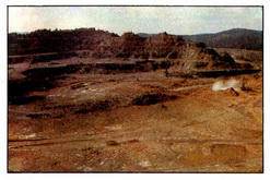
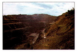
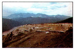
Mining . A wide range of geological prospecting and exploration work, carried out in the post-war years, led to the discovery of new deposits of ores of ferrous, non-ferrous metals, various non-metallic minerals. On the basis of mineral and hydropower resources, the Sayan territorial-production complex was created, which is part of the large East Siberian economic region... Mining iron ore is carried out at the Abakanskoye, Irbinskoye fields and the fields of the Krasnokamensk group. For more details see Irbinskoye Ore Management and Krasnokamenskoye Ore Management. The Aktovrakskoye field is being developed. Graphite is mined at the Botogolsky deposit, the Kibik-Kordonsky marble deposit and the Izerbelsky granite deposit are being developed by the country's largest stone-processing plant. Jewelry and ornamental jadeite is mined at the Kashkarak deposits, and jade at the Ospinsky and Botogolsky deposits. In addition, non-ferrous metal ores are mined in the Sayan Mountains. The building materials industry is based on the use of local raw materials.