Asia is the world's largest part of the world and covers about 30% of the Earth's land area. In addition, it is the leader in terms of population (about 60% of the total population of the planet).
Asia's share of the world market has increased significantly over the past half century. Today, some Asian countries are leading producers in agriculture, forestry, fish farming, industry and mining. This production has affected the economic growth of certain countries, and at the same time, has led to a number of negative consequences for the environment.
Water resources
Fresh water
Lake Baikal, located in the south of Russia, is the most deep lake in the world, reaching a depth of 1620 meters. The lake contains 20% of the world's unfrozen fresh water, making it the largest reservoir on Earth. It is also the oldest lake in the world, over 25 million years old.
the Yangtze is the most long river in Asia and the third longest in the world (after the Amazon in South America and the Nile in Africa). Reaching 6,300 km in length, the Yangtze moves east from the glaciers of the Tibetan Plateau and flows into the East China Sea. The Yangtze is considered the lifeblood of China. The river occupies 1/5 of the country's territory and is home to one third of the country's population, and also greatly contributes to the growth of the Chinese economy.
The Tigris and Euphrates rivers rise in the mountains of eastern Turkey and flow through Syria and Iraq before emptying into the Persian Gulf. The land between two rivers, known as Mesopotamia, was the center of the earliest civilizations, including Sumer and Akkad. Today, the Tigris and Euphrates river system is under threat due to increased agricultural and industrial use. This pressure caused desertification and an increase in salts in the soil, and caused severe damage to local watersheds.
Salty water
The Persian Gulf has an area of more than 239 thousand km². It washes Iran, Oman, United United Arab Emirates, Saudi Arabia, Qatar, Bahrain, Kuwait and Iraq. The Persian Gulf is subject to high rates of evaporation, which makes the depth shallow and the water very salty. The seabed of the Persian Gulf contains approximately 50% of the world's oil reserves. The countries bordering the gulf have been involved in a number of disputes over the extraction of this valuable resource.
The Sea of Okhotsk covers 1.6 million km² and is located between the Russian mainland and Kamchatka. As a rule, during the period from October to March, the sea is covered with ice. Large areas of ice make movement by sea almost impossible.
The Bay of Bengal is the largest bay in the world, covering almost 2.2 million km². It washes Bangladesh, India, Sri Lanka and Burma. Many major rivers, including the Ganges and the Brahmaputra, flow into this bay.
forest resources

The forest cover of Asia is about 20%. The largest number of forests, relative to the area of the country, is concentrated in: Laos (71.6%), Japan (67.0%), Bhutan (64.5%), South Korea(64.0%), Myanmar (63.6%) and North Korea (63.3%). Forest cover less than 1% is in the following countries: Yemen (0.9%), Bahrain (0.7%), Kuwait (0.3%), Afghanistan (0.3%), Qatar (0%).
Forestry is an important sector of the Asian economy, but in some countries it has negative consequences. More than half of the territory of China, Indonesia and Malaysia is covered by forest resources. China is considered major exporter wood products and ranks first in the world in the production of panels, paper and wooden furniture. Indonesia and Malaysia are the main producers of tropical timber products. tropical trees, such as teak, are mainly used for making high quality furniture and flooring.
During the last 10 years, forest cover in Asia has increased by 30 million hectares. It's connected with artificial creation forest areas, so that you can get higher yields and use them in industry. It is believed that by 2020, the forest industry in Asia will produce about 45% of production. In addition, artificial plantations are extremely important from an environmental point of view, since natural forest resources are depleted every year in huge quantities.
Asia's rapid population growth has created an increased demand for forest products, and lenient legislation has led to illegal logging and smuggling flourishing. Especially, the damage is noticeable in the South East Asia where high-value tree species grow. Therefore, Asian countries have some of the worst deforestation rates in the world.
Land resources

The total land area of Asia is 44,580,000 km², and the area of land resources used in national economy- 30,972,803 km². Agricultural land occupies 52.2% (of which: arable land - 15.8%, perennial plantations - 2.2%, pastures and meadows - 34.2), forest land - 18%, surface water- 2.9%, and other lands - 26.9%.
The five countries of Central Asia (Kazakhstan, Kyrgyzstan, Tajikistan, Turkmenistan and Uzbekistan) are the most agrarian states in this part of Asia. Arable land that is suitable for growing crops is about 20% of the total agricultural land. More than 80% of arable land in Kyrgyzstan, Tajikistan, Turkmenistan and Uzbekistan is irrigated, while in Kazakhstan only 7%.
In Northern Asia (which mostly consists of the Asian part of Russia), arable land makes up 60-80% of the agricultural area.
In South Asia, the largest areas of arable land are concentrated in India and Bangladesh - more than 30%.
In the countries of the Middle East, namely in Iran and Iraq, arable land is less than 20%, and in other countries - no more than 10%.
The arable lands of East Asian countries, including China, South Korea, and Japan, occupy no more than 20% of agricultural land. land, in the DPRK - less than 30% and Mongolia no more than 10%.
V South-East Asia arable land occupies no more than 30% of the agricultural land.
Mineral resources
Coal
Asia has a huge amount of coal, which is almost 3/5 of the world's reserves, but they are unevenly distributed. The largest deposits are located in Siberia, countries Central Asia, India and especially in China; Indonesia, Japan and North Korea have smaller coal reserves.
Oil and natural gas
At least 2/3 of the world's known oil and natural gas reserves are in Asia; the number of deposits may increase as Siberia, the Caspian Basin and the seas of Southeast Asia are still being explored. Many of the islands bordering Southeast Asia have geological formations that are favorable for gas and oil deposits. The largest oil reserves are in Western Asia ( Saudi Arabia, Iraq, Kuwait, Iran, Qatar and the United Arab Emirates). The rest of the countries in Southwest Asia have limited oil reserves and are also small oil fields on the Indian subcontinent.
uranium ore
The richest deposits of uranium ores are located in Kyrgyzstan, between the Osh region and the Tuya Muyun mountain range. China and India have their own reserves. Chinese uranium deposits are believed to be in the Xinjiang region and Hunan province.
Iron
Many regions of Asia have deposits iron ore However, not every country has its own domestic reserves. South Korea, Taiwan, Sri Lanka and several smaller countries in Southwest Asia have small iron ore reserves. In Japan, there are fewer reserves of this mineral resource than it is required for the iron and steel industry, so the country is heavily dependent on imports. Thailand, Myanmar and Pakistan have good reserves of relatively low-grade iron ore, while Vietnam and Turkey have good ore in significant quantities. Indonesia and India have large reserves of quality iron, which are wisely distributed.
Although China was previously considered poor in iron ore, huge deposits of this mineral of various varieties were discovered in the country. China is currently one of the world's largest producers of iron ore.
Smaller deposits were located in several places in Eastern Siberia. In Central Asia, the main deposits are located in Eastern Kazakhstan.
Nickel
Nickel reserves in Asia are not significant. There are small reserves in Norilsk and north-central Siberia; Indonesia, China and the Philippines also have nickel reserves.
Chromium
Chromium deposits are concentrated in Turkey, India, Iran, Pakistan and the Philippines, as well as in the north-west of Kazakhstan.
Manganese
There are large reserves of manganese in Transcaucasia, Central Asia, Siberia and India; Chinese deposits are also significant.
Tungsten
Southern China has exclusively large deposits tungsten. The deposits of tungsten in Central Asia are as significant as those of molybdenum.
Copper
Asia is not rich in copper. In Central Asia, the main reserves are located southeast of Tashkent (Uzbekistan); from Zhezkazgany to the west of Karaganda; and from Kungrad to Lake Balkhash (Kazakhstan). In Siberia, deposits are mainly concentrated in the Kuzbass. The Philippines has limited copper reserves.
Tin
Significant deposits of tin extend from southwestern China to the Malay Peninsula. Thailand, Myanmar, Vietnam, Laos, and Yunnan in China also have tin deposits. Siberia has significant deposits in Transbaikalia, as well as in the Sikhote-Alin in the Far East.
Lead and zinc
The largest reserves of lead and zinc are located in the Kuzbass, in Central and Eastern Kazakhstan. China also has rich deposits of zinc and lead, and North Korea has significant deposits of lead.
bauxites
Asia has huge reserves of bauxite. The largest deposits are located in Kazakhstan and the Sayans. There are also large deposits in India, Indonesia, Turkey, Malaysia and China.
precious metals
Many Asian countries have mined gold from alluvial placers in past centuries, and some of them continue to do so today. There are small volumes of gold ore in Myanmar, Cambodia and Indonesia, as well as near the headwaters of the Yangtze River. Previously, India had large gold deposits, but now many of them have been exhausted. North and South Korea, Taiwan and the Philippines have significant reserves of hard rock. Siberian gold reserves are currently significant.
Nonmetallic minerals
Stocks of asbestos are found in abundance in China, South Korea, and also on the eastern slope of the Middle Urals. Mica is found in large quantities in Eastern Siberia and India. Asia has huge reserves of rock salt. There are significant deposits of sulfur and gypsum in Central and Western Asia. Japan has large deposits of sulfur. There are deposits of phosphates in Kazakhstan. Diamonds are formed in the central and eastern parts Siberia and India. India, Sri Lanka, Myanmar and Cambodia have deposits of rubies, sapphires, and other precious stones.
biological resources

Crop and livestock
Northern and central parts of Asia are subject to cold and dry Arctic winds, especially in the Siberian region of Russia. Hardy grains such as barley, buckwheat, millet, oats and wheat are grown in the central and southern regions of this zone, where permanent frosts stifle plant growth. Animal husbandry is also very important in this zone. In Mongolia, for example, 75% of agricultural land is allocated to livestock (sheep, goats, cattle, etc.).
Southwest Asia is dominated by dry and hot climate, which stretches from the Gobi Desert in Mongolia through China, Pakistan, Iran, and to the Arabian Peninsula. There are very few areas in this zone with sufficient moisture and rainfall to produce a good harvest. Cereals such as barley and corn are the main crops grown in some countries. The lack of pastures and land suitable for cereals means that heat-resistant vegetables and fruits are most widely grown in this zone. Figs, apricots, olives, onions, grapes, cherries are the most important fruits and vegetables of the region.
The zone to the southeast is heavily affected by the summer monsoons. As a result, many parts of Southeast Asia are considered to be among the wettest places on earth, receiving more than 254 centimeters of rain each year. High temperatures and heavy rainfall are ideal conditions for growing rice and tropical fruits. Rice is considered one of the most important agricultural products of Asia and the main source of nutrition for the entire continent (79 kg of rice per inhabitant of Asia per year). As a result, most rice in Asia remains in the regions, and international trade is rather low.
In Southeast Asia in large scale grow tropical fruits such as mango, papaya and pineapple. India produces the largest number of mangoes in the world, while Thailand and the Philippines are famous for pineapples.
Fish farming
Asia is the most important fisheries and aquaculture region in the world. Aquaculture is the rearing of fish and other aquatic animals under controlled conditions. In 2008, in maritime industrial areas Asia was caught about 50% of the world's fish catch. Six of the world's top 10 fish producers are located in Asia, namely China, Indonesia, Japan, India, Myanmar (Burma) and the Philippines.
Seafood is an extremely important food source for many Asian peoples. A recent study by the National Geographic Society found that China and Japan are the top consumers of seafood (approximately 765 million tons per year).
Flora
Asia has the richest vegetable world from all parts of the world. Since it is a large part of the largest continent, Eurasia, it is not surprising that about 100,000 diverse plant species are found within its various natural zones, which range from tropical to arctic.
Asian plants, which include ferns, gymnosperms and flowering vascular plants, make up about 40% of the Earth's plant species. Endemic species of flora consist of more than 40 families and 1500 genera.
Asia is divided into five main regions based on the species diversity of flora: the humid evergreen forests of Southeast Asia, mixed forests East Asia, humid forests of South Asia, deserts and steppes of Central and West Asia, taiga and tundra in North Asia.
Fauna
Asia is the most populous part of the world and also one of the most biologically diverse places. It is home to both unique species of wild animals and the most common on the planet. Asian countries have become home to many mammals, birds, amphibians, reptiles, fish, etc. However, some of these species are thriving and others are facing serious threats that could wipe out their populations. Animals such as the giant panda and orangutans may be the first to disappear from Asia.
An important cause of the extinction of wild animals is human activity and extremely high density population in certain areas.
It is a region of contrasts.
In general, the mineral resources of the region are very diverse.
Reserves of international importance are: China ( coal, India (iron and manganese ores), and (chromites). A tin-tungsten belt stretches from to the region. There are certain reserves of polymetallic, copper and aluminum ores, phosphorites and others.
However, the main wealth of the region, which largely determines its role in the MGRT, is oil.
Oil and natural gas reserves have been explored in most countries of the region. But the main oil-bearing regions are the region of the Persian Gulf and the region of the Mesopotamian trough (and).
Natural resource prerequisites for the development of agriculture in the region are very diverse. The growing season in many countries makes it possible to grow food and industrial crops all year round. However, there are two big problems in the region that significantly reduce the possibilities of agriculture.
1. Lack of land resources. Most of the territory of Foreign Asia is occupied by mountain systems, uplands and plateaus, which are not very suitable for agriculture. Compared to extensive mountain ranges the area of the lowlands is small. Given the large number of people in the region, security land resources per capita is very low (provision of arable land - 0.1 - 0.2 ha per person).
2. Uneven distribution of moisture across the region. Is it for Overseas Asia? arable lands of the world (China, India, Iran, Syria, Iraq, Turkey, the Persian Gulf).
The most favorable for agricultural use are the low-lying regions of Foreign Asia (all of them are located along its western, southern and eastern outskirts) are well provided with moisture, as they are located in the monsoonal (eastern and southern part of the region) and Mediterranean ( Western part region) climate. High thermal and moisture availability (the amount of precipitation reaches 1000-2000 mm per year) in combination with the fertile soils of the alluvial plains makes it possible to develop almost any area of agriculture here. More than 90% of its arable land is concentrated in this part of the region.
Overseas Asia has certain. Southeast Asia is provided with them to the greatest extent. This region is famous for the presence of especially valuable tree species (ironwood, ebony, polysander tree), as well as species containing essential oils and resins (camphor and sandalwood trees).
Relief Overseas Asia has significantly higher average heights than Europe. There are many highlands here, the highest of which - Tibet - rises to 4.5 km. The climate of Asia is much hotter than that of Europe. The abundance of precipitation on the eastern and southeastern coasts is replaced by an arid climate in Central and Southwestern Asia. This is the desert area. The climate of Asia is largely influenced by relief. Let's take an example. The Himalayas almost do not allow moist air masses from the Indian Ocean to pass north. Therefore, up to 12,000 mm of precipitation falls annually on the southern slopes, while to the north Himalayan mountains there is one of the most arid deserts in the world - Takla Makan.
Southwestern Asia is located on the Arabian Peninsula, the Mesopotamian lowland, as well as on the vast uplands: Asia Minor, Armenian and Iranian, along the outskirts of which rise high, relatively recently formed folded mountains. With the advancement from the Mediterranean Sea to the east, the climate from the Mediterranean gradually becomes subtropical continental. The mountain ranges prevent the penetration of moisture to the east. Arabia is located in an area of tropical dry climate. Here is the desert of Rub al-Khali. Desert landscapes are characteristic of most of Southwest Asia. The most convenient places for people to live are along the shores of the Mediterranean Sea and on the Mesopotamian lowland, where the Tigris and Euphrates rivers (Indian Ocean basin) create favorable conditions for irrigated agriculture.
Central Asia is a combination of huge plateaus and uplands with high mountain ranges Tien Shan and Kun-Lun, whose peaks rise to 7 km or more. The main feature of the climate of Central Asia is a sharp continentality with large daily and annual amplitudes temperatures. This is the land of dry steppes and deserts, the largest of which - the Gobi - is located northeast of the Tibetan Plateau. High ridges prevent the penetration of wet air masses from the oceans, so Tibet receives only 100 mm of precipitation per year. Glaciers are located here, giving rise to large rivers: the Yangtze, the Yellow River, the Mekong, the Brahmaputra, the Indus.
East Asia includes mainland (Eastern China and the Korean Peninsula) and island ( Japanese islands) natural complexes. This is an area of monsoon climate with variable wet (monsoon) forests. From north to south, the region is crossed by two climatic zones: temperate and subtropical. Therefore, in the north, the winter monsoon is dry and cold (average temperatures are negative), and the summer monsoon is humid and hot. To the south, winter and summer temperatures gradually increase. The large Chinese rivers Yangtze (5800 km) and Yellow River (4845 km), carrying their waters to the Pacific Ocean, overflow in summer during the wet monsoon.
Feature climate East Asia and the Japanese Islands - typhoons. These are hurricane winds originating in the Pacific Ocean. They cause great destruction and are accompanied by heavy downpours.
South Asia includes the Himalayas - the greatest mountain system world, ten peaks of which exceed 8 km; Indo-Gangetic lowland deep rivers Indus (3180 km) and Ganges (2700 km), flowing into the Indian Ocean; the Hindustan Peninsula, where the Deccan Plateau is located, exceptionally rich in ores of ferrous and non-ferrous metals; the peninsula of Indochina with its tin-tungsten belt, as well as deposits of zinc, silver, gold and diamonds; as well as the Malay Archipelago, whose islands are covered with humid equatorial forests.
South Asia is located in the subequatorial and equatorial belts and is under the influence southwestern monsoons.
In the Himalayas, altitudinal zonality is pronounced. Here you can find almost everything natural areas Lands that replace each other when climbing the mountains. It is not for nothing that plant hunters tend to the Himalayas, because here you can collect an extraordinary collection, especially since the places are difficult to access and little mastered by man.
Population and political map. Foreign Asia is the most populous region of the Earth: about 4 billion people live here, i.e. over half of all mankind. The population is extremely diverse in racial and national composition. Representatives of all three major races live here, as well as peoples who combine in their appearance the features of different races. The most numerous peoples speak Indian and Sino-Tibetan languages. In Southwest Asia, they speak Arabic and the languages of the Iranian language group.
Due to the peculiarities of the relief, the population is distributed over the territory extremely unevenly. Very high population density in the river valleys and coastal regions of South and East Asia. The high-mountainous and desert central regions of the region are very sparsely populated. The population of Overseas Asia is growing very rapidly, especially in China and India. 34% of the population lives in cities. Largest cities: Tokyo, Beijing, Seoul, Mumbai (Bombay), Shanghai, Jakarta, Calcutta. On the political map There are 48 states in the region, which vary greatly in size and population. Almost all countries in terms of economic development are among the developing countries, and Japan is in the lead in the list of developed ones. Significant economic success in last years achieved largest country world - China, as well as Indonesia, Malaysia, the Republic of Korea, Singapore.
The idea of Europe and Asia as different parts of the world developed in ancient times, much earlier than geographical ideas about the true size and contours of the entire continent as a whole were formed. Therefore, for a long time there was a concept of Europe and Asia not only as different parts of the world, but also as different continents. This concept, reinforced by contrasts in the natural conditions of Europe and Asia, was accepted and supported by many geographers. However, if we call continents large areas of land surrounded on all or almost all sides by the waters of the oceans, then Europe and Asia can only be considered as a single continent. Its division into parts of the world has not a physical-geographical, but a historical basis, and is largely due to the fact that the idea of parts has developed among mankind much earlier than the idea of \u200b\u200bthe whole. This also explains why the title greatest continent Earth - Eurasia - consists of the names of two parts of the world located within it.
oceans and seas, going deep into the mainland, strongly dismember its outskirts. The most narrow and deeply dissected by the seas is the western part of Eurasia outside Russia, i.e. foreign Europe: 1/3 of its surface falls on islands and peninsulas and the greatest distance from the sea is only 600 km. To the east, the mainland expands. In its Asian part, the islands and peninsulas account for less than 1/4 of the total area.
In the west and southwest, Eurasia is washed by Atlantic Ocean and its seas. The northeastern part of the ocean immediately adjacent to Eurasia, east of the Mid-Atlantic Ridge, is occupied by the West European Basin, maximum depth which is about 5000 m. The steep ledge of the continental slope serves as a transition from the basin to the continental shelf, which reaches a particularly large width near the western coast of Europe - several hundred kilometers. Within its boundaries are the northeastern part of the Bay of Biscay, the semi-enclosed North and Irish Seas, the inland Baltic Sea and the straits connecting them with each other and with the ocean. The British Isles are on the mainland. To the south, it narrows, and the ocean depths rise almost to the southwestern shores of Europe. The narrow (only 15 km) and relatively shallow Strait of Gibraltar (depth at the threshold of about 300 m) connects the Atlantic Ocean with mediterranean sea, consisting of several deep basins, separated by bottom elevations, peninsulas and islands. The most isolated from the ocean are the inland seas washing the southeastern shores of Europe - the Black Sea and the associated Kerch Strait Azov (the shallowest sea in the world with an average depth of only 7 m). In the South-West Black Sea through the Bosphorus (threshold depth less than 40 m) and the Dardanelles (threshold depth about 50 m), separated by the Sea of Marmara, it communicates with the eastern basin of the Mediterranean Sea.
underwater threshold between Greenland and southwest coast Scandinavia with depths of no more than 600 m separates the Atlantic Ocean from the Arctic Ocean. At the intersection of this threshold with the Mid-Atlantic Ridge, south of the Arctic Circle, is the island of Iceland, to the south-east of it, on the rises of the bottom, are the islands of the Faroe and Shetland. Between the seas of the Arctic Ocean - deep Norwegian and shallow Barents - begins Europe's largest Scandinavian Peninsula. Within a wide strip of the continental shelf of the Arctic Ocean, on the Eurasian side, there are marginal seas washing the Arctic coast of Russia. North of the continental shoal, the ocean floor breaks up into a series of deep basins separated by underwater ridges, to which the groups are confined. mainland islands- Svalbard, Franz Josef Land, etc.
Much of the coast foreign Europe washed by inland and semi-enclosed seas. Their water exchange with open ocean limited, which makes them particularly sensitive to pollution and other negative effects economic activity in the water area and in the coastal zone. About a third of the population of Europe lives within 50 km from the coastline, so the growth of cities, the development of industry and especially tourism in these areas significantly increase anthropogenic pressure on coastal waters.
Of particular concern are phenomena such as eutrophication, pollution of the marine environment with heavy metals, persistent organic compounds and oil products, as well as overfishing and degradation of coastal ecosystems. The most significant damage was done to the North, Baltic and Black Seas. The seas of the Arctic Ocean also suffer greatly from pollution.
Eastern Shores Eurasia is washed by the waters of the Pacific Ocean. Its Eurasian coastline is distinguished by exceptional dissection and an abundance of islands. Grouped into submeridionally elongated garlands, islands and peninsulas separate a system of marginal seas connected to each other from the ocean. The northernmost position is occupied by the Bering Sea, located between two continents - Eurasia and North America- and separated from the Pacific Ocean by the islands of the Commander-Aleutian arc. Peninsula Kamchatka and Kurile Islands separate the Sea of Okhotsk, and the Japanese Islands and the Korean Peninsula - the Sea of Japan. Between the mainland, Korea and the Ryukyu Islands, on the continental shelf, there are the Yellow and East China Seas; Indochina, Philippines and sunda islands border the South China Sea. The marginal part of the Pacific Ocean has a complex structure with continental crust and transitional bark. The West Pacific belt is characterized by a complex bottom topography: wide strips of the continental shelf are combined with depressions and a system of deep-water trenches stretched along island arcs and submarine ridges. The deepest sections of the ocean floor are connected with the trenches: the depth of the Kuril-Kamchatka Trench is 9783 m, the Mariana Trench, the deepest on Earth, is 11,650 m, the Philippine Trench is 10,265 m. At the same time, the height of the mountains on the adjacent islands reaches 2-3 thousand m and more. The depth of the basins between the island arcs is 4-6 thousand m (the Sea of Japan - 3720 m, the South China Sea - 5377 m, the Philippine Sea - 7534 m).
Three largest peninsulas jut into the Indian Ocean - Arabian, Hindustan and Indochina, between which there are seas and gulfs washing southern shores Eurasia. The continental shelf in the Indian Ocean is gradually expanding from 10-80 km in the northwest to 400 km off the coast of the Indochina peninsula; the continental slope is a steep ledge, in some places dissected by underwater valleys major rivers. largest area(4221 thousand km2) has the Arabian Marginal Sea. Through the Gulf of Oman and the Strait of Hormuz, it is connected in the northwest with the inland sea of the Persian Gulf, and in the southwest - through the Gulf of Aden and the Bab el-Mandeb Strait - with the Mediterranean Red Sea, which occupies a narrow long depression with steep slopes and a median rift a valley up to 3000 m deep. In the northeast, the Bay of Bengal is located, which is actually a marginal sea. The Andaman Sea is separated from it by the Andaman Islands.
Southern and East Coast Eurasia has an exceptionally long coastline, along which about half of the world's population living in coastal areas is concentrated. The negative impact on the adjacent water areas is manifested in an increase in the volume of municipal and industrial waste, intensification of dredging, increased coastal erosion and destruction of coastal habitats. The degradation of marine ecosystems is due to the ever-increasing flow of pollutants and sediments with river waters. The development of aquaculture, designed to compensate for the lack of marine biological resources, has caused the death of mangroves off the coast of South and Southeast Asia, as well as in southern Japan, as a result of which the protection of coasts from cyclones and storms has decreased, intrusion has increased sea waters, acidification of surface water bodies occurred. Massive land reclamation and coastal development have damaged large areas of coral reefs, especially in the Philippines.
With the enormous size of Eurasia, its internal parts are separated from the seas and oceans by thousands of kilometers, which enhances the natural contrasts within the mainland. The nature of its surface also changes from west to east. The dissected relief of foreign Europe is being replaced by vast expanses of the East European Plain, the West Siberian and Turan lowlands and the Central Siberian Plateau. A belt of mountain structures stretching across the entire southern part Eurasia from the Atlantic to the Pacific, in the direction from west to east is becoming more powerful and high, reaching greatest heights on Earth within the Himalayas and the Tibetan Plateau.
In the west and south of Eurasia, the sublatitudinal strike of the main orographic elements prevails, in the middle part of the continent and, especially, in the east, it is replaced by submeridional. Thus, the relief does not prevent the influence of the Atlantic and Arctic oceans from penetrating deep into the mainland, while the influence of the Pacific and Indian Oceans the inner parts of Eurasia are separated by mountain uplifts and it appears only on its outskirts.
The huge size of Eurasia, the complexity of its structure and relief, the position between the circumpolar and equatorial latitudes, varying degrees of impact from the oceans create big variety zonal features of nature and significant differences in the manifestation of the zonal structure of the biosphere. On the mainland there are barren arctic deserts and wet equatorial forests; vast areas are occupied by drainless territories, where there is almost no rain, and on equally large areas the population suffers from excess moisture. Eurasia is characterized by the largest temperature and altitude contrasts on Earth. Within it are the highest Mountain peak and deepest dry depression the globe. The unique dimensions of Eurasia and the complexity of natural conditions are its main feature, originality, and main difference from other continents. This makes it difficult to study, but at the same time very interesting.
The provision of foreign Asia with resources is determined, first of all, by the variety of relief, location, nature and climate.
The area is extremely homogeneous in terms of tectonic structure and relief: within its limits, the greatest amplitude of heights on earth (more than 9000 m) is noted, both ancient Precambrian platforms and areas of young Cenozoic folding, grandiose mountainous countries and vast plains. As a result, the mineral resources of foreign Asia are very diverse.
The main pools of coal, iron and manganese ores, and non-metallic minerals are concentrated within the Chinese and Hindustan platforms. Within the Alpine-Himalayan and Pacific fold belts, ores predominate, including a copper belt along the Pacific coast. But the main wealth of the region, which also determines its role in the international geographical division labor is oil and gas. Oil and gas reserves have been explored in most countries of Southwest Asia (Mesopotamian trough earth's crust). The main deposits are located in Saudi Arabia, Kuwait, Iraq, Iran, and the United Arab Emirates. In addition, large oil and gas fields have been explored in the countries of the Malay Archipelago. Indonesia and Malaysia stand out especially in terms of reserves. The countries of Central Asia are also rich in oil and gas (Kazakhstan, Turkmenistan).
The largest salt reserves are in the Dead Sea. There are large reserves of sulfur and non-ferrous metals in the Iranian Highlands. In general, Asia is one of the main regions of the world in terms of mineral reserves.
Countries with the largest reserves and diversity of minerals:
3. Indonesia.
5. Kazakhstan.
6. Turkey.
7. Saudi Arabia.
The agro-climatic resources of Asia are heterogeneous. Vast arrays mountainous countries, deserts and semi-deserts are not very suitable for economic activity, with the exception of animal husbandry; the provision of arable land is low and continues to decline (as the population grows and soil erosion increases). But on the plains of the east and south, quite favorable conditions for agriculture are created. Asia contains 70% of the world's irrigated land.
The countries of East and Southeast Asia, as well as some regions of South Asia, have the largest reserves of water resources. At the same time, water resources are sorely lacking in the countries of the Persian Gulf.

Rice. 2. Desalination plant in Israel ()
In terms of general indicators, China, India, and Indonesia are provided with soil resources to the greatest extent.
The largest reserves of forest resources: Indonesia, Malaysia, Thailand, China, India.

Rice. 3. Rainforests in Malaysia ()
Homework
Topic 7, Item 1
1. What are the features of accommodation mineral resources in overseas Asia?
2. Give examples of foreign Asian countries and their characteristic resources.
Bibliography
Main
1. Geography. A basic level of. 10-11 cells: Textbook for educational institutions / A.P. Kuznetsov, E.V. Kim. - 3rd ed., stereotype. - M.: Bustard, 2012. - 367 p.
2. Economic and social geography of the world: Proc. for 10 cells. educational institutions / V.P. Maksakovskiy. - 13th ed. - M .: Education, JSC "Moscow textbooks", 2005. - 400 p.
3. Atlas with a set of contour maps for grade 10. Economic and social geography of the world. - Omsk: Federal State Unitary Enterprise "Omsk Cartographic Factory", 2012. - 76 p.
Additional
1. Economic and social geography of Russia: Textbook for universities / Ed. prof. A.T. Khrushchev. - M.: Bustard, 2001. - 672 p.: ill., cart.: tsv. incl.
Encyclopedias, dictionaries, reference books and statistical collections
1. Geography: a guide for high school students and university applicants. - 2nd ed., corrected. and dorab. - M.: AST-PRESS SCHOOL, 2008. - 656 p.
Literature for preparing for the GIA and the Unified State Examination
1. Thematic control in geography. Economic and social geography of the world. Grade 10 / E.M. Ambartsumova. - M.: Intellect-Centre, 2009. - 80 p.
2. The most complete edition of typical options for real USE assignments: 2010. Geography / Comp. Yu.A. Solovyov. - M.: Astrel, 2010. - 221 p.
3. The optimal bank of tasks for preparing students. Unified state exam 2012. Geography: Tutorial/ Comp. EM. Ambartsumova, S.E. Dyukov. - M.: Intellect-Centre, 2012. - 256 p.
4. The most complete edition of typical options for real USE assignments: 2010. Geography / Comp. Yu.A. Solovyov. - M.: AST: Astrel, 2010. - 223 p.
5. Geography. Diagnostic work in the format of the Unified State Examination 2011. - M .: MTSNMO, 2011. - 72 p.
6. USE 2010. Geography. Collection of tasks / Yu.A. Solovyov. - M.: Eksmo, 2009. - 272 p.
7. Tests in geography: Grade 10: to the textbook by V.P. Maksakovskiy “Economic and social geography of the world. Grade 10 / E.V. Baranchikov. - 2nd ed., stereotype. - M.: Publishing house "Exam", 2009. - 94 p.
8. Study guide for geography. Tests and practical tasks in geography / I.A. Rodionov. - M.: Moscow Lyceum, 1996. - 48 p.
9. The most complete edition of typical options for real USE assignments: 2009. Geography / Comp. Yu.A. Solovyov. - M.: AST: Astrel, 2009. - 250 p.
10. Unified state exam 2009. Geography. Universal materials for the preparation of students / FIPI - M .: Intellect-Center, 2009. - 240 p.
11. Geography. Answers on questions. Oral exam, theory and practice / V.P. Bondarev. - M.: Publishing house "Exam", 2003. - 160 p.
12. USE 2010. Geography: thematic training tasks / O.V. Chicherina, Yu.A. Solovyov. - M.: Eksmo, 2009. - 144 p.
13. USE 2012. Geography: Standard exam options: 31 options / Ed. V.V. Barabanova. - M.: national education, 2011. - 288 p.
14. USE 2011. Geography: Standard exam options: 31 options / Ed. V.V. Barabanova. - M.: National Education, 2010. - 280 p.
Materials on the Internet
1. Federal Institute of Pedagogical Measurements ( ).
2. Federal portal Russian Education ().
Teacher: Greeting students. Creation of a collaborative environment.
The bell rang and was silent -
The lesson starts.
You sat quietly at your desks,
Everyone was looking at me.
Wish you success with your eyes
And forward, for new knowledge!
Students: Students prepare for the lesson in a positive atmosphere.
Teacher: splits the class into groups (1,2,3).
Students: They are divided into groups.
Teacher: Offers to complete Task 1 (individual) Checking homework survey. ESSAY "Asia is our future" ""
Students: listen to essays prepared by students, if you have questions, ask. Peer assessment "From fist to 5 fingers"
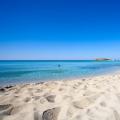
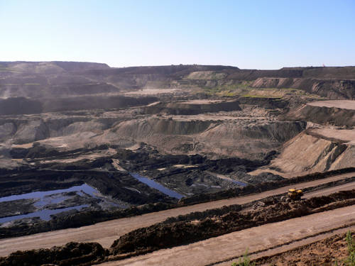
Teacher: Suggests to determine the topic of the lesson by looking at the pictures
Students: look at the pictures and determine the topic of the lesson. In the workbooks write down the topic of the lesson.
The teacher is talking: Modern Asia is a continent of contrasts where wealth and poverty coexist. But it is impossible not to admit that in our time Overseas Asia is demonstrating serious economic growth.
The successes achieved in the development of Foreign Asia allow us to say with confidence that the prospects for economic growth are quite favorable. According to World Bank forecasts, over the next 10 years, the average growth rate in South Asia should be 5.4%, East Asia - 7.7%. It is expected that the increase in per capita income for 2010-2015 will be in East Asia - 6.6%. On average, the income of each inhabitant of the Earth, according to the forecast, will increase annually by 1.9%.
What do you think allowed Foreign Asia to achieve such success in such a short time in its economic development?
Student responses: Asia has made significant progress due to its favorable economic and geographical position, high resource endowment, and high endowment labor resources).
Teacher: offers to complete task 2 (group) during the analysis of cartographic and statistical material, as well as the text on pages 89-91, to prove the correctness of the assumptions made. Logbook strategy. Students complete the table as they go. First, what idea do they have on this issue, then what did they learn from additional sources. Mutual evaluation "Two stars one wish"
Group 1 - analysis of the natural conditions of Asia
Group 2 - analysis of the natural resource potential of Asia
Students: first fill in the first column answering their question, that is, what they know, after they have studied this issue from additional sources, they fill out the second column. Mutual evaluation "Two stars one wish"
Material for the teacher.
Natural resource potential the region is huge. However, resources are unevenly distributed, which also leads to uneven distribution of the population and economy. The main wealth of Asia is minerals:
oil (regions of the Persian Gulf and the Mesopotamian Trough (Iran, Iraq, Saudi Arabia, Kuwait, Bahrain, United Arab Emirates, Qatar), as well as Indonesia, Myanmar, the shelf zone of the marginal seas of East and Southeast Asia); Of the 30 giant oil fields explored throughout the world, 15 are located in the Persian Gulf.
hard coal (China, India);
iron and manganese ores (India);
chrome ores (Turkey, India, Philippines);
tin ores (Myanmar, Thailand, Malaysia);
copper and nickel ores (Jordan).
Great resources inland waters. However, they are placed extremely unevenly. The most dense river network in South and Southeast Asia. Vast expanses of Central and Southwestern Asia are arid.
Agro-climatic resources are characterized by large reserves of heat with a lack of moisture in many areas, so artificial irrigation has been used in Asia since ancient times.
Soils are not very fertile, with the exception of alluvial soils of river valleys.
Forest resources are presented tropical rainforests South-East Asia. Valuable species of trees have been preserved here: red, iron, sandalwood, camphor.
Many countries have significant recreational resources, both natural and anthropogenic.
Teacher: Offers to complete Task 3 (individual)
"Question - answer" Strategy "Hot chair". Peer assessment "From fist to 5 fingers"
1. What are the main features that characterize the natural conditions of Asia?
2Using the maps of the atlas, compare the minerals of the Arabian Peninsula and the Hindustan Peninsula?
3. What types of resources do Asian countries lack? What measures are being taken to solve this problem?
4. The lowest place in Asia?
5. highest peak Asia?
6. What is the climate of Asia?
Students: answer the questions posed by the teacher and give answers. Peer assessment "From fist to 5 fingers"
Teacher: Homework: displays on a slide, organizes the recording of homework in diaries.
Students: Write down homework: for category A: prepare a presentation of the natural conditions and resources of Asia; for category B, C Apply to contour map"Mineral Resources" of Asia
Reflection: Teacher: Invites students to compose a syncwine on the question “What is Asia like?”
For instance:
Asia
Multifaceted, unique, enticing!
Keeping traditions, moving forward!
Asia has a great future!
Collaborate!
Pupils: Express their thoughts in the form of a verse. At the end of the lesson, hand over to the teacher.