Everest from Airplane (shrimpo1967 / flickr.com) Everest (Neil Young / flickr.com) Mount Everest from Base Camp (Rupert Taylor-Price / flickr.com) Mount Everest, Base Camp and Rongbuk (Göran Höglund (Kartläsarn) / flickr. com) Summit of Chomolungma (jo cool / flickr.com) View of Everest (Christopher Michel / flickr.com) cksom / flickr.com Mahatma4711 / flickr.com McKay Savage / flickr.com ilker ender / flickr.com Fred Postles / flickr. com Jeff P / flickr.com Everest in the clouds (Jean-François Gornet / flickr.com) utpala ॐ / flickr.com View of Everest from an airplane (Xiquinho Silva / flickr.com) Rick McCharles / flickr.com Climbing Everest (Rick McCharles / flickr.com) Everest Base Camp - Gorak Shep - Nepal (lampertron / flickr.com) akunamatata / flickr.com Top of Mount Chomolungma (Everest) (TausP. / Flickr.com) Denn Ukoloff / flickr.com Mount Everest (Christopher Michel / flickr.com) Returning from Everest Base Camp (valcker / flickr.com) Everest and Nuptz e (smallufo / flickr.com) Stefanos Nikologianis / flickr.com
Everest or Chomolungma is the highest mountain peak in the world. It is located in the Himalayas, on the border of Nepal and the Tibet Autonomous Region of China. Geographical coordinates Mount Everest: 27 ° 59′17 ″ north latitude and 86 ° 55′31 ″ east longitude.
The height of Chomolungma is 8848 meters above sea level. For comparison, the height of Elbrus, the highest point in Russia, is only 5642 meters above sea level, i.e. 3206 m below Chomolungma.
The first ascent of Everest was undertaken on May 29, 1953 by New Zealand climber Edmund Hillary and Sherpa Tenzing Norgay.
The mountain is best known throughout the world as "Everest". This name was given to the peak in honor of George Everest, who was the chief surveyor British India in the 1830s and 40s.

Mount Everest (Christopher Michel / flickr.com)
Interestingly, the mountain was so named during the life of Everest, about a year before his death. The name was proposed by a student of the scientist who calculated the exact height of the peak and thereby proved that it is the highest on Earth. Prior to this, the summit was also known as "Peak XV".
The traditional Tibetan name of the peak is Chomolungma, which can be translated as "mistress of the winds." This name is widely used in Russian cartography, but in Western countries it is not very well known, as it is considered rather difficult to pronounce.
On the maps published in our country, the peak is usually signed as "Chomolungma", and the name "Everest" is indicated in brackets. There is also a traditional Nepalese name for the mountain - Sagarmatha.
Where is Mount Everest (Chomolungma)?
Almost every child knows where Everest is today. Looking at geographic map, then you can see that it is located in the highest mountain system of the Earth - the Himalayas, on the border of Nepal and the PRC.
Everest coordinates: 27 ° 59′17 ″ N and 86 ° 55'31 "E. Mount Everest is part of the Mahalangur-Himal ridge; the Nepalese part of it is located within the Sagarmatha Park.
Summit of everest
The top of Mount Chomolungma looks like a pyramid with three almost flat sides. The southern slope is steeper, snow and ice hardly even linger on it, the northern slope is slightly flatter.
The relative height of the mountain is about 3550 m. The South Col pass, which reaches 7906 meters above sea level, connects Everest with Mount Lhotse (8516 m), and the North Col pass (7020 m) - with Mount Changse (7553 m). Most of the climbing routes pass through these two passes.
Geographic characteristic
In the hollow between the peaks of Chomolungma and Lhotse, there is the Khumbu glacier. Below it turns into the icefall of the same name, which is considered the most dangerous area when climbing the South Wing.

View of Everest (Christopher Michel / flickr.com)
This can be explained by the fact that the icefall is almost constantly in motion. Climbers use various ladders and railings to climb this place.
Below the icefall, the glacier continues again and ends only at an altitude of 4600 meters. Its total length is 22 km.
Another notable site of local topography is the Kangshung Wall. This is the eastern wall of the summit of Mount Chomolungma, the height of which is 3350 meters, and the width of the base is about 3000 meters.
The glacier of the same name is located at the foot of the wall. Climbing the summit on the Kangshung wall is significantly more dangerous compared to the standard routes.

Everest in the Clouds (Jean-François Gornet / flickr.com)
Climate - what time of year is it suitable for climbing Mount Everest?
The summit of Everest is characterized by extremely unfavorable climatic conditions. There are often very strong winds that blow at a speed of over 50 meters per second.
The temperature at the summit is never above 0 degrees. The average July temperature is minus 19 degrees, and average temperature January - 36 degrees below zero. On winter nights, temperatures can drop to 50-60 degrees below zero.
What is the best period of the year for conquering the summit? Based climatic conditions, the most favorable for climbing is the beginning of May. At this time, the winds are usually the least strong here.
How was Everest formed?
The history of the formation of Everest is closely related to the history of the formation of the Himalayas, which dates back to many millions of years ago and stems from global geological processes.

The summit of Chomolungma (jo cool / flickr.com)
About 90 million years ago, the Indian plate broke away from the giant mainland of Gondwana and began to move northward rather quickly.
The speed of movement reached twenty centimeters per year, which is significantly higher than the speed of movement of any other plate. crust... About 50-55 million years ago, the Indian Plate began to collide with the Eurasian Plate.
As a result of this collision, the Eurasian plate was strongly deformed - a vast mountain belt was formed, the most high part of which the Himalayas are.
At the same time, the sedimentary rocks that previously made up the bottom of the ancient ocean were crushed into huge folds and were often at great heights. This explains the fact that the summit of Everest is composed of sedimentary rocks.

Everest education scheme
Today, the Indian Plate continues to move northeastward, deforming the Eurasian Plate. In this regard, mountain building processes in the Himalayas continue.
The height of the mountain system in general and of individual peaks in particular continues to slowly increase by several millimeters per year.
During large earthquakes, the change in the height of the territory can occur almost instantly and be much more significant.
Ecology: trash left by climbers, bodies of the dead
The environmental situation on Mount Chomolungma leaves much to be desired. During the ascent, a huge amount of debris has accumulated on its slopes.
As of 2007, only the Tibetan section of the mountain contains about 120 tons of various garbage left by climbers. How to remove garbage from the slopes is not entirely clear.
In the past few years, there have been attempts to collect waste, but this was clearly not enough. Another problem is the evacuation and burial of the bodies of deceased climbers.
- Quite an interesting fact is that the water at the highest peak in the world boils at a temperature of only +68 ° C. You may be asking why? This is due to the fact that Atmosphere pressure here it is only a third of the normal pressure at sea level.
- Another interesting fact- this is the gradual growth of the mountain. Indeed, the height of Chomolungma increases every year by an amount from 3 to 6 millimeters. The same trend is characteristic of all the Himalayas, which is explained by the ongoing processes of mountain building and the associated rise in the territory.
- I would also like to mention such an interesting fact that Everest is the highest point in the world, only if we take into account the height from the level of the world ocean. So, the Mauna Kea volcano on the island of Hawaii, rises relative to the ocean floor by 10 203 meters, while its height above sea level is only 4205 meters.
A place with a view of Everest
Thanks to the efforts of the www.AirPano.com team, it became possible virtual walk on Everest. AirPano specializes in virtual tours filmed in high definition bird's-eye. Below is a panorama with a view of Everest.
Mount Everest (also called Chomolungma) is known as the highest in the world, but only if you do not take absolute height as a criterion. Everest rises above sea level for the maximum distance among the other mountains of the Earth, but there is a volcano growing from the bottom of the ocean, so in fact its height is higher. Nevertheless, since the summit of Everest reaches the highest mark on the planet, it is the main goal of most climbers who dream of conquering a giant at least once.
Mount Everest location and characteristics
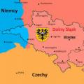
There are hardly those who do not know on which continent the highest peak is located (Eurasia). They talk about Everest in geography lessons, showing where the mountain is located, which hemisphere belongs to. Many people miss which country Chomolungma is located in, but geographical coordinates will help determine the exact position of the highest point on the planet, and this is China. Its latitude and longitude in degrees are as follows: 27 ° 59′17 ″ N. sh. 86 ° 55'31 "in. etc. 
The mountain is part of the mountain range, being part of the Mahalangur-Himal ridge. In fact, it belongs to two countries: Nepal and the PRC, while the highest point, the North Peak, is part of China. Its height in meters is 8848. The southern peak is slightly inferior in terms of its indicator, but, nevertheless, reaches 8760 meters. 
Due to its outstanding height, Everest was measured relatively recently. The first estimate appeared back in 1852 in the course of trigonometric calculations. In the 1950s, theodolites were already used: with their help, it was possible to fix the exact value equal to 8848.13 meters. Later, various information appeared, in which the measurements fluctuated up and down. The reason for this was that the peak consists of glaciers, which for a number of reasons can increase and decrease. It is officially recognized that the height of Everest is 8,848 meters, and its solid rock ends at around 8,844 meters. 
The shape of Everest resembles a pyramid with three faces, while from the south the slope is steep and bare, as snow and ice slide from this side. Because of great height it is not surprising that wind speeds can exceed 200 m / s. In summer, the temperature fluctuates around 0 degrees, in January it drops to -35 degrees during the day and -50 and even -60 at night.
origin of name
Chomolungma is a Tibetan name that means "Divine Mother of vital energy." This unusual name was chosen to honor the Bon goddess Sherab Chamma. She is a symbol of the mother's energy. The Tibetans also gave the mountain a second name with the same etymology - Jomo Gang Kar, which translates as "Holy Mother, white like snow." 
Another popular name comes from English, as it was given as a tribute to the merits of George Everest. At the beginning of the 19th century, he was famous figure geodetic research. The scientist's successor put forward his surname as a name after the employee of the service where Everest worked, made the world's first measurement of "Peak XV", which was considered the highest in Eurasia and presumably on the planet.

There is another name given by the inhabitants of Nepal. In their language, Mount Chomolungma sounds like Sagarmatha, which means "mother of the Universe." In Nepal, they are especially warm to highest peak, so they prefer to call it in their native language.
Mountaineering Center
Mount Everest, due to its outstanding size, has long attracted the attention of climbers, but today climbers climb the proven routes. Many groups prepare in the camps, trekking organized almost daily during the season. This is one of popular destinations tourism, so Mount Chomolungma can hardly be called uninhabited. 
The pioneers Tenzing Norgay and Edmund Hillary, who first reached the highest point in the world in 1953 on May 29, entered the history of ascents. After their luck, many expeditions managed to reach the peak, but only with early XIX over the centuries, hiking has become available to a large circle of comers. 
Climbing to the top is allowed in spring and autumn, as there are fewer winds during these seasons. In the fall, use the rise only from the south side. The preparation takes about two months, as the body must go through a period of acclimatization. The last 300 meters are considered the most dangerous, but the impressions of the opening view are worth it. Not in a single picture or photo can you see what the conqueror of the mountain will receive, because emotions will greatly enhance the effect of what he sees.
The path of the longest mountain belt in the Universe has been beaten through all of Eurasia. It, starting from the foot of the French Alps, stretches all the way to the vastness of South Vietnam. The highest ridge of the gigantic mountain range recognized Himalayas.
The majestic mountain looks like a grandiose petrified wave that ascended into the heavens. The crest of a wave frozen in stone is crowned by the Great Himalayas. In the main Himalayan ridge, stretching along the border of Tibet and Nepal, 11 peaks connected. Each mountain range here has a height of over 8,000 meters.
Historical names of the highest mountain range
Here, in the "abode of eternal snows", on the lands of China, the Chomolungma Mountain is spread - the highest of the Himalayan "eight-thousanders" ridge. The giant mountain, which soared into the skies to an incredible height, has two more names. The inhabitants of Nepal named her Sagarmatha - "Lord of the sky."
The Tibetans call the peak Chomolungma (translated as "the Goddess of the Earth"). For Europeans, it is the peak of Everest. They named the mountain so when India was going through the era of colonization, being under the yoke of Great Britain, and the topographic service of the enslaved state was headed by Major D. Everest, who was studying the colossal mountain system.
Top of the world
The Himalayan massif is considered a unique place. In this wondrous corner are the sources of the Indus and the Ganges. The Chomolungma mountain with its high status became known to the Chinese much earlier than people from the New World. Tibetan monks at the northern foot of the "top of the sky" founded the Ronkbuk monastery, which is still active today.
A majestic spectacle opens before a person entering the inner monastery courtyard - imposing mountain ranges of stunning beauty. The splendor of the grand peak is felt with mountain passes adjacent to it and located many kilometers from it.
Everest formation
The Himalayan ridge, according to geologists, was formed during the split of the ancient continent of Gondwana. The mainland broke into slabs. The Indian plate, moving northward, hit the Eurasian debris. In the zone of plate joining, the earth's crust was compressed and a huge fold was formed, which was called the Himalayas.
Himalayan mountain system formed three grand steps, spreading from north to south. The “pre-Himalayas”, which form the southern step, have a lower height. The mountain ranges have an altitude of about 1000 m.
The middle step is represented by massifs, towering 3500 m. In the northern part, the height of the mountain peaks ranges from 6000-8000 m. The width of the mountain ranges reaches 80-90 km.
The growth of the Himalayan Range has not stopped until now. Scientists assure that the height of the Himalayas increases by 3-10 mm annually. The mountain range contains 75 peaks exceeding 7,000 meters. The Nepalese Himalayas are recognized as the highest.

And above all the ridges, Mount Chomolungma ascended. Where is its peak? It towers over the endless Chinese expanses. The highest peak Everest is surrounded by other giant peaks that form a real "roof of the world" that holds the skies above the ground.
Mount Everest
The mountain peak, proudly towering up from the eternal Himalayan snows, beckons tourists with its grandeur and mesmerizing beauty. Many climbers dream of conquering the steep slopes of the grandiose mountain range with the shape of a trihedral pyramid. Overcoming for them difficult mountain paths with a length of 8848 meters (such is the height of Mount Chomolungma) is a great honor!
The exact height of the peak was established by English topographers in 1852. Since then, many attempts have been made that would refute the primacy of Everest. However, they were repeatedly debunked, because they all turned out to be untenable.

While the bulk of the high peaks included in the mountain complexes of the world have been submitted to climbers, to the "seven-thousanders" and "eight-thousanders" that form Mount Chomolungma, Everest, if you like, the climbers did not know how to approach.
Climate on Chomolungma
The steepness of the southern slope is much greater than that of the other two. Snow does not linger on it, so a naked rock appears before the eyes of travelers. The rest of the slopes are covered with glaciers, stretching up to 5,000 meters.

Clarifying the coordinates of Mount Chomolungma, tourists understand that the climate at the "top of the world" is far from comfortable. When bad weather is playing out on the mountain range, it is very dangerous to stay in its vastness. The thermometer freezes here at around -60 0 С, and the wind whistles at a speed of 200 km / h.
Climbing Chomolungma
The magnetic pull of the highest point on Earth is incredible. Year after year, climbers head to the East, to where Mount Chomolungma is located, where the tip of its giant peak piercing the clouds is located. The temptation to conquer this peak is great, but only a few reach it.
The philosophy of Everest is harsh. The path to its peak is reserved for those who are fussy and hurried, unprincipled and careless. It often turns into a tragedy for them. The first climbers, who began climbing at the dawn of the 20th century, suffered a fiasco due to poor equipment. For the first time, Mount Chomolungma conquered people in 1953.
Climbers compete incessantly in the difficulty of climbing Mount Everest. Some try to climb the icy slopes in the middle of winter. Others, intending to climb the summit, refuse to grab oxygen. Emancipated women, united in a group, try to overcome difficult path without men.

However, only Reinhold Messner was able to surprise everyone. The rebellious mountain Chomolungma gave him great grace - to set several records at the same time! He, climbing alone on the northern slope without oxygen, overcame the ascent to the top in 3 days. In 1992, 32 climbers climbed the peak as part of the Russian team "Lada-Everest".
The ascents of the last time
The success of the expedition depends not so much on the quality of the equipment as on the climate, which determines the latitude and longitude of Mount Chomolungma (27 ° 59′17 ″ N, 86 ° 55′31 ″ E), as well as its height. In addition, climbers have to overcome altitude sickness, which occurs when the air is too rarefied.

About 500 travelers annually go to conquer the peak. The governments of the Celestial Empire and Nepal are not averse to making money on the granting of the right to climb the slopes of the harsh summit. Nowadays almost all ascents are carried out on a commercial basis. Tourists negotiate in specialized firms about the organization of the ascent to the peak of Everest.
Professional guides accompany travelers to the very top. The service to climbers costs 65,000 dollars. This amount includes training, the provision of the required equipment and security (to the extent possible) on the laborious mountain route. It takes about 2 months to acclimatize and climb.
Mount Everest (Nepal) - detailed description, location, reviews, photos and videos.
- Tours for May Worldwide
- Last Minute Tours Worldwide
Previous photo Next photo


The highest peak of the planet Everest looks at the world calmly from a height of 8848 meters. To conquer Everest or, as the locals call it, Chomolungmu ("mistress of the winds") is an honor for any climber, a dream that in most cases remains unfulfilled. However, in our age of commerce and any tourist routes, the impossible becomes less and less: at least 35,000 USD and two months of free time (plus excellent health) - and you soar above the clouds, standing on a 20-meter platform at the top of the world. And if you do not have such impressive reserves on your current account, but you still want to join the beautiful, you can limit the route to parking in the Base or Advanced Base Camps of Everest. Prices on the page are for October 2018.
A bit of history and geography
Everest is the most high point planets, height - 8848 meters. The mountain is part of the Himalayan mountain system and lies exactly on the border between China (northern slope) and Nepal (southern slope), so you can climb from two countries at once, to choose from.
The appearance of Everest is a triangular pyramid with two passes - the North and South saddle and two subsidiary peaks - Lhotse (South) and Changse (North). On the eastern side of the pyramid there is a wall inaccessible for ascents. From a 5-kilometer height to the very summit, Everest is covered with glaciers.
In the English version, the mountain is called Everest in honor of the head of the survey of British India in the middle of the 19th century, Sir George Everest. Well, the first person to ascend to the "throne of God" was New Zealander Edmund Hillary - it happened on May 29, 1953.
To date, more than 4,000 climbers have visited the highest peak in the world, and the lion's share of them falls on the recent years of the development of mountaineering on Everest and the commercialization of climbing. More than 500 people climb the summit annually, but not all of them reach it.
Climbing Mount Everest
Climbing Everest is carried out in spring and autumn; during the rest of the year, monsoons are raging here, in winter the temperature drops to -50 ° C, strong winds blow. Several agencies, including Russian ones, are involved in organizing tours. The main requirements for the potential conqueror of Everest: firstly, a round amount in stock (at least 35,000 USD; the optimal package is 55,000 USD), and secondly, two months of free time (necessary for acclimatization, gradual ascent, training exits, etc.) .), thirdly, good health, which allows you to successfully pass acclimatization at an altitude of almost 9 km.
The ascent program is structured as follows. Arrival in Kathmandu, further flight to Lhasa, two transfers to villages closer to Everest, acclimatization day and transfer to Everest Base Camp at an altitude of 5300 meters. From the Base Camp - a cycle of training ascents and transfer to the Advanced Base Camp (6400 m). The actual ascent (at the top you will stand no more than 20 minutes) and the return descent, then the route in the reverse order.
The main problem that awaits the conquerors of Everest is the inability to acclimatize. The rest of the route is designed for well-to-do tourists who have already been everywhere, with not the most outstanding level of physical fitness.
If you are not ready to part with such an impressive amount, you can limit yourself to the ascent to Everest Base Camp and spending here from one to one and a half months. At the same time, the cost will significantly decrease - up to 6000-8000 USD.
Anyone who has studied geography at least a little has a rough idea of where Mount Everest is. This is one of the most famous peaks our planet, also known under the Tibetan name of Chomolungma and the Nepalese name of Sagarmatha.
Translated from the Tibetan language, Chomolungma means "Divine mother who gives life energy." Patroness of the mountain in religious tradition Bon is considered the goddess Sherab Chamma, symbolizing the motherhood. Among the people of Tibet, she is also known as "Jomo Gang Kar" - "Holy Mother, white as a blanket of snow." This name is explained by the mountains in which Everest is located: the Himalayas are known for their harsh winters and frequent snowfalls.
The peak received its European name in honor of Sir George Everest. In the first half of the 19th century, he was appointed head of a geodetic expedition in areas of India occupied by British troops.
Geography
Any schoolchild knows exactly on which continent Chomolungma is located. It is part of the Himalayan mountain range and is part of the area known as Khumbu Himal. There are two peaks in the mountain: North and South. The southern peak with a height of 8760 m is located on the border of Tibet and Nepal, and its northern counterpart is located on the territory of the Chinese People's Republic... In the case of the North Summit absolute height the mountain is 8848 m.
Chomolungma resembles a three-sided pyramid in shape. The steepness of the southern slope is significantly greater, as a result of which the snow cover does not hold on it and it remains constantly exposed. Everest is closely surrounded by mountains on all sides: it is connected with Lhotse by the South Col pass. A similar pass in the north connects the peak with Mount Changze. To the east is the insurmountable Kangashung mountain wall. Melted glacial waters flow down all slopes of Chomolungma, not reaching its foot for about 5 km.
The mountain is over 60 million years old. It arose as a result of a noticeable movement of the Indian tectonic plate in relation to the Asian one. Since the region is seismically active, Everest's height increases by about a quarter of an inch annually.
The mountain is predominantly composed of sedimentary rocks. The strongest hurricanes blow at its top: the wind speed sometimes exceeds 200 km / h. Climbing Everest without special thermal clothing is simply impossible, since even in the height of summer the average air temperature here is no more than 0 ° С. In winter, however, the thermometer often drops to -40 ° C (at night, the temperature can drop to -50 -60 ° C).
For a long time there was a debate about which country is Mount Everest. Since 1959, it is believed that the mountain giant separates the territories of Nepal and China and is equally considered national treasure both states. The coordinates of Mount Chomolungma are equal to 27 ° 59′17 ″ s. sh. 86 ° 55'31 "in. etc.

The tragedies of Everest
The conquest of Chomolungma remains the ultimate dream of most professional climbers. However, the most high mountain the world is not always inferior to the attempts of climbers to reach its summit. It is estimated that in the period from the 1920s to our time, at least 300 athletes with different levels of training and material capabilities tried to do this. Only a few daredevils succeeded in this.

Conquering Everest where your own life is at stake
Most of the extreme lovers died while climbing or descending from oxygen starvation, avalanches, snow falls, rockfalls and altitude sickness. At the same time, the circumstances of their death were sometimes simply terrifying: the mountain of death does not forgive the slightest mistake.
Even with the vast possibilities of modern civilization and almost perfect technology, it is not always possible to save climbers and even lower their corpses to the foot of the mountain. After all, helicopters cannot fly at such an altitude, and few people dare to carry bodies by hand and risk their own lives. Therefore, in our time, modern climbers have to literally climb to the top through the corpses of their comrades, many of whom remain on the slopes for decades.
The most creepy and unusual stories associated with the ascent of Chomolungma, the following are considered:
- On the mountainside lie the remains of Irving and Mallory - the first climbers who, despite the natural elements, conquered unapproachable mountain back in 1924. However on way back they were overtaken by an inexorable death, caused either by oxygen starvation, or by frostbite. It is not possible to accurately determine this due to the remoteness of the years, but athletes confirm that Mallory's body can still be seen on the southern slope of Everest a little off the trail. The action of the wind and other natural conditions easily turned the corpse into an almost skeleton without flesh, making a frightening impression.
- If you ever plan to climb Chomolungma, rely only on your strength and finances. The best equipment and reliable Sherpa guides are the guarantee that you will be able to return unharmed. Indeed, on the slope of the mountain, everyone can rely only on himself. This is well illustrated by the story of climbers from India who suffered from a snow storm during their ascent. Their Japanese colleagues, who were rising almost at the same time, calmly walked past people who were begging for help, so that on the way back, they would be found dead.
- Mystical story connected with the death of the English climber David Sharp. He did not have enough money for spare equipment and payment for the services of guides. Therefore, when at an altitude of more than 8000 m, his oxygen cylinder failed, the unfortunate athlete simply lost consciousness and was left to die on the slope. Expeditions, absolutely indifferent to the sight of a dying man, passed by him, hurrying to mark the summit of Everest. One of them was a squad of well-equipped hikers from Hall and Weber mountaineering. With disgust, they stepped over the corpse of Sharpe, who was dying painfully for several days, but were punished by some mystical forces. Weber literally 100 m before the summit lost sight and was forced to turn back, after which he suddenly fell into the arms of the guide and died. His companion Hall, an experienced climber, also felt unwell. Sherpas were sent to help him, but they could not bring him to his senses. Only a couple of days later, through the combined efforts of several expeditions, Hall were able to save. He got off pretty lightly - with just frostbitten hands.
- Chomolungma also became the last refuge for couples in love, the most famous of which are the Russian climber Sergei Arsentiev and his wife of American descent. Having climbed to the top of the mountain without oxygen, they practically set a new record. However, on the way back natural conditions separated the husband and wife, after which the exhausted Francis lay for a couple of days on the southern slope before her death. Attempts to save her were in vain, since they threatened the death of the rescuers themselves. Sergei tried to save his beloved, but fell into the abyss. Later, his body was found in an unusual bowing position, as if he was praying to grief.

Ghosts of everest
When climbing Chomolungma, even seasoned masters of sports can be frightened not only by the numerous bodies of brave brave men who risked everything for the sake of mountaineering records, but also by their restless souls. The ghost stories of Everest are numerous, and many of them are attributed to quite sane and skeptical climbers:
- In 1975, one of the members of the English expedition to Mount Ascot at night climbed on ropes to the top and suddenly noticed a silently moving silhouette behind him out of the corner of his eye. He made no sound and stopped with the frightened athlete. An agitated Ascot contacted the camp and learned that no one had left it. However, immediately after the British left, a cameraman tragically died at the base.
- In 2004, rock climber Dorje, while descending, saw more than 10 translucent silhouettes reaching out to him and begging for food and warmth. Since then, those who dare to resist the natural elements on Everest, while climbing, scatter rice groats, burn juniper branches and pray. It is believed that this eases the suffering of the restless souls of the dead climbers.
- The famous Italian climber Massner climbed Chomolungma on his own and without additional oxygen equipment. Having passed two-thirds of the way to the summit, at the place of the death of the first conquerors of the summit in 1924, he saw two translucent figures beckoning him and longing to eat and warm up. The frightened climber hastened to retreat, mistaking them for hallucinations.
Modern esoteric experts believe that thin air and extreme environment Everest awaken paranormal abilities in a person and open access to another dimension.
Organization of tours to Chomolungma
The easiest way to get to Everest is to buy air tickets to Kathmandu (capital of Nepal) for 480 USD - 550 USD. The flight duration is about 11 hours. Visa foreign tourists issued directly at the airport, but it is advisable to take a passport photo with you. Its cost is 15 USD for 15 days and 40 USD for 30 days.
After arrival, you can rent a car and drive to one of the base camps: North, which is located on the border with Tibet, or South, located in Nepal. average price climbing the largest mountain on the planet is approximately:
- 30,000 USD if you are going to climb alone or with a small organized group of climbers;
- 60,000 USD if you decide to use the services of a tour operator;
- 90,000 USD if you want to make the ascent as comfortable and safe as possible (the cost of wireless Internet and telephone communication is included).
This price does not include the services of Sherpa guides, with whom it is better to negotiate on the spot. However, these amounts include the collection of the government of Nepal from all climbers who come to Chomolungma. Depending on the season and the number of members of the expedition, this tax can be 11000 USD - 25000 USD.
Climbing Mount Everest will remain one of the most vivid memories of your life, but do not forget that one wrong step can cost you your life.