Despite the availability of inland waters, Australia has been awarded the status of the driest continent on Earth. The climate and relief of the continent are rather monotonous, which cannot be said about the animal and plant world. The main part of Australia receives a small amount atmospheric precipitation, and the main watershed is located east of the center of the mainland. This explains the strange shape of the drainage systems.
Australia climate
The main part of the continent is located on the Australian Plate. The relief was formed during the Archean folding. For this reason, there is almost no mountain ranges. Climatic conditions resemble those of the African continent. At a time when there is snow on the territory of Eurasia, Australia is at the mercy of a hot summer. average temperature in the center of the mainland - about 35 ºC. The winter period starts in June and lasts until September. The average air temperature is about 10 ºC. In the dark, frosts are possible. Most of the territory receives no more than 250 mm of precipitation during the year.
The Australian continent is in three natural areas ah: tropical, subtropical and subequatorial. About 44% of the area is occupied by deserts, of which there are 8. southern part the continent is characterized by sultry and dry summers, while winters, on the contrary, are rainy. Northern australia is influenced by the South Tradewind Current. It rains abundantly in summer, and clear and dry in winter.
Tectonics
Most of the continent's mountain systems disappeared as a result of weathering processes over several billion years. Highest peak Australia - Mount Kostsyushko. The main part of the hills has a height of less than 200 m. About 40 million years ago, the Great Dividing Range was formed. It is significantly deformed mountain system, moreover, the only one here.
The mainland is located far from the places of contact of tectonic plates. This circumstance explains the fact that there are no volcanoes in Australia. The joint is in Oceania. There is high volcanic activity in this place.
Inland waters of Australia: at a glance
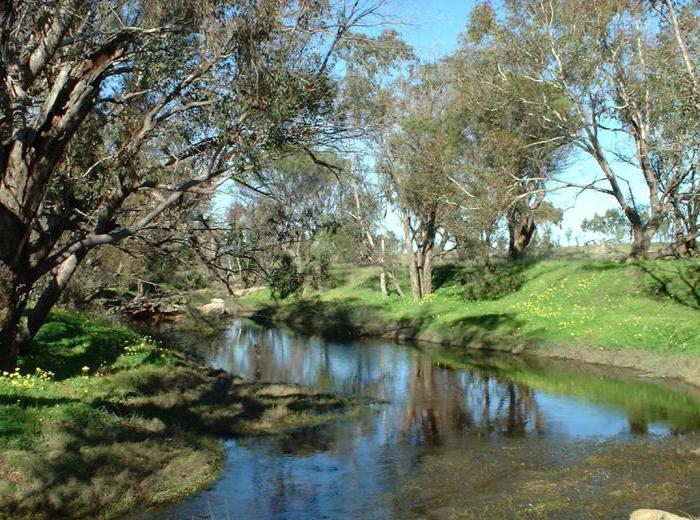
The continent has a small indicator of river flow. Most of the waterways dry up. The rivers that begin on the eastern slopes of the Dividing Range and are located in Tasmania are year-round. Inland waters Australia, located to the west, dry up during the summer heat. Most of the territory has streams and rivers flowing inland. The boundaries of the pools that collect water are weakly expressed.
The rivers
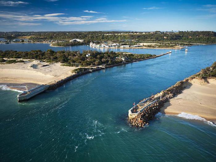
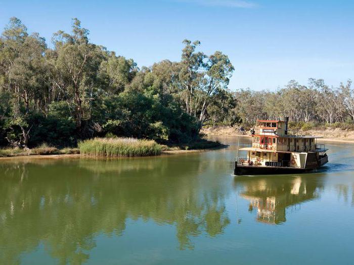
The inland waters of Australia, the photos of which are in the article, are represented by the main river - the Murray. It has three large tributaries collecting moisture from an area of over 1,000 km 2. The sources of the main tributaries are located 200 km from the eastern coast of the continent. Along the course of the current, they combine into large streams, flowing along winding channels in the direction of the sea. The length of Murray is 2,575 km. The lower course is navigable for 970 km from the mouth.
An obstacle for large water transport are sandbanks. Due to their location near the estuary, seagoing vessels cannot navigate the Murray. Marrumbidgee is a tributary of the largest river on the continent. Its length is about 1690 km, the river originates in the Kuma region. "Snowy Mountains" is a hydroelectric power station that regulates the joint flow of these two rivers.
The Darling is the second major tributary of the Murray, collecting water from the western slopes of the Dividing Range. The length of this river is 2740 km. In its channel and on some tributaries there are dams that regulate the flow all the time, except for severe droughts.
Water regime
The peculiarities of the inland waters of Australia are not limited to this. The main part of the continent's territory has an isolated runoff or belongs to inland basins. An example of such a zone is the Western Plateau. In numerous channels, water appears rarely and for a short period of time. Runoffs lead to dry lakes or wetlands.
The huge territory, the area of which is 1143.7 thousand km 2, belongs to the basin of the lake. Air, one of the ten largest on Earth. The pool includes the Cooper Creek, Diamantina and Georgina streams. Their angle of incidence is very small, the channels are meandering, in places they intersect.
She is studying the inland waters of Australia in the 7th grade of a comprehensive school. It is known from the curriculum that river beds in the basin are almost always dry, and water flows appear in them only after heavy rainfall. At this time, the width of water streams reaches several kilometers. However, they almost always disappear before reaching the lake basin. Water appeared in it for the first time only in 1950 for the entire time of observation by Europeans who arrived on the mainland.
Australia's climate and inland waters are interconnected. The consequence of the low amount of precipitation was the instability of most of the continent's rivers. For this reason, they cannot be used for the benefit of man. There are few areas suitable for the construction of dams, especially in the central part of the mainland, where the problem of water supply is very acute. To solve it, many deep reservoirs are needed.
In the driest regions, large amounts of water simply evaporate. Only in Tasmania does inland waters of Australia have a stable year-round flow.
Lakes
The relief, climate of Australia and inland waters have led to a large number of dry lakes. The bottom of these hollows is covered with clay rich in salts. In some cases, there are lakes filled with water. However, they are saturated with salts and silt at a shallow depth. Most of them are in the western part of the continent, and the largest are in the southern part (Eyre, From, Torrens, etc.).
In the southeast of the mainland there are many lagoons with salt-rich water, which are separated from the sea by sandy barriers. Tasmania is a region where you can find the largest lakes of the continent with some built hydroelectric power plants.
The groundwater
Australia's underground inland waters are a vital resource. Most rural settlements supplied from this source. The areas occupied by underground basins are huge (over 3240 thousand km 2). Most contain dissolved solids that are not suitable for irrigation. However, this water can be used for livestock farms.
The largest on the planet, the Great Artesian Basin, is located underground. Its area is 1,751.5 thousand km 2. The underground waters contain a large amount of salt. However, without this source of moisture, the mainland will be at risk. There are also smaller artesian basins in other parts of the continent.
1) Working with a contour map:
a) sign the names and coordinates extreme points Australia;
b) designate the climatic zones of Australia and indicate in numbers the change average annual quantity precipitation in areas that cross the parallels 20 and 30 °.
2) Compare the geographic location of Australia and Africa. Fill the table.
- Answer:
|
Similarity |
Differences |
|
|
Australia |
||
|
1) Washed by waters Indian Ocean. |
1) Washed by the Pacific Ocean. |
1) Washed by the Atlantic Ocean. |
|
2) Slightly cut edges. |
2) Located south of the equator. |
2) The equator crosses almost in half. |
|
3) Crosses the southern tropic. |
3) The smallest continent. |
3) Second place in S. |
|
4) Identical KP. |
4) The driest continent. |
4) The hottest continent. |
|
5) High temperatures all year round. |
5) The greatest remoteness from the continents. |
5) The closest continent to Africa is Eurasia. |
3) Make a forecast of change geographic location Australia, building on the theory of lithospheric plates.
- Answer: Australia is located on the Indo-Australian Plate. This plate moves to the North-East at a speed of 67 mm / year. In millions of years, the mainland will approach Eurasia, and in billions it can reach North America.
4) What geographic objects Australia are named after travelers, explorers and other famous personalities?
- Answer: o. Tasmania, Tasman Sea, Bass Strait, Lake Air North, Cape Byron.
5) What large parts in the relief of the mainland can be distinguished on a physical map?
- Answer:
- 1) Western Australian Highlands.
- 2) Central lowland.
- 3) Great Dividing Range.
6) Is it true that Australia is the hottest and driest continent on our planet? Explain your answer.
- Answer: The statement is not true, because the hottest continent is Africa.
7) Using climate map Atlas, Climate Characteristic by Australia Point. Fill the table.
- Answer:
|
Average temperature, ° С |
Average annual precipitation, mm |
Climate type |
||
|
Mouth of the Murray River |
Moderate |
|||
|
Perth city |
Subtropical |
|||
|
Brisbane city |
Tropical |
|||
|
Equatorial |
||||
8) What areas of Australia and Africa have a similar climate? Why?
- Answer: Northern Australia and Central Africa, since the continents cross the tropics (Australia - the Southern Tropic, Africa - the Southern and Northern Tropics: the climate is subequatorial).
9) When does Tasmania get a lot of rainfall? Why?
- Answer: Winter (June, July, August). Because O. Tasmania in the subtropical KP, in which precipitation is associated with the arrival of VMs from temperate latitudes.
10) why Australia is poor surface waters?
- Answer: This is due to the dominance of a dry tropical and subtropical climate on the mainland.
11) It is known that there are few rivers and freshwater lakes in Australia. How did you solve the problem of providing the population and the economy with fresh (or almost fresh) water?
- Answer: Construction of water desalination facilities.
12) What is the peculiarity of the placement of natural areas in Australia?
- Answer: Savannah and tropical deserts occupy a large area (central and western parts).
13) What are the differences between the Australian deserts and the Sahara:
a) climate.
- Answer: More rainfall, less dry and hot climate.
b) by vegetation.
- Answer: There are no areas free of vegetation.
c) in the animal world.
- Answer: The most diverse.
d) inland waters.
- Answer: There are no rich reserves of groundwater.
14) What plants and animals brought to the mainland contribute to the disruption of connections between the components of nature?
- Answer: Dogs, sheep, rabbits, cows, cacti, aloe, oak, poplar.
What components of Australia's nature have been most modified by humans?
- Answer: Vegetation and fauna.
15) Where are the most big cities Australia? Why?
- Answer: South-East, East, South-West. These areas have the most favorable natural conditions.
16) How would Australia's climate change if the Great Dividing Range were located on the western coast of the mainland?
- Answer: More humid climate, decrease in the area of deserts.
Australia- the smallest continent the globe, it is occupied by the only country - the Australian Union, or simply Australia. Kangaroos, koalas and emu are as common here as hares are in Russia. Australia supplies the world market with wool and ores, wheat and diamonds. This region is always on the sidelines of world catastrophes and wars, its population lives calmly and measuredly and, as it sometimes seems to the Australians themselves, even a little bored.
What is the nature of Australia?
Several tens of millions of years ago, Australia was part of the huge ancient continent of Gondwana, which included Africa in addition to it, South America, Antarctica. After Australia broke away from Gondwana, it developed in isolation, so its nature is very peculiar. Several thousand years ago, Australia was connected to Eurasia by a land bridge, which was located on the site of the Sunda Islands. On this bridge, some plants and animals, as well as people, came to the mainland from Eurasia.
Australia is the lowest continent on Earth. Her average absolute height is 215 m; the highest point, located in the southeast of the mainland, rises above sea level by only 2230 m. On the surface of the Australian plains in some places there are remnants that arose after the destruction of ancient mountains.
Along the shore The Pacific stretches the Great Dividing Range - an ancient Mountain country... Now mountain building processes are not taking place here, so there are no volcanoes and earthquakes. In the southern part of the Great Dividing Range - the Australian Alps - is the most high point mainland - Kostsyushko. Due to the low altitude of the mountains, there are no glaciers on them, and the snow on the slopes lies only in winter.
Between the highlands and plateaus of Western Australia and the Great Dividing Range lies the Central Lowland, with a hot, dry climate. Once upon a time, this place was the bottom of the ocean, where layers of sedimentary deposits were formed. In the middle of the lowland is Lake Eyre, the deepest depression in Australia (about 12 m below sea level). The entire surface of the deserted Central Lowland is covered with a dense network of screams - dry river beds for most of the year.
There are practically no large rivers in Australia. This is due to the dry climate and the peculiarities of the relief of the mainland (the mountains "cut off" the most humid part of it from the rest of the territory). The most abundant river in Australia - Murray - carries 23 times less water than the Volga.
Australia is poor in surface waters, but rich in underground, artesian. The large Artesian groundwater basin stretches from north to south of the mainland for more than 2 thousand km, and from west to east - for 1.8 thousand km. The underground waters of the Great Artesian Basin are located at a depth of up to 1200 m. They are warm and slightly saline.
Why Australia can be called a mainland reserve?
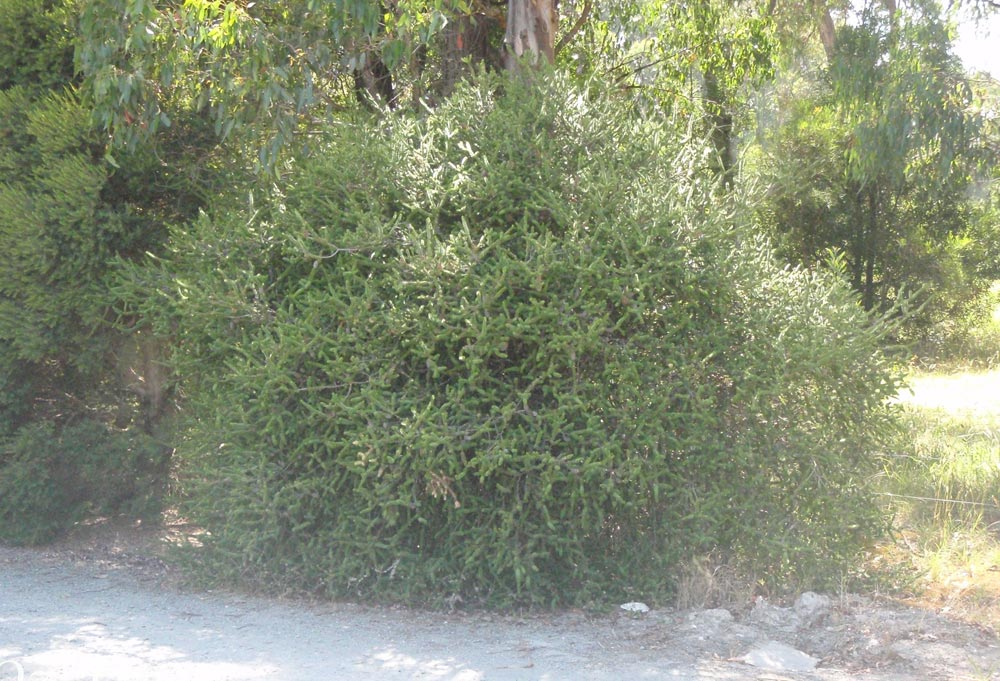
Animal and vegetable world Australia has little in common with other continents, as it developed in isolation. There are a lot of endemics on the continent. Among the plants, the most famous is eucalyptus, which has become a symbol of the mainland. There are over 600 species of eucalyptus trees, including trees and shrubs. Individual trees can be up to 150 meters high. Eucalyptus trees do not provide shade, as the leaves of the trees are turned parallel to the sun's rays. Eucalyptus grows in forests on mountain slopes, in savannas, and in semi-deserts, where they, together with acacias, form thorny thickets - scrub. These plants recover well after forest fires, which are very common in dry climates.
Eucalyptus. Individual trees can be up to 150 meters high.
Scrub - thorny Australian thickets.
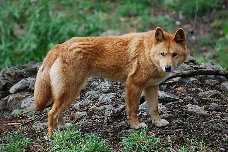
Among the animals of Australia, there are many such that were widespread on Earth in more ancient times, for example, the echidna, the platypus. The most famous Australian animals are marsupials: kangaroo, wombat, koala bear. On the coat of arms of Australia there are images of a kangaroo and an emu. Australian sheep breeders consider kangaroos to be their enemies, because they eat grass that their sheep could eat. The most famous Australian predator, the wild dog dingo, came to the mainland with a man over a land bridge from Eurasia.
The wild dog dingo is the most famous Australian predator.
When did Europeans find out about Australia and settled in it?
Due to its remoteness, Australia has long been unknown to Europeans. For the first time the inhabitants of the Old World set foot on the Australian coast in 1606 They were members of the Dutch expedition,
landed on Cape York Peninsula in the north of the mainland.
The eastern coast of the mainland was discovered by the British navigator James Cook. He named new land New South Wales in honor of one of the regions of Great Britain and declared it the possession of the English king.
At first, Great Britain made the territory of Australia a place of exile for criminals. The first ship with convicts dropped anchor off the coast of the mainland in 1788. At the same time, the first English settlement was founded on Australian soil - future city Sydney. Ships with convicts arrived in Australia until the middle of the 19th century, many of those exiled quickly died in the unfamiliar climate.
A significant influx of population from Europe took place in the middle of the 19th century. and was triggered by the so-called "gold rush": people went to Australia, hoping to get rich quickly by discovering a gold mine.
The number of settlers, mainly from England, Ireland and Scotland, quickly exceeded the number of indigenous people - aborigines, who were forced into the desert lands in the center and west of the country.
Already at the beginning of the 20th century, Australian cities consisted of beautiful stone buildings, their streets were paved with cobblestones, there was a water supply in the houses, telephone communications and electric lighting were developed.
The cities were located on the southeastern and southwestern shores of the mainland. For a long time, the settlers did not know the true size of Australia and the features of its nature.
How does he live modern population Australian Union?
The Australian Union was proclaimed an independent state in 1901. The country's territory is inhabited and developed unevenly More than half of the total population lives on the Pacific coast of the country no further than 80 km from the sea. Most of the inhabitants are Anglo-Australians. In addition to them, Australia is also inhabited by representatives of other nationalities.
The indigenous inhabitants of the mainland - the Australian aborigines - belong to the Negro-Australoid race. For a long time, the main occupation of the aborigines was hunting using throwing weapons: darts, spears, and boomerangs - curved wooden objects capable of returning to hunters. For a long time, Australian aborigines lived on reservations in desert areas, where unauthorized access was prohibited. During the population census, information about them was not taken into account. Only in 1967 were indigenous Australians recognized as full citizens of the country and were given the opportunity to move freely on its territory. Now about half of Aboriginal people continue to live in the north and west of Australia, while the other half live in cities.
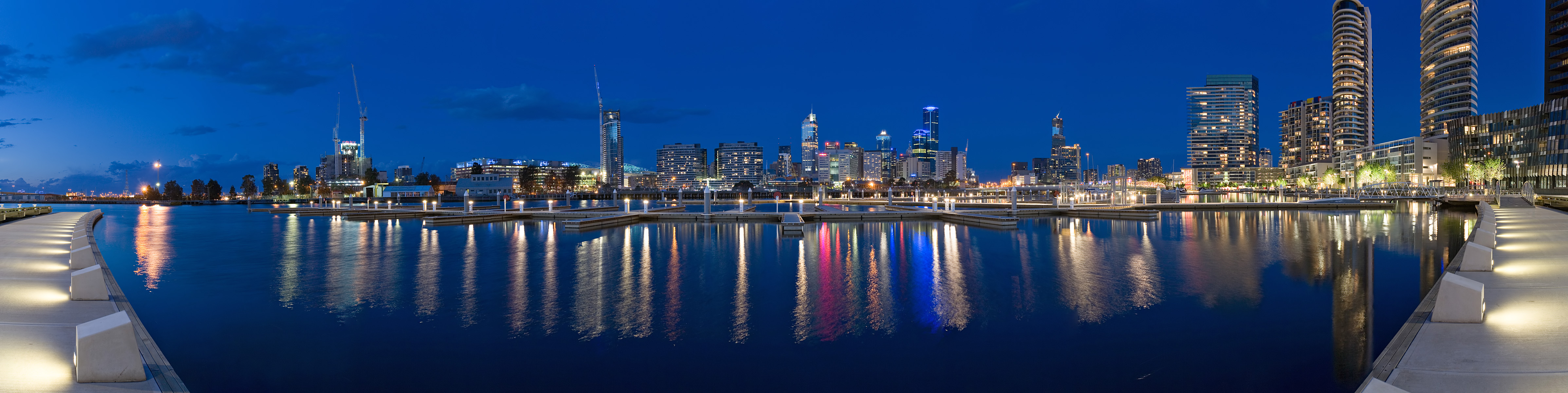
Australia is a country of cities. Nine out of ten of its inhabitants are city dwellers. The largest and oldest city in Australia - Sydney - is home to about 4 million people. Melbourne is the country's second most populous city and Sydney's longtime rival. It is noteworthy that both largest cities Australia were the capitals of the Summer Olympics: Melbourne in 1956 and Sydney in 2000. To reduce the intensity of the rivalry between the two largest cities in the state at the beginning of the 20th century. at approximately equal distance from them was built the city of Canberra - the current capital of Australia.
Sydney is the most Big city Australia.
![]()
Melbourne is the second most populous city in the country.
Canberra is the current capital of Australia.
![]()
Australia is an economically developed country, so most of its inhabitants are employed in the service sector, science, and management.
The presence of excellent pastures on the eastern slopes of the Great Dividing Range contributed to the development of sheep breeding. At present, pastures occupy about half of the country's territory. Wool sheared from sheep is used to produce fabric, and it is sold abroad.
Livestock farms in Australia have a large area: it is not uncommon for farmers to visit remote parts of their property only once a month. Most of the pastures are equipped with artificial watering holes, where water comes from the ground.
Australians are engaged not only in animal husbandry, but also in crop production: they grow wheat, various fruits and vegetables.
Australia is rich iron ores, gold, aluminum ores, coal and other minerals. She is one of the main mining powers in the world.
Uluru massif. Included in the number of objects of the world. Is the character of many local legends... The height of the massif is 348 m, the perimeter of the base is approximately 9 km. Uluru is composed of red sandstone. Most tourists come to see how Uluru changes color depending on the time of day and weather.
Lack of high mountains with snow and. there are few rivers and lakes, about 60% of the mainland has no runoff into the ocean. No other continent has such a relative large area.
For the main part of the continent, especially for its interior desert and regions, temporary gutters - screams - are characteristic. Water appears in them only after rare rains and for a short time. The rest of the rivers of the mainland belong to the basins of the Indian and. The rivers of the basin are short, shallow, and often dry up in the dry season. The Pacific Ocean basin includes rivers flowing from the eastern slopes of the Great Dividing Range. These rivers are full-flowing throughout the year, as there is a lot of rainfall; short and rapids. Most of the rivers of the mainland are fed mainly by rain, and in - mixed.
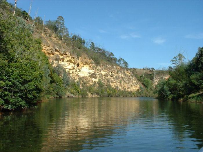
The most significant river system Australia is a river with a tributary Darling. Murray (length - 2570 km) originates in the Australian Alps, feeds not only on rain, but also partly on snow. In summer, the river is full-flowing, during the rainy season it often overflows its banks, in winter it grows shallow. The main tributary of the Murray is Darling, Australia itself (2740 km). But this river is shallow. The water level varies greatly depending on the seasons of the year (up to 8 m above low water). During the dry season, Darling does not always bring its waters to Murray and breaks up into separate bodies of water.
There are about 800 lakes in Australia. Most of them are relic lakes, the basins of which were formed in more humid geological epochs. Many of the modern lakes of Australia (Torrance, From, Amadies, etc.) are dry basins filled with loose clayey-saline silt, covered with a crust of salt or gypsum. They fill with water only after rare rainstorms that fall in Western Australia once over several years.
The most large lake Australia - closed drainage salt Lake Ayr. It lies in a depression 12 m below sea level. In the dry season, Lake Eyre splits into many separate ones, and during the period of heavy rains it turns into an immense body of water with an area of about 15 thousand km2.
Against the backdrop of a rarefied and almost complete absence of fresh lakes, the amazing wealth of Australia is striking. The area of all artesian basins occupies 1/3 of the mainland. More than 15 artesian basins are confined to the basement syneclises between the plateaus of Western Australia and the Great Dividing Range. The depth of groundwater is from 100 to 2100 m. Sometimes (for example, in the area of Lake Eyre) they come to the surface in the form of springs under natural pressure. The largest underground water storage in Australia - the Great Artesian Basin in the Central Lowland - covers an area of 1,736 thousand km2.
Lakes
The rivers
Inland waters
Climate
Relief
Much of Australia is located within the ancient Australian Plate away from the edges of the lithospheric plates. This explains the predominantly flat character of its relief.
In the western part of the mainland is located Western australian highlands height of 400-600 m. It lies within the shield, therefore, minerals of magmatic origin are mined there: iron and nickel ore, gold.
In the southeast, the plateau turns into Central lowland, which in the area of Lake Eyre plunges below ocean level. In a thick layer of sedimentary cover, deposits of oil and natural gas were found there.
In the east of the mainland along the coast, there are severely destroyed ancient Paleozoic mountains - Great Dividing Range... In the extreme southeast, the mountains reach their greatest height and are called Australian alps... Here is the most high mountain Kostsyushko (2230 m). There is not one on the mainland active volcano, there are no earthquakes.
The climate of the mainland is very dry and hot. The southern tropic crosses Australia almost in the middle, so the Sun is at its zenith over the northern part of its territory. Therefore, the mainland receives a large amount of solar radiation due to the large angle of incidence of the sun's rays. Australia lies entirely in Southern hemisphere, therefore, the warmest month on the mainland is January, the coldest is July.
Australia's climate is influenced by constant winds - southeast trade winds that blow from the tropics to the equator. They come from the Pacific, so they are wet air masses... But the Great Dividing Range is holding back the trade winds. This affects the redistribution of precipitation: only small coastal areas up to the mountains receive them, there is little precipitation beyond the mountains.
The coastal climate is influenced by sea currents: cold currents cause dry weather, warm ones - wet. Therefore, they remain a little wet west coasts(due to the cold West Australian Current) and southerly (due to the current of the West Winds). Receive a lot of precipitation eastern shores due to the warm East Australian Current. Australia is the driest continent on the planet.
On the territory of Australia, there are
subequatorial climatic zone(warm with summer season rains and winter dry season),
tropical(warm with different moisture content: continental in the center of the mainland - with insufficient and uneven distribution of precipitation throughout the year, nautical in the east - with excessive and even distribution of precipitation throughout the year),
subtropical(with wet warm winter and dry hot summers).
Due to the aridity of the climate, the continent is poor in surface waters.
The Murray River is the most large river Australia. Together with the Darling tributary, it originates on the Great Dividing Range and belongs to the Indian Ocean basin. The main source of power is rain (rain power). Darling dries up in summer. Murray, which additionally feeds on melted snow from the mountains, grows shallow, but does not dry out completely.
Most of the mainland does not drain into the ocean. Time streams prevail here - screams.
Lakes in Australia are closed and saline.
The most big lake- Ayr is of relic origin. It often dries up and the bottom is covered with a crust of salt. There is no life in the lake, which is why Eyre is called the "Dead Heart of Australia".
Australia is poor in surface water but rich in groundwater. More than 30 artesian basins have been discovered under the surface of the mainland. The biggest one is Great Artesian Basin under the Central Lowland. It occupies more than half of the mainland area. During the year, the water in it is warm (about 30 ° C) and slightly salty and suitable for water supply.