A.N. NOVIK
geography teacher at secondary school number 1
pos. Moskovsky, Leninsky district
Moscow region
Lesson type and location. Combined lesson.
At the beginning of the lesson - testing on the studied topic "Natural zones of Russia". The main part of the lesson is the study of the Russian Plain (geographical location, tectonic structure and relief):
1. Geographical position and relief.
2. Climate and inland waters.
3. Natural complexes.
4. Natural resources and human influence.
Lesson steps
Stage 1. Organizational (3 min).
Stage 2. Homework check (10 min).
In the previous lesson, the students finished learning natural areas Russia. At the end of each topic, testing is carried out.
Stage 3. Updating (2 min).
The teacher announces the topic of the lesson, sets goals and objectives, sets homework on a new topic.
It is advisable to ask homework at the beginning of the lesson: firstly, the students are more attentive, and secondly, it helps to actualize the students' activities in the lesson.
4 and 5 stages. Learning new material (25 min) and consolidation (5 min).
Consists of several semantic blocks that differ in the type of student activity.
Geographical position of the Russian Plain
The task of the semantic block is to form a figurative representation of the territory.
Pupils are invited to answer the questions:
In which part of the country is the Russian Plain located? To the basins of which seas and oceans are the rivers of the plain?
For better memorization of the geographical position of the studied territory, a diagram is drawn in which the Russian Plain is represented in the form of a rectangle. Students use the map to identify the neighbors of the plain.
It is important to draw the attention of students to the fact that the largest part of the Russian Plain belongs to the Caspian Sea basin (area of internal flow).
Tectonic structure of the Russian Plain
The task is to recall the features of the structure of the ancient platform on the example of the Russian Plain. The structure of the ancient platform is studied in detail in the lessons in the topic "Relief
Russia ", therefore, answering the teacher's questions, students should remember the material:
Why is the relief of the studied area flat? Which platform lies at the base of the plain? What is it called? How many layers does it consist of? What is the name of the bottom layer? What is the name of the top layer? What criteria can be used to determine that the platform is ancient? What is a shield? What is a stove?
To consolidate the material, a profile of the tectonic structure of the Russian platform is sketched from the Baltic shield to the Caspian lowland. Students should be drawn to the fact that the foundation of the platform to the south goes to a great depth (more than 10 km).
The flat relief is due to the fact that the ancient Russian platform lies at the base of the plain.
Game-auction "Who is higher?"
The main task of this semantic block is to determine the highest elevations of the Russian Plain. Since this stage takes place in the second half of the lesson, it is necessary to conduct it in a playful way in order to reduce student fatigue.
Exercise: find the highest peak of the Russian Plain on the map in the atlas. Usually the students do not find it right away, but call the lower ones. The teacher asks: "Who is higher?" Further, other large hills are called: 471 m (Timan ridge), 375 m (Zhiguli).
The name Zhiguli is absent in the atlas, so you need to let the students guess it for themselves using the following hint: “Near this hill is the city of Togliatti with the VAZ automobile plant. It was by the name of this hill that the most widespread brand of passenger cars in Russia, produced at this plant, was named. " Students with genuine surprise, but will quickly give the correct answer.
Here it is necessary to note the most low point Russian Plain - the level of the Caspian Sea (-27 m).
Landforms
The task of the semantic block is to systematize knowledge by external (exogenous) factors that influence the relief of the Russian Plain.
Pupils draw and fill in the table in their notebook, answering the teacher's questions:
What landforms are associated with ancient glaciation? What is moraine? How was the sea formed? What is erosion? What landforms have been created by erosion? How is a ravine different from a beam? What is the reason for the formation of the plain in the Caspian lowland?
We enter information about the relief in the table.
Types and forms of relief of the Russian Plain
| Type of relief |
Geographic position |
Forms relief |
How formed |
|---|---|---|---|
| Glacial | North part of the plain |
Moraine hills and depressions |
As a result ancient glaciation |
| Erosive | Central and South part plains |
Ravines and beams |
As a result erosion |
| Primorskaya plain |
Caspian lowland |
Flat or weak hilly plain |
As a result of flooding Caspian lowland |
In the tectonic structure of the Russian Plain, geologists distinguish very diverse structures of the most ancient Precambrian crystalline platform. The orographic pattern of the relief of the territory is represented mainly by flat, upland and lowland areas.
History of origin
The formation of the relief of the vast Russian Plain at all times was strongly influenced by numerous natural factors, the main ones being water, wind and the work of an ancient glacier. The crystalline basement of the platform in the area of the Ukrainian and Baltic shields was formed in the early Archean period 3.2-3.5 billion years ago. Later, during the Sami stage of folding, 2.5-3 billion years ago, the cores of the most ancient protoplatforms were formed; today they are preserved in the form of gneiss and granite intrusions. During the Belomorian stage of folding 2.5-1.9 billion years ago, ancient igneous rocks poured out and solidified in the same places on the Russian platform. In the Middle Proterozoic, the next stage of the formation of the Karelian territory began. It lasted 1.9-1.6 billion years ago. Granite intrusions again penetrated into the body of the Baltic tectonic shield, strata of crystalline schists, effusive and metamorphic deposits were formed. The foundation of the oldest platform under the landforms is located at different depths. In the areas of the Kola Peninsula and Karelia, it appears as a Baltic tectonic shield over the land surface. With the presence of this structure, geologists consider the formation of the Khibiny mountains. In other areas, a thick sedimentary cover has formed above the basement. The elevated areas were formed by basement uplift, tectonic troughs, or glacier activity.
Tectonic structures
V different zones the lithosphere contains different structures. They represent vast areas, their boundaries run along deep tectonic faults. The main structures in tectonics are ancient platforms and folded belts. The platform is a stable flat tectonic structure. The platform is most often found in zones destroyed during the geological periods of fold belts. The platforms are two-tiered in structure. Below is a tier of solid crystalline foundation made of ancient rocks. From above it is covered by a cover of sedimentary rocks, formed much later. On the platform, geologists distinguish between stable plates and rock outcrops, shields. In the areas of the slabs, the foundation is located at great depths and is completely covered by a sedimentary cover. In the area of the shield, the platform foundation comes out to the surface. The platform cover here is not solid and low-powered. In the mobile belts, active mountain-building processes continue today.
The structure of the tectonic strata
The nature of the orographic relief pattern of the Russian Plain is flattened, but high and low areas are distinguished in it. It depends on the peculiarities of the tectonics of the plain. The tectonic structures of the plain are heterogeneous, modern movements manifest themselves in different ways crust... The ancient Russian platform was formed from different tectonic elements. These are shields, anteclises, syneclises and aulacogens.
Shields
In the structure of the Russian oldest platform, geologists distinguish the Baltic tectonic shields in the north and the Ukrainian tectonic shields to the south. The rocks of the Baltic tectonic shield are manifested in Karelia and on the Kola Peninsula; the territory of the shield continues into northern Europe. Archean and Proterozoic rocks are overlain here by modern alluvial deposits of the Quaternary period. From the coast Sea of Azov outcrops of the Ukrainian tectonic shield are located across the Dnieper Upland to the southern Polesie. It is covered with deposits of the Tertiary age, its rocks are manifested along the river valleys.
In the interval between these shields, the foundation of the ancient platform is at great depths. They are calculated up to 1000 m, on the Belarusian anteclise up to 500 meters.
Anteclise
Geologists call anteclises zones where the platform foundation is shallow. The most significant of the Voronezh anteclises and the Volga-Uralskaya to the east are located in the center of the plain. The Volga-Ural tectonic structure includes depressions and uplifts. The thickness of sedimentary deposits here is up to eight hundred meters. The bedding of the rocks shows that, on the whole, the structure of the Voronezh anteclise descends towards the north. The basement here is mainly covered by thin Carboniferous, Devonian and Ordovician rocks. In the southern part of the anteclise, there are Cretaceous, Carboniferous and Paleogene deposits.
The tectonics of another anteclise on the Russian platform, the Donetsk ridge, is interesting. This is a folded Early Paleozoic peneplained mountain structure. To the south, in the Ciscaucasia, there is a folded area of Paleozoic age. Today, scientists consider the ridge to be the northern edge of this folded area.
Syneclises
Scientists of tectonics call syneclises the areas where the foundation of the ancient platform is at great depth. The oldest and rather complex structure is the syneclise of the Moscow tectonic zone. The basis of the Moscow depression is formed by aulacogens, deep tectonic ditches filled with powerful Riphean deposits. Above the basement there is a sedimentary cover of Cambrian and Cretaceous rocks. In the Neogene and Quaternary geological periods, the syneclise experienced a powerful irregular uplift. This is how the Smolensk-Moscow and later, by geological standards, the Valdai Uplands appeared, along with the North-Dvinskaya and Upper Volga Lowlands. Interesting in geological structure Pechora syneclise. Its uneven, blocky foundation lies at depths of up to 6,000 meters. It is overlapped by powerful Paleozoic, later Mesozoic and Cenozoic rock strata. One of the deepest on the Russian platform is the Caspian syneclise. The foundation of the Russian platform is located in this area at a depth of 10 km.
Aulacogens
Geologists call the deep ancient tectonic faults and ditches aulacogenes. Scientists attribute the Moscow, Soligalichsky and Kresttsovsky tectonic ditches to similar structures on the Russian platform.
Outputs of Baikal folding
On the Russian platform there is an outcropping of the Early Paleozoic Baikal folding, a low rise called the Timan Ridge. It stretches from the northwest to the southeast for 900 km from the Czech Bay to Barents Sea... In the north, its tundra and forest-tundra parts are represented by low hills reaching a height of 303 meters. In the central part of the ridge between the rivers Pizhma Mezenskaya and Pechora is located highest peak mountain system Chelassky Kamen, its height is 471 meters. To the south is the taiga on a low plateau dissected by river valleys up to 350 meters high. The rocks of the Baikal folding are associated with rich deposits of titanium and aluminum ores in Devonian basalts. The richest oil and gas fields are confined to this territory. Oil shale, peat, and building materials are associated with sedimentary rocks.
The relationship of tectonic structure with minerals
Over a very long period of development, the ancient Russian platform is represented by a rather powerful geostructure. The richest deposits of various minerals have been explored in its depths. Found in the area of the Kursk magnetic anomaly iron ore, which belong to the Precambrian basement. In the sedimentary cover lies coal... High-quality coals are mined in the Donetsk and Moscow region lignite basins. Gas and oil were found in the rocks of the Mesozoic and Paleozoic in the Ural-Volga basin. Oil shale occurs near Syzran. Deposits of building materials, phosphorites, bauxites and salts are associated with the rocks of the sedimentary cover of the Russian Plain.
Relation between tectonics and relief
The Russian Plain has a flattened flat relief. This is, first of all, a consequence of its complex tectonic structure. Irregularities in the basement of this tectonic structure are manifested in the relief in large low-lying and elevated areas. Voronezh tectonic uplift caused the appearance of the Central Russian vast upland... Large deflections in the basement of the platform formed the Caspian lowlands in the south and the Pechora lowlands in the north. Almost the entire northern part of the Russian Plain is low-lying. It is a coastal low-lying plain with small elevated areas. The Smolensk-Moscow Upland, the Valdai and the Severny Uvalov Uplands are located here. The area is the watershed between the Atlantic, the Arctic Ocean basin and the Aral-Caspian closed-drain area. In the south, there are vast low-lying areas of the Black Sea and the Caspian Sea. The highest height up to 479 m is observed on the plain in the region of the Bugulma-Belebey Upland.
In the cover of sedimentary rocks of the Russian Platform, volcanic intrusions have been discovered by geologists. This means that on the platform after the Proterozoic era, more in the Devonian period, there were manifestations of ancient volcanism. The orographic pattern of the Russian Plain depends on the tectonic structure and processes. All high and low areas in the plain are of tectonic origin. The relief depends on the structure of the foundation of the ancient platform. Geologists consider the Baltic crystalline shield the cause of the uplifts in the relief of Karelia and Kola Peninsula... The Ukrainian tectonic shield caused the appearance of the Azov and Dnieper uplands. The Voronezh anteclise caused the appearance of the Central Russian Upland. On the syneclises of the south vast plain the Caspian and Black Sea lowland zones are located today. The modern relief does not always correspond to the tectonic structures in the center of the plain. So, Northern Uvaly are located on the Moscow syneclise. The Volga upland region is located on the Ulyanovsk-Saratov syneclise. The Oka-Don lowland zone is located in the east of the Voronezh large anteclise.
Erosion is vigorous in the elevated areas of the Russian Plain. earth surface... Such areas can be identified on maps by bedrock outcrops surrounded by newer sediments. Areas of subsidence of the earth's crust have become zones of accumulation of loose sedimentary rocks of the Quaternary age, where erosion processes are weak.
The territory of Russia is based on large tectonic structures (platforms, shields, folded belts), which are expressed in various forms in the modern - mountains, lowlands, hills, etc.
Plains occupy three quarters of the territory of Russia. Three vast plains are distinguished:, and a plain (lowland).
This is due to the fact that within Russia there are several large platforms, differing in age. There are two large ancient Precambrian platforms (their basement was formed mainly in the Archean and Proterozoic) - these are the Russian and Siberian. An idea of the tectonic structure can be obtained from the tectonic, and the conditions of occurrence - from the geological map.
Areas of platforms where the foundation is submerged to a depth under the sedimentary cover are called slabs(West Siberian plate). The places where the crystalline basement emerges on the surface of the platforms are called shields(shield on the Russian or East European, Anabar and Aldan shields of the Siberian platform).
The heights of most of the Russian Plain are less than 200 m, but within its limits there are also uplands (Central Russian, Smolensk-Moscow, Privolzhskaya, Northern Uvaly, Timan Ridge). In the south, the Russian Plain is bordered by mountains that have formed in the modern, mountain building cycle. The heights of the predominant part of the West Siberian Plain do not exceed 200 m. The Russian is separated from the West Siberian by the ancients, stretching from north to south for 2.5 thousand km. The West Siberian Plain is bordered from the southeast.
Has an altitude of 500-800 m above sea level, highest point- at (1701 m). From the south, the Siberian platform is framed by areas of the most ancient (Baikal) folding. In modern relief, it is the Yenisei Ridge. and are located on the Aldan shield - part of the Siberian platform.
East of, up to, and also in mountain ranges Mesozoic folding (ridges: Chersky, Verkhoyansk, Kolyma Upland).
In the extreme northeast and east of the country, there is a folding, including a ridge. Further south this area of young mountains continues on. Kurile Islands are the tops of the highest (about 7 thousand m) mountains rising from the bottom of the sea. Most of them are under water.
Powerful mountain building processes and shifts (Pacific and Eurasian) in this area continue. This is evidenced by intense and seaquakes. The places of volcanic activity are characterized by hot springs, including periodically gushing geysers, as well as emissions from craters and cracks, which indicate active processes in the depths of the earth. Operating geysers and geysers are most widely represented on the Kamchatka Peninsula.
With such an abundance and variety of landforms, the vastness of the territory, differences and natural and climatic conditions, it seems natural to have a large spectrum presented in the bowels of our state.
NATURAL ZONES OF RUSSIA
EASTERN EUROPEAN (RUSSIAN) PLAIN
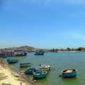
See photos of the nature of the East European Plain: Curonian Spit, Moscow Region, Kerzhensky Reserve and the Middle Volga in the Nature of the World section of our website.
The East European (Russian) Plain is one of the largest plains in the world in terms of area. Among all the plains of our Motherland, only it comes out to two oceans. Russia is located in the central and eastern parts of the plain. She stretches from the coast Baltic Sea to the Ural Mountains, from the Barents and Of the White Seas- to the Azov and Caspian.
The East European Plain has the highest rural population density, big cities and many small towns and urban-type settlements, various Natural resources... The plain has long been mastered by man.
The following signs serve as the rationale for its determination to the rank of a physico-geographical country: 1) an uplifted stratal plain formed on the plate of the ancient East European platform; 2) Atlantic-continental, predominantly moderate and insufficiently humid climate, formed largely under the influence of the Atlantic and Arctic oceans; 3) natural zones are clearly expressed, the structure of which was greatly influenced by the flat relief and neighboring territories - Central Europe, North and Central Asia. This led to the interpenetration of European and Asian species of plants and animals, as well as to a deviation from the latitudinal position of natural zones in the east to the north.
Relief and geological structure
The East European Elevated Plain consists of elevations with heights of 200-300 m above sea level and lowlands along which flow large rivers... The average height of the plain is 170 m, and the highest - 479 m - on Bugulma-Belebey Upland in the Urals part. Maximum elevation Timan ridge slightly less (471 m).
According to the peculiarities of the orographic pattern, three stripes are clearly distinguished within the East European Plain: central, northern and southern. Across central part the plains is a strip of alternating large hills and lowlands: Central Russian, Volga, Bugulma-Belebey Uplands and Common Syrt divided Oka-Don lowland and the Low Trans-Volga region, along which the Don and Volga rivers flow, carrying their waters to the south.
To the north of this strip, low plains prevail, on the surface of which, here and there, smaller uplands are scattered here and there in garlands and singly. From west to east-northeast, they stretch here, replacing each other, Smolensk-Moscow, Valdai Uplands and Northern Uvaly... They are mainly used for watersheds between the Arctic, Atlantic and internal (closed-drainage Aral-Caspian) basins. From the Northern Ridges, the territory goes down to the White and Barents Seas. This part of the Russian Plain A.A. Borzov called the northern slope. Large rivers flow along it - Onega, Northern Dvina, Pechora with numerous high-water tributaries.
The southern part of the East European Plain is occupied by lowlands, of which only the Caspian region is located on the territory of Russia.
Rice. 25. Geological profiles across the Russian Plain
The East European Plain has a typical platform relief, which is predetermined by the tectonic features of the platform: the heterogeneity of its structure (the presence of deep faults, ring structures, aulacogens, anteclises, syneclises and other smaller structures) with unequal manifestation of the latest tectonic movements.
Nearly all major highlands and lowlands of the plain tectonic origin, with a significant part inherited from the structure of the crystalline basement. In the process of a long and difficult path development, they formed as a single territory in the morphostructural, orographic and genetic relation.
At the base of the East European Plain lie Russian plate with Precambrian crystalline basement and northern edge in the south Scythian plate with a Paleozoic folded basement. The border between the slabs is not expressed in the relief. On the uneven surface of the Precambrian basement of the Russian Plate, there are strata of Precambrian (Vendian, in places Riphean) and Phanerozoic sedimentary rocks with slightly disturbed bedding. Their thickness is not the same and is due to the unevenness of the basement relief (Fig. 25), which determines the main geostructures of the slab. These include syneclises - areas of deep basement (Moscow, Pechora, Caspian, Glazovskaya), anteclises - areas of shallow basement (Voronezh, Volga-Ural), aulacogenes - deep tectonic ditches, in the place of which syneclises subsequently appeared (Kresttsovsky, Soligalichsky, Moskovsky, etc.), protrusions of the Baikal basement - Timan.
The Moscow syneclise is one of the most ancient and complex internal structures of the Russian plate with a deep crystalline basement. It is based on the Central Russian and Moscow aulacogens filled with thick Riphean strata, above which the sedimentary cover of the Vendian and Phanerozoic (from the Cambrian to the Cretaceous) lies. In the Neogene-Quaternary time, it experienced uneven uplifts and in the relief it is rather expressed. large hills- Valdai, Smolensk-Moscow and lowlands - Verkhnevolzhskaya, North-Dvinskaya.
The Pechora syneclise is located wedge-shaped in the northeast of the Russian plate, between the Timan ridge and the Urals. Its uneven block foundation is lowered to various depths - up to 5000-6000 m in the east. The syneclise is filled with a thick stratum of Paleozoic rocks overlain by Meso-Cenozoic sediments. In its northeastern part there is the Usinsky (Bolshezemelsky) vault.
In the center of the Russian plate there are two large anteclises - Voronezh and Volga-Ural separated by Pachelm aulacogen... The Voronezh anteclise slopes gently to the north into the Moscow syneclise. The surface of its basement is covered with thin Ordovician, Devonian and Carboniferous deposits. Carboniferous, Cretaceous and Paleogene rocks occur on the southern steep slope. The Volga-Ural anteclise consists of large uplifts (arches) and depressions (aulacogenes), on the slopes of which flexures are located. The thickness of the sedimentary cover here is at least 800 m within the highest vaults (Tokmovsky).
The Caspian marginal syneclise is a vast area of deep (up to 18-20 km) subsidence of the crystalline basement and belongs to structures of ancient origin, almost on all sides of the syneclise it is bounded by flexures and faults and has angular outlines. From the west it is framed by the Ergeninskaya and Volgograd flexures, from the north - flexure of Obshchy Syrt. In some places they are complicated by young faults. In the Neogene-Quaternary, further subsidence (up to 500 m) and the accumulation of a thick layer of marine and continental sediments took place. These processes are combined with fluctuations in the level of the Caspian.
The southern part of the East European Plain is located on the Scythian Epigercyn Plate, which lies between the southern edge of the Russian Plate and the Alpine folded structures of the Caucasus.
Tectonic movements of the Urals and the Caucasus have led to some disruption in the occurrence of sedimentary plate deposits. This is expressed in the form of dome-shaped uplifts, significant along the length of the swells ( Oksko-Tsniksky, Zhigulevsky, Vyatsky and others), individual flexural bends of layers, salt domes, which can be clearly traced in the modern relief. Ancient and young deep faults, as well as ring structures, determined the block structure of the plates, the direction of river valleys, and the activity of neotectonic movements. The predominant direction of the faults is northwest.
A brief description of the tectonics of the East European Plain and a comparison of the tectonic map with the hypsometric and neotectonic maps allow us to conclude that the modern relief, which has undergone a long and complex history, is in most cases inherited and dependent on the nature of the ancient structure and manifestations of neotectonic movements.
Neotectonic movements on the East European Plain manifested themselves with different intensity and direction: in most of the territory they are expressed by weak and moderate uplifts, low mobility, and the Caspian and Pechora lowlands experience weak subsidence (Fig. 6).
The development of the morphostructure of the north-west of the plain is associated with the movements of the marginal part of the Baltic shield and the Moscow syneclise; therefore, there are developed monoclinal (inclined) bed plains, expressed in orography in the form of hills (Valdai, Smolensk-Moscow, Belorusskaya, Northern Uvaly, etc.), and stratal plains occupying a lower position (Verkhnevolzhskaya, Meshcherskaya). The central part of the Russian Plain was influenced by the intense uplifts of the Voronezh and Volga-Ural anteclises, as well as the subsidence of neighboring aulacogens and troughs. These processes contributed to the formation layer-tiered, stepped elevations(Central Russian and Volga) and the Oksko-Don plain. The eastern part developed in connection with the movements of the Urals and the edge of the Russian plate; therefore, a mosaic of morphostructures is observed here. Developed in the north and south accumulative lowlands edge syneclises of the plate (Pechora and Caspian). Alternating between them stratal-tiered uplands(Bugulminsko-Belebeevskaya, General Syrt), monoclinal-bed Uplands (Verkhnekamskaya) and intra-platform folded Timansky ridge.
In the Quaternary, a cooling of the climate in the northern hemisphere contributed to the spread of ice sheets. Glaciers had a significant impact on the formation of relief, Quaternary sediments, permafrost, as well as on changes in natural zones - their position, floristic composition, fauna and migration of plants and animals within the East European Plain.
Three glaciations are distinguished on the East European Plain: Okskoe, Dnieper with the Moscow stage, and Valdai. Glaciers and fluvioglacial waters created two types of plains - moraine and outwash. Permafrost processes prevailed in the wide periglacial (preglacial) belt for a long time. Snowfields had an especially intense effect on the relief during the period of reduced glaciation.
Morena of the most ancient glaciation - Oksky- was studied on the Oka, 80 km south of Kaluga. The lower, heavily washed-out Oka moraine with Karelian crystalline boulders is separated from the overlying Dnieper moraine by typical interglacial deposits. In a number of other sections to the north of this section, under the Dnieper moraine, the Oka moraine was also found.
Obviously, the moraine relief that arose in the Oka Ice Age has not survived to our time, since it was first washed out by the waters of the Dnieper (Middle Pleistocene) glacier, and then it was covered by its bottom moraine.
Southern boundary of maximum spread Dniprovsky integumentary glaciations crossed the Central Russian Upland in the Tula region, then descended with the tongue along the Don valley - to the mouth of the Khopr and Medveditsa, crossed the Volga Upland, then the Volga near the mouth of the Sura River, then went to the upper reaches of the Vyatka and Kama and crossed the Ural in the area of 60 ° N. In the basin of the Upper Volga (in Chukhloma and Galich), as well as in the basin of the Upper Dnieper above the Dnieper moraine, the upper moraine lies, which is attributed to the Moscow stage of the Dnieper glaciation *.
Before the last Valdai glaciation in the interglacial epoch, the vegetation of the middle zone of the East European Plain had a more thermophilic composition than the modern one. This testifies to the complete disappearance of its glaciers in the north. In the interglacial epoch, peat bogs with Brazen flora were deposited in lacustrine basins formed in depressions of the moraine relief.
In the north of the East European Plain, the boreal ingression arose during this era, the level of which was 70-80 m above the present-day sea level. The sea penetrated along the river valleys of the Northern Dvina, Mezen, Pechora, creating wide branching bays. Then came the Valdai glaciation. The edge of the Valdai ice sheet was located 60 km north of Minsk and went to the northeast, reaching Nyandoma.
In the climate of the more southern regions, due to glaciation, there have been changes. At this time in more southern regions In the East European Plain, remnants of seasonal snow cover and snowfields contributed to the intensive development of nivation, solifluction, and the formation of asymmetric slopes in erosional landforms (ravines, gullies, etc.).
Thus, if ice existed within the distribution of the Valdai glaciation, then in the periglacial zone a nival relief and sediments (boulderless loams) were formed. The non-glacial, southern parts of the plain are overlain by thick strata of loess and loess-like loams, synchronous with the ice ages. At this time, in connection with the humidification of the climate, which caused glaciation, and also, possibly, with neotectonic movements in the basin of the Caspian Sea, marine transgressions took place.
West Siberian Plain with a total area of 3.5 million square meters. km belongs to the accumulative type of plains. It is one of the largest low-lying marshy areas on earth, covered with tundra and taiga. For a long time, the harsh climate and permafrost hindered the geological study of the territory. Today geologists attribute the plain to the presence of the tectonic plate of the same name. Its foundation is best studied at the periphery. By the method of drilling deep and superdeep wells, geologists have studied its southern region and center quite well. If drilling is not available, scientists use geophysical data. The tectonic structure and structure of the large West Siberian plate is very diverse and not entirely clear. It is the structure of the foundation that causes a lively scientific discussion. Most scientists agree that the crystalline basement consists of large geoblocks, consolidated and separated by deep faults.
Geology of the West Siberian Plain
Is the plain Western Siberia on the epigercyn tectonic plate of the same name, which has a pronounced two-tiered structure. At its base, it is represented by a heterogeneous basement of different ages from the Precambrian to the Paleozoic. The base of the tectonic plate is, first of all, a depression with steep sides from the northeast. It is exposed in a few elevated areas along the edges of the lowland. The basement rocks are covered with a layer of marine and continental Mesozoic and Cenozoic geological deposits of clays and sandstones up to 1000 meters thick. In the depressions of the base of the slab, the thickness of the deposits reaches 3-4 thousand meters. In the basement of the slab, geologists distinguish three ophiolite volcanic belts. They were named after their location as Nizhnevartovsk-Aleksandrovskiy, Zauralskiy and Zapadno-Surgutskiy; cherpnol-schist deposits, siliceous shales and jaspers of Devonian age appear here.
Scientists determine the age of the foundation by the pre-Paleozoic time, the ancient Baikal, followed by the Caledonian and Hercynian folding. It is dissected by deep tectonic faults of different geological ages. The fault lines of the Omsk-Pursky and Zauralsky ones extend submeridionally. The diagrams of the location of isolated tectonic structures on the plain show that in the basement of the plate it is possible to distinguish between the near-edge and the vast inner regions; it has depressions and uplifts. It is covered by a cover of sedimentary rocks of the Mesozoic and Cenozoic age. In the cover, marine and coastal-continental deposits are distinguished up to 3-4 thousand meters in the south and 7-8 thousand meters in the north. Young alluvial and lacustrine sediments formed in the south, sea and glacial strata to the north.
History of the formation of the territory
The formation of the plate began in the late Jurassic period. Then, as a result of the action of the geological forces of the earth, a huge area between the Urals and Siberian platform gradually began to descend. During its development, the plate has repeatedly experienced the impact of sea transgressions. In the Oligocene period, the ancient sea left the West Siberian plate, and a huge lacustrine alluvial alluvial plain was formed here. In the Oligocene and later in the Neogene, some of its parts experienced tectonic uplifts and subsidence under the action of the internal forces of the earth. During development, the territory was repeatedly flooded with sea in the Jurassic, Cretaceous and Paleogene periods. This is the reason for the constant swampiness of the plain over vast areas.
In the Upper Triassic, the plate gradually subsided and gradually accumulated a sedimentary cover. In the Mesozoic and Cenozoic geological time, these processes continued with a prolonged deflection of the plate. Today the cover is composed of sandy, siltstone, mudstone, continental and clayey deposits up to 8 km in the north of the plain. When tectonic movements appeared at different stages of development, local geological structures arose in the cover. In such uplifts on the territory of the fault zones, reservoirs of gas and oil were formed.
In the Oligocene, tectonic movements separated the sea of Western Siberia from the large Arctic basin. The sea regime still persisted in the center of the plate for a short time, but in the Oligocene the sea left the plain. Therefore, the upper horizon of the cover is composed of continental lacustrine-alluvial and sandy-clayey sediments up to 2 km thick.
V neogene period Ob-Yenisei sublatitudinal uplifts began to gradually separate, they are located above the large Trans-Siberian fault and clearly correspond to the Siberian Uvaly upland. It was then in the Neogene period that the main features of the plain orography pattern were gradually formed. Depressions in the relief corresponded to troughs, along which large rivers flowed. The ancient sea was 200 meters below the current level, the bottom Kara Sea it was dry land.

Tectonic structures
The Yamalo-Gydan and Nadym-Taz syneclises are located in the most submerged northern region of the plate. They are separated by a narrow sublatitudinal Messoyakhsky mega-shaft. The large Khanty anteclise is located in the center of the slab. In it, geologists distinguish between two formed vaults, they were named Surgut and Nizhnevartovsk. The large anteclises are Ket-Vakhskaya and Khanteyskaya. To the south of them are the sublatitudinal Kulundinskaya and Sredneirtyshskaya syneclises. The Khantymani and Chulym syneclises are distinguished by their size. The Purskiy Trench is located above the Koltogorsko-Urengoy rift zone. The Khudosey tectonic trench connects with the small Chulman syneclise.
Between the cover and the pre-Paleozoic basement, there is a transitional layer of rocks of Triassic and Jurassic geological age. Geologists associate its formation with basement movements, which resulted in the formation of a rift zone within the continent with graben-like depressions. They accumulated sedimentary and volcanogenic coal-bearing horizons, their thickness reaches 5 km. The volcanic strata of the transitional geological layer are basaltic lavas. The formation of the rift zone on the continent in Western Siberia did not continue, and a new ocean did not form.
The relationship of tectonics with minerals
The deposits of the sedimentary cover of the plain contain horizons of pure fresh, saline underground water and brine. In some areas there are hot springs with temperatures ranging from 100 ° C to 150 ° C. In the bowels of the slab there are the richest deposits of natural gas and oil on an industrial scale. They are concentrated in the depths of the prospective West Siberian oil and gas basin. At a depth of more than two kilometers in the deposits of the Khanty-Mansiysk large syneclise, in the Salym, Surgut and Krasnoselsky regions, the richest shale oil deposits in the country are concentrated in the strata belonging to the Bazhenov formation.
Relationship between tectonic structure and relief
The modern landforms of the plain are often caused by the long-term geological development of the territory, its tectonic structure and the influence of the processes of physical weathering. The modern orographic pattern depends on the tectonic structure and structure of the plate. This gradually occurs even under conditions of long-term Meso-Cenozoic subsidence and the process of accumulation of thick strata of loose sediments. Such accumulation levels out all the irregularities of the Epigercynian basement, which is in the relative Late Cenozoic calm. The small amplitude of new tectonic movements determines the low-lying hypsometric status of the plain. The maximum amplitudes of uplifts on the plain were heights from 100 to 150 m at the periphery; to the north and closer to the center, identical subsidence was observed. On the vast territory of the plain, low-lying and elevated areas can be distinguished.
The entire territory of the plain of Western Siberia plunges stepwise from south to north and looks in the orographic drawing as a stepped giant amphitheater, it is open to the coast of the Kara Sea. In its orographic structure, geomorphologists distinguish three high-altitude levels. Half of the territory belongs to the first level up to 100 meters high. The second hypsometric level is heights from 100 m to 150 m, the third from 150 m to 200 m, some areas up to 250-300 m.
The relief of Western Siberia is monotonous, almost even, with a predominance of a height of 100 meters. Only in the periphery, in the west, north and south, the height of orographic structures reaches 300 meters. In the center of the plain there are large Sredneobsky and Kondinsky lowlands. In the north, there are the vast Nadym, Nizhneobskaya and Purskaya lowlands. On the periphery of the plain there are low Turin, Ishim, Severo-Sosva plains, Chulym-Yenisei and Priobskoe plateau, Lower Yenisei, Verkhnetazovskaya and Tymskaya uplands. A single chain inside the plain runs 150-meter separate ridges of the Siberian Uvaly. Parallel to them is the vast Vasyugan plain.
A clear correspondence is observed between the Lyulimvor uplands and the Verkhnetazovskaya anticlinal tectonic structures. The syneclises in the basement of the slab correspond to the Kondinskaya and Barabinskaya lowlands. Disconforming or inversion structures are often found on the plain. Thus, the Vasyugan plain was formed on a gentle syneclise, and the Chulym-Yenisei plateau is located on the tectonic deflection of the plate basement.