Section 38. Climatic zones
Remember who distinguish air masses depending on the area of their formation.
Climatic zones. Climatic zones - latitudinal belts earth surface having a relatively homogeneous climate. The belts differ from each other in air temperature and superior air masses, which, according to their properties, determine the main features of the belt's climate. Climatic zones vary from the equator to the poles, i.e. zonal. Distinguish 7 major climatic zones: equatorial, Two tropical, Two moderate and two polar (arctic and Antarctic) - One in each hemisphere. Each of them is dominated by one air mass throughout the year - equatorial, tropical, temperate, arctic (Antarctic), respectively.
Between the major belts in each hemisphere are formed transitional climatic zones: subequatorial, subtropical and subarctic (subantarctic) ... They are called sub-belts - from Latin "sub" means "under", that is, under the main ( ideally, pidtropic, etc.). In transition zones, air masses change with seasons. They come from the neighboring main zones: in summer, air mass reigns south of the main zone, and in winter - in the north. For example, in the subequatorial zone, equatorial air reigns in summer - the wet season of the year begins, in winter tropical air comes in - the dry season begins. Therefore, the climate of the subequatorial zone in summer is similar to the climate of the equatorial zone, and in winter - to tropical.
On the map of climatic zones, it is clearly seen that their borders do not run strictly along parallels, but deviate from north to south. This is due to the influence of the third Climate-forming factor - underlying surface: oceans, land, relief, currents, ice sheet.
Within the climatic zones, climatic regions are distinguished with different types of climates: Continental and maritime, a peculiar climate of the western and eastern coasts of the continents.
Rice. Climatic zones
The main types of climate. In different territories under the same influence Climate-forming factors a certain type of climate is formed. The name of the type of climate is determined by the name of the climatic zone (equatorial, subtropical, tropical, temperate climate and others), a subtype of air masses (Marine, continental climate), temperature and humidification features.
Have equatorial belt humid equatorial air masses prevail. Air temperatures are high (24 ... 28 0 С). The updrafts produce powerful cumulonimbus clouds that bring thunderstorms every day. A large amount of precipitation per year (over 2000 mm) is also facilitated by the trade winds, which bring humid oceanic air. Temperature and rainfall remain almost unchanged over the year.
For subequatorial belts seasonal change of air masses is characteristic. The summer monsoon brings equatorial air, the winter monsoon brings continental tropical air. Therefore, in summer it is hot and humid, like in the equatorial zone. And in winter, the temperature decreases slightly (20 0 С, humidity is low, there is no precipitation. Such a climate with humid summers and dry winters is called monsoon... Deciduous forests grow.
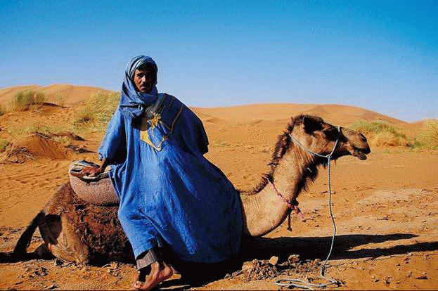
Have tropical zones dry tropical air masses predominate. There is high atmospheric pressure and downward air movement. The temperature in summer is very high (35 0 С), in winter it decreases slightly (20 0 С). A very large daily amplitude of fluctuations (30-40 0 С). The tropical air is too dry, so there is generally little rainfall. According to the amount of precipitation in this belt, climatic regions with different types of climate have been formed. Tropical desert climate (almost no precipitation, only abundant dew and thick fogs are formed) formed on west coasts continents, which are washed by cold currents. Tropical wet the climate (there is a lot of precipitation - over 1000 mm per year) dominates on east coasts continents, which are washed by warm currents.
Have subtropical zones the climate is influenced by seasonal change of air masses: tropical in summer, moderate in winter. Continental subtropical the climate is dry, with hot summers and cool winters. On the western coasts of the continents, the climate subtropical Mediterranean with hot, dry summers and mild wet winters. Climate on the eastern coasts monsoon(Summers are hot, humid, winters are cool, dry). Inland climate sharply continental(Cool summers, harsh winters, little rainfall).
Have temperate zones dominated by moderate air masses and westerly winds, cyclones and anticyclones. There are well-defined seasons with positive temperatures in summer and negative in winter. There is a lot of precipitation, but they are unevenly distributed: many in the west of the continents, little in the interior, enough in the east. Various climatic regions have formed in the belt. Continental temperate the type of climate (from moderately continental to sharply continental) is widespread in the interior regions of the continents. On the western coasts of the continents, marine temperate climate, in the east - monsoon.
Subarcticі subantarctic belts the seasonal change of air masses is also characteristic: moderate in summer, arctic in winter. Summers are cool (10 0 С) and damp, winters are harsh (-40 0 С), long and with little snow. There is little rainfall - 200 mm per year. Permafrost is widespread - freezing of rocks to a great depth (up to 500 m). Maritime climate with cool summers and mild winters observed around the Arctic Ocean and Antarctica.
Have arctic (antarctic) belt cold and dry arctic (Antarctic) air masses prevail. Air temperatures are negative throughout the year. There is very little rainfall - 100 mm per year.
The climate plays an important role in the living and inanimate nature of the Earth. It determines the distribution of soils, flora and fauna, the state of rivers, lakes, seas, glaciers.
Rice. Arctic belt
Rice. Tropical belt

Rice. Subequatorial belt
Climate map. Climate maps will help you understand the complex formation and placement of climates on Earth. They contain data on the main elements of the climate: the temperature of the warm and cold months (January and July), the direction of the wind, the amount of precipitation. The average air temperature is shown by isotherms. Separate numbers indicate low and high temperatures. To show on the map how much and where precipitation falls, places with different annual amounts are painted over with different colors. The prevailing wind directions are shown with arrows. The climate map can be used to characterize the climate of any territory.
Influenced the climate on a person. Weather and climate affect the living conditions of people. People have learned to adapt to different types of climate. Their dwelling, clothing, footwear, food is the result of such an adaptation. Everyone knows that the dwelling, clothing, footwear of the inhabitants of the Far North are different from where they live and what the inhabitant of the equatorial belt is wearing and wearing. The climate determines not only the need for warmth or coolness, but even the mood.
The harvest and the daily work of builders, pilots, and sailors are associated with the climate. Without knowledge about the climate, it is impossible to choose the right place for dams, reservoirs and airfields, to determine the directions of airlines and sea routes. Weather and climate affect people's health and well-being. For example, people who come to work in the polar regions are sometimes forced to come back, because not everyone's body can adapt to the conditions of the harsh climate with strong winds and frost. Resorts for recreation and treatment have been created in areas with a warm maritime climate.
Climate change. If the weather is marked by variability, then the climate, on the contrary, is persistent. If it does change, then slowly and over a very long time - tens of thousands and millions of years. In the distant geological past, climate change occurred in waves: there was a warming, then a cold snap. Such climate fluctuations are confirmed by the fossil remains of plants and animals that existed under certain conditions, as well as various rocks. For example, coal could form in warm and humid climates. So its deposits in Antarctica indicate that once the climate there was completely different. Due to the cooling of the climate, which took place about a million years ago, an ice age began on Earth. Then large areas of land were covered with glaciers. This period ended only 10-12 thousand years ago.
Questions and tasks
1. Which are the main and transitional climatic zones on Earth?
2. What air masses "pass" in winter and summer into the subtropical and subarctic belts?
3. How does the type of climate change in temperate with a distance from the Atlantic Ocean?
4. What kind of climate indicators can be found on climate maps?
5. What is the influence of climate on human living conditions?
6. Can climate change over geological time?
AND dominant air masses... In accordance with their properties, the main features of the climate are determined. The change of climatic zones on the planet is taking place zonal, i.e. from equator to poles... The classification of climatic zones, which is used in Russia and in most countries of the world, was created by a Soviet climatologist B.P. Alisov at $ 1956 $. It allocates basic and transitional climatic zones.
There are seven main climatic zones:
- Equatorial belt;
- Two tropical zones;
- Two temperate zones;
- Two polar belts – arctic and antarctic.
In these climatic zones, one air masses dominate during the year, with the same names.
Equatorial climate zone located on either side of the equator. The territory and water area of the belt receives a large amount of heat throughout the year, and average monthly temperatures are $ 24 - $ 28 degrees. On land, the radiation balance reaches $ 90 kcal / cm2. in year. Annual quantity precipitation up to $ 3000 $ mm per year, and on windward slopes - up to $ 10,000 $ mm. Humidification is excessive here, because the amount of precipitation is much higher than evaporation.
Tropical climatic zones... One tropical belt located in North hemisphere of the planet, the second - in South hemispheres. Tropical belts cross all continents except Antarctica and are well expressed in the oceans between $ 20 and $ 30 by the parallels of both hemispheres. The formation of the climate in the tropics is influenced by tropical air masses, with their characteristic high atmospheric pressure and anticyclonic circulation. During the year there is very little cloud cover, relative humidity and annual rainfall. The prevailing winds are trade winds... Summer average monthly air temperatures are + $ 30 - $ 35 degrees, winter temperatures are not lower than + $ 10 degrees. Daily allowance and annual amplitudes high enough. Annual precipitation from $ 50 $ - $ 200 mm. The exception is the eastern outskirts of the continents, and on the islands the windward slopes of the mountains receive up to $ 2000 mm and more. For example, in the Hawaiian Islands, about $ 13000 mm falls. On the western coasts of the continents, the climate will be cooler due to the cold ocean currents. There will be higher air humidity, even temperature and frequent fogs.
Moderate climatic zones... One moderate belt is located in North hemisphere, between $ 40 $ and $ 65 $ parallel, the other - in South between $ 42 $ and $ 58 $ parallel. These are the largest climatic zones in terms of their area. One of the differences between these belts is that in the Northern Hemisphere, the belt occupies more than half sushi, while in Southern hemisphere, vice versa. There, $ 98 \% $ falls on Ocean... In temperate zones, there is a clear seasonality of the climate. It is expressed in a large difference between summer and winter temperatures. Moreover, in the Northern Hemisphere, the annual and daily amplitude is much higher than in the Southern. The western transport of air masses dominates here. temperate latitudes, there is intense cyclonic activity. Towards the outskirts of the continents, the amount of precipitation increases, and the annual amount is $ 800 - $ 2000 $ mm. On the windward oceanic slopes, their number increases and reaches $ 5000 - $ 8000 mm.
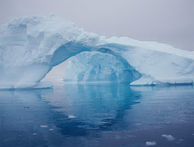
Polar climatic zones(arctic and antarctic). In the Northern Hemisphere arctic the belt starts north of the $ 70 $ parallel, and Antarctic south of the $ 65 $ parallel. Both belts are characterized by polar nights and polar days. Eternal ice and snows emit a huge amount of solar heat, which causes the air to be very chilled. Atmospheric pressure is high all year round and easterly winds prevail. Located in Antarctica cold pole planets. In the summer average temperature air - $ 30 $ degrees, and winter - $ 70 $. At the Russian polar station " East"The temperature drops to - $ 88.3 degrees. On the Antarctic coast, average monthly summer temperatures are from - $ 1 to - $ 5 degrees, and winter temperatures are from - $ 18 to - $ 20 degrees. Over the Greenland ice sheet in Arctic climatic conditions similar but softer. In the Atlantic regions Arctic and to the pole the summer temperature is about $ 0 $ degrees, and with a warm air invasion it rises to + $ 5 $. Average winter temperatures are around $ 20 degrees. American the arctic sector is more severe with temperatures - $ 50 degrees in winter and $ 10 degrees in summer. The largest amount of precipitation falls on European sector of the Arctic, where $ 300 - $ 350 mm falls, and in Asian and American sector from $ 160 $ - $ 250 mm.
Transitional climatic zones.
Between the main climatic zones zones are located transition belts... Their $ 6 $ and they are characterized by a seasonal change in the prevailing air masses, i.e. one air mass dominates there in summer, and another in winter. The prefix “ sub", Which translated from Latin means" under", Ie, the belt located under the main.
Transitional belts include:
- Two subequatorial belts;
- Two subtropical zones;
- Subarctic belt;
- Subantarctic belt.
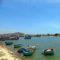
Subequatorial climatic zone... These belts are located to the south and north of the equatorial. As a result of the shift in climatic zones according to the seasons, in the summer period humid equatorial air, in winter comes dry tropical. Summer for subequatorial belts will be wet, a dry winter... Despite this average annual amount precipitation is excessive and reaches $ 1500 mm per year. On the slopes of the mountains, precipitation falls even more - $ 6,000 - $ 10,000 mm per year. The difference between summer and winter temperatures is small, but the difference with equatorial belt felt. Summer temperatures range from $ 22 - $ 30 degrees. Beyond the oceans subequatorial belt goes through South America, Central Africa, Hindustan, Indochina, Northern Australia.
Subtropical climatic zones... They are located within $ 30 - $ 40 degrees in the Northern and Southern Hemispheres. In the south, the subtropics are bordered by the tropical belt, and in the north with the temperate belt in the Northern Hemisphere. In the Southern Hemisphere, the tropical belt lies north of the subtropics, and the temperate belt to the south. Thermal regimes alternate in half-years - a moderate regime is observed in winter, and a tropical regime in summer. For the subtropics, frost is already possible. Within the ocean, the belts differ high temperature and high salinity of water.
Subarctic climate zone... This transition belt is the closest to North Pole Earth. Moderate and arctic air masses replace each other throughout the year. The belt takes Northern Canada, Alaska, southern tip of Greenland, northern Iceland and the Scandinavian Peninsula. Within Russia, it passes through the northern part of Western and Central Siberia, as well as the Far East.
Subantarctic climate zone... Located in the Southern Hemisphere, this belt covers a number of Antarctic islands and the northern tip of the Antarctic Peninsula. The belt is characterized by a short summer with temperatures below + $ 20 degrees. Cold air masses in winter reduce the temperature to negative values. And it keeps below zero for most of the year. The same is true for subarctic belt... There is little precipitation and they are reduced from $ 500 - $ 250 mm and below.
Climatic factors
The formation of the planet's climate is greatly influenced by external and internal factors. Most of the external factors affect the total amount of incoming solar radiation, its distribution by seasons of the year, by hemispheres and continents.
External factors include the parameters of the earth's orbit and the earth's axis:
- Distance between the Sun and the Earth. It determines the amount of solar energy received;
- The inclination of the rotation of the earth's axis to the plane of the orbit, which determines the seasonal changes;
- Eccentricity of the Earth's orbit. Influences heat distribution and seasonal changes.
Internal factors include:
- Configuration of oceans and continents and their relative position;
- The presence of volcanoes that can change the climate up to volcanic winter;
- Albedo of the Earth and its surface;
- Air masses;
- The proximity of oceans and seas, which soften the climate, with the exception of cold currents in them;
- The nature of the underlying surface;
- Human economic activity;
- Heat flows of the planet.
I liked the presentation - show it ...
Full screen Download Embed in your site
Climatic zones. 7 class
The climatic zone is a vast territory with more or less homogeneous conditions. Climatic zones are: Basic (7) Transitional (6) Basic climatic zones are zones in which the general nature of air movement throughout the year remains unchanged. Transitional climatic zones are areas where six months are signs of one main belt, and the next six months are signs of another main belt.
The main climatic zones. Equatorial (1) Tropical (2) Moderate (2) Polar (2): Arctic and Antarctic
Intermediate climatic zones Equatorial l Subequatorial Tropical Subtropical Moderate Subpolar Polar
Equatorial climatic zone. There are no seasons. All year round 26-280С Precipitation all year round. More than 2000mm per year. The length of the day during the year is equal to the night. The climate is always warm and very humid
V equatorial climate moist equatorial forests grow. MMM
Subequatorial climate On both sides of the equator between 5-15C. There are seasons: the rainy season and the dry season. Hot rainy summers. Dry winters. Here are the SAVANNAS
Savannahs are located in the subequatorial climate.
Tropical climate. Located along the tropics. All year round high pressure area In summer it is very hot up to 40-50gr. With winter up to 15C Little precipitation up to 100mm High daily temperature fluctuations Deserts are characteristic.
V tropical climate usually deserts are located.
Subtropical climate Located between 30-40 degrees of both latitudes. In summer, the temperature is 25-30C, there is no rain. In winter, up to 15C, rains. Summers are hot and dry, and winters are mild and rainy. The climate is good for health.
Moderate climatic zone. Four seasons Located between 400 and 650 in both latitudes. They are distinguished by a maritime, continental and harsh continental climate. They differ in the amount of precipitation, maximum and minimum temperatures and amplitude. Depending on the temperatures (winter and summer) and precipitation in the temperate zone, there are deciduous, mixed, coniferous (taiga) forests, steppes and deserts.
Temperate deciduous forests.
Taiga - temperate coniferous forests
Temperate zone. Steppe
Moderate climatic zone. Gobi Desert.
Subpolar climate zone Low temperature in winter Summer signs of temperate zone Winter long and cold Summer is cool and windy. Permafrost is characteristic - a thick layer crust that does not thaw for hundreds or thousands of years. The tundra is located here.
Tundra. Subpolar climate.
Polar climate. Arctic .. Very cold Most pronounced in Greenland. In summer, on polar days, it is warmer to minus 10-150. Little precipitation and low evaporation. In the Arctic, there is water under the ice, except for the islands. V Arctic desert few animals. Polar bears live here.
Antarctic climatic zone. The coldest belt on Earth In 1983, -89.20C was recorded - this is the cold pole. The mainland is under the snow. The climate is very dry. Central Antarctica has the most dry place on the Earth - there is no precipitation. Of the animals, flightless birds - penguins - live on the coast of the ocean. There are polar days and nights and the northern lights.
Antarctica
Thank you for your attention! Were used by: www.ecosystema.ruwww.google.com
In latitudinal space - from the equator to the poles - distinguish climatic zones... Each belt has constant climatic indicators throughout the year.
Climatic zones - latitudinal bands the globe with a relatively homogeneous climate.
Allocate seven main climatic zones: equatorial, two tropical, two moderate, two polar (arctic and Antarctic).
Between the main climatic zones there is six transitional: two subequatorial, two subtropical, subarctic and subantarctic(the prefix "sub" means "between"). On transition belts the adjacent main climatic zones are significantly affected.
Let us consider by what indicators the features of the main climatic zones are determined.
- Region atmospheric pressure: Р В - high pressure; NS- low pressure.
- Upward and downward air flows ↓↓.
- Prevailing air masses. (Computer - equatorial, UVM - moderate, AVM - Arctic and Antarctic air masses.)
- Average January temperatures ( t i) and July ( t Il).
- The amplitude of temperature fluctuations throughout the year is At.
- Precipitation amount - O.
- Constant winds - trade winds ( <п ); westerly winds of temperate latitudes ( → sound); northeastern ( / from-to) and southeastern ( \ u-v).
Using the climatic map of the world from the atlas and conventional signs of the main climate indicators, we will characterize the climatic zones.
Equatorial climate zone: NS, Computer, t I =+24 ° С, t Il= + 24 ° С, At = 0 ° C, O= 2000-3000 mm, <п .
In the equatorial climatic zone during the year, there is a low atmospheric pressure and equatorial air masses. January and July temperatures reach + 24 ° С. The amplitude of temperature fluctuations is about 0 ° С, i.e. in the equatorial climatic zone there is no division into seasons. Annual precipitation is 2000-3000 mm. Accordingly, the climate is hot and humid. Trade winds blow from the northeast (Northern Hemisphere) and southeast (Southern Hemisphere).
Tropical climatic zones of both hemispheres — Р В, TVM, t i= +20 ° С, t Il= +30 ° С, At= 10 ° C, O= 100-250 mm, <пф (trade winds are forming). Material from the site
Moderate climatic zones. In both hemispheres, low atmospheric pressure and moderate air masses prevail. There is a large temperature difference between the coldest and warmest months. The seasons are clearly defined. The amount of precipitation depends on the remoteness of the seas and oceans. So, under the influence of westerly winds of temperate latitudes, the largest amount of precipitation falls in the western regions of the continents, the smallest - and in the central, in the eastern part it increases again on the coast of the oceans.
Polar climatic zones (arctic and Antarctic). High pressure. Arctic (Antarctic) cold and dry air masses prevail. Annual air temperatures usually do not exceed 0 ° С. There is very little precipitation (up to 200 mm per year). Katabatic winds are formed here.
On this page material on topics:
An essay on what climatology studies
Climatic zones with conventional signs
Arctic and Antarctic belts high or low pressure
-
It occurs under the influence of many factors. All their diversity can be reduced to three groups: 1) the amount of solar heat supplied to the earth's surface (latitude); 2) circulation of the atmosphere; 3) the nature of the underlying surface and relief.
The main climatic indicators are air temperature, annual amount and mode of precipitation, prevailing wind direction and others. They are shown on climate maps.
Depending on temperature conditions, prevailing air masses and winds, the earth's surface is divided into climatic zones.
The main climatic zones include: equatorial, tropical, temperate, arctic, antarctic. There are transitional ones between them: subequatorial, subtropical, subarctic, subantarctic. In the transition zones, air masses change seasons: they come here from neighboring zones.
Therefore, the climate of the subequatorial zones in summer is similar to the climate of the equatorial zone, and in winter it is similar to the tropical climate. The climate of the subtropical zones in summer is similar to that of the tropical, and in winter - with the climate of the temperate zone. This is due to the seasonal movement of belts over the Earth. atmospheric pressure moving after the Sun: in summer - to the north, in winter - to the south.
Climatic zones are subdivided into regions - parts of climatic zones. For example, the tropical belt of Africa is subdivided into areas of tropical dry and tropical humid climates, and in Eurasia, the subtropical belt is subdivided into areas of the Mediterranean, continental and monsoon climates.
In mountainous areas, a high-altitude climatic zonation is formed due to the fact that with an altitude temperature air drops.
Characteristics of the features of climatic zones and types of climate are given in table 10 on p. 114-115.
Dependence of the climate on the geographical latitude.
The distribution of sunlight and heat on Earth is uneven. The territories on both sides of the equator receive the most heat. These are equatorial, subequatorial, tropical and subtropical zones.
V equatorial belt the whole year is dominated by equatorial air masses. There are always high temperatures and a lot of precipitation. This is due to the high position of the Sun above the horizon throughout the year and the rising air currents characteristic of the low pressure belt.
V tropical climates tropical air masses predominate. They have a fairly high temperature, but less humid than the equatorial ones.
Climates
Climate type Climatic zone Average t, ° January july Equatorial Equatorial +26 +26 Tropical monsoon Subequatorial +20 +30 Tropical dry Tropical + 12 +35 Mediterranean Subtropical + 7 +22 Subtropical dry Subtropical 0 +40 Moderate marine Moderate +2 + 17 Moderate continental Moderate -15 +20 Moderate monsoon Moderate -20 +23 Subarctic Subarctic -25 +8 Arctic (antarctic) -40 0 Table 10
Of the earth
Mode and amount of precipitation Circulation of the atmosphere
Examples of territories 2000 mm throughout the year In the area of low atm. warm and humid equatorial air masses are formed Equatorial regions of Africa, South America and Oceania 2000 mm during the summer monsoon Monsoons North Africa, Central Australia 200 mm throughout the year Trade winds South and South-East. Asia, Zap. and Center. Africa, North. Australia 500 mm mostly in winter In summer - anticyclones at high atmospheric pressure; in winter - cyclones Mediterranean, South coast of Crimea, South Africa, South-West. Australia 120 mm throughout the year Dry continental air masses Inner parts of the continents 1000 mm throughout the year Westerly winds Western parts of Eurasia and North. Of America 400 mm throughout the year Westerly winds Inner parts of the continents 560 mm mostly during the summer monsoon Monsoons Eastern edge of Eurasia 200 mm throughout the year Cyclones prevail Northern outskirts of Eurasia and North. Of America 100 mm throughout the year Anticyclones prevail Water area North. Arctic Ocean and Antarctica In temperate climates where temperate air masses prevail, it is much colder than in tropical zones. The seasons are clearly defined. The prevailing westerly winds bring air masses from the ocean, which cause precipitation in the western parts of the continents. In the inner parts of the continents, little precipitation falls, and in the east, when the summer monsoon blows, they again become more.
In the arctic and antarctic belts Arctic and Antarctic air masses with very low temperatures and low humidity prevail.
Influence of the oceans on climate. The climate, which is characterized by warm winters and cool summers, a small annual temperature range and a large amount of precipitation, is called marine. In Great Britain, for example, the climate is maritime. In places far from the oceans, less precipitation falls, the winters are cold, the summers are warm, the annual amplitude is large. This climate is called continental because it is typical of places located in the interior of the continent. In Moscow, the climate is moderately continental, in Chelyabinsk - continental, in Irkutsk - sharply continental.
Influence of sea currents on the climate. Warm sea currents warm atmosphere in those areas where they flow, for example, the warm North Atlantic Current in the southern part of the Scandinavian Peninsula creates favorable conditions for coniferous and deciduous forests, while most of Greenland, which lies at about the same latitudes as the Scandinavian peninsula, covered with a thick layer of ice all year round.
The dependence of the climate on the relief. You already know that as the terrain rises for every kilometer, the air temperature drops by 5-6 °. Therefore, on the slopes of the Pamirs, the average annual temperature is -1 ° C, although it is located slightly north of the tropics.
The location of mountain ranges has a great influence on the climate. For example, the Caucasus Mountains hold back moist sea winds, and significantly more precipitation falls on the slopes of the mountains facing the Black Sea than behind the Caucasus Mountains. At the same time, they serve as an obstacle to cold northerly winds.
Climate dependence on prevailing winds... On the territory of the East European Plain, winds from the Atlantic Ocean prevail for almost the entire year. Therefore, winters in this area are relatively mild.
The regions of the Far East are under the influence of monsoons. In winter, winds constantly blow from the depths of the mainland. They are cold and very dry, so they do not give precipitation. In summer, on the contrary, winds carry a lot of moisture from the Pacific Ocean. In autumn, when the wind dies down from the ocean, the weather is usually sunny and calm. This is the best time of the year here.
The influence of climate on human life and economic activity. A person living in a certain area gets used to (adapts - from Lat. Adaptatio - adaptation) to the conditions of his environment, primarily to the climatic features of the area. His clothes, shoes, food, dwellings, occupations are the result of this adaptation.
Adaptation is necessary for a person when climatic conditions change. The famous Russian traveler N.N. Miklukho-Maclay vividly described human adaptation to the tropical climate in his diaries.
Protection of the atmosphere. Industrial plants and automobiles are the main sources of air pollution. In big cities, the problem of gas pollution on the main transport routes is very acute. That is why in many large cities of the world, including in our country, environmental control of the toxicity of vehicle exhaust gases has been introduced. According to experts, the smoke and dustiness of the air can halve the supply of solar radiation to the Earth's surface.
Questions and tasks to prepare for the exam1. What layers does the atmosphere of planet Earth consist of?
2. What is the percentage of the air we breathe?
3. What is the name of the layer of the atmosphere that absorbs the ultraviolet part of solar radiation?
4. Why does the air temperature decrease with increasing altitude?
5. How does atmospheric pressure change with increasing altitude?
6. What explains the displacement of air masses in winter - to the south, and in summer - to the north?
7. Describe the mechanism of formation of permanent winds of the Earth.
8. What is the name of the atmospheric vortex in which the air in the Northern Hemisphere moves counterclockwise?
9. In which vertical direction does the air move in the cyclone: up or down? How is smoke coming out of chimneys spread during cyclonic weather conditions?
10. What is an atmospheric front?
11. What is included in the concept of "atmospheric circulation"?
12. Where is the lowest surface temperature recorded?
13. What will happen to the barometer if you go uphill with it from the seashore?
14. Which air can hold more moisture: warm or cold?
15. What is the difference between relative humidity and absolute humidity?
16. List the types of precipitation. How is precipitation formed?
17. What are the winds associated with seasonal differences in temperature and pressure between continents and oceans called?
18. Name the climate-forming factors.
19. Which of the following cities has the coldest winters: Moscow, Belgorod, Murmansk, Ulan Bator?
20. What explains the abundance of rainfall on the eastern slopes of Australia's Great Dividing Range?Maksakovsky V.P., Petrova N.N., Physical and economic geography of the world. - M.: Ayris-press, 2010 .-- 368s.: Ill.
Lesson content lesson outline support frame lesson presentation accelerative methods interactive technologies Practice tasks and exercises self-test workshops, trainings, cases, quests home assignments discussion questions rhetorical questions from students Illustrations audio, video clips and multimedia photos, pictures, charts, tables, schemes humor, jokes, jokes, comics parables, sayings, crosswords, quotes Supplements abstracts articles chips for the curious cheat sheets textbooks basic and additional vocabulary of terms others Improving textbooks and lessonsbug fixes in the tutorial updating a fragment in the textbook elements of innovation in the lesson replacing obsolete knowledge with new ones For teachers only perfect lessons calendar plan for the year methodological recommendations of the discussion program Integrated lessons