Modern glaciers occupy a small area in Russia, only about 60 thousand km 2, but they contain large reserves of fresh water. They are one of the sources of river feeding, the importance of which is especially great in the annual flow of the rivers of the Caucasus.
The main area of modern glaciation (more than 56 thousand km 2) is located on the Arctic islands (see Table 7), which is explained by their position in high latitudes, which determines the formation of a cold climate. The lower border of the nival zone drops here almost to sea level. Glaciation is concentrated mainly in the western and central regions, where more atmospheric precipitation falls. The islands are characterized by cover and mountain-cover (mesh) glaciation, represented by ice sheets and domes with outlet glaciers. The largest ice cap is located on the North Island New Earth... Its length along the watershed is 413 km, and its maximum width reaches 95 km (Dolgushin L.D., Osipova G.B., 1989). Ushakov Island, lying between Franz Josef Land and Severnaya Zemlya, is a solid ice dome, the edges of which break off to the sea with ice walls from several meters to 20-30 m high, and on the island Victoria located to the west of Franz Josef Land, only a small stretch of the beach with an area of about 100 m 2 is ice-free.
Moving eastward, more and more of the islands remain ice-free. So, the islands of the archipelago Franz Josef Land almost entirely covered with glaciers, on New Siberian Islands glaciation is typical only for the northernmost group of islands De Long and on the island Wrangel There is no cover glaciation - only snowflakes and small glaciers are found here. Most of the snow and ice formations are perennial snowfields with infiltration ice cores.
The thickness of the ice sheets of the Arctic islands reaches 100-300 m, and the water reserve in them approaches 15 thousand km 3, which is almost four times more than the annual flow of all rivers in Russia.
Glaciation of the mountainous regions of Russia, both in area and in volume of ice, is significantly inferior to the cover glaciation of the Arctic islands. Mountain glaciation is typical for the highest mountains of the country - the Caucasus, Altai, Kamchatka, the mountains of the Northeast, but also occurs in low mountain ranges in the northern part of the territory, where the snow border lies low (Khibiny, northern Urals, mountains Byrranga, Putorana, Kharaulakh mountains) , as well as in the area of Matochkin Shara on the North and South Islands of Novaya Zemlya.
Many mountain glaciers lie below the climatic snow limit, or "365 level," at which snow stays on a horizontal underlying surface 365 days a year. The existence of glaciers below the climatic snow boundary becomes possible due to the concentration of large masses of snow in negative landforms (often in deep ancient crust) leeward slopes as a result of snow drift and avalanches. The difference between the climatic and actual snow boundary is usually measured in hundreds of meters, but in Kamchatka it exceeds 1500 m.
The area of mountain glaciers in Russia is slightly more than 3.5 thousand km 2. Most widespread tar, tar-valley and valley glaciers... Most of the glaciers and glaciers are confined to the slopes of the northern points, which is due not so much to the conditions of snow accumulation, but also to greater shade from the sun's rays (insolation conditions). In terms of the area of glaciation among the mountains of Russia, it takes the first place Caucasus(994 km 2). It is followed by Altai (910 km 2) and Kamchatka(874 km 2). Less significant glaciation is characteristic of the Koryak Upland, the Suntar-Khayata and Chersky ridges. Glaciation in other mountainous regions is not great. The largest glaciers in Russia are the glacier Bogdanovich(area 37.8 km 2, length 17.1 km) in the Klyuchevskaya group of volcanoes in Kamchatka and a glacier Bezengi(area 36.2 km 2, length 17.6 km) in the Terek basin in the Caucasus.
Glaciers are sensitive to climate fluctuations. In the XVIII - early XIX centuries a period of general reduction of glaciers began, which continues to this day.
Tien Shan
Tien Shan is one of the highest (second after the Pamirs) and one of the most visited by tourists and climbers (after the Caucasus) mountain systems in b. THE USSR. The former Soviet part of the Tien Shan is located mainly in Kyrgyzstan, the northern and westernmost ridges are located in Kazakhstan, the southwestern tip of the Tien Shan reaches Uzbekistan and Tajikistan.
Most of mountain ranges The Tien Shan has a latitudinal or sublatitudinal strike. They stretch from west to east for about 1200 km (within the former USSR) and have a maximum width of 350-400 km. In the north, the Tien Shan is bounded by the Ili Valley, in the south by the Fergana Basin, to the east of which it joins the Alai ridge of the Gissar-Alai system.
The Tien Shan ridges, separated by intermontane basins, are composed of sedimentary, metamorphic and igneous rocks - shales, sandstones, limestones, marbles, gneisses, granites. Intermontane basins are filled with continental sedimentary deposits.
Geologists attribute the Tien Shan to rather old mountains of the Caledonian (in the north) and Hercynian folding, which underwent subsequent uplift in the Alpine era of the formation of tectonic structures. The tectonic activity of the Tien Shan continues to this day, as evidenced by its high seismicity. The devastating Tashkent earthquake of 1966 is still fresh in human memory, and seismologists testify that the number of locally localized earthquakes recorded here, in the Tien Shan, has increased again in recent years and amounts to 30-40 cases per year.
According to the orographic structure, the Tien Shan is usually divided into Northern, Western, Central, Inner and Eastern (the latter is on the territory of the PRC). Tourists and climbers usually in their classification Central and Inner Tien Shan, counting the region of the Kayindy (Kaindy-Katta), Enilchek-Too (Inylektau), Sary-Jaz, Tengritag ranges as the eastern part of the Central Tien Shan and referring the Kuylyu, Akshyrak, Dzhetymbel ranges , Naryn-Too, Borkoldoy, At-Bashy and the rest of the Terskey-Ala-Too (Terskey-Alatau) ridge just to the Central Tien Shan.
The Northern Tien Shan includes the Kyrgyz ridge, Kungei-Ala-Too (Kungey-Alatau), Ketmen, Chu-Ili mountains and Zailiyskiy Alatau, located north of Issyk-Kul.
By the Western Tien Shan we mean the Talas Alatau ridge with the Chatkal, Chandalash (Sandalash), Pskem, Maidantal, Ugam and their spurs, as well as the Fergana and Atoynok, cut at the junction by the narrow Naryn gorge.
Most of the Tien Shan ranges have a typical mountain-glacial "alpine" relief. However, along with sharp ridges with sharp tops and peaks, often, especially in the Central and Inner Tien Shan, flat ancient surfaces of the leveling are located on the ridges of the ridges, inclined to one side due to their folded deformation. Such surfaces, inclined to the south, crown the Terskey-Alatau ridge.
In the Inner and Central Tien Shan, the bottoms of high mountain valleys, covered by moraine deposits with other sediments, also have a leveled surface. Covered with grassy vegetation, they are pastures. The Kyrgyz call them syrts, as if proto-assigning a useful area of high mountains to mountains with rocky slopes - "tau" and mountains covered with eternal snow and ice - "bel".
On the slopes of the Tien Shan ranges, erosion processes are intensively developing, talus and rockfalls, landslides are formed, and mudflows in the gorges. A particularly high mudflow activity is observed on the northern slopes of the Zailiyskiy Alatau. The mudflows here repeatedly caused damage to the capital of Kazakhstan - Almaty, in 1963 a catastrophic mudflow destroyed Lake Issyk. They sat down here every year during a stormy melting snow or after heavy rains, and, unfortunately, there are times when people die in them.
The climate of the Tien Shan is sharply continental: hot summers in the foothills and valleys and completely cool in the nival and subnival zones, unusually severe winters for these latitudes, large daily and annual temperature fluctuations, slight cloudiness and significant dryness of the air. There is a lot of sun here. The average annual duration of sunshine fluctuates in this area within 2500-2700 hours (in Moscow - about 1600 hours). However, the complexity of the Tien Shan relief, expressed in the combination of the highest ridges and deep depressions, the presence of a wide variety of expositions in the mountains, introduces many local corrections to the duration of sunshine. Cloudiness also has a certain effect on the duration of sunshine near the earth's surface, the average annual value of which in the regions of Kyrgyzstan is 5-6 points. The maximum cloud cover falls in March-April and reaches 7-8 points, the minimum - in August-September and is 3-4 points.
A significant influence on the formation of the weather is exerted by air masses... The thermal regime in the Tien Shan is very diverse. From the foot to the tops of the mountains, the same ones are replaced heat belts, which is at a great distance from the southern borders b. USSR to the shores of the Arctic Ocean. This is primarily due to a decrease in temperature with altitude. Vertical temperature gradient - temperature drop for every 100 m of rise is about 0.7 ° in summer; 0.6 ° in autumn and spring; 0.5 ° in winter. In addition, there is a temperature jump, reaching in the Central Tien Shan a value of minus 2-2.5 ° above large glaciers compared to the same heights in the free atmosphere or at the same altitude, but outside the glacier.
Western air currents have a great influence on the formation of the region's climate. They bring moisture-laden air masses from the Atlantic to the Tien Shan mountains. Mountainous terrain causes aggravation of atmospheric fronts and precipitation, locally up to 1600 mm per year in mid-mountainous and high-mountainous zones, mainly on slopes facing west and north-west. On the eastern slopes and in the valleys of the Inner and Central Tien Shan, arid conditions are created (precipitation is 200-300 mm per year). The maximum precipitation is in summer, but on the western slopes of the mountains there is a lot of precipitation in winter. On them and in the valleys opening to the west, the thickness of the winter snow cover reaches 2-3 m, while on the eastern slopes and behind them, especially in the valleys of the Inner and Central Tien Shan, almost no snow falls in winter, and these valleys, despite at low average temperatures (-25-28 ° С in January, February), are used as winter pastures.
The lake itself has a strong softening effect on the climate of the Issyk-Kul depression. Its huge water mass increases the air temperature by about 10 ° and causes such an unusual Central Asia cool summer: in July-August in Przhevalsk, the average monthly temperature is + 16.5-16.9 ° С.
Due to the increase in the continentality of the climate from the northwest to the southeast, the snow line rises in the same direction.
On the Talas Alatau and the Kyrgyz ridge, it is located at an altitude of 3600-3800 m on the northern slopes and 3800-4200 m on the southern slopes. In the Central Tien Shan, in the area of Khan Tengri - Pobeda Peak, it is located at an altitude of 4200 - 4450 m. However, it is the Central Tien Shan that is characterized by the greatest glaciation, which is determined by its great height... The largest glaciers of the Tien Shan are located here: South Inylchek (about 60 km), North Inylchek (about 35 km), Kaindy (26 km), Semenov (21 km), Mushketov (20 km).
The total area of the Tien Shan branch exceeds 7300 sq. km., the total number of glaciers reaches almost 7800. Valley, tar, hanging glaciers are represented here. Glaciers of flat tops are characteristic of Terskey-Alatau; in the form of small shields, they cover the flat, slightly sloping surfaces of the ridge crests. There is nowhere to fall on them with stone debris, only atmospheric dust settles, so they have poorly developed moraine deposits. Glaciation is almost stationary - some glaciers are retreating (there are a little more of them), others are advancing.
In the era of the great glaciation, the alpine Tien Shan was covered with even more powerful glaciers. Traces of their activity - ramparts, moraines, glacial valleys (troughs), glacial lakes - can be found everywhere in the Tien Shan.
The rivers of the Ili, Chu, Tarym, Syr Darya and other basins. They come to an end in the closed lacustrine reservoirs of the deserts of Central and Central Asia or in the inner Tien Shan lakes. Rivers starting in the highlands are fed by glaciers and snows, and therefore have two floods, the most powerful of which is summer (in the second half of July - early August).
Among the rivers of Kyrgyzstan, the Naryn deserves a separate consideration - the seventh river in b. USSR in terms of energy content. Naryn is fed by 700 glaciers, they give birth to 630 rivers - a tributary of the main river Tien Shan. Like a giant staircase (700 km horizontally and 4 km vertically), the river descends from the Tien Shan, gaining strength along the way. The average fall of Naryn is 6 m per kilometer of the way, the average fall of himself large inflow Kokomerena (in the upper reaches known as Susamyr) - 10 m per kilometer. The dizzying descent of Naryn from the heights of the Tien Shan charges him with tremendous energy.
There are many lakes in the Tien Shan, of which the largest and most beautiful is Issyk-Kul. It occupies a deep tectonic depression between the Kungei-Alatau and Terskey-Alatau ridges. Its maximum depth is 702 m, average - 278 m, length - 182 km, maximum width - 58 km. Issyk-Kul occupies the seventh place among lakes b. Soviet Union, in depth - the third (after Lake Baikal and the Caspian Sea), in terms of water volume - 1.7 times higher than the water reserves in the Aral Sea. Issyk-Kul has no runoff, which is why the water in it is brackish, but the salinity is insignificant, 2 times less than in the Aral Sea.
The most significant lakes of the Inner Tien Shan are Song-Kel and Chatyr-Kel, of which the first is drainage, and the second is closed, currently drying up. Quite a lot of small lakes are found on the syrts in depressions of the moraine relief. There are also glacial lakes in the highlands. But all of them, of course, do not have any significant effect on the climatic conditions of the Tien Shan.
As already noted, the relief, climatic features, the boundaries of the snow line, and, consequently, vegetation and animal world individual regions of the Tien Shan mountain system differ significantly.
In the Central Tien Shan, mountain travel enthusiasts are most attracted by the Terskey-Alatau (Terskey-Ala-Too) ridge, the Kuylyu and Akshiirak mountain ranges, as well as the most powerful glaciation node in the Tien Shan located to the east - the Pobeda and Khan-Tengri peak massif, ridges Sary-Jaz, Kaindy, Inylchektau.
The Terskey-Alatau ridge ("colorful mountains, turned away from the sun") is located latitudinally and frames from the south the basin of Lake Issyk-Kul. The length of the ridge is about 375 km, the ridge in the east joins the Kungei-Alatau ridge, outside the Issyk-Kul depression it adjoins the Sary-Jaz ridge. The average height of the ridge is about 4500 m, highest point reaches 5216 m (Karakol peak).
One large glaciation node of the ridge is located in the upper reaches of the Dzhetyoguz, Karakol, Arashan, Ak-Suu, and Turgen-Ak-Suu rivers, the other is in the upper reaches of the Konurulen. Significant glaciation of the ridge is facilitated by its height, atmospheric circulation, as well as moisture evaporating from the surface of Lake Issyk-Kul.
The total number of glaciers on the slopes of the Terskey-Alatau ridge is about 1100, the area of glaciation is 1081 sq. km., the distribution of glaciation on the slopes of the northern and southern exposure is almost the same.
On the northern slope of Terskey-Alatau, the length of valley glaciers reaches 5-7 km (Ailanysh and others). The glaciers on the southern slope are much longer (for example, the Kolpakovsky glacier reaches 10 km). Glaciers are retreating everywhere, and their surfaces are clogged with debris. Glacier tongues usually lie at altitudes of 3000-3500 m.
The snow line in the western part of the northern slope of Terskei is located at an altitude of 3900-4000 m, and in the eastern part due to the large number of atmospheric precipitation- drops to 3700 m. On the southern slope, the snow line rises to 4000-4200 m.
From west to east, the amount of precipitation increases at the bottom from 200 mm (Bokonbaevskoe) to 400 mm (Karakol - b. Przhevalsk) and at an altitude - from 1000 to 2000 mm per year. From west to east, the degree of glaciation increases accordingly.
The Terskey-Alatau ridge is asymmetric - it has a short gentle southern slope and a long northern one. Dismembered by deeply cut gorges, the northern slope descends with giant steps to Issyk-Kul (the water edge of which is 1609 m). The crest of the ridge itself is little dissected, it bears flat surfaces inclined to the south, in places imperceptibly passing into the southern slope.
The western part of the Terskey-Alatau ridge is very ruined, it has many saddles available for passage. The heights reach almost 4800 m, the passes - at the heights of 3500-4400 m, the difficulty category of the passes is up to 3A. The northern slope is strongly dissected by longitudinal valleys into a system of short and low ridges. The extreme, western, part of the ridge is devoid of vegetation due to the low amount of precipitation, the appearance of the area is also deserted here, as well as on the western coast of Issyk-Kul, where the Chu River turns into the Boom Gorge.
The rivers of the region are turbulent, but mostly not full of water, belong to the Chu river basin (Kara-Kungei, Kelchkek and the much larger Kara-Kujur river), feed Maly Naryn (Chon-Karakoman, Uchemchek) or Lake Issyk-Kul (Tura Suu, Kongurleng, Ton).
The largest glaciers (up to 5-6 km) are concentrated in the upper reaches of the S. Konurulen (Kongurleng) River. There are many flat-topped glaciers that resemble the ice sheets of the Arctic. They do not have a significant rock frame. These glaciers are nourished by atmospheric precipitation that falls directly above their surface, most of which occurs in the period from April to October. The Konurulenskaya valley itself is stretched from west to east for almost 50 km and is protected from cold winds from the north and south by ridges, therefore, from early spring to late autumn it is used as a pasture.
The weather in the western part of Terskey-Alatau in summer is unstable, with frequent winds. Precipitation falls in the form of rain and hail in the valleys and snow in the mountains. During the winter, up to 1000 mm of snow precipitation accumulates on the surface of the glaciers, which forms a snow cover of up to 2-3 m. The peak of summer is August, when a significant part of the body of the glaciers is freed from snow.
The western part of Terskey-Alatau is located in the Ton region of the Issyk-Kul region and the Kochkor region of the Naryn region. The main routes to the region are from the regional centers Bokonbaevskoe and Kochkork, where you can get by bus from Bishkek. Enough good roads lead to the Konurulenskaya valley (bus to the village of Don-Tala) and in the upper reaches of the Kara-Kujur (bus to Jer-Kechkyu), there is a road and then to the valleys of the tributaries of the Small Naryn and further to regional center Naryn.
The highest and most frequently visited part of the Terskey-Alatau ridge is the central part, between the Barskaun and Turgen-Aksu gorges. Here are the largest glaciers and the most technically complex and diverse passes. Tourist routes often pass not only along the valleys and passes of Terskey-Alatau, but also lead to the syrts of Kumtor and Arabeli, cover the Kuilyu and Akshiirak mountain ranges.
The passes of the Terskey-Alatau ridge in this area have heights from 3600 to 4800 m and difficulty categories up to 3B. The vast majority of the passes of the main ridge and its southern spurs are snow and snow-ice. The passes of the northern spurs of the ridge are more varied; here there are rock, ice, snow, and talus passes, and most often they are combined.
The massif of the Kuylyu ridge stretches in the latitudinal direction for about 50 km, and in the meridional direction for 25 km. The natural borders of the region are the Sary-Jaz, Uch-Kel, Sarychat, Kuylyu rivers and the Kuylyu pass. The ridge is located parallel to the Terskey-Alatau ridge, but south of it. In the east, it almost adjoins the Sary-Jaz ridge, and in the west - to the Akshiirak ridge. The average height of the Kuylyu ridge is 4,700 m, and the highest peaks rise above 5,000 m (the Constitution peak - 5203 m). short approaches to the relief of the Central Caucasus. The average height of the snow line is about 3700-3900 m on the northern slopes and 4000-4200 m on the southern slopes. The heights of the glacier tongues are 3700-3900 m.
The rivers of the northern slope have wide, easily accessible trough-type valleys. The valleys of the southern slope in the upper reaches, as a rule, are troughs, and in the middle and lower reaches they are rugged and difficult to access, with the exception of the Terekty River.
The northern border of the Kuylyu region is usually considered to be the valley of the Keolyu River (Vostochnaya Kuylyu River), the right tributary of the Keolu River. Sary-Jazz. The valley is a typical north-east oriented trough. The valley is about 50 km long. The river itself crashed into the bottom of the trough. The width of the trough bed reaches 700 m. The bottom of the trough is a terrace overgrown with grass in the lower part, in places with areas of spruce forest.
The southern border of the Kuylyu massif is considered to be the r. Uch-Kel, also a right tributary of the river. Sary-Jazz.
The largest area of modern glaciation is in the basins of the Ashutor, Karator and Bordutor rivers on the northern slope of the Kuylyu ridge, the Terekty, Kuilyu, Yuzhnaya, Bashkul and Ikichat rivers on the southern slope. Valley glaciers, located in complex multi-chamber circuses and confined to the crests of the main watersheds, both hanging and crumb types, located on transverse spurs, in the zone of smaller absolute heights... Flat-topped glaciers are not typical for the Kuylyu massif. The greatest length of glaciers is 5-6 km, tongues of large valley glaciers descend to heights of 3500-3600 m, tongues of crimson and hanging glaciers are located in an altitude interval of 3900-4100 m. ... The height of the snow line varies from 3600 to 3900 m on the north-eastern and eastern slopes, to 4100-4600 m on the southern slopes.
The passes are predominantly snowy, snow-ice, less often rocky-ice in nature and have difficulty categories 3A-3B. The heights of the passes are 3600-4800 m.
In the watershed between the basins of the Sary-Jaz and Naryn rivers, the second largest glaciation node is located on the b. Soviet Tien Shan - Akshiirak massif. It borders on the southern slopes of the Terskey-Alatau ridge and the Kuylyu massif, being separated from them by the Sarychat River, which below is called the Irtash and Uch-Kel and is the left tributary of the Sary-Jaz River. From the west, the massif is adjoined by the Kumtor syrts stretching for 50-60 km in length and 20-30 km in width.
The Akshiirak massif (its average height is 4700 m, the highest point is 5126 m) consists of three close parallel ridges (ridges), located en-echelon, oriented from northeast to southwest and separated by large longitudinal valleys. Between the northern and middle ridges lies a deep longitudinal valley, in the western part of which there is the Petrov glacier (its length is 14 km, it is the third largest glacier of the Soviet Tien Shan). In the eastern part there are glaciers of the Dzhaman-Su river basin. The length of the Jaman-Su glacier is more than 10 km. Glaciers lie between the middle and southern ridges: from the western part - Kara-Sai North (more than 10 km long), and from the east - Kaindy (Koendu) (more than 8 km long). The western slopes of Akshiirak are covered with an almost continuous firn cover. The total number of glaciers in the massif is more than 130, the area of glaciation is about 450 sq. km. Glacier tongues lie at altitudes of 3700-4100 m, snow line - 4100-4400 m, depending on the exposure of the slopes.
The relief of the inner part of the Akshiirak massif has a typical alpine appearance - narrow rocky watersheds, steep walls, sharp peaks and ridges. The latter, due to the steepness of the slopes, are often devoid of a cover of ice and firn, even if they rise above the snow line. Many valley glaciers also have an Alpine "appearance".
In the Akshiirak massif there are many technically difficult snow-ice and rock-ice passes (up to 3A category of difficulty), but there are also quite simple and at the same time of cardinal importance 1B-2A passes of difficulty category. But groups that have recently become addicted to mountain tourism, nevertheless, you should not plan a trip here because of the need for a long continuous stay at an altitude, obligatory overnight stays in the snow-ice zone and a very harsh climate. By the way, mountain tourists can get detailed information about the weather at the high-mountain meteorological station "Tien Shan", located on the syrts in the immediate vicinity of the massif, at an altitude of 3600 m.
The average annual temperature in syrts is -7-8 ° С, i.e. lower than in the Pamirs or, say, on New Earth, and only 2 ° C higher than in the Antarctic Mirny. Here, only three months of the year have a positive average temperature, and there is not a single day without frost. The average daily temperature of the warmest month - July - in the syrt area is +4.7 ° С, in August - +3.0 ° С. But this is on syrts, and at an altitude here, as well as in other regions of the Tien Shan, the temperature drops in summer with a rise of 0.7 ° for every 100 m. And also the wind, which does not subside either day or night.
The contrast between the northern and southern slopes of Terskey-Alatau is striking. And it manifests itself in the relief, and in the climate, and in vegetation, and in the animal kingdom.
The vegetation of the northern slopes of the Terskey-Alatau ridge is quite rich and diverse. Tien Shan spruce (Shrenka spruce) grows on shady and wet slopes at altitudes from 2100 to 3100 m, to which Semyonov's fir is mixed in places. They are accompanied by bushes of barberry, honeysuckle, currant and rose hips up to a height of about 2500 m. Above the forest zone there are high-mountain subalpine and further alpine meadows with creeping juniper and caragana. Even higher (up to about 3800 m) there are spots of alpine meadows, individual plants of stellate, edelweiss, anemones, mosses and lichens.
The vegetation of the syrts is very poor. Its characteristic features are extreme poverty, oppression, rarefaction. In a thin layer of soil cover, lying on the permafrost zone, only plants develop that are well adapted to the harsh conditions of existence. Most of the territory of the syrts is occupied by sparse steppe and desert vegetation, a smaller part - by alpine meadows, there are swampy lowlands overgrown with sedge. As it rises, this vegetation is replaced by mosses and lichens.
The rivers of the central part of the Central Tien Shan belong to the Tien Shan type and are mountain streams with a fast and stormy current. The greatest flood occurs in July - early August. River valleys, flowing along the lateral spurs of the ridge, are wide, and the valleys of the transverse tributaries are narrow. The water, as a rule, is clean and transparent, with the exception of the largest rivers, in particular the Irtash. Crossings across the Terskey-Alatau, Kuylya and Akshiirak rivers are usually quite difficult and require appropriate training, knowledge, time and effort. Syrt rivers have a calm flow and a well-developed delta. Crossing them is usually easy.
Most tourist trips to the regions of the Central Tien Shan begin in Karakol (formerly Przhevalsk), which is connected to Bishkek and Alma-Ata by air. In addition, there is a regular bus service along the northern and southern shores of Issyk-Kul to Bishkek. Local buses run from Karakol to many nearby villages (Teploklyuchenka, Dzhetyoguz resort, Pokrovka village, Barskaun village).
To organize a transfer to the Akshiirak village, to the Tien Shan weather station and to Kuylya, you can contact the Karakol truck depot, which operates flights to syrts in the Akshiirak region through the Barskaun pass (3754 m) and to the Kuylyu - Sary-Jaz regions through the Chon pass -Ashu (3982 m). You can also get there by passing collective farm or expeditionary vehicles. Roads operate here all year round. Pack transport throughout the Tien Shan is difficult to get, so you should not count on a caravan.
If the route passes along the southern slopes of Terskey-Alatau, crosses the Kuylyu and Akshiirak masses, a special permit (admission to the border zone) is required to travel, which should be issued with the FSK authorities at the place of residence, or (recently) in Almaty or Bishkek ... Group travel certificates must be marked in Karakol.
To plan routes in the central part of the Central Tien Shan, you should know the specifics of each season. In winter, it is very harsh on the southern slopes of Terskey-Alatau, in Kuylyu and Aksheirak. The relief here creates conditions for stagnation and strong cooling of the air. There is a long-term average temperature January-February -28 ° С, absolute minimum-53.6 ° C. On the northern slopes, due to the influence of Issyk-Kul, the average temperature at the same heights is 10-12 ° higher. There is no snow cover in the valleys of Kuylyu and Sarychat (Irtash, Uch-Kel). On the syrts of Kumtor and Arabeli, the snow cover reaches 10-20 cm and is not continuous. Little precipitation falls. Apparently, therefore, a single winter-spring trip to this region is known so far.
In spring, there are sharp changes in weather, frosts are frequent in the foothills of Terskei, frosts at altitude are weakening. Spring is below, in the valleys, rainy, short. It comes, as, indeed, all seasons, not at the same time. In the mountains, every 100 m of uplift, spring is about three days late. And although spring in the mountains cannot be attributed to the optimal travel times, there are already known cases of travel along the northern slopes of Terskey-Alatau during the May holidays and in May. Summer is the most stable season, it begins at the bottom, in the valleys, in May, in the mountains, in June. Summers are cool, especially in the first half. At altitudes of 3000 m, the average daily temperature becomes positive at the beginning of July and negative at the end of September, when autumn comes. Thus, the optimal timing of tourist travel in the Central Tien Shan should be considered the period from June 1 to September 30, and the most favorable - from July 15 to August 31.
In the Central Tien Shan, there is not yet sufficient experience in conducting tourist trips in the fall. The weather at this time already quite often experiences abrupt changes. In general, autumn is long, cold and dry. In the mountains, it stretches until early November.
Eastern part of the Central Tien Shan
... In the practice of tourism, the eastern part of the Central Tien Shan is understood as the highest mountainous region b. Soviet Tien Shan, bounded from the north by the eastern part of the Terskey-Alatau ridge, from the west by the meridian along the Sarydzhaz river valley, from the south by the state border along the Kokshaaltau ridge and from the east by the Meridional ridge, along which the state border of Kyrgyzstan with China also runs. The area is characterized by powerful glaciation, the highest peaks are located here b. Soviet Tien Shan - Pobeda peak (7439 m) - the second and Khan Tengri peak (6995 m, according to the latest data 7010 m) - the fifth highest peak b. THE USSR.
Administratively, the district is located in two republics - the northern part belongs to Kazakhstan (Narynkol district of the Alma-Ata region), the southern part belongs to Kyrgyzstan (Inylchek district of the Issyk-Kul region). To enter the area, you need to issue passes to the border zone.
The main ridges of the region have a latitudinal strike. From north to south they are located in the following order: Terskey-Alatau, Adyrtor, Sarydzhaz, Tengritag, Inylchektau, Kaindy-Katta, Kokshaaltau. The only ridge with a meridional direction is called the meridional ridge and is located along the eastern border of the region.
The Terskey-Alatau ridge begins from the Eleven peak in the Sarydzhaz ridge and is poorly developed within the boundaries of the region, has low heights and weak glaciation in the northern spurs. The southern slopes of the ridge have no glaciers and no snow cover. The small ridge Adyrtor has the same character, small glaciers are located in its northern spurs, the slope of the southern exposure has a talus character and is not dissected at all.
The Saryjaz ridge rises like a mighty snow-covered barrier. Its peaks rise above 5000 m (the highest point of the ridge is Semenov peak-5816 m). The ridge is characterized by powerful glaciation of the northern slopes; the southern slopes have less powerful, but rather developed glaciation. The ridge has such a character in the eastern part, west of peak 5063 it degrades rather quickly - the heights of the peaks drop sharply, snow cover and glaciation sharply decrease.
To the south of the Saryjaz ridge there is a short but extremely powerful Tengritag ridge. It seems to serve as a grandiose pedestal for the graceful pyramid of Khan-Tengri peak, which rises for a kilometer above the crest line of the ridge. Several more peaks in the eastern part of the ridge exceed the height of 6000 m, to the west the ridge is slightly lower.
Further to the south, the snow-white slopes of the most powerful ridge b. Soviet Tien Shan-Kokshaaltau with powerful northern spurs. The entire eastern part of the ridge from the junction with the Meridional ridge to Kirov Peak is a grandiose snow-covered wall, the ridge line of which is at the level of 6000 m. The rise in the eastern half of this wall with the highest elevation of 7439 m is called Pobeda Peak. To the west of Kirov peak, the ridge gradually degrades.
From the Kirov peak to the north, the Inylchektau ridge branches off, which, after a few kilometers, turns sharply to the west and continues, gradually decreasing, to the valley of the Sarydzhaz river. In the eastern part, the ridge, although it cannot be compared in height with the Tengritag and Kokshaaltau ridges, has sufficiently developed glaciation and snow cover.
From the peak of the Red Army in the Inylchektau ridge to the west, a relatively low Kaindy-Katta ridge branches off, which has a developed orography of northern slopes and completely undifferentiated southern slopes. In the area of Bulantor Peak, the ridge branches into two parallel branches.
The meridional ridge has powerful glaciation and snow cover from the junction with the Kokshaaltau ridge in the south to the junction with the Saryjaz ridge in the north. Further north, it degrades rapidly.
Glaciers are located in the valleys between the ridges and their spurs.
The depression between the Meridional ridge in the east, the Terskey-Alatau ridge in the west, its spurs in the north and the Sarydzhaz ridge in the south is filled with the Bayankol glaciers system.
Between the Terskey-Alatau and Adyrtor ridges, the Semenov glacier flows to the west, which is the main source of the Sarydzhaz river. The large glaciers of the northern slopes of the Sarydzhaz ridge are the left channels of the Mushketov glacier, flowing to the west. There are no right tributaries of the glacier, since the right side of the glacial bed is the Adyrtor ridge.
The large North Inylchek glacier flows to the west between the Saryjaz and Tengritag ranges. Its length is over 30 km. The glacier is inaccessible - its valley is located between powerful ridges, and the mouth of the valley is locked by the glacial lake Merzbacher. The lake is formed by the runoff of the North Inylchek glacier, dammed by the ice dam of the South Inylchek glacier body. Regularly once a year, usually in the first ten days of August, the lake breaks out down the valley; the mechanism of the breakout has not yet been clarified.
The second largest glacier flows between the Tengritag and Kokshaaltau ridges b. USSR - South Inylchek. Starting on the slopes of the Kokshaaltau ridge in the easternmost part of the ridge, it flows several kilometers to the north, and then turns sharply to the west. Its length exceeds 60 km. Its powerful left tributaries, lying in the northern spurs of the Kokshaaltau ridge, have their own names: Zvezdochka, Dikiy, Proletarian tourist, Komsomolets (from east to west).
Between the ridges of Inylchektau and Kaindy-Katta lies the calm Kaindy glacier about 25 km long.
And finally, to the south of the Kaindy-Katta ridge there is a small Kuyukap glacier.
The area is very interesting for sports groups. Difficult snow and ice slopes, high aesthetic values of the high-mountainous part, valleys overgrown with Tien Shan spruces and edelweiss always attract travel lovers to this region. However, it should be remembered that these mountains are conquered only by highly qualified sports groups. High altitudes, high avalanche danger, technically difficult ice slopes, very unstable weather conditions - all this requires a lot of experience, high physical and technical readiness, high-quality equipment.
The mountain ranges' cross-over possibilities are not the same. In the Terskey-Alatau and Adyrtor ridges, the difficulty of the passes varies within 1A-2A categories. The most explored in terms of tourism is the Sarydzhaz ridge in the entire high-mountainous area does not have passes below the 3A category of difficulty.
To date, there is only one pass in the Tengritag ridge - the Western shoulder of Khan-Tengri of 3B category of difficulty and the area of Lake Merzbakher across the spurs of the Batonosets peak - the westernmost peak of the ridge - 2B. The saddles of the ridge await pioneers.
The Inylchektau ridge from the valley of the Atdzhailyau Yuzhnaya river to the Kirov peak is relatively well developed; many passes from 1A to 3A of difficulty category have been passed in it.
The Kaindy-Katta ridge has a group of passes, including 3B category of difficulty, in the eastern part and several simple passes in the area of Bulantor peak. The middle part of the ridge has been little explored due to the deep canyon of the Terekty River flowing from the Kuyukap glacier.
There are several rather difficult passes in the northern spurs of the Kokshaaltau ridge, but there are still many interesting tasks for first ascents.
There are three options for entering the area. The northern option is through Alma-Ata. A regular bus runs from Almaty to the regional center of Narynkol. From the village of Narynkol up the valley of the Bayankol river, you can drive by passing vehicles to the mouth of the Ashutor river. Above, you usually have to walk.
The northwestern option starts from Bishkek and Karakol. From Przhevalsk through the Chon-Ashu pass to the valley of the Sarydzhaz river to the village of Kulttsentr you have to get by passing cars. It is better to rent a car at car depots in Bishkek or Karakol.
The western option is from Karakol to the village of Inylchek. An airplane flies to the mouth of the Inylchek River. Possible option for passing or rented cars. From the village of Inylchek to the frontier post in the Maidaadyr tract in the valley of the Inylchek river (about 20 km) - only passing or rented vehicles.
Kyrgyz ridge and Karamoinok ridge
A mighty mountain range with eternal snows and ice sparkling in the sun rises 40-60 km south of the capital of Kyrgyzstan - this is the Kyrgyz range. It is located in the northwestern part of the Tien Shan within Kyrgyzstan and partly in Kazakhstan. Stretched for 400 km from west to east - from the city of Dzhambul to the Boom gorge of the Chu river. In the northern part, it joins with the Talas ridge, and through the watershed of the basins of the Western Karakol and Eastern Karakol rivers, with the short (about 70 km) Kara-Moinok (Karamoinok) ridge, located to the south and almost parallel to the Kirghiz ridge and included in the Jumgalatau system. The peaks of the Kyrgyz ridge reach almost 5000 m: the highest are the Semenov-Tyan-Shansky peak (4875 m) and the Western Alamedin peak (4856 m). The highest point of the Karamoinok ridge is Shnitnikov Peak (4281 m). The total glaciated area of the region is more than 500 sq. km.
The formation of the modern relief of the region is the result of a two-sided process: powerful tectonic movements lead to mountain building; on the other hand, erosion processes take place - washing out by rivers, weathering. Rivers also create some positive landforms (for example, fan loops on the Ala-Archa and Alamedin rivers). As a result of weathering, massive talus was formed - a very characteristic element of the relief here. Some of the weathering products are carried out by glaciers and water into valleys and are deposited in the form of moraines or extensive pebble floodplains along river beds.
The climate of the region is strongly influenced by atmospheric circulation processes over Western Siberia and Kazakhstan, as well as altitudinal zoning and significant solar radiation. Mountain systems strongly affect the climate: powerful cyclones form above them, they also block the flow of air from the Atlantic. The influx of air masses comes mainly from Siberia and Kazakhstan: in winter, cold northeastern winds from Siberia prevail, in summer - from Western Siberia and southeastern regions of the European part of b. USSR (north and north-west winds). In the south, over Central Asia, more warm masses air, however, they rarely penetrate to the area - the powerful mountain systems located south of the ridge interfere.
In addition, there are local winds: hair dryers and mountain breezes. A warm and dry hair dryer occurs at high air pressure on the Susamyr plateau, which lies south of the Kyrgyz ridge. It brings warmth and dryness to the northern slopes. Mountain breezes occur due to the daytime heating of the Chui Valley. They determine the daily wind direction in the gorges of the ridge: during the day it is north, at night - south. The wind speed in the alpine zone reaches 3 m / s, on the passes - 4 m / s and more. The valleys are characterized by mountain-valley winds, blowing from the mountains in the cold time of the day, and from the valleys in the warm. Relative humidity is 60-70% and varies little throughout the year.
In general, the climate of the region is continental, but the complexity and dissection of the relief cause significant contrasts in temperatures and the degree of moisture. The amount of precipitation is highly dependent on the altitude and time of the year. Fogs, rains, snowfalls are frequent in spring; the amount of precipitation is 80 mm per month. Summers are humid and cool; the average temperature of the summer months is + 12 ° С. The warmest and driest month of summer is August. Autumn is clear, warm, the driest and warmest month of autumn is September. November is a cold winter month. For three autumn months, 50 mm of precipitation falls, mainly in November. The winter is cold, but not harsh: the valleys are protected by ridges from the north winds. In the highlands, winters are colder - this is due to the altitude and the fact that these places are open to winds. The coldest month is February; the average temperature at an altitude of 2100 m is 7.5 ° C. The Kyrgyz ridge in winter is exposed to rather frequent exposure to warm hair dryers, which cause thaws; the air temperature rises to 0 ° and higher. Precipitation for the winter is 80 mm, falling mainly in the form of snow.
The total amount of precipitation is low (520-760 mm per year) and depends on the height. In summer, their number increases with height, and vice versa in winter. The driest month for all belts is September. The wettest is May. Summers in the mountains are humid; in July in the highlands there is 7-8 times more precipitation than in the middle-high mountains.
The prevalence of north-western winds in summer and north-eastern winds in winter leads to an uneven distribution of precipitation, depending on the exposure of the slopes; the northern slopes are more humid than the southern ones. The position of the snow line also strongly depends on the exposure: on the northern slopes it drops to 3600-3800 m, on the southern slopes it reaches 3900-4200 m. Eternal snows stretch for 200 km between the upper reaches of the Merke and Kindykty rivers in the west and the Shamsi pass in the east. It is here that the main glaciers are located, the most interesting passes and peaks for tourism and mountaineering, and the northern spurs of the Kyrgyz ridge are higher and more difficult than the main watershed ridge. Most of the difficult and interesting passes are located in two of these spurs - Alaarchinsky (Aksai horseshoe) and Alamedinsky (Alamedinsky wall). The most developed area of the Ala-Archa River, where the alpinist camp of the same name is located. The Karamoynok ridge is relatively little developed.
Both ridges are characterized by strong north-south asymmetries. The northern slopes have a powerful glaciation, there are almost no glaciers on the southern slopes, they are usually rocky, heavily destroyed. The consequence of this asymmetry is a large number of one-way passes, the tactics of passing which and the equipment used strongly depend on the direction in which the pass passes.
The highlands of the Kyrgyz ridge represent a deeply dissected alpine relief, which determines the abundance of various forms of glaciers. The largest number of glaciers belongs to the tar and valley types, there are many hanging glaciers and various transitional forms. Many glaciers in various areas are covered with debris, almost all have powerful modern moraines. Extensive fault zones, icefalls, and ice spills are often encountered. For the Karamoinok Ridge, the most characteristic are tar glaciers, often "reserved" by a moraine cover. There are practically no icefalls here; cracks, as a rule, are few. The glacier tongues of the region descend to 3000 m and below. The speed of glaciers' movement is low - up to 30 m per year.
The rocks in the area are mostly badly destroyed, but there are monolithic walls, buttresses, ribs. In the Kyrgyz ridge, there are a lot of mobile talus, composed of debris of various sizes.
The rivers are of a typical mountainous character, the average slope is 6 m / 1 km in length. The rivers are fed mixed, that is, they receive water from the melting of glaciers and eternal snows, on the one hand, and seasonal snows, on the other. Rainwater supply is available only in summer, when floods can form with a large increase in the water level. River flow, depending on the season, is: 10% - in spring, 62% - in summer, 19% - in autumn and 9% - in winter.
The lakes of the region are usually small, shallow, dammed by moraines (for example, Lake Protsenko, a lake under the southern slope of Molodaya Gvardiya peak). A very beautiful group of milky-emerald lakes in the upper reaches of the Alamedin gorge.
The change in climatic conditions with height determines the high-altitude nature of the vegetation. Below, to a height of 900 m, lies the steppe, developed for agriculture. Above, up to a height of 1600 m, there is a belt of small tree-like cereals. In the mountains of medium height - 1600-2800 m - grasses, shrubs, juniper and in some gorges spruce forests dominate, at the upper border of the forest - juniper woodlands. Even higher (2600-3700 m) - a belt of subalpine and alpine meadows, juniper dwarf. The subalpine meadows are full of flowers, lush green grass. However, all this in July, by mid-August, dries up and burns out, only some types of flowers remain: edelweiss, targyl, cinquefoil, wormwood. Above 3700 m - the kingdom of stones, snow, ice.
In the valley of the Ala-Archa river, a protected regime has been introduced; a national park is located here. To enter and stay in the park, you must obtain a permit from its administration. However, you can go down the Ala-Archa gorge almost without hindrance.
The Kyrgyz ridge is located at a short distance from Bishkek and has fairly convenient approaches. The valleys large rivers well developed and have motor roads sometimes up to the very upper reaches (Ala-Archa, Kegeti), through the Kegety pass a motor road has been laid to the valley of the Vostochny Karakol River. The valleys of all major rivers of the Kyrgyz ridge are connected by convenient bus service to Bishkek. Along the valleys of the rivers Karakol Zapadny and Karakol Vostochny, a road has been laid through the Karakol pass, connecting the villages of Susamyr and Kochkorka, which in turn are connected with Bishkek. A road from Susamyr to Kochkorka was laid along the valleys of the rivers Suek Zapadny and Suek Vostochny through the Suek pass, but it is used much less frequently than the road along Karakol.
Tourist development of the region began in the second half of the 70s (except for a few earlier hikes), and by now a little more than half of the passes known in the Kyrgyz ridge and about a quarter in the Karamoynok ridge have been passed, but information about them is still scattered and not systematized. There are no descriptions of many passes, even those that have been used for a long time.
A large number of passes 1A, 1B of categories of difficulty and a sufficient number of passes of 2A, 2B of categories of difficulty make it possible to make mountain hikes in the area of I-IV categories of difficulty. All of these passes are very technical and varied in nature. There are few passes FOR the difficulty category, they have approximately the same character: in the south and east there is a snowy or talus slope, in the north and west there is a steep ice or rocky slope (you can compare, for example, the passes Yuzhnaya Korona, Severnaya Korona, Vostochny Salyk (Usechenka) and etc.). Therefore, it is advisable to plan the passage of these passes in different directions: one - from west to east, the second - vice versa. This will allow you to make full-fledged mountain hikes of the V category of complexity here.
In conclusion, we note that the area is becoming more and more popular. Convenient approaches, a wide network of clean rivers, rich nature - all this attracts a large number of travel lovers here. There is no doubt that in the coming years, the "blank spots" on the tourist map of the Kyrgyz ridge and Karamoynok ridge will be removed, and then the area will become even more accessible.
Zailiyskiy Alatau and Kungey-Alatau
To the south of Alma-Ata, the northern spurs of the mountain system rise, which is divided here into two dividing ridges - the Zailiyskiy Alatau (so named by the first settlers who moved from the north, for whom it was the first ridge beyond the Ili River) and Kungey - Alatau (“colorful snowy mountains, facing the sun "). The natural border of this mountainous region from the south is Lake Issyk-Kul.
The strike of the Zailiyskiy Alatau is almost latitudinal. Its length is about 280 km and its width is 40-60 km. Morphologically, the Zailiyskiy Alatau is divided into western, central and eastern parts. In the west, the Zailiyskiy Alatau will split into two branches. Northern branch behind the pass. Kastek got the name of the Kindyktas mountains, the southern one approaches the valley of the Chu river, behind which the Kyrgyz ridge begins. The eastern continuation of the Zailiyskiy Alatau is the parallel stretching ridges of Syugaty, Bogaty and Turaigyr.
The highest elevations of the Zailiyskiy Alatau, between the Kumbel passes in the west and Amanzhol in the east, refer to the central part of the ridge - to the Talgar (Chiliko-Keminsky) mountain knot, where the highest point of the entire system rises - Talgar peak or Talgar peak (4973 m). In the central part of the Zailiyskiy Alatau, modern glaciation, numbering 370 glaciers with a total area of 540 sq. km. The snow line fluctuates between 3800 - 4100 m, and it is lower on the northern slopes (3800 - 3900 m) and higher on the southern slopes (4000 - 4100 m). The ends of the valley glaciers descend along the northern slope to 3200 - 3500 m.
The largest glaciers in the Trans-Ili Alatau on the southern slope of the ridge are Korzhenevsky (12 km), Bogatyr (8 km), on the northern slope - Dmitriev (6.6 km), Constitution (4.6 km), Toguzak (4.5 km) ...
Numerous rivers originate from the glaciers of the Zailiyskiy Alatau. Cutting through the ridge with deep valleys, Uzun-Kargaly, Chemolgan, Kaskelen, Aksai, Bolshaya and Malaya Almaatinki, Talgar, Issyk, Turgen flow down from its northern slope, flowing into the Ili. The southern slope is cut by valleys of low-water rivers. The level of the rivers changes dramatically during the day.
The vertical profile of the Zailiyskiy Alatau is characterized by a tiered structure. The high-mountain tier, which has an alpine relief, is distinguished by extremely deep dissection (the area of Talgar peak, Komsomol peak, etc.). It is an area of steep, often sheer and rocky slopes that flank deep trough valleys and vast snow car parks. Below there is a layer of deeply dissected mountainous relief, typical elements of which are steep river valleys with areas of poorly preserved terraces. The low-mountain relief is typical for the eastern and western spurs of the Zailiyskiy Alatau, where it is expressed by a series of small hills, separated by wide valleys. The so-called "counters" in the form of plateau-like hills, which descend to the foothill plain by a series of stepped ledges, also belong to the same level of the relief. Feature in the central part of the ridge, there are dry channels of mud - stone flows (mudflows) with powerful carry-over of clastic material. The north-facing slopes are predominantly covered with snow and ice, the southern slopes with huge talus of heavily destroyed bedrocks. Many valleys of the Zailiyskiy Alatau in the upper and middle parts are partitioned off by powerful ancient and modern terminal moraines. Moraines on glaciers occupy a relatively large area - up to 20% of the glaciated area.
To the south of the Zailiyskiy Alatau, behind the deep longitudinal valleys of the Chilik and B. Kemin (Chon-Kemin) rivers, there is a chain of snow-capped peaks of the Kungey-Alatau ridge, bordering Lake Issyk-Kul from the north.
Kungey - Alatau begins in the Boom gorge in the west and stretches in a direction close to latitudinal, forming an arc facing the convex part to the north, ending in the east near the valley of the Karkara River. The length of the ridge within the indicated boundaries is 275 km in a straight line, the average height is 3700 m.
Kungey - Alatau is a relatively narrow alpine chain. The width of the ridge in its highest part is 30-35 km. The maximum heights are in the Chotkal massif (4771 m) and in the middle part of the ridge, in the area adjacent to a powerful uplift extending to the northwest of the Keminsky peak peak (4643 m) towards the Zailiysky Alatau ridge and known as the Chiliko-Keminsky jumpers. There are many beautiful peaks height 4500 - 4600 m and here the Zailiyskiy and Kungey - Alatau ridges converge so that the distance between their ridge lines is reduced in a straight line to 8 km. The Chiliko-Kemin bridge is a watershed between the two largest rivers of the region - Chilik and Chon (g) - Kemin.
The total glaciation area of the Kungei - Alatau ridge exceeds 400 sq. Km, the number of glaciers is 427. The glaciation of the northern slope (64%) significantly exceeds the glaciation of the southern one, which, however, is understandable, since more humid air masses are intercepted mainly by the Zailiyskiy Alatau; the rest falls in the form of precipitation on the northern slopes of the Kungey - Alatau, and only a small part - on its southern slopes. True, on the southern slopes of the Kungey - Alatau in summer time there are heavy rains in the afternoon, which come with thunderclouds from the Issyk-Kul Lake, but they do not significantly affect the size of the glaciers.
The largest nodes of glaciation are Central, Aksuisky, Syutbulaksky, Chon (g) -Aksuisky and Choktalsky. More than half of the glaciers are small forms of glaciation: tar and hanging, and various types of valley glaciers are widespread. The largest of them are Zhangyryk (8.9 km), South Zhangyryk (8.0 km), Atajailoo (Chon-Ak-Suu) (7.6 km), Novy (6.4 km).
The height of the firn line varies greatly depending on the exposure, the average height for the northern slope is 3800 - 3850 m, the southern slope is about 4000 m. The glaciers drop to 3550 - 3600 and 3650 - 3700 m, respectively.
On Kungey - Alatau, traces of ancient glaciers are well preserved: moraines, ancient troughs, terraces, especially in the valleys of the Jindysu, Taldy, Chotkal rivers.
The Kungei - Alatau rivers (and there are almost 100 of them) are mainly of glacial feeding. On the northern slope of the ridge, in its high part, the most significant rivers are the Dure, Kashka-Suu, Jindysu, Koisu, Orto-Koisu, Chon (g) -Koisu, Tortunchu-Koisu, Cholpon-Ata, Dolonaty, Ak-Suu, flowing into stormy Chon (g) -Kemin, the most powerful tributary of the Chu River. To the east of the cofferdam, the rivers Novaya, Kensai, Zharbulak, Zheldysay, Kugantor, Kairakty, Korumdyk, Syutbulak and others flow down from the northern slope. They are all right tributaries of the swift Chilik, which carries its waters into the Ili River.
The rivers of the southern slope often have the same names as the rivers flowing down on the opposite side of the ridge and belong to the basin of Lake Issyk-Kul. These are Dure, Kobyrga, Chotkal, Koisu, Orto-Koisu, Chon (g) -Koisu, Cholpon-Ata, Bakty-Dolonaty, Orto-Dolonaty, Rosary-Dolonaty, Chon-Ak-Suu, Ak-Suu, etc. All these rivers are relatively small in size (from 15 to 35 km) and only Chon (g) -Aksu reaches a length of 50 km. All rivers are characterized by narrow, often canyon-like gorges in the lower reaches and wide, trough valleys in the upper reaches. The level of rivers changes sharply throughout the year and day, reaching a maximum in July and by 16-18 hours.
Note that, in general, the rivers of the Zailiyskiy Alatau and Kungey-Alatau, like all mountain rivers, are deep and treacherous. This is especially true for the rivers of the northern exposure. As a rule, there are no bridges on these rivers, so for crossings you have to choose the most comfortable seats and the right time. Ford crossings through the main rivers of the Chilik and Chon (g) - Kemin region are possible only in the upper reaches. Below, due to the greater development of these gorges (cattle breeding), bridges and cables are occasionally encountered, but they can be temporary and non-permanent in their location. Therefore, when planning a trip, you need to make inquiries about the presence of bridges in advance.
Zailiyskiy Alatau and Kungey - Alatau are famous for their picturesque lakes. Many lakes are moraine, which have arisen on the bottom of mountain valleys, barred by terminal moraines. Usually these lakes are located at high altitudes near the tongues of glaciers. Another group of dammed origin, i. E. lakes formed as a result of damming the valley with rock falls. As a rule, such lakes have the shape of a gorge elongated along the valley, rocky and steep shores and great depth. The most beautiful mountain lakes include the Big Almaty Lake, Dzhashyl-Kel, Chon-Kel-Ter (Kol-Kogur), a chain of lakes in the Taldy valleys, Kelsai.
The climate of the Trans-Ili Alatau and Kungei-Alatau region is continental and, in addition to general regularities, has many features inherent in it, due to the relief, altitude zoning, and on the southern slope of Kungei-Alatau - and the presence of a deep non-freezing lake. Climatic conditions in this mountainous region change rapidly as you climb up.
The dry steppe at the foot of the ridges gives way to a strip of gardens and groves, forests and meadows rise above them with a steep ledge, and glaciers and snowfields sparkle above them on the ridges of the ridges. This striking contrast between the foothills and the high mountains depends mainly on the amount of moisture that the western and northwestern currents of the high atmosphere bring to the mountains. Moisture falls at the foot of the ridges in heavy rains, and high in the mountains - in the form of snow. From the west of the region to the east, at the same heights, the temperature decreases, and the amount of precipitation increases.
Against the background of general seasonal phenomena during the year, there is a number of sharp cold snaps associated with the passage of cyclones in summer and anticyclones in winter. They significantly change the usual pattern of the weather.
According to meteorological data, in the Chon-Kemin river basin at an altitude of 3600 m, the average monthly temperature in January is -13.9 ° С, the average monthly temperature of the warmest month - July, is + 2.5 ° С, the average annual temperature is -5.6 ° С ... The maximum temperature is + 18 ° С, the minimum is below -30 ° С. Precipitation is 633 mm, in the lower part of the same valley - 433 mm. Summer precipitation -54% of the annual rate.
In the north and south of the region, temperature contrasts are less precipitation on the northern slopes of the Zailiyskiy Alatau, more on the southern slopes of the Kungey-Alatau - less.
In the first half of summer, the weather is usually unstable, in the second half it is better, and in late August and September, sunny days with little rainfall are common. In winter, the most stable weather conditions are in January-February.
Mountain-valley winds are well pronounced in the high-mountainous zone in summer. Glacial winds are also noted in the glacial zone. The wind speed is usually low, but gusty winds of significant force occur in spring and summer when atmospheric fronts pass. During the day, the maximum wind speed was recorded at night and in the morning.
The nature of the region is diverse in its types and forms. Lifeless valleys give way to amazingly beautiful gorges covered with slender firs. The dark coniferous forest belt is located at an altitude of 1600-1800 m to 2800-3100 m. The forest grows mainly along the northern, northeastern and northwestern slopes of the gorges. There are juniper thickets. Edelweiss grows high in the vicinity of the glaciers, often covering entire glades here with solid silver carpets. In total, more than a thousand species of rich and varied vegetation are found in the region, of which more than half grows at an altitude of 1300 to 1700 m - thickets of wild apple trees, apricots, boyars, aspen, birch, wild rose, barberry, honeysuckle, raspberry.
Such a wealth of nature and a variety of relief, as well as the accessibility of the terrain, make the region of the Zailiyskiy Alatau and Kungei-Alatau ridges the most popular and most visited in the Tien Shan.
The most interesting in terms of tourism is the central part of this mountainous region, including the Chiliko-Kemin bridge. The main glaciers are concentrated here, as well as the most beautiful and technically challenging passes. The difficulty categories of the Zailiyskiy Alatau and Kungei-Alatau passes are up to 3B inclusive, which allows you to make routes of any complexity category. The height of the main categorical passes of the Zailiyskiy Alatau ranges from 3500 to 4700 m, Kungey-Alatau - from 3700 to 4300 m.
Unlike the Caucasus Mountains, this region has long valleys in the lateral spurs, and the passes are at a considerable distance from each other, which increases the time for transitions and approaches to them. Although the passes are generally higher here than in the Caucasus, the drier air and drier air and smoother approaches make the altitude easier to carry in this area.
Some more features of the area. The speed of the glaciers is low, the relief of the surface and the bottom of the bottom is calm. There are no significant icefalls here, although cracks and especially gullies are found on all glaciers. For the most part, glaciers are closed.
Despite the fact that there are forests of the famous Tien Shan spruce in the region, the timber reserves are small, and in many places the forest has been completely destroyed by cattle breeders and, unfortunately, by tourists (as, for example, in the Aksu river gorge). You can count on firewood only on the northern slopes of the Zailiyskiy Alatau and in the eastern regions of the right bank of the river. Chilik after the confluence of the Dzhelkaragay river.
As indicated, the area is very accessible. There are popular routes from Almaty or from other cities and towns from the north of the region to the south, to Lake Issyk-Kul and back. It should be noted that in connection with the creation of a resort zone on the northern shore of Issyk-Kul, the accommodation of tourists in their tents there meets certain difficulties.
From the north of the region, shuttle vehicles make it easy to get to the starting point of the route. Access from Almaty is convenient, fast and cheap.
It is easy to get to the northern shore of Issyk-Kul (this is the south of the considered area) by bus from Bishkek or by plane to Cholpon-Ata from Bishkek or Almaty
The Western Tien Shan is a system bounded in the north by the Talas Alatau ridge to the Ala-Bel and Otmek passes, in the west by the Chychkan, Naryn, Kekirim rivers and the northwestern end of the Fergana ridge to the Sary-kush pass, in the south by the Fergana depression with "Farhad gate" and from the west - the deserts of Central Asia.
The relief of the Western Tien Shan was greatly influenced by the last glaciation, forming ancient flattening surfaces, which subsequently underwent significant uplifts and, as a result, significant erosion along the direction of the main faults. Plateau-like surfaces have survived only in the western desert part (Palatkhon plateau, Angren plateau, Ugam plateau, plateau in the middle part of the Karzhantau ridge). Most of the ranges of the system in the foreseeable past experienced significant uplifts, the largest in the eastern part of the Chatkal ridge, which contributed to the formation of alpine forms there.
In terms of the delicacy of the orographic structure and the complexity of the joints of ridges and spurs, the Western Tien Shan has priority over all mountain systems of the Central Asian part of the b. THE USSR. Almost all forms of mountainous relief can be found here, except for kalgaspores and glacial bogs.
The highest points of the Western Tien Shan are Chatkal peak (4503 m) in the ridge of the same name, Manas peak (4482 m) in Talas Alatau and Mount Baubashata (4427 m) in the western part of the Fergana ridge.
All rivers of the Western Tien Shan belong to the Syrdarya river basin, being its right tributaries. As a rule, the most deep (with a discharge of more than 50 cubic meters / s) have a latitudinal or sublatitudinal strike. Typical features of rivers with a catchment area of more than 300 km. sq. and more than 60 km long are as follows: narrow deeply cut valleys of sources, giving way to wide valleys of the middle course and ending in gorge-like pre-estuary sections (the Chatkal, Pskem, Ugam, Koksu, Sandalash rivers, etc.), as well as narrow gorges with dried up sides reaching 1 km rivers with a meridional direction.
Rivers starting in the highlands are fed by glaciers and snows; they have high water from late April to late June, depending on the height of the feeding basin.
Small rivers, the sources of which are located in the lower altitude tiers, feed on ground, melted snow and rainwater.
The deepest rivers - Chatkal, Pskem, Naryn - are impassable ford all year round. The rivers Ugam, Koksu, Angren, Akbulak, Ters, Sandalash, Maidantal, Oygaing, Padysha-Ata, Itokar, Aflatun Yuzhny, Maili-Suu, Karaunkur, Otuzart are extremely difficult to pass during floods.
The snow line in the Western Tien Shan rises from the periphery
inside the mountain system, in general, from northwest to southeast. This is due to the increase in the southeast direction of the dryness of the climate. In Talasskiy Alatau, the snow line is located at an altitude of 3600-3800 m on the northern slopes and 3800-4000 m on the southern slopes.
Glaciation of the system is insignificant and is represented mainly by glaciers of the tar and mixed type on the slopes of the Talasskiy Alatau, Pskemskiy, Maidantalskiy and Ugamskiy ridges.
The most significant kars with a pronounced valley part are the Kolesnik, Pakhtakor, Koziy glaciers in the headwaters of Shavursai (Pskem river). Often sandwiched by narrow rocky sides of gorges, glaciers in a short valley part (up to 3 km) form complex multistage icefalls (Ayutorsky glacier, near Sairamsky peak, Tekesh and Kogurgentor glaciers). The most dangerous are the Jenysu and Karabulakulkun glaciers, the passage of which, regardless of the steepness of the ridge part, increases the difficulty of the passes to 2B and requires the entire arsenal of technical means to overcome the steep ice slopes.
Most glaciers of the Western Tien Shan are of the "Turkestan" type with mixed firn-avalanche feeding. Therefore, mountain hikes in the 30-40-kilometer zone of the junction of the Maidantal, Pskemsky, Sandalash, Chatkal and Talas Alatau ridges, as well as in areas of other ridges with an average height of more than 3800 m and peaks over 4000 m in the period from mid-October to mid-May should be plan for the possible avalanche hazard.
The climate is moderately continental. The complexity and ruggedness of the relief cause significant contrasts in temperatures and the degree of moisture. The climate of the foothills and low mountains is influenced by the influence of neighboring deserts. The average July temperature in the Western Tien Shan is + 19-20 ° С, and the absolute maximums reach + 30-40 ° С. In January in the lower reaches the temperature ranges from -3 ° to -8 ° С, in the highlands it reaches -15-20 ° С. The absolute minimum reaches -40 ° C.
The climate of the region is characterized by a low amount of precipitation - up to 1000 mm on the windward slopes of the sources of Chatkal and Pskem and up to 600 mm in the rest of the system. Maximum precipitation occurs in March - April.
In the forty-kilometer zone where the Ugamsky, Maidantal, Pskemsky, Chatkalsky ridges adjoin the Talas Alatau in the period from the end of April to the end of May, precipitation falls up to 200 mm, the number of sunny days is about 50%, days of continuous clouds with precipitation and fog at heights of over 2500 m up to 30 %.
In the northwestern part of the Fergana ridge (Baubashata, Isfanjailau, Kekirimtau mountains), the characteristics are approximately similar. On the Kuraminsky ridge, the Sargardon-Kumbel ridges, the southwestern part of the Pskemsky, Chatkalsky, Ugamsky from the Sairamsky peak (4238 m), the Keksuisky ridges, the amount of precipitation is up to 100 mm, the number of sunny days is about 60%, continuous bad weather is up to 5%.
Summer temperatures are positive at altitudes less than 4000 m. There is practically no precipitation in summer.
Mountain forest-meadow-steppe vegetation begins from an altitude of 1200-2000 m. In the lower zone of the zone, meadow steppes, shrub thickets and deciduous forests are widespread. Deciduous forests of the Western Tien Shan do not form a continuous belt. They are located in separate massifs among meadow steppes, rocks and bushes. On the southern slopes of the Chatkal ridge, the western slope of the Fergana ridge, on the Ugam and Pskem ridges in the valleys protected from the cold air masses by the ridges of the mountains, there are forests of walnut with an admixture of maple and birch, with cherry plum, buckthorn, apple, honeysuckle , hawthorn. Deciduous forests extend mainly up to an altitude of 2500 m. The next landscape zone begins at an altitude of 2600-2800 m. This is a zone of alpine and meadow steppes, in places with creeping juniper. Low-growing meadow alpine vegetation rises to eternal snow.
In terms of tourism, the Western Tien Shan can be attributed to the mountains of medium difficulty. It is difficult to create logical mountain routes above the III category of difficulty. But for mass mountain hiking trips and for hiking trips up to the V category of complexity, this area meets all the requirements. Difficult orography, high temperatures in summer, snow and high water in spring, along with a variety of mountain pass slopes and approaches to them, require the participants of the hikes to be physically and technically well prepared. And the ability to overcome rapids mountain rivers (sais), steep rocky-talus slopes, small shrub thickets, to protect themselves from excessive solar radiation along with the knowledge of poisonous plants and reptiles is a must here.
Tourist development of the Western Tien Shan began from its southwestern, western and central parts. This is due to the convenience of approaches and short approaches to the beginning of the active part of the routes in these areas. To date, tourists have explored the Karzhantau, Ugamsky, Maidantalsky, Pskemsky, Keksuisky, Western part Chatkal ridge, Talasskiy Alatau from the east to the junction of the Pskem ridge. The overwhelming majority of sports hikes in the Western Tien Shan pass along these ridges. The less visited Kuramin Ridge, located in the south of the Western Tien Shan. This is due to the isolation of its location in relation to other ridges, which creates certain difficulties in the development of logical lines of mountain routes here above the I category of complexity.
Full-flowing rivers Chandalash and Chatkal, washing the Chandalash ridge from the northwest and southeast, are a serious obstacle to the development of the ridge by tourist groups. The eastern part of the Western Tien Shan is practically little studied by tourists, to which the Atoynok ridge, Talas Alatau from the junction of the Chatkal ridge and partially the Baubashata mountain, Isfanjailau, Kekirimtau of the north-western part of the Fergana ridge can be attributed. Long approaches and approaches, the absence of powerful spurs and ridges adjacent to the Talas Alatau somewhat limit the tourist opportunities of this part of the Western Tien Shan.
In the Western Tien Shan, the following are usually carried out: mountain and hiking trips of the 1st category of difficulty - along the Kuraminsky ridge, along the western end of the Chatkal ridge, through the Ugamsky, Keksuisky ranges and the Sargardon-Kumbel ridge; mountain trips II and hiking II-III categories of difficulty - through the ridges of Talasskiy Alatau, Ugamskiy, Pskemskiy, Maidantalskiy, Chatkalskiy, Sargardon-Kumbel, along the mountains of Baubashata, Isfandzhailyau, Kekirimtau of the Fergana ridge; mountain trips III and hiking III-V categories of difficulty - through the ridges of Talasskiy Alatau, Maidantalskiy, Pskemskiy, Chatkalskiy, mountains Baubashata, Isfandzhailyau, Kekirimtau of the Fergana ridge.
A number of interesting tourist passes are located in the areas of the highest points of the Western Tien Shan ridges: Chatkal peak (4503 m) of the Chatkal ridge, Manas peak (4482 m) of the Talas Alatau, Kattakumbel mountain (3950 m) of the Sandalash ridge, 3363 m peaks in the upper reaches of the rivers Shavursaya and Chonishkuldy of the Pskem ridge, Chondyrtyube mountains (3928 m) of the Keksuy ridge, the peaks of 4258 m of the Maidantal ridge, the Sairam peak (4238 m) of the Ugam ridge, the peaks of 3363 m in the upper reaches of the Togutba river of the Karzhantau ridge (3769 m).
The optimal time for sports hikes in the Western Tien Shan is from late April to late October. It should be noted that the Western Tien Shan is popular among tourists as a spring region, i.e. the largest influx tourist groups falls in May-June.
From the terminal points of the bus service indicated on the maps and atlases for general use, to the points of the beginning of the active part of the routes can be reached by passing transport: from the north - from the village of Burnoye 30 km along a dirt road to the Aksai cordon on the Aksai River; 40 km up the Maidantal river; from the village of Koksay 35 km along a dirt road to the Tyuzashu pass; from the village of Kirovskoe along the Karabura river through the pass of the same name to the Chatkal river valley and through the Chapchama pass to the Fergana valley; from the city of Talas 20 km up the Kolba River and the Beshtash River; from the village of Budyonny through the Otmek pass, the Alabel pass to the Toktogul village; from the east - from the Toktogul village along the Uzunakhmat river to the abandoned Aral village; to the village of Akdzhar; to the village of Karasu and 5 km up the river Karasu; from the south - from the village of Karavan to the village of Aflatun and 25 km along the Aflatun Yuzhny river; to the village of Itagar and 10 km up the river Itagar; from the village of Nanai up the Padysha-Ata river 15 km; from the village of Sumsar 10 km up along the river of the same name; from the south-west - from the city of Angren 12 km to the Naugarzan mine; to the GMS "Kyzylcha" from the village of Iertash; from Krasnogorsk village 15 km up the Boshkyzylsay river; from the west - from the Gazalgent settlement 30 km up the river; from the village of Kumyshkan 3 km up the river; from Krasnogorsk village 15 km up the Boshkyzylsay river; from the west - from the Gazalkent village 30 km up the Aksakata river; from the village of Burchmulla 12 km up the Chatkal river; from the village of Sidzhak up the Pskem River to the village of Pskem and to the HMS "Maidantal"; from the village of Pervomaevka to the village of Kyzyltal in the middle reaches of the Ugam River; from the village of Kaskasu to the pioneer camp "Alatau" and further along the river Kyrzhalsay 4 km; from the village of Novomikhaylovka 30 km along the Dzhabaglysu river.
| Tourist routes |
Glaciers and rivers
Eternal throwing snow in the mountains, accumulating from year to year in comfortable hollows, circuses and on gentle slopes, acquires a granular structure and turns into firn. As the firn gradually thickens, it transforms into crystalline ice. When a lot of firn and ice accumulates in the depressions, it begins to "flow out" from them and, under the influence of gravity, slowly slides down the slope in the form of ice streams - glaciers. The largest glaciers descend to the bottom of the valleys and fill their upper reaches. Such glaciers are called valley glaciers. But many glaciers end on the slopes or do not come out of the depressions at all. These are hanging and tar glaciers.
The area of modern glaciation in the mountains depends on the height of the snow or firn line - the lower boundary of the zone of eternal snow and glaciers, above which snow never melts.
Each glacier is divided by a firn line into two parts: an upper, or firn basin, where firn and ice accumulate (this is the so-called glacier recharge area) and a lower, or glacial tongue, descending from the firn basin down the valley and representing an area of melting or ablation glacier.
Often on the surface of the glacier, one can see cracks of various sizes and shapes, formed as a result of the movement of the glacier. The faster the glacier moves, the more cracks there are. Depending on the location and strike, the cracks are divided into longitudinal, transverse and diagonal, or marginal. Sometimes cracks also occur on the surface of firn fields, along their edges, at the foot of steep slopes - then they are called bergschrunds. Deep and snow-masked cracks pose a great danger to people passing along the glacier. There are especially many cracks in the places where the glacier bed falls, where the glacier is dissected by them into many ice sheets, teeth, spiers, the so-called seracs, which form difficult icefalls. On gentle sections of the glacier, the melting of stones from ice leads to the formation of peculiar forms of glacial relief: glacial tables, glasses, wells, ant heaps, etc. The glacier, when moving down, gradually wears out its bed and plows out a trough-like valley - the so-called trough with steep slopes and wide flat bottom covered with moraine sediments.
In destructive work, the glacier is helped by those debris that constantly slide down from the surrounding slopes to its surface and form lateral, middle and surface moraines. Part of these debris freezes into the ice and with their help the glacier, like a plane, abrades and grinds the bed and sides of its valley.
Moraines, covering the surface of the glacier and frozen into its body, slowly creep along with it along the glacial valley. Blue ice carries with it small grains of sand, and small fragments of stone, and huge boulders, sometimes reaching several meters in diameter and many hundreds of tons of weight. Water cannot bear such boulders, and in this sense ice is a more powerful worker than water.
Where the glacier finally stops, all this debris is discharged at its end and sides. This is how terminal and coastal moraines are formed - a kind of barrier over which it is not easy for unfamiliar people to climb the glacier.
In the Digoria mountains, the firn line is located at an average altitude of 3450 m, rising from 3400 m in its western part to 3500 m in its eastern part. In addition, in each individual mountain range, the snow line lies slightly higher on the southern slopes than on the northern ones. Therefore, the largest glaciers are located on the northern slopes of the ridges. In the high-mountainous Digoria, there are more than 60 glaciers, with a total area of about 90 square meters. km.
The largest number of glaciers is located on the northern, more gentle slopes of the ridges, where numerous spurs form basins convenient for the accumulation of snow and ice.
The largest glaciation center in Digoria is the Karaug-Saudi mountain-glacial junction, located in its central part, in the upper reaches of the Karaugomdon and Aygamugidon rivers. This "knot" accounts for more than half of the entire area of the modern glaciation of Digoria - 52.3 square meters. km, with a total number of glaciers 32. Here, at the intersection of the Main Dividing Range with its northern spurs, the largest valley glaciers of Digoria are located - Karaugomsky, Songuti, Bartui and Fastag.
The Karaugom glacier, descending from the top of Bubiskhokh in the northwest direction, is the longest glacier in North Ossetia (13.3 km) and the second largest glacier in the Caucasus (26.6 sq. Km), after the Dykhsu glacier in Kabardino-Balkaria.
The second largest glacier in Digoria, Songuti, is located in the upper reaches of the Songutidon River (the main source of the Aygamugidon River). Its length is currently about 7 km, and its area is 8.2 square meters. km.
The first neighbor of Karaugom from the west is the Fastag glacier with a length of 3.5 km, followed by Bartuy, the third largest glacier of Digoria, reaching 4.8 km in length.
To the west of the Songuti glacier lie in deep cirques the smaller glaciers - Skatikom, Kadurkhoshkhin and Huppara, giving rise to the Sardidon River - the left source of Aygamugidon. To the east of the Songuti glacier are the Kaysar and Donisar glaciers, which feed the right tributaries of the Songutidon - Kaysardon and Donisardon.
Modern glaciation is also widely developed in the western part of the Main Watershed. Here, from the slopes of the Laboda and Gezetau massifs, two large valley glaciers descend towards the Khares Gorge - Tana, 3.5 km long and Mosot, 3.6 km long, giving rise to the right tributaries of the Khares River.
Between the Tana and Bartuy glaciers there are three small, but very beautiful glaciers - Taymazi (Western and Eastern) and Gebi, often visited by climbers and tourists.
On the Sugan ridge, glaciers are concentrated mainly on its northern slopes, in the upper reaches of the Khaznidon, Bilyagidon, Psygansu rivers, where there are 12 glaciers with a total area of about 16 square meters. km. On the southern steep slope of the Sugan ridge, modern glaciation is much less developed. Small tar and hanging glaciers prevail here.
The modern glaciation of Digoria, like the entire Caucasus as a whole, is only a small remnant - a relic of an ancient much more powerful glaciation that covered not only the mountains, but also the foothill plain 1 million years ago. And even more recently, in the first half of the 19th century, glaciers descended along river valleys much lower than now, to absolute marks of 1600-1700 m.Then, as a result of climate warming, they began to rapidly retreat up the valleys and survived only in their upper reaches.
The retreat of glaciers continues to this day. During the period after their first survey (80-90s of the last century), many glaciers have reduced their size by almost half, some small crust glaciers have disappeared altogether, large ones have divided into less significant ones.
However, the rate of retreat of glaciers is not the same even in neighboring gorges or on different slopes of the same mountain-glacial massif. The glaciers of the southern and eastern slopes are retreating most rapidly, and the glaciers of the northern exposures are much slower.
Some glaciers, located in deep gorges and covered with powerful moraines, are in a stationary state, others, due to favorable nutritional conditions, even advance.
Observations of the most recent years indicate that since the 60s of the XX century, many glaciers have shown signs of stabilization, a decrease in the rate of retreat, and even a transition to the stage of ice advancing. At present, Digoria, as well as throughout the Caucasus, is dominated by small tar and hanging glaciers with a size of 0.8-1.0 square meters. km, there are only 18 large valley glaciers more than 2.0 km long.
Glaciers, conserving in themselves centuries-old reserves of moisture, then give it drop by drop to rivers, streams and groundwater.
Digoria is very rich in surface waters. All its numerous rivers and streams belong to the basin of one river - the Urukh - a large left tributary of the Terek River, which flows into it far on the foothill plain, outside North Ossetia, in Kabardino-Balkaria. The total length of the Urukh River is 105 km, of which the high-mountainous Digoria accounts for 27 km. Starting from under the glaciers of the Main Vodorazdelny and Su-Gansky ridges, this river in its upper reaches is called Khares and flows from southwest to northeast along the longitudinal Shtulu-Khares valley.
After the confluence with the Karaugomdon River (absolute height 1490 m), flowing out from under the Karaugom glacier, the river immediately becomes abundant (increasing in volume of water by 2.5-3 times) and turns steeply to the north. Hence it is called Urukh ( Locals this river is often called Iraf.)
Flowing further along the bottom of the wide Urukh gorge, the Urukh river receives its two largest tributaries: on the left - Bilyagidon, on the right - Aigamugidon. 4 km below the village of Matsuta, Urukh cuts into the dense light gray limestones of the Rocky Range, forming a narrow and deep Digorskaya gorge. The Urukh River reaches the plain near the village of Kalukh (absolute height 750 m).
The rivers of the high-mountainous Digoria feed mainly on melted snow and glacial waters, but they also receive a significant share of water from rain and groundwater... Therefore, their regime is distinguished by great inconstancy. Mountain rivers are most full-flowing in summer, in July-August, when glaciers melt most intensively. The water in them at this time is muddy and dirty. Boulders rolling along the bottom of the river collide with each other and produce an incessant rumble, which intensifies especially towards the end of the day and in the evening.
When there are heavy rainfalls in the mountains, the amount of water in the rivers increases many times and floods occur. Rivers overflow their banks, turning into powerful stormy streams, washing away everything in their path. An example is the flood of August 6, 1967, when all the rivers of the Terek basin overflowed their banks, destroying roads, bridges and settlements... The usual amount of water in the Urukh River - 27.4 m3 / sec - increased at that time in the alignment of the village of Akhsarisar by 2.5 times and reached 68.5 m3 / sec.
The water level changes noticeably in mountain rivers ah and during the day, it rises sharply in the afternoon. Therefore, it is necessary to cross these rivers in the morning, before the snow and glaciers begin to melt.
Mountain rivers look completely different in the cold half of the year. From muddy and noisy streams, in autumn and winter, they turn into small streams with transparent, like glass, bluish water streaming along their rocky bed.
Due to the fast current, the water in mountain rivers does not freeze in winter, and only during severe frosts do banks form on them, ice freezing along the banks.
This region is one of the most favorite destinations for Russian travelers. And for good reason - where else can you find such a combination of beautiful weather, breathtaking landscapes, unique vegetation, ancient monuments and mineral springs.
Caucasus is the name of the mountains located between the Caspian and Black Seas, as well as the country that these mountains and their spurs fill. For the first time this name is found in the tragedy of Aeschylus "Bound Prometheus" (479 BC). The origin of the word has not been precisely established, researchers believe that it may be associated with the Hittite "kaz-kaz" - this is the name of the people who lived on south bank The Black Sea.
The central position in the Caucasus is occupied by the mountain system - the Greater Caucasus, the axial zone of which corresponds to the Main, or Vodorazdelny, and Lateral ridges. On the highest points - Mount Elbrus (5642 meters) and Mount Kazbek (5033 meters), tourists are not always taken on the first try. Vorontsovskaya, Novoafonskaya caves, Sataplia and others are widely known.
The Caucasus is famous for its exceptional diversity of landscapes, which is explained by the complexity of its orography and climatic contrasts, as well as the peculiarities of the history of the formation of different parts of the Caucasus and the influence of neighboring territories. The flora and fauna are very rich in rare species, including endemics and relics.
The region of the Western Caucasus is the object of the World natural heritage UNESCO. Its value lies in the fact that it is one of the few large mountain ranges in Europe where nature has not yet undergone significant anthropogenic influence: vast untouched mountain forests, stretching from the low-mountain zone to the subalpine, are unique in Europe, and graze on local alpine and subalpine meadows only wild animals.
Five reserves and three national parks are organized on the territory of the Caucasus, but even they cannot cover all the natural and cultural diversity of the Caucasus. To really get to know the Caucasus, you need to come back here again and again: in summer and winter, spring and autumn ...
Republic of North Ossetia - Alania
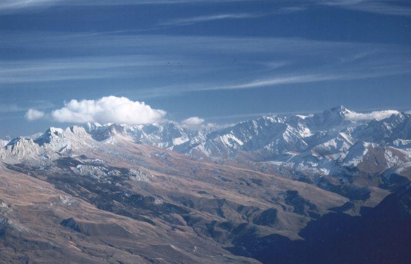
Foundation history
Imagine: in the darkness of the night, in the pale sky, the outlines of huge snow giants and the outlines of inaccessible rocky ridges are looming more and more clearly. Colored with rays rising sun, the tops of the mountains, at first light, barely perceptible, gradually turn into majestic and unshakable. Then the bright colors of the mountains seem implausible - they look like a decoration created by an artist with unbridled imagination ... Surrounded by mountain ranges lies the territory of a wonderful national park"Alania". It was created in 1998 for the protection and study of unique natural complexes, as well as their use for environmental education and ecotourism.
The territory of "Alania" is located on the northern slope of the Central Caucasus, in the basin of the Urukh River, at altitudes from 800 to 4646 meters (Mount Wilpat). Rocks, talus and glaciers occupy most of the entire territory of the park. The total area of modern glaciation is more than 80 km2.
The main waterway of the park, the Urukh River, originates from the confluence of the Karaugomdon and Haresidon rivers. In total, there are over 70 rivers and large streams here.
The climate of the NP "Alania" is moderate continental with a predominance of precipitation in the spring and summer period. Mountain ranges and their spurs, many valleys, gorges and intermontane basins complicate the general circulation and create big variety microclimatic conditions. Within the park, two territories are distinguished according to the climate: the Zadaleskaya depression with an arid climate and a high-mountain zone with a more severe climate. In the Khares gorge, at an altitude of 1700 meters above sea level, the coldest month is February (-9C), and the warmest is July (+ 13C).
Diversity of flora and fauna
The vegetation of the national park is very diverse. There are mountain pine forests, pine-birch forests, juniper woodlands, small fragments of deciduous beech-hornbeam forests, subalpine and alpine meadows, carpets, wastelands. Almost a fifth of the territory is covered with forests in the national park.
At the foot and in the lower part of the slopes of the Lateral and Vodorazdelny ridges, there are areas of mountain steppes and communities of upland xerophytes, above forest belt large areas are occupied by colorful subalpine meadows. In the meadows, there are Voronov's fescue (variegated), hedgehog, reed-like reed grass, golden jaundice, beautiful larkspur and others.
The territory is rich in medicinal, edible, melliferous and highly decorative plants. Among them are the lily, bracts larkspur, narrow-leaved snowdrop, valley saffron, Olympic catchment, Caucasian scabiosa, large-flowered letter, etc.
The characteristic inhabitants of deciduous forests are the small mouse, pine marten, wild forest cat, wild boar, and roe deer. The high-mountainous part of the park is inhabited by Prometheus, Dagestan and Gudaur voles, ermine, stone marten, Dagestan tur, chamois.
15 species of birds living in the park are listed in the Red Book of Russia, including the Caucasian black grouse, bearded vulture, golden eagle, vulture, peregrine falcon.
The only fish in the park is brook trout.
Cultural heritage
Many historical monuments have been preserved in the park and its protected area. Since ancient times, people have used caves and rocky grottoes and sheds for parking, which are especially abundant on the Rocky Range. Some caves were fortified with stone walls. There are such cave fortifications in the villages of Lesgor. Alanian catacomb burial grounds are known in the villages of Donifars, Kumbulta. Medieval towers and sanctuaries have been preserved in the protected area of the park and adjacent territories. In some villages there are medieval burial vaults.
What to watch
The national park has a great variety of interesting sites, both natural and cultural.
In the park, excursions to the Tana glacier have been developed, during which you will get acquainted with the altitudinal zonality and peculiarities of the nature of the Central Caucasus, its flora and fauna; hiking to the Chifandzar bog - the largest mountain bog in the Central Caucasus - through pine and deciduous forests. Along the way, you will see an ancient cattle drive road, fenced with stone walls, giant glacial boulders, footprints mudflows and avalanches.
The Galdoridon waterfalls, monuments of ancient stone architecture - sanctuaries, crypts-tombs, medieval towers are very impressive.
In the period from April to June, you will definitely see Dagestan (East Caucasian) tours, snowcock - endemics of the East and Central Caucasus.
Kabardino-Balkarian High-Mountain Reserve
Kabardino-Balkarian Republic, Cherek and Soviet regions
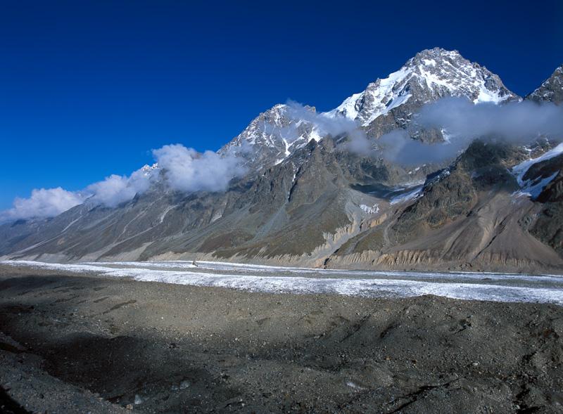
History of creation
The Kabardino-Balkarian high-mountain reserve was created to protect the high-mountain landscapes of the Central Caucasus, their flora and fauna, primarily the Caucasian tur and leopard.
The areas and boundaries of the reserve have changed many times. It became more and more “high-mountainous” and increased in size, as the cutting off of the lower meadow areas was compensated by the generous addition of nival-alpine ones. Now its area is 358.4 thousand hectares.
Physical and geographical features
The reserve occupies the highest part of the Caucasus and all of Russia. All "five-thousanders" are located here North Caucasus except for Elbrus and Kazbek, the highest point of the reserve is Dykh-tau (5204 m.), the lowest is 1800 m above sea level.
There are 256 glaciers in the reserve, the total area of glaciation, including the adjacent rocky outcrops of the lifeless nival belt, makes up about 61% of the reserve's territory.
The territory is covered with a dense network of rivers originating from numerous glaciers. The largest rivers - Chegem, Cherek Bezengi and Cherek Balkarsky - begin from the glaciers of the Main Ridge.
In climatic terms, the reserve is included in the high-mountainous zone of the Greater Caucasus. Temperature regime on the territory of the reserve is determined by the peculiarities of atmospheric circulation and a wide range of heights. The absolute minimum air temperature at an altitude of 2000 meters is -30 ° C, at an altitude of more than 4000 meters -50 ° C. The warmest month is July, according to long-term observations, the average temperature is + 13 ° C.
Diversity of flora and fauna
The vegetation of the reserve is very diverse, which is associated with differences in heights and the complexity of the relief. The altitudinal zonation is well expressed: the belt of forests and forest meadows is replaced by subalpine, and then alpine. At an altitude of 3000 meters, there is no continuous vegetation cover. Lichens, creeping willow, baleen saxifrage, two-columnar sorrel and other species settle on stones and rocks.
The flora contains many valuable plants, endemic and rare species and forms, including relatives of cultivated plants, for example, Bieberstein currants, mountain raspberries, rose hips, hawthorns, meadow strawberries, Caucasian mountain ash.
A typical inhabitant of the highlands is the Caucasian tur. Tours of each gorge to one degree or another have their own characteristics of color, size, shape and twist of the horns.
The brown bear is ubiquitous, its population is quite high, there are cases of its attacks on domestic animals. Lynx is typical; in the reserve this species feels quite comfortable. There is information about the sightings of the Caucasian leopard.
Each altitude zone has its own bird inhabitants. Spruce pebbles, bullfinches live in a pine forest, a bipedal owl lives there, blackbirds and woodpeckers have mastered the entire forest space, and jackdaws and choughs are characteristic of rocks in the Alpine wastelands, Alpine Accentor and large lentils live among rare vegetation, stone sparrows can be found everywhere ...
What to watch
The mountains of the Caucasus have always attracted sports tourists, but these places are just ideal for observing nature. A variety of vegetation, rare animals, impressive landscapes will help you completely forget about the everyday life of the city, relax and learn a lot.
Caucasian Reserve
Republic of Adygea - Maykop district, Krasnodar region- Lazarevsky, Khostinsky, Adler and Mostovsky districts, Karachay-Cherkess Republic - Urupsky district
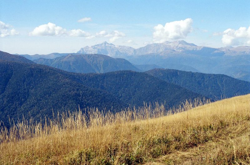
Foundation history
The Caucasian Reserve is located on the northern and southern slopes of the Western Caucasus. Actually, this territory was declared a reserve in 1924, but the history of preserving the unique natural complex began much earlier, from the moment the Grand Duke "Kuban Hunt" was organized in 1888. Separated from the main territory, in the Khostinsky district of Sochi, there is the subtropical Khostinsky department of the reserve - the world famous yew-boxwood grove.
The Caucasian Reserve is the richest treasury of biodiversity that has no analogues in Russia. It is of great value as an area of untouched nature that has preserved pristine landscapes with unique flora and fauna. This is recognized by the fact that the reserve is included in the list of UNESCO World Natural Heritage Sites.
Physical and geographical features
The territory of the reserve is a typical mountain landscape and is characterized by elevations from 260 to 3360 meters above sea level. The basis of its relief is the Main Caucasian Range, which stretches from northwest to southeast.
Some areas of the reserve are karst landscapes with a very large number of caves. Thus, there are over 130 of them on the Lagonaki Highlands.
The rivers are typical mountain streams with frequent waterfalls, narrow rocky gorges, gorges and canyons.
Numerous lakes give the mountain landscape of the reserve a special uniqueness. Usually they are small, and only Lake Silence has a water surface area of 200 thousand m2.
Warm and humid climate in low mountains it has a subtropical character with positive average temperatures in January (+ 4.2 °) and high average temperatures in July and August (20 ° С and 21 ° С). With the rise in the mountains, the temperature drops by about 0.5 ° C every 100 meters.
Diversity of flora and fauna
Most of the reserve is covered with forest vegetation, and only in the highlands are subalpine and alpine meadows developed.
The flora of the reserve is characterized by the presence of ancient species and representatives of limited distribution - every fifth plant in the reserve is endemic or relict.
Berry yew is found almost throughout the reserve. This ancient evergreen coniferous tree can live up to 2.5 thousand years, and such patriarchs are not uncommon in the Khosta department of the reserve.
The fauna of the reserve is heterogeneous in its origin. Representatives of the Mediterranean, Caucasian, Colchian and European faunas meet here. Endemic and relict species are found in all altitudinal zones of the mountains.
Large mammals are the most vulnerable link in natural ecosystems. In the reserve, these are bison, red deer, brown bear, West Caucasian tur, chamois, lynx, roe deer and wild boar.
What to watch
You can get into the distant past of the Earth in a unique yew and boxwood grove. This is a real wild, ancient forest filled with relics and endemics of the Caucasus. The grove is inhabited by yews, whose age ranges from 700 to 1.5 thousand years.
In the open-air cage complex on the Laura cordon, you will see the Caucasian red deer, roe deer, the rarest ancient bison, fox, jackal, raccoon dog, wild boar, rare bird species.
Kabardino-Balkar Republic, Zolsky and Tyrnauzsky districts
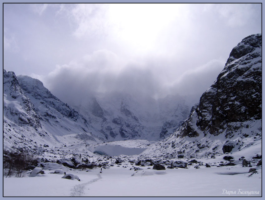
Foundation history
The unique nature of the Elbrus region attracts tourists from all over the world who want to enjoy the view of the majestic Elbrus, snow-capped mountain peaks, picturesque gorges of the North Caucasus. Marvelous landscapes, the purest mountain air, mineral springs, snow sparkling in the bright sun - all of this can be found here in abundance.
To preserve this unique natural complex and develop sustainable tourism in 1986, the Elbrus National Park was established with an area of 101 thousand hectares.
Physical and geographical features
The territory of the national park is located in the region of the Central Caucasus, includes part of the Main Caucasian and Lateral ridges.
The most famous object of the national park is Mount Elbrus (6542 and 5621 meters). This is an extinct volcano, on the eastern summit of which sulfur dioxide emissions are observed - signs of not yet extinct volcanic activity.
In the area of the mountain, lava flows are widely developed, flowing from it along the valleys of the main rivers. In the valley of the Malka River, the length of the lava flow is 23 km. About 15% of the entire territory of the park is covered by glaciers and snow.
More than 100 springs are concentrated in the park mineral waters, many picturesque lakes. One of the most interesting is Syltran-Kol, located in the upper reaches of the Syltran river.
The rivers of the Elbrus region are famous for their waterfalls. This is "Maiden's Braids", a waterfall listed in the book "100 most beautiful waterfalls the world ”, Sultan and others.
On the territory of the national park, the climate is generally temperate continental, with cold winters and hot summers. The very complex topography of the territory, a significant difference in absolute heights above sea level, the influence of glaciers, the proximity of the Black Sea and a large volume of air exchange with the free atmosphere - all this provides a rather sharp difference in the climatic features of this region from others. The coldest month is February with a temperature of -17.7 ° C at an altitude of 4100 meters above sea level and -3.4 ° C at an altitude of 1467 meters. In August, the temperature at an altitude of 1467 meters is + 17.0 ° C, and 2600 meters above + 0.2 ° C.
Diversity of flora and fauna
Climate change with height determines the vertical zoning of the vegetation cover. A powerful belt of coniferous forests is replaced by a narrow strip of woody and shrub woodlands, which gradually turn into a belt of subalpine and then alpine meadows. The most interesting plant in the park is the Caucasian rhododendron, the largest in the heather family. Its lush, creamy and pale pink blossoms form giant fairy-tale flower beds that blend beautifully with the dark green foliage.
Alpine forests are rich in mushrooms, lingonberries, blueberries, strawberries, and drupes. Sea buckthorn is widespread, the thickets of which are strictly protected along the Baksan River.
The fauna of the Elbrus region is predominantly Asian in nature. Before the beginning of the great glaciation, the Caucasus united with the land of Western Asia, through which animals from Central Asia penetrated.
Tour is one of the ancient relics. Severtsov's tour and Dagestansky meet here. Probably, this is the most famous animal of the high-mountainous Caucasus. Another abundant species is the wild boar, which also lives in mountain forests. Chamois are less common. In the forests of the Elbrus region, there are wolves, jackals, common fox, lynx, brown bears.
Of the mammals living in the park, 8 species are listed in the Red Book of Russia, including the Central Asian leopard, Caucasian forest cat, pointed bat and giant nocturnal.
Among the birds, 11 are listed in the Red Book: Caucasian black grouse, Saker falcon, golden eagle, burial ground, Caucasian peregrine falcon, bearded vulture, white-tailed eagle and others.
What to watch
The park has a huge number of wonderful places to visit. These are many natural monuments: Narzan Glade, the upper reaches of the Malka River, the Sultan waterfall, the Dzhil-Su tract at the foot of Elbrus and others.
Monuments of history, archeology and ethnography are represented here by the remains of residential and household buildings, burials. At the entrance to the national park in the Baksan gorge, a historical and cultural zone is created with a network of historical and ethnographic excursions and routes, as well as workshops on folk crafts.
You can combine your visit to the park with a visit to the astronomical and neutrino observatory; in Azau, the glaciology museum of the MSU educational base is open for you.
Republic of North Ossetia-Alania, Alagir district
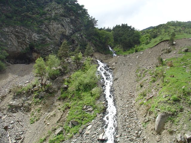
History of creation
On the territory of the republican reserve "Tseisky" in 1967, the North Ossetian reserve was created, first of all, to preserve in a natural state and study the characteristic natural complexes of the northern macroslope of the Central Caucasus. The total area of the reserve is almost 30 thousand hectares.
Physical and geographical features
The territory of the reserve is located on the northern slope of the eastern part of the Central Caucasus, at altitudes from 500 to 4500 thousand meters. The relief of the Lateral Ridge, on which the main territory of the reserve is located, is characterized mainly by very steep and rocky slopes. In general, rocks, talus and glaciers occupy more than 70% of the entire area of the reserve. The largest glacier with an area of almost 10 km² is Tseyskiy.
The main river of the reserve is Ardon, and there are more than a hundred rivers and large streams in total.
The climate is moderately continental. The coldest month is February and the warmest is July. In the Tsei gorge at an altitude of 1750 meters, the average monthly temperature in February is -9 ° С, in July + 13 ° С.
Diversity of flora and fauna
The reserve presents natural communities from broad-leaved forests to rock-talus vegetation. Forests cover about a third of the reserve. There are broad-leaved beech-hornbeam and maple forests, mountain pine forests. Of the trees, the most common: oriental beech, Koch pine, Litvinov birch, gray alder.
A huge number of endemics, characteristic only for the Caucasus, grow here, and some of them are found only in Ossetia. These are, for example, bells from Tseiskiy, cold-loving and Ardonian, growing on granite rocks.
In deciduous forests, the most characteristic animals are: pine marten, forest cat, wild boar, roe deer, re-climatized red deer and Caucasian-Belovezhsky bison, listed in the Red Data Books of various ranks.
The alpine part of the reserve is inhabited by ermine, stone marten, Dagestan tur, chamois. And such animals as bear, lynx, wolf, fox, are found in all altitudinal zones - from forests of foothills to alpine meadows, rocks and stone deposits.
What to watch
The second largest in North Ossetia is located on the territory of the reserve. karst cave- Shubi-Nykhasskaya. The halls and corridors of the cave are covered with bizarre incrustations, stalactites and stalagmites. It is inhabited by bats that have become ubiquitous and are listed in the Red Book of Russia.
In the reserve it will be interesting to see such historical monuments as the Mesolithic site Shau-lagat in the village of Dzivgis, cave towns in the villages of Ursdon, Dzivgis, Nuzal, as well as catacomb burial grounds in the villages of Arkhon and Kartsa.
The reserve has developed very interesting routes lasting from three to ten days, on which you will see the Skaz and Tsei glaciers, the 12th century church, the Tsei gorge waterfall and other attractions. Choosing an animal observation tour, you can observe the life of the tours, peregrine falcon, beard-lamb, and see the grouse current. Bears and lynxes are not often seen.
Krasnodar region
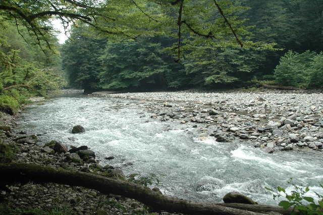
Foundation history
The Sochi National Park is one of the very first parks created in our country. It was founded in 1983 with the aim of preserving and restoring natural complexes and objects of high environmental, scientific and recreational value. Its area is about 194 thousand hectares.
Sochi National Park - perfect place for ecotourism due to the unique climatic conditions for our country, biological and landscape diversity, the uniqueness of many natural objects.
Physical and geographical features
The national park is located in the northwestern part of the Greater Caucasus, on its Black Sea slope. The relief of the territory is mountainous, highly dissected.
In total, 40 rivers and streams flow through the territory of the national park, the longest are Mzymta, Shakhe, Psou. There are a large number of waterfalls and canyons on rivers and streams: Bezymyanny (72 m) on the Psou River, Orekhovsky (ЗЗ m) on the right tributary of the Sochi River at the confluence of the Bezumenka stream.
There are interesting karst formations in the park - the famous Vorontsovskiy and Akhunskiy caves.
The subtropical climate of the territory is characterized by warm and mild winters and hot summers. Average air temperature changes with altitude and movement from north to south. Average temperatures on the northern part of the coast in January are about + 5 ° C, in July + 23 ° C, and at an altitude of 2000 m (Circassian pass) -5 ° C and + 12 ° C.
Diversity of flora and fauna
The most widespread in the park are forests with a predominance of oriental beech. Its silvery-gray trunks reach 50 meters in height! Oak stands occupy about a quarter of the forested area and are found mainly on the dry and warm southern slopes of the mountains. Only in the Caucasus, in natural conditions, grows the sowing chestnut (European), which is a relict species.
Boxwood plantations are very picturesque: lace of small, black-green, glossy foliage of boxwood and fluffy moss hanging from trunks and branches everywhere, long, like beards of fairy-tale heroes, moss gives the forest a fantastic look of a green kingdom.
This territory, like the entire Caucasus, is rich in very rare and valuable species. The Red Book of Russia includes common figs, Caucasian lily, Caucasian kandyk, Lipsky's tulip, types of orchids: ophys, pyramidal anakamptis, purple orchis and many others.
The fauna of the national park numbers about 70 species of mammals: brown bear, deer, lynx, Caucasian and European roe deer, marten, otter and others.
The most rare and valuable species of animals are listed in the International Red Book. These are the Caucasian cross, Aesculapius snake and the Caucasian viper.
What to watch
Dozens of tourist routes pass through the territory of the national park, many of which have a long history. They include visits to Agurskiy and Orekhovskiy waterfalls, Akhun mountains, Vorontsovskiy caves, Akhshtyrskiy and Khostinskiy canyons.
And also one cannot fail to visit the Narzan springs, the Mamedovo Gorge, the archaeological monument "Dolmen", the Volokonskoye Gorge, speleological routes through numerous caves.
Teberda Reserve
Karachay-Cherkess Republic, Karachaevsky district
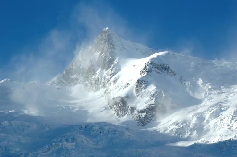
History of creation
Teberda Nature Reserve was established in 1936. Its area is currently 85.8 thousand hectares. During its creation, among the tasks of the work were the provision of favorable conditions for the development of tourism, as well as the reconstruction of the flora and fauna of the Teberda region through the acclimatization of new useful animals, new woody, shrub and herbaceous plants in the reserve.
Physical and geographical features
Teberda Nature Reserve is located in a typical mountainous area at an altitude of 1260 to 4047 meters above sea level, and more than three quarters of the territory is located at an altitude of 2000 meters.
About 30 rivers flow through the reserve, which originate on glaciers, snowfields or lakes. Descending from the mountains, they form picturesque waterfalls and seething rapids.
There are a lot of small lakes in the reserve, most of which are located above 2000 meters and are inaccessible.
30 outlets of mineral waters in the protected area are traces of past volcanic activity.
In general, the warm and humid climate of this area is highly variable at different altitudes. The average summer temperature in the Teberda region is + 15 ° C, winter temperature is -2 ° C, on Dombai it is lower by about three degrees.
Diversity of flora and fauna
More than a third of the reserve is occupied by forests, another third - by meadows, large areas are represented by rocks, placers and talus, glaciers.
Five high-altitude belts are well defined here: forest, subalpine, alpine, subnival and nival, covered with “eternal” snow and ice.
Among the many species of the Teberda reserve in the Red Book, one can mention the Kesselring lily, purple orchids, painted and helmet-bearing, valley saffron.
One of the most characteristic representatives of mammals in the reserve is the tur or the Caucasian stone goat. Distinctive feature of these animals - saber-shaped horns, reaching 1 meter in length in old males and 30 centimeters in girth at the base!
Another iconic animal is the bison. This animal was exterminated here at the beginning of the twentieth century, but then several specimens were brought to the reserve, and now the livestock lives completely in natural conditions.
The Teberda Nature Reserve is one of the key bird areas of international importance. Here lives the Caucasian black grouse, endemic to the Caucasus, you will not find it anywhere else in the world. Rare birds include the bearded man, the black vulture, the eagle owl and a number of others.
What to watch
Many interesting routes have been developed in the Teberda Nature Reserve, which will allow you to visit the Amanauz and Ptysh gorges, Chuchkhursky waterfall, Alibek glacier and Turye lake.
In the village of Arkhyz there is a special astrophysical observatory of the Russian Academy of Sciences with one of the world's largest optical telescopes. There are also many valuable archaeological sites from the Bronze Age to the Middle Ages, an Alan settlement with the most ancient Christian temples, the remains of medieval fortresses.
The entire Teberda-Dombay-Arkhyz region has excellent opportunities for active rest- mountaineering, water and cycling tourism.
Republic of Ingushetia, Dzheyrakhsky and Sunzhensky regions
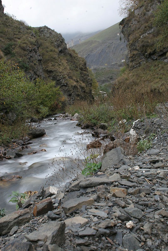
History of creation
The Erzi State Nature Reserve was established in 2000 and is one of the youngest reserves in Russia. The object of protection in the reserve is the beautiful nature of the Dzheyrakh-Assin depression, as well as historical and cultural monuments. The total area of the reserve is not very large and amounts to 5.97 thousand hectares.
Physical and geographical features
The territory is located within the high-mountainous and mid-mountainous relief of the Greater Caucasus. The mountains are cut by numerous rivers, gorges, gullies and ravines. Along the southern border there is a chain of ridges up to 4229 meters high. The slopes are steep, often steep and rocky.
The rivers on the territory of the reserve mainly belong to the Terek river basin. The largest of them are Assa and Armhi. Crossing the transverse ridges, the river valleys are, for the most part, narrow and deep gorges and crevices with rapid flows, abounding in rapids and waterfalls. The reserve also has numerous springs in gullies, ravines, river valleys and on the slopes at the foot of the mountains.
Due to the mountainous relief, the climate changes significantly with altitude. Summer in the valleys is cool, sunny, in the mountains - cold, rainy and cloudy. Winter is stable and snowy.
Diversity of flora and fauna
About a third of the territory is occupied by forests, which grow mainly on mountain slopes. On the northern slope of the Lateral Ridge, at an altitude of 800 m, there are small areas of oak forest. On the northern slopes of the ranges, at an altitude of 500 to 1500 meters, there are beech forests, sometimes with an admixture of Norway maple. In the floodplains of the Assa and Armkhi rivers, sea buckthorn, willow and gray alder grow. Above 1500 meters, on steep slopes, the stand is formed by hooked pine with an admixture of oak, birch, hornbeam, linden, mountain ash. Even higher is the crooked birch forest with an undergrowth of Caucasian rhododendron.
Above 2000 meters there are mountain steppes and mountain meadows, above which there are alpine meadows, and above 3500 meters there is a belt of glaciers and snowfields.
The fauna of the reserve is very diverse. Mammals are represented here by wolves, foxes, bears, martens, and wild boars. Dagestan tur, chamois, bezoar goat are typical. In the mountain forests of the reserve there are bears, weasels, rarely badgers, forest cats, and leopards.
In the forests, you can find very rare species of birds for the republic - crossbill, yellow-headed kinglet. Ulars, Caucasian lentils nest in the subglacial belt. Birds of prey are represented by the black vulture, the bearded vulture, the buzzard, the golden eagle and the common kestrel rise here, and, very rarely, the peregrine falcon.
What to watch
There are several wonderful natural monuments on the territory of the reserve.
Armkhinsky (Lezhginsky) waterfall on the Lezhgi river falls down from sheer cliffs in a deep forest gorge.
Armkhin pine grove is unique as the only place of growth of Crimean pine in mountainous Ingushetia, which was brought here at the beginning of the 20th century.
Also of interest are the hooked pine massif in the upper reaches of the Myagikha River, the nearby Myagi-Erdy sanctuary, and a healing spring on the Bisht pass.
The territory of the reserve is extremely rich in historical and cultural monuments of varying degrees of preservation. These are sanctuaries, temples, tower settlements, necropolises and crypts, sacred groves. Among them, a special place is occupied by the Mai-Lam complex of sanctuaries. The most well-preserved temple-sanctuary is Myatzel, which is part of this complex.
The famous Dzheyrakh-Assinsky State Historical and Architectural Museum-Reserve is located near the reserve, within its protective zone.
Altai-Sayan mountainous country is located in the center of Asia and occupies the middle part southern belt mountains, stretching from the Carpathians to the shores of the seas The Pacific... It consists of Altai, Kuznetsk Alatau, Salair Ridge, Kuznetsk Basin, Western and Eastern Sayan Mountains, East Tuva Upland and Tuva Basin. The boundaries of the Altai-Sayan mountainous country are defined by faults, displacement of block structures as a result of repeated tectonic movements. The border with the West Siberian Plain runs along fault benches with a height of 300-500 m; in the north-east - along benches of 400-500 m to the Central Siberian Plateau. In the southeast, the Eastern Sayan borders on the Baikal mountainous country in the Baikal rift zone along the Tunkinsky graben. Along the southern ridges and intermontane basins (lakes Zaisan and Ubsu-Nur) of Altai and Sayan there is a state border with the Mongolian and Chinese People's Republics... The Altai-Sayan mountainous country is a large block morphostructure with a complex mountain-basin relief. The grounds for the allocation of this territory into an independent physical and geographical country are:
- The dominance of medium-altitude and high-mountain folded-block mountain systems, separated by large and small basins. The modern appearance of the relief reflects the geostructure of the Paleozoic fold belts, raised by the latest tectonic movements up to 500-1000 m in intermontane basins and up to 3000 m in the mountains.
- Throughout the year, continental air masses prevail and, in the conditions of the mountain-basin relief, create a sharply continental climate, especially in intermontane basins. The influence of the western circulation is actively manifested on the windward slopes and ridges from an altitude of 2000 m. This is reflected in the formation of the natural appearance of the forest and high-mountain belts.
- A single structure of altitudinal zonation, expressed by the type of forest-meadow with loaches. The forest belt (taiga) prevails. Treeless belts form steppes, alpine meadows and mountain tundra.
Botanists study altitudinal belts, especially treeless areas - steppe intermontane basins and highlands, and continue to supplement the generalizing works of P. N. Krylov, as well as the works of K. A. Soboleva on the vegetation of Tuva and L. I. Kuminova in Altai.
Geological structure, history and relief
The orographic pattern of different mountain structures that make up the country is different. The general orographic pattern of the Altai-Kuznetsk region has the shape of a "fan" deployed to the west and northwest. This determines the free invasion of air masses from the northwest, as well as the penetration of steppe complexes into the interior of Altai. In the Sayan Mountains and the Tuva Upland, two directions prevail mountain systems - northwestern and northeastern. Therefore, the Sayans form a mountain arc, the bulge of which is directed to the north. The central ridges of the entire arc rise to 2500-3000 m; to the north and south, the altitudes decrease to 900 m. The Sayan mountains consist of two mountain systems : Western Sayan, which abruptly drops off to the Minusinsk and Tuva basins. The ridge is cut by a narrow rapids valley of the Yenisei. The Eastern Sayan extends from the northwest - from the left bank of the Yenisei river - to the southeast to the Tunkinsky graben. Minusinsk and Chulym-Yenisei, as well as the East Tuva uplands. The Eastern Sayan serves as a watershed between I'm waiting for the basins of the Angara and Yenisei rivers. Its highest height - Munku-Sardyk (3491 m) is located in the southeastern part. At the junction of the Western and Eastern Sayan mountains, a mountain knot was formed with a summit - the Grandiose peak (2922 m). Altai-Sayan folded-block geostructures frame from the southwest Siberian platform... They are classified as large heterogeneous structures created in different eras and periods. The most ancient mountain-building movements took place in the late Riphean - early Cambrian. As a result, they created the Baikal fold belts in the east of the Sayan Mountains. They were joined in the middle of the Cambrian - early Devonian by the structures of the Caledonian folding: they formed the Sayan Mountains and a significant part of Altai. The last folding (from the Late Devonian to the end of the Permian) - Hercynian, or Varissian, manifested itself in the west of Altai. Late Caledonian mountain building due to movement crust and by the occurrence of faults, large intermontane depressions and troughs (Chulym-Yeniseiskaya, Minusinskaya, Tuvinskaya) were laid on the uneven-aged folded base. Depressions continued to form in the Hercynian folding, for example, the Kuznetsk Trough, located between Salair and Kuznetsk Alatau. Folded complexes are penetrated by Paleozoic granitoids. In the Mesozoic, almost the entire territory was dry land. In the process of its denudation, the most ancient weathered surfaces were created. In the Cenozoic, the destroyed Altai-Sayan structures experienced new tectonic movements, expressed in a smooth arched uplift, the formation of faults and the emergence of volcanoes (for example, the Oka group). Blocky vertical and horizontal displacements occurred along the faults: some areas rose by 1000-3000 m, while others sank or lagged behind in the uplift, creating intermontane basins and valleys. As a result of neotectonic movements, revived folded-block highlands, highlands, middle mountains, low mountains and intermontane basins were formed on the folded Paleozoic belts. These morphostructures were changed by external processes, since the rise of the territory caused an increase in erosion, a cooling of the climate, and the development of glaciation. Almost all mountains experienced ancient glaciations (2-3): the relief preserved the forms they created: kars, troughs, sharp ridges and carlings, moraine ridges, hilly moraine and outwash plains. In a drier climate, loess deposits were formed in the foothills on watersheds and in valleys (for example, in the interfluve of Biya and Katun). External processes created a complex and uneven-aged complex of erosion-denudation and nival-glacial morphosculpture. These types of relief, being at different levels, create morphological zonation.
The first belt is glacial-nival highlands with kars, circuses, trogs, carlings (examples are the Datunsky, Chuisky, Chikhachev ridges in Altai and Sayansky, Tunkinsky, Munku-Sardyk in the Sayan Mountains).
The second belt is the ancient peneplain. These are high mountain ranges with leveled surfaces and steep, often stepped slopes. Above the surface of the peneplain, separate outliers rise in the form of flat domes or narrow ridges, composed of the hardest rocks. The peneplain contains the remains of an ancient, slightly incised river network and traces of glacial accumulation. The watersheds are not clearly expressed, in most cases they are flat and boggy (examples are the flat surfaces of watersheds in the Sayan Mountains - "Sarams or Belogoriya").
The third belt - erosion-denudation low mountains and middle mountains - has heights from 500 to 1800-2000 m. These are smooth rounded forms of low ridges, widespread in the western and northern parts of Altai, as well as in the north of the Sayan Mountains.
Climate
The climate of the Altai-Sayan mountainous country is sharply continental. It is characterized by very cold winters and cool summers. Its formation is significantly influenced by the western air masses, which are associated with the main amount of precipitation, as well as the continental air. temperate latitudes in the foothills of Altai and Sayan. Of great importance are the orographic conditions that determine the sharp climatic contrasts (uneven precipitation in the territory, vertical climatic zonation, temperature inversions, the development of mountain-valley winds - phenes).
The influence of the western circulation is more pronounced on the windward slopes and ridges (above 2000 m). This is reflected in the formation of various natural complexes of forest and high-mountain belts, as well as modern mountain-valley glaciation. Noticeable differences in climate can be observed in parts of the country. Altai and Kuznetsky Alatau, to a greater extent than the Sayan and Tuva Uplands, are influenced by the western air masses and are located farther from the center of the Asian anticyclone. Therefore, the climate of Altai and Kuznetsk Alatau is less continental (the amplitude of annual temperatures is less and more precipitation is). The climate reaches the greatest continentality in closed basins, especially in Tuva. Winter weather defines the Asian High. Average January temperatures reach large limits: from -16 ...- 18 ° C in the foothills of Altai to -34 ° C in the Tuva basin. In winter, weak south-westerly winds blow; sometimes they pass over ridges, turn into hair dryers and contribute to higher temperatures on the northern slopes. On the mountain slopes, winter temperatures are slightly higher, which is associated with temperature inversions. The largest amount of snow is on the windward slopes of Altai and Sayan Mountains (up to 150-200 cm).
Summers in the mountains are cool, the westward transfer, cyclonic activity and precipitation increase, in the west of the ridge. Katunsky - up to 2500 mm. In the hollows - about 200-300 mm, and the minimum is 100-200 mm (in Chuiskaya and Khemchinskaya). The average July temperature in the mountains is about + 10-14.8 ° C and more, in the foothills + 16-18 ° C, and in the intermontane basins + 19-20 ° C. Annual quantity precipitation in the highest ridges reaches 1200-1500 mm. The climatic conditions and the ancient glacial relief of the highlands contribute to the development of modern glaciation. The largest number of glaciers is concentrated in Altai - 1300 glaciers with a total area of 900 km2 are known there. In the Sayan Mountains, only the highest massifs of the East Sayan and East Sayan Uplands have glaciation. The height of the snow border in the west of the region reaches 2300 m, and to the east it rises in Altai up to 3500 m in the Chikhachev ridge and in the Sayan mountains up to 2940 m in the Munku-Sardyk mountain.
Soils, vegetation and fauna
At the western foothills of Altai and the Salair Ridge, the latitudinal strike of the steppe and forest-steppe ends natural areas plains of the Soviet Union. Steppes from Western Siberia enter the Altai foothills and intermontane basins. In the rest of the Altai-Sayan country, the steppe is distributed in isolation between mountain ranges covered with taiga. On the western slopes of Altai, they rise up to 500-700 m, and in the inner regions of the mountains they enter along river valleys and intermontane basins up to an altitude of 1000-1500 m. Under the steppes, chernozems and chestnut soils are formed under various conditions of relief, heat and moisture; In the foothills of the northwestern and northern Altai, there are ordinary chernozems, and to the north, in the foothills of the Salair Ridge and Kuznetsk Alatau, there are leached chernozems. In the arid foothills of the southern Altai, chestnut and solonetzic soils are formed. The intermontane basins are characterized by leached, ordinary, southern and mountain chernozems, and, in the driest places, mountain chestnut chernozems. The mountains are covered mainly by taiga spruce-fir, as well as larch, larch-cedar and pine forests... On the most humid slopes of the west and north of Altai and Sayan Mountains, under the cedar-fir-aspen forests (rough taiga), mountain gray forest soils have formed. On the inner ridges with a more continental climate, under larch and pine forests, podzolic, brown-taiga acidic non-podzolized soils dominate. In the Sayan and Tuva regions, where permafrost, permafrost soils are formed - taiga podburs, which are often found east of the Yenisei.Significant areas are occupied by a high-mountain belt, consisting of shrubs (dwarf birch forests), subalpine and alpine meadows, mountain tundra, in some places stone deposits and glaciers. It is located at various heights. The lowest position of the lower border of the high-mountain belt is in the northern part of the Kuznetsk Alatau - only at an altitude of 1100-1150 m. To the south and southeast of the country, this border rises higher and higher. For example, in Tuva, on the Sangilen upland, it already reaches 2100-2300 m. The complex structure of the altitude belts of the Altay-Sayan mountainous country naturally changes both in the meridional and latitudinal directions. This pattern can be traced in all altitudinal zones. For example, significant differences in the high-mountain belt are observed between Altai, Sayans and the East Tuva Upland. In the west (Altai) in conditions excessive moisture, thick snow cover and low temperatures, subalpine and alpine meadows with a varied species composition are widespread. Mountain meadow soils have formed under the meadow vegetation. In the east (Sayany, Tuva Upland), where the continentality of the climate is more pronounced, alpine and subalpine meadows are confined only to low, humid areas of the highlands, and mountain tundra dominates all around, represented by communities of bushy lichens on mountain-tundra light, slightly humus-rich soils, - on mountain tundra peaty soils, herbaceous dryad communities - on mountain tundra soddy soils. All tundras of the Altai-Sayan mountainous country are similar in floristic composition and appearance to the northern plain tundra. There are no similar tundras in the mountains of Central Asia and the Caucasus.
The fauna of the Altai-Sayan country is characterized by great diversity. This is due to the diversity of modern geographic landscapes (from steppes to alpine tundra and glaciers), the history of their formation, as well as the border position of the country between two large zoogeographic subregions of the Paleoarctic region: European-Siberian and Central Asian. The fauna consists of taiga, mountain-tundra and steppe species, among the latter there are animals of the Central Asian subregion. In the mountains of Altai and Sayano-Tuvinsky highlands, four reserves have been created: Azas (1985), Altai (1967), Sayano-Shushensky (1975, biosphere) and "Pillars" (1925). rare natural complexes Altai and Sayan. The oldest reserve "Stolby" is located in the northern low-mountain spurs of the Eastern Sayan, not far from Krasnoyarsk. There are preserved syenite rocks destroyed by time - "Ded", "Berkut", "Perya" and others, overgrown with larch and pine in the lower belt. And from heights of 500 to 800 m, all the peaks of the mountains are covered with spruce-fir and cedar forests. Altai (area 869481 hectares) is one of the largest reserves. It is located near Lake Teletskoye. and higher - in the middle and high mountains of Altai at the watershed of the Ob and Yenisei rivers. Among the forests of various species composition, ancient cedars have survived. The largest areas are occupied by alpine meadows and mountain tundra, where many ungulates live. Argali and Altai snowcock have become rare in Altai. They are included in the Red Data Books. Sayano-Shushensky biosphere reserve is located on the left bank of the Yenisei near the deep-water narrow reservoir of the Sayano-Shushenskaya HPP. The typical mountain landscapes of the Western Sayan are protected here. The reserve is of particular importance for the protection of the Altai snow leopard, snow leopard, red wolf and Siberian ibex populations. From the eastern ridges of the Tuva Upland flows down the river. Azas and, flowing through the moraine-hilly lake Todzha depression, flows into the river on the right. Big Yenisei (Biy-Khem). In 1946, on the river. At Azas, a surviving settlement of Tuvan beavers was discovered. In the mid-70s, 35-45 individuals were counted here in the entire population.
In 1976, the Azassky reserve was organized there, on the basis of which the Azas reserve was created with an area of 337.3 thousand hectares to preserve the taiga-lacustrine landscapes of the Todzhinsk depression and the only Upper Yenisei population of beavers.
Natural resources
In the depths of the Altai-Sayan country, various and richest minerals are concentrated. The largest coal basin is located in the Kuznetsk Basin. Thick coal seams (9-50 m) lie here at a shallow depth. In many open-pit mines, mining is carried out in an open way. Jurassic coals are mined in the Chulym-Yenisei and Tuva basins. Deposits in Gornaya Shoria are associated with intrusions iron ore... Altai polymetallic ores are also associated with Paleozoic intrusions. Most large deposits polymetals (Leninogorskoye, Zyryanovskoye, Zmeinogorskoye, etc.) are confined to the north-western strike. In the Eastern and Western Sayan, among the Precambrian deposits, there are ferruginous quartzites. The Botogolsk ridge contains deposits of high-quality graphite. Numerous sulfur and carbon dioxide springs emerge in the fault zones.A significant part of the mountains is covered with large tracts of mature and over-mature forests, consisting of valuable tree species (larch, pine, spruce, fir, cedar, etc.). They are also important hunting and fishing grounds. Squirrel, sable, ermine, marten, Siberian weasel, maral are mined here. Muskrat and American mink have been acclimatized, and the beaver has been restored.
The main places of squirrel and sable extraction are located in the Eastern Sayan and the Eastern Tuva Upland.
The rivers of the Altai-Sayan country have huge reserves of hydropower. The Krasnoyarsk and Sayano-Shushenskaya HPPs were built on the Yenisei. A project was proposed for the construction of a cascade of dams on the river. Katun. But with a deep analysis and broad discussion, it turned out that when the valley is flooded, the ecosystems of unique and most valuable territories will be destroyed. Mountain Altai... When drafting the project, the environmental problems of the region were poorly taken into account. A number of rivers are used for timber rafting. Navigators Yenisei, Biya, Bukhta RM a. The climatic conditions of the Altai-Sayan country are favorable for the development of agriculture. Agriculture is concentrated mainly in the northern and western foothills, as well as in intermontane basins. Spring wheat, oats, millet, sunflower and potatoes are grown here. All over the territory natural conditions favorable for cattle breeding. In spring, cattle are grazed on steppe pastures, in hollows, and in summer they are driven to mountain meadows of forest and high-mountain belts. In winter, livestock graze on the mountain slopes, mainly of southern exposure, since it is warmer there than in the hollows, and the low snow cover allows the animals to easily get food.
Mountain provinces
Altai
in the north and northwest it borders on the Kuznetsk Alatau, Salair Ridge, Gornaya Shoria and the West Siberian Plain. In the east, Altai adjoins the Sayano-Tuva Upland. In the west, the spurs of Altai descend to the Irtysh depression. Southern border runs along the tectonic fault between the Southern Altai and the Zaisan depression. Altai is divided into five parts: South, East, Central, North-West and North-East. The Southern Altai includes large ridges (Southern Altai, Kurchumskiy, Tarbagatai, Narymskiy, etc.), located between the valleys of the Black Irtysh, Bukhtarma and the basin of the lake. Zaysan. In the western part, the height of the ridges is about 1200-2000 m, in the east the ridges gradually rise up to 3500 m. Southern Altai is slightly dissected. It is characterized by high, rugged passes, steep northern slopes and relatively gentle southern slopes. Eastern Altai is formed by ridges of various strikes: northeastern, northern and northwestern with maximum heights of more than 3000 m (Saylyugem, Shapshalsky, etc.). The Central Altai includes the main mountain ranges - the Katunsky ridge with Belukha (4506 m), the North-Chuisky and South-Chuisky ranges. To the west, the ridges decrease to 2600 m (Kholzun). Between the ridges there are intermontane depressions - steppes: Uimonskaya, Abayskaya, Kuraiskaya, Chuiskaya and Ukok plateau. All of them are cut by river valleys. Northwestern Altai consists of medium-altitude ridges, fan-shaped from the ridges of the Central Altai, - Terektinsky and Listvyaga. Northeastern Altai is located between the Severno-Chuisky and Terekta ridges in the south, the Salair Ridge and the Kuznetsk Alatau in the north. The ridges are separated by deep valleys and the Chulyshman highlands, along which the river flows. Chulyshman, flowing into Lake Teletskoye. Altai is composed mainly of Paleozoic sedimentary, igneous and metamorphic rocks.The oldest rocks are Precambrian. These are crystalline schists occurring in the axial parts of anticlinoria (Katunsky, Terektinsky, etc.). The Cambrian is represented by a thick stratum of crystalline limestones, clay shales, basic effusive rocks, tuffs and is distributed in the cores of anticlines in the northeastern part of Altai. Ordovician and Silurian deposits, consisting of green sandy-shale strata and conglomerates, widespread in the basins of the Chulyshman and Katun rivers. The northeastern part of Altai was created in the Caledonian folding. And in the south-west of Altai, at the end of the Carboniferous, Varissian (Hercynian) mountain building began. The Hercynian structures are composed of Paleozoic strata: in the north, Lower Paleozoic deposits are more common, and in the south, mostly Upper Paleozoic. In the Mesozoic, Altai was subjected to denudation processes; a vast peneplain surface was formed. Intensive recent tectonic movements caused the arched uplift of the territory, the formation of horsts and grabens. This, in turn, will lead to increased erosion. The lines of young faults are predominantly latitudinal, with outcrops of hot springs with a water temperature of 31-42 ° C. The height and width of the raised horsts are different: the narrowest and raised blocks are in the southern part of Altai, and towards the north they become wider and lower. As a result of displacements, the surface of the peneplain turned out to be at different levels - from 500 to 3500 m. The first Quaternary glaciation reached the greatest thickness in Altai and covered significant areas of mountains and intermontane depressions - the Chuya and Kurai steppes, onto which glacial tongues emerged along the river valleys. During the interglacial period, tectonic block movements along the old and new fault lines appeared again: grabens of the Teletskoye and Markakol lakes were formed, and the movements of the northern Altai scarp over the Priobskoye plateau resumed. In connection with a change in the bases of erosion, there was an increase in the activity of rivers, a restructuring hydrographic network and erosion of moraine deposits of the first glaciation. The last glaciation was of the valley and crust types. After the retreat of the glaciers in the upper reaches of the valleys, many kars, dammed lakes, hanging valleys remained, on which numerous waterfalls formed, especially in the valley of the river. Chulyshman and along the shores of Lake Teletskoye. Glaciers have changed the course of many large rivers. So, for example, the moraines of the glaciers of the Sarymsakty ridge blocked the course of the river. Bukhtarma to the west and directed it to the north, where the river used the valleys of other rivers. Large intermontane depressions are of great importance in the natural appearance of Altai. They stretch between ridges, with the height of the bottoms of the depressions increasing to the east. The elevation of the ridges over the depressions reaches 2000-3500 m. For example, the slopes of the Terekta and Katunsky ridges rise above the Uimon depression with almost sheer walls. Intermontane depressions tectonic origin, but they changed as a result of the activity of rivers, glaciers and lakes. Their bottoms are filled with moraines, fluvio-glacial, alluvial and lacustrine deposits. Modern rivers have cut through these deposits, forming a series of terraces. Steppes formed on the terraces: Chuiskaya, Kuraiskaya - on the river. Chue, Uimonskaya - on the river. Katun. The steppes are located at different heights: the highest of them is Chuiskaya (1750 m), along the edges of the steppe there are wooded slopes of ridges, the relative height of which is 2000 m and higher.
Altai has a continental climate. It is different from the climate West Siberian Plain greater softness: winter is warmer, summer is cooler, more precipitation. Arctic air masses, highly transformed, reach the northern spurs of the mountains, penetrate through the valleys into the inland territories and influence the types of weather.
The influence of western circulation in the formation of weather types is often decisive from an altitude of 1000-1200 m. The main amount of moisture falls out of the air masses coming from Atlantic Ocean(up to 80%). They are unevenly distributed. In the west of Altai, the amount of precipitation reaches 1500 mm or more per year (for example, on the Katunsky ridge - up to 2500 mm), and in the southeast of Altai - up to 200-300 mm. The largest amount falls during the warm season.
Winter in Altai is cold, with little snow in the foothills and "in intermontane basins and with much snow in the mountains. The spur of the Asian maximum passes through the Southern Altai, therefore dry cold southwestern winds prevail in winter. Cold air stagnates in the basins: windless, cloudless, very frosty and even severely frosty weather with temperature inversion.So, at an altitude of 450 m, the average temperature in February is -22.3 ° C, and at an altitude of 1000 m - only -12.5 ° C. In the Chuya steppe, the average temperature in January is -3.7 ° С, the absolute minimum reaches -60.2 ° С.The height of the snow cover is only 7 cm, permafrost is developed at a depth of 1 m.In the foothills of the Southern Altai in winter, the average January temperature reaches -18 ° С, and at this time in the northern and western foothills -12.6 ° С (Leninogorsk), -16 ° С (Ust-Kamenogorsk). The absolute minimum reaches -50 ° С. ogoda. A large amount of snow falls on the western slopes of the ridges (especially at altitudes over 1000 m) and in the valleys open to the west, due to the prevalence of westerly moist winds.
Summer in Altai is much cooler and shorter than in the neighboring plain steppes. In closed intermontane valleys and on high plateaus, night frosts are possible in July, temperatures drop to -5 ° C, snowfalls and ice formation on lakes and swamps. The average July temperature in the foothills reaches + 19 ° С, and at an altitude of 2000 m + 8-10 ° С. On some ridges there is a snow line already at an altitude of 2300 m. In the Southern Altai, under the influence of the dry tropical air of the deserts of Central Asia, dry weather is often repeated and it is rarely rainy. The average July temperature is + 21.8 ° C. In the Western and Northern Altai, cloudy and rainy weather prevails, so the warming process is weakened. The average temperature in July is + 18.4 ° C. Maximum temperature reaches +37.5 ° C in Chemal. In the intermontane basins of Central Altai, due to the uplift of the territory, it is cloudy and rainy, and dry weather is rare. These plains are sufficiently humid and the average July temperature is + 15.8 ° С. Large foci of modern glaciation are concentrated in the high ridges of the Central, Southern and Eastern Altai. On the lower ridges there are individual glaciers, for example, on the Kholzun, Kuraisky and others, the Katunsky ridge has the largest number of glaciers. Glaciers descend along deep valleys to an altitude of 1930-1850 m.
In Altai, several main types of glaciers are distinguished: valley, tar, hanging - and several glaciers of flat tops. The main area of glaciation is concentrated on the northern slopes. On the northern slope of the Katunsky ridge, the area of glaciation is estimated at 170 km2, and on the southern slope - only 62 km2. On the South Chuisky ridge, 90% of the glaciated area is located on the northern slope. The river network in Altai is well developed, especially in its western and northern parts. Rivers originate on flat watersheds, often swampy (the headwaters of the Bashkaus river), from the edges of glaciers (the Katun and Argut rivers), from lakes (the Biya river). The watersheds do not always correspond to the highest parts of the ridges, since many of them are cut by rivers. An example is the gorge of the river. Arguta (a tributary of the Katun River), separating the Katunsky and Yuzhno-Chuisky ridges.
All Altai rivers belong to the river basin. Ob (Katun, Biya, Chulyshman, etc.), and only small ones, flowing down from the eastern slopes of the Korbu and Abakansky ridges, are included in the basin of the river. Yenisei. The main feeding of the rivers is snow and rain. The rivers of the high-mountainous part of Altai are fed by snow and glaciers. They are characterized by summer floods with a maximum in early July, low and long winter low water periods, and prolonged freeze-up (7 months). The rivers of the Altai mountain-forest belt are characterized by spring-summer floods (70% annual flow) with a maximum at the end of May, summer and autumn floods, which sometimes exceed floods. Rivers freeze in winter. The duration of the freeze-up is 6 months. On the rapids, the current persists until the middle of winter. Through non-freezing rapids, water comes out to the surface of the ice, forming ice. There are many lakes of various sizes and origins in Altai. The largest of them are tectonic - Teletskoe and Markakol.
Teletskoe lake located among the ridges at an altitude of 436 m above sea level. Its basin consists of two parts: meridional - southern and latitudinal - northern. The lake is 78 km long, with an average width of 3.2 km. The shores are almost steep and often rise up to 2000 m.In many places near the coast, the depths immediately drop to 40 m. Maximum depth- 325 m. The depth of Lake Teletskoye. ranks fourth in territory the former USSR... Tectonic basin of Lake Teletskoye processed by the ancient Chulyshman glacier. The lake is flowing: many mountain rivers flow into it, but most of all it brings water from the river. Chulyshman. The river flows out of it. Biya and carries out the bulk of the incoming water. The water temperature at the surface is low (+ 14-16 ° C), which is explained by the significant depth and mixing of the water due to strong wind activity. Winds of two types arise over the lake: "verkhovka" and "nizovka". The first blows from the mouth of the Chulyshman to the source of the river. Biya. This is a blow dryer type wind; it brings clear and warm weather with low relative humidity (up to 30%), and with its high strength the waves reach 1.2 m. "Nizovka" blows from the Biya river to the Chulyshman mouth. the formation of fogs and heavy rainfall The lake is rich in fish.Telets whitefish, Siberian grayling, perch, pike, burbot are of commercial importance.
The flora of Altai consists of 1840 species. It includes alpine, forest and steppe forms. About 212 endemic species are known, which is 11.5%. In the northwestern and western foothills, the plains' steppes turn into mountain steppes and forest-steppes. On the slopes of the Altai mountains, a forest belt dominates, giving way on the highest ridges to a belt of subalpine, alpine meadows and mountain tundra, over which many high peaks glaciers are located. In the northern and western parts of Altai, the boundaries of all belts are lower than in the southern and eastern ones. So, for example, the lower border of forests in the west is at an altitude of 350 m, in Southern Altai - about 1000-1500 m. And only in the extreme northeast does the forest belt merge with the taiga of Gornaya Shoria, Kuznetsk Alatau and Salair ridge.
The steppes are located at different altitude levels and in various morphological and climatic conditions, therefore, they differ sharply from each other and are divided into two types.
1. Steppes of hilly foothills.
Along the northwestern, western and southern foothills of Altai stretch a continuous strip of steppe. The northern and western forb-sod-grass and forb steppes consist of grasses (feather grass, fescue, fine-legged), forbs (anemone, geranium, iris, etc.). But with the rise of the foothills and the increase in precipitation, many shrubs of honeysuckle, meadowsweet, wild rose, and bean appear. Under the steppes, common chernozems and mountain chernozems are developed mainly on loess-like loams, turning into forest-steppe into mountain forest gray soils. Feather-fescue steppes and wormwood semi-deserts on brown and light chestnut soils enter South Altai from the Zaisan depression and the Irtysh valley. Among them, along the depressions, there are salt licks and salt marshes. These plant groups on chestnut soils rise along the slopes to an altitude of 1000 m, and along river valleys - up to 1500 m. The floodplains of steppe rivers are occupied by dense deciduous forests of sedge poplars, or black poplars, silver poplars and willows. The steppes are used as pastures, but part of their territory is plowed up, and millet, wheat, watermelons, and melons are cultivated there.
2. Mountain steppes
developed in separate spots along valleys, hollows and plateaus. Their climate is more continental: due to stagnation of cold air in winter, the temperature is very low, summer is warm and humid. Significantly affect the appearance of the steppes and parent rocks: fluvioglacial and lacustrine sediments prevail. Rainwater quickly penetrates deeper horizons, and the steppe remains dry. Therefore, xerophytic vegetation develops there on southern chernozem and chestnut soils, and in some places on salt marshes. In the steppes, subalpine meadow species appear, for example, edelweiss, astragalus and shark fish. Alpine steppes are developed in the southeastern part of Altai at an altitude of 1500-2200 m. Brown and chestnut calcareous soils and even salt marshes (on the floodplains of the Chuya steppe) are formed under the highly thinned herbaceous cover. The vegetation cover is formed by pebble feather grass, astragalus, shark fishermen, caragana, etc. The lowest steppes are plowed up for grain crops. Early frosts are detrimental to crops, so an early ripening variety of wheat, "uimonka", barley is cultivated here.
Altai forests
formed mainly by conifers: larch, spruce, pine, fir and cedar. Larch is the most widespread. Pine grows in the foothills and rises along the slopes to an altitude of 700 m. Larch occupies almost all mountain slopes in central regions Altai, often rising to the upper border of the forests, where it, together with the cedar, forms larch-cedar forests. Sometimes larch descends along river valleys into forest-steppe and steppe. Above 700 m, light larch forests dominate in the forest belt. They have a park character: trees grow sparsely, the sun's rays penetrate freely. Therefore, in these forests there is an abundant and varied grass cover, consisting of irises, lights, anemones. In the marginal parts of the mountains, the slopes are covered with aspen-fir forests, the so-called black taiga. In the upper parts of the forest belt, there are cedar forests. The cedar rises along the slopes of the mountains, often higher than other conifers, forming the upper border of the forest belt. Various mountain-taiga podzolic, mountain brown forest and gray forest soils are developed under the forests. The forest belt in the direction from north to south and from west to east in connection with decreasing precipitation and increasing dry air decreases and rises into the mountains. The upper border of forests in Western and North-Western Altai is at an altitude of 1700-1800 m, in Central Altai - 2000 m, in the south and east - 2300-2400 m. The highest forests rise in the Chuiskiye ridges, up to 2300-2465 m. the upper border of the forest, among individual trees, there are shrub thickets of dwarf birch with an admixture of juniper elfin woods, willows, honeysuckle, and red currant. Thickets of bushes alternate with tall grasses. The height of the herbaceous subalpine meadows reaches 1 m; they consist of hedgehogs, oats, bluegrass. Many large-leaved dicotyledons: highlander, umbrella. They are replaced by alpine meadows, which are characterized by a relatively low height. The grasses that compose them are distinguished by large and brightly colored flowers: the Siberian catchment with blue flowers, lights, or roasts, orange, pansies from yellow to dark blue, white anemones, poppies, buttercups, gentians with deep blue goblet flowers. Low humus sod or latent podzolic soils are formed under subalpine meadows, and mountain meadow soils under alpine meadows. Subalpine and alpine meadows reach up to 2800 - 3000 m. These rich meadows are used as mountain pastures for animal husbandry. Mountain tundras rise above the alpine meadows, which are bordered by eternal snows and glaciers. The tundra is characterized by alternation of rubble or stony soil, devoid of a soil layer and swampy areas. In the moss-lichen mountain tundra with mosses and lichens, dwarf birch and dwarf willow 50-70 cm high (dwarf birch tundra) grow. Dryad tundras are located in places where wind activity is weakened and more snow accumulates in winter.
Fauna of Altai
also varied. Zoogeographically, in Altai, its southeastern part, which is referred to as the Central Asian subregion, stands out sharply. In the high-mountainous steppes (Chuiskaya, Kuraiskaya, Ukok plateau), the fauna, unlike the rest, has Mongolian features. Among mammals, the gazelle antelope, mountain sheep (argali), snow leopard, or irbis, jerboa, Mongolian marmot, Daurian and Mongolian pika live here; from birds, the Indian goose, Mongolian Upland Buzzard, Mongolian bustard, Saja are occasionally found. Argali, gazelle, snow leopard and bustard are included in the Red Data Books. Altai mountain sheep at the beginning of the 19th century. was everywhere in the Altai-Sayan country. At present, it has become rare, is endangered and lives in alpine cobresia meadows and mountain tundra of the Saylyugem, Chikhachev, and Southern Altai ridges. This is the northern limit of its range. Reindeer live in the Chulyshman Upland. Of the rodents in the highlands, the Altai high-altitude vole is widespread - an endemic of Altai, Altai pika, marmot; from birds - Altai snowcock, or Altai mountain turkey, - endemic to Altai, included in the Red Data Books. She flies badly and avoids the forest. In the rocky tundra (up to an altitude of 3000 m), the ptarmigan is found, and in the alpine and subalpine meadows - the mountain horse, Altai finch, red-billed jackdaw, etc. The northeastern part of Altai differs from other regions in the predominance of taiga fauna. Its typical representatives of mammals are Siberian weasel, wolverine, bear, otter, sable, wolf, fox, maral, musk deer, white hare, squirrel, chipmunk, flying squirrel, ermine, Altai mole. Among birds, wood grouse, hazel grouse, deaf cuckoo, nutcracker are widespread in the northern forests of Altai. In the rest of Altai, the fauna consists of representatives of the steppe, taiga and alpine species. For steppe and forest-steppe landscapes, numerous ground squirrels, red duck, and demoiselle crane are typical.
Tuva Basin and Tuva Upland
are located south of the Western and Eastern Sayan Mountains in the center of Asia and are characterized by exceptional isolation. The territory was formed in the Archean-Proterozoic and Caledonian folding. Cenozoic faults and block displacements of the ancient peneplain of the East Tuva Upland, the Tuva depression and the Tannu-Ola ridges have largely determined the features of the modern relief. Young faults occurred mainly along the Caledonian and Precambrian lines: in the southeastern part of the highland, the relief forms are subordinate to meridional lines, and in the northern and western parts, mainly latitudinal. These fault lines also determined the direction of the main river valleys. In the Neogene-Quaternary time, after the outpouring of basalts, the entire Sayano-Tuva Upland and the Tannu-Ola ridges began to rise. Dislocations of Paleogene-Neogene sediments, rectilinear fault sections of ancient denudation troughs on the southern slope of the ridge testify to the young tectonic movements of Tannu-Ola and subsidence of neighboring basins; hot springs along fault lines; frequent earthquakes; young erosional forms. Neotectonic movements created revived folded-block highlands with intermontane basins. The morphostructures are composed of Precambrian, Lower Paleozoic rocks (Cambrian, Ordovician, Silurian), there are outcrops of the Devonian and Carboniferous, Jurassic deposits are widespread in the central part of the Tuva depression. From minerals deposits of gold, coal, rock salt are known here. Self-deposited table and Glauber's salt is formed in the lakes of the basin. Numerous outcrops of mineral sulphurous and carbonic sources are confined to tectonic fissures in many regions. The East Tuva Upland consists of plateaus, mountain ranges and hollows. The highland is composed mainly of Precambrian rocks, broken by ancient and young intrusions. Its large plateau is Biy-Khem, located north of the latitudinal section of the river valley. Biy-Khem (Big Yenisei). The plateau is raised in the eastern part to 2300-2500 m. To the west, the surface gradually decreases to 1500 m. South of the Biy-Khem plateau, the Academician Obruchev ridge stretches, which is the watershed of the Biy-Khem and Ka-Khem rivers (Small Yenisei). In the east, its heights reach 2895 m. The ridge is strongly dissected by glacial and river erosion. Its lowest areas have plateau-like, in places swampy watershed surfaces. In the East Tuva Upland, between the ridges and plateaus, there are intermontane basins: the largest of them is the Todzha basin. In the interfluves and in the valleys of the basin, traces of ancient glaciation are visible everywhere, expressed by accumulative forms and a large number of glacier-plowed and moraine-dammed lakes. In the northeastern part of the East Tuva Upland, glaciers descended from ridges and plateaus, merged into two powerful tongues (up to 200 km long): along the Biy-Khem valley and along the Todzha depression. Glaciers more than 30 km wide descended to the west: their lower end lay at an altitude of 800-1000 m. the largest alpine massif of Tuva is Mungun-Taiga (3970 m). The massif is formed by granite intrusion. In its highest parts, modern glaciation is developed. The Tuva basin consists of several basins and small ridges and plateaus separating them. It is cut by the Yenisei and its left tributary - r. Hemchik. The heights in the Yenisei valley are about 600-750 m, along the edges of the basin -800-900 m, ridges and plateaus - up to 1800-2500 m. Within the basin along the foothills, there are shallow hills and gently sloping plumes, which are composed of rubble-sandy loam deposits. The deluvial-alluvial plains are widespread, occupying the central parts of the basins. Aeolian forms are developed on the sandy terraces of the rivers, inspired by the prevailing northwestern winds. The Tannu-Ola ridges separate the Tuva basin from the drainless Ubsunur basin. East of Tannu-Ola is the Sangilen Highlands. The watershed between the Arctic Ocean basin and the internal drainage area of Central Asia runs along it. Western Tannu-Ola reaches a height of 3056 m. It is composed of thick strata of sandstones, shales and conglomerates of the Silurian and Devonian. The leveled watersheds have separate bald uplands and ancient hollows. In some places, glacial forms - troughs - have been preserved. East Tannu-Ola is a horst composed of limestones, effusive rocks and intrusions of granitoids. Horst is split by large faults of west-north-west strike. Longitudinal depressions run along the fault lines, dividing the ridges into separate ridges. The watershed ridges have a mountain and erosional relief, alternating with flat swampy highland plains. The highest heights reach 2385-2602 m. The Sangilen Highlands are composed of Proterozoic metamorphic schists, Cambrian marbles and granites. The main watershed of the ridge rises to a height of 2500-3276 m. Its surface has a predominantly smoothed relief, but in some places sharp ridges are well pronounced, glacial forms - troughs, kars and circuses. To the south of the Tannu-Ola ridges lies the Ubsunur Basin. Its bottom is covered with rubble and sandy sediments, over which separate ridges, hills and hills, composed of granites, rise. Flat surface the basin is dissected by rivers flowing from the Tannu-Ola ridges.Tuva climate
Sharply continental. It is characterized by large temperature amplitudes, winter temperature inversion, warm summers, little precipitation, uneven precipitation, and high air dryness. Winter is long, cold and dry. Winter types of weather are formed under the influence of the Asian High. In winter, the entire territory is filled with cold continental air of temperate latitudes, which accumulates and stagnates for a long time in the basins, contributing to strong cooling, the development of low temperatures and temperature inversion. There are no thaws for three months (December-February). The snow cover here is insignificant, its height is 10-20 cm. The average January temperature in the Tuva depression reaches -32.2 ° C, and the absolute minimum in Kyzyl is -58 ° C. Severe frosts contribute to deep freezing of the soil and its slow thawing in spring. Therefore, permafrost remains there.  Summer in the mountains is short and cool, in the East Tuva Uplands it is cold and rainy, and in the basins, where the air is intensely warming up, it is warm and even hot. In the steppes of Tuva, the average July temperature is + 19-20 ° С, the maximum reaches +36.9 ° С. In July, the temperature can drop to + 3-6 ° С. In elevated areas, the climate is more temperate, there are frosts in all summer months, the growing season is sharply reduced. Hair dryers are common. In the foothills, the average July temperature is +19 ° С, and on the mountain slopes + 14-16 ° С. From the foothills to the passes, the summer period is shortened by 40 days. In summer, cyclonic activity (along the polar front) and the western transport of air masses, bringing the bulk of precipitation, mainly in the form of showers, intensify. Annual precipitation is the highest (400 mm and more) in the East Tuva Upland: it often rains there in summer. In Kyzyl, the annual precipitation is 198 mm, in the Ubsunur depression - 100-200 mm. In the depressions, their western parts are driest, since the western air masses descend into the depressions along the slopes of the ridges and hair dryers are formed. Sharp continental climate and the relief of the Sayano-Tuvinsky highlands have a significant impact on the development of agriculture.
The most important agricultural and cattle-breeding region is the Tuva depression. It has created irrigation canals, developed rainfed and irrigated agriculture. Wheat, barley, fodder crops are cultivated. Land areas are small. Most of the Tuva depression and almost the entire Ubsunurskaya with the adjacent mountain-steppe territories are used as pastures.
The river network of the East Tuva Upland is dense, which is primarily due to the dissected relief. Almost all rivers belong to the Yenisei basin, a small number of small rivers flowing from the southern slopes of Tannu-Ola and Sangilen are directed into the closed basin. The rivers of the upper Yenisei basin flow in deep valleys and cut ridges, forming winding gorges up to 100-200 m deep. Rivers are fed mainly by rains and melting snow, ground and glacial nutrition is insignificant. The high water on most of them begins in mid-April. Snow melting at various heights occurs in different time Therefore, the rivers remain abounding for a long time.
There are many lakes in Tuva at the sources of rivers, on watersheds, in river valleys and basins, but their sizes are small. A large number of moraine lakes are concentrated in the Todzha depression. Rivers and lakes are rich in fish; taimen, lenok, grayling, etc. are common in them.
The mountain slopes are covered with larch and larch-cedar forests, under which mountain gray forest soils, mountain podburs, taiga permafrost and mountain taiga podzolic soils are formed. Huge woodlands consist mainly of mature and overmature trees and have large reserves of timber and hunting and commercial fauna. In the fur trade, the first place is occupied by squirrels and sables. The forests are inhabited by red deer, reindeer, roe deer, musk deer, elk, the latter is widespread in the basins of the Big and Small Yenisei. The mountain goat is found in the alpine zone.
In the Tuva depression, small sod-gramineous serpentine-ridge and pygmy steppes dominate, and in the Ubsunur depression, along with the steppes, semi-deserts are also widespread on dark chestnut and light chestnut soils. About 1/3 of the territory of Tuva is occupied by steppes. Almost the entire western part of the Tuva depression is covered with flat and hilly steppes; they stretch in wide strips along the right bank of the river. Hemchik and go to eastern part depressions - in the lower reaches of the Big and Small Yenisei. Isolated steppe areas are widespread in the mountains, on dry rocky slopes and plateaus. According to the species composition, the Tuvan steppes are divided into two types:
1) cereal-wormwood on chestnut soils, consisting of cold wormwood, crested and creeping couch grass, spreading serpentine and eastern feather grass. In some areas, shrub thickets of the dwarf caragana are widespread;
2) stony-gravel on stony and gravelly light chestnut soils. They consist of pebble feather grass, wheatgrass, serpentine, wormwood, and shark fish. In the humid areas of river valleys, meadows of cereal-leguminous and cereal-forbs dominate. Along the floodplains, a narrow strip of coastal forests, or urems, consisting of poplar, birch, aspen, and alder, stretch.