Taganay is a mountain range located in the west Chelyabinsk region... It takes part national park"Taganay". This is a magnificent creation of nature, beauty embodied in stone.
History of the name
Translated from Bashkir, Taganay means "Moon Stand". And this is very similar to the truth - on a clear night one can observe how the Moon seems to "sit" on one of the peaks. Locals know many beautiful legends about their land. They are happy to tell them to tourists.
For example, about the battle between the Svarog brothers and Diva, after which the Divya people were hidden under the Ural Mountains. The Diva kingdom sank underground and is still in captivity to this day. Almost all legends local population built on the fact that in the depths of the mountain there is a people who have been hiding from people for thousands of years.
Mount Taganay - characteristics
Taganay - mountains that surprisingly combine mountain outcrops on the tops with granite rocks in the middle of a century-old forest, and picturesque river channels. Mount Taganay is the common name for the three ranges. Their total length is over 20 kilometers. Local residents call them Small, Medium and Big Taganai.
Big Taganay consists of several peaks. These are Responsive Comb, Two-headed Sopka, Kruglitsa and Dalny. The highest of them is Mount Kruglitsa (Taganay). She rose to 1178 m above sea level. Kruglitsa has a round shape, probably from which the name originated. The indigenous people call it the "Bashkir cap". It really resembles a cone-shaped Turkic headdress in outlines. According to the height of Kruglitsa, it is considered that the height of Mount Taganay is 1178 meters.
The upper sections of Taganai are formed by quartzites. The peculiarity of these places is considered to be a unique mica with interspersed sparkles that sparkle in the sun. This is taganaite, better known as aventurine. It looks great in souvenirs and jewelry.
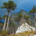
Almost all Taganai ridges are distinguished by the steepness of slopes of 10-15 ° at the base, 15-25 ° in the middle and 25-35 ° at the top. As a rule, the peaks are inaccessible. They impress everyone who comes to see Taganay. The mountains are striking in their grandeur and beauty. Especially noteworthy is the luxurious responsive comb.
Rivers
In this mountain range, rivers originate, which then feed the great Caspian. First of all, it is the Kusa river with its tributaries Shumga, Bolshaya and Malaya Tiesma.
Natural features
On this earth two are distinguished climatic zones: one of them is located on the tops. It is made up of subalpine forests and meadows, and the second - in the valleys and on the lower slopes of the mountains.
Various natural areas, which unite at Taganay, give this region a special originality. The northern part of the ranges is covered with spruce and fir forests of the middle taiga. On the eastern slopes, there are taiga forests in which larch, birch, and larch trees grow. In addition, there are areas covered by the most beautiful 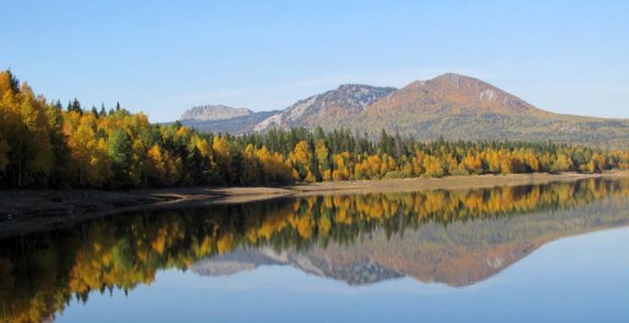
Mount Taganay (Zlatoust) in the highlands is covered with mountain tundra and subalpine meadows. These places are unique in that plants of Central European, Western, Eastern species, and Central Siberian flora coexist here. Arctic plants descend in the highlands far to the south, and steppe vegetation tends to the north along the foothills of the east.
Mount Taganay is an old Ural massif. Manifestations of seismic activity have been registered here. In 2002, the last earthquake with a magnitude of 3.5 was recorded.
Riddles of Taganay
On sunny and hot days, many tourists, as well as locals, observe an interesting effect - Mount Taganay seems to sway. Experts explain this phenomenon by the proximity of groundwater. Under the influence of sunlight, moisture begins to actively evaporate, and the effect of mobility of the mountain range is created in the air ascending currents.
Mount Taganay is part of the Ural zone, which is considered anomalous. Here you can often meet expeditions of ufologists, locals manage to see traces of the "Bigfoot", tourists talk about encounters with ghosts. 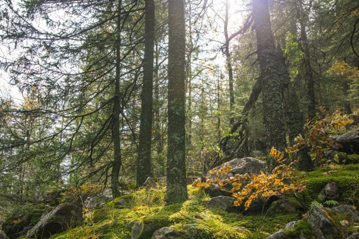
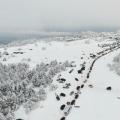
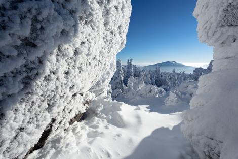
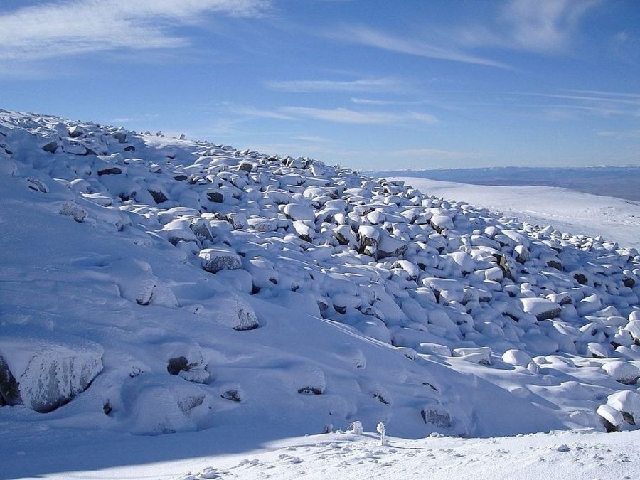
Weather conditions in Taganay are amazing. In a matter of minutes, they can change dramatically. During the day, temperatures often hover around ten degrees. Local residents will not be surprised by the snow that fell in June. Tourists can experience all seasons in one day - from sultry summers to harsh and windy winters. Another feature is strong winds, their speed sometimes reaches 50 m per second.
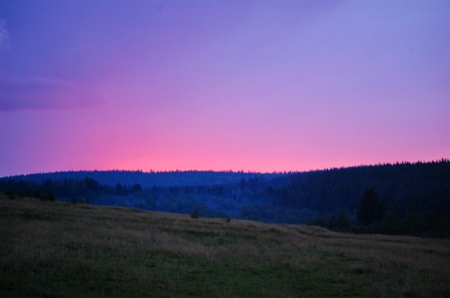
From the Taganai mountains an amazing picture of the South Urals opens. Beauty and features natural complex fascinate and surprise. Even in bad weather the peaks of Taganay, shrouded in a veil of fog, amaze with their grandeur. Tourists from different regions country. Traditional tourist trails run here.
National park
This unique park was established in March 1991. Its uniqueness lies in the fact that in a relatively small area a variety of animals live and plants from different geographic zones grow.
National park Taganay is full of secrets and mysteries. Mountain range surrounded by a dense forest - the best place for the habitation of various evil spirits. Locals say that the caves of the ridge are inhabited by amazing creatures, and Mount Kruglitsa is the point of contact with extraterrestrial intelligence - Roerich himself wrote about this. 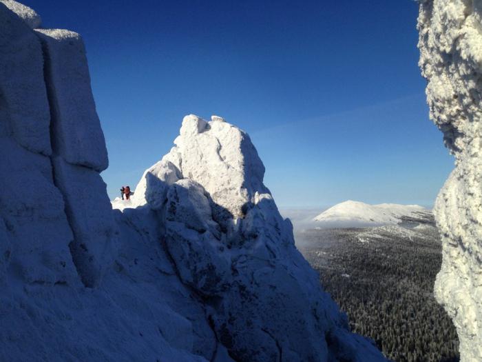
Nature has generously endowed the Taganay Park with its amazing creations. In the relict forest, among the extraordinary, stone rivers flow, petrified live, and the water from the springs is considered alive. All this splendor fascinates even the experienced traveler.
The Taganay Mountains will conquer even an unprepared tourist. When going on a hike, put on comfortable shoes and don't forget the tick and mosquito repellent. In the rainy season, travelers are unlikely to be able to do without rubber boots.
Stone river
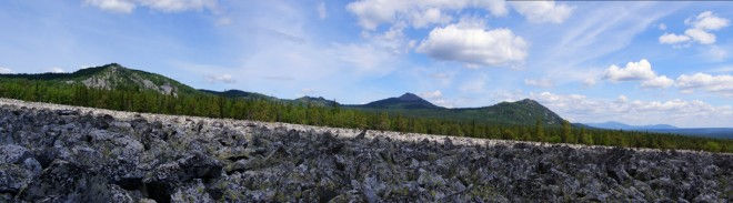
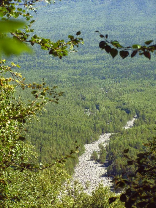
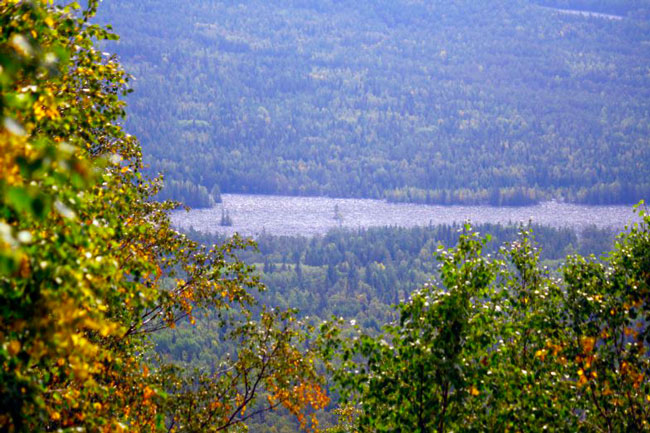
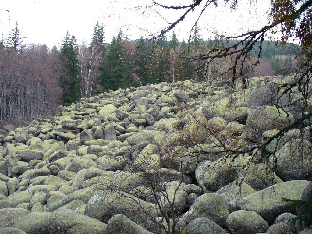
Unique sights can be seen in this array. Taganay became famous all over the world for its amazing natural formation, which is a uniform pile of huge rocky debris. The Taganai stone river is more than six kilometers long, and its width reaches 200 meters. 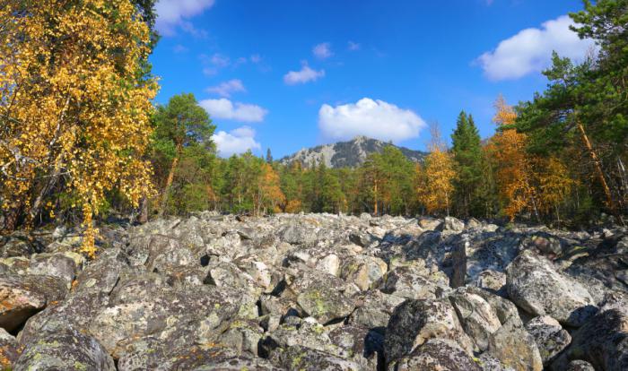
The stone river "flows" between the Dvuhglavaya Sopka mountain and the Middle Taganai ridge. Its origin has not yet been determined. There is a version that the stone river was formed by a glacier that descended from the Taganay mountains.
Anomalous zone
In the Taganai forestry, which was built at the foot of the mountain, V.N. Efimova, an employee of the environmental department, confirmed rumors about the anomalousness of these places.
As it turned out, in the mountains - on the Urenga ridge - fireballs quite often appear, more often than in other places. Not uncommon in the village of Veselovka. These objects behave rather strangely - they hit the same places, as if they deliberately loop while moving. According to experts, there are "lightning nests" in the classic form, with a reduced soil resistance. It speaks either about large deposits metal or underground water sources.
Mysterious swamp
Anomalous Taganay is represented even more mysterious place- Bolshoi It is located between the tip of Maly Taganai in the north and the southern foothills of Itsyl. The swamp covers an area of 36 sq. kilometers and is located in a giant depression tectonic origin... It resembles an oval bowl with a long axis.
On this territory, the human psyche is changing - orientation is disturbed, because of this, even experienced foresters can get lost here. Travelers see all sorts of amazing things here that seem so real that they are taken at face value.
This is most likely due to a mixture of underground gases, which contains carbon dioxide and methane. They come out of a large deep fault and have a toxicomatic and psychotropic effect on humans.
Those who wish to wander through the marsh swamps expose themselves to intoxication and sometimes serious poisoning. This state promotes encounters with "flying saucers", humanoids, translucent substances, kikimors.
Sound mirages also happen here. Various forest noises can be heard - rustling of foliage, as when approaching, close footsteps. In fact, no one will be around. 
Tourists often stop at the Responsive Ridge. It got this name for its ridge-like outlines and loud, multiply amplified echo, which occurs due to the reflection of sound from each vertical rock. If you look at the crest from afar, it resembles a stegosaurus lizard, a sea wave, and an elongated crest.
In the northeast of the ridge, there is a tectonic fault. In 2002, tourists noticed several swirls of air in the form of dark pillars over Taganai. Later, the meteorological services confirmed this information. The tornado appeared when a cold front passed through Taganai. It consisted of three independent vortices that merged together.
Sand slides
If you walk along the path leading to Kruglitsa, you can get to the "Valley of Fairy Tales" - Sand hills. This is an area of extraordinary beauty - the saddle of a stunted one. Here you can see glades with numerous original outliers.
The valley is located in a zone of intense tectonic movements of the past. Walking fog often appears between the rocks. Moreover, he also "sings" when he falls into stone cracks and rubs against grains of different strength. There are a lot of topped spruces here - they have suffered from autumn and winter windblows.
Batteries run out very quickly in the meadow, as a result - all electronic devices (video cameras, clocks, cameras) refuse to work. Photos, as a rule, are blown out, and people see, for example, flying glowing balls.
The northern part of Kruglitsa is very attractive for ufologists. This is an ideally flat area measuring 0.2x0.4 kilometers. Particularly fanatical ufologists are sure that this is the place where energy exchange with the Cosmos takes place. There are some symbolic letters and signs made of stones. Here, like a magnet, esotericists, occultists, psychics are drawn. Judging by the ribbons hung in this place, which symbolize the made wishes, and the sacred signs inscribed on the stones, the Roerich people regularly visit here. Pilgrims are sure that such attention is paid to the summit due to the presence of a special positive energy.
Weather station
Meteorological station "Taganai Gora" is located on the top of Dalniy Taganai. The meteorological site is located at an altitude of 1108 meters.
The station was opened in August 1932. Here, observations were made of wind speed, air temperature and atmospheric pressure, cloudiness, amount of precipitation. All information was transmitted by radio to the Office of the Ural Hydrometeorological Service (Sverdlovsk).
During its operation, the station was rebuilt twice (in 1965 and 1982). In May 1992, it was closed, and the premises were later transferred to the ownership of the city. Today the meteorological post of the Taganai Park and the rescue service are based there.
A landscape with character
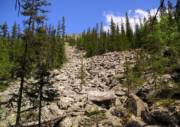
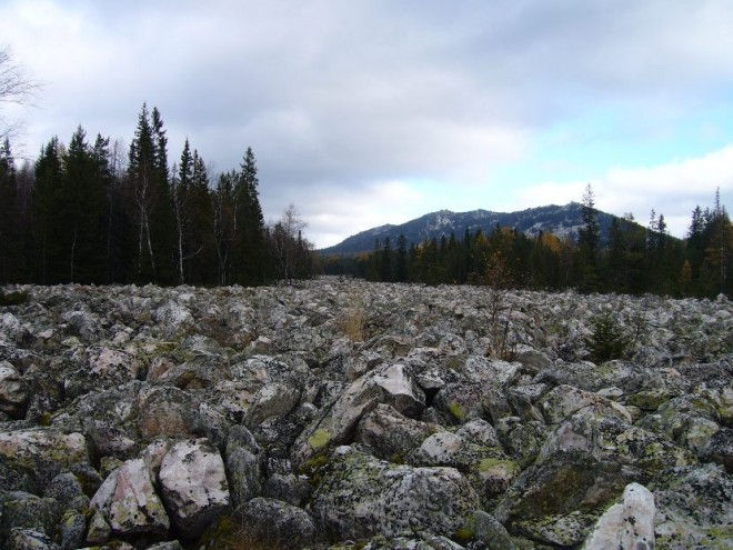
Above the border of the forest, all the Ural mountains are almost entirely covered with stone placers-curums. But only in the Southern Urals do kurums stretch for kilometers along the bottom of some valleys. These are the famous stone rivers.
Kurumas are large blocks or fragments of solid rock that form due to weathering. Usually located on gentle slopes, as well as at their feet. 
The word kurumy has a Turkic origin and means “fragments of rocks”, “piles of stones” or “stony placers”. One of the characteristic features of kurums is their slow movement down the slope.
Stone rivers can be found in large numbers in the Urals. Here they are called kurumniks. Usually rock fragments are large, up to one or two meters, they are always not run-in, they look like freshly broken ones.
The size of the kurums can range from a few square meters to huge fields. Separate regions are known on Earth, the surface of which is completely covered with such stone "covers".
Curums are formed in places where solid rocks emerge to the surface. Usually, kurums appear due to the destruction of limestones, basalt rocks, sandstones, quartzites, granites, dolerites, porphyrites, diabases.
The first hypothesis about the origin of kurums was expressed by the Russian geographer N.M. Przhevalsky. In his opinion, the genesis of these mountain formations is due to the large difference between day and night temperatures, as well as their uneven heating and cooling. It is known that the formation of kurums occurs more intensively in autumn and spring.
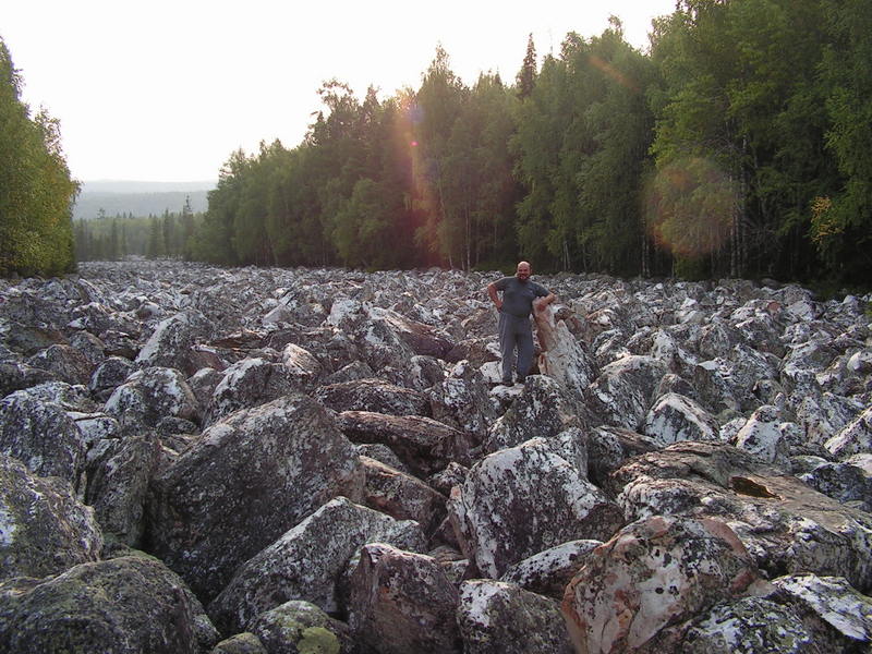
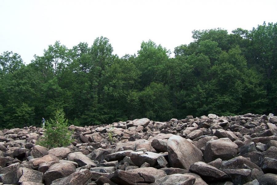
In the Chelyabinsk region there is such a miracle of nature as the Stone River: an amazing and impressive natural formation. The Big Stone River Taganaya is a natural monument. A formation similar to it in size and beauty of stones is known only in India and nowhere else on the globe.
The Stone River is a uniform heap of huge rocky debris, which stretches for many hundreds of meters and looks very much like a river.
Bolshaya Kamennaya River is located between the Bolshoi and Srednii Taganai ridges and stretches from northeast to southwest for about 6 km, reaching a width of 20 to 270 m. -4 m³). 100 sq. meters there are up to 300 blocks, in depth they lie at least 4-6 m, i.e. 3-4 layers. There is no vegetation, except for lichens. Nothing can grow through a stone pile.
Numerous mountain streams are often buried under the "bed" of ancient stone streams.
Stone rivers consist mainly of quartzites, and on Taganay - of their variety - aventurine.
The origin of the stone rivers is not fully understood, there are versions that the Bolshaya Kamennaya was formed by a glacier during the descent from the Taganaysky mountains.
Many people mistakenly call the stone river kurumnik. Unlike kurums, which continue to slowly slide down today, the Bolshaya Kamennaya River is currently practically motionless, and the slope here does not exceed 2.5 °.
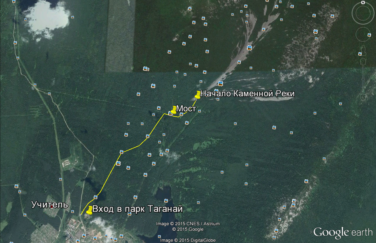
Coordinates the beginning of the stone river on the hiking trail:
55 ° 14'44.58 ″ N
59 ° 46'24.27 ″ E
Further, the trail crosses a stone bed
Every tourist is obliged to visit this miracle of nature. The stone river on Taganay is also available for a family hike. It's easy to get there.
In the north of Zlatoust, find the village. Pushkinskiy (the road to the village of Magnitka starts from it.
After 300 m, there will be a worship cross on the left, and a signpost “Taganay National Park” on the right. Here in the house with the inscription "Tourist registration" you need to check in the magazine. There are information boards in front of the park entrance.
The "lower" path leads to the Kamennaya River itself, the one that crosses the Bolshaya Band on the lower bridge. You can see the details of the route at the stands or ask the park employee.
 Stone river. Map. Click to enlarge.
 "Stone rivers flow of immeasurable depth, of which solid drops make up huge blocks" - so poetically described this phenomenon of nature PP Anosov. Stone rivers (locally called placers) are not uncommon in Taganai, Urenga and other ridges of the Southern Urals. They are linearly elongated accumulations of stone blocks and rubble that have moved from the mountain slopes to intermountain valleys. From the top of the mountains placers really resemble real rivers. Their formation dates back to the era of the last glaciation. At this time, glaciers in the South Urals covered only the tops of the ridges, the height of which was close to the heights of the modern Alps (up to 4800 m). In this zone, due to physical weathering, there was an intensive destruction of rocks. The peaks broke up into large blocks, which, under the influence of gravity, slowly shifted along the slopes of the ridges, having formed by the present day large placers, the largest of which in Taganai - the BOLSHAYA KAMENNAYA RIVER - stretches for 5-6 km., Reaching a width of 20 to 250 and even up to 700 meters.
Imagine that this entire area is occupied by large rounded blocks of quartzite, including aventurine, with a volume of 0.2-30 cubic meters (on average 3-4 cubic meters) and weighing 9-10 tons. 100 sq. meters of placers are located up to 300 individual blocks, and in depth they lie at least 4-6 meters, that is, in 3-4 layers. Unlike kurumniks, which to this day slowly move along the slopes of the mountains, the Bolshaya Kamennaya River today is practically motionless, because it lies on the surface with a slope of only 2.5 °.
Under the "bed" of ancient stone streams, numerous mountain springs are often hidden, the muffled murmur of which can be heard in different places large placers.
As the well-known local historian of the city of Zlatoust writes - Kozlov Alexander Veniaminovich, and he then climbed the whole Kamennaya River up and down: The total area of the Bolshaya Kamennaya River is about 90 hectares. On this territory, on the surface alone, there are more than 2.5 million boulders with a volume of 1-2 cubic meters. m each, and in total there can be up to 8-9 million of them, given that in placers they lie in three or four layers. For comparison: for the construction of the famous egyptian pyramid Cheops went to 2.3 million blocks of limestone with a volume of about a cubic meter each. Hence, it turns out that only in one Big Stone River in the "disassembled" form lie 3-4 pyramids of Cheops. These are these wonderful places, we decided to visit. To see for yourself, well, to show you.
1.Welcome to the fairy tale.
2. getting lost in the Taganay National Park is getting harder and harder, but people manage to do it. 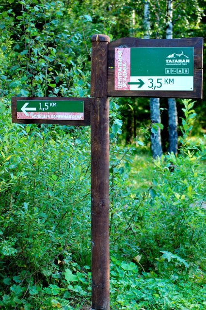
3.transparent water of the Tesma river. 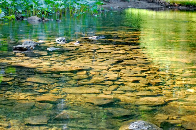
4. Buruniks. 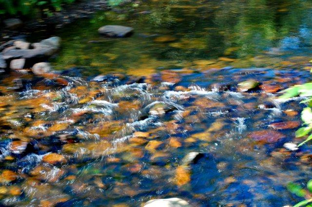
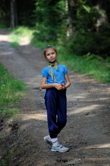
5. As in every fairy tale, in ours the same is present - the princess. 
6. The knight and the queen in search of mushrooms))) 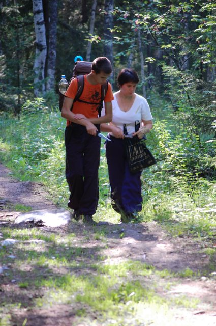
7. now the princess has joined them. 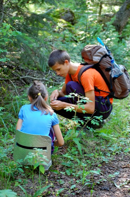
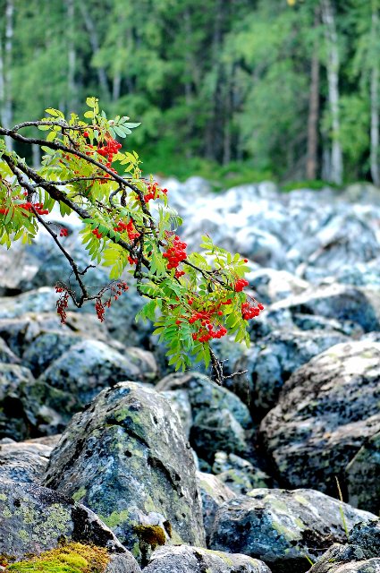
8. Rejuvenating rose hips. 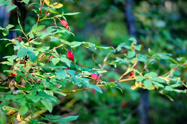
9. And here is the mountain ash near the first stone stream, a tributary of the Kamennaya River. 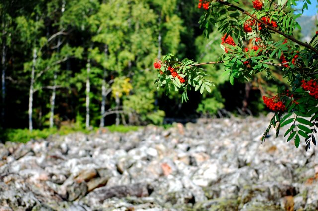
10. his majesty fly agaric. 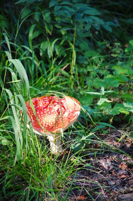
11. Together we strain our eyes and see a mythical dragon lying on the ground with his head towards us. This is a Responsive ridge, there is even a legend about it: Many years ago, it was as if a fierce beast lived in the cave of the Taganay ridge. He indiscriminately grabbed foot and horsemen and devoured them. Once a holy hermit was walking, perhaps the same Zosimus, saw the beast crawling out of the cave, and turned with a prayer to God for the destruction of the monster. The Lord heeded the prayer and killed the beast with a boulder, and left his voice in the mountains as a keepsake, “great and terrible,” add literate storytellers of some schismatic sense. 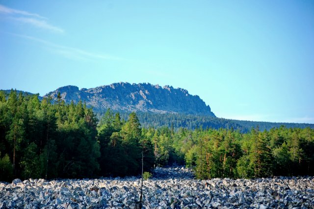
12.
13. a snack on the Stone River, stones heated in the sun, the murmur of water and beauty around !!! 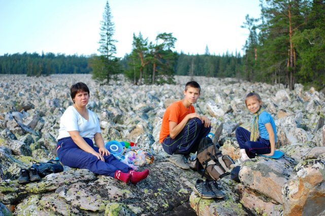
14.Otkliknoy and Bolshaya Kamennaya river 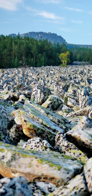
15. and there is a place for a miracle 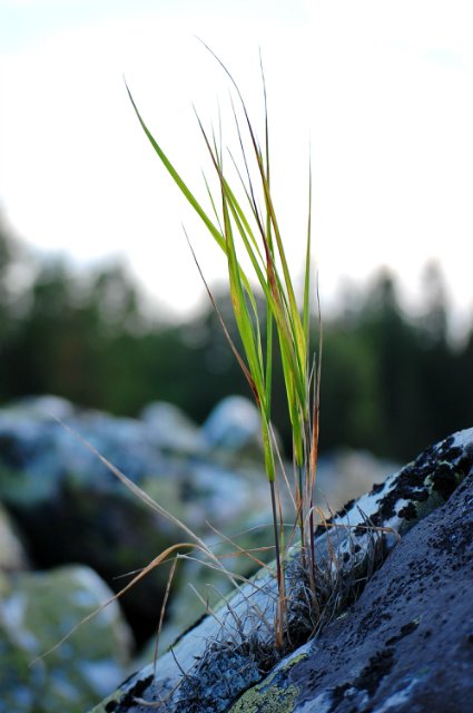
16.How ??? 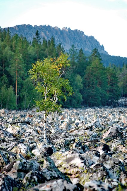
17. Here is the craving for life !!! 
18. Well, here, a whole pine tree has grown, without a gram of soil on the stones. Isn't it a miracle !? 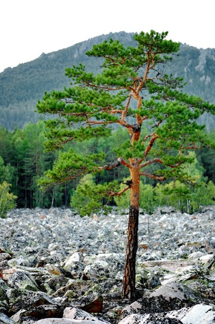
19.A Stone River, know yourself "runs" further ... 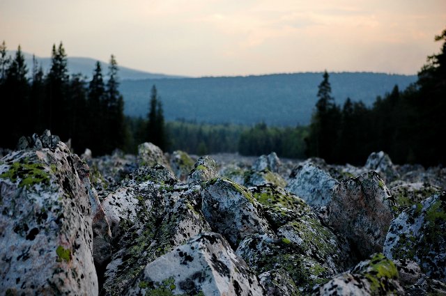
20. in the frame of the Taganay Mountains. View from the Kamennaya River to Sredny Taganai. 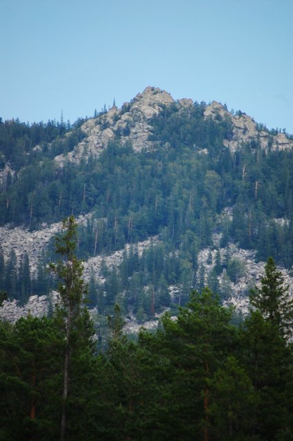
21. A cloud came and we were getting ready to go home. 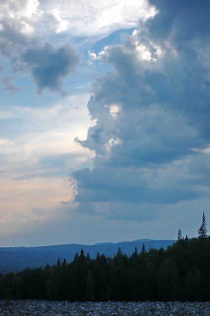
22.Vooon to that tower, not far from it, are our mansions)))) 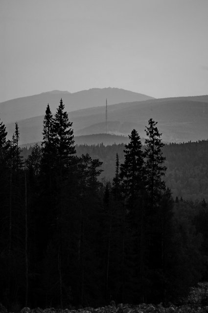
23. on the way. 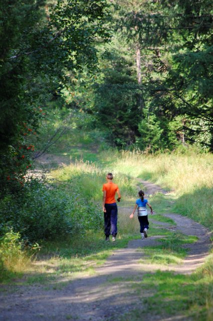
24.
25. And goodbye, Taganay presented us with amazing beauty - a sunset !!! 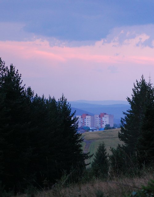
26. Small Taganay (Sabbat). 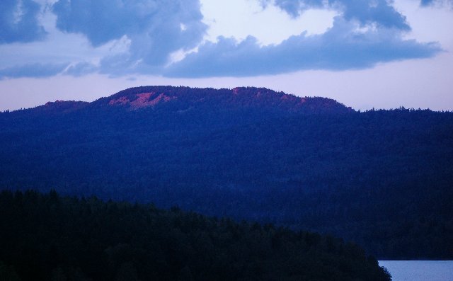
27.
28. Mind-blowing))) 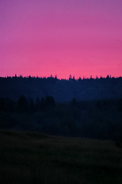
Well, this cloud probably flew to Taganay for the night ...... Remember how Lermontov's?
A golden cloud slept
On the chest of a giant cliff;
In the morning on the road she rushed away early,
Playing on the azure merrily;
But there was a wet trace in the wrinkle
The old cliff. Alone
He stands, thought deeply
And he cries softly in the desert. 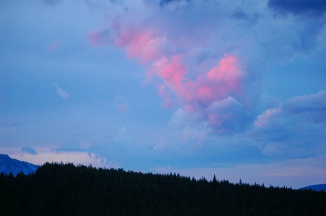
See you in the South Ural open spaces.
The Big Stone River in Russia is a chaotic jumble of large boulders "flowing" down the slope of Mount Taganai in the Chelyabinsk Region in Russia. The river is 6 km long and 200 meters wide on average. In some places, the width reaches 700 meters!
The giant landslide is thought to have originated about 10,000 years ago during the last ice age. At this time, glaciers covered the peaks of the Taganay Mountains, reaching an altitude of 4,800 meters. Under the enormous weight of the ice, the tops of the mountains were crushed into millions of large cobblestones. As the ice melted, the stones slowly rolled down, forming stone rivers. This place is named a river only for its external resemblance, there is no current here and the stones lie motionless.
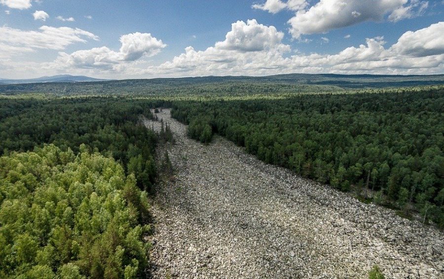
The river is filled with large boulders of quartzite (a strong and durable rock) and aventurine (a type of quartz containing mica and iron compounds that give it a shimmering effect) weighing up to 9-10 tons each. The depth of the stone layer is as much as 6 meters!
It is noteworthy that when approaching the river, a light sound of murmuring water is heard. In fact, many small streams flow under the stones.
However, the Great Stone River is not the only one on our planet. Similar clusters of stones can be found in other regions of the Ural Mountains.
Also, several stone rivers have been found in the Vitosha Mountains, Bulgaria. The largest is located on the Subalpine plateau. It is called the Golden Bridges and is 2 km long. The name comes from the golden color of the moss that grows on the stone boulders.
These places are quite popular among tourists, so there are many hiking trails.
The Ringing Stones is a park located in the forests of Pennsylvania, USA. The territory of the park is covered with huge cobblestones with an unusual property. When they hit stone on stone, they sound as if they were made of metal. Many tourists take hammers with them to hear these unusual sounds with their own ears.
In June 1890, a certain J.J. Ott collected enough stones with different sounds and played a whole melody to the accompaniment of a musical group.
The origin of the stone rivers is still not known for certain. There are many theories, some of them are quite plausible, others are like a fairy tale.
If you liked our article, then share it with your friends and subscribe to our updates. We also offer you to download the presentation "Stone rivers - a mystery of nature", which will be useful to you in class or other events. Until next time!