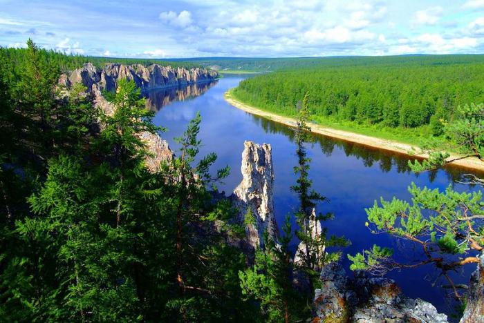
For many of our compatriots, and even more so for most foreigners, the concept of Siberia is associated with a very harsh climate. Like many other cliches, this statement is only partly true. Of course, the weather conditions of the Siberian lands do not pamper their inhabitants, but they are not as extreme as it is commonly believed. In addition, the climate tends to change, and Siberia is nowhere near as harsh as 100 years ago.
It is worth paying attention to the fact that Siberia occupies vast territories. There are still disputes about the geographical boundaries of the entire region (you can read more about this here - Geography and Borders of Siberia), so when characterizing climatic conditions of this region, we will restrict ourselves only to the boundaries of the Siberian Federal District, conditionally dividing it into the Western, Eastern and Northern parts.
Characteristics of the climate of Western Siberia
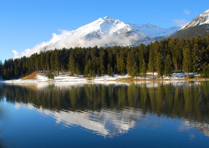
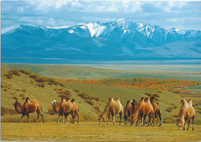
We classified the following regions in the western part of Siberia - Omsk, Tomsk, Novosibirsk and Kemerovo Regions, Altai Krai and the Republics of Khakassia and Altai. Perhaps this part of Siberia has the mildest climate. The Altai mountains cover the above regions from Kazakh winds, and the extended Vasyugan swamps soften the summer heat characteristic of continental climate... The average temperature in winter ranges from -15 ° C to -30 ° C. Because of strong winds, the frost in these places is felt a little harder. The snow cover is established, as a rule, at the end of November and reaches a thickness of 15-20 cm. The summer period is characterized by a range from + 15 ° С to + 35 ° С, which is somewhat softer than in the Kazakh steppe. So the climate Western Siberia not perfect, but neither can you call it nightmarish.
Climatic and weather conditions of Eastern Siberia
Eastern Siberia within the Siberian Federal District is the Irkutsk Region, the Republics of Tyva and Buryatia, the Trans-Baikal Territory, as well as the southern part of the Krasnoyarsk Territory. Climate Eastern Siberia can be described as sharply continental. The average annual temperature is 0 ° C. In winter, temperatures can reach -40 ° C, but due to the lack of winds, the cold is tolerated relatively easily. In the winter season, in the north of Eastern Siberia, you can observe polar nights. Total darkness reigns, the sun may not appear for a month, or even more. The climate of Eastern Siberia is very sunny summer during which it rarely rains. Maximum temperature in July-August it does not reach more than + 15 ° С. Snow begins to fall in October, with a height of about 20-25 centimeters. During the year, precipitation falls in an amount from 300 to 500 mm per year, and in mountainous areas about 900-1000 mm.
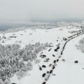
The climate of the northern regions of Siberia.
The northern territories of the Krasnoyarsk Territory, including the Dolgano-Nenets and Evenk regions, are practically a real tundra. The climatic conditions here are so severe that they could easily become the prototype of the prototype that developed about the Siberian climate. There is practically no summer in these parts, and the winter period is not only long enough, but also frosty. The duration of the time period with air temperatures> 10 ° C is in practice less than one calendar month. In winter, the thermometer can easily drop below -40 ° С, and in summer it rarely rises above + 10 ° С. In the mountainous and northern regions, the snow cover lies all year round. Perhaps this is real Siberia, the climate of which is a real test of the will and endurance of a person.
Weather conditions in different regions of Siberia.
except general characteristics climatic conditions of Siberia, we have prepared descriptions of climate and weather for each of the 12 regions of the Siberian Federal District... More information about the weather in a particular city of the Siberian Federal District can be found here:
The temperate climate on the territory of Western Siberia is characterized by a greater continentality in comparison with the EPR. Inflow increases, increases annual amplitude air, in the southern regions the climate becomes arid. To the east of the ridge, the influence is completely weakened and continental dominates here. The climate of Western Siberia is more homogeneous than on the other side of the Urals in European territory.
In the cold period, cyclonic activity resumes in the north and cold continental air comes from Central Siberia, which makes temperature regime unstable. In January, in most of Western Siberia, temperature fluctuations from day to day are on average 5 °. (This phenomenon is hardly observed in other regions of the world.) Winter is cold, average temperature in January it varies from -18 ° in the south to -28, -30 ° in the northeast. With light winter precipitation in the southern regions, the height is less than 30 cm.In the northeast, in the area of the Verkhne-Tazovskaya and Lower Yenisei uplands, where they are frequent, it increases to 80 cm.
In summer, cyclones develop over the entire territory of Western Siberia. Their number decreases from north to south. The northern regions are invaded by cyclones from the European part of Russia and the Atlantic. Cyclones come to the southern regions from the west and southwest (from the lower reaches, from the seas). The most intense cyclonic activity is observed between 54 and 60 ° N. NS. During the summer period, precipitation ranges from 300 to 400 mm. To the north and south of this area it decreases. In summer, arctic air comes in, which turns into continental. The influx of air increases the dryness and intensifies the continentality to the south.
In most of the territory of Western Siberia, the climate is humid. The zero isoline of the difference in precipitation and evaporation, which is the southern border of the forest, runs approximately along the line - Novosibirsk (56 ° N). the region of Western Siberia is the most waterlogged territory of Russia. There is a significant accumulation of surface waters, the forests are swampy. Precipitation, the annual amount of which is 600 mm, in most of the territory exceeds the evaporation rate by 100 - 200 mm. A lot of solar heat is spent on evaporation. The averages vary from north to south from 14 to 18 °. South of 56 ° N NS. cyclonic activity weakens and the annual precipitation decreases to 350 - 400 mm. Potential evaporation exceeds the amount of precipitation, the climate becomes arid. Dominate.
The material was found and prepared for publication by Grigory Luchansky
A source: M.I.Mikhailov. Siberia. State publishing house Geographical literature ... Moscow. 1956 g.
Siberia climate
As you know, Siberia is one of the coldest countries in the world. The most characteristic features of its climate are explained primarily by geographic location... Siberia occupies the northern part of the Asian mainland and lies in the northern and partly middle latitudes Soviet Union, within the zones of temperate and cold climates. Many thousands of kilometers separate the territory of Siberia from the shores of the Atlantic Ocean, high mountain ranges rise to its southern and eastern borders and prevent the penetration of warm and humid winds from the seas located to the south and east of the Asian continent. Only from the north, from the Arctic Ocean, far into the depths of Siberia, do masses of dry and cold Arctic air reach.
Almost everywhere north of the Siberian line railroad on the plains, plateaus and mountain ranges, a very cold winter continues for more than half a year, in the middle of which there are frosts of 40-50 °, and in some places even 60 °. However, summer in Siberia (with the exception of only its most northern regions) is warm, and in the southern half it is sometimes even hot and rather long. Already at the end of May, and in the north in June, under the bright rays of the sun, there is a strong warming of the land surface. Mercury in the thermometer rises during the day to 20–25 °, and at the beginning of July in the steppe zone, the heat often exceeds 30–35 ° for several days in a row. In almost the entire territory of Siberia, summer is much warmer than in the corresponding latitudes of the European part of the Soviet Union. In Yakutsk, which lies on the same latitude as Leningrad, the temperature in July is on average 2-3 ° higher than on the banks Gulf of Finland; the temperature difference between Kiev and Semipalatinsk is approximately the same.
The transitions from summer to winter and from winter to summer are made quickly in Siberia. Therefore, the duration of the transitional seasons - spring and autumn - is generally short.
The climate of Siberia is sharply continental throughout. The difference between the average temperatures of the coldest and warmest months in its various regions is from 35 to 65 °, and the absolute temperature amplitudes in areas such as Eastern Yakutia reach 95–105 °. The continental climate of Siberia is also manifested in rather sharp fluctuations in temperature during the day and in a relatively small amount of precipitation, which falls in most regions mainly in July and August.
The huge size of the territory and the large differences in the relief determine the significant variety of climates in individual regions of Siberia. This is primarily due to the large extent of Siberia from north to south and therefore the unequal amount of incoming solar heat. Some southern regions of Siberia receive solar heat no less than the southern regions of Ukraine and the lower Volga region. It is a different matter in the north. As you know, about a quarter of Siberia lies north of the Arctic Circle. In winter, here for several weeks, and in the very north - for two or even three months, the sun does not rise above the horizon at all and there is a "dark time" of the polar night. At the end of January, the length of the day begins to increase rapidly, and at the end of May - beginning of June, a multi-week polar day begins. The huge disk of the sun makes a full circle during the day, not hiding behind the horizon.
Polar day and night are characterized by very small fluctuations in daily air temperatures. In winter, both "day" and "night" are almost equally cold. With the onset of summer, with round-the-clock lighting and a continuous influx of solar heat, the melting of the snow cover and the development of plants are very rapid here.
The climatic differences between the western and eastern regions of Siberia are also quite significant. The climate of Eastern Siberia is generally more continental than in the western part, the plains of which are often reached air masses from the Atlantic Ocean. True, when passing over Western Europe and the Russian Plain, they lose a lot of moisture, and in winter, in addition, they also become very cold. Nevertheless, the masses of Atlantic air over the territory of Western Siberia are still more humid than the continental air of Eastern Siberia. That is why more precipitation falls in the western part.
The difference in the climates of Western and Eastern Siberia is also explained by the different nature of their relief. In Eastern Siberia with its high mountain ranges and plateaus, separated by deep valleys, accumulation and stagnation of masses of heavier cold air occurs in depressions. This phenomenon is especially pronounced in winter. At this time, in clear and frosty weather, a very large amount of heat is radiated from the surface. Heavy supercooled air flows into the hollows, where it is even more cooled. It is this circumstance that explains the extremely low temperatures of the winter months and the phenomenon of the so-called inversions (Usually, with altitude, a gradual decrease in temperature is observed, averaging about 0.5-0.6 ° for every 100 m of rise. But there are cases when the temperature is up to a certain altitude rises, and sometimes quite significantly.For example, at the Mangazeisky mine located in the Verkhoyansk ridge, at an altitude of about 1,000 m, the average temperature in January is –29 °; in Yakutsk, located at the foot of this ridge, –43 °, and in Verkhoyansk even -50 ° C. This phenomenon is called temperature inversion), especially characteristic of intermontane depressions in Eastern Siberia.
The relief also has a very significant effect on the distribution of precipitation. It is known, for example, that slopes facing humid winds receive significantly more precipitation than opposite slopes of the same ridge. So, in Western Altai at an altitude of 1200-1500 m, sometimes more than 1500 mm of precipitation falls per year (B last years Siberian hydrologists, according to data on the amount of water flowing into rivers, found that in some areas of Western Altai and Kuznetsk Alatau up to 1800 and even 2 thousand mm of precipitation falls per year, that is, almost the same as in the humid subtropics Black Sea coast Caucasus), and at the same height in the depressions of the Eastern Altai only 200–300 mm. An equally striking example in this respect is the Khamar-Daban ridge. Its northwestern slopes facing Baikal receive up to 800–1000 mm of precipitation per year, and the thickness of the snow cover in winter here reaches 1.5–2 m. On the opposite, southeastern slope, less than 300 mm falls per year; due to the lack of snow, it is not possible to ride a sleigh there every winter.
Many of the features we noted Siberian climate due to the distribution atmospheric pressure and the circulation of air masses over the territory of Siberia and neighboring countries. It is known that the land in the cold season cools faster and more intensely than the surface of the seas and oceans. For this reason, usually from the beginning of autumn, the air above it becomes colder and denser, and the so-called anticyclonic region of high atmospheric pressure gradually forms. The mainland of Asia is one of the most significant and compact land masses in the world. Therefore, the process of the formation of increased pressure in winter in the center of the continent is extremely pronounced, and the atmospheric pressure here is much higher than on the seas surrounding the continent.
Already at the end of September, the atmospheric pressure over the territory of Northeast Siberia becomes relatively high, and by the end of autumn the area of increased pressure gradually spreads to the whole of Eastern Siberia. The pressure is highest in Transbaikalia and the eastern part of Yakutia. In January, it reaches an average of 770–775 mm here. In connection with the emergence of an area of high atmospheric pressure, the penetration of humid air masses from neighboring territories here stops. This circumstance explains the clear, almost cloudless, but very cold and dry weather prevailing in Eastern Siberia in winter. The winds at this time are very rare and differ in very little force.
Unlike Eastern Siberia, over the northern part of the West Siberian lowland and especially over the seas The Pacific the pressure in the cold season is lower and sometimes does not exceed 760 mm. Due to the large difference in atmospheric pressure, cold and dry air from the East Siberian high-pressure region spreads to the west and east. Its penetration causes a significant cooling in the neighboring regions, which in the west extends even to the territory of the European part of the USSR.
In the warm season, when the land heats up more than the water surface, the picture of pressure distribution over Siberia changes dramatically. Already in April, the pressure over the mainland begins to drop rapidly and the Siberian anticyclone disappears. By the middle of summer, in North Asia, almost everywhere the air pressure becomes below normal and does not exceed 755–758 mm on average. In contrast to winter in the north, over the seas of the Arctic Ocean, and in the west - in the European part of the Union, the pressure at this time is somewhat higher. Therefore, in summer, air masses often come to Siberia either from the north (Arctic) or from the west (Atlantic). The former are most often cold and dry, while the latter are more humid and bring a significant part of summer precipitation.
The wind regime is also closely related to the seasonal distribution of pressure and air masses. The coldest months of the year (December, January and February) are characterized by relatively calm weather in almost the entire territory of Eastern Siberia. Windy days in winter are usually accompanied by a noticeable increase in temperature and little rainfall.
In Western Siberia, where areas with relatively high pressure are located in the south in winter, and an area of low pressure forms over the Kara Sea, southern winds prevail. They reach their greatest strength in the middle of winter. It was at this time that blizzards and blizzards rage in treeless areas in the south of Western Siberia and in the tundra zone on the shores of the Arctic Ocean. With a tremendous wind speed, sometimes reaching 30–40 m / s in the north, the swept-up snow and ice crystals fill the surface layers of air so much that nothing is visible even at five paces; movement in a blizzard becomes almost impossible. It is especially dangerous to be caught in the tundra, far from settlements the so-called "dark blizzard". It begins suddenly and often does not subside for five to ten days, only at times weakening somewhat. During a strong blizzard, the air temperature almost always rises by 10–20 °.
Winds have a completely different character during the warm Siberian summer. At this time, north-westerly and northerly winds prevail everywhere. The first of them are wet and bring a large amount of precipitation falling in the form of rains, and the relatively cold winds of the northern points cause a strong decrease in temperature in summer, and sometimes they are accompanied by frosts in May, June and August.
Due to the significant diversity of the surface in some places in Siberia, especially in mountainous areas, local winds are also observed. In Altai, in the Sayan Mountains and the mountains of North-Eastern Siberia, they often acquire the character of fen (Fen is a relatively warm and dry wind blowing from the slopes of the mountains into the valleys. It occurs when different pressure is established over the opposite slopes of the ridge, or when over The pressure on the ridge crest is higher than on its sides. Descending from the slopes, as a result of compression, the air heats up and becomes dry. In the mountains of Siberia, this phenomenon is most often observed in winter. 20 and even 40 °. So, for example, on the night of December 2 to 3, 1903, as a result of the hair dryer, the temperature in Verkhoyansk rose from -47 ° to -7 °. Hair dryers often cause thaws, and in spring - rapid melting of the snow cover). In the basin of Lake Baikal, which is surrounded on all sides by mountain ranges, very peculiar winds blow. Many of them are remarkable for their amazing consistency of direction. Such is, for example, the north-east wind "barguzin", south-west, or "kultuk", and the north, called by the local population "angara", or "verkhovik". The very strong Sarma wind blowing in autumn and winter in the middle part of the lake is especially famous. During the "sarma", a storm occurs on Lake Baikal, sometimes lasting for several days. On frosty days, wind-blown clouds freeze in the air, and ships are often covered in thick ice. Sometimes, as a result of a storm caused by the "sarma", fishermen's boats perish on Lake Baikal.
In Siberia, the average annual temperatures are almost everywhere below 0 °. In some northern regions, they drop even below –15–18 ° (Novosibirsk Islands - 19 °, Sagastyr –17 °, Verkhoyansk –16 °). Only in the southernmost parts of the West Siberian Lowland, already within the northern regions of the Kazakh SSR, the average temperature of the year rises to 2-3 ° C.
The severity of the Siberian climate is determined primarily by a very low temperatures winter and its long duration. Nowhere on the globe winters are never so cold, and only a few areas in central Antarctica or on the Greenland ice sheet can rival Siberia for the harshness of their winters. However, even there has not yet been observed such cold weather as occurs in January in Oymyakon or Verkhoyansk.
Even in the relatively “warm” winter southern and western regions of the West Siberian Lowland, the average January temperature does not exceed - 16–20 °. In Biysk and Barnaul, located almost at the same latitude with the capital of Ukraine, in January it is colder than in Kiev, by 10 °. On some days, temperatures of -45 ° can be everywhere in Siberia; 50-degree frosts were observed even in the south of Western Siberia - in Barnaul, Omsk, Novosibirsk.
Winter is especially cold in Eastern Siberia, over the territory of which, as we already know, an area of increased air pressure is located at this time. Throughout the winter, the weather is clear, cloudless and absolutely calm. In such weather conditions, an extremely intense cooling of the surface occurs, especially at night. Therefore, in winter, in most of the territory of Yakutia, temperatures are kept below -40 ° for a long time and there are no thaws. Particularly severe cold is in closed basins, in the region of Verkhoyansk and Oymyakon. The average temperature in January is lower here - 50 °, and on some days there are frosts even up to 70 °.
Winter in the eastern part of Siberia is on average twenty degrees colder than in the western one. Even the northernmost parts of Western Siberia, located on the coast Kara Sea, at this time they sometimes turn out to be warmer than some regions of Eastern Siberia, lying almost 2 thousand km south of them. For example, in Chita, the air temperature in January is much lower than on the banks of the Ob Bay.
Due to the constancy of the weather, the great dryness of the air, the abundance of clear, sometimes even sunny days and the absence of winds, low air temperatures in winter are tolerated by the local population relatively easily. A resident of Krasnoyarsk or Yakutsk considers an invigorating thirty-degree frost to be as common as a frost of 10 ° for a Leningrader. Getting off the train that arrived from Moscow or Leningrad, in a large Siberian city, you won't even feel right away that the temperature here is 20-25 ° lower. The bright sun, not like winter, floods the snow-covered surroundings with its rays, the air does not move, not a cloud in the sky. From the rooftops, sometimes at the beginning of March, drops begin, and a person who is not used to the peculiarities of the Siberian climate looks with disbelief at the thermometer showing –15, or even –20 °.
Especially often clear and sunny days are observed in winter in Eastern Siberia. The number of sunny days and the duration of hours of sunshine in many regions of Southern Transbaikalia are much greater than, for example, in Odessa or Crimea.
As we have already said, summer in Siberia is warm, and in the south, in the steppe zone and in Transbaikalia, it is hot. The average temperature of the warmest month, July, even in the forest zone ranges from 10–12 ° at its extreme northern limit to 18–19 ° in the south. Even more high temperatures observed in steppe regions, where July is warmer than in Ukraine. Only in the north, in the coastal tundra and on the coast of the Arctic Ocean, July and August are cool, for example, in the area of Cape Chelyuskin, the average July temperature is only + 2 °. True, on some, the warmest days, the temperature in the tundra can sometimes rise to 20-25 °. But in general, there are few such days in the north.
In early summer, even in the southernmost regions of Siberia, short-term night frosts are possible. In some regions, crops of grain crops and vegetables are often affected by them. The first autumn frosts usually occur at the end of August. Spring and autumn frosts noticeably shorten the duration of the frost-free period. In the north, this period is everywhere shorter than two months, in the taiga zone it lasts from 60 to 120–130 days, and only in the steppes from late May to mid-September frosts are usually not observed or are extremely rare.
Most of the precipitation that falls in Siberia in the form of rain and snow is brought by air masses coming here from the west and northwest. Wet eastern winds from the seas of the Pacific Ocean, fenced off from the territory of Eastern Siberia by a strip of rather high mountain ranges, penetrate occasionally only in the eastern regions of Transbaikalia. Unlike the rest of Siberia, only here at the end of summer heavy rains fall, brought from the east by monsoon winds.
The amount of precipitation falling in Siberia, in general, decreases markedly to the east. Even in the most rainfall-rich forest areas of Western Siberia, there are somewhat fewer of them than in the middle zone of the European part of the Soviet Union. Even less precipitation falls in Eastern Siberia, where in the taiga zone the population of some regions is forced to resort to artificial irrigation of their fields and hayfields (Central Yakutia).
The amount of precipitation also changes significantly in different geographic areas... The northernmost, tundra regions of Siberia receive relatively few of them. In the tundra of the West Siberian Lowland, no more than 250–300 mm falls annually, and in North-Eastern Siberia - 150–200 mm. Here on the coast of Chukotka, and East Siberian seas, as well as on the New Siberian Islands there are places that receive less than 100 mm of precipitation per year, that is, less than some desert areas Central Asia and Kazakhstan. The forest-tundra regions of Western Siberia and the taiga of the Central Siberian Plateau receive slightly more (from 300 to 400 mm) precipitation.
The greatest amount of precipitation in the plains falls on the taiga zone of Western Siberia. Within its limits, precipitation throughout the year exceeds 400 mm everywhere, and in some places even more than 500 mm (Tomsk 565, Taiga 535 mm). A lot of precipitation (500-600 mm per year) also falls on the western slopes of the Central Siberian plateau - in the Putorana mountains and on the Yenisei ridge.
In the south, in the forest-steppe and steppe zones, the amount of precipitation decreases again, and in the driest areas in the middle reaches of the Irtysh and southern Transbaikalia, they already account for less than 300 mm.
Everywhere in Siberia, precipitation falls mainly in the summer in the form of rains. The warm season in some places accounts for up to 75–80% of the annual precipitation. The maximum amount of precipitation in most of Siberia falls in July and August. Only in the south, in the steppes of the West Siberian Lowland, June is usually the rainiest month.
The predominance of precipitation in the form of summer rains is generally favorable for the development of vegetation and agriculture. In most parts of Siberia, rains deliver moisture to plants just when they need it most. Due to the relatively low evaporation from the soil surface, this moisture is quite sufficient almost everywhere. However, some southern steppe regions of Siberia, where the maximum precipitation occurs in June and where strong winds in spring noticeably increase evaporation, sometimes suffer from drought. On the contrary, in areas where summer rains are relatively high, they sometimes complicate haymaking and harvesting crops. Summer precipitation falls mainly in the form of prolonged heavy rains, and only in the most eastern regions there are often heavy rainfalls. The maximum amount of precipitation falling per day usually does not exceed 30-50 mm. However, there are cases when up to 120-130 mm dropped out per day (Kamen-na-Obi, Babushkin). Heavy showers are especially typical for the eastern part of Transbaikalia, where they occur at the end of summer almost every year. These showers often cause significant summer flooding here.
With regard to the precipitation regime in many regions of Siberia, "year after year does not occur." This applies to both the annual amount of precipitation and the precipitation of the warm season. So, for example, in forest-steppe regions, the annual precipitation can vary from 600 mm in an exceptionally rainy year to 175 mm in a dry year with average annual number approx. 275 mm. There is also a very large difference between the maximum and minimum precipitation in the summer months.
In winter, due to low air humidity and clear weather, the amount of precipitation is relatively small almost everywhere. In the tundra zone, as well as in Transbaikalia and Yakutia, for the entire cold period of the year, they fall no more than 50 mm; Even in the wettest winter regions of the middle part of the West Siberian Lowland, the period with subzero air temperatures accounts for only about one fifth of the annual precipitation, that is, slightly more than 100 mm.
The entire territory of Siberia at the beginning of winter is covered with snow for a long time. First of all, it is installed in the extreme northern regions - on the New Siberian Islands and Severnaya Zemlya. Here the snow that fell at the end of August does not melt anymore. During September, snow cover appears everywhere on the coast of the Arctic Ocean, in the tundra zone, in the highlands in the east and south of Siberia, as well as in the northern and middle parts of the Central Siberian Plateau. At the end of October, snow already covers the whole of Siberia, with the exception of only some areas of Southern Transbaikalia.
The duration of the period with a stable snow cover ranges from 300 days on the islands of the seas of the Arctic Ocean to 150–160 days in the south of Siberia. Only in areas with little snow in Transbaikalia and in the southwestern part of the West Siberian Lowland, the time during which the snow cover lies is somewhat less. However, even here it is held for more than four to five months.
In the middle and end of April, under the rays of the warming spring sun, all southern regions of Siberia are relatively quickly freed from snow. In the taiga zone, the snow cover remains at the beginning of May, and in the tundra even in June. The latter, at the end of June and even in July, are freed from the seasonal snow of the coast and the islands of the Arctic Ocean.
Despite the very significant duration of the snow cover and the almost complete absence of thaws in the winter months, the thickness of the snow cover in Siberia is generally relatively small and in most regions ranges from 30 to 70 cm. On the slopes of the Central Siberian Plateau, the thickness of the snow cover in March - early April reaches 100 and even 120 cm.
But the snow cover is especially thick in some areas in the mountainous regions of Siberia. Soft, fluffy snow covered in winter by strong mountain winds fills the upper reaches of river gorges, accumulates in crevices mountain peaks and on wooded slopes. Its thickness in such shelters in some places reaches several meters. A lot of solar heat is needed in order to melt these many-meter snowwalls, and the high-mountain belt does not always receive the amount of heat required for this. In cooler summers, along the shaded depressions on the northern slopes and at the bottom of narrow valleys, even at the end of August one can often find significant fields of "flying" snow that did not have time to melt.
Of course, there are places in Siberia where very little snow falls, for example, in the southern foothills of Altai, in the Minusinsk Basin and in southern Transbaikalia. In a number of districts of the Chita region and the Buryat-Mongolian Autonomous Soviet Socialist Republic, the thickness of the snow cover does not exceed 10 cm, and in some areas it is only 2 cm. Here, far from every year, a sled path is established, and you can observe how in forty-degree frosts locals ride carts. It is not surprising that in March, when the sun begins to warm up in spring, there is snow on open places you will not find it anywhere. The thin snow cover disappears here completely without a trace, without forming spring streams. The low thickness of the snow cover in South Transbaikalia and its early disappearance in spring are explained by both the insignificant amount of winter precipitation and the frequent strong winds that “dry up” the snow.
Differences in snow depth have a marked effect on economic activity local population... So, in many areas of the forest belt of Western Siberia in winter, the population is forced to fight with heavy snow drifts on the roads, and in the steppes and forest-steppe, where there is little snow, it is necessary to resort to special measures to keep snow in the fields. Permafrost is often found in areas where the thickness of the snow cover is low in winter and the summer is not very hot.
We got acquainted with the most characteristic features of the Siberian climate. There are few places on the globe that can compete with it in terms of such a distinct severity of the continental climate. It is quite natural that the conditions of the continental climate give some specific features to the geographical landscapes of Siberia.
They affect primarily the nature of vegetation, soil formation and weathering processes. For example, in a continental climate with its very cold winters, broad-leaved trees are almost completely absent in Siberia, and conifers of the Siberian taiga dominate in the forest zone. On the other hand, warm and not very wet summer is the reason for more significant than anywhere on the globe, the movement of forests to the north, and in the mountains - high up. Forests on Taimyr, for example, cover almost up to 72 ° 30 "N. (On the Commander Islands, lying almost 2 thousand km to the south (54 ° N.), there are no forests at all. Even on the mainland in the northern part Of the Far East the southern border of the tundra zone lies at about 60 ° N. sh.), and in Altai their upper border sometimes rises to 2300-2400 m.
Relatively warm summer is also one of the reasons for the more northerly position of the border of agriculture - in Siberia, vegetables are sometimes grown north of the 72nd parallel, and cereals - at the latitude of the Arctic Circle. The features of the continental climate are associated with the distribution within the taiga, often near the Arctic Circle, of significant islands of steppe vegetation on chernozem soils and even halophytes on salt marshes (Central Yakut lowland), and typical steppe grasses are found even in the mountains near Verkhoyansk.
Spring in areas with the most continental climate is passing rapidly. Sometimes its duration does not exceed three to four weeks. Under the warm rays of the sun, the snow cover amicably melts, and the vegetation develops with cinematic speed. That is why, for example, many vegetables and even watermelons ripen in the vicinity of Yakutsk during a short but hot summer; barley sown in May is harvested in mid-July, before the onset of frost. This time coincides with the harvesting of barley in the Kuban and in the northern regions of Central Asia.
The sharp temperature fluctuations characteristic of the Siberian climate are associated with the intense destruction of rocks, which occurs under the influence of physical weathering processes. Typical for areas with maritime climate the processes of chemical weathering are relatively poorly developed here.
The peculiarities of the continental climate also explain the very wide distribution of permafrost in Siberia. This very peculiar phenomenon was noticed in Siberia already by its first explorers - explorers. Taking out the soil during the construction of "ostrozhki" or digging a well, they in many places at a shallow depth, even on hot summer days, encountered solid frozen soil. This was so unusual even for the inhabitants of the northern regions of European Russia that the Yakut governors considered it necessary to specially "write off" this to the tsar himself. "And in the Yakutsk land, sir," they wrote, "according to the attitude of commercial and industrial service people, grain arable land is not to be desired - the land, sir, does not grow all in the middle of summer."
Soviet scientists have studied this phenomenon in detail and in detail, which has received the name of perennial, or permafrost, permafrost. They established the boundaries of its distribution, showing on special maps areas where, at a more or less significant depth, there is a layer of soil or rock, in which negative temperatures persist continuously for many years.
It turned out that especially large areas are occupied by permafrost in the northern and eastern regions Siberia. The southern boundary of the distribution of permafrost in western Siberia begins south of the mouth of the Ob, goes from here to the east to the upper reaches of the river. Taz, then goes to the Yenisei approximately at the mouth of the Podkamennaya Tunguska, and then sharply turns southeast to the northern tip of Lake Baikal. The northern regions of Transbaikalia and the entire territory of the Yakut ASSR also lie in the permafrost zone. Permafrost occurs sometimes and much to the south of this border, but already in the form of separate, sometimes, however, very large in area "islands" of permafrost soils among the areas where permafrost is absent in summer. The area of distribution of this "island permafrost" includes the northern part of the taiga zone of Western Siberia, the southwest of Trans-Yenisei Siberia, the southern and southeastern regions of Transbaikalia.
A layer of permafrost soil is usually found at a certain depth, since even in the northernmost and coldest regions of Siberia in the summer, the upper horizons of the soil thaw and have positive temperature... This soil horizon thawing in warm weather is called the active layer. In various regions of Siberia, its thickness ranges from 10–20 cm (in the Far North and the islands of the Arctic Ocean) to several meters (near the southern limit of the permafrost distribution). The thickness of the active layer is of great importance for the life of plants and animals, as well as for the formation of soil. Only in thawed ground do plant roots develop (In recent years, it has been proven that the roots of many plants also penetrate into frozen soil layers. (VP Dadykin. Features of the behavior of plants on cold soils, Moscow 1952), animals dig their holes, processes decay of organic matter.
The thickness of the permafrost layer is quite significant in some places. Its maximum thickness reaches several hundred meters (Nordvik 600 m, Ust-Port 325 m). But to the south, of course, it decreases. Already close southern border the spread of continuous permafrost, its thickness is 35-60 m, and on the "islands" of frozen soils found in the south of the Krasnoyarsk Territory, Irkutsk Region and the Buryat-Mongolian Autonomous Soviet Socialist Republic, it does not exceed 5-10 m.
Permafrost is common in areas with a particularly harsh climate, with an average annual temperature below –2 °. Its existence is possible only in places that are distinguished by very long and extremely cold winters, as well as short, usually not very warm summers, during which the soil does not have time to thaw at a certain depth. Permafrost is especially widespread in those regions of Siberia where little snow falls in winter and its cover does not reach significant thickness, for example, in the southern regions of Transbaikalia.
However, it is not always possible to explain the reasons for the emergence and very high thickness of permafrost only by the conditions of the modern climate. Seasonal freezing does not extend to a depth of several hundred meters; it is difficult to explain only by this the finds in the frozen strata of well-preserved corpses of long-extinct animals (mammoth, rhinoceros). Moreover, in a number of regions of Siberia, even melting and retreating (degradation) of permafrost is currently observed. Therefore, there is reason to consider permafrost an ancient formation associated with the conditions of an even more severe climate, which was here during the periods of glaciation or in the late glacial time (Recently, in many regions of Siberia, facts have been established that speak of the possibility of not only preserving, Thus, in the lower reaches of the Yenisei, permafrost was found in young (post-glacial) river sediments, in the Tunkinskaya depression (Buryat-Mongolian ASSR), it was formed after the appearance of a man here, and in Eastern Yakutia, dumps of rock worked out by prospectors after a few years firmly bound by permafrost).
Permafrost in its areas of distribution has a great impact on all elements of the geographical landscape. It is possible to point out, for example, the specific character of the coast of the New Siberian Islands, composed of layers of fossil ice with a thickness of several tens of meters, the sinking (so-called "thermokarst") basins of lakes, widespread in the tundra zone and the Vilyui depression, and the hillocks characteristic of the northern part of Siberia with an ice core ("bulgunnyakhi"), etc.
Permafrost also largely determines the features of the regime of surface and groundwater... By preventing the penetration of water into the ground, it is the reason for the large swampiness of many flat areas of Siberia. In spring, melt water quickly rolls down the frozen ground into the valleys and causes a high rise in the level in the rivers; in summer, water formed due to the slow thawing of the upper horizons of frozen soil serves as a source of water supply for watercourses. But in winter, when frosts freeze the moisture of the active layer, the flow of water almost stops and many small rivers freeze to the bottom. Permafrost is associated with the formation of river and ground ice, as well as the phenomena of swelling and cracking of the soil, etc.
Where the thickness of the soil thaws in summer is low, it is characterized by low temperature and high humidity, which slows down the processes of soil formation, since the decomposition of plant residues occurs extremely slowly under these conditions. Therefore, soils in permafrost areas are usually thin, contain a lot of undecomposed plant debris, and are highly moistened. The hard surface of the upper permafrost horizon and low temperatures even in thawed ground limit the possibility of plant roots penetrating deep into the soil. Therefore, the roots here are most often forced to spread horizontally, and during strong winds the trees are often uprooted. This explains the large number of felled trunks that form "windfalls" known to every Siberian in the East Siberian taiga.
Siberia is a huge picturesque territory that occupies more than 60% of the area of all of Russia. It lies in three climatic subarctic and arctic), so the natural conditions and weather differ markedly in different subjects of the Federation. This article describes only general information and features of the climate of the region.
Climate of Western Siberia
Western Siberia extends from Ural mountains to the Yenisei River. Most of its territory is occupied by the West Siberian Plain. The climate in this area is continental.
Climate features are formed from the indicators of the weather regimes of all subjects Russian Federation located in this part of Siberia. The Trans-Urals, Omsk, Kemerovo, Novosibirsk and Tomsk regions, as well as the Altai Territory and the Republic of Khakassia lie entirely in the vastness of Western Siberia. This partly includes the Chelyabinsk, Sverdlovsk, Tyumen and Orenburg regions, the Krasnoyarsk Territory, the Republic of Bashkortostan, as well as the Khanty-Mansi Autonomous Okrug and Yamalo-Nenets Autonomous Okrug.
Precipitation, wind
The climate of Siberia in its western part is not affected by the Atlantic air masses, since this territory is well protected by the Ural Mountains.
From April to September in Western Siberia, winds prevail, brought from the Arctic Ocean and from the east. Arctic cyclones and anticyclones come in the form of cyclones, bringing coolness with them.
Dry Asian winds blow from the south and southwest (Uzbekistan, Kazakhstan) and bring clear and frosty weather with them in cold weather.
The weather in Siberia is stable, so the average annual precipitation rarely changes in one direction or another. Approximately 300-600 mm of atmospheric moisture falls annually, with most of it falling in summer and autumn. This is meteorological precipitation in the form of rain. Snow falls about 100 mm in almost the entire space of Western Siberia. Of course, this is the average. For example, in the autonomous districts the snow cover reaches a level of 60-80 cm.In comparison, in the Omsk region this mark barely reaches 40 cm.
Temperature regime
The peculiarities of the climate of Siberia in its western part are that most of the territories there are occupied by swamps. They have a huge impact on air humidity, which leads to a decrease in the influence of the continental climate.
Winter in the north of Western Siberia lasts about nine months, in the center - about seven. The south was a little more fortunate, there climatic winter reigns five months. These calculations are directly related to the average air temperature in each region. Thus, the southern part of Western Siberia has an average winter temperature of -16 ° C, and the northern part - at -30 ° C.
Summer also does not please these regions, since the average temperature ranges from + 1 ° C (in the north) to + 20 ° C (in the south).
The lowest mark on the thermometer was recorded at -62 ° C in the valley of the Vakh river.
Eastern Siberia climate
It is located on the territory from the Yenisei to the watershed ridges of the Pacific Ocean. Features are determined by its position in the temperate and cold zones. That is why it can be described as harsh and dry. Unlike Western Siberia, Eastern Siberia is sharply continental.
Great value for natural conditions has the fact that Eastern Siberia is located mainly in elevated and mountainous areas. There are no swamps and lowlands are rare.
The following regions are located in its vastness: Krasnoyarsk and Trans-Baikal Territories, the Republics of Yakutia, Tuva, Buryatia, as well as the Irkutsk Region. Siberia (Russia) in this part is rather harsh, even unpredictable.
Precipitation, wind
In winter, in Eastern Siberia, the southern dominates, bringing with it anticyclones from Asia. The result is the establishment of clear and frosty weather.
In spring and summer, dry Asian air also prevails in Eastern Siberia, but despite this, southerly winds often replace air masses from the east, which are carried by the sea winds of the Pacific Ocean. Cold arctic air is brought here by the northern ones.
The weather in Siberia has decreed that precipitation is unevenly distributed over the area of Eastern Siberia. The smallest number of them is in Yakutia: only 250-300 mm per year in almost all the expanses of the republic. The Krasnoyarsk Territory is in some way a record holder. It accounts for the largest amount of precipitation: from 600-800 mm (west) to 400-500 mm (east). In the rest of the territory of Eastern Siberia, the annual amount of precipitated moisture is 300-500 mm.
Temperature regime
Winter months are extremely cold in Eastern Siberia. The temperature amplitude changes sharply depending on the transition of the continental climate in the west to the sharply continental climate of Siberia in the east. If in the south of the Krasnoyarsk Territory the average temperature of the second month of winter is about -18 ° C, then to the north it drops to -28 ° C, and near the city of Tura it reaches -36 ° C.
The northwest of Eastern Siberia has an average January temperature of about -30 ° C, and on the way to Norilsk and further east, it drops to -38 ° C. Northern Yakutia, where the average temperature is extremely low, -50 ° C, became the record holder in 1916, when the thermometer showed -82 ° C.
In the south and southwest, frosts are noticeably weakening. In Yakutsk itself, this is almost imperceptible, but in the Trans-Baikal Territory and Buryatia, the average January temperature rises to -24 ...- 28 ° C.
The average temperature of the warmest month of the year varies from +1 ... + 7 ° C in the north of the Krasnoyarsk Territory and the Republic of Yakutia to +8 ... + 14 ° C in the central part and up to +15 ... + 18 ° C in southern. The zone of mountain ranges and hills, typical for regions such as the Irkutsk region, Buryatia, Zabaykalsky Krai, causes uneven heat distribution. Thus, significant differences appear in the average monthly temperatures of the spring-summer period. On average, in July, the thermometer stops at around +13 to + 17 ° C. But in some places the temperature range can be much larger.
Siberia (Russia) in its eastern part is characterized by a cold climate. Winter lasts from 5-6 months (Baikal region) to 7-8 months (the center of Yakutia and Krasnoyarsk Territory). In the far north, summer is almost impossible to wait, since winter reigns there for about 11 months. In the central and southern parts of Eastern Siberia, the warm season (including spring and autumn) lasts from 1.5-2 to 4 months.
The climate of the northern regions of Siberia
The northern regions are located in the arctic and subarctic belts... Territory arctic deserts- these are solid glaciers and impassable snow. Almost no vegetation can be found there. The only oases in this ice kingdom are mosses and lichens, which can withstand low temperature fluctuations.
The climate of Siberia in this part is greatly influenced by albedo. The sun's rays are constantly reflected from the surface of the snow and the edge of the ice, that is, heat is repelled.
Despite the fact that the average annual precipitation is small (about 400 mm), the soil is saturated with moisture and snow very deeply and freezes.
The harsh Arctic climate is aggravated by terrible hurricanes and storms that sweep across the entire territory at great speed and leave traces of giant snow drifts.
Also, this part of Siberia is characterized by frequent fogs in summer time years, as the ocean water evaporates from its surface.
During the summer, the earth does not have time to warm up, and the snow melts very slowly, because the average temperature ranges from 0 to + 3 ° С.
Here you can see such as the polar night and the northern lights.
Permafrost
Surprisingly, more than 60% of Russia's area is occupied by permafrost. This is mainly the area of Eastern Siberia and Transbaikalia.
Permafrost is characterized by the fact that the soil never completely thaws. In some places it is frozen a thousand meters down. A record for the depth of occurrence was recorded in Yakutia permafrost- 1370 meters.
In Russia, there is a Museum of Permafrost with its own underground, where you can see this amazing phenomenon.
Southern Siberia climate
The mountainous relief located in Southern Siberia caused the contrast of the climate.
The continentality increases to the east, where precipitation is abundant on the slopes. It is because of them that the numerous snows and glaciers of the Western Altai are so widespread.
In winter, the climate of Siberia in this part is characterized by cloudless, sunny weather with low temperatures. Summer is cool and short everywhere, only in intermontane basins it is dry and hot (the average temperature in July is about +20 о С).
It is very interesting to answer the question of how the oceans affect the climate of Southern Siberia. Despite the fact that Russia has no direct contact with Atlantic Ocean, it is he who has the greatest impact on the climate of this territory of the country. In southern Siberia, it carries abundant snowfalls and, at the same time, decreases in frost and thaw.
The climate of the Siberian part of Russia is rather harsh, but this fact does not prevent it from being the heart of our country.