Quantity solar radiation decreases from the equator to the poles, and air masses are formed along the thermal zones, i.e. depending on latitude. The climatic zone is also determined by latitude - huge territories within which the main climate indicators practically do not change. Climatic zones determined by the Russian scientist-climatologist BP Alisov. Their definition is based on the dominant types of air masses, by which the climatic zones got their name.
Climatic zones are divided into basic and transitional. Where the influence of one type of air masses prevails throughout the year, the main climatic zones have formed. There are only seven of them: equatorial, two tropical, two temperate, arctic and antarctic. Seven main climatic zones correspond to four types of air masses.
The equatorial climatic zone is dominated by a reduced Atmosphere pressure and equatorial air masses. The sun here is high above the horizon, which contributes to high air temperatures, and due to the prevalence of ascending air currents and the influence of humid oceanic air masses that come with the trade winds, a lot (1000-3500 mm) of precipitation falls in this belt.
V tropical zones tropical air masses, high pressure and low air masses prevail. Tropical air masses are always dry, because the air that comes from the equator in the tropics at an altitude of 10-12 km already contains little moisture. As it sinks, it heats up and becomes even drier. Therefore, it does not rain often here. The air temperature is high. Such climatic conditions contributed to the creation of zones here tropical deserts and semi-deserts.
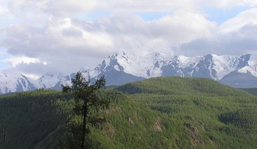
The temperate climatic zone is influenced by westerly winds and moderate air masses. The four seasons are clearly defined here. The amount of precipitation depends on the remoteness of territories from the ocean. So, most of all precipitation falls in the western part of Eurasia. They are brought by the westerly winds from Atlantic Ocean... The further to the east, the less precipitation, that is, the continentality of the climate increases. In the far east, under the influence of the ocean, the amount of precipitation increases again.
The Arctic and Antarctic climatic zones are areas of high pressure that are influenced by katabatic winds. The air temperature rarely rises above 0⁰С. The climatic conditions in both zones are very similar - it is always cold and dry here. There is less than 200 mm of precipitation in a whole year.
Areas where air masses change seasonally twice a year are classified as transitional climatic zones. The prefix "sub" appears in the names of the transition zones, which means "under", i.e. under the main belt. Transitional climatic zones are located between the main zones. There are only six of them: two subequatorial, two subtropical, subarctic and subantarctic.
So, the subarctic belt is located between the arctic and temperate, the subtropical - between the temperate and tropical, the subequatorial - between the tropical and equatorial belts... In transition zones, the weather is determined by air masses that come from neighboring main zones and change with seasons. So, for example, the climate of the subtropical zone in summer is similar to the climate of the tropical, and in winter - to the climate of the temperate zone. And the climate subequatorial belt in summer it has signs of equatorial, and in winter - tropical climate... In the subarctic zone, moderate air masses determine the weather in summer, and arctic ones in summer.
Thus, climatic zones are located zonally and this is due to the influence of solar radiation. Thus, the type of climate on Earth changes zonal. The type of climate is understood as a constant set of climatic indicators characteristic of a certain period of time and a certain territory. But the earth's surface is heterogeneous, therefore, different types of climate can form within climatic zones.
The boundaries of climatic zones do not always coincide with the direction of the parallels. And in some places they deviate significantly to the north or south. This is primarily due to the nature of the underlying surface. Therefore, within the same climatic zone, various types of climate can form. They differ from each other in the amount of precipitation, the seasonality of their distribution and the annual amplitudes of temperature fluctuations. For example, in the temperate zone of Eurasia, there are marine, continental and monsoon climates... Therefore, individual climatic zones are further subdivided into climatic regions.
Thus, 13 climatic zones are conditionally distinguished on Earth: 7 of them are basic and 6 are transitional. The determination of climatic zones is based on the air masses prevailing in the region throughout the year. Separate climatic zones (temperate, subtropical, tropical) are also divided into climatic regions. Climatic regions are formed under the influence of the underlying surface within the boundaries of one climatic zone.
Russia is a country that occupies a huge area. Many peoples and ethnic groups live on its territory. But, besides this, it is also subdivided into different climatic zones. Depending on this, different flora and fauna settle in different territories of the country. What are the climatic zones of Russia, what are the criteria for the division and what are the features of these zones - read about all this in the presented article.
Total number of climatic zones
Initially, you need to understand how many climatic zones exist in general. So, in nature there are four of them (counting from the equator line):
- Tropical.
- Subtropical.
- Moderate.
- Polar
Generally speaking, the division into climatic zones occurs in accordance with the average temperature of the surface warming up by the sun's rays. It should be noted that such zoning was based on long-term observations and conclusions drawn from analytical data.
About climatic zones of Russia
What are the climatic zones of Russia? The country's territory is very large, which allowed it to settle in three of them. So, if we talk about belts, then on the territory of Russia there are three of them - temperate, arctic and subarctic. However, the natural and climatic zones of Russia are subdivided according to meridians, of which there are 4 on the territory of the state, belonging to the 20th, 40th, 60th and 80th meridians. That is, there are four climatic zones, the fifth is called special.
Table of natural and climatic zones
There are 4 climatic zones in Russia. The table is presented for easier perception of information:
| Climatic zone | Territories | Peculiarities |
| 1st zone | South of the country (Astrakhan region., Krasnodar region, Stavropol Territory, Rostov Region, Republic of Dagestan, Ingushetia, etc.) | Warm regions of the country, winter temperature is in the region of -9.5 ° С, in summer it can rise to +30 ° С (the maximum recorded in the last century is +45.5 ° С) |
| 2nd zone | This is the Primorsky Territory, as well as the regions located in the west and north-west of the country. | The zone is very similar to the 1st one. Here, the average winter temperature is in the region of -10 ° С, summer temperatures are approximately +25 ... + 30 ° С. |
| 3rd zone | Areas of Siberia and the Far East that are not included in the 4th zone | Winter temperatures are much colder, on average reaching -20 ...- 18 ° С. In summer, temperature indicators fluctuate in the range of +16 ... + 20 ° С. Windiness is low, wind speed rarely exceeds 4 m / s |
| 4th zone | Northern Siberia, Far East, Yakutia | These areas are below the Arctic Circle. Winter temperatures are around -41 ° С, summer temperatures are close to 0 ° С. Windiness - no more than 1.5 m / s |
| Special zone | Here are located the territories that are beyond the Arctic Circle, as well as Chukotka | The winter temperature here is in the region of -25 ° С, the wind speed in winter can reach 6.5 m / s |
Considering the climatic zones of Russia, it should be noted that most of the country is located in the Arctic and subarctic belts... Also, quite a few territories occupy a moderate strip. There are not so many subtropics, it is less than 5% of the entire territory of Russia.
Arctic climate
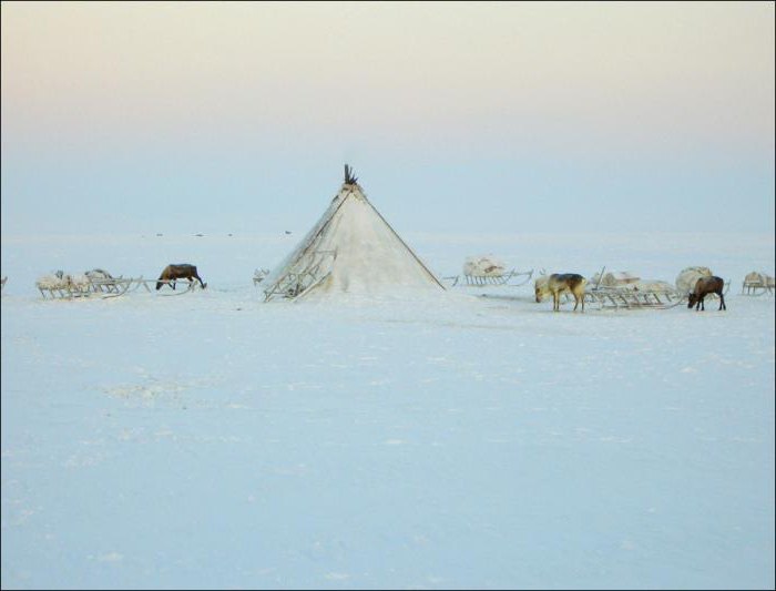
Consideration of the climatic zones of Russia should start with the Arctic climate. It is characteristic for a special, and also partially for the 4th zone. Mostly located here arctic deserts as well as the tundra. The soil hardly warms up, the sun's rays just glide over the surface, which makes it impossible for the flora to grow and develop. The fauna is also scarce, the reason for everything is lack of food. Winter takes most of the time, which is about 10 months. During the summer period, the soil does not have time to warm up, since the heat in the region of 0- + 3 ° С lasts no more than a couple of weeks. During the polar night, temperatures can drop to -60 ° C. There is practically no precipitation, it can only be in the form of snow.
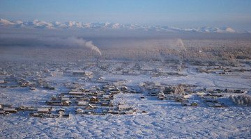
Subarctic climate
Widely distributed on the territory of Russia. So, it includes the 4th zone, as well as partially special and the third. Winter is also long and cold, but less severe. Summers are short, but the average temperature is 5 degrees higher. Arctic cyclones cause strong winds, cloudiness, precipitation occurs, but not strong.
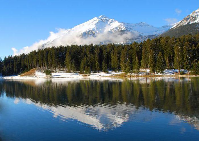
Temperate climate
The 3rd and 2nd climatic zones of Russia belong to the temperate climate. Covers most of the country's territory. The seasons are pronounced here, there are spring, summer, autumn and winter. Temperatures can range from +30 ° C in summer to -30 ° C in winter. For convenience, scientists subdivide this zone of Russia into 4 more:
- Moderate continental. Summer is hot, winter is cold. Natural areas can replace each other from steppes to taiga. Atlantic air masses predominate.
- Continental. The temperature ranges from -25 ° C in winter to +25 ° C in summer. Large amount of precipitation. The zone is mainly formed by western air masses.
- Sharply continental. Partly cloudy, little precipitation. In summer, the soil warms up well, in winter it freezes deeply.
- Maritime as well as monsoon climates. Are characteristic strong winds, which are called monsoons. The precipitation is heavy, there may be floods. Summer is not hot, the average air temperature is +15 ... + 20 ° С. Winters are very cold, the air temperature can drop to -40 ° C. In the coastal areas, winter and summer are smoother.

Subtropical climate
1 climatic zone of Russia partially covers a small territory of the country in the region Caucasus mountains... Summer is long here, but not hot. In winter, the temperature does not drop below 0 ° C. Due to the proximity of the mountains, there is quite a lot of precipitation, they are abundant.
Tropikov and equatorial zone on the territory of Russia is not.
Road climatic zones
Few people know, but there are also road-climatic zones in Russia. They are divided according to the peculiarities of the construction of highways for a certain territory (depending on temperatures, precipitation and other climatic indicators). In this section, you can find 5 zones.
| Zone | Peculiarity |
| 1 | These are cold tundras, a permafrost zone. The road goes as follows settlements: De-Kastri - Birobidzhan - Kansk - Nes - Monchegorsk |
| 2 | This zone is characterized by forests, where the soil is very abundantly moistened. Tomsk-Ustinov-Tula |
| 3 | Forest-steppe, soils are also very moist. Turan - Omsk - Kuibyshev - Belgorod - Chisinau |
| 4 | The soils are not so moisturized. The road passes through the cities of Volgograd - Buinaksk - Julfa |
| 5 | These are desert roads, arid soils, which are also characterized by increased salinity. |
The benefits of dividing into climatic zones
Why highlight the climatic zones of Russia? Table 1 and Table 2 indicate that there are many of them. All of this is there for convenience. So, this division is important for many areas of activity and knowledge. Most often, such zoning is important:
- For the tourism business, resort planning.
- When constructing buildings, roads (including railways), designing communications.
- When assessing the possibility of living in a given area of people.
- When planning mining, natural resources.
- When organizing agriculture, farming.
Well, generally speaking, knowledge of climatic zones helps many people to improve their lives in various parts of the country. This knowledge helps many to optimize and master a particular territory for living. For example, cold areas are expensive; in temperate climates, it is best to breed animals and grow useful vegetation.
Our country covers a large area, and it is not surprising that it is divided into different climatic zones. The conditions of living, construction and cultivation of crops depend on the characteristics of a particular climate. Read an overview of the characteristics of nitrile gloves.
The climatic zone is a fairly extensive part of the earth's surface, on the territory of which the climate is formed approximately the same, which spreads throughout the entire region. The planet Earth was conditionally divided into 4 zones:
- Polar;
- Moderate;
- Subtropical;
- Tropical.
Different climatic zones on the planet appear due to different temperatures of heating of its surface by the Sun. The division of the main zones is carried out according to the location of the meridians.
Different climatic zones have different effects on living conditions. Studying them will allow you to find out how to develop certain territories, how to build roads and buildings, how to develop agriculture and extract minerals. Most often the colder climates are the most expensive. On the other hand, there are many useful resources in such conditions. And in a warm climate, it is great to develop agriculture and tourism. The temperate climate is good for the majority of the population. Find out if you need goggles to work with your computer and how to choose them.
How many are there in Russia?
Russia has a huge territory, which is simultaneously located in three climatic zones:
- Moderate;
- Arctic;
- Subarctic.
The temperate climatic zone is subdivided into several more types of climate, which, having similar features of the weather and changes in the seasons, still differ in temperature and amount of precipitation.
table

The climatic zones of Russia correspond to four meridians - the twentieth, fortieth, sixtieth and eightieth, which are multiples of 20. Thus, on the territory of our country there are 4 climatic zones and a special zone:
- 1 zone - it includes regions and districts southern territory RF;
- Zone 2 - it includes regions and republics located in the west and north-west of Russia, as well as the Primorsky Territory;
- Zone 3 - refers to it Western part countries, Siberia and the Far East, with the exception of several northern regions, which are included in zone 4;
- Zone 4 - it includes the more northern regions of Siberia, the Far East and the Urals, as well as Yakutia. That is, those areas that are geographically below the Arctic Circle;
- A special zone - it includes areas that are located beyond the Arctic Circle, as well as north of the northern latitude of 60 degrees, this also includes Chukotka.
Map
The arctic climate includes tundra, steppes and arctic deserts. The surface of the earth does not warm up well, this is the main reason for such a harsh environment.
Such conditions do not allow especially the development of vegetation and animals. Cold air predominates in the Arctic climate throughout the year, and the situation is aggravated by long polar nights. In winter, the air temperature can drop to 60 degrees Celsius below zero, and the length of winter can last 10 months. In summer, the temperature does not rise above 5 degrees, and autumn and spring are completely absent. More warm winter on the islands in the Arctic Ocean, this is due to the fact that the ocean pours heat into the air. Precipitation is scarce, falls mainly in the form of snow.
In the subarctic climatic zone, winters are quite long, but less severe than in the Arctic, and summers are warmer, the temperature here in summer can rise to +12 degrees, but it does not last long. Precipitation is also small, strong winds and a lot of clouds often blow, all this is due to arctic cyclones.
The climate of the temperate zone is largest area Russia, in this regard, it was divided into 4 parts:
- Moderate continental;
- Continental;
- Sharp continental;
- Monsoon.
Characterize temperate climate 4 seasons, which are clearly separated, while the temperatures in winter and summer differ sharply.
Moderately continental climate The ice zone is characterized by hot summers, the temperature rises to 30 degrees, and in cold winters drops to 30. The amount of precipitation in this zone depends on the proximity of the location to the Atlantic.
The harsh continental climate is characterized by air temperate latitudes, there are few clouds and little precipitation, they fall mainly in the warm season. The earth warms up very well in the warm season, and freezes well in winter, all because of the small amount of clouds. That is why winters are very cold and summers are oppositely hot.
In a monsoon and maritime climate, due to an increase in atmospheric pressure, masses of cold and dry air are directed towards the ocean, where the air is much warmer, since the water cools down for a long time.
In summer, the earth warms up better than water, cold air masses return to the mainland. Hence the strong monsoon winds, from which it got its name and climate. In warm weather, precipitation falls quite abundantly, there are floods. Summers are cool, the temperature does not rise above 20 degrees, and winters are colder, with temperatures down to -40 degrees.
The subtropical climate zone is visible only in a few cities along the Black Sea. There are the Caucasus Mountains, which cover the sea coast from cold air masses. In the coldest time of the year, the temperature does not drop below 0 degrees Celsius, the summer is not particularly hot, this is typical for the subtropics, but at the same time it is protracted. Due to the proximity of the mountains, a lot of precipitation falls here, which are evenly distributed throughout the year.
Types
Different climates also affect the characteristics of the construction of buildings and structures. In colder climates, buildings need to be insulated, in warm climates, on the contrary - such hassle is not required. In more detail this issue is dealt with by construction climatologists, which identifies 4 main climatic regions in Russia for construction.
Video
Watch a video clip about a temperate climate:
Knowledge and constant study of the characteristics of climatic zones will improve life in different areas country.
On Earth, depending on the prevailing type of climate, such climatic zones are distinguished: two polar (Arctic and Antarctic), two temperate, two tropical, one equatorial and transitional - two subequatorial, two subtropical, two subpolar.
Equatorial belt applies to the basins of the Amazon and Congo rivers, the shores of the Gulf of Guinea, Sunda Islands... All year round the sun occupies high position, due to which the earth's surface is very hot. Average annual temperatures in this climatic zone range from 25 to 28 ° C. Moreover, this territory is characterized by high humidity (70-90%). Annual quantity precipitation is usually more than 2000 mm, and it is evenly distributed throughout the year. Due to the constant hot weather and high humidity, conditions are created for the development of lush vegetation - the equatorial jungle.
Subequatorial belts cover a huge territory, in particular Central Africa north and east of the Congo Basins, the Brazilian Highlands in South America, peninsula of Hindustan and Indochina, Northern Australia... A characteristic feature of the climate of this zone is the change in the types of air masses during the seasons of the year: in summer, the entire territory is covered by equatorial masses, in winter - by tropical masses. Accordingly, two seasons are distinguished: summer wet and winter tropical. Most of the belt is covered with woodlands and savannahs.
Tropical belt located on both sides of the tropics, on the sea and on land. Tropical air masses prevail here year-round. In the presence of high atmospheric pressure and slight cloudiness, it is characterized by high temperatures... The average monthly temperature of the hottest month is over 30 ° C. Very little precipitation falls here (less than 200 mm). It is in this belt that the most extensive deserts in the world are located - the Sahara, the desert of the Arabian Peninsula, the Western Australian.
Subtropical belt runs between 25 ° and 40 ° north and south latitude. The climate here is characterized by a change in the types of air masses according to the seasons of the year. So, in summer, tropical air dominates, in winter - air masses of temperate latitudes. This belt is subdivided into three more climatic regions: western, eastern and central. The summer of the western region is characterized by clear and dry weather, while the winter is warm and humid. This is the so-called Mediterranean climate. In the central and eastern regions, the climate is somewhat different.
Temperate zone spreads north and south of the subtropical and reaches the polar circles. V Southern hemisphere it is characterized by an oceanic type of climate, in the North it is divided into three climatic regions: western, central and eastern. V western region and the southern hemisphere is dominated by wet sea air. Annual amplitudes temperatures are small. The distribution of precipitation throughout the year is uniform. A decrease in temperature in winter is observed due to the movement of Arctic (Antarctic) air masses. The eastern region has a monsoon climate. In the central region, continental air masses of temperate latitudes accumulate, and there are sharp changes in temperature throughout the year. The transitional subarctic and subantarctic belts extend north of the temperate belts of the two hemispheres. They are characterized by a change in air masses in accordance with the change of seasons of the year. Summers are short and cold, winters are long, snowy, with frosts and blizzards. The Arctic and Antarctic belts lie in the polar regions. The climate here is formed at high atmospheric pressure by cold air masses. A characteristic feature of these belts are polar nights and days lasting up to six months. The ice sheet does not melt and covers Antarctica and Greenland.
Territory Russian Federation very extensive and occupies a huge land area of the earth's surface. It stretches for thousands of kilometers across Eurasia, is washed by the seas of three oceans, and contains a colossal number of rivers and lakes. The relief of the surface varies from steep mountains to lowlands lying below sea level.
Russia includes almost all climatic zones that exist on Earth - from the hot subtropical to the icy Arctic.
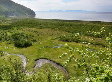
In the northwest of Russia reigns maritime climate... When moving to the center of the Russian Federation, it changes to a continental climate and further to a subtropical climate in the city of Sochi, next to the Black Sea. In Siberia, the climate is sharply continental, and in Far East monsoons reign. All this is the result of the significant length of the territory of the Russian Federation from east to west and from north to south.
What are climatic zones. Map of climatic zones of Russia

Climatic zone- This is a wide area of the earth's surface, within which an approximately homogeneous climate is created throughout the entire length of such an area. The land is divided into 4 conditional main zones: polar, temperate, subtropical and tropical. Basically, natural and climatic zoning arises due to different heating of the Earth's surface by its luminary - the Sun. The main division occurs along the meridians. Within Russia, the division into climatic zones basically coincides with the twentieth, fortieth, sixtieth and eightieth meridians - that is, multiples of 20.
To determine the temperature of the comfortable mode of operation of suits and jackets, tests were carried out in a specialized climatic chamber of the Scientific Research Institute of MT RAMS
| 1 ZONE | Astrakhan region Belgorod region Volgograd region Kaliningrad Region Republic of Kalmykia Rostov Region Stavropol Territory Republic of Adygea Republic of Dagestan Republic of Ingushetia Kabardino-Balkarian Republic Karachay-Cherkess Republic Republic of North Ossetia-Alania Chechen Republic Krasnodar Territory |
| 2 ZONE | Bryansk region Vladimir region Voronezh region Ivanovo region Kaluga region Kursk region Leningrad region Lipetsk region Republic of Mari El Republic of Mordovia Moscow Region Nizhny Novgorod Region Novgorod Region Oryol Region Penza Region Primorsky Territory Pskov Region Ryazan Region Samara Region Saratov region Smolensk region Tambov region Tver region Tula region Ulyanovsk Region Chuvash Republic Yaroslavl Region |
| 3 ZONE | Altai Republic Amurskaya Oblast Republic of Bashkortostan Republic of Buryatia Vologda Region Irkutsk Region (except for the areas listed below) Republic of Karelia Kemerovo Region Kirov Region Kostroma Region Krasnoyarsk Region (except for the areas listed below) Kurgan region Novosibirsk region Omsk Region Orenburg Region Perm Region Sakhalin Region(except for the regions listed below) Sverdlovsk region Republic of Tatarstan Tomsk region (except for the regions listed below) Republic of Tyva Tyumen region (except for the regions listed below) Udmurt Republic Khabarovsk region(except for areas listed below) Chelyabinsk region Chita Region Republic of Khakassia Trans-Baikal Territory |
| 4 ZONE | Arkhangelsk region (except for areas located beyond the Arctic Circle) Irkutsk Region (areas: Bodaibinsky, Katangsky, Kirensky, Mamsko-Chuisky) Kamchatka Region Republic of Karelia (north of 63 ° north latitude) Komi Republic (areas located south of the Arctic Circle) Krasnoyarsk Territory (territories of the Even Autonomous Okrug and Turukhansky District located south of the Arctic Circle) Kurile Islands Magadan Region (except for the Chukotka Autonomous Okrug and the regions listed below) Murmansk Region The Republic of Sakha (Yakutia) (except for the Oymyakon Region and regions located north of the Arctic Circle) Sakhalin Region (regions: Nogliksky, Okhinsky) Tomsk Region (regions: Bakcharsky, Verkhneketsky, Krivosheinsky, Molchanovsky, Parabelsky, Chainsky and the territories of Aleksandrovsky and Kargasoksky districts located south of 60 ° north latitude) Tyumen region (areas of the Khanty-Mansiysk and Yamalo-Nenets autonomous circles, except for areas located north of 60 ° north latitude) Khabarovsk Territory (areas: Ayano-Maisky, Nikolaevsky, Okhotsky, named after Polina Osipenko, Tuguro-Chumikansky, Ulchsky) |
| SPECIAL ZONE | Magadan Region (districts: Omsukchansky, Olsky, Severo-Evensky, Srednekansky, Susumansky, Tenkinsky, Khasynsky, Yagodninsky) Republic of Sakha (Yakutia) (Oymyakonsky district) Territory located north of the Arctic Circle (except Murmansk region) Tomsk Region (territories of Aleksandrovsky and Kargasoksky districts located north of 60 ° north latitude) Tyumen Region (areas of the Khanty-Mansiysk and Yamalo-Nenets Autonomous Districts located north of 60 ° north latitude) Chukotka Autonomous Okrug Nenets Autonomous Okrug |
The entire north of Russia and the islands of the Arctic Ocean are located in the arctic and subarctic belts; the middle zone of the Russian Federation has a temperate climatic zone. The south is located in the subtropics, but it is very insignificant - even 5% of the territory of the Russian Federation is not included in this zone.
 The coldest point on the territory of the Russian Federation is the "Pole of Cold" located not far from the city of Verkhoyansk (pictured). The thermometer can drop to -62 degrees Celsius. While Sochi, being in subtropical zone, boasts temperatures as high as +38 Celsius in July. But this is not a record - the absolute maximum in Russia was recorded at + 45.4 ° С, at the Utta, Kalmykia meteorological station.
In the European part of the Russian Federation, the climate is more moderate. In Moscow in January the average temperature is in the range between –9 ° С and –16 ° С, and in July from +13 ° С to +23 ° С.
Arctic climate of Russia
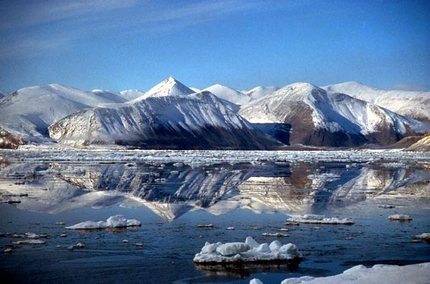 The tundra and arctic deserts are located here. The conditions are so harsh because the soil hardly warms up - the sun's rays only glide here over the planet's surface, not transferring enough heat. Animal and plant worlds in arctic climates are scarce due to lack of food. Polar nights exacerbate the negative effects of the harsh climate, and temperatures can drop down to minus 60 degrees Celsius in winter. The duration of winter is about 10 months, and in summer the earth does not have enough time to get enough heat, because summer in such a climate lasts no more than 2 weeks, with temperatures up to +5.
In the Arctic Ocean, the temperature in winter is slightly higher, which is explained by the heat transfer from the water masses to the air.
 You may also be interested in learning about the choice of insulation for work in ultra-cold weather conditions. You can read more about this in our material about.
What is holofiber and how is it better than traditional insulation, like padding polyester -.
Subarctic belt
Winters in a subarctic climate are cold and long, but less severe than in the Arctic zone. Summer is only 5-7 degrees warmer, but also short. Precipitation occurs more frequently, but it is less abundant than in the arctic climate. Arctic cyclones often pass here.
![]()
The climate of the temperate zone of Russia
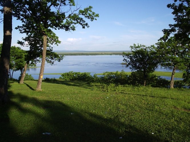 Temperate zone the largest in area, length and population in the Russian Federation. The seasons are clearly expressed: autumn, winter, spring and summer.
The temperate zone is subdivided into 5 regions due to the tangible differences in climate between them:
- The Sea of Okhotsk with Magadan is located in the maritime climate;
- Half of the Amur River, which flows into the Sea of Okhotsk and the city of Vladivostok, are in the monsoon climate;
- Yakutsk, Chita and Lake Baikal are included in the region of a sharply continental climate;
- Krasnoyarsk and Tobolsk are located in the area of continental climate;
- St. Petersburg, Moscow and Astrakhan are located in the region of the temperate continental climate.
Moderate continental climatic zone of the Russian Federation
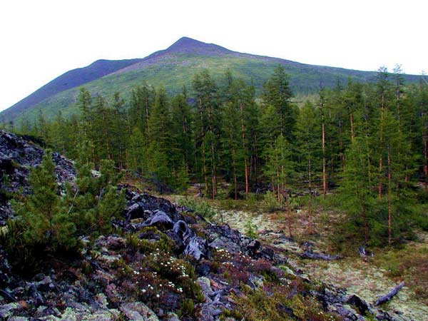
There are hot summers (up to + 30 ° С) and frosty winters (up to –30 ° С). The spread in temperature per year is up to 60 degrees. The climate is influenced by the Atlantic air masses. Due to the different humidification of the soil and air, natural zones vary from taiga to steppe.
Continental climatic zone of Russia
 It is formed under the influence of air masses coming from the west. At the same time, air masses moving in the opposite direction from the north and south meet and this results in three times more precipitation than in the south. average temperature in July it reaches + 26 ° С, in January - up to –25 ° С. Natural zones of this climate are widely diversified along the way of their entire length, from frozen taiga to steppes with emerald grass.
Sharply continental climate
The air of temperate latitudes prevails here. Specific traits this climate - little cloudiness and insignificant amount atmospheric precipitation. Earth surface heats up quickly in summer and cools down in winter, which gives hot summers and frosty winters. In winter, the soil freezes strongly.
Monsoon and maritime climates
 In winter, atmospheric pressure increases, so cold and dry air masses rush to the ocean, where the air is warmer (after all, water cools more slowly). Upon the arrival of summer, the mainland warms up better than water bodies (they need more time for this), and cold air rises to the continent. Therefore, strong winds arise, which are called monsoons, which gave the name to the climate.
Sometimes there are typhoons here. Summer precipitation is frequent and abundant. Floods are frequent. Summers are cool here (15-20 ° С in July), and winters are cold, down to –40 ° С (average 25 ° С). Near the sea itself, the climate is smoother, both in summer and in winter.
Subtropical climatic zone of the Russian Federation
There are almost no subtropics in Russia - just a couple of notable cities nestling on a narrow strip of the Black Sea coast from the Caucasus Mountains. They close the coast warm sea from the masses of cold air that move from the East European Plain. In the coldest month, the temperature does not drop below zero degrees. Summers are not hot, as for a subtropical climate, but long. There is a lot of precipitation due to the proximity of the mountains, but with an even distribution throughout the year.
There are no other climatic zones (equatorial, tropical) in Russia.
Road and climatic zoning of Russia
A road-climatic zone is a part of the country's territory, which is characterized by homogeneous features of the construction of roads, approximately the same climatic conditions, average homogeneity of the water surface and approximately similar indicators of soil freezing and the depth of groundwater.
Brief description of the road and climatic zones
| Road climatic zones | Approximate boundaries and a brief description of each of the road-climatic zones |
| 1 | Cold tundra covered with forest and permafrost are located north of the line of the designated cities: De-Kastri - Birobidzhan - state border - Kansk - Tunguska - Sukhaya - Oshkurya - Nes - Ponoy - Monchegorsk. |
| 2 | Forests with constantly abundantly moist soils are located from line 1 to the border of line 2: state border - Kansk - Tomsk - Kyshtym - Ustinov - Gorky - Tula. |
| 3 | Further, there is a forest-steppe with periodically abundantly moist soils: Turan - Biysk - Omsk - Magnitogorsk - Kuibyshev - Belgorod - Kirovograd - Chisinau. |
| 4 | In zone 4, you can no longer find abundantly moistened soils. The line Volgograd - Kizlyar - Buinaksk - Stepanakert - Julfa. |
| 5 | The last, fifth zone is located southwest of zone 4. It includes desert areas with arid climate and very salty soils. |
Why do we need climate zones?
Climatic zones- this is the conditional division of the space of a country or planet into regions with different climates, which affects the variety of living conditions. Climatic zones are studied by mankind in order to understand the optimal conditions for the development of a particular territory. As a rule, living in cold zones requires more costs, but they contain more natural resources - mineral resources and fossil fuels. Hot areas are good for farming, farming, and recreation. Temperate zones suitable for the life of the majority of the population.
Where knowledge about climatic zones is applied
Knowledge about climatic zones are used for a wide range of needs:
- When constructing buildings, structures. Each construction project must take into account the characteristics of the area. For buildings, this is the thickness and material of the walls, the presence or absence of waterproofing of the foundation, the density and variety of roof materials, the need for deep burial of communications, etc.
- When designing engineering communications- the use of the material, the need additional protection from cold or heat, the need to use special construction materials.
- When building roads- the thickness of the coating, the need for additional strengthening or elevation of the soil, the possibility of laying above-ground or only underground communications and their protection.
- When planning the extraction of natural resources- what design of wells, factories and communications should be used.
- When assessing the possibility of human habitation- it is recommended or not for people to live in specific conditions, an assessment of their living and working conditions, which determines the complexity of the construction of cities and the amount of payment to employees for the presence or absence of extreme conditions.
- When laying railways- pile frequency, number of fastenings, construction budget.
- In agriculture, fish farming and plant growing- which species can live in such a climate and which cannot; the profitability of such an enterprise as a whole.
- When planning resorts, becoming attached not only to the climate, but also to the peculiarities of a particular place. This is how ski and balneological resorts, popular beaches and salt health caves can appear.