It refers to exogenous (external) forces that affect. Weathering is of different types:
A variety of physical weathering is frosty weathering, which is also characteristic of subarctic climatic zones. Here, water freezes not only in cracks, but also in capillaries, tearing the rock to a loose state.
chemical weathering. This is the destruction of rocks when they interact with chemically active elements (oxygen, carbon dioxide, organic acids). This type of weathering is especially noticeable in rocks containing iron - they are covered with a brown crust. Main areas the globe where a similar process occurs are tropical latitudes. Here, rocks are destroyed by rainwater with chemically active elements dissolved in it.
This type of weathering is characterized by the accumulation in lakes and: bauxites, phosphorites, cobalt, sedimentary iron.
organic weathering. It proceeds under the action of living organisms, which crush rocks with plant roots and acid during the decomposition of plant and animal remains. Animals, making moves and holes in, loosen it. Some marine mollusks drill holes for themselves in solid coastal rocks. Mosses and lichens secrete acids that dissolve rocks. The main result of organic weathering is the formation of soils.
The rock mass, which has undergone destruction, forms a weathering crust - a loose layer that is created in the zone of water seepage. In hot weather and where conditions are most favorable for its formation, the weathering crust reaches 100–200 m or more, although its thickness is usually 30–60 m. Depending on the weathering crust, not only the thickness of the weathering crust is different, but also its composition.
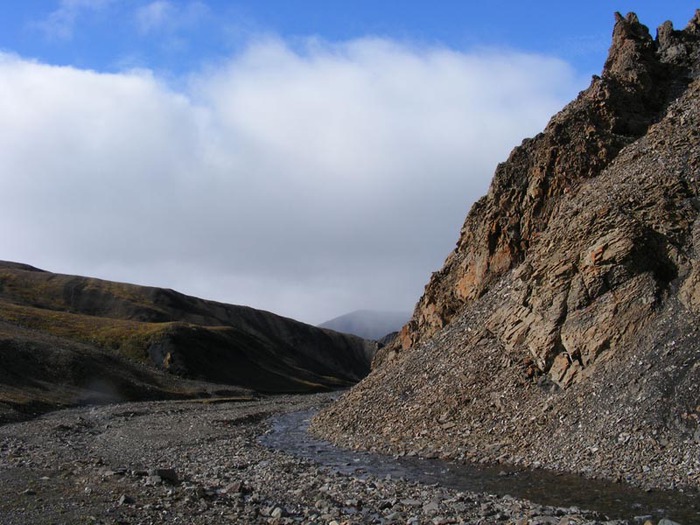
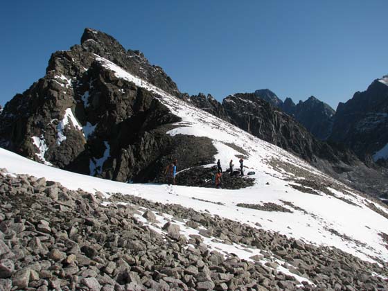
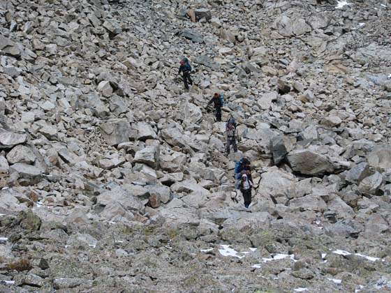
Invisible, inconspicuous forces of weathering, working day after day, destroy the rocks, near which large and small fragments from boulders to sand accumulate. They roll, slide, slide down the slope, forming scree. They usually have the shape of a cone leaning against a slope. Gradually, the talus grows in width and height, joins with neighboring ones, forming a trail of taluses. Mountains seem to "sink" in piles of debris. Screes form more often in spring, when snow melts, or in quiet frosty weather.
Weathering- a set of processes of physical and chemical destruction of rocks and their constituent minerals at their place of occurrence: under the influence of temperature fluctuations, freezing cycles and chemical effects of water, atmospheric gases and organisms.
Weathering occurs due to the combined effect on the upper shell of the lithosphere of weathering agents (factors) from the hydrosphere, atmosphere and biosphere. As a result, weathering crust and weathering products are formed. Weathering can penetrate to a depth of 500 meters.
"Mountain of death" near the park "Cornish" in Serovo in St. Petersburg
weathering types
There are several types of weathering that can prevail to varying degrees:
Physical or mechanical (friction, ice, water and wind);
Chemical;
Biological (organic);
Radiation (ionizing).
Physical
The greater the temperature difference during the day, the faster the weathering process. The next step in mechanical weathering is the entry of water into the cracks, which, when frozen, increases in volume by 1/10 of its volume, which contributes to even greater weathering of the rock.
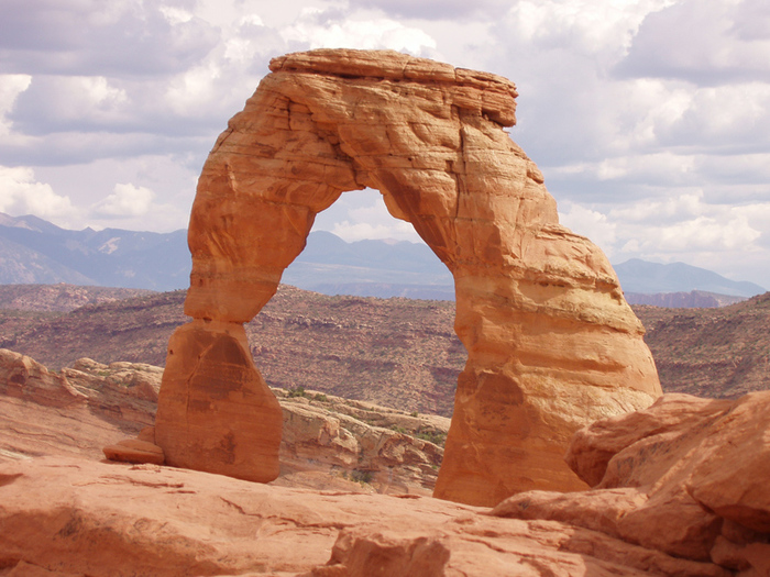
"Arch" in Utah (USA), an example of mechanical weathering
If blocks of rocks fall, for example, into a river, then they are slowly worn down and crushed under the influence of the current. Mudflows, wind, gravity, earthquakes, volcanic eruptions also contribute to the physical weathering of rocks. Mechanical grinding of rocks leads to the passage and retention of water and air by the rock, as well as a significant increase in surface area, which creates favorable conditions for chemical weathering. As a result of cataclysms, rocks can crumble from the surface, forming plutonic rocks. All the pressure on them is exerted by side rocks, due to which the plutonic rocks begin to expand, which leads to the scattering of the upper layer of rocks.
Chemical
Chemical weathering is a combination of various chemical processes, as a result of which there is a further destruction of rocks and a qualitative change in their chemical composition with the formation of new minerals and compounds.
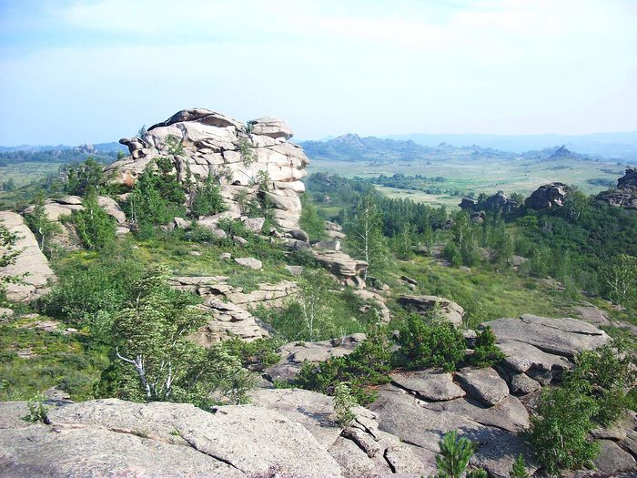
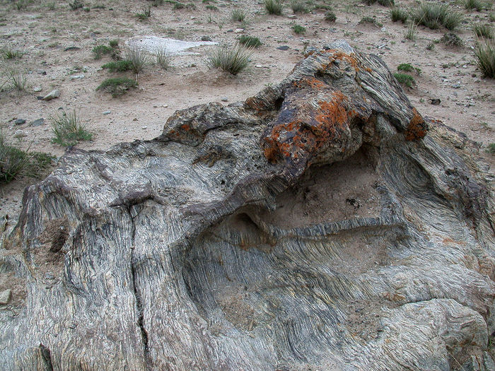
Rocks near Kolyvan lake, Altai Territory
The most important factors chemical weathering are water, carbon dioxide and oxygen. Water is an energetic solvent of rocks and minerals. The main chemical reaction of water with minerals of igneous rocks is hydrolysis, which leads to the replacement of cations of alkaline and alkaline earth elements of the crystal lattice with hydrogen ions of dissociated water molecules.
The resulting base (KOH) creates an alkaline environment in the solution, in which further destruction of the orthoclase crystal lattice occurs. In the presence of carbon dioxide, KOH changes to the carbonate form.
The interaction of water with minerals of rocks also leads to hydration - the addition of water particles to mineral particles.
In the chemical weathering zone, the oxidation reaction is also widespread, to which many minerals containing oxidizable metals undergo. A striking example of oxidative reactions during chemical weathering is the interaction of molecular oxygen with sulfides in aquatic environment. Thus, during the oxidation of pyrite, along with sulfates and hydrates of iron oxides, sulfuric acid is formed, which is involved in the creation of new minerals.
biological
Biological weathering is produced by living organisms (bacteria, fungi, viruses, burrowing animals, lower and higher plants). In the course of their life, they act on rocks mechanically (destruction and crushing of rocks by growing plant roots, when walking, digging holes by animals). Microorganisms play a particularly important role in biological weathering.
radiation
Radiation weathering is the destruction of rocks under the influence of radiation, or solar radiation. Radiation weathering affects the processes of chemical, biological and physical weathering. A typical example of a rock subject to radiative weathering is regolith on the moon.

regolith(from ancient Greek ῥῆγος - blanket and other Greek λίθος - stone) - residual soil, which is the product of rock weathering in place.
At present, this term is most often used to refer to the surface layer of loose lunar soil.
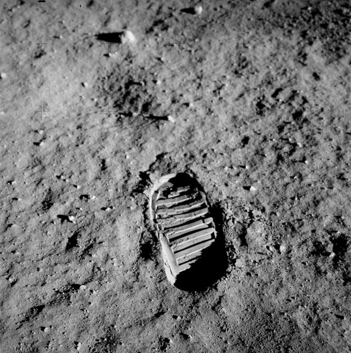
Footprint of B. Aldrin's boot on regolith (Apollo 11)

Lunar soil delivered by the crew of Apollo 11 (a gift from the USSR from the USA), Museum of Cosmonautics
Term regolith first applied by the American geologist H.P. Merrill in 1897. He gave it this definition:
Regolith - all surface loose formations representing the upper layers of the earth's surface: humus soils, alluvium, weathering products of rocks, what are laterite, eolian deposits, slope talus, glacial deposits, etc.
Modern term regolith most often applied to lunar soil, as:
Unconsolidated product of crushing and redeposition of lunar rocks, covering the surface of the Moon with a continuous cover. Regolith consists of fragments of lunar rocks and minerals ranging in size from dust particles to several meters in diameter, glasses, lithified breccias, meteorite fragments, etc.
The term is also applicable to materials that cover the surfaces of other small atmosphereless planets and satellites (for example, Mercury, Deimos), as well as asteroids. Regolith arises as a result of crushing, mixing and sintering of lunar rocks during the fall of meteorites and micrometeorites in vacuum conditions and in no way attenuated cosmic radiation.
By radioisotopes, it was found that some fragments on the surface of the regolith were in the same place for tens and hundreds of millions of years.
Composition of the lunar regolith
Unstratified, loose, inequigranular detrital-dust layer, reaching a thickness of several tens of meters. It consists of fragments of igneous rocks, minerals, glass, meteorites and breccias of shock-explosive origin, cemented by glass.
According to the granulometric composition, it belongs to silty sands (the main mass of particles has a size of 0.03–1 mm). The color is dark gray to black with inclusions of large particles that have a mirror finish. Soil particles have high adhesion due to the absence of an oxide film on their surface and high electrification. In addition, lunar dust easily rises from impacts and adheres well to the surface of solid bodies, which caused a lot of inconvenience to the members of the Apollo expeditions. According to Armstrong, Aldrin and Professor W. F. Scott in earth's atmosphere regolith has a characteristic smell of burning and shot caps.
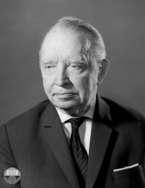
Alexander Pavlovich Vinogradov(August 9 (21), 1895 - November 16, 1975) - Soviet geochemist, organizer and director of the Institute of Geochemistry and Analytical Chemistry (GEOKHI) of the USSR Academy of Sciences, founder and head of the first domestic department of geochemistry (at Moscow State University), vice president, academician of the USSR Academy of Sciences. Foreign member of the Bulgarian Academy of Sciences (1974).
A.P. Vinogradov distinguishes two types of particles in regolith: angular, similar to freshly crushed rock, and predominantly rounded particles with traces of melting and sintering. Many of them are vitrified and look like glass and metal drops. According to the mineral composition of the regolith, it has been established that the lunar seas are composed mainly of basalts, while anorthosites and their varieties predominate among the rocks of the continents. Both types of regolith are characterized by the presence of metallic iron particles.
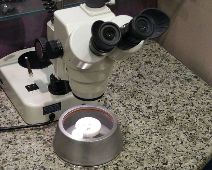
Samples of lunar regolith (N. I. Grodekov Khabarovsk Regional Museum)
Delivery of regolith from the Moon
The first instrumental determination of the density and strength of the surface layer of regolith was carried out by the Soviet automatic station "Luna-13" on December 24-31, 1966.
For the first time, lunar soil was delivered to Earth by the crew of the Apollo 11 spacecraft in July 1969 in the amount of 21.7 kg. During the lunar missions under the Apollo program, a total of 382 kg of lunar soil was delivered to Earth.
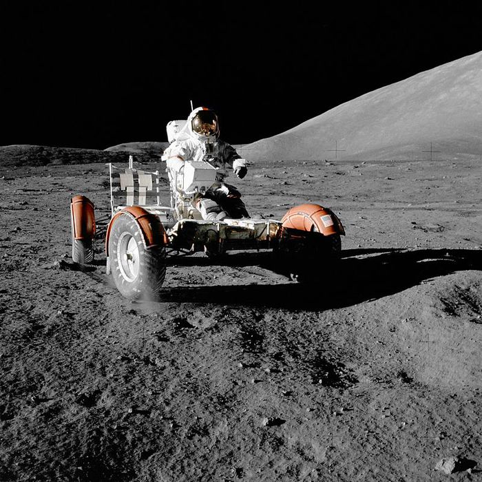
Regolith under the wheels of the Lunar Car
The Luna-16 automatic station delivered 101 g of soil on September 24, 1970 (already after the Apollo 11 and Apollo 12 expeditions).
"Luna-16", "Luna-20" and "Luna-24" delivered soil from three regions of the Moon: the Sea of Plenty, the continental area near the Ameghino crater and the Sea of Crisis in the amount of 324, and it was transferred to the GEOKHI RAS for research and storage.
China's lunar program plans to deliver up to 2 kg of regolith by the Chang'e-5 spacecraft in 2017.
weathering products
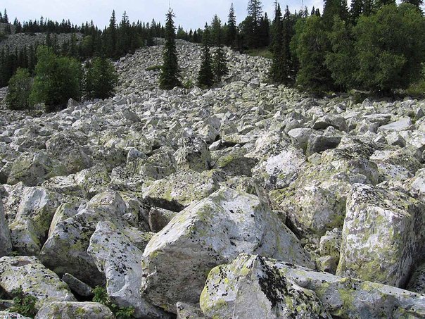
Weathering products in a number of areas of the Earth on the day surface are kurums. Weathering products under certain conditions are crushed stone, gruss, "slate" fragments, sandy and clay fractions, including kaolin, loess, individual rock fragments of various shapes and sizes, depending on the petrographic composition, time and weathering conditions.
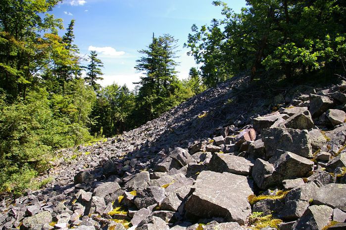
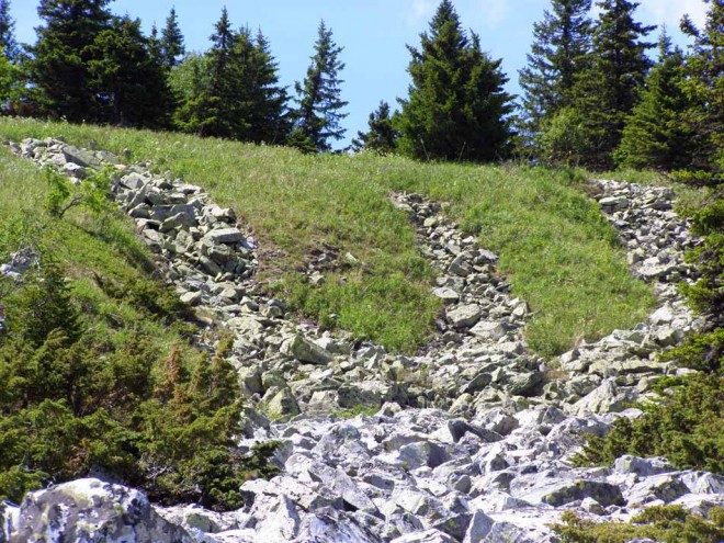
Kurumy
Kurums (ancient Turkic gorum - "rocky placers", "heaps of sharp stones", "fragments of rocks") - a term used by physical geography, geology and geomorphology; has two meanings:
Local, limited in three-dimensional space, accumulations of stone acute-angled boulders, formed naturally, having the appearance of a closed undivided cover on the daytime surface of the earth;
View of the earth's surface of a complex structure, - kurumland,- which is a closed group of large boulders with sharp broken edges, located on an undivided underlying surface of various inclinations and having the ability to move. It has its own microclimate, hydrology, flora and fauna.
The leading scientific center for the study of kurums in Russian Federation is Moscow State University named after M.V. Lomonosov.
Vitosha (Bulgarian Vitosha) is a mountain range in Bulgaria
![]()
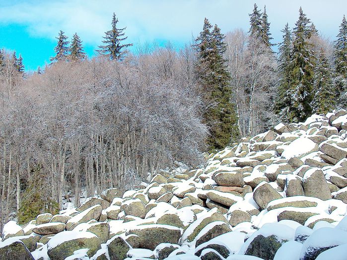
Vitosh
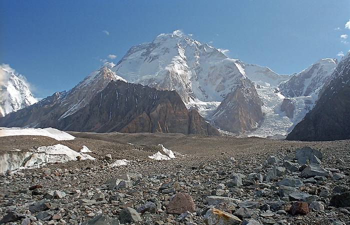
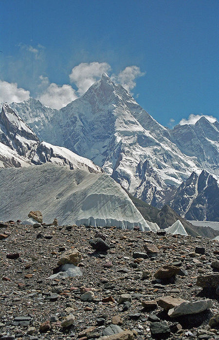
The term is widely used in many areas of Asia. firmly established in the global geographical literature and cartography in the name of the mountain system Karakoram or Karakurum, which means from the ancient Turkic "black stone, black rock."
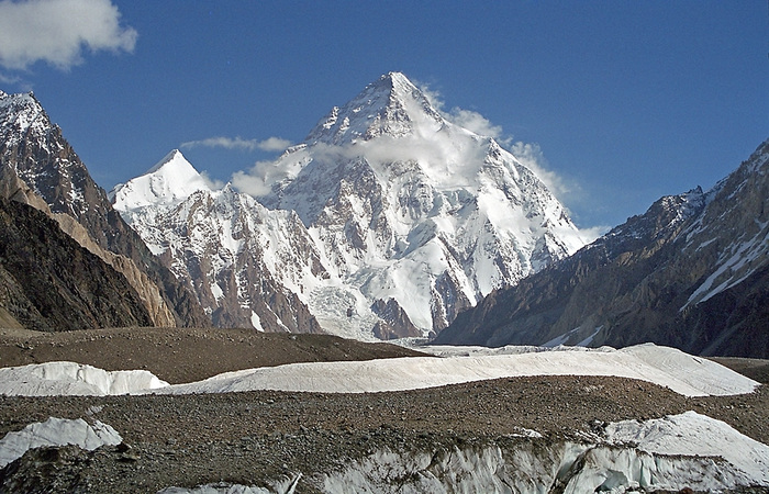
K2 (Baltoro Muztagh, Central Karakoram, Pakistan)
In scientific circulation in Russian, the term kurum to designate vast coarse-clastic stone placers was introduced by the Russian geologist Ya. A. Makerov in his monograph Upland Terraces of Siberia and Their Origin (1913). The term is firmly established in a number of other languages. However, in the Russian scientific literature, a large number of synonyms for the word “kurum” are used - “scree”, “stone placer”, “stone plume”, “detrital accumulations”, “blocky placer”, “kurum field”, “stone river”, “ stone sea", "stone glacier", "moving stream of rubble", "kurumnik", "collapses of stone blocks". The Russian researcher A.F. Glazovsky cites information that in a number of mountainous regions of Altai and Sayan this natural phenomenon is called "uronics".
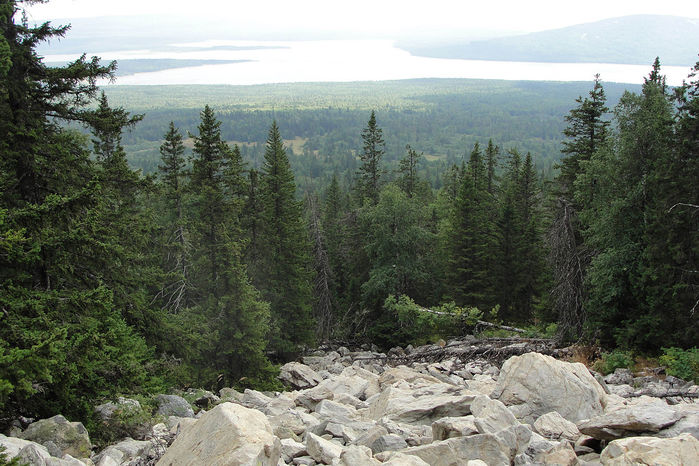
Kurumnik in the Urals
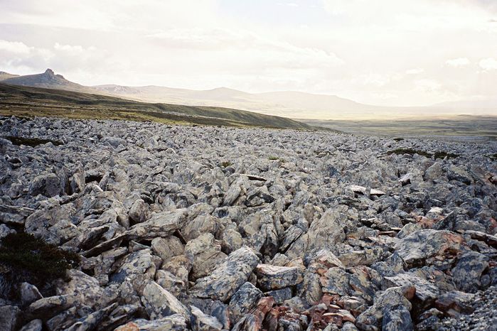
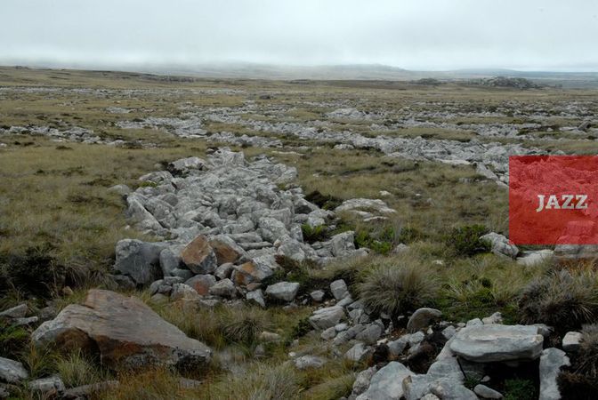
Stone River in the Falkland Islands
Distinctive features of kurum: these are usually large blocks - the statistical dimensions have not yet been determined, but usually from a few cm in small diameter to 1-2 m, having the appearance of freshly broken, but never rounded, in motion when colliding with each other and rubbing against the underlying surface can acquire a very slight roundness, merge with each other, forming groups ranging from several blocks to tens of thousands or more. Kurum can occupy an area from a few m² in projection onto the underlying surface to colossal “fields” or “ stone seas". In some regions of the Earth, kurums completely cover the entire area with a stone cover, forming a kind of so-called "day surface" that is unlike anything else.
Kurums must be distinguished from crushed stone and gruss placers, which are composed of fine detrital material - crushed stone and gruss.
Kurums are formed where solid rocks come to the surface. Most often these are mountainous regions or plateaus of all continents. Kurums are usually formed during the destruction of various types of limestones, crystalline schists, granites, gneisses, basalts, dolerites, sandstones, quartzites, amphibolites, diabases, porphyrites, vitroclastic tuffs.
One of the first to point out the genesis or origin of the kurums was the Russian military geographer of Belarusian origin N. M. Przhevalsky; he believed that kurums are formed as a result of the destruction of rocky rocks due to uneven heating and cooling where the amplitude of day and night temperatures is large. It is also obvious that kurum formation is more intense in spring and autumn for the same reasons. It is possible that cracking of rocks can occur when cold rain pours down on the heated surface of the rocks.
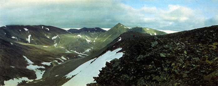
There are several natural areas formations of kurums, all of which have a severe nival climate: the Arctic, Antarctica and the polar and subpolar regions adjacent to them, the subnival and nival or "cold" belt of mountains, zones of winter anticyclones. So, in the zone of the winter Siberian anticyclone, usually from mid-autumn all winter and part of spring there is clear sunny weather with the lowest surface air temperatures in the Northern Hemisphere of the Earth. This is an area of wide distribution of kurums, which indicates frosty weathering of rocks protruding onto the day surface.
The distribution of kurums over the surface of the Earth is extremely uneven. There are areas where kurums are the predominant type of the earth's surface, in other places they are only "spots" in the relief, somewhere kurums are not found at all, and this is the mystery of modern geomorphology. The origin or genesis of kurums, and hence the geography of their distribution, is obviously the result of a large number of different factors: lithology, climate, slope exposure, absolute altitude terrain and others. So in the Tien Shan and Gissar-Alai, kurums are not the predominant type of surface; in the Vitim River basin, kurums occupy extremely large areas.
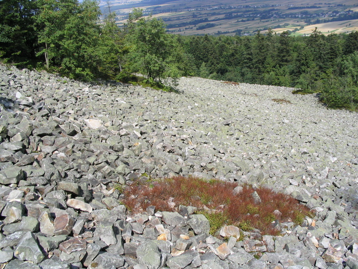
Swietokrzyskie mountains, Poland
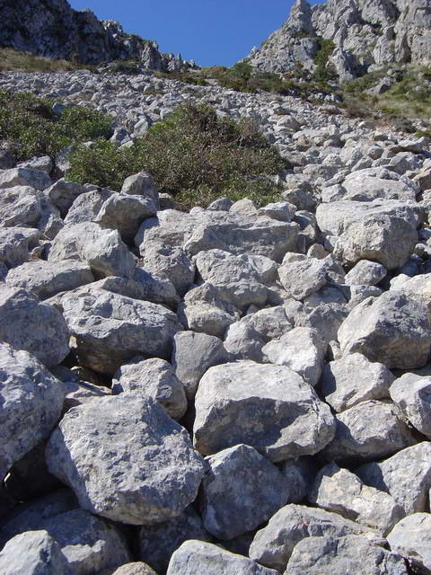
Mallorca
The question of the origin or genesis of kurums is the subject of scientific discussions, and the opinions of researchers differ. According to existing data, kurums can generally be classified into three groups:
Relic kurums left in the relief from past eras;
- "young" kurums formed in the era of the last continental glaciations;
Kurums currently being formed.
Initially undivided "parent" rocks serve as the initial material for the formation of stone units or blocks. The place where kurums form is sometimes referred to as the "nourishing area" of the kurum. Over time, kurum can grow, increasing in size, move along the underlying surface and occupy an ever larger area. The advancing leading edge of the moving mass of closed large-clastic blocks is called the “kurum front”, its lateral margins are called “flanks”, and the area where the kurum originates and from where it began its movement is called the “kurum rear”. There are usually no kurums on the flat tops of the mountains, but their slopes are often abundantly covered with a continuous layer of large stone fragments.
A number of observations show that kurums, buried earlier in the thickness of loose deposits, may reappear on the day surface for various reasons.
Kurums can supply detrital stone material for moraines of various genesis, mudflows, slope screes, form rapids in rivers and streams, or generally block their channels. The presence of kurums, their ability to move must be taken into account in the construction of various structures. Therefore, kurums and their properties are studied by engineering geology and geomorphology.
IN general view the process of formation of kurums and the movement of stone masses of kurums down the slope leads to a leveling of the relief and a decrease in its absolute height. Kurums are a product of the destruction of "parent" rocks, which is a process of destruction of rock masses and leads to denudation of the relief.
Inattentive researchers sometimes confuse kurums with moraines of various origins, wasps, stopped mudflows, talus and other forms of detrital and other covers composed of stone fragments. Sometimes kurums form long ribbons on the slopes of mountains, when the width of such a “stream” is less than its length, and then such formations are called “stone rivers”. The depth or thickness of the cover, consisting of blocks, is different, but not too great. Crushed stone, gruss and other small fragments are usually destroyed, washed down by water down the slope, exposing the voids between the blocks. For small animals, kurums provide shelter from larger predators. It is extremely difficult for large animals, horses and humans to move along the surface of the kurum, and sometimes it is simply impossible.
Observations and experiments show that many kurums move, usually down the slopes of mountains. Sometimes this is a slow movement, sometimes it is catastrophically fast, as, for example, during an earthquake. Cases of movements of kurums with a terrible roar in winter in the mountains of the north are described. Eastern Siberia. In their movement, kurums can cut off the soil cover, destroy vegetation, change the living conditions of animals, the hydrological regime and atmospheric processes in the surface layer.
An immovable kurum is called "dead" or "sleeping". An immovable kurum tends to be covered with various types of vegetation and inhabited by certain types of animals, which the kurum provides the opportunity to arrange burrows and shelters, as well as naturally protected communication passages.
Kurum has its own microclimate, which is determined by its morphometry, location, and the flora and fauna inhabiting it. According to the Russian geomorphologist Yu. G. Simonov, in Eastern Siberia, the depth of penetration of daily temperatures into the “body” of kurum averages 0.4 m.
Sometimes kurums are completely covered with mosses and other vegetation, which completely masks them. By virtue of their architectonics, kurums have their own very specific properties: thus, ice and firn can be preserved all year round in the “body” of kurum; it is obvious that the sun's rays do not penetrate inside the "thick" kurum, it is not blown inside by warm winds and is a cold accumulator. Sometimes kurums "armor" the underlying rocks and "spots" form under the kurums in a nival climate. permafrost. From the melting of snow and firn in the "body" of the kurum, temporary, and sometimes permanent ones are formed, changing only the volume of runoff depending on the time of day and year, water flows that are invisible from the surface, but clearly audible. Merging, such streams down the slopes of the mountains come to the surface and form real streams and even rivers that form their own channels. Kurums also in some regions have the ability to accumulate atmospheric moisture in their “body” and, to the surprise of travelers, one can find pools of water and streams even near the tops of mountains. Hydrogeologists have not yet been able to reliably take into account the water balance, taking into account the "kurum" waters. In Buryatia and the Chita region, according to the Russian hydrogeologist N. A. Velmina, up to 20% of groundwater is formed due to the condensation of atmospheric moisture in kurums. This feature of the covers, composed of clastic rocks, has been used by the civilizations of Asia since ancient times. So, in some areas, creating an artificial cover of rock fragments around trees, a person completely satisfied the plant with the necessary moisture and watering was not required! This agricultural technique was widely used by the inhabitants of the Crimea. There is also an amazing way to "create" artificial streams in desert areas, namely: an extended trough is made on an inclined rocky or clay surface and, then, along its entire length, stone pyramids are laid; atmospheric moisture passes from gaseous to liquid state on the surface of the stone, flows down and forms a real stream of fresh water.
Kurums, without using the real term, were described by many geographers and travelers of all times and peoples. One of the first kurums on the slope of the Munku-Sardyk mountain range in the Eastern Sayan mountains was marked on his map by the Russian geologist and geographer S.P. Peretolchin in his monograph “Glaciers of the Munku-Sardyk Range”.Since the 20th century in Russian topographic maps and other engineering and geological documentation, kurums are indicated by a special symbol.
Regions of wide distribution
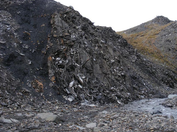
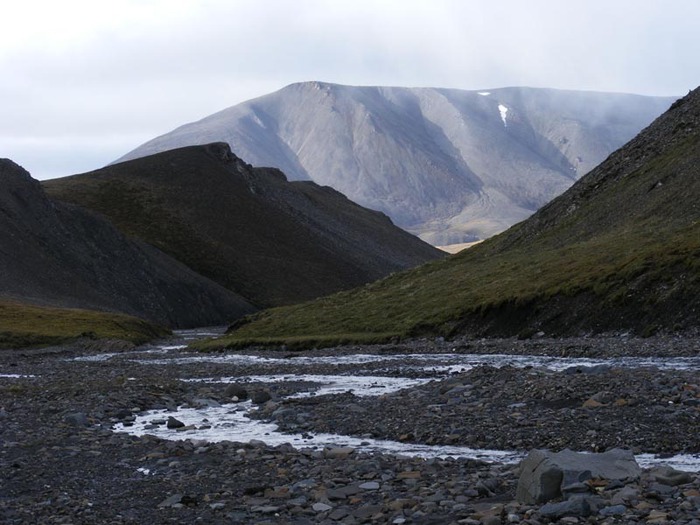
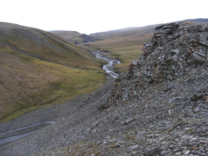
Byrranga
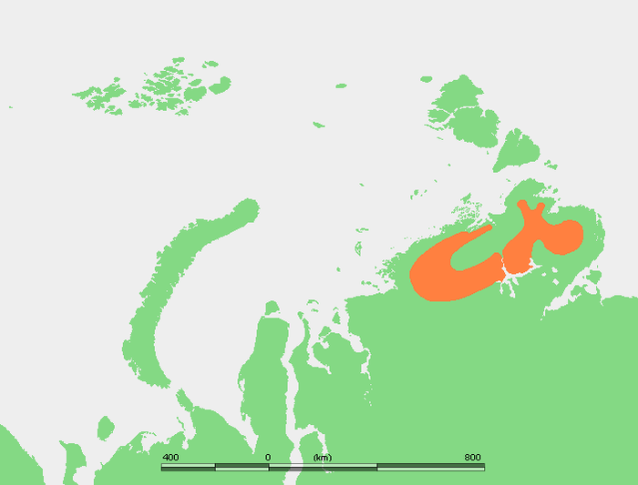
Approximate location of the Byrranga Mountains on the Taimyr Peninsula
Sayans
![]()
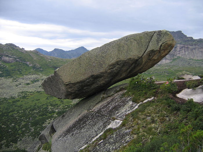
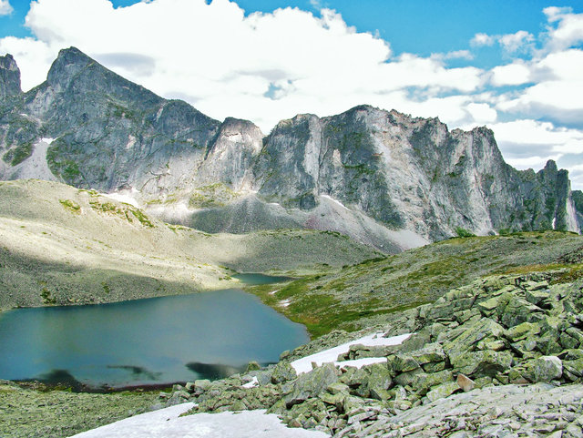
Western Sayan, Ergaki ridge. Hanging stone in the western part of Ergak
Ural
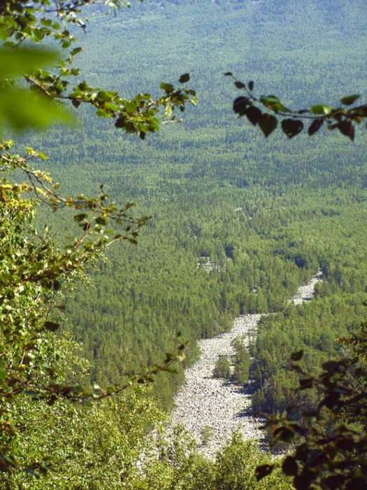
Stone rivers of the Urals
Wrangel Island
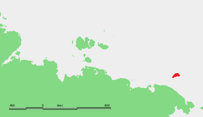
Wrangel Island - Location Map
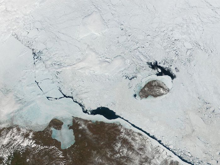
Color photograph of Wrangel Island taken from space in 2001
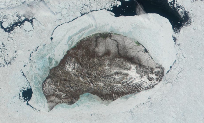
Wrangel Island - a picture from space
Mountains on Wrangel Island
In the mountains on Wrangel Island
Stanovoye Highlands
![]()
Falkland Islands
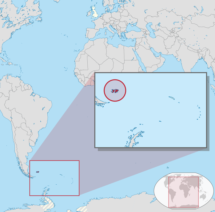
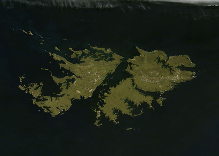
Satellite image of the archipelago
Erosion
Erosion (from lat. erosio- erosion) - the destruction of rocks and soils by surface water flows and wind, including the separation and removal of fragments of material and is accompanied by their deposition.
Often, especially in foreign literature, erosion is understood as any destructive activity of geological forces, such as sea surf, glaciers, gravity; in this case, erosion is synonymous with denudation. However, there are also special terms for them: abrasion ( wave erosion), exaration ( glacial erosion), gravitational processes, solifluction, etc. The same term (deflation) is used in parallel with the concept wind erosion, but the latter is much more common.
According to the rate of development, erosion is divided into normal And accelerated. Normal occurs always in the presence of any pronounced runoff, proceeds more slowly than soil formation and does not lead to a noticeable change in the level and shape of the earth's surface. Accelerated is faster than soil formation, leads to soil degradation and is accompanied by a noticeable change in relief.
For reasons allocated natural And anthropogenic erosion. It should be noted that anthropogenic erosion is not always accelerated, and vice versa.

Erosion in Antelope Canyon, Southwest USA
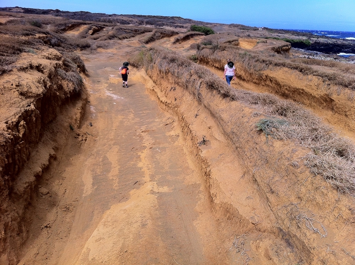
Wind erosion of soils, about. Hawaii
wind erosion
This is the destructive action of the wind: waving sands, forests, plowed soils; occurrence of dust storms; grinding of rocks, stones, buildings and mechanisms with solid particles carried by the force of the wind. Wind erosion is divided into two types:
Casual
dust storms
The beginning of a dust storm is associated with certain wind speeds, however, due to the fact that flying particles cause a chain reaction of detachment of new particles, it ends at speeds much lower.
Gneiss boulder exposed to wind erosion (Nanshan Mountains, China)
The strongest storms took place in the USA in the 1930s (“Dusty Bowl”) and in the USSR in the 1960s, after the development of virgin lands. Most often, dust storms are associated with irrational human economic activity, namely, the massive plowing of land without carrying out soil protection measures.
There are also specific deflationary landforms, the so-called " blowing basins": negative forms, elongated in the direction of the prevailing winds.
water erosion
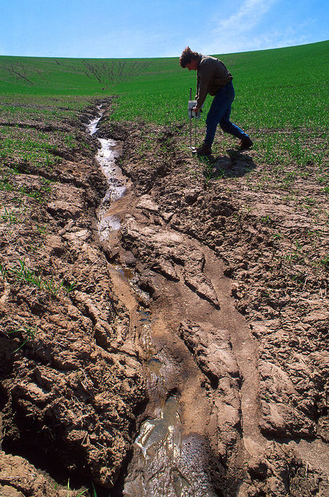
Scours in a wheat field, USA
Water erosion occurs under the influence of temporary flows of atmospheric water (rain showers, melt water, etc.).
drip erosion
Destruction of the soil by impacts of raindrops. Structural elements(lumps) of soil are destroyed by the kinetic energy of raindrops and are scattered to the sides. On slopes, downward movement occurs over a greater distance. Falling, soil particles fall on a film of water, which contributes to their further movement. This type of water erosion is of particular importance in the humid tropics and subtropics..
planar erosion
Planar (surface) erosion is understood as a uniform washout of material from slopes, leading to their flattening. With some degree of abstraction, they imagine that this process is carried out by a continuous moving layer of water, but in reality it is produced by a network of small temporary water flows.
Surface erosion leads to the formation of eroded and reclaimed soils, and in more large scale— deluvial deposits.
Linear erosion
Unlike surface erosion, linear erosion occurs in small areas of the surface and leads to the dismemberment of the earth's surface and the formation of various erosion forms (gullies, ravines, gullies, valleys). This also includes river erosion produced by constant flows of water.
The eroded material is deposited usually in the form of alluvial fans and forms proluvial deposits.
Linear erosion is of two types:
G hollow (bottom) - destruction of the bottom of the watercourse. Bottom erosion is directed from the mouth upstream and occurs before the bottom reaches the level of the erosion basis;
Lateral - the destruction of the coast.
In each permanent and temporary watercourse (river, ravine), both forms of erosion can always be found, but at the first stages of development, the deep one prevails, and in the subsequent stages, the lateral one.
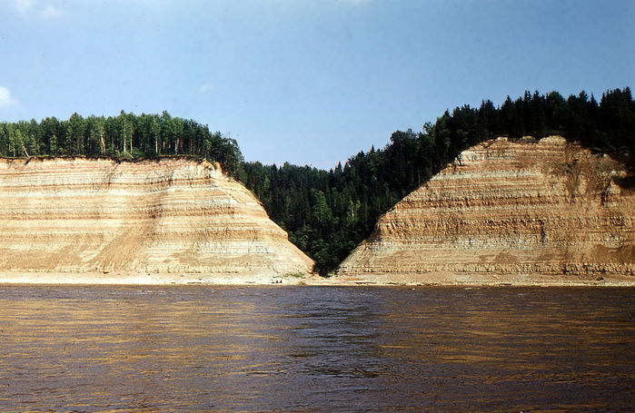
An example of combined lateral and deep erosion. Sukhona coast
spreading erosion
Erosion processes are widespread on Earth everywhere. Wind erosion prevails in arid climate conditions, water erosion - in humid climate conditions.
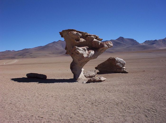
Corrazion (lat. corrado- scrape, scrape) - the process of mechanical erosion, turning, abrasion, grinding and drilling of rock masses by moving masses of detrital abrasive material moved by water, wind, ice or shifted by gravity along the slopes. So, in deserts, corrosion occurs under the action of sand, in the bed of a glacier - by boulders, in a riverbed - by fragments drawn by water. As a result, a cellular structure, furrows, hollows and other depressions are formed on the surface of the rocks.
Suffusion (from lat. suffosio- digging) - the removal of small mineral particles of rock by water filtering through it. The process is close to karst, but differs from it in that suffusion is a predominantly physical process and the rock particles do not undergo further destruction. One of the characteristics of soil erosion.
Suffusion leads to subsidence of the overlying strata and the formation of depressions (suffusion funnels, saucers, depressions) with a diameter of up to 10 and even 100 meters, as well as caves. Another consequence may be a change in the granulometric composition of rocks both subject to suffusion and acting as a filter for the removed material.
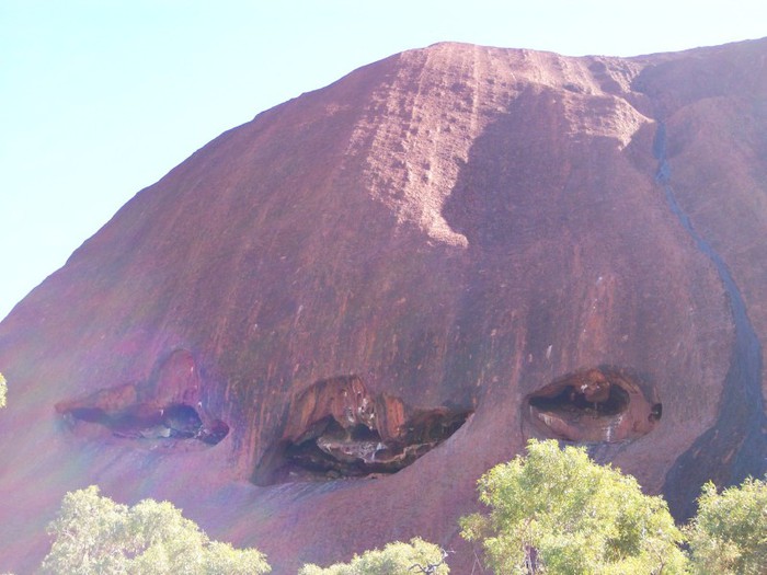
One of the outlandish landforms that complicates Uluru. There are many caves here, the genesis of which is not yet clear. Perhaps their formation is associated with suffusion or karst. Apparently, these processes took place here over millions (or tens of millions of years), which led to the formation of landforms, which, rather, can be expected on a limestone plateau...
Suffusion is most widely developed in the area of loess and loess-like loams, under the slopes of river valleys, often along the paths of burrowing animals. One of the necessary conditions for suffusion is the presence in the rock of both large particles that form an immovable frame, and washed out small ones. The removal begins only with certain values of water pressure, below which only filtration occurs.
In carbonate and gypsum-bearing sandy-argillaceous deposits and marls, karst and suffusion can appear simultaneously. This phenomenon is called clayey karst or clayey pseudokarst.
Kigilyakhi (Yakut. kisilyakhi, kisi - man) - high rocky pillars of a bizarre shape, formed as a result of cryogenic weathering. Stones protruding from the surface of flat mountains or from under ice and snow look like a person, hence the name.
Kigilyakhi. stone giants and their secrets
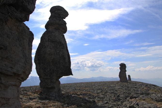
Photo: meic/ykt.ru
There are many places on our planet, the origin of which a person is not able to fully explain. Around such objects, many legends and tales are born, explaining what is difficult to rationally explain. Kigilyakhs, or kisilyakhs, are one of such objects. They are high pillars formed from rocks that are usually located on the tops of rocks during weathering. It is not surprising that high pillars, resembling the frozen figures of giants, have become the heroes of many legends in Yakutia, where they are located.
HISTORY OF FORMATION OF KIGILYAKH
The largest number of Kigilyakh pillars is located in northern Yakutia, the most impressive stone figures are located on the New Siberian Islands, this is where most tourists come. It is interesting that from the Yakut language “kisilyakh” literally translates as “a place where there are people”, since the very word “kis” means “man”. It is known that the Yakut kisilyakhs arose about 120 million years ago. Approximately at this time, the Verkhoyansk and Chersky ridges were formed as a result of the collision of the North American continental plate with the Eurasian one. It was after the formation of folds on these ridges that kigilyakhs began to form. True, they owe their origin to weathering, which, in conditions of frosty weather and location (tops of rocks), forms stone pillars. The material of which the kigilyakhs are made is hard rocks, mostly granite.
There is another version of the origin of these rocks, which, as usual, is associated with otherworldly forces. The legend says that once the earth was not yet covered with snow and permafrost, then people lived mainly in mountainous areas. But over time, the climate also changed, the dwelling in the rocks became unsuitable, as a severe cooling began. At the moment when life became completely impossible, people decided to move to the south, to descend from the mountains. But during the crossing of the Kisilakhsky Range, many of them, unable to withstand the cold, froze. Over time, they turned into stone pillars, which, being covered with more and more layers of stone, reached their real sizes.
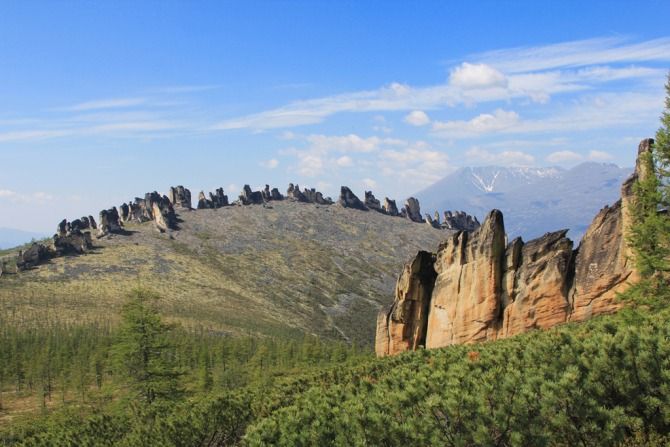
Photo: meic/ykt.ru
LOCATION
Kigilyakhs are quite common all over the world, they are in Kazakhstan - the Koitas massif is known, there are mountain ranges in Transbaikalia. IN different countries stone pillars are called differently, somewhere - "stone monks", due to the fact that they resemble frozen praying clergymen. In Russia, the most famous kigilyakhs are located in Yakutia, where tourists interested in magic stones come every year. The most famous locations for the stones are the Kisilakhsky Range, the Medvezhy and Lyakhovsky Islands. In general, the word "kigilyakh" itself began to be used by geologists all over the world relatively recently, this happened after the discovery of the Lyakhovsky Islands, when Cape Kigilyakh and the peninsula of the same name were discovered and named. Two islands belonging to the Lyakhovsky group - Chetyrekhstolbovoy and Stolbovoy - are located mainly in the Laptev Sea. Another famous place The “habitats” of the Kigilyakhs are Mount Kisilyakh-Tas, it is located 100 kilometers from the coast East Siberian Sea, on the banks of the Alazeya River flowing through the tundra. It is on this mountain that the Kigilyakhs form the so-called ridge, since a ridge of pillars stretches along the entire top of the mountain. It is also important to be able to distinguish kigilyakhs from nunataks (from the Eskimo "nun" and "tak", which literally means "lonely peak"). These various stone pillars are very similar, nunataks are rocks that stand alone, or rocky peaks that form on the surface of a glacier. This is precisely their main difference from the Kigilyakhs - nunataks are formed not only as a result of weathering, their appearance is also influenced by rocks collapsing by the glacier. But if the ice around disappears and the nunatak remains standing on a bare rocky surface, you will hardly be able to distinguish this stone pillar from the kigilyakh. Perhaps only geologists can accurately determine the cause of the formation of stone pillars.
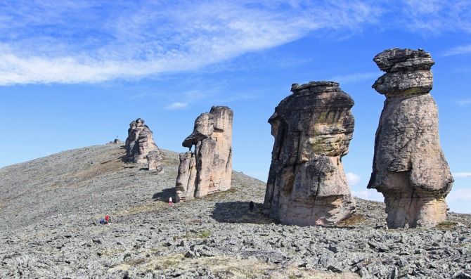
Photo: meic/ykt.ru
KISILYAKH RIDGE
The Kisilakhsky Ridge is one of the most scenic spots habitat of the Kigilyakhs, it is located on the watershed of the Adycha and Yana rivers. Besides, in mountain system Chersky, this ridge is one of the smallest. Its length is about 80 meters, and the most high peak reaches a mark of 1548 meters. The ridge consists of many different rocks, which allows us to consider it complex, it includes: shales, Jurassic sandstones, mudstones and other minerals, scientists believe that all these granitoids belong to the Cretaceous period in age. It is these sedimentary rocks that form kigilyakhs, some of which can reach a height of 30 meters. They are located on the main crest of the ridge and, in addition, stretch along the entire watershed. Interestingly, it is on the Kisilyakh Ridge that the Kigilyakhs sometimes form impenetrable walls or labyrinths with small passages between the pillars. The lower the kigilakh is, the lower it is, but at the same time, perfectly even pillars are located on the top, and below they acquire interesting and bizarre shapes. Kigilyakhs are assigned the same strange names, which talk about what the pole looks like. In general, many tourists consider it their duty to somehow unusually name their favorite kigil. Therefore, if you read the travel notes of different travelers who have visited the same place, you will not find the same names of stone pillars. Everyone will give them names at their discretion, focusing on what the stone reminded them of. The Kisilyakh range is covered with many cracks and crevices, and its northern side is completely covered with lichens and mosses. Many researchers note another feature of the Kigilyakhs - the presence of a leg. The well-known geologist G. Meidel wrote in his research that the foot of stone pillars is a base as tall as a person, while it is slightly thinner than the kigilakh itself. At the same time, the exact age of the stones remains unknown: how many scientists, so many guesses.
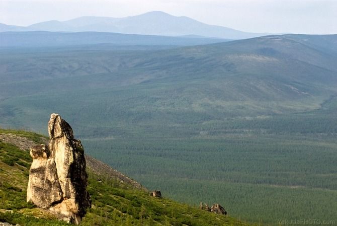
Photo: Ayar Varlamov/yakutiaphoto.com
EXPEDITIONS TO STUDY KISLYAKHI
Many scientists in different time made expeditions to the islands of Yakutia in order to find out the true origin of the Kigilyakhs. So, in 1921-1923, F.P. Wrangel conducted an expedition, during which his group explored the Bear Islands, which are located in the East Siberian Sea. The group of these islands included the island of Chetyrehstolbovoy, it was on it that Wrangel discovered the Kigilyakhs for the first time, in his notes on the campaign he sought to find out the reasons for their formation. “It can be concluded that the three now separated stones were once one large cliff: gradually splitting and collapsing from the force of frost or other physical problems, it lost its original appearance,” he wrote, first noting weathering as main factor formation of new kigilyakhs.
And in 1935 on the same island with new expedition the geologist S. Obruchev arrived, who also explored the Kigilyakhs. In his memoirs, he described not only the theory of the formation of stones, but also told the story of their discovery. According to him, the Bear Islands were discovered as early as 1702 and first visited in 1720. Another fact noted by him is interesting: the pillars collapsed very quickly. Obruchev wrote that if in 1720 there were four pillars, then only three were found in 1935, and the fourth turned into a stone placer and lay at the foot of the rest. At the same time, the geologist notes that only 200 years are enough for all the kigilyakhs on Chetyrekhstolbovy to be destroyed. But Obruchev's research was not taken seriously, as he made too many inaccuracies in his notes. So, in the same 1935, another expedition visited the island - the researcher Vorobyov, who discovered and described all four kigilyakhs. However, on this moment it is known that the pillars located on the Kisilyakh Range are covered with vertical cracks and therefore are rather unstable. But, despite the existing danger of collapse, locals Kigilyakhs have been considered since ancient times the best place recreation. Sitting with them, according to legend, you can gain mental strength and peace of mind. And in 1986, at the foot of the Kisilakhsky Range, archaeologists discovered more than 68 sites of ancient people and a burial place. These finds indicate that the mountainous area of Yakutia was quite densely populated in ancient times. And perhaps the locals are right, believing that the Kigilyakhs carry the powers of their ancient ancestors.
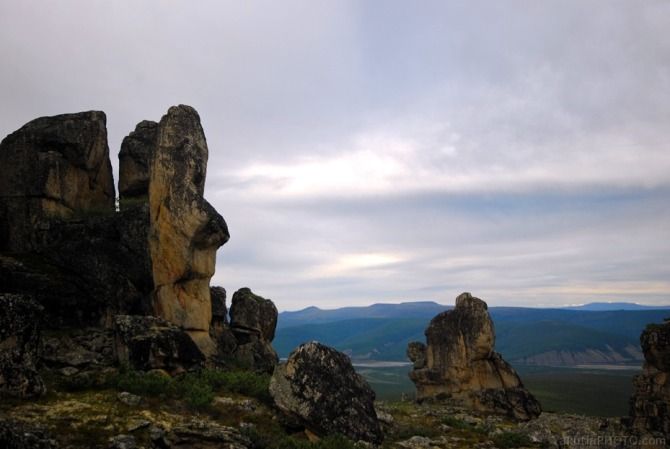
Photo: Ayar Varlamov/Yakutia
Weathering is understood as a set of physical, chemical and biochemical processes of transformation of rocks and their constituent minerals in the near-surface part earth's crust.
This transformation depends on a number of factors: temperature fluctuations, chemical effects of water and gases - carbon dioxide and oxygen (which are in the atmosphere and dissolved in water); the impact of organic substances formed during the life of plants and animals and during their death and decomposition. Those. weathering processes are closely related to the interaction of the near-surface part of the earth's crust with the atmosphere, hydrosphere, and biosphere. It is the boundary region of different phases that has a high reactivity. The near-surface part of the earth's crust, in which the transformation of mineral matter occurs, is called the weathering zone.
The weathering process depends on the climate, topography, organic world and time.
PHYSICAL WEATHERING
In this type, temperature weathering is of little importance, associated with daily and seasonal temperature fluctuations, which causes either heating or cooling of the surface part of the rocks.
Large differences in the “expansion-compression” coefficient of rock-forming minerals under prolonged exposure to temperature fluctuations leads to the fact that the adhesion of individual mineral grains is broken, cracks form, and then the rocks disintegrate into fragments (blocks, crushed stone, sand, etc.). The processes of physical weathering are very intensive in deserts, where there is little precipitation and high differences in (daily) temperatures.
On the mountain slopes, along with weathering, gravitational processes develop: landslides, rockfalls, talus, landslides. The products of gravitational processes (screes, landslides) accumulated at the base of the slopes represent a peculiar genetic type of continental deposits, called colluvium.
In polar and subpolar countries, where there is permafrost and excessive surface moisture, weathering is associated with the wedging action of freezing water in cracks. When water freezes (the volume of ice is 9% higher than frozen water), stresses appear in cracks, crushing of rocks and formation of blocky material. Such weathering is called frost.
Roots of plants, especially trees, have a wedging effect on rocks. A variety of burrowing animals also perform mechanical work.
Purely physical weathering leads only to mechanical fragmentation of rocks without changing their mineral and chemical composition.
CHEMICAL WEATHERING
Simultaneously with physical weathering, the processes of chemical weathering occur - the chemical decomposition of rocks and the formation of new minerals.
During the mechanical destruction of rocks, cracks form in the latter, through which water and gases penetrate. The penetration of water causes the migration of various chemical compounds with it.
Hydrolysis. Hydrolysis destroys the atomic structure of minerals, especially silicates, due to the action of water and the ions dissolved in it. The water molecule has a polar structure: one end of it carries a weak positive charge due to two hydrogen atoms, and the other is negative due to the oxygen atom. Each end of the molecule can attach itself to an oppositely charged ion in the mineral lattice and pull the latter out of the structure. In addition, water weakly dissociates into hydrogen ions (H +) and hydroxyl groups (OH -), which, upon dissociation, acquire freedom and can react with ions of the crystal structure. Natural waters usually contain dissolved ions of certain substances, especially HCO 3 - , SO 4 2- , Cl - , Mg 2+ , Na + , K + . These ions can also replace charged atoms in the structure, thus violating the the primary lattice of the mineral. Ca 2+ , Mg 2+ , Na + and K +
Hydration - under the influence of water, water molecules are fixed in the crystal structure of the mineral. In this case, new minerals are formed, for example, the transition of anhydrite to gypsum:
CaSO 4 + 2H 2 O→CaSO 4 ∙ 2H 2 O
Or the transition of goethite to hydrogoethite
FeOOH + nH 2 O → FeOH ∙ nH 2 O
By hydration, chlorite, talc, serpentine, zeolites, etc. are formed.
Carbonatization. Minerals containing Ca, Mg, Na and K ions react with natural waters saturated with carbon dioxide. In this case, carbonates and bicarbonates of these minerals are formed. This process is called carbonization.
Dissolution. Many minerals dissolve under the action of water flowing down the surface of rocks and seeping through cracks and pores to a depth. The acceleration of dissolution processes is facilitated by a high concentration of hydrogen ions, oxygen, carbon dioxide and organic acids.
Of the minerals, chlorides - halite, sylvin, etc. - have the best solubility. In second place are sulfates - anhydrite, gypsum. In third place are carbonates - limestones and dolomites. Due to the dissolution of these rocks, karst forms both on the surface and at depth.
Oxidation is the addition of oxygen to minerals, especially those that contain iron in their composition. Oxygen from air and water destroys sulfides and ferruginous silicates - such as olivine, pyroxenes and amphiboles, and turns ferrous iron into ferric:
Organics. Plants and animals help not only physical but also chemical weathering. Lichens, which are among the first to grow on newly exposed rock, absorb some of the chemical compounds from it and “corrode” the rock. The roots of other plants remove new portions of inorganic material. The chemical activity of numerous and ubiquitous bacteria leads to the formation of ammonia, nitric acid, carbon dioxide, etc.
WEATHERING CRUST
Weathering crust - loose surface layer of rocks formed as a result of weathering. The composition of the weathering crust also includes water, air and living organisms located in this layer. The weathering crust usually has a clayey composition. The thickness of the weathering crust depends on climatic conditions and from the duration of the weathering process, there are places where the weathering crust is absent. In the upper part, the weathering crust usually passes into the soil. Deposits of ores of nickel, iron, chromium, aluminum, phosphorus, rare elements, gold, etc. are associated with the ancient weathering crust.
The weathering products left at the site of the destruction of the parent (primary) rocks are called eluvium.
The weathering crust is a collection of various eluvial formations. Such residual weathering crust is called automorphic.
With prolonged weathering and appropriate conditions, well-defined zones of the weathering crust are formed, which have their own textural and structural features and mineral composition.
Due to the presence of oxides and hydroxides of Al and Fe, the eluvium of the upper part of the weathering crust in the dry state resembles burnt brick, often forming shells and colored red. Therefore, such weathering crusts are called lateritic (Latin - later - brick).
Among the weathering crusts, two main morphogenetic types have been distinguished: areal and linear.
Areal weathering crusts develop in the form of a cover or cloak, occupying vast areas up to tens and hundreds of square kilometers on relatively leveled relief surfaces.
Linear weathering crusts have linear (elongated) outlines in plan and are confined to zones of increased fracturing, to faults and contacts of rocks of different composition. Under these conditions, more free penetration of water and the active components contained in them occurs, which causes an intensive process of chemical weathering.
The process of weathering crust formation is a series of successive and interrelated phenomena:
1. Destruction and chemical decomposition of rocks with the formation of weathering products;
2. Partial removal and redistribution of weathering products;
3. Synthesis of new minerals as a result of the interaction of weathering products during their migration;
4. Metasomatic replacement of parent rock minerals.
Many valuable mineral deposits are associated with weathering crusts of various ages - bauxites, iron ore, manganese, nickel, cobalt, etc.
Cycles of substances in the biosphere. Large (geological) and small (biological) cycles and their role in soil formation
There are two main cycles of substances in nature: large (geological) and small (biogeochemical). ) is due to the interaction of solar energy with the deep energy of the Earth and redistributes matter between the biosphere and deeper horizons of the Earth.
Sedimentary rocks formed due to the weathering of igneous rocks in the mobile zones of the earth's crust again plunge into the zone high temperatures and pressure. There they are melted down and form magma - the source of new igneous rocks. After raising these rocks to earth's surface and the action of weathering processes again transforms them into new sedimentary rocks (Fig. 6.7). The symbol of the circulation of substances is a spiral, not a circle.
solar energy
Igneous rocks
Igneous rocks
Weathering, transport, deposition, petrification
Crystallization
Sedimentary rocks
metamorphism
Remelting
metamorphic rocks
Energy of radioactive decay
This means that the new cycle of circulation does not exactly repeat the old one, but introduces something new, which over time leads to very significant changes.
The Great Cycle is also the circulation of water between land and ocean through the atmosphere. Moisture evaporated from the surface of the oceans (which consumes almost half of the solar energy coming to the Earth's surface) is transferred to land, where it falls in the form of precipitation, which again returns to the ocean in the form of surface and underground runoff. The water cycle also occurs according to a simpler scheme: evaporation of moisture from the surface of the ocean - condensation of water vapor - precipitation on the same water surface of the ocean.
It is estimated that more than 500 thousand km3 of water participate in the water cycle on Earth every year.
The water cycle as a whole plays a major role in shaping the natural conditions on our planet. Taking into account the transpiration of water by plants and its absorption in the biogeochemical cycle, the entire supply of water on Earth decays and is restored in 2 million years (see Fig. 6.10).
The biological cycle is the leading process of soil formation. With the settlement of lower plants (microorganisms, algae, fungi and lichens) on rocks, weathering processes (biological weathering) intensify, the number of water-soluble compounds increases, some of which the body uses to build its body, some is washed out by water, falling into a large geological circulation of substances.
Of the various water-soluble compounds that are initially formed, plants do not assimilate all the elements, but only those that they need for growth, that is, selectively. After the death of plants, dead organic matter is deposited on the surface and in the upper part of the parent rocks, which gradually accumulate along with the most important elements nutrition needed by plants.
During the decomposition and mineralization of organic substances that occur simultaneously with weathering, nutrients are released and again become available to plants, which are fully or partially absorbed by the next generations of living organisms.
Thus, due to the vital activity of living organisms, against the background of a large geological circulation of substances, a small biological cycle arises, and with it the primary change in loose rocks, or the primary process of soil formation. With an increase in the number of organisms per unit area, an increasing number of nutrients are intercepted by them from the geological cycle and retained in the form of living organic matter.
The decomposition and mineralization of organic substances are produced by numerous and diverse microorganisms, releasing a significant amount of nutrients. At the same time, under the influence of microorganisms, the synthesis of new humic acids and organic compounds peculiar only to soils takes place, which, together with decomposed organic residues, color the top-stump layers of soils in gray, dark gray, and sometimes black.
Under the influence of living organisms and organic acids, profound changes also occur in the mineral part of the parent rock, which, over time, is divided into layers - horizons that differ from each other both in their properties and in appearance. Ultimately, a completely new natural-historical body, the soil, is formed.
Thus, as a result of the biological cycle of substances, there is an exchange of substances and energy between plant and animal organisms and loose parent rock, on the surface and in the thickness of which, with the participation of microorganisms, new organic substances are accumulated, destroyed and formed, profound changes occur in the mineral composition and properties of soils. , causing in turn changes in the conditions for supplying plants with water and food - this is the essence of the soil-forming process.
the process of soil formation soil-forming rocks.
Soil formation. The process of soil formation. All rocks covering the surface of the globe, from the very first moments of their formation, under the influence of various processes, began to immediately collapse.
In the process of weathering (hypergenesis), the original appearance of rocks, as well as their elemental and mineral composition, changed. Initially massive (i.e. dense and hard) rocks gradually passed into a fragmented state. Grass, sand, and clay can serve as examples of rocks crushed as a result of weathering. Becoming fragmented, rocks acquired a number of new properties and features: they became more permeable to water and air, the total surface of their particles increased in them, which increased chemical weathering, new compounds were formed, including easily water-soluble compounds and, finally, mountain rocks acquired the ability to retain moisture, which is of great importance for providing plants with water.
Loose and capable of absorbing water, rocks became a favorable environment for the vital activity of bacteria and various plant organisms. Gradually, the upper layer of the weathering crust was enriched with the products of vital activity of organisms and their dying remains. The decomposition of organic matter and the presence of oxygen led to complex chemical processes, which resulted in the accumulation of elements of ash and nitrogen food in the rock. Thus, the rocks of the surface layer of the weathering crust (they are also called soil-forming, bedrock or parent rocks) became the soil. The composition of the soil, therefore, includes a mineral component corresponding to the composition of bedrocks, and an organic component.
Therefore, the beginning of the process of soil formation should be considered the moment when vegetation and microorganisms settled on the weathering products of rocks. From that moment on, the crushed rock became soil.
Soil-forming, or parent rocks are loose, weathered rocks, from which soils are formed due to the development of soil formation processes.
The main process in the formation of parent rocks is weathering. This is a long, complex and dynamic process. Different speed and features of destruction of rocks lead to the formation of unequal loose parent soil-forming rocks that differ in features and properties. These include the following parent breeds.
Eluvium is the weathering products of rocks left at the site of formation. IN mountainous areas on the slopes, eluvium is rock fragments mixed with fine earth.
Aeolian deposits are formed under the influence of wind. These are the sands of dunes and dunes, hilly and cumulus sands, sorted by mechanical composition with irregular cross-bedding. Buried soils are often found under it.
Loesses are pale-colored deposits, carbonate, non-stratified, porous, 70-85% composed of silt particles, well sorted, forming vertical walls. The most probable origin of loess is eolian. Most often found on the outskirts of deserts, in an arid climate in the foothills.
Deluvial deposits are formed in the lower parts of the slopes. They consist of material carried down from watersheds by snowmelt and rainwater, are usually well sorted and, as a rule, are composed of smaller particles than the source rocks, on watersheds, often humus. Where the watersheds pass into the lower parts of the slopes, deluvial-eluvial deposits are formed.
Proluvial deposits are formed under the influence of temporary mud-stone mudflows, which, breaking out into flat areas, spread and form alluvial fans, consisting of heterogeneous detrital material. During the formation of temporary streams in ravines, materials are also carried out into the wide valleys of beams or rivers. These deposits are usually more or less sorted, layered, can be distinguished into natural conditions and are called proluvial-alluvial deposits of ravines.
Alluvial deposits are deposits of permanent streams (rivers, large streams). The river valleys are completely composed of alluvial deposits. These deposits are easily identified by the following features: they are layered, well sorted by mechanical composition (usually finer on top than on the bottom), and may contain peat inclusions. Ancient alluvial deposits change over time in the process of soil formation, losing layering.
Lacustrine sediments form at the bottom of lakes. Very often these are thin silty layered deposits, often mixed with organic residues, forming sapropelic and organic silts and even peat.
Coastal marine deposits consist, as a rule, of coarse clastic material, boulders, pebbles, well sorted. Deposits of shallow seas - shelf deposits (mostly sandy) have a thin layering, well sorted by mechanical composition. In deltas, sandy-silty or silty sediments are often formed, formed from marine and river sediments saturated with organic matter, ferromanganese and phosphorite neoplasms. In the shallow part, sediments of organic and chemical origin are formed: shell rocks, limestones, salts. Variegated silts and clays are formed on the continental slope, containing a significant amount of iron compounds, organic substances and carbonates. They are always saline and, when exposed to the surface, contribute to the formation of saline soils.
Glacial deposits are loose rocks carried by a glacier. As a rule, they are not sorted, non-layered, have a different mechanical composition - from sands to heavy loams of red, yellow and red-brown color. They contain a significant amount of often roughly polished unrounded stones - boulders of various sizes, cartilage, chaotically arranged lenses and interlayers of different mechanical composition. Deposits can be acidic, neutral and slightly alkaline.
Weathering
Weathering- destruction of rocks. A set of complex processes of qualitative and quantitative transformation of rocks and their constituent minerals, leading to the formation of weathering products. Occurs due to the action on the lithosphere of the hydrosphere, atmosphere and biosphere. If rocks are on the surface for a long time, then as a result of their transformations, a weathering crust is formed. There are three types of weathering: physical (ice, water and wind) (mechanical), chemical and biological.
Physical (mechanical) weathering
"Arch" in Utah (USA), an example of mechanical weathering
The greater the temperature difference during the day, the faster the weathering process. The next step in mechanical weathering is the entry of water into the cracks, which, when frozen, increases in volume by 1/10 of its volume, which contributes to even greater weathering of the rock. If blocks of rocks fall, for example, into a river, then they are slowly worn down and crushed under the influence of the current. Mudflows, wind, gravity, earthquakes, volcanic eruptions also contribute to the physical weathering of rocks. Mechanical grinding of rocks leads to the passage and retention of water and air by the rock, as well as a significant increase in surface area, which creates favorable conditions for chemical weathering.
chemical weathering
Chemical weathering is a combination of various chemical processes that result in further destruction of rocks and a qualitative change in their chemical composition with the formation of new minerals and compounds. The most important factors in chemical weathering are water, carbon dioxide and oxygen. Water is an energetic solvent of rocks and minerals. The main chemical reaction of water with minerals of igneous rocks - hydrolysis, leads to the replacement of cations of alkaline and alkaline earth elements of the crystal lattice with hydrogen ions of dissociated water molecules:
KAlSi 3 O 8 +H 2 O→HAlSi 3 O 8 +KOH
The resulting base (KOH) creates an alkaline environment in the solution, in which further destruction of the orthoclase crystal lattice occurs. In the presence of CO 2 KOH goes into the form of carbonate:
2KOH+CO 2 \u003d K 2 CO 3 + H 2 O
The interaction of water with minerals of rocks also leads to hydration - the addition of water particles to mineral particles. For example:
2Fe 2 O 3 + 3H 2 O \u003d 2Fe 2 O 3H 2 O
In the chemical weathering zone, the oxidation reaction is also widespread, to which many minerals containing oxidizable metals undergo. A striking example of oxidative reactions during chemical weathering is the interaction of molecular oxygen with sulfides in the aquatic environment. So, during the oxidation of pyrite, along with sulfates and hydrates of iron oxides, sulfuric acid is formed, which is involved in the creation of new minerals.
2FeS 2 +7O 2 + H 2 O \u003d 2FeSO 4 + H 2 SO 4;
12FeSO 4 + 6H 2 O + 3O 2 \u003d 4Fe 2 (SO 4) 3 + 4Fe (OH) 3;
2Fe 2 (SO 4) 3 +9H 2 O \u003d 2Fe 2 O 3 3H 2 O + 6H 2 SO 4
radiation weathering
Radiation weathering is the destruction of rocks under the action of radiation. Radiation weathering affects the process of chemical, biological and physical weathering. Lunar regolith.
biological weathering
Biological weathering is produced by living organisms (bacteria, fungi, viruses, burrowing animals, lower and higher plants, etc.).
see also
Links
Wikimedia Foundation. 2010 .
Synonyms:See what "Weathering" is in other dictionaries:
WEATHERING, in geology and physical geography, the destruction and chemical change of rocks and minerals on the surface of the Earth as a result of physical, chemical and organic processes. Influences the formation of soil and plays a major role in ... ... Scientific and technical encyclopedic dictionary
The weathering process is divided into three types of weathering - physical, chemical and biological. The allocation of each weathering is based on any weathering factors that are decisive. Despite this, all three types of weathering always act together and simultaneously.
1. physical weathering It is expressed mainly in the mechanical crushing of mineral bodies (rocks, building materials, etc.) without a significant change in their mineral composition. Temperature fluctuations play a large role in this “crushing” destruction. So, for example, in deserts, daily temperature fluctuations are very significant, in the daytime up to +80 ° C, and at night only +20 ° C. The destruction of rocks and building structures increases when water penetrates microcracks. When freezing, water increases in volume by 9-11%, a large lateral pressure develops and the rock is destroyed. This phenomenon is commonly referred to as "frost weathering". Many rocks, especially clay ones, break into pieces when wet and dry alternately. Physical weathering prevails in desert regions and in regions with a cold climate (arctic, high mountain regions, etc.).
2. chemical weathering expressed in the destruction of rocks, building materials and building structures up to complete decay, i.e. to the level of anions and cations, with the simultaneous formation of new mineral formations. The main factors of this weathering are water, oxygen, carbon dioxide, organic acids, etc. Complex chemical processes are associated with these factors - dissolution, oxidation, hydration, carbonitization, hydrolysis.
The intensity of chemical weathering depends on the area affected by water, its temperature, and the duration of the processes. Carbonates, sulfates, etc. are most susceptible to this weathering. Chemical weathering has the greatest destructive power in a warm and humid climate.
3.biological weathering sometimes called organic. It manifests itself in the form of mechanical and chemical effects of living and plant organisms on the earth's surface.
Mechanical destruction is produced by plants by the root system. Tree roots can destroy even strong rocks and concrete slabs. In addition to the mechanical force of destruction, plant roots have the ability to destroy rocks and building materials with organic acids, which they release both during their growth and after death during decomposition processes. Various excavations significantly violate the integrity of rocks.
Biological weathering manifests itself almost everywhere, especially in areas with humid climate which promotes the growth and development of plants.
To a certain extent to species weathering should be attributed to man-made human activities, in particular, the construction of buildings and structures. Although it should be noted that this activity destroys the surface of the earth's crust by all kinds of weathering process.