Geographical position of Croatia
Croatia is located in the south of central Europe, has common borders with Bosnia and Herzegovina for 932 kilometers, with Slovenia for 670 kilometers, with Hungary for 329 kilometers, with Serbia for 241 kilometers and Montenegro for 25 kilometers. The coast of the Adriatic Sea stretches for 1777 kilometers, and the entire length of the coastline, together with the islands, is 4058 kilometers. Geographical coordinates Croatia 45 ° 8'30 ″ N 16 ° 13'45 ″ E
Extreme geographic points Croatian territory: eastern 45 ° 12 ′ s. sh. 19 ° 27 ′ E d. (G) (O), westerly 45 ° 29 ′ N sh. 13 ° 30 ′ east d. (G) (O), south 42 ° 23 ′ N sh. 16 ° 21 ′ east (G) (O) North 46 ° 33 ′ N sh. 16 ° 22 ′ E d. (G) (O).
In the southeast, Croatia interrupts its coastline with the exit of Bosnia and Herzegovina to the coast of the Adriatic Sea with the city of Neum.
Geography of Croatia
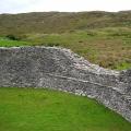
The country's territory is 56,594 square kilometers, which is the 127th result in the world. V geographically Croatia can be divided into the Adriatic coast, the Dinaric Highlands and the Middle Danube Lowland, 53.54% of Croatia's territory is valleys below 200 meters above sea level, most of them are in the north in the Middle Danube Lowland. The highest points of Croatia are located on the territory of the Dinaric Highlands, which is located southeast of the Alps from the Chicharia and Učka mountains in the west in Istria and to the umberak mountains in the northeast. Mount Dinara is the highest in Croatia and has a height of 1831 meters, in addition, the mountains Sneznik, Svilaia, Risnjak, Kapela, Velika, Plesivica, Velebit and Biokovo are over one and a half kilometers high. Cavers will be interested in the campfire massif of the Dinaric Highlands with countless caves, fifty of which are over 250 meters long, and three caves are over one kilometer long, including the Kita-Gacheshina cave, which is 20 kilometers long.
The middle Danube lowland stretches from the north of Croatia to the territory of Hungary, the highest points are the mountains Medvednica 1035 meters and Ivanschitsa 1059 meters in the north of the country's capital.
The Adriatic coast is the most tasty morsel for tourists, in addition, the bathing islands of Krk, Korcula and Cres are of interest, as well as the picturesque high island of Brač with a height of 780 meters. Most of Croatia's coasts are indented with castor relief; traces of volcanoes can be found on the islands of Brusnik, Yabuka, Vis and in the vicinity of the town of Komiza.
62% of Croatia's territory belongs to the Black Sea basin. The largest rivers of the country are Kupa 296 kilometers, Mura, Drava 505 kilometers, Sava 562 kilometers, Danube 188 kilometers, Neretva river 20 kilometers and Cetina 101 kilometers belong to the Adriatic Sea basin.
The most large lake in Croatia Vransko with an area of 30.7 square kilometers in northern Dalmatsi, on the Drava river there is Dubravskoe reservoir, on the Cetina Peruchanskoe river. However, tourists are interested in the small but picturesque Plitvice Lakes, which are connected by waterfalls, but separated by natural dams, you can swim near the waterfalls, all lakes have their own unique color.
Croatian nature
In terms of biodiversity, Croatia is the most rich country in Europe, forests cover 47% of the country's territory, in Croatia 444 protected natural areas, accounting for 8.5% of the total area. Including 8 national parks, 11 nature parks and 2 nature reserves, the most popular nature Park- these are Plitvice Lakes, which, moreover, are the object of World heritage UNESCO, tourists are also interested in the Velebit Natural Park.
Half of Croatia lives on only 26.8% of the country's territory, for example, in Zagreb, which occupies 6.6% of the territory, more than a quarter of the entire population of Croatia lives.
Earthquakes in Croatia are frequent, especially on the Adriatic coastal resort, you should know Foreign tourists, so as not to be frightened in vain, once a decade in Croatia there are quite strong earthquakes.
Within the framework of a unified Yugoslavia, Croatia ranked second after Slovenia in terms of industrial development and per capita output (this figure was about a third higher than the national average). The republic specialized in mining (oil, coal, bauxite), shipping and tourism.
Formation of the independent Republic of Croatia and subsequent Civil War 1991-1995 provoked hyperinflation and a sharp decline in the level economic development... The country's economy before 1996 can be regarded as a wartime economy, when 40% of government spending was directed to defense. During the period from 1989 to 1994, the economic decline in Croatia reached 46%.
The heavy industry of modern Croatia includes metallurgical and steel-rolling mills, machine-building plants, hydroelectric power plants, shipyards, cement and reinforced concrete factories.
Leading industries- chemical, petrochemical, electrical and electronic, food, textile, woodworking, pharmaceutical. There are breweries, wine and vodka factories, meat processing plants, leather goods, sugar and agricultural processing enterprises in the country.
Croatia's northeastern plains are the main the granary of the country. Grain crops (corn and wheat), sugar beets, soybeans, hemp, flax, sunflowers, potatoes, fodder crops (clover, alfalfa, fodder beets) are grown here, and cattle are raised. On the hillsides and in the low mountains, they are traditionally engaged in gardening (they grow mainly plums and apples) and viticulture. The main crops of the mountainous regions are barley and potatoes. Istria and Dalmatia are characterized by viticulture and winemaking, the cultivation of early vegetables and southern fruits, including citrus fruits and olives.
In the fall of 1993, the country began implementing a plan for economic stabilization. In such industries National economy, such as tourism, mining, shipbuilding, oil refining, many enterprises were privatized, and by 1995, with the assistance of foreign investors, programs for their reconstruction had begun. However, after the Croatian invasion of Krajina in August 1995, this aid was curtailed.
Since 1997, the process of privatization of the country's largest enterprises has accelerated, including railways, the INA oil and gas concern, which was built with the expectation of supplying oil products to the entire Yugoslavia, and the power industry.
The total number of the economically active population is estimated at 1.68 million people. Grows and stays on high level unemployment: if in 1996 there were 15.9% of the working-age population unemployed, then in 1997 - 16.6%, in 1998 - 17.2%, in 1999 - 19.1%, in 2000 - 22%. In this regard, tens of thousands of workers left for the West in search of work.
Annual growth rate industrial production since 1997 they were estimated at 3-5%, but in 2000 they dropped to 1.7%. The inflation rate in 1996 was 3.5% (in 1993 it exceeded 1500%), in 1997 - 4.6%, in 1999 - 4.4%, in 2000 - 6%. At the same time, there has been a steady growth of GDP: in 1997 - 18.92 billion dollars, in 1998 - 20.6 billion, in 2003 - 47.05 billion dollars.At the same time, GDP growth (in 1990 prices) in 1998 amounted to 2.5%, in 2003 - 4.3% (in 1999 there was a decrease in GDP by 0.4% compared with the previous year). GDP per capita in 1992 amounted to $ 1,800, in 1993 - $ 2,705, in 1994 - $ 2,974, in 1995 - $ 3,487 (62.5% of the 1989 level), in 1996 - $ 3,650, in 2003 reached 10 600 dollars. In the structure of GDP, the share of the service sector is 71% (1999) outstripping the share of industry (19%) and agriculture (10%). The share of the service sector is increasing, in particular due to the revival since 2000 of the tourism business in coastal Croatia.
Croatia is characterized by a developed transport system ... So, in 1997 the length railways reached 2.3 thousand km, motor roads - 27.8 thousand km (with hard surface 23.5 thousand km, including 330 km of expressways). Zagreb is connected by highways with Slovenia, Yugoslavia and Hungary. The Adriatic Highway connects all the main cities of coastal Croatia. The channel of the Sava almost along its entire length, as well as the channel of the border river Danube, were navigable before the hostilities. To restore navigation on inland waterways, work is required to clear the channels of these rivers. There are several seaports on the coast of the Adriatic Sea, providing sea transportation not only to Croatia and the former Yugoslavia, but also to a number of other European countries. The largest ports are Rijeka, in the Gulf of Rijeka, in the north and Ploce, at the mouth of the Neretva, in the south, the smaller ones are Pula, Split, Sibenik, Dubrovnik. Merchant navy Croatia has 53 vessels with a deadweight of more than 1000 gross register tons each, with a total tonnage of 631 853 gross register tons. In 1999, 22 airports operated in the country. An oil pipeline with a length of 670 km, a 20-km oil product pipeline and a gas pipeline with a length of 310 km pass through the territory of Croatia.
Croatia is gradually forming a foreign market. So, in 1999, the volume of exports of goods and services amounted to $ 4.3 billion. Transport equipment, products of chemical and petrochemical industry, textiles, food. The main export partners are Italy (18%), Germany (15.7%), Bosnia and Herzegovina (12.8%), Slovenia (10.6%), Austria (6.2%). Imports amounted to 7.8 billion dollars. Croatia imports cars, transport and electrical equipment, fuel and lubricants, food. The main import partners are Germany (18.5%), Italy (15.9%), Russia (8.6%), Slovenia (7.9%), Austria (7.1%).
During the 1990s, there was an increase in external debt. In 1997, it was estimated at 31.1% of GDP (in 1996 - 26.6%, in 1995 - 25%), in 1999 in absolute terms it reached $ 9.3 billion. In 1998, the country's budget revenues amounted to $ 6 billion. dollars, expenditure - 4.7 billion dollars.
Since 2000, the government has stepped up foreign economic relations and set a goal to increase the investment attractiveness of the main industries. At the same time, it is taking steps to stabilize the financial system and reduce external debt.
The post-Tujman government is more focused on joining Western European structures (EU, NATO) and accordingly modifies the country's economic development. In general, despite the significant destruction caused by the hostilities (the damage is estimated at $ 18.7 billion), Croatia remains the second (after Slovenia) most economically developed state among former republics SFRY.
The Republic of Serbia has an area of 88.4 thousand square meters. km, population 10,150,265 million people and borders on Macedonia in the south, Bulgaria and Romania in the east, Hungary in the north, Croatia and Bosnia and Herzegovina in the west, Montenegro and Albania in the southwest. Three regions are distinguished: Serbia proper, which in 1991 was inhabited by 5.82 million people, and the autonomous regions - Vojvodina (2 million) and Kosovo (1.95 million). In 1999 there was a large wave of emigration of Albanians from Kosovo, and in 2000-2001 - emigration of Kosovo Serbs. GDP-4400. EAN- 2.961. GDP per year - 5.9%. Unemployment is 31.6%.
a griculture: 16.6%
industry: 25.5%
services: 57.9%
Exports - commodities: manufactured goods, food and live animals, machinery and transport equipment
The population is dominated by Serbs (62%) and Albanians (17%). Montenegrins (5%), Hungarians (3%) and a number of national minorities also live in Serbia. Before the outbreak of hostilities in 1999, Serbs constituted 85% of the population of Serbia proper, 54% in Vojvodina and 13% in Kosovo; Hungarians and Croats are numerous minorities in Vojvodina. Most Serbs are Orthodox Christians. Muslims are few in Serbia proper and constitute the majority in Kosovo.
State structure. After World War II, in accordance with the 1946 constitution, Serbia became one of the six republics in the federal Yugoslav state. The Constitution of the Socialist Republic of Serbia was adopted in 1963.
In September 1990, a new Serbian constitution was adopted, which established a unicameral parliament, the Assembly (250 seats), whose deputies are elected for a four-year term. The head of the Republic of Serbia is the President, elected for a five-year term in direct general elections. The highest body of executive power is the Council of Ministers, headed by the chairman, who is elected by the parliament from among the candidates proposed by the president. The chairman forms the government, which is approved by the parliament.
The Republic of Montenegro is part of the Union of Serbia and Montenegro. Its area is 13 812 sq. km. Montenegro is located on the Dinaric Highlands and has access to the Adriatic Sea; it borders Albania to the southeast, Serbia to the northeast and east, Croatia and Bosnia and Herzegovina to the northwest. In Montenegro, three regions are distinguished: fertile lowlands along the coast of the Adriatic Sea, in the basin of Lake Shkoder and adjacent sections of the valleys of the Zeta and Moraca rivers in the southwest; mountainous western region (Old Montenegro), west of the Zeta river; mountains to the north and east (known as Brda) used for pasture and forestry purposes. The capital of the republic is Podgorica (formerly Titograd, 1945–1992). Until 1945, the capital was the city of Cetinje.
642.5 thousand people live in Montenegro. The population is dominated by Montenegrins (61.7%), other most numerous national groups: Bosans (Muslim Bosnians, or Muslims as an ethnic community, 13%), Serbs (9.3%), Albanians (6.5%). Most Montenegrins and Serbs traditionally belong to the Serbian Orthodox Church, while a significant proportion of the Bosanians and Albanians are Muslims. Small communities of Croats, Serbs and Albanians are Catholic.
State structure. According to the constitution of Yugoslavia in 1946, Montenegro became one of the six federal republics. The communist leadership of Montenegro after 44 years of rule was ousted in January 1989 under pressure from demonstrations organized by the pro-Serb opposition. As a result, the most important posts in the republic were occupied by new political forces.
On October 12, 1992, the Constitution of Montenegro was adopted, according to which supreme body the legislative branch is the Assembly, which consists of 77 deputies. The President of Montenegro is elected for a five-year term by direct secret ballot on the basis of universal, equal suffrage.
The post of President of Montenegro has been vacant since 2002, since the required number of voters did not come to the presidential elections. And about. President - Filip Vujanovic (Democratic Party of Socialists of Montenegro). Since 2003, the head of the government of Montenegro has been the leader of the HRHR Milomir (Milo) Djukanovic. "
Economy and social structure. Until the 19th century. The main driving forces for the development of society in Montenegro and Brda were blood feud, partisan war, disintegration and merging of clans. Until the Berlin Congress of 1878, according to the decisions of which several small settlements were transferred to Montenegro, including Podgorica, there were no cities in the country. The state began to build roads suitable for the passage of horse-drawn carriages; organized postal, telegraph and telephone communications; stood for the protection of the principles of private property; controlled the public education system
Until the end of the 20th century. The main source of livelihood for about 80% of the population of Montenegro remained agriculture and cattle breeding. Due to unfavorable natural conditions(mountainous terrain, low soil fertility) and backward agricultural technology in the region produces no more than 2/3 of the food consumed. Montenegro specializes mainly in the cultivation of corn, fishing and cheese making. Tobacco remains the main cash crop, although cotton is also grown in the more fertile valleys. The leading industries are woodworking, shipbuilding, building materials and tobacco processing. In addition, in Montenegro, much attention is paid to the development of tourism, electrification, the construction of railways and highways. In connection with the depreciation of the dinar, the government of Montenegro introduced the deutsche mark as a parallel means of payment in 1999, the Yugoslav dinar was banned from November 13, 2000, and the mark remained the only currency in the republic. Since January 1, 2002, the euro has been in circulation.
The introduction of institutional transformations and the creation of a truly functioning common trade policy and a single market in Serbia and Montenegro are an indispensable requirement for stabilization and subsequent accession to the EU. The European Commission has already begun work in this direction and has adopted a Plan to create a single internal market in Serbia7. Thus, Chris Patten, in the Progress Report on Serbia and Montenegro (October 2004), notes that the EU has come to the final stage in the issue of Serbia and Montenegro's participation in the stabilization program. Moreover, the commissioner expressed the readiness of the European Union to cooperate separately with each subject of the state formation of Serbia and Montenegro on the problems of economic development, trade and regional policy8.
Macedonia
Republic of Macedonia- an independent state in Europe, the former union republic of Yugoslavia (SFRY). Located on the Balkan Peninsula in southeastern Europe. It is often referred to simply as Macedonia, but it should not be confused with the state of Ancient Macedonia and the historical region of Macedonia in neighboring Greece. The Republic of Macedonia occupies about 38% of the area of historical Macedonia and accounts for about 44% of its population.
The territory of the Republic of Macedonia was previously the most southern part Yugoslavia. Its modern borders were established shortly after World War II, when the SFRY was formed Socialist Republic of Macedonia- thus the Macedonians were recognized as an independent people within Yugoslavia. In 1991, during the disintegration of Yugoslavia into separate states, the territory of Macedonia did not undergo any changes. At the same time, the emergence of this separate state led to endless political disputes with Greece over the use of the names "Macedonia" and "Macedonians" - so for a long time in official documents this state was called the "Former Yugoslav Republic of Macedonia".
· 1991 - Declaration of sovereignty and referendum on the independence of Macedonia. The first President of Macedonia is Kiro Gligorov (1991-1999).
· 1992 - the withdrawal of parts of the Yugoslav army.
· 1993 - introduction of the "blue helmets" (the former Yugoslav Republic of Macedonia) of the UN.
· 1995 - after the assassination attempt on Kiro Gligorov, Stoyan Andov was acting head of state for a short period.
As a result of the war in Kosovo in 1999 about 360,000 Kosovars Albanians fled to the territory of Macedonia. The refugees soon left the country, but a little later the local Albanians, following their example, put forward a demand for autonomy for the regions of the republic with a predominantly Albanian population.
1999-2004 - President Boris Traikovsky.
· 2001 March - August - Albanian uprising, which swept the north and west of the country (especially the Tetovo region). The Albanian Army of National Liberation (leader Ali Ahmeti) launched military guerrilla actions against the regular army of Macedonia. Only NATO intervention put an end to the confrontation, as a result of which the Albanians were granted limited legal and cultural autonomy (the official status of the Albanian language, the amnesty of the rebels, the Albanian police in the Albanian areas).
· 2002 - sporadic relapses of the Albanian-Macedonian interethnic conflict.
|
Republic of Macedonia |
|
|
Coat of arms |
|
|
Capital |
|
|
Macedonian |
|
|
Parliamentary republic |
|
|
The president |
Branko Crvenkovski |
|
Currency |
Macedonian denar |
|
Neighbours |
Serbia, Bulgaria, Greece, Albania, |
|
Climate |
|
|
Territory |
|
|
Location |
Southeast Europe, north of Greece |
|
Square : general land water |
|
|
Neighbours |
In the north it borders with Serbia, in the east - with Bulgaria, in the southeast - Greece, in the west - with Albania. |
|
Climate |
Warm; summer and autumn are dry; relatively cold winters with heavy snowfalls |
|
Natural resources |
copper, gold, copper, nickel, lead, manganese, asbestos, iron ore, zinc, chromite, wood, tungsten, gypsum |
|
Land use arable land sown land |
22.01% |
|
Natural hazards |
high seismic hazard |
|
Population |
|
|
Age structure: 0-14
over 65 |
|
|
Average age general male female |
(forecast for 2007) |
|
Population growth |
|
|
Life span(forecast 2007): general male female |
74.21 years |
|
Ethnic groups |
Macedonians 64.2%, Albanians 25.2%, Turks 3.9%, Greeks 2.7%, Serbs 1.8% (for 2002) |
|
Literacy Rate |
|
|
GDP (purchasing power parity) |
$ 221.4 billion |
|
Share of GDP per Agriculture industry service sector |
9% |
|
Working population |
|
|
Share of the working population in Agriculture industry service sector |
|
|
Unemployment rate |
|
|
Population below the poverty line |
|
|
Main agricultural products |
tobacco, wine, grapes, vegetables, milk, eggs |
|
Industrial goods |
food and drinks, chemical products, iron, steel, cement, energy, pharmaceuticals, textiles. |
|
Exported goods |
food, beverages, tobacco, textiles, iron and steel, and a variety of industrial products. |
|
Export - partners |
Serbia and Montenegro 22.5%, Germany 17.8%, Greece 15.3%, Italy 8.3% (2005) |
|
Imported goods |
machinery and equipment, cars, chemicals, fuels, food |
|
Import - partners |
Russia 13.25, Germany 10.4%, Greece 9.2%, Serbia and Montenegro 8.2%, Bulgaria 7.3%, Italy 6% (2005) |
Located at the crossroads of the roads leading to Central Europe and the Mediterranean, the Republic of Croatia belongs to the Mediterranean and Central European-Danubian regions at the same time. It in the form of an arc stretches from the Danube River in the northeast to the west to the Istrian peninsula and south to Boka Kotorska.
Croatia shares land borders with five countries, with a total length of 2028 km. The country has a land border with Hungary (329 km), Serbia (241 km), Bosnia and Herzegovina (932 km), and with Slovenia (546 km) and Montenegro (25 km), it borders both by land and by sea. The country has an exclusively maritime border with Italy.
The land area of the Republic of Croatia is 56,538 sq. km, the area of its territorial waters - 31,067 sq. km, - thus, the Republic of Croatia covers a total area of 87,605 sq. km. The total length of its coastline is 5,835 km, of which 1,778 km are on the continental part, and 4,057 km on the island. The direct distance between the extreme capes of the Croatian continental coastal area is 559 km. The continental coastline of the country is significantly indented, and in the distant past this had a huge impact on the creation of numerous ports and marinas, and in the last 100 years - on the development of picturesque tourist centers... Croatia has about 1,185 islands and small islets along the Adriatic coast, of which 66 are inhabited.
- The largest Croatian island is Krk with a total area of 409 km2.
- The longest, as the name might seem, is not the Dugi (Long) island, but the Hvar island. Its length is 68 km, and its area is 300 km2.
- The highest island is Brac. Its Vidova Gora (779 m) is the highest point in the Adriatic archipelago.
- The most wooded island of the Adriatic is Mljet. Almost 72% of its surface is covered by forests, 22% is arable land, and 6% is stones.
- The sunniest Adriatic island (and, in general, the sunniest place in Croatia) is Hvar. Here the sun shines 2,718 hours of sunshine a year. Moreover, for the entire Adriatic Sea, the average annual rate is 2,600 hours.
The territory of the northern part of the country is mostly lowlands and plains: the Sava River basin, the hilly plains of Slavonia, Podravina, Posavina. On the Adriatic coast there is the Dinaric Highlands with the highest mountain in the country Troglav (1,913 m), the Velebit mountain range (maximum height of 1,758 m), and the Capela ridge. The main rivers are Sava, Danube with tributaries Drava and Mura.
 In terms of land area and number of inhabitants (according to the latest census - 4 381 352 people), the Republic of Croatia is in 25th place among European countries. Croatian citizens live in 6.694 settlements, with about 20% of residents in four large cities (in Zagreb, the main city of about 770,000 inhabitants, as well as in Osijek, Rijeka and Split), with a population of over 100,000 inhabitants, and 51% in 177 cities or urban-type settlements, which occupy 16% of the territory of Croatia. The most densely populated are the northwestern regions (over 140 people / sq. Km), and the least populated are the zones of Lika, Gorski Kotar, the interior regions of the Istrian peninsula and some islands.
Croatia is located on the Balkan Peninsula in Southeast Europe. The area of the country is about 56 thousand km 2, the water area is about 33 km 2.
Croatia shares a border with several countries:
In the south with Bosnia and Herzegovina - 932 km, as well as with Montenegro - 25 km;
In the east with Serbia - 241 km;
In the north with Slovenia - 670 km;
In the north-west with Hungary - 329 km.
The country seems to be divided into 2 parts: the Adriatic (an elongated narrow strip along the coast of the Adriatic Sea); and continental, which is located in the basin of the Sava River.
In the central region of the country, the climate is moderately continental. Summers are hot and dry, winters cold and humid.
The mountainous region has cool summers and cold winters with lots of snow.
The Adriatic coast has a Mediterranean climate. Summers are hot and very dry. Winters are warm and humid.
Average January temperature in different climatic zones:
V central area from -1 to 3 ° C;
In the mountainous region from -5 to 0 ° С;
On the coast 5-10 ° C.
Average temperature in August:
In the central region 20 - 23 ° С;
In the mountains 13 - 18 ° С;
On the coast 23 - 26 ° С.
Visas, entry rules, customs regulations
Since 2012 for the entry into the territory of Croatia for citizens Russian Federation Schengen visa required. Because Croatia joins the EU.
But during the entire tourist season of 2011 - Russian citizens will be able to enter Croatia without a visa, but simply upon presentation of a passport. A similar opportunity is provided to citizens of Ukraine and Kazakhstan. Citizens of the Russian Federation, Ukraine and Kazakhstan who entered Croatia without a visa have the right to stay on the territory of this country for up to 90 days without leaving.
At normal times, tourists from Russia entering Croatia need to present a tourist voucher, original invitation or visa at the border.
At the border, you must present your passport, which expires after the end of the trip, an invitation certified by a notary or at the Croatian embassy, or confirmation of hotel reservation with a stamp and signature of the responsible manager. V international passport stamped with the date of entry.
If the purpose of the trip is transit or a tourist trip during which it is planned to visit other countries, the visa must be issued in advance by contacting the Croatian Embassy.
Cruise ship passengers traveling to the Adriatic islands along the Croatian coast require a visa to disembark. Such a visa must be obtained in advance at the Croatian embassy.
A transit visa is valid for 7 days, other types of visas - up to 3 months. Consular fee 52 $. There is no fee for children under 6 years old.
For citizens of other countries, a visa is issued within 1 day to 1 month.
There is a restriction on the import and export of local currency - 2000 kuna. Foreign currency is imported and exported without restriction.
You can import duty-free:
200 cigarettes, 50 cigars, 250 grams of tobacco;
Strong alcoholic drinks up to 1 liter;
Wine up to 2 liters;
Tea or coffee no more than 1 kg;
Sports equipment and radio equipment for personal use.
It is forbidden to import and export: any types of weapons, drugs, antiques, items of historical value, animal skins.
Upon departure, a fee of $ 8 is charged.
Population, political status
The population of Croatia is 4,700,000. Croats make up 90% of the population, other nations are represented in small numbers (Serbs, Bosnians, Hungarians, Albanians, Italians, Slovenes, Germans, Czechs, Gypsies and others). Serbs - the largest national minority - live mainly in Slavonia, Lika, Gorski Kotar. Italians live in Istria, Hungarians along the Hungarian border, Czechs in Daruvar. The rest of the nations are scattered throughout the country.
Most of the population is people from 15 to 65 years old - 67%. Children under 15 years old - 16.6%, and elderly people over 65 years old - 16.4%. The birth rate per 1000 people is 9.51. The average life expectancy in the country is 74.14 years, with 70.21 for men and 78.29 for women. About 370 thousand people in Croatia do not have a permanent place of residence.
Croatia is a parliamentary republic with a presidential form of government. The legislative branch is the Council of the Republic of Croatia. Consists of 2 chambers - the House of Commons and the House of Representatives. The term of office is 4 years. The House of Commons has 68 deputies (3 from each community + 5 appointed by the president).
The executive branch is the cabinet of ministers formed by the prime minister and approved by the parliament.
The president is the head of state. The term of office is 5 years. The President is the Supreme Commander of the Armed Forces, appoints and dismisses the Prime Minister, his deputies, ministers and other members of the government, calls parliamentary elections, referendums, awards awards, appoints and recalls Croatian diplomatic representatives abroad, and represents the country abroad.
What to see
Croatia has a rich history, which is why the country has a huge number of interesting places worth visiting.
The Istrian peninsula is the most developed region in Croatia. The combination of green hills and picturesque landscapes of tiny towns make it look like a French or Italian province. Thanks to its rich history, azure sea and excellent recreational opportunities, the peninsula is the most popular among tourists. The most attractive cities for travelers are Umag, Rovinj, Pula, Porec. Pula has superbly preserved monuments of ancient Roman architecture (Arena amphitheater, Roman theater, Triumphal Arch, Colosseum, Gates of Hercules), in some of them to this day, performances are held. In Umag, it is worth seeing the Church of St. Roca, built in 1514. You cannot ignore the ancient Roman temples, medieval fortress walls and towers located in Porec. In the city of Rovinj, the city hall, the church of St. Euphemia, the chapel of the Holy Trinity, the Fraciscan monastery, and the city museum are interesting.
The Alps are located two hours' drive from Istria, and with a Slovenian visa, you can easily go there. Two of the seven national parks can be visited from the peninsula
Croatia - Plitvice Lakes and the Brijuni archipelago. National park Plitvice Lakes are 16 lakes connected by 92 different waterfalls. These lakes are protected by a UNESCO foundation.
From Istria, an excursion to the capital of Croatia - Zagreb is organized. It is best to start your acquaintance with the capital of Croatia from the Old Town, which was surrounded by walls in the Middle Ages. Trade area Ilica starts from the main street. There are hundreds of small eateries and shops on it, where you can buy gifts and souvenirs. The National Theater and the Zagreb Tretyakov Gallery - the Mimara Museum - are very close. Be sure to visit the Baroque Archbishop's Palace. If you want to admire the view of the city, you should visit the Lotrscak tower .. While walking around the city, it is worth seeing and visiting: Botanical and Zoological Gardens, the remains of fortifications of the XII-XVIII centuries, various museums and art galleries according to your wishes and taste, Gothic churches, Town Hall, Late Gothic Cathedral, Palaces in the Baroque and Classicism style, theater building ( end of XIX century, eclecticism) and the stock exchange (1920s).
The island of Korcula is one of the most beautiful islands in Croatia.
Bays and bays, centuries old pine forests, lush Mediterranean vegetation that completely covers the island. Hot summers soften the mistral wind, creating ideal surfing conditions. Here you can see the monastery sacristy, paintings by Leonardo da Vinci, a rich collection of icons and much more. In the northwestern part of the island of Mleet is the National Park, which was founded in 1960.
In the 7th century, Slavic Croatian tribes migrated to the coast of the Adriatic Sea. Very soon, the Croatian kingdom became the most powerful in the region. But as a result of the dynastic crisis in 1102, the country fell into dependence on the Kingdom of Hungary. In the 15th century, the Turks began to rule in the north of the country, and Dolmatia came under the influence of Venice. Only the Dubrovnik Republic remained independent.
In 1526, an alliance was concluded between Croatia and the Habsburg Empire to counter Turkish expansion.
In 1929 the state was renamed the Kingdom of Yugoslavia. In 1941, under the leadership of Ante Pavelic, the Independent State of Croatia was created. But soon the Pavelic regime fell and the Socialist Federal Republic of Yugoslavia or the SFRY was created, it included six federal republics: Croatia, Serbia, Slovenia, Montenegro, Macedonia, Bosnia and Herzegovina.
In 1991 Croatia declared independence. The independence was approved by the international community. After the proclamation of independence of Croatia and some other countries, the disintegration of the SFRY began. The country's integrity was finally restored in 1998. Franjo Tudjman became the first president of the new country.
International trade
The shops
The shops are open on weekdays from 8.00 to 20.00, on weekends until 14.00. During beach season small shops are open on the coast.
Tourists in Croatia can buy ceramics, embroidery, leather and wool products, carpets, and jewelry.
Aromatherapy lovers can buy oils and herbs. You can buy a tie or fountain pen as a gift for a man. The best food source is cheese aged in olive oil. From alcoholic beverages, it is better to give preference to tincture or liquor.
Demography
| Age structure: 0-14 years: 16% (male 368.639 / female 349.703) 15 to 64: 67.1% (male 1,499,354 / female 1,515,932) 65 years and over: 16.9% (male 292,526 / female 467,158) |
| Average age: total: 40.6 years male .: 38.6 years female: 42.3 years (2007) |
| Population growth rates: -0.035% |
| Fertility rate: 9.63 newborns / 1000 people |
| Mortality rate: 11.57 deaths / 1000 people |
| Migration level: 1.58 migrants / 1000 people |
| Sex ratio: at birth: 1.06 male / female under 15: 1.054 male / female 15 to 64 years: 0.989 male / female 65 years and over: 0.626 male / female total population: 0.926 male / female |
| Child mortality rate: total: 6.6 deaths / 1,000 live births male: 6.6 deaths / 1000 live births female: 6.6 deaths / 1000 live births |
| Life expectancy at birth: total population: 74.9 years male: 71.26 years female: 78.75 years |
| Total fertility rate: 1.41 newborns / women |
Industry
Within the framework of a unified Yugoslavia, Croatia ranked second after Slovenia in terms of industrial development and per capita output (this figure was about a third higher than the national average). The republic specialized in mining (oil, coal, bauxite), shipping and tourism.
The formation of the independent Republic of Croatia and the ensuing civil war of 1991-1995 provoked hyperinflation and a sharp decline in the level of economic development. The country's economy before 1996 can be regarded as a wartime economy, when 40% of government spending was directed to defense. During the period from 1989 to 1994, the economic decline in Croatia reached 46%.
The heavy industry of modern Croatia includes metallurgical and steel-rolling mills, machine-building plants, hydroelectric power plants, shipyards, cement and reinforced concrete factories.
Leading industries are chemical, petrochemical, electrical and electronic, food, textile, woodworking, pharmaceutical. There are breweries, wine and vodka factories, meat processing plants, leather goods, sugar and agricultural processing enterprises in the country.
Vegetable and animal world
Croatia is incredible beautiful country in the Mediterranean. About 4300 plant species grow on the territory of the country.
In the south of Dalmatia and on the Adriatic islands, the vegetation is subtropical - deciduous forests of oak, hornbeam, maple, interspersed with shibljak thickets. In the central mountainous regions - oak-hornbeam, beech, and in the upper mountain belt - beech-fir and spruce forests.
In Slavonia, the natural vegetation is steppe and forest-steppe with significant areas of broad-leaved forests of oak, linden, hornbeam, maple.
In the valleys of large rivers, meadows are widespread, poplar, willow, oak, and bushes grow. The richest Croatian flora on the islands.
Borax, red and green algae grow in the waters of the Adriatic Sea.
The fauna is represented by a smaller variety of individuals. In the highland forests, there are brown bears, forest cats, forest and stone martens, hares, foxes, wolves, deer, chamois, roe deer, and badgers. Snakes and lizards live on the treeless, well-warmed slopes of the Dinaric Highlands. Turtles are common in coastal areas. There are different types of birds in Croatia: eagles, kites, wood grouses, partridges, storks, gulls and some waterfowl. There are many species of woodpeckers in the forests. The bald vulture eagle lives on the island of Cres.
There are many commercial fish species in the Adriatic Sea. Of the aquatic mammals, the monk seal is characteristic.
Banks and money
Croatian banknotes / currency converter
Monetary unit of Croatia - kuna (HRK, Kh), is equal to 100 lipa. In circulation there are banknotes in 1000, 500, 100, 50, 20, 10, 5 kuna, as well as coins in 1, 2, 5 kuna and 10, 20, 50 lime.
Currency exchange can be done at banks, post offices, exchange offices, travel agencies, as well as at any hotel. In many banks, the exchange is made without commission, but usually the commission is 1-1.5%. The reverse exchange can be carried out only at the bank with receipts. Most banks in the country accept travelers checks. Plastic cards are accepted everywhere.
Banks are open on weekdays from 8.00 to 19.00 and on Saturday from 8.00 to 12.00.
When buying goods in one place for more than 500 kuna, VAT can be screwed in when leaving the country at the customs office. To do this, you must present a receipt, the product itself and your passport.
Currently, in Croatia, the bulk of the population is Catholic - 76.5%. Also widespread are such religions as: Orthodoxy - 11.1%; Islam - 1.2%; Protestantism - 1.4%; atheists in the country - 3.9%; 6.9% are accounted for by other religions.
Economic and geographical position of Croatia
Croatia is an independent state on the Balkan Peninsula, located on the northeastern coast of the Adriatic Sea.
The country is bordered by Serbia and Montenegro (east), Hungary (north), Slovenia (northwest), Bosnia and Herzegovina (southeast).
The capital of Croatia is Zagreb. The total area of the country is 56.5 thousand square meters. km.
Remark 1
After the declaration of independence in 1991, the level of economic development in Croatia dropped sharply. The main tasks of the economic development of this country: reducing the level of taxation, developing entrepreneurship, reducing government spending, increasing employment, strengthening the social protection system, increasing the importance of science and the latest technologies in economics.
Leading industries in Croatia: petrochemical, chemical, electronic and electrical, textile, food, pharmaceutical, woodworking. The main granary of the country is its northeastern regions, where wheat, corn, soybeans, sugar beets, flax, hemp, potatoes, sunflowers, and forage crops are grown.
In the low mountains and on the slopes of the hills, they are engaged in gardening (mainly apples and plums), viticulture.
Croatia consists of a continental part located in the basin of the river. Sava and stretched along the coast of the sea, the Adriatic part. The country's Adriatic coast is characterized by a large number of islands. The most big islands- Cres and Krk, with a total area of over 405 sq. km.
Relief and climatic conditions
Most of the country is located at an altitude of over 500 m above sea level. Mountain ranges separate the interior regions of Croatia from the Adriatic coast.
The central and western regions of Croatia are represented by the sharply dissected Dinaric Highlands. Karst formations are widespread here - caves, craters, etc. high peak- Tsintsar (2085 m). The eastern regions of the country are a hilly plain crossed by the Drava and Sava rivers.
Different regions of Croatia have different climatic conditions:
- central regions - temperate continental climate, characterized by cold and humid winters, dry and hot summers; average temperature the cold season - from -1 to + 3º С, the warm season - from 20 to 23º С;
- mountainous areas- characterized by cold, snowy winters and cool summers; the average temperature in winter is from -5 to 0 ° С, in summer - from 13 to 18 ° С;
- Adriatic coast - Mediterranean climate with warm and humid winters, hot and dry summers; the average temperature of the cold period is from +5 to + 10º С, during the warm season - from 23 to 26º С.
Natural resources
Water resources. The total volume of renewable water resources is 105.5 cubic meters. m. Include the Danube with the tributaries Sava and Drava, the Rasa and Mirna rivers in Istria, Krka, Ermania, Cetina and Neretva in Dalmatia. few small rivers, waters of the Adriatic Sea. The most big lake- Vransko. 16 Plitvice Lakes are famous (Fig. 1).
Minerals. Deposits have been developed on the territory of the country coal, oil, natural gas, bauxite, lignite, bitumen, iron and manganese ores, calcium, cement marl, quartz, graphite, alumina, mica, building stone and rock salt. Large valuable deposits of bauxite are found in Istria, Dalmatia and on the islands.
Natural healing resources. The main natural healing resources are bioclimate, landscape, curative mud, mineral waters. There are three types of resorts: climatic, balneological, mud. Mineral water: radon (Krapinskoe Toplice); sulfide (Varaždinski Toplice, Tuchelske Toplice); iodine thermal water (Bizovachke Toplice); sulfo-radon waters (Istarskoe Toplice); ferruginous, iodine-bromine, hydro-carbonate waters (Topusko); sodium chloride water (Naftalan).
Tourism resources. There are 444 protected areas in Croatia (8.5% of the total area). The most popular parks and reserves are the Brijuni islands with Mediterranean vegetation, Plitvice karst lakes (16 lakes and the Korana river connected by waterfalls), the Kornati island group, the Paklenica rocky mountains, the Velebit mountain range, the wild fauna of the Rysnjak forest.
Flora and fauna
Remark 2
Croatia is a Mediterranean oasis with numerous rare plant and animal species.
The vegetation is very diverse (4300 species) and is very different in different parts of Croatia:
- Islands, areas of the Adriatic coast, south of Dalmatia. The vegetation is subtropical. In the mountains and foothills, broad-leaved forests of hornbeam, maple, oak grow, interspersed with shibliak thickets.
- Central mountainous regions. Beech, oak and hornbeam forests predominate. Spruce and beech-fir forests grow in the upper belt of the mountains.
- Plain terrain (Baranja, Slavonia). Forest-steppe and steppe vegetation with large areas of deciduous forests of linden, oak, hornbeam and maple.
- The valleys large rivers... There are oak, willow, poplar, various shrubs, and many meadows.
- Adriatic Sea. It is famous for its variety of green, brown and red algae.
The diversity of the fauna is less pronounced. V mountain ranges brown bears, deer, wolves, foxes, forest cat, stone and pine martens, hares, roe deer, chamois, badgers live.
Snakes and lizards are found on the well-warmed and treeless slopes of the Dinaric Highlands. There are many turtles in the coastal areas.
The avifauna is diverse on the territory of Croatia. The most notable species: kite, eagle, falcon, partridge, wood grouse, gull, stork. There are many waterfowl and nesting species. A large species diversity of woodpeckers: three-toed, gray-haired, black (yellow), great and small variegated, white-backed, verti-necked.
There are many birds in the wetlands at the confluence of the Danube and Drava.
In the coastal waters of the Adriatic Sea, there is a monk seal and many commercial fish species.