This methodical development presents a generalization of work experience in organizing excursion and field studies with schoolchildren to study Baltic Sea and its biodiversity, carried out by the author on the coast of the Baltic Sea (Kaliningrad region). The lesson introduces the key issues of the Baltic and the organisms that inhabit it (using the example of the inhabitants of the coastal strip). If necessary, the content of the lesson can be shortened or separate elements can be used to highlight the necessary topics.
Level: Designed for middle and senior school age.
Purpose: acquaintance with the main features of the Baltic Sea, the ecology of the sea, its fauna and flora.
Lesson time: 5 hours (2 hours. theoretical work and 3 hours of excursion).
Location: classroom or other classroom, seashore.
Necessary equipment:
for the theoretical part - technical teaching aids (projector, computer, lesson presentation), handouts, markers;
for practice - jars, white plastic trays, sea water, tweezers, a net, binoculars, glass slides, colored markers.
Course of the lesson
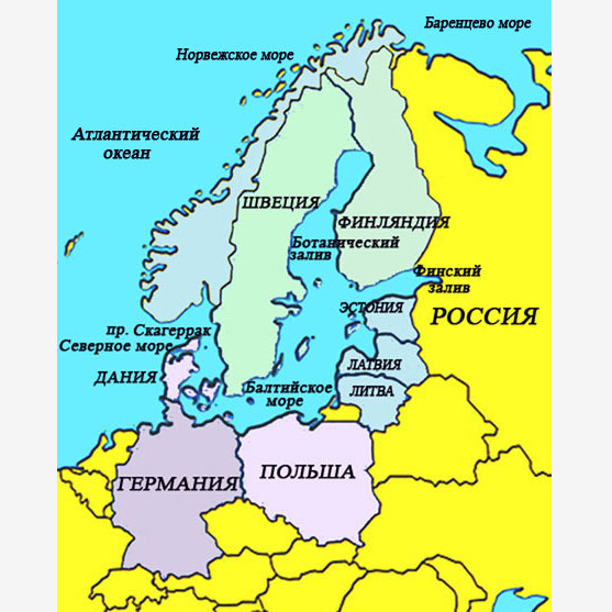
1. What do we know about the Baltic Sea?
At the beginning of the activity, invite the students to recall and list information they know about the Baltic Sea that they can write on the chalkboard. How many countries have access to the Baltic? Which coming neighbouring countries? After that, they can be given work cards number 1 and offer to apply on outline map Baltic region: the countries that are part of it, remember the capitals of the countries, sign the largest parts of the Baltic Sea, bays, rivers flowing into the sea.
Discuss with the students: calculate how many countries are included in the Baltic region? ( nine), why is indicated on the map more countries? (Norway, Czech Republic, Ukraine are included in the drainage basin of the Baltic Sea). Please note that Russia has access to the Baltic Sea in St. Petersburg and Kaliningrad.
Information about the Baltic Sea.
Age: about 15 thousand years
Area: 412,560 km 2 with the Kattegat Strait (about 390,000 km 2 without it).
Length coastline: about 8 thousand km.
Average depth: 52 m.
Maximum depth: 470 m (Landsort Basin).
Salinity: varies from 1-2 ‰ in the Gulfs of Finland and Bothnia to 25-30 ‰ in the straits.
The largest bays: Bothnian, Riga, Finnish.
The largest islands: Aland, Bornholm, Gotland, Rügen, Saaremaa, Hiiumaa, Oland.
The largest rivers flowing into the sea: Neva, Daugava, Neman, Venta, Vistula, Oder. In total, about 250 rivers flow into it.
Climate: Temperate maritime.
2. What is salinity and what is it in the Baltic Sea?
Everyone knows that sea water tastes salty, since a large number of various salts are dissolved in it, incl. and table salt - sodium chloride. In the oceans and most seas, water has a fairly stable salt content, determined by the amount of ions dissolved in water, which is equal to 35 ‰ ... Salinity is measured in ppm - the amount of grams of salt dissolved in 1 liter of water, i.e. this level of salinity means that one liter contains about 35 grams of salt.
The Baltic Sea is unique in that the amount of salt in it is much less than in the ocean and other seas. Baltic - brackish water body ... In the central part of the sea, the average salinity of water is 5-9 ‰, in the Gulfs of Finland and Bothnia it is even lower - about 3-4 ‰. As we approach the straits connecting the Baltic with the North Sea, salinity increases.
Modeling in the classroom. Talking about the salinity of water can be accompanied by a little modeling of the salt content in different seas. Calculate with students and prepare solutions of the following concentration. For greater accuracy, you can use a salt meter.
- The Dead Sea - 240 ‰ salt
- Mediterranean Sea - 39 ‰ salt
- World Ocean - 34.7 ‰ salt
- North Sea - 30 ‰ salt
- Strait of Kattegat - 15 ‰ salt
- Baltic Sea off the coast of Denmark - 9 ‰ salt
- Baltic Sea near Kaliningrad - 7 ‰ salt
- The Gulf of Finland - 3 ‰ salt
Some students can gently start the “tasting” with the most concentrated water, and some with the least concentrated water. Discuss your findings.
3. Organisms living in the Baltic Sea
Invite students to name the species of animals and plants that live in the Baltic Sea. Why are there no “real” marine animals in the Baltic Sea - whales, sharks, octopuses, corals? (Gather a variety of student responses). The discussion should suggest that the Baltic is in some way fundamentally different from other seas, and this feature is associated with salinity of water.
Compared to the real seas, the Baltic Sea with its brackish water has a poor flora and fauna. This is due to the fact that many marine organisms are not able to survive in low salinity, while for freshwater organisms, a slight increase in salt in water also causes death. Nevertheless, plant and animal species of both marine and freshwater origin successfully exist in the Baltic Sea.
Work in groups (3-4 people). Distribute cards ( work card number 2) depicting various organisms living in the Baltic Sea. The task is to correctly name the organism (or group of organisms); based on available knowledge, draw up short description (where it lives, what it eats, etc..). Then the groups make mini-performances. Then invite students to think about how these organisms are connected in the ecosystem, try to make a food web with them ( other types can be added). Discuss how other organisms are interconnected with each other? ( For example, the habitat - other algae, molluscs and crustaceans live on the fucus; some animals use bivalve shells as a substrate).
4. Excursion to the Baltic Sea coast
During your excursion to the seaside, collect a collection of storm emissions, i.e. marine organisms that can be collected from the seashore. Label your collection with the date, collection location and distance of discharge from the water's edge. In a classroom or field station (during summer camps, this can be any room, including a veranda), analyze the collection, identify the collected species of animals and plants. As a result of the excursion, you can arrange an exhibition or exposition " Baltic nature”, And also, having saved up the material, use it for the research work“ Storm emissions of the Baltic Sea ”.
Lift up the stones thrown by the sea of the board, slide the net through the thickets of green algae, stuck to the huge stones, look at the piles of the breakwaters. Collect all the organisms you come across, incl. empty clam shells. In addition, organisms that lead a motionless attached lifestyle are interesting and diverse. Such organisms belong to the ecological group of the periphyton. Use a scraper to inspect the fouling on wooden piles and stones... Here you can find green algae cladophora and eneteromorph, houses of balanus crustaceans, bryozoans, settled mussels.
After the tour, disassemble the collected material, breaking it into groups. Algae, invertebrates (crustaceans, molluscs), fish can be put in separate trays. Try to identify the animals and plants found, guided by the identifiers. You may need qualifiers to work. Release live animals into the sea, and take empty shells of mollusks and other similar finds to replenish collections. The results of your work should be displayed in the coastal survey card ( work card number 3).
What can be found in storm surges
Molluscs: Mussel (Mytilus edulis) - lives at a depth of 1 to 60 m. The most common mollusks of the Baltic. They are held firmly in place by their strong threads called byssus. They get their food by filtering the water. A large mussel can filter 5 liters of water per hour. For a year, all mussels manage to filter all the water in the Baltic.
Baltic macoma (Macoma baltica) - in storm emissions, it is easy to find the pale triangular shells of the Baltic macoma shell. They can be white, yellowish, pale pink. The maqoma inhabits the entire Baltic water area and survives even in freshened bays.
Miya's Sand Shell (Mya arenaria) Is the largest Baltic mollusk, its shell is 12 cm long. The shell is dirtier in color compared to the elegant Baltic shell. These molluscs can burrow to a depth of 1 m.
Heart (Cerastoderma spp.) - if you find a grayish-white shell resembling a heart on the coast, then it is a heart-shaped shell. These molluscs prefer clay and sand, burrowing, exposing siphons outside to filter the water.
Crustaceans: Sea acorn (Balanus spp.) is a barnacle that attaches to rocks, algae, and shells. Their body is hidden inside a special shell that forms a small house.
Bokoplav (Gammarus sp.) are small crustaceans that are easy to spot in algae accumulations. They are actively rushing about, swimming in circles.
Sea flea (Talitrus saltator) - small crustaceans, which are easy to find on the coast burrowing in the sand or hiding under algae.
Seaweed: Fucus (Fucus spp.) - Sea kelp growing on rocks. On the surface of the water, only floating bubbles are usually visible. Often other algae and balanus crustaceans can be found on the fucus.
Filamentous algae - a whole group of different types of green algae, which are thrown out during a strong storm. It is here that you can find a huge number of amphipods. The most common filamentous algae species are cladophora and ceramium.
Furcellaria (Furcellaria sp.) - belongs to the department of red algae. It can often be found after storms as black, branchy clumps. Sometimes the algae is thrown out in whole thickets. On the branches of furcellaria, you can often find raids in the form of nets - these are colonial organisms - bryozoans.
Higher vegetation: Zooster (Zoostera marina) - after a storm, a large amount of algae appears on the sandy shores, which looks like unwound ribbons stretching along the coast. This is a zooster, or sea grass. It forms whole underwater meadows at the bottom of the sea, where numerous inhabitants of the Baltic find their refuge.
Working card number 3.
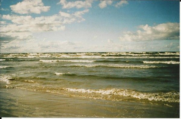
The Baltic Sea is the inland sea of the basin Atlantic Ocean and is located in a shallow depression between the Scandinavian Peninsula and the European continent. The system of the Danish straits, through the North Sea, connects the Baltic Sea with the ocean area.
The surface area is 386 thousand square kilometers, the average depth is 71 m, and the maximum depth is 459 m (the Landsortsjupet basin south of Stockholm).
The ancient Slavs called this sea Varangian.
Location of the sea on full map Atlantic Ocean -.
As a result of studying the bottom topography and the nature of the soils, scientists came to the conclusion that in the preglacial period there was land on the site of the Baltic Sea. Then, during the Ice Age, the depression, which now houses the sea, was filled with ice, the process of melting which led to the formation of a lake with fresh water.
About 14 thousand years ago, this lake merged with the ocean as a result of the subsidence of land areas - the lake turned into a sea. Then, after another uplift of the land in the region of Central Sweden, the connection between the sea and the ocean was severed, and it again turned into a closed lake-type body of water.
About 7 thousand years ago, another sinking of the land took place in the area of the modern Danish straits and the connection of the lake with the Atlantic was resumed.
Subsequent fluctuations in land level led to the formation of the modern Baltic Sea. ![]() The rise of land in the area continues to this day. So, in the area of the Gulf of Bothnia, the bottom rise is about 1 m in 100 years.
The rise of land in the area continues to this day. So, in the area of the Gulf of Bothnia, the bottom rise is about 1 m in 100 years.
The climate in the maritime region is temperate, characterized by small seasonal temperature fluctuations, frequent precipitation in the form of rains, fogs and snow.
Temperature surface waters in summer reaches +20 degrees C. As you move to the north, the water is cooler and in the Gulf of Bothnia does not warm up above + 9- + 10 degrees C. In winter, the water cools down to freezing point and the northern bays of the sea are covered with ice. Central and southern regions usually remain free of ice, but in extremely cold winters the sea can be completely covered with ice.
The sea water is highly desalinated, especially in areas remote from the Danish straits. The reason is the numerous rivers and streams (almost 250) flowing into the sea.
Among the large rivers, one can note the Neva, Narva, Vistula, Kemijoki, Western Dvina, Neman, Oder.
The currents in the sea form a cyclonic gyre; often their direction and speed are corrected by the winds.
The tides in the sea are very low - 5-10 cm, however, wind surges, especially in narrow bays, can exceed 3-4 meters.
The coastline of the Baltic Sea is heavily indented. There are many large and small bays, bays, capes, and spits. The northern shores are rocky; as you move to the south, rocks and stones are replaced by sand-pebble mixtures and sand. Here the shores are low and flat.
Islands of continental origin, especially many small rocky islets in the northern part of the sea. Large islands: Gotland, Bornholm, Sarema.
The relief of the seabed is complex. There are many uplifts and depressions that have appeared as a result of the activity of glaciers, river beds, and land fluctuations. However, the elevation differences are small - the sea is shallow.
The fauna of the Baltic Sea is relatively poor in the represented species. A feature of the sea fauna is the distribution of freshwater and marine animal species in different regions. In the northern, more fresher areas, especially near river mouths, there are mainly freshwater animals and species that easily tolerate water desalination. Closer to the Danish straits, the sea water is much saltier, so many typical marine life can be found here. The general species composition of the sea is scarce, but rather rich in quantitative terms.
The poverty of the sea fauna is also explained by its youth, because in the form that it has now, its age is estimated only five thousand years. Scientists predict that another 5,000 years will pass, and the Baltic Sea will again lose its connection with the ocean and turn into a large fresh lake... Many forms of marine life in such a short time simply did not have time to adapt to the local conditions of existence.
Nevertheless, the quantitative composition of the animals living in the Baltic Sea is quite large.
Bottom animal species are represented mainly by worms, gastropods and bivalve molluscs, small crustaceans and bottom fish - flounder, gobies. In some places you can find a shaggy-hand crab - an alien from the North Sea and has taken root here. Near the Danish straits, there is even a giant among jellyfish - cyanea. And another type of jellyfish - eared aurelia in the Baltic Sea is found almost everywhere. Small schooling fish - three-spined stickleback, Baltic sprat.
In the desalinated areas of the sea, there are many river fish: roach, perch, pike, bream, ide, pike perch, anadromous whitefish, burbot, etc.
In the Baltic Sea, such valuable fish are hunted as herring (about half of the total fish catch), sprat (sprat), salmon, eel, cod, and flounder.
Marine mammals in the Baltic Sea are represented by only three species of seals: the gray seal (tyvyak), the common seal (seal), and the common porpoise, which is a toothed cetacean.
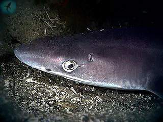
Sharks in the Baltic Sea are represented only by the ubiquitous katrana - a small spiny shark, which is dangerous to humans only by its spines on its dorsal fins. But these fish are not settled in all areas of the sea - too freshened and shallow areas are not suitable for them to live.
However, in the area of the Danish Straits, which connect the Baltic with the North Sea, other predators are sometimes found - herring sharks. No such guests have been registered on the Russian shores of the Baltic Sea.
In conclusion, I would like to note that at the present time the Baltic Sea is intensively polluted by various chemical and biochemical effluents, as well as microelements contained in precipitation. This leads to the mass death of microflora and microfauna, which in large quantities settle to the bottom and are processed by bacteria into hydrogen sulfide. And hydrogen sulfide has a detrimental effect on all living organisms in the bottom layer of water. If urgent measures are not taken, the number of aquatic animals in the sea will be significantly reduced.
One of the inland seas of the Atlantic is a small
The Baltic Sea is the northern marginal body of water in Eurasia. It cuts deeply into the land, and due to this it belongs to the internal type of water flows. The sea fills the waters of the Atlantic. It is located in Northern Europe. The Baltic countries have access to the Baltic Sea. And also such states as: Denmark, Sweden, Finland, Germany, Russia and Poland. The stream connects to the ocean through the system and
The area of the reservoir is about 415 thousand square km. The volume of the water surface is more than 20 thousand cubic meters. km. The deepest trench is 470 meters.
Hydrology
The Baltic Sea, the salinity of which greatly affects the animal and vegetable world, filled with a huge number of Their constant source is precipitation. Salt streams penetrate into the reservoir through bays and tributaries. The tides have insignificant levels and, as a rule, their magnitude is not more than 20 cm.
It is constantly within the radius of one mark. They can have a strong influence on her air masses... At the coast, it can rise up to 50 cm, in narrower places - up to 2 meters.
There are practically no storms on the water stream. Like other seas washing Russia, the Baltic body of water is calm, and rarely when its waves can reach a height of 4 meters. Most of all storms in autumn, in November. The maximum fluctuations are 7-8 points. In winter, they practically stop, this is facilitated by ice.
The constant current of the Baltic Sea is small. Within 10-15 cm / s. The maximum current increases during storms up to 100-150 cm / s.
The tides of the Baltic Sea are almost imperceptible. This is facilitated, to a greater extent, by the isolation of the water flow. Their level varies within 20 meters. The maximum increase in the water level is in August and September.
Much of the coastline is covered with ice from October to April. South part and the center of the sea does not freeze, but glaciers can drift along them during the thawing period (June-August).
The Baltic Sea is rich in Natural resources... Oil reserves are hidden here, new fields are being developed. Also recently found large deposits of amber. The Nord Stream gas route runs along the seabed.
Moreover, the Baltic Sea is rich in fish and seafood. V last years the ecology of the stream has deteriorated significantly. The waters are clogged with toxins coming out of large rivers. The presence of chemical weapons dumps is also recorded.
Due to the shallow depth of the sea, shipping is not very developed here. Only light ships are able to cross the watercourse without any problem. The largest ports of the Baltic Sea are Vyborg, Kaliningrad, Gdansk, Copenhagen, Tallinn, St. Petersburg, Stockholm.
The waters of this reservoir are unsuitable for the development of resort tourism, but nevertheless there are sanatoriums and hospitals on the coastal part. These are the Russian resort towns of Svetlogorsk, Zelenogorsk, Sestroretsk, Latvian Jurmala, Lithuanian Neringa, Polish Koszalin and Sopot, German Albek and Bints. 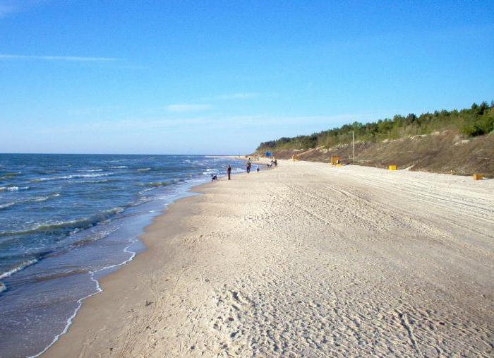
Brief characteristics of water temperature and salinity of the sea
In the central part of the Baltic Sea, as a rule, the temperature rarely exceeds 15-18 o C. At the bottom, it is about 4 degrees. Calm weather is often observed in the bay and +9 .. + 12 о С.
The Baltic Sea, the salinity of which decreases in the direction from west to east, at the beginning of the current has an official indicator of 20 ppm. At depth, this figure increases by 1.5 times. 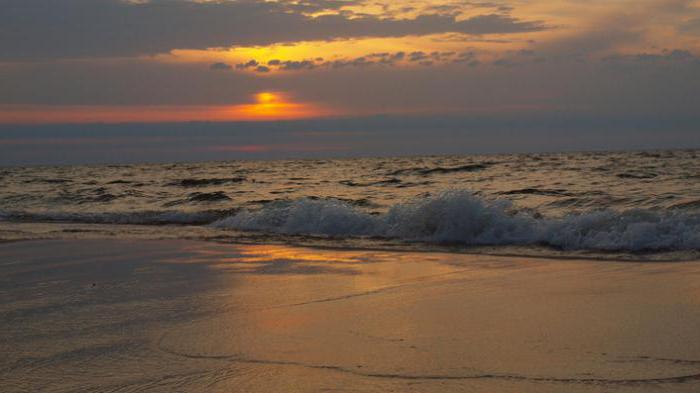
Name
For the first time, the etymological name "Baltic" is found in a historical treatise of the 11th century. The earlier name of the sea is Varyazhskoe. This is what is mentioned in the famous "Tale of Bygone Years". 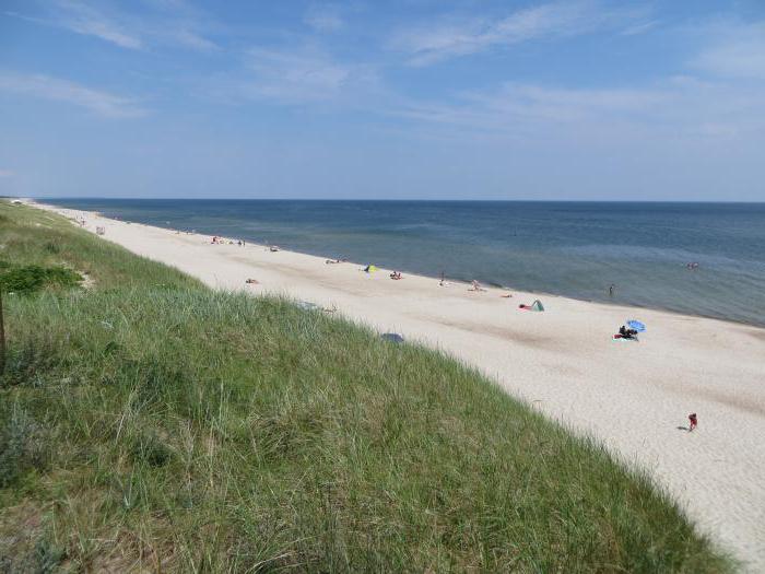
Extreme points
Extreme points of the Baltic Sea:
- southern - Wismar (Germany), coordinates - 53 ° 45` s. NS.;
- northern - Arctic Circle coordinates - 65 ° 40` s. NS.;
- eastern - St. Petersburg (Russia), coordinates - 30 ° 15` east. etc .;
- western - Flensburg (Germany), coordinates - 9 ° 10` east. etc.
Geographical characteristics: territory, tributaries and bays
The Baltic Sea (salinity and its characteristics are described below) stretches from southwest to northeast for 1360 km. The greatest width is located between the cities of Stockholm and St. Petersburg. It is 650 kilometers long.
By historical information, The Baltic Sea has existed for about 4 thousand years. At the same time period, the Neva (74 km), which flows into this body of water, begins to exist. In addition to it, more than 250 rivers merge with the stream. The largest of them are the Vistula, Oder, Narva, Neman, Zapadnaya Dvina.
Several ports of the Baltic Sea lie on its large bays. To the north is the Gulf of Bothnia, the largest and deepest. In the east - Riga, located between Estonia and Latvia, Finnish, washing the shores of Finland, Estonia, Russia, and due to the fact that the latter is separated from the sea by a sand bar, the water in the stream is practically fresh. This is a unique feature.
The average depth of the Baltic Sea is 50 meters, the bottom is completely within the continent. This nuance makes it possible to attribute it to inland continental reservoirs. 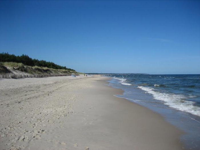
Islands
There are more than 200 islands of different sizes in the sea. They are located unevenly both near the coast and far from them. The largest Baltic islands are Zeeland, Falster, Meen, Langeland, Lolland, Bornholm, Funen (owned by Denmark); Öland and Gotland (Swedish islands); Fehmarn and Rügen (refers to Germany); Hiiumaa, Saaremaa (Estonia).
Coastline
The Baltic Sea (the ocean strongly affects it with its waters) has a different coastline along the entire perimeter of the waters. In the northern part - the bottom is uneven, rocky, and the coast is indented with small bays, ledges and small islands. The southern part, on the contrary, has a flat bottom, and the coast is low, with sandy beach, which in some areas is represented by small dunes. A frequent occurrence on the young coast is sand spits that cut deep into the sea.
The sedimentary bottom is represented by green, black silt (has glacial origin) and sand, and the soil consists of stones and boulders. 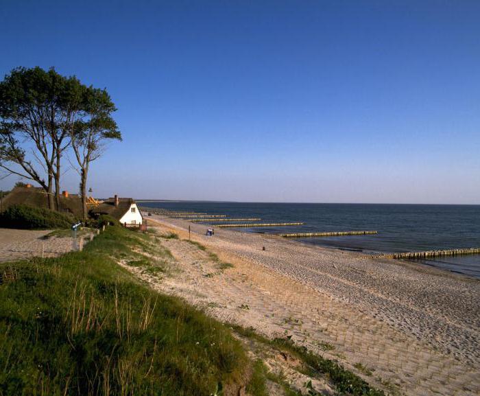
Salinity and its regular changes
Due to the large amount of precipitation and powerful water runoff from the rivers, the Baltic Sea (the salinity of the reservoir is relatively low) is filled with an abundance of fresh water. It is distributed unevenly. Where the Baltic reservoir deeply enters the coast, the water is practically fresh, and its salinity is influenced by the North Sea. This situation is not permanent. Storm winds stir up the water.
Based on this, the salinity of the Baltic Sea is low. A decrease in its level is characteristic of the coastline, the largest number of ppm is at the bottom.
In the territory where the watercourse meets the straits in the west, the salinity of the waters is up to 20 ‰ on the sea surface, at the bottom - 30 ‰. The lowest rate is found on the shores of the Gulf of Bothnia and the Gulf of Finland. It does not exceed 3. The level from 6 to 8 ‰ is typical for the waters of the central part.
Seasonality also affects the distribution of the salinity of the Baltic Sea waters. So, in the spring-summer season, it decreases by 0.5-0.2 ppm. This is due to the fact that thawed rivers carry fresh water to the sea. And in autumn and winter, on the contrary, it increases due to the influx of cold northern masses.
The change in the salinity of the sea is one of the important factors that regulate biological, physical and chemical processes on the coast. Partly due to the freshness of the water, the coast has a loose structure.
The Baltic Sea is located between Central and Northern Europe and is part of the Atlantic Ocean basin. The reservoir washes the shores of such states as Russia, the Baltic countries (Estonia, Lithuania, Latvia), Poland, Germany, Denmark, Scandinavian countries (Finland, Sweden). The water surface area is 415 thousand square meters. km. The volume is 21.7 thousand cubic meters. km. The maximum length is 1600 km. The maximum width is 193 km. The average depth corresponds to 55 meters, and the maximum is 459 meters. The length of the coastline is 8 thousand km.
Geography
The reservoir is connected by artificial canals with the North and White Seas. In the first case, it is the Kiel Canal (length 98 km). It allows ships, without skirting Jutland, to immediately enter the North Sea. In the eastern part of the canal there is german city Keel, in western city Brunsbüttel. Concerning Of the White Sea, then the way to it goes through the White Sea Canal.
The Baltic is naturally connected to the North Sea through the Kattegat (200 km long) and Skagerrak (240 km long) straits. It is a body of water between Jutland and Scandinavia.
Gulfs
There are the following large bays in the Baltic: Botanichesky, Finnish, Riga, Curonian.
The Botanical Bay is located in the northern part of the body of water between Sweden and Finland. In the southern part it has the Aland Islands. Its area is 117 thousand square meters. km.
The Gulf of Finland is located in the eastern part of the Baltic. It washes the shores of Estonia, Russia and Finland. Its area is 29.5 thousand square meters. km. On its banks there are such big cities like St. Petersburg, Helsinki and Tallinn.
The Curonian Lagoon is a lagoon separated from the sea by the Curonian Spit. Its area is 1610 sq. km. The waters of the gulf belong to Lithuania and the Kaliningrad region of Russia. The city of Klaipeda is located at the junction of this small reservoir with the sea.
Islands
The Aland Islands are an archipelago in the Botanical Bay. There are 6757 islands in it, but only 60 people live. The largest island is Åland with an area of 685 sq. km. The total area of the archipelago is 1552 sq. km.
The island of Gotland (Sweden) is located in the central part of the sea and 100 km from the Swedish coast. Its area is almost 3 thousand square meters. km. About 57 thousand people live on it.
Another Swedish island is called Öland. Its area is 1342 sq. km. This piece of land is home to 25 thousand people. They receive at least 500 thousand tourists every summer.
Although the island of Bornholm is located near the Swedish coast, it belongs to Denmark. Its area is 588 sq. km. It is home to 42 thousand people. From the island to Copenhagen 169 km, and to Sweden 35 km.
Poland owns the island of Wolin with an area of 265 sq. km. On it is the city of Volin with a population of about 5 thousand people.
The island of Rügen belongs to Germany. Its area is 926 sq. km. It is home to 77 thousand people. These are the lands of the Prussian province of Pomerania.
The Estonian island of Saaremaa, which is part of the Moonsund archipelago, also belongs to the large islands. It belongs entirely to Estonia. As for Saaremaa, its area is 2.7 thousand square meters. km with a population of 35 thousand people. The archipelago has 4 large and about 500 small islands. Their total area is about 4 thousand square meters. km.
Rivers flowing into the Baltic Sea
V salt water such rivers as the Neva with a length of 74 km, Narva (77 km), Daugava or Western Dvina (1020 km), Neman (937 km), Vistula (1047 km), Pregolya (123 km), Venta (124 km), Odra or the Oder (903 km).
Baltic Sea on the map
Hydrology
The reservoir is notable for the fact that it constantly contains a large excess of fresh water. They come from rivers and as a result of precipitation. Surface salt water flows into the North Sea through the Kattegat and Skagerrak straits. And here salty water enters the Baltic in the same way, but only through a deep current. Minor hot flashes. Their size does not exceed 20 cm.
Wind has a much greater effect on the water level near the coast. It can raise the level up to 50 cm, and in narrow bays and bays up to 2 meters. If we talk about standing waves (seiches), then here the amplitude of oscillations reaches 50 cm.
In terms of storms, the Baltic Sea is generally calm. The wave height does not exceed 4 meters. On rare occasions, winds can create waves with a height of 10 meters. Since the salinity of the water is low, the hulls of ships can be iced during the winter period.
Ice appears in the bays in the month of November. This applies to the northern and eastern regions. At the same time, the thickness of the ice crust can reach 60-65 cm. The southern and central parts of the reservoir are not covered with ice. The ice cover melts in the month of April. In the north, floating ice floes can be found in the month of June. Since 1720, the reservoir has completely frozen 20 times. The last such case was recorded in January 1987. During this period, there was an extremely harsh winter in Scandinavia.
V central regions of the sea, the color of the water is bluish-green. It also has maximum transparency. The closer to the coast, the transparency decreases, and the color changes to pale green with a yellowish or brown tint. Poor transparency is often caused by plankton.
Water temperature and salinity
V central parts sea surface water temperature is 14-17 degrees Celsius. In the Botanical Bay, the corresponding values are 9-12 degrees Celsius. But in Gulf of Finland 1 degree warmer than in the central part. At depth, the temperature first decreases and then rises. At the bottom, it is 4-5 degrees Celsius.
Have sea water salinity decreases from west to east. In the extreme western points, it is equal to 20 ppm at the sea surface. At a depth of 30 ppm. In the center of the reservoir, the salinity at the surface is 7-8 ppm. In the north it is 3 ppm, and in the east 2 ppm. With depth, these figures increase and reach 13-14 ppm.
1992 Helsinki Convention
In 1992, the states, whose shores are washed by the Baltic Sea, signed a convention on the strict observance of environmental and maritime law in the waters of the Baltic. The governing body of the convention is the Helsinki Commission (HELCOM) or the Marine Environment Protection Commission. The contracting parties are Russia, Sweden, Finland, Estonia, Latvia, Lithuania, Denmark, Germany, Poland. The ratified letters were deposited in Germany, Sweden and Latvia in 1994, Finland and Estonia in 1995, Denmark in 1996, Lithuania in 1997, Russia and Poland in 1999.
The convention testifies to the high responsibility that people feel in relation to the unique region formed by the Baltic waters. Its flora and fauna should not be at risk of ecological disaster.
The Baltic Sea is washed by nine countries: Latvia, Lithuania, Estonia, Russia, Poland, Germany, Finland, Sweden and Denmark.
The coastline of the sea is 8.000 km. , and the sea area is 415,000 sq. km.
The sea is believed to have formed 14,000 years ago, but 4,000 years ago in the current outline.
The sea has four bays, the largest Bothnian(washes Sweden and Finland), Finnish(washes Finland, Russia and Estonia), Riga(washes Estonia and Latvia) and freshwater Curonian(washes Russia and Lithuania).
On the sea there are the large islands of Gotland, Oland, Bornholm, Wolin, Rügen, Alandia and Saaremaa. Most big Island Gotland belongs to Sweden, its area is 2.994 sq. km. and with a population of 56.700 people.
Such flow into the sea large rivers like the Neva, Narva, Neman, Pregolya, Vistula, Oder, Venta and Daugava.
The Baltic Sea is a shallow sea with an average depth of 51 meters. The most deep place 470 meters.
The bottom of the southern part of the sea is flat and rocky in the North. The coastal part of the sea is sand, but most of the bottom is a deposit of green, black or brown clayey silt. The clearest water is in the central part of the sea and in the Gulf of Bothnia.
There is a very large excess of fresh water in the sea, which is why the sea is slightly salty. Fresh water enters the sea due to frequent precipitation, numerous big rivers... The saltiest water is off the coast of Denmark, where the Baltic Sea meets the saltier North Sea.
The Baltic Sea is one of the calm ones. It is believed that in the depths of the sea, waves do not reach more than 4 meters. However, off the coast, they can reach 11 meters in height.
In October-November, ice can already appear in the bays. The coast of the Gulf of Bothnia and Finland can be covered with ice up to 65 cm thick. The central and southern parts of the sea are not covered with ice. Ice melts in April, although drifting ice can be found in the north of the Gulf of Bothnia in June too.
The water temperature in the summer in the sea is 14-17 degrees, the warmest Gulf of Finland is 15-17 degrees. and the coldest Bothnian
bay 9-13 gr.![]()
Due to the shallow depths in the Gulf of Finland and the Archipelago Sea, many vessels with significant draft are inaccessible. However, all the largest cruise ships pass through the Danish Strait to the Atlantic Ocean.
The main limiting factor of the Baltic Sea is bridges. This is how the Great Belt Bridge connects the islands of Denmark. This suspension bridge was built in 1998, its length is 6790 km. and about 27,600 cars pass through the bridge every day. Although there are bridges that are longer, for example, the Erssun bridge is 16 km., And the most big bridge Femersky, its length is 19 km and it connects Denmark with Germany across the sea.
In the Baltic Sea, weasel is found, some individuals were caught in 35 kg. In the sea are also found cod, flounder, eelpout, eel, lamprey, anchovy, mullet, mackerel, roach, ide, bream, crucian carp, asp, chub, pike perch, perch, pike, catfish, burbot, etc.
Whales have also been sighted in Estonian waters.
Not so long ago, one could find a seal in the Baltic, but now there are practically no seals left due to the fact that the sea has become more freshwater.
.
The largest ports in the Baltic Sea: Baltiysk, Ventspils, Vyborg, Gdansk, Kaliningrad, Kiel, Klaipeda, Copenhagen, Liepaja, Lubeck, Riga, Rostock, St. Petersburg, Stockholm, Tallinn, Szczecin.
Resorts of the Baltic Sea.
: Russia: Sestroretsk, Zelenogorsk, Svetlogorsk, Pionersky, Zelenogradsk, Lithuania: Palanga, Neringa, Poland: Sopot, Hel, Koszalin, Germany: Ahlbeck, Binz, Heiligendamm, Timmfendorf, Estonia: Parnu, Narva-Jõesuu, Latvia: Saulkrasti and Jurmala .
The Latvian ports of Liepaja and Ventspils are in the sea, while Riga and the resorts Saulkrasti and Jurmala are located in the Gulf of Riga.
Gulf of riga
, it is the third of the four bays of the Baltic Sea and it washes two countries, Latvia and Estonia. The area of the bay is only 18,100 km2, it is 1 \ 23 part of the Baltic.The deepest part of the bay is 54 meters. The bay cuts into the land from the open sea for 174 km. The width of the bay is 137 km.
The most important cities on the coast of the Gulf of Riga are Riga (Latvia) and Pärnu (Estonia). The main resort town of the bay is Jurmala. In the gulf the most large island Saaremaa belongs to Estonia with the city of Kuressaare.
The western coast of the bay is called Livsky and is a protected cultural zone.
The coast is mostly low and sandy.
The water temperature in summer can rise to +18, and in winter it drops to 0 degrees. The surface of the bay is covered with ice from December to April.