The Azov sea is rightfully considered the shallowest sea. It is this inland sea that has the smallest depth, due to which its waters warm up very quickly with the arrival of heat, but also cool down quickly in the autumn period.
Average annual temperature water in the Sea of Azov is 12C. This is significantly higher than, for example, in the neighboring Black Sea. For Azov, winter freezing of the upper layers of water is characteristic. This is due to their low salt content, despite the fact that salt-enriched water from the Sivash is regularly poured into the Sea of Azov.
Maximum depth Sea of Azov small - almost 15 m. At the same time, in the coastal part, the depth fluctuates at the level of 2-6 m. Distinctive feature Of the Sea of Azov lies in the complete absence of ebb and flow. Instead, there are constant changes in bottom surfaces as a result of the action of silt deposits.
Factors that can affect the maximum depth of the Sea of Azov.
The Azov Sea is inland. The main sources of water entering it are rivers, Sivash and Black Sea, with which Azov is connected by the Kerch Strait, as well as precipitation... Changes in water intake from even one of these sources can significantly affect sea depth.
In addition, how much the sea receives water and rivers, seas and bays, snow and rain, one more should be considered important factor – high temperatures air masses, which provoke accelerated evaporation of water in the summer.
The next factor is silt deposits. The bottom of the Sea of Azov throughout its entire area is flat and flat, very soft. This is ensured by deposits of bottom silt covered with fine sand. During storms (which are not so rare here), silt masses rise and are carried by water currents to other areas. It is this feature that often complicates the work of the crews of ships that navigate the Sea of Azov. In order not to unexpectedly get aground, it is recommended that ship captains, at a distance from the central part of the sea, in which the maximum depth of the Sea of Azov reaches 13.5-14.5 m, periodically check the depth. Only this will help to secure the further path, since the compiled depth maps for the sailing of the Sea of \ u200b \ u200bAzov very quickly become outdated and lose their relevance.
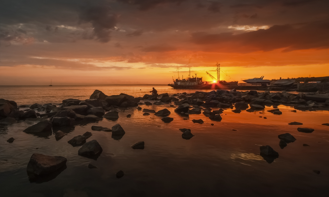
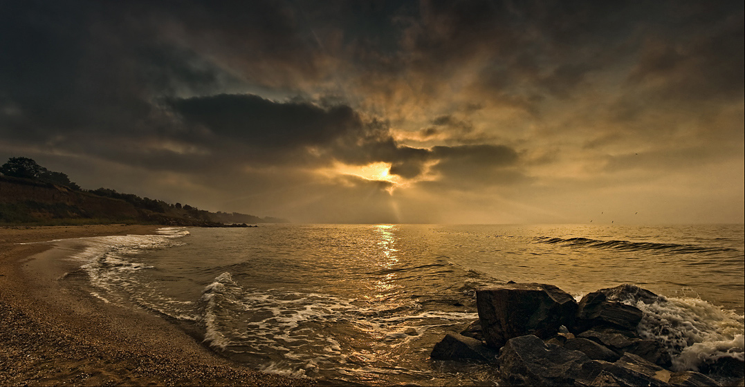
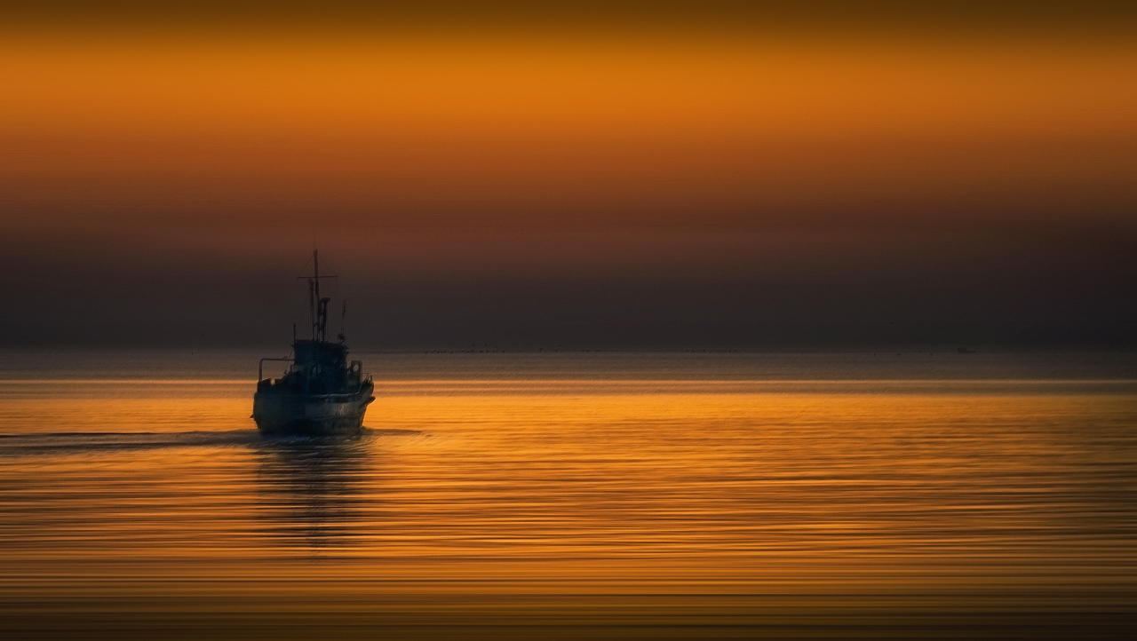
The shallow depth of the Sea of \ u200b \ u200bAzov is an advantage for tourists and a disadvantage for those who plow its expanses on ships. But be that as it may, it is thanks to this factor that the water in the sea is so warm in summer, which cannot but please everyone who wants to swim in the gentle sea waters and experience the healing power of local mud baths.
Sea of Azov (Ukrainian Sea of Azov, Old Greek Μαιῶτις λίμνη, Latin Palus Maeotis) - a semi-enclosed sea Atlantic Ocean in the east of Europe. The shallowest sea in the world: the depth does not exceed 13.5 meters, the average depth is about 7.4 m (according to various estimates, from 6.8 to 8 m).
The Sea of Azov is connected to the Atlantic Ocean by a long chain of straits and seas ( Kerch Strait- Black Sea - Strait of Bosphorus - Sea of Marmara - Strait of Dardanelles - Aegean Sea - Mediterranean Sea - Strait of Gibraltar - Atlantic Ocean).
The two largest rivers flow into the sea - and the Kuban River.
THE COAST OF THE SEA OF AZOV AND THE RIVER DELTA
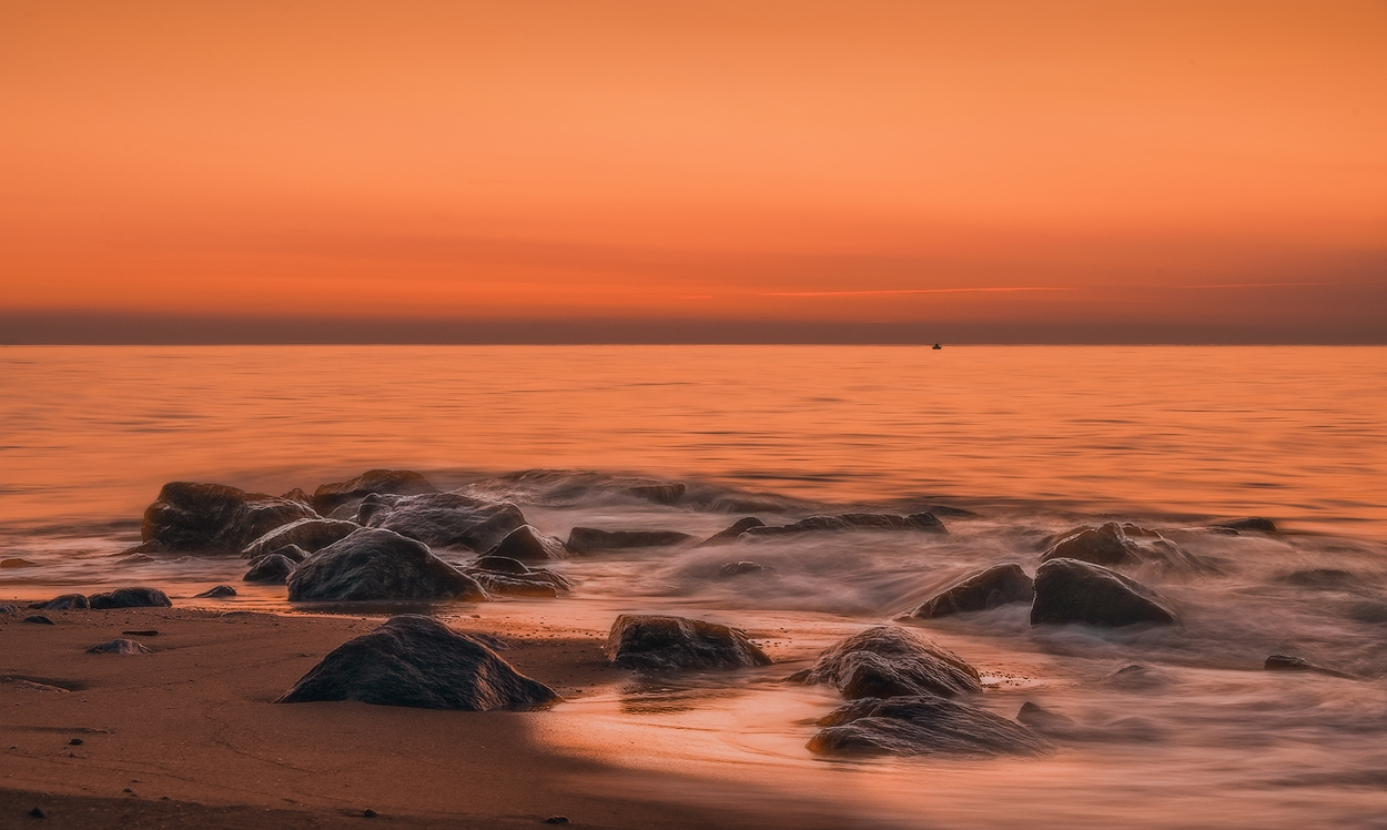
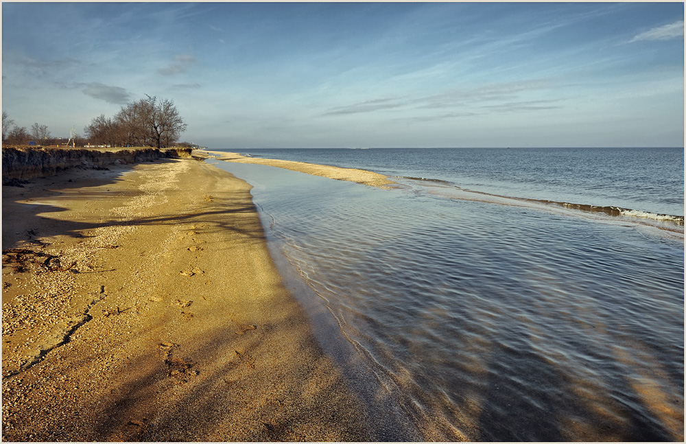
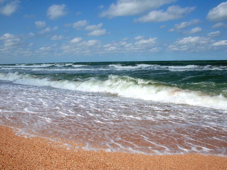
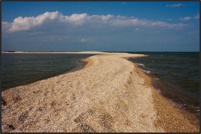
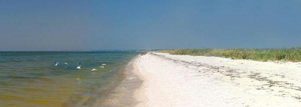
The coast of the Azov Sea is less picturesque and diverse than the Black Sea. But it also has its own, unique beauty. The steppes come close to the sea, and in some places the floodplains overgrown with reeds. The shores are treeless, they are either low and gentle, with a sandy-shell beach, or low, but steep, composed of yellow loess-like loams. The coastline of the sea forms rather smooth curves, and only long sandy spits give it some ruggedness. A large number of spits is one of the characteristic features of the shores of the Azov Sea.
West Coast.
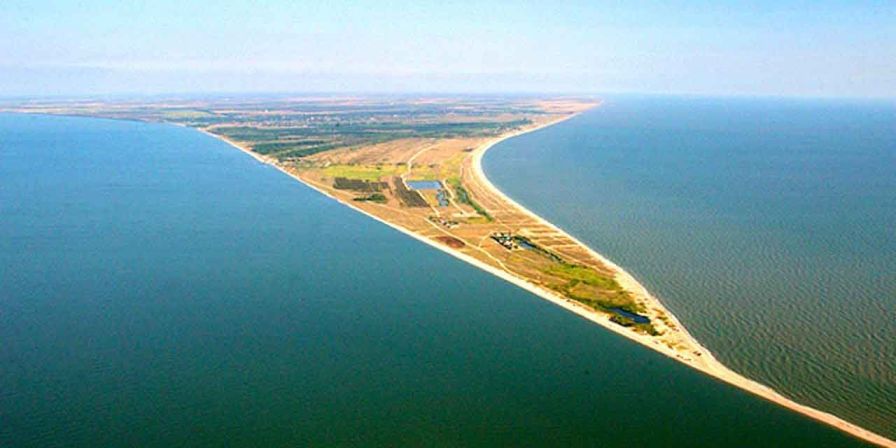
The western coast of the Sea of Azov is represented by a long braid - the Arabat arrow. It stretches along the sea coast for 112 km, separating the shallow Sivash Bay from it. The width of this flat sandy-shell spit ranges from 270 m in the southern and middle parts of it to 7 km in the northern, where there are several small hills.
The Arabat arrow is a huge natural beach... A series of long shoals stretched parallel to it. They are perfectly visible from the walls of the old Genoese fortress, located near the village of Arabat, or directly from the elevated indigenous coast. In quiet sunny weather, the greenish-blue waves of the sea with a light noise gently run onto the sandy-shell beach and the foam of the light surf borders it, like a narrow white lace. White-winged gulls glide low over the water, lurching onto the wing. In the distance, on the spit, the salt extracted from the Sivash shines dazzlingly under the rays of the hot sun. The sea is beautiful and in a storm. When the fierce Nordost blows, it darkens, becomes harsh.
With an angry noise, boiling white foam, steep-walled waves crash onto the shores. You can admire for hours the foamed sea space, the headlong run and the stormy surf of the waves.
Any person who has visited the Sea of Azov will always have a memory of its discreet, but soul-stirring beauty.
Hot springs are open on the Arabat Spit mineral water, in its own way chemical composition and medicinal properties superior to Matsesta. On the basis of these healing waters, it is planned to create a new resort - the Azov Matsesta.

South coast.
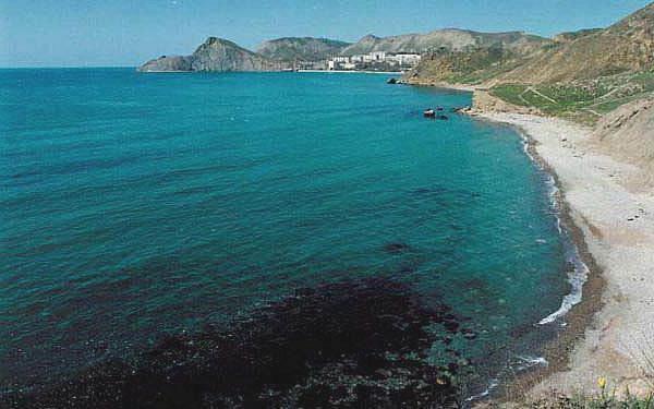
It is represented by the territory of the Kerch and Taman peninsulas, between which the Kerch Strait is located, connecting the Azov and Black Sea... The Kerch Peninsula is the eastern end of the Crimea; its area is about 3 thousand square meters. kilometers. Found in the bowels of the peninsula large deposits iron ores feeding the metallurgy of the Azov region, oil and natural gas.
The northern and northeastern parts of the Kerch Peninsula are composed of marls, clays, limestones; Sandstones of the Tertiary age are found in some places.
The western part of the Kerch Peninsula is flat, the eastern part is hilly. Within the peninsula, the southern coast of the Sea of Azov for the most part drops abruptly into the sea, leaving only a narrow strip of the beach. In places, the steep banks are composed of bryozoan limestones, which staunchly resist the onslaught of sea waves. Such, for example, is Cape Kazantip, at the base of which lies a bryozoan reef - an atoll. To the west of this cape is the Arabat Bay, to the east is Kazantip Bay. To the east of Cape Kazantip, there is a low-lying alluvial section of the coast. The shores of both bays are composed of soft clay rocks. Yuzhneemys Kazantip - Aktash salt lake. This is a relict lake. It is the remnant of the Kazantip Bay, which once jutted far into the land.
In the middle of the Kerch Peninsula, the low Parpach ridge stretches from west to east. Between this ridge and the coast of the Sea of Azov. there is a wide longitudinal valley. In the lower parts of it there are salt lakes, in particular the Chokrak Lake, known for its healing properties, as well as a number of mud volcanoes.
East of the Kazantip Bay, near the Kerch Strait, the coast of the Sea of Azov is calmer, but here it is characterized by capes composed of solid bryozoan limestones, for example, capes Zyuk, Tarkhan and others.

The Kerch Strait, which connects the Black and Azov Seas, is shallow and relatively narrow. Its width ranges from 4 to 15 km. The length of the strait is 41 km. The depth is about 4 m.
In ancient times, the Kerch Strait was called the Cimmerian Bosporus. The name itself contains an allusion to the depth of the strait, since "Bosporus" in Russian means "bull ford".
The Crimean coast of the strait is steep in places. In its northern part is the port city of Kerch.
The Caucasian coast of the Kerch Strait is low, sandy, in places with dunes. The channel's fairway is cluttered with reefs, sandbars and coastal shoals, which previously made navigation difficult. Now a channel has been dug in the strait for the passage of ships with a large draft.
Communication through the strait between the Crimea and the Caucasus was previously carried out by ordinary steamships carrying goods and passengers. In the spring of 1955, a railway crossing was opened. On the Crimean coast, northeast of Kerch, built railroad station Crimea, and on the Caucasian coast, on the Chushka spit, the Caucasus railway station was built.
On large diesel-electric ferries, trains are easily and quickly transported through the Kerch Strait. The railway route between the Crimea and the Caucasus is thus significantly reduced.
Taman Peninsula, which is part of Krasnodar Territory, covers an area of approximately 1900 sq. km. Of these, a little more than 900 square meters fall on land. km, and the rest of the territory - estuaries and floodplains.
Its nature is peculiar. From a geological point of view, this is a young peninsula, as it was formed in the Quaternary period. Back in the 1st century A.D. e. in its place there were about five islands, the transformation of which into a peninsula took place, apparently, in the 5th century AD. e. under the influence of accumulative "activity of the Kuban River, mud volcanoes and tectonic uplifts. Taman Peninsula continues.
The surface of the peninsula is a hilly plain with low dome-shaped heights, elongated in the form of discontinuous ridges from the southwest to the northeast. Mud volcanoes and ancient burial mounds are scattered almost everywhere. The landscape is enlivened by numerous estuaries. Plains overgrown with reeds and sedges are also widespread.
The Taman Peninsula contains in its depths such natural resources as oil, combustible gases, iron ore, salt, building materials in the form of limestone, clay and gravel.
The climate of the peninsula is moderately warm. The sun generously supplies it with the warmth of its rays, but there is little precipitation here - only 436 mm per year - and therefore there is a lack of moisture.
On the peninsula there are fertile chernozem-like and chestnut soils covered with drought-resistant steppe, and along the Kuban River valley - with flooded vegetation.
It is famous now for its vineyards.
The shores of the Taman Peninsula are quite diverse, but two types of shores prevail: high, steep - abrasive, that is, formed as a result of the destructive work of sea waves, and low, flat - accumulative. The latter were formed from sandy-argillaceous deposits as a result of the activity of sea waves and currents.
The coast of the Taman Bay, from Cape Tuzla to the village of Taman, is elevated and steep. On average, its height here ranges from 15 to 30 m. To the east of the village of Taman, the coast decreases and remains low throughout the southern and east coast bay. Only in some places there are steep cliffs, and this is often due to the cultural layer of ancient Phanagoria.
The northern coast of the bay is also elevated and in some places drops abruptly to the sea.
“Accumulation” in Latin means “accumulation”. This term in geology denotes the process of deposition of loose material of various origins.
The Chushka Spit, built largely of quartz sand and broken shells, has low banks.
Further to the east, the coast of the Taman Peninsula is high (up to 50-60 m above the level of the Sea of Azov) and often has a stepped landslide character. It is composed mainly of loess-like clay and is bordered by a strip of beach, consisting of sandy-clay deposits, in some places with an admixture of shells, pebbles and rubble.
Then, right up to the village of Golubitskaya, the coast of the Sea of Azov goes down and up again, but, starting from this village, it becomes low, and in the area of the Kuban River delta it acquires a swampy character.
It is interesting to note that in the area of the village of Kuchugury on the low coast of the Sea of Azov, there are aeolian landforms in the form of low (1-3 m) sandy mounds - dunes, formed under the influence of northern winds.
The attraction of the Taman Peninsula are mud volcanoes (salzes), which number up to 25. Many of them look like low cones with truncated tops. Some salses are temporarily inactive. Others give off dirt and gases such as methane and nitrogen. carbon dioxide, carbon monoxide, hydrogen sulfide, hydrogen.
The eruptions of mud volcanoes are usually calm and quiet, but sometimes they resemble the eruptions of real volcanoes, since they are accompanied by an explosion, and the products of volcanic activity are then scattered hundreds of meters from the crater, and the liquid mud forms large streams.
Very interesting phenomenon represent mud volcanoes at the bottom of the Sea of Azov near the shores of the Taman Peninsula. Thus, intense mud volcanic activity was observed near the village of Golubitskaya. One of the eruptions was noted on September 6, 1799. An underground rumble was heard, then a deafening crack was heard, and over the sea, 300 meters from the shore, a column of fire and black smoke rose. The eruption lasted for about two hours, which led to the formation of an island of mud with a diameter of over 100 m and a height of up to 2 m. A few months later, it disappeared, washed out by the waves of the sea.
Similar eruptions were repeated later - in 1862, 1906, 1924, 1950 and 1952. In 1952, to the west of the village of Golubitskaya, 5 km from the coast, also as a result of mud volcanic activity, a mud island was formed, which was then washed out by sea waves.
East coast of the Azov Sea
The eastern coast of the Sea of Azov, from Temryuk to Primorsko-Akhtarsk, for about 100 km is a low-lying delta of the Kuban River with numerous estuaries, channels, extensive floodplains overgrown with reeds and sedges. The Kuban River, originating from the glaciers of Mount Elbrus, is one of the largest and most abundant rivers North Caucasus... Its length is 870 km. The catchment area is 57,900 sq. km. Its delta was formed on the site of the gulf of the Sea of Azov, which went deep into the land. Tens of thousands of years ago, this bay stretched to the place where Krasnodar is now located. The huge lagoon was separated from the sea by an embankment and then gradually filled with river sediments. A well-known role in the formation of the southwestern part of the delta was played by the activity of mud volcanoes (salz) of the Taman Peninsula, which at that time still had the appearance of an archipelago of small islands. The products of the eruptions of mud volcanoes carried the channels between the islands and, along with the river nayaos, gradually filled the lagoon.
The formation of the delta continues in our time, and it is experiencing subsidence, amounting to 5-6 mm per year for Achuev, and 3 mm per year in the rest of the delta.
The Kuban River annually carries to the Sea of Azov an average of 11.4 billion cubic meters. meters of water containing in total over 3 million tons of dissolved substances and a mass of turbidity. The water in the river is muddy all year round, but it carries a lot of sediment during floods, which are observed in the Kuban on average 6-7 per year. The total amount of solids carried out by the river (the so-called solid runoff) is 8.7 million tons per year. To transport such a load would require over 52,000 boxcars. Due to these sediments, the Kuban delta is growing. Now the Kuban delta, covering an area of 4300 sq. km, begins at the so-called Raz-der, near the city of Slavyansk, where the Protok arm separates from the Kuban to the right (north). The latter carries away about 40-50% of the Kuban water and flows into the Sea of Azov at Achuev.
Below the Protoka, not far from the mouth, the Kuban is still divided into a number of branches, of which the largest are the Petrushin branch and the Cossack erik. The Petrushin arm, which is the main navigable channel of the Kuban River, goes past Temryuk and flows into the Sea of Azov.

The Cossack Erik is a left-bank branch of the Kuban; it carries its waters into the large Akhtanizovsky estuary, which has a connection with the Sea of Azov through the Peresypskoye mouth.
The modern delta of the Kuban River is a whole labyrinth of shallow lakes or estuaries, interconnected by channels, or, in local terms, eriks, which form bizarre loops between low-lying areas of marshy land.
In the Kuban delta, huge areas are occupied by floodplains that stretch for tens of kilometers. The floods of the Kuban delta, adjacent to the Sea of Azov, are called Priazovskie. They are divided by the Protoka river into two massifs: the Azov floodplain proper in the western part and Angelino-Cheburgolsky in the eastern part.
The Azov floodplains are bizarre labyrinths of bogs and estuaries of various sizes, with fresh, semi-saline and salt water, overgrown with surface and underwater vegetation. The former is dominated by reeds, reeds, sedges, reed maces, and headworms. The underwater, or "soft" vegetation of estuaries is charove algae, pondweed, hornwort, water lilies, etc.
In the Azov estuaries, there are thickets of a wonderful plant - a lotus. During the flowering period, large pink flowers of amazing beauty rise on stems above the spreading emerald leaves, spreading a strong aroma. This tropical newcomer, brought to us from Africa, is a useful medicinal and food plant.
The estuaries of the Kuban delta are rich in fish. Here you can find more than 70 species of it, including ram, bream, pike perch, pusanok, sprat, carp weighing up to 15 kg, catfish weighing up to 100 kg.
The floodplains and estuaries of the delta are inhabited by a lot of birds, especially waterfowl: wild geese, ducks. There are whole colonies of cormorants and pelicans. Swans, herons, and many birds of prey live here. Among mammals, foxes are numerous, wild cats and wild boars are found in deaf floodplains. Muskrat has been acclimatized, producing beautiful brown fur.
The bowels of the delta are rich in minerals - natural gas, oil, mineral waters.
Most of the Kuban River delta has not yet been developed agriculturally, although the soils are very fertile.
But gradually the Azov region changes the landscape. In the floodplains, instead of dense reeds and rotten estuaries, blue squares of rice paddies already stretch for many kilometers. In 1952, the Kuban irrigation system with an area of 23 thousand hectares was put into operation. In 1967, rice cultivated 62 thousand hectares of land reclaimed from the floodplains by ameliorators. When the Krasnodar Reservoir on the Kuban River comes into operation, the rice fields will expand to 250-300 thousand hectares and will annually provide our Motherland with up to 700 thousand tons of high-quality rice.
North of Primorsko-Akhtarsk, up to, floodplains are found only in the mouths of the steppe Azov rivers - Beisug and Chelbas.
The shores of the Azov Sea are represented in this area by low and gentle sandy spits, but for the most part the coast here is steep or steeply descending to the sea. It is complex, as well as the coastal plain, by loess and loess-like loams and clays of the Late Ice Age. Loess is a rock that is easily washed away by waves, and therefore the sea coast here quickly collapses. The average rate of destruction along the entire coast is 3 m per year. The maximum is up to 18 m. The soils of this part of the Azov region are represented by calcareous Western Ciscaucasian fertile chernozems. Previously, this entire area was a feather-grass-forb steppe, on which herds of wild horses, tarpan, and herds of swift-footed saigas grazed. There were even moose. Now these lands are plowed up, and in summer here [the boundless yellow-green sea of grain sways, fields of corn and sunflower are spread out.
In addition to the Kuban River, such steppe rivers flow into the Sea of Azov from the east (counting from south to north) such as the Kirpili, pouring their waters into the Kirpil estuary; Beysug, flowing into the Beysugsky estuary; Chelbas, flowing into the Sladky estuary; It carries water into the large Yeisk estuary, and, finally, the small rivers Mokraya Chuburka and Kagalnik, which flow directly into the Sea of Azov.
A characteristic feature of the landscape of the eastern coast of the Sea of Azov, as noted above, is the presence of numerous estuaries.
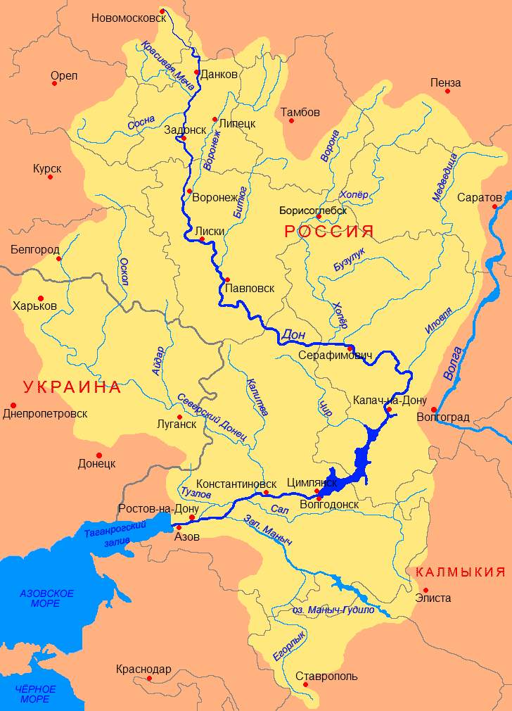
Delta Don.
In its northeastern part, the Sea of Azov forms a vast, highly elongated Taganrog Bay, into which one of the largest rivers of the European part of the USSR, the Don, flows. Its length is 1,870 km, and the catchment area is 422,000 sq. km. The Don annually brings out to sea an average of about 28.6 cubic meters. km of water. Significant masses of river water strongly desalinate the Taganrog Bay, and the sediments carried out by the river shallow it and lead to, which occupies an area of 340 sq. km. The modern Don delta begins 6 km below Rostov-on-Don, where the non-navigable arm of the Dead Donets separates from the river to the right.
There is always a lot of activity on the Don River; a varied and numerous vessels sail upstream and downstream. The calm surface of the mighty river is cut by passenger ships, cargo ships and fishing boats.
Below the village of Elizavetinskaya, the Don begins to wind heavily along a wide low-lying valley, splitting into numerous branches and channels, which, in local terms, are not called eriks. There are more and more of these sleeves and eriks as we approach the Sea of Azov.
The landscape is peculiar here. Everywhere one can see islets slightly rising above the water, with bizarrely indented shores, covered with dense thickets of reeds. Islets close to the sea are constantly inundated sea water With strong westerly winds, the waters of the Sea of Azov rush to the mouth of the Don, propping up the river waters, the Don overflows the banks, flooding not only the delta, but also the embankment almost 100 km upstream.
East winds blowing downstream of the Don have the opposite effect. There is a drainage of water, moreover, sometimes so strong that not only the branches of the river, but also the Taganrog Bay, become shallow, which disrupts normal navigation. The amplitude of the surge phenomena is +3, -2 m.
The Don carries out to the sea on average about 14 million tons of river sediments and about 9.5 million tons of dissolved minerals. Due to sediment, the Don delta is growing, gradually moving further and further into the sea at a speed of about 1 km per century.

North coast
The northern coast of the Sea of Azov stretches from the mouth of the Don to the city of Genichesk. On this site, a number of small rivers flow into the Sea of Azov. Starting in the spurs of the Donetsk ridge, the rivers Mius and Kalmius carry their waters into the sea. Originating on the low Azov Upland, the rivers Berdya, Obitochnaya, Korsak and a number of small rivers that dry up in summer flow into the Sea of Azov. The northern coast is characterized by the presence of a number of sandy spits, stretched mainly from the north and northeast to the south and southwest. moreover, the braids bend with their ends to the west, for example, Krivaya, Belosaraiskaya (south of the city of Zhdanov), Berdyanskaya (near the city of Berdyansk).
Bays and estuaries, such as Berdyanskiy and Obitochny, are formed between the spits and the bedrock coast. If we exclude the alluvial braids, then the rest north coast The Azov Sea is a flat steppe, for the most part sloping down to the sea. The braids and narrow coastal strip are composed mainly of Quaternary marine sediments. To the north, the plain is composed of loess, loess-like loams and clays of the late glacial time. Fertile chernozems have developed on these rocks. Back in the last century, boundless feather-grass-forbs stretched here, and in the western half - feather-grass-fescue steppes. Tarpans, wild camels grazed in them, and even earlier there were even red deer and elk. There were beavers in the rivers. During the flowering period, these steppes, according to N.V. Gogol, represented a green-golden ocean, over which millions of flowers were splashed. However, such steppes have long disappeared, they are almost completely plowed up. They were replaced by endless fields of wheat, corn, sunflower, orchards and vineyards.
THE NATURE OF THE SEA OF AZOV
The Sea of Azov is a peculiar and remarkable body of water in many respects. It is the smallest of all seas Soviet Union, but by its meaning in national economy is not in the last place. Its area, limited by the parallels 45 ° 16 "N and 47 ° 17" N. latitude and meridians 33 ° 36 "E and 39 ° 21" E. d. is only 37,800 sq. km (without Sivash and estuaries). The greatest depth does not exceed 14 m, and the average depth is about 8 m. At the same time, depths up to 5 m occupy more than half of the volume of the Sea of Azov. Its volume is also small and is equal to 320 cubic meters. km. For comparison, let's say that the Aral Sea is almost 2 times larger than the Azov Sea, the Black Sea is almost 11 times larger than the Azov Sea, and 1678 times larger in volume. And yet the Sea of Azov is not so small, it would be free to accommodate such two European states as the Netherlands and Luxembourg. Its greatest length is 380 km, and its greatest width is 200 km. Total length coastline sea is 2686 km.
The underwater relief of the Azov Sea is very simple, the depths generally slowly and smoothly increase with distance from the coast, and the greatest depths are in the center of the sea. Its bottom is almost flat. The Sea of Azov forms several bays, of which the largest are Taganrog, Temryuk and the strongly isolated Sivash, which is more correct to be considered an estuary. Large islands on this sea no. There are a number of shallows, partly flooded with water and located near the coast. Such are, for example, the islands of Biryuchiy, Turtle and others.
HISTORY OF THE SEA OF AZOV
Meotida
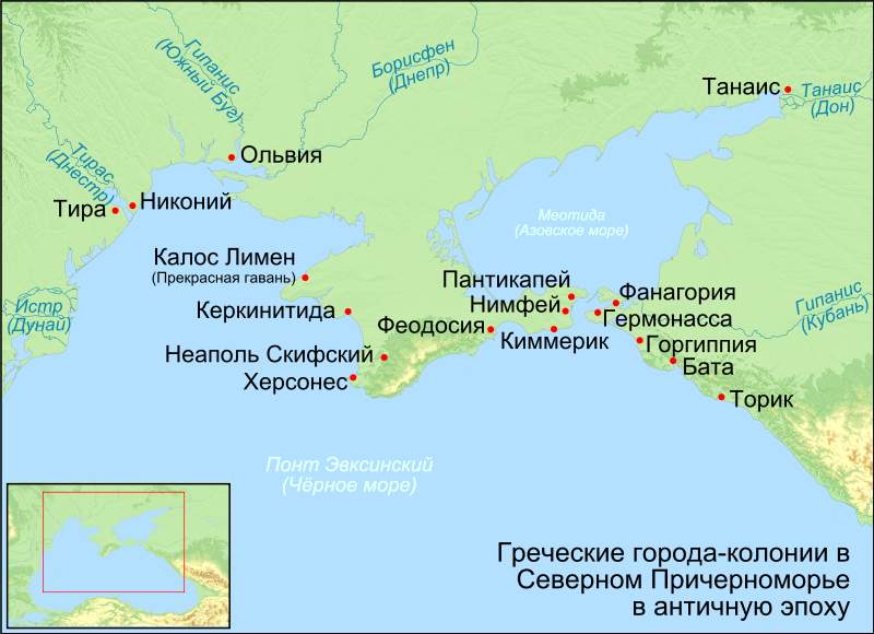
In antiquity, the Sea of Azov did not exist, and the Don flowed into the Black Sea in the area of the modern Kerch Strait. The theory of the Black Sea flood suggests that the filling of the Azov Sea area happened around 5600 BC. e.
In antiquity, the Sea of Azov was called by the Greeks Meotian Lake (ancient Greek Μαιῶτις), by the Romans Palus Maeotis (“Meotian swamp”), by the Scythians Kargaluk, by the Meots of Temerind (which means “mother of the sea”), among the Arabs - Bahr al -Azuf, among the Turks - Bahr el-Assak or Bahr-s Assak (Dark Blue Sea; modern tur. Azak Denizi) and also - Balisira, among the Genoese and Venetians - Mare delle Zabacche.
The sea was renamed many times (Samakush, Salakar, Mayutis, etc.). At the beginning of the XIII century. the name of the Saksin Sea is approved. The Tatar-Mongol conquerors replenished the collection of the names of Azov: Balyk-dengiz (sea of fish) and Chabak-dengiz (chabach, bream sea). According to some data, Chabak-dengiz as a result of the transformation: Chabak - Dzybakh - Zabak - Azak - Azov - the modern name of the sea came about (which is doubtful). According to other sources, azak is a Turkic adjective, meaning low, low, according to other sources, azak (the Turkic mouth of the river), which transformed into Azau, and then into the Russian Azov. In the interval of the above names, the sea also received the following: Barel-Azov (Dark-blue river); The Frankish Sea (the Franks meant the Genoese and Venetians); Surozh Sea (Surozh was the name of the modern city of Sudak in the Crimea); Kaffa Sea (Kaffa - Italian colony in place modern city Feodosia in Crimea); Cimmerian Sea (from the Cimmerians); Akdeniz (Turkish meaning White Sea). It is most reliable that the modern name of the sea comes from the city of Azov.
There are a number of hypotheses on the etymology of the word "Azov": by the name of the Polovtsian prince Azum (Azuf), who was killed during the capture of the city in 1067; by the name of the tribe of the Wasps (Assy), which in turn allegedly came from the Avestan, meaning "fast"; the name is compared with the Türkic word azan - "lower", and the Circassian uzev - "neck". The Turkic name of the city of Azov is Auzak. But even in the 1st century. n. e. Pliny, listing the Scythian tribes in his writings, mentions the Asoka tribe, similar to the word Az. It is believed that the modern name of the Sea of Azov came into Russian toponymy at the beginning of the 17th century, thanks to the chronicle of Pimen. Moreover, at first it was assigned only to a part of it (the Taganrog Bay, which before the appearance of the city of Taganrog was called the Donskoy Liman). Only in the second half of the 18th century, the name "Sea of Azov" was assigned to the entire reservoir. The sea gave the name to the villages of Azov and Priazovskaya, and the cities of Azov (in the lower reaches of the Don River, Rostov region) and Novoazovsk, the village of Priazovskoye and other settlements.
There are three stages in the history of the study of the Sea of Azov:
Ancient (geographical) - from the time of Herodotus to early XIX Art.
Geological and geographical - XIX cent. - 40s of XX century.
Complex - mid XX century - today.
The first map of Pontus Euxinus and Meotida was compiled by Claudius Ptolemy, he also identified geographical coordinates for cities, river mouths, capes and bays of the Azov Sea coast.
In 1068, the Russian prince Gleb Svyatoslavich, who ruled at that time in Tmutarakan, measured the distance between Kerch and Taman on the ice. As evidenced by the inscription on the Tmutarakan stone, the distance from Tmutarakan to Korchev (the ancient name of Kerch) was approximately 20 km (in 939 years this distance increased by 3 km.) the Genoese and Venetians began to compose portolans (sailing directions and nautical charts) The Black and Azov seas.
GEOGRAPHY OF THE SEA OF AZOV
The extreme points of the Sea of Azov lie between 45 ° 12'30 "and 47 ° 17'30" s. latitude and between 33 ° 38 ′ (Lake Sivash) and 39 ° 18 ′ east. longitude. Its greatest length is 380 km, the greatest width is 200 km; the length of the coastline is 2686 km; surface area - 37,800 km² (this area does not include islands and spits, which occupy 107.9 km²).
By morphological features, it belongs to flat seas and is a shallow body of water with low coastal slopes. In terms of distance from the ocean, the Sea of Azov is the most continental sea on the planet.
In winter, partial or complete freezing is possible, while ice is carried into the Black Sea through the Kerch Strait. As a rule, ice formation is typical for January, but in cold years it can take place a month earlier.
Depths of the Sea of Azov 
The underwater relief of the sea is relatively simple. With distance from the coast, the depths slowly and smoothly increase, reaching 13 m in the central part of the sea. The main area of the bottom is characterized by depths of 5-13 m. The region of greatest depths is located in the center of the sea. The arrangement of the isobaths, which is close to symmetric, is disturbed by their slight elongation in the northeast towards the Taganrog Bay. The 5 m isobath is located about 2 km from the coast, moving away from it near the Taganrog Bay and in the bay itself near the mouth of the Don. In the Taganrog Bay, the depths increase from the mouth of the Don (2-3 m) towards the open part of the sea, reaching 8-9 m at the border of the bay with the sea. In the bottom relief of the Sea of Azov, there are systems of seamounts stretching along the eastern (Zhelezinskaya bank) and western (Morskaya and Arabatskaya banks) coasts, the depths above which decrease from 8-9 to 3-5 m. The underwater coastal slope of the northern coast is characterized by wide shallow waters (20-30 km) with depths of 6-7 m an underwater slope down to a depth of 11-13 m.
The catchment area of the Azov Sea Basin is 586,000 km².
The seashores are mostly flat and sandy, only on south bank there are hills of volcanic origin, which in places turn into steep advanced mountains.
Sea currents are dependent on the very strong north-east and south-west winds blowing here and therefore very often change direction. The main current is a counterclockwise circular current along the shores of the Sea of Azov.
Salinity
Changes in the salinity of the Sea of Azov in the XX century
The hydrochemical features of the Sea of Azov are formed primarily under the influence of the abundant inflow of river waters (up to 12% of the water volume) and the hindered water exchange with the Black Sea.
The salinity of the sea before the regulation of the Don was three times less than the average salinity of the ocean. Its value on the surface varied from 1 ppm at the mouth of the Don to 10.5 ppm in the central part of the sea and 11.5 ppm near the Kerch Strait. After the creation of the Tsimlyansk hydroelectric complex, the salinity of the sea began to increase. By 1977, the average salinity of the sea increased to 13.8 ppm, and in Taganrog Bay - to 11.2. In the greater part of the sea, the water became saline up to 14-14.5 ‰. During the period of relatively high moisture content (1979-1982), there was a rapid decrease in salinity to 10.9 ‰, but by 2000 its value increased again and stabilized at the level of 11 ‰. Average seasonal fluctuations in salinity values rarely reach 1-2 percent.
In the northern part of the Sea of Azov, the water contains very little salt. For this reason, the sea freezes easily, and therefore, before the emergence of icebreakers, it was not navigable from December to mid-April. southern part the sea does not freeze and the temperature remains moderate.
During the XX century, almost all more or less large rivers, flowing into the Sea of Azov, were blocked by dams to create reservoirs. This has led to a significant reduction in the discharge of fresh water and silt into the sea.
The main ionic composition of the open sea water differs from salt composition in the ocean by the relative poverty of chlorine and sodium ions and an increased content of the predominant components of land waters - calcium, carbonates and sulphates.
Water clarity and color
The transparency of the waters of the Azov Sea is low. She is not the same in different areas and in different time Years and ranges from 0.5 to 8 m. The influx of a large amount of turbid river waters, the rapid stirring of bottom silts during rough seas and the presence of significant masses of plankton in the Azov water determine its low transparency. The lowest transparency is observed in the Taganrog Bay (0.5-0.9 m, occasionally up to 2 m). The color of the water here varies from greenish-yellow to brownish-yellow. In the eastern and western regions of the sea, the transparency is much higher - on average, 1.5-2 m, but it can reach 3-4 m. central area Due to the great depths and the influence of the Black Sea waters, the Azov Sea transparency has values from 1.5-2.5 to 8 m. The water here is greenish-blue. In summer, transparency increases almost everywhere, but in some areas of the sea, due to the rapid development of the smallest plant and animal organisms in the upper layers of water, it drops to zero and the water acquires a bright green color. This phenomenon is called the "blooming" of the sea.
Flora and fauna
Phytoplankton and benthos are developed. Phytoplankton consists (in%): of diatoms - 55, peridinium - 41.2, and blue-green algae - 2.2. Among the biomass of benthos, mollusks occupy a dominant position. Their skeletal remains, represented by calcium carbonate, have a significant share in the formation of modern bottom sediments and accumulative surface bodies.
The ichthyofauna of the Sea of Azov currently includes 103 species and subspecies of fish belonging to 76 genera, and is represented by anadromous, semi-anadromous, marine and freshwater species.
Anadromous species of fish feed in the sea until the onset of sexual maturity, and enter the river only for spawning. The breeding period in rivers and or on floods usually does not exceed 1–2 months. Among the Azov migratory fish there are valuable commercial species such as beluga, stellate sturgeon, herring, vimbets and shemaya.
Semi-anadromous species enter rivers for reproduction from the sea. However, in rivers, they can stay for a longer time than anadromous ones (up to a year). As for the juveniles, they roll down from the spawning grounds very slowly and often remain in the river for the winter. Semi-anadromous fish include common species such as pike perch, bream, ram, sabrefish and some others.
Marine species breed and feed in salt waters... Among them, the species that constantly live in the Sea of Azov stand out - pelengas, Black Sea kalkan, gloss flounder, tulka, percarina, three-spined stickleback, long-nosed needle fish and all types of gobies. And, finally, there is a large group of marine fish entering the Sea of Azov from the Black Sea, including those making regular migrations: the Azov and Black Sea anchovy, Black Sea herring, red mullet, singil, ostronos, striped mullet, Black Sea kalkan, horse mackerel, mackerel, etc.
Freshwater species usually constantly inhabit one area of the reservoir and do not make large migrations. These species usually inhabit freshened sea areas. Here you can find such fish as sterlet, goldfish, pike, ide, bleak, etc.
Marine mammals in the Sea of Azov are represented by one species - the harbor porpoise (other names are Azovka, Azov dolphin, Pykhtun, Chushka). The porpoise leads a gregarious life. The groups include from two to ten individuals. The population size has always been small, modern data are not available. Azovka is the smallest animal from the group of cetaceans. And representatives of the local Azov-Black Sea population are smaller than dolphins from other parts of the range. Females are somewhat larger than males: 90-150 cm. maximum dimensions males reached 167 cm, and females - 180 cm. The average weight of azovka is 30.2 kg. Life expectancy is 25-30 years.
In terms of the number of plant and animal organisms, the Sea of Azov has no equal in the world. In terms of fish productivity, that is, the number of fish per unit area, the Azov Sea is 6.5 times higher than the Caspian Sea, 40 times the Black Sea and 160 times the Mediterranean Sea.
Sea of Azov, city of Yeysk 
Geographical objects of the Azov Sea
Major or of particular interest listed geographic objects in clockwise order along the coast starting from the Genichesk Strait.
Bays and estuaries:
On the territory of Ukraine:
in the northwest: Utlyuk estuary, Molochny estuary, Obitochny bay, Berdyansk bay.
On Russian territory:
in the northeast: Taganrog Bay, Miussky estuary, Yeysky estuary;
in the east: Yasensky Bay, Beysugsky estuary, Akhtarsky estuary;
in the south-east: Temryuk Bay;
in the southwest: Kazantip Bay, Arabat Bay;
in the west: Sivash Bay (since April 1, 2014, it is de facto a section of the Russian-Ukrainian state border).

Spits, capes, largest islands:
Main article: Scythe of the Sea of Azov
On the territory of Ukraine:
in the northwest: Fedotova Spit and Biryuchiy Island Spit (Utlyuchiy Estuary), Obitochnaya Spit (Obitochny Gulf), Berdyanskaya Spit (Berdyanskiy Gulf);
in the northeast: Belosaraiskaya spit, Krivaya spit.
On Russian territory:
in the northeast: Beglitskaya Spit, Petrushina Spit, Taganrog Cape;
in the east: Cape Chumbursky, Glafirovskaya spit, Dolgaya spit, Kamyshevatskaya spit, Yasenskaya spit (Beysugsky estuary), Achuevskaya spit (Akhtarsky estuary), Yeyskaya spit, Sazalnikskaya spit;
in the southeast: Cape Achuevsky and Cape Kamenny (Temryuk Bay);
in the Kerch Strait: Chushka spit, Tuzlinskaya spit, Tuzla island;
in the southwest: Cape Chroni, Cape Zyuk, Cape Chagany and Cape Kazantip;
in the west: the Arabat Strelka spit.
Rivers flowing into the sea:
On the territory of Ukraine:
in the northwest: Maly Utlyuk, Molochnaya, Korsak, Lozovatka, Obitochnaya, Berda, Kalmius, Gruzsky Elanchik;
On Russian territory:
in the northeast: Wet Elanchik, Mius, Sambek, Don, Kagalnik, Wet Chuburka, Eya;
in the southeast: Protoka, Kuban.
Legal status
The international legal status of the sea is determined by a number of sources of law, the most relevant of which is the Treaty between The Russian Federation and Ukraine on cooperation in the use of the Sea of Azov and the Kerch Strait (ratified by both sides in 2004). In this document Azov is categorized as inland waters Russia and Ukraine.
___________________________________________________________________________________________
SOURCE OF PHOTOS AND MATERIAL:
Team nomad
Sea of Azov // Brockhaus and Efron Encyclopedic Dictionary: In 86 volumes (82 volumes and 4 additional). - SPb., 1890-1907.
Neznamov P. A. Map of the Sea of Azov in 1699 // Proceedings of the State. ist. museum. - 1941. - Issue. 14. - S. 73-81, repr. cards.
Velokurova N. I. Hydrometeorological characteristics of the Sea of Azov / N. I. Velokurova, D. K. Starov. - Moscow-Leningrad: Gidrometeoizdat, 1947.
Tushin Yu. P. Russian navigation in the Azov, Caspian and Black seas (XVII century) / Yu. P. Tushin; Auth. foreword V.V. Mavrodin; Artist. D. Stankevich; Leningrad Order of Lenin State University named after A.A. Zhdanov. - M .: Nauka (Editor-in-chief of the eastern literature), 1978 .-- 184 p. - 10,000 copies. (region)
Encyclopedia of Taganrog. - Rostov-on-Don: Rostizdat, 2003 .-- 512 p. - ISBN 5-7509-0662-0.
Brodyanoy A. V. Names of the Sea of Azov. - Vradievka: Publishing house Kovalenko A.G., 2008 .-- 48 p. - ISBN 978-966-2035-01-8.
http://club.foto.ru/
Wikipedia website
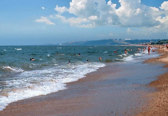
The Azov Sea is an inland sea in the east of Europe. This is the shallowest sea in the world, its depth does not exceed 13.5 meters. By morphological features, it belongs to flat seas and is a shallow body of water with low coastal slopes. The sea shores are mostly flat and sandy, only on the southern coast are hills of volcanic origin, which in places turn into steep advanced mountains. Far from the ocean, the Sea of Azov is the continental sea of the planet. The coastline is indented by bays and spits, the territory of which is a nature reserve or resort and recreational zone. The shores of the Sea of Azov are low-lying, composed of sand and shell deposits. The large rivers Don, Kuban and numerous small rivers Mius, Berda and others flow into the Sea of Azov.
SalinityThe salinity level of the Sea of Azov is formed primarily under the influence of the abundant inflow of river waters (up to 12% of the water volume) and the difficult water exchange with the Black Sea. The water contains very little salt in the northern part of the Azov Sea. For this reason, the sea freezes easily. In winter, partial or complete freezing is possible, while ice is carried into the Black Sea through the Kerch Strait.
The underwater relief of the sea is relatively simple. With distance from the coast, the depths slowly and smoothly increase, reaching 13 m in the central part of the sea. The main area of the bottom is characterized by depths of 5-13 m. The area of greatest depths is located in the center of the sea. The arrangement of the isobaths, which is close to symmetric, is disturbed by their slight elongation in the northeast towards the Taganrog Bay. The 5 m isobath is located about 2 km from the coast, moving away from it near the Taganrog Bay and in the bay itself near the mouth of the Don. In the Taganrog Bay, the depths increase from the mouth of the Don (2-3 m) towards the open part of the sea, reaching 8-9 m at the border of the bay with the sea.In the relief of the bottom of the Sea of \ u200b \ u200bAzov, there are systems of seamounts elongated along the eastern (Zhelezinskaya bank) and western (Morskaya and Arabatskaya banks) coasts, the depths above which decrease from 8-9 to 3-5 m.The underwater coastal slope of the northern coast is characterized by wide shallow water (20-30 km) with depths of 6-7 m, and the southern coast is steep underwater slope to depths of 11-13 m.
Sea currents are dependent on the very strong north-east and south-west winds blowing here and therefore very often change direction. The main current is a counterclockwise circular current along the shores of the Sea of Azov.
FaunaThe ichthyofauna of the Sea of Azov currently includes 103 species and subspecies of fish belonging to 76 genera, and is represented by anadromous, semi-anadromous, marine and freshwater species.
Anadromous species of fish feed in the sea until the onset of sexual maturity, and enter the river only for spawning. The breeding period in rivers and or on brooks usually does not exceed 1-2 months. Among the Azov migratory fish, there are valuable commercial species such as beluga, sturgeon, stellate sturgeon, herring, vimba and shemaya.
Semi-anadromous species enter rivers for reproduction from the sea. However, in rivers, they can stay for a longer time than anadromous ones (up to a year). As for the juveniles, they roll down from the spawning grounds very slowly and often remain in the river for the winter. Semi-anadromous fish include common species such as pike perch, bream, ram, sabrefish and some others.
Marine species breed and feed in salty waters. Among them, the species that constantly inhabit the Sea of Azov stand out. These are pilengas, flounder-kalkan, glossa, tulka, percarina, three-spined lump, needle fish and all kinds of gobies. And, finally, there is a large group of marine fish entering the Sea of Azov from the Black Sea, including making regular migrations. These include: Azov anchovy, Black Sea anchovy, Black Sea herring, red mullet, singil, ostronos, mullet, Black Sea kalkan, horse mackerel, mackerel, etc.

Freshwater species usually constantly inhabit one area of the reservoir and do not make large migrations. These species usually inhabit freshened sea areas. Here you can find such fish as sterlet, goldfish, pike, ide, bleak, etc.
In terms of the number of plant and animal organisms, the Sea of Azov has no equal in the world. In terms of productivity, the Sea of Azov is 6.5 times higher than the Caspian Sea, 40 times higher than the Black Sea and 160 times higher than the Mediterranean Sea. But in size it is 10 times smaller than Black.
MineralsGeologists are unanimous on the fact that the bowels of the Azov Sea are very rich. Zircon, rutile, ilmenite were found here. Under the seabed are minerals that contain a good half of the periodic table. There are underwater mud volcanoes in the southeastern part of the sea. Industrial reserves of natural gas have been found in the depths of the Sea of Azov.
Our ancestors who inhabited ancient Russia knew the Sea of Azov back in the first century. But they called it differently - affectionately the Blue Sea. It may well be that our great poet Alexander Sergeevich Pushkin, who was staying in Tmutarakan (former name) and wrote the Tale of the Fisherman and the Fish, which is still popular among children and adults, and meant the hut of an old man with an old woman with a broken trough on its shore.
He also called him "blue" !? And "Lukomorye has a green oak" from the poem "Ruslan and Lyudmila"? - this is also about the Blue Sea. The truth about the one that merged with the Black Sea through the Kerch Strait. And the place where our warm southern seas rush into each other's arms and was called Lukomorye! It is not far from the resort on the shores of the Temryuk Bay of the Azov Sea, which Muscovites are especially fond of: there is a lot more sun here than in Sochi and Gelendzhik (it shines 280 days a year), plus magnificent sandy beaches, plus a lot of attractions and entertainment. But it is also surprising that, after returning home, tourists quite often confuse which seas they swam in: from the Azov Sea to a stone's throw, and there are strong temptations to swim in both! What vacationers do with great passion!
But after all, only Russians lived on the shores of the Sea of \ u200b \ u200bAzov. As then, and to this day, their shores were inhabited and inhabited by representatives of other large and small nations. Therefore, say, the Greeks and now living in compact settlements with a pronounced culture of the Hellenes and Athenian architecture, called this shallowest body of water in the world - Lake Meotian. Romans - Meotian swamp. Turks - Bahr - el Assak or Bahr-s Assak, which literally translates - the dark blue sea.
I must say that throughout its history, the Sea of Azov was renamed several times. It was called Samakush, Salakar, Mayutis. And as evidenced by the chronicles, in particular, of Pimen, dating back to the seventeenth century, the Sea of Azov became consonant with the city of Azov, founded on its coast. At least in the eighteenth century, such a name was firmly entrenched behind him. Hence the villages derived from it - Azovskaya, Priazovskaya, the city of Novoazovskiy or the village of Priazovskiy.
Taking into account the fact that the Sea of Azov through the Kerch Strait nevertheless connects with the Black Sea, it can rightfully be called a semi-enclosed sea. It splashes in the east of Europe. This is the most, once again, the shallow sea in the world. Its average depth ranges from 6 to a little over seven meters, the maximum depth exceeds thirteen and a half meters.
Like the Black Sea, the Azov straits and seas are connected to the great Atlantic Ocean. In this sequence: through the Kerch Strait - with the Black Sea, through the Bosphorus Strait with the Sea of Marmara, then through the Dardanelles Strait with the Aegean and Mediterranean seas and already through the Strait of Gibraltar merges with the Atlantic Ocean. Quite muddy rivers flow into the Sea of Azov, plus not so great depth, silt deposits at the bottom. Therefore, unlike the Black Sea, the Azov Sea is not so transparent - from 0.5 to 8 meters of visibility, depending on weather conditions.
Dimensions and features of the Sea of Azov
Its surface area is 37,800 square kilometers. To these you can add another 107.9 square kilometers, which fall on the islands and spits. The coastline exceeds 1,470 kilometers. The longest is 380, the greatest width is 200 kilometers. The drainage area is 586,000 kilometers.
Salinity exceeds 14-15 percent. Unlike the Black Sea, the water contains less chlorine and calcium, but it is richer in carbonates and sulfates. The average annual water temperature is about 11 degrees, in the summer it warms up to 24-26, but sometimes, in some places, and up to 30. In winter, it can cool down to one with a plus sign or to zero. With more low temperatures air even forms ice, which through the Kerch Strait enters the Black Sea. Adding unnecessary trouble to the sailors, especially in the Novorossiysk region, when in winter the northern bora wind breaks through the surrounding mountains, binding the hulls of ships with an ice shell.
Marine life
The Azov Sea is a real paradise for fishing lovers. There is no more reservoir in the world richer in fish! It is found here six and a half times more than, for example, in the Caspian Sea. Forty times more than in the Black Sea. And 160 times more than the Mediterranean. More than a hundred species and subspecies of fish are found. There are so-called anadromous migrants that enter rivers for spawning - beluga, stellate sturgeon, herring, vimbets. There are semi-anadromous - which enter rivers for breeding and even winter in them - carp, bream, ram, pike perch, etc. In the desalinated sea area there are sterlet, bleak, pike, goldfish, ide. Well, who among the lovers of fishing is not aware of such inhabitants of the Sea of Azov as red mullet, striped mullet, horse mackerel, mackerel, pelengas from the mullet family or anchovy, which the same Muscovites take away to their native land in large containers, salted or salted in large containers and treat them to their relatives and friends. With boiled potatoes - the most relish!
There are also larger inhabitants in the sea. For example, the porpoise is the Azov dolphin. It is also called chushka, puffin. They live either in pairs or in flocks of up to ten or more individuals. Females are larger than males - 90, 150 centimeters. Weighing thirty or more kilograms. They live for 25-30 years. In the floodplains of estuaries adjacent to the sea, there is a lot of waterfowl; among the reeds you can see wild boar and fox and muskrat brought here from North America.
Vacation at sea
We have already said that the length of the coastline of the Sea of \ u200b \ u200bAzov reaches almost one and a half thousand kilometers. Of course, most of them are located on the magnificent sandy beaches. And the entire coast of the sea is an almost continuous recreation area with resort towns and villages, thousands of sanatoriums, boarding houses, recreation centers, children's health camps, tent cities, hotels, hotels, a huge private sector. For example, the same world-famous Taman in 2001 received the status of a resort of federal significance due to the presence here of a large number of medicinal muds, both extracted from the bottom of salt lakes, estuaries, and extinct or active mud volcanoes.

send a message
|
Defense against robots, solve an example: 3 + 1 = |
Please wait...
Our Russia is washed from all sides by seas and oceans, it has seventeen outlets to the big water, which makes it simply a unique world power. Some seas are located in the southern part of the country and belong to the resort area, while the northern Russian waters abound in fish and other commercial species of marine life. Most often, our compatriots visit the Black Sea and the Sea of Azov, which we will compare today.
Sea of Azov: a short description
The Azov Sea is located in the southern part of Russia, it is a semi-enclosed sea view and is related to the Atlantic Ocean basin. The sea is connected with the ocean by a chain of straits and various seas. The salinity of the water is provided by the inflow of water masses from the Black Sea, but for the most part they are diluted by river flows. V last years people are active on the coast of the sea, so the inflow of fresh water has significantly decreased. This fact affected the population of marine life.
Black Sea: briefly about the main
The Black Sea is an inland sea of the Atlantic Ocean, it is connected with the Mediterranean and Aegean Seas by various straits. The water area has long been inhabited by people, now Russia, Turkey, Georgia and Bulgaria have access to the waters of the Black Sea.
One of the features of the water area is the impossibility of the existence of life at great depths. This is due to the release of hydrogen sulfide at a depth of more than one hundred and fifty meters, moreover this feature does not allow different layers of water to mix with each other. Therefore, in the Black Sea, there are large temperature differences at shallow depths.

Where did the Sea of Azov come from
In ancient times, the Sea of Azov did not exist, this territory had a swampy character. Scientists believe that the water area was formed approximately five thousand six hundred years BC as a result of the Black Sea flood. This version was expressed by ancient philosophers and is supported by modern hydrologists and oceanologists.
During its existence, the Sea of Azov has changed its name many times. They can even trace the history of the development of the reservoir itself, because the ancient Greeks attributed it to lakes, and the Romans to swamps. Although already the Scythians used the word "sea" in their name of the water area.
Scientists have counted more than fifty different names. Each people who took a liking to the shores of the Sea of Azov sought to give it a new name. Only in the eighteenth century the familiar word "Azov" was fixed in the Russian language. Although back in the first century AD, some Greek scholars mentioned a name that is close in sound to the modern pronunciation.
The history of the Black Sea
Hydrologists believe that on the site of today's Black Sea there has always been fresh lake... It is worth noting that at that time it was the largest in the world, the filling of the water area with sea water occurred as a result of the same Black Sea flood, thanks to which the Sea of Azov was formed. A large flow of salt water caused a massive death of freshwater inhabitants of the lake, which became the source of the release of hydrogen sulfide from the depths of the sea.
I would like to note that the Black Sea almost always had names close to those of today. It is believed that the Scythian tribes living on the coast called the sea "dark". The Greeks, in turn, changed the name and began to call the water area "Inhospitable Sea". This is associated with frequent storms and difficulties in passing the fairway. Some hydrologists put forward a hypothesis according to which sailors have noticed since ancient times that anchors, when raised from the depths, acquire a deep black color. This was the prerequisite for the name of the sea.
Where the Black and Azov seas are located: coordinates and dimensions
The Black Sea has an area of more than four hundred thousand square kilometers, the length of the surface between the two most distant points is approximately five hundred and eighty kilometers. The volume of water in the water area is equal to five hundred and fifty cubic kilometers. The coordinates of the Black Sea lie between forty-six degrees thirty-three minutes and forty degrees fifty-six minutes north and between twenty-seven degrees twenty-seven minutes and forty-one degrees forty-two minutes east.
The area of the Azov Sea is thirty-seven square kilometers, the length between the most distant points is equal to three hundred and eighty kilometers. The coordinates of the sea lie between 45 ° 12'30 ″ and 47 ° 17′30 ″ north latitude and between 33 ° 38 ′ and 39 ° 18 ′ east longitude.

Depth
The Black Sea and the Sea of Azov differ significantly from each other. First of all, an ordinary person is struck by the differences in depths. The fact is that the depth of the Sea of Azov is constantly changing. Scientists are seriously concerned about the tendency towards shallowing of the Azov water area. V this moment the sea is one of the smallest in the world, and the shallowing process is gaining momentum and becoming more active every year. According to the latest data, the average depth of the Sea of Azov is only seven meters, the most deep place in the entire water area it is marked by thirteen and a half meters.
The Black Sea is distinguished by a heterogeneous bottom topography. Therefore, the depth in different areas is seriously different. The maximum depth reaches two thousand meters. In the Yalta region, the average depth is five hundred meters, and this mark is reached already several kilometers from the coast.
It's amazing how interconnected everything in our world is. This also applies to the seas. Every student knows that the Black Sea and the Sea of Azov are connected to each other. It is a narrow strip of water not exceeding four kilometers wide. The depth of the strait is five meters on average.
Those who in Soviet times often visited the Black Sea and the Sea of Azov know that there is an absolutely unique place where you can see the contact of two seas. If you come to Tuslova Spit, then on one side of you there will be the Sea of Azov, and on the other - the Black Sea. Tourists claim that this braid is extraordinary good place for relax. There are practically no people here, and the opportunity to swim in both seas at once cannot but delight unspoiled vacationers.
It should be noted that in comparison with the Sea of Azov, the waters of the Black Sea look lighter. What is the reason for this, scientists find it difficult to say.
What does the coast of the seas look like
The coast of the Black and Azov Seas differ significantly from each other. Azov is represented by flat beaches with little indented relief. Most of the beaches are covered with sand, Russian part is two hundred and fifty kilometers of the coastal strip. A feature of the coast of the Sea of \ u200b \ u200bAzov is the washed-up spits, they usually protrude deep into the water area and do not exceed five kilometers in width.
The length of the Russian part of the Black Sea coast is four hundred and fifty-seven kilometers. The coastal strip is weakly indented and is represented mainly by pebble beaches, which in some places are more than three hundred meters wide. The Black Sea is distinguished by a large number of islands, chaotically scattered throughout the entire water area.
Transparency and color of water masses
The Black Sea and the Sea of Azov have a different composition of water, which affects their color. If you look at the Black Sea on a sunny day, you will see how the water takes on a deep cobalt hue. This is due to the absorption of sunlight in the red and orange spectrum. The Black Sea is not one of the most transparent, but nevertheless the visibility on a fine day here reaches more than seventy meters.
In calm weather, the waters of the Azov Sea are greenish in color, but the slightest wind immediately turns the water into a dirty yellow substance. This is due to the large amount of phytoplankton that has flooded the sea area. The fact is that shallow water with heated water is ideal for its development, which corresponds to the indicators of the Sea of Azov. It is the shallow depths that affect the transparency of the water; it is almost always cloudy with low visibility.
Flora and fauna of the seas
Hydrologists and oceanologists often compare the Black Sea and the Sea of Azov in terms of the richness of flora and fauna. This indicator reveals significant differences between the two areas.
At one time, the Sea of Azov had no competitors in terms of the number of fish, several were engaged in catching it. large companies... In recent years, the population of marine species has declined significantly. According to oceanologists, more than one hundred and three species of fish live in the Sea of Azov. Almost all of them are commercial:
- herring;
- stellate sturgeon;
- tulle;
- flounder and so on.
The Black Sea is considered relatively poor in terms of marine life, because at depth, due to emissions of hydrogen sulfide, life is simply impossible. The sea is home to about one hundred and sixty species of fish and five hundred species of crustaceans. But phytoplankton is represented by six dozen species, as opposed to two species in the Sea of Azov.

Despite the fact that the Black Sea and the Sea of Azov are located nearby and even have a common border, they differ significantly from each other. Some of these differences can only be determined by scientists, and some are perfectly visible even to ordinary vacationers, who often prefer the coast of these seas to foreign resorts.