Precipitation - This is water in a liquid or solid state that falls out of clouds or is deposited from the air on the ground or other objects. The following precipitation can fall from the clouds: snow, rain, hail, drizzle, cereal. Precipitated from the air: frost, dew, ice, frost. There are two types of precipitation - torrential and overburden. Heavy rainfalls are associated with cold fronts, heavy rainfall - with warm ones. Precipitation is one of the links that is responsible for moisture circulation in earth surface. Important elements the water cycle in nature is evaporation and condensation.
To measure precipitation, special equipment is used: rain gauges, pluviographs and precipitation gauges at meteorological stations. With the help of radar, large areas of precipitation are determined. They are measured by the thickness of the precipitated water layer in millimeters. In the desert and in high latitudes, about 250 mm of precipitation falls annually. All over the globe on average, there is 1000 mm of precipitation per year.
The defining characteristics of the climate are the average monthly, seasonal, annual, perennial number of cages, as well as their distribution over the entire land, frequency, annual and daily variation and intensity. All these characteristics are of great importance for the agricultural sector and other sectors of the national economy.
Heavy precipitation, which begins and ends gradually, is characterized by monotonous precipitation without significant fluctuations in intensity. In time, continuous heavy precipitation can last for several hours, in rare cases - 1-2 days. They fall out of high-stratus or nimbostratus clouds. At the same time, cloudiness is mostly continuous - 10 points and in rare cases at the beginning or end of the period of precipitation is significant - 7-9 points. Sometimes weak short-term massive precipitation, which falls continuously for half an hour or an hour, are noted from stratus, altocumulus and stratocumulus clouds. The number of clouds in this case is from 7 to 10 points. At sub-zero temperatures, light snow falls out of the cloudy sky.
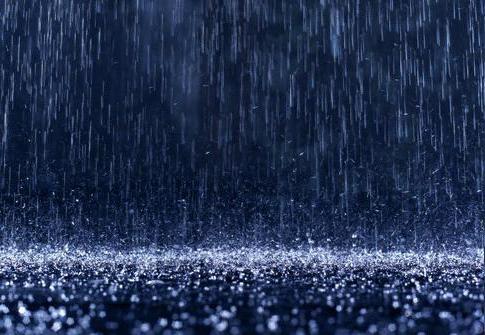
Rain- These are liquid precipitation-drops, the diameter of which can be 0.5-5 mm. In isolated drops, rain can leave a trail on the surface of the water in the form of a diverging circle and in the form of a wet spot on the surface of dry objects.
Hypothermic rain- These are liquid precipitation-drops, the diameter of which is 0.5-5 mm. They fall out at subzero air temperatures (0 ... -15 °). Falling on objects, drops freeze among themselves, and ice forms.
Icy rain- solid precipitation that falls at subzero air temperatures (0 ... -15 °). Outwardly, they look like hard ice balls with a diameter of 1-3 mm. They contain unfrozen water inside. When the balls fall, they break into pieces, water flows out of them and ice forms.
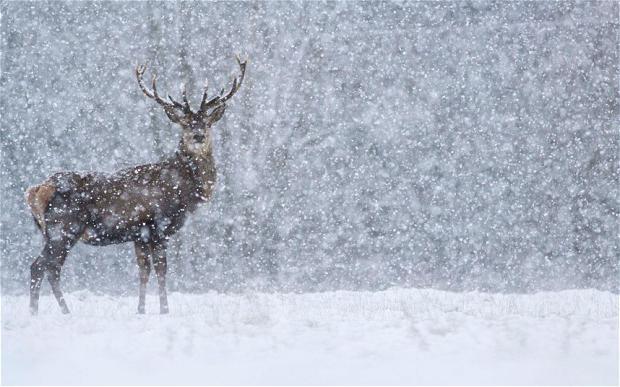
Solid precipitation that falls in the form of snow crystals or flakes is called snow... Snow crystals are called a simple and familiar word for everyone - snowflakes. Most often, snow falls at sub-zero temperatures. Horizontal visibility with light snow is 4-10 km, with moderate - 1-3 km, with heavy snow - less than 1 km. The increase in snowfall occurs gradually, therefore visibility values of 2 km or less can be seen only an hour after the beginning of the snowfall. At an air temperature of -10 ° ... -15 ° C, light snow can fall from a slightly cloudy sky. Wet snow is reported as a separate phenomenon. These are mixed precipitation in the form of melting snow flakes, which fall at a slight above-zero air temperature.
Mixed precipitation, which falls as a mixture of drops and snowflakes, is called rain with snow... It is mainly observed at positive air temperatures. In the event that rain and snow falls at sub-zero temperatures, small particles of precipitation freeze onto solid objects and ice forms.
Drizzling precipitation is characterized by: low intensity and monotony of precipitation without changing the intensity. Drizzling precipitation begins and stops gradually. Continuous precipitation can last for several hours, in rare cases - 1-2 days. Dropped by fog or stratus clouds. At the same time, cloudiness is mostly continuous - 10 points, sometimes - at the beginning or end of the period of falling out significant - 7-9 points. Drizzling precipitation is often accompanied by fog or haze that impairs visibility.
Liquid precipitation in the form of very small droplets with a diameter of less than 0.5 mm, which seem to float in the air, are called drizzle... When they fall out, a dry surface gets wet very slowly and evenly. When deposited on the surface of the water, drizzle does not leave diverging circles on it.
Drizzle supercooled- these are liquid precipitates in the form of very small drops, the diameter of which is less than 0.5 mm. They seem to float in the air and fall out at sub-zero air temperatures (0 ... -15 °). Falling on objects, drops freeze among themselves, and ice forms.
Solid sediments in the form of small, white, opaque particles less than 2 mm in diameter are called snow grains. They fall out at sub-zero air temperatures.
Heavy rainfall is characterized by a sudden onset and end of precipitation, as well as a sharp change in intensity. Continuous rainfall can last from several minutes to several hours; in the tropics, heavy rainfall can occur for 1-2 days. In rare cases, heavy rainfall is accompanied by a squally wind. Fall from cumulonimbus clouds, the number of which can be significant 7-10 points and small 4-6 points, sometimes even 2-3 points. High intensity is not the main sign of heavy rainfall. The fact of precipitation from convective clouds determines the fluctuations in the intensity of precipitation. On a hot day, light rainfall falls from powerful cumulus clouds. Sometimes light rain falls from cumulus clouds.
Heavy snow- this is snow of a torrential nature, which is characterized by sharp fluctuations in horizontal visibility from 61-10 km to 2-4 km or 500-1000 m, sometimes even 100-200 m. These fluctuations last from several minutes to 30 minutes.
Mixed rainfall, which falls most often at sub-zero temperatures in the form of a mixture of drops of snowflakes and are called heavy rain with snow... Heavy rain with snow can also fall at sub-zero temperatures. In this case, ice forms due to the fact that precipitation particles freeze onto objects.
Snow groats often falls at the same time as heavy snowfall or just before it starts. These are solid rainfall precipitates that fall out at bullet air temperatures and outwardly look like opaque white grains with a diameter of 2-5 mm. These grains can easily be crushed with your fingers due to their fragility.
Solid rainfall precipitation, which falls in the form of transparent or translucent grains of ice 1-3 mm in diameter, are called ice grits... It usually falls out at air temperatures from -5 to + 10 °, in the center of the grains is an opaque core. It is difficult to crush ice pellets with your fingers, its hard grains bounce off when hit on a hard surface. In rare cases, the grains are covered with a water film or fall out with water droplets. At zero air temperature, when they hit objects, the grains freeze among themselves, and ice forms.
Hail- This is solid precipitation that falls in the warm season in the form of pieces of ice of different sizes and shapes. Most often, hail falls at an air temperature of + 10 ° C. Pieces of ice are 2-5 mm in diameter; in rare cases, some hailstones can reach the size of a pigeon's or chicken's egg. Such large hailstones cause serious damage to plants, the exterior of cars, can break window panes, etc. The hail does not fall long in time - from 1-2 to 10-20 minutes. Most often, hail can be accompanied by thunderstorms and heavy rain.
Unclassified precipitation
Ice needles- solid precipitation in the form of very small ice crystals that float in the air. Formed in frosty weather at an air temperature of -10 ° ..- 15 °. Ice needles sparkle beautifully in the sunlight during the day and in the moonlight or in the light of lanterns at night. Sometimes at night they form beautiful sparkling pillars that go up from the lanterns into the sky. Most often, ice needles can be seen in low cloud or clear skies. In rare cases, they fall out of cirrostratus or cirrus clouds.
Zolation- rare a natural phenomenon that occurs during light thunderstorms. Outwardly, it looks like precipitation in the form of large or rare water bubbles.
Precipitation that forms on the ground and on objects
Dew- these are water droplets that form on the surface of the earth, plants, objects, roofs of cars and houses. Dew appears from the condensation of water vapor, which is contained in the air at positive air and soil temperatures, weak winds and a cloudless sky. It can be seen at night or early in the morning and be accompanied by fog or haze. Abundant dew flows down from the rooftops to the ground.
Frost Is a white crystalline sediment that forms on the surface of the earth, grass, objects, roofs of cars and houses, snow cover. It appears as a result of the transformation of water vapor contained in the air at sub-zero soil temperatures, weak winds and little cloudy skies. Rime is observed in the evening, night and morning and is accompanied by fog or haze. It is analogous to dew, only formed at sub-zero air temperatures.
A white crystalline precipitate, which consists of small fine-stringed shiny ice particles, is called crystalline frost... It appears as a result of the transformation of water vapor contained in the air on trees and wires in the form of fluffy garlands that easily crumble when shaken. Crystalline frost is observed in frosty, slightly cloudy weather, with fog or haze, with little wind or calm. Rime deposition occurs at night, during the day, under the influence of the sun, it crumbles. On cloudy days and in the shade, it can persist throughout the day.
A loose snow-like white precipitate, which forms as a result of the deposition of small droplets of supercooled fog on trees and wires in foggy cloudy weather, is called granular rime... It is observed at air temperatures from 0 to -10 ° C and moderate or strong wind... Enlarged droplets of fog can turn into ice. With a decrease in air temperature and in combination with a weak wind and a decrease in cloudiness at night, granular rime can turn into crystalline. As long as the fog lasts, the growth of grainy frost continues.
Ice- dense glassy ice, which forms on the ground as a result of freezing of precipitation particles, as well as on plants, objects, electrical wires. It is observed upon contact with a surface that has a subzero temperature from 0 to -15 °. Ice creates difficulties for the movement of people, animals, vehicles and can cause falls and accidents. It leads to broken wires, breaking off tree branches, sometimes to the fall of the trees themselves and the masts of power lines. Ice builds up as long as supercooled precipitation lasts. This can take several hours, and in rare cases, with fog and drizzle, several days. The accumulated ice may persist for several days.
Ice- This is a layer of icy snow or bumpy ice. Ice forms on the ground due to the freezing of melt water during the period when the temperature of the air and soil decreases after a thaw, i.e. the thermometer bar shows negative temperature values. Unlike ice, ice is observed on the ground. Most often it can be seen on the road, paths and sidewalks. The formed ice may persist for long days in a row until it is covered from above with freshly fallen snow or completely melts due to an increase in the temperature of the air and soil.
First of all, let us define the very concept of "precipitation". In the "Meteorological Dictionary, this term is interpreted as follows:" Precipitation is water in a liquid or solid state, falling out of clouds or deposited from the air on the surface of the earth and on objects. "
According to the above definition, atmospheric precipitation can be divided into two groups: precipitation emitted directly from the air - dew, hoarfrost, rime, ice, and precipitation falling from clouds - rain, drizzle, snow, snow pellets, hail.
Each type of precipitation has its own characteristics.
Dew represents the smallest droplets of water deposited on the surface of the earth and on ground objects (grass, tree leaves, roofs, etc.). Dew forms at night or in the evening in clear, calm weather.
Frost appears on surfaces cooled below 0 ° C. It is a thin layer of crystalline ice, the particles of which resemble snowflakes in shape.
Rime- This is the deposition of ice on thin and long objects (tree branches, wires), which forms at any time of the day, usually in cloudy, foggy weather at negative temperatures (below -15 ° C). Rime can be crystalline and granular. On vertical objects, frost is deposited mainly from the windward side.
Among the sediments that stand out on the earth's surface, of particular importance is ice... It is a layer of dense transparent or cloudy ice that grows on any objects (including trunks and branches of trees, bushes) and on the surface of the earth. Formed at an air temperature of 0 to -3 ° C due to freezing drops of supercooled rain, drizzle or fog. The frozen ice crust can be several centimeters thick and cause branching to break off.
Precipitation falling out of clouds is subdivided into drizzling, overlying and showers.
Drizzle (drizzle) consist of very small water droplets with a diameter of less than 0.5 mm. They are of low intensity. These precipitations usually fall from stratus and stratocumulus clouds. The droplets are falling so slowly that they appear suspended in the air.
Overhead precipitation- it is rain, consisting of small water droplets, or snowfall of snowflakes with a diameter of 1-2 mm. This is long-term precipitation falling from dense high-stratus and nimbostratus clouds. They can last for several hours or even days, capturing vast territories.
Heavy rainfall it is distinguished by great intensity. These are coarse droplets and irregular precipitation, both liquid and solid (snow, groats, hail, sleet). The downpour can last from several minutes to several hours. The area covered by a rainstorm is usually small.
Hail, which is always observed during a thunderstorm, usually together with heavy rain, forms in cumulonimbus (thunderstorm) clouds of vertical development. It usually falls in a narrow strip in spring and summer, and most often between 12 and 17 hours. The duration of the hail is calculated in minutes. Within 5-10 minutes, the ground can be covered with a layer of hail several centimeters thick. With intense hail, plants can be damaged to varying degrees or even destroyed.
Precipitation is measured by the thickness of the water layer in millimeters. If 10 mm of precipitation fell, then this means that the layer of water that fell on the surface of the earth is 10 mm. And what does 10 mm of precipitation mean for a plot of 600 m 2? It’s not hard to calculate. Let's start the calculation for an area equal to 1 m 2. For her, this amount of precipitation will be 10,000 cm 3, ie 10 liters of water. And this is a whole bucket. This means that for an area equal to 100 m 2, the amount of precipitation will already be equal to 100 buckets, but for an area of six acres - 600 buckets, or six tons of water. This is what 10 mm of rainfall is for a typical garden plot.
If you find an error, please select a piece of text and press Ctrl + Enter.
Water that falls on the Earth's surface in the form of rain, snow, hail, or precipitates on objects in the form of condensation like frost or dew, is called atmospheric precipitation. Precipitation can be massive, associated with warm fronts, or torrential, associated with cold fronts.
The appearance of rain is caused by the merging of small water droplets in a cloud into larger ones, which, overcoming the force of gravity, fall to the Earth. In the event that the cloud contains small particles of solids (dust grains), the condensation process proceeds faster, since they act as condensation nuclei. At negative temperatures, condensation of water vapor in the cloud leads to snow falling. If snowflakes from the upper layers of the cloud fall into the lower ones with a higher temperature, which contains a large number of cold water droplets, then the snowflakes combine with water, losing their shape and turning into snowballs up to 3 mm in diameter.
Precipitation formation
Hail forms in the clouds of vertical development, characteristic features which is the presence of positive temperatures in the lower layer and negative - in the upper one. In this case, globular snowballs with ascending air currents rise to the upper parts of the cloud with more low temperatures and freeze with the formation of spherical pieces of ice - hail. Then, under the influence of gravity, the hailstones fall to the Earth. They usually vary in size and can range in diameter from a pea to a hen's egg.
Types of precipitation
Such types of precipitation as dew, frost, rime, ice, fog are formed in the surface layers of the atmosphere due to condensation of water vapor on objects. Dew appears when more high temperatures, frost and rime - with negative. With an excessive concentration of water vapor in the surface atmospheric layer, fog appears. If fog mixes with dust and dirt in industrial cities, it is called smog. 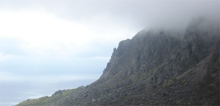 Measurement of precipitation is carried out by the thickness of the water layer in millimeters. On our planet, on average, about 1000 mm of precipitation falls per year. To measure the amount of precipitation, a device such as a precipitation gauge is used. For many years, observations have been made of the amount of precipitation in different regions planets, thanks to which the general laws of their distribution over the earth's surface were established.
The maximum amount of precipitation is observed in equatorial belt(up to 2000 mm per year), the minimum - in the tropics and polar regions (200-250 mm per year). V temperate average annual quantity precipitation is 500-600 mm per year.
In each climatic zone there is also unevenness in precipitation. This is due to the features of the relief of a certain area and the prevailing direction of the wind. For example, on the western outskirts of the Scandinavian mountain range falls 1000 mm per year, and on the eastern - more than two times less. Areas of land have been identified where precipitation is almost completely absent. These are the Atacama deserts, the central regions of the Sahara. In these regions, the average annual rainfall is less than 50 mm. A huge amount of precipitation is noted in southern regions Himalayas, in Central Africa(up to 10,000 mm per year).
Thus, the defining features of the climate of a given area are the average monthly, seasonal, average annual precipitation, their distribution over the Earth's surface, and intensity. These features of the climate have a significant impact on many sectors of the human economy, including agriculture.
Rain, snow or hail - we are familiar with all these concepts since childhood. We have a special relationship with each of them. So, rain brings sadness and depressing thoughts, snow, on the contrary, cheers and lifts the mood. But the hail, for example, few people like, as it can cause enormous damage to agriculture and serious injury to those who find themselves on the street at this time.
We have long learned how to outward signs determine the approximation of certain precipitation. So, if in the morning it is very gray and cloudy outside, precipitation is possible in the form of prolonged rain. Usually this rain is not very heavy, but it can last all day. If thick and heavy clouds appear on the horizon, precipitation in the form of snow is possible. Light clouds in the form of feathers foreshadow a heavy downpour.
It should be noted that all types of precipitation are the result of very complex and very lengthy processes in earthly atmosphere... So, in order for ordinary rain to form, the interaction of three components is necessary: the sun, the surface of the Earth and the atmosphere.
Precipitation is ...
Atmospheric precipitation is water in liquid or solid state that falls out of the atmosphere. Precipitation can either fall directly on the surface of the Earth or settle on it or on any other objects.
The amount of precipitation in a specific area can be measured. They are measured by the thickness of the water layer in millimeters. In this case, solid types of sediments are preliminarily melted. The average amount of precipitation per year on the planet is 1000 mm. In drops no more than 200-300 mm, and most dry place on the planet - this is where the recorded annual amount of precipitation is about 3 mm.
Education process
How are they formed, different types of precipitation? The scheme of their formation is one, and it is based on a continuous one. Let's consider this process in more detail.
It all starts with the fact that the sun begins to warm up the earth's surface. Under the influence of heating, the water masses that are contained in the oceans, seas, rivers are transformed into mixing with air. Vaporization processes occur throughout the day, constantly, to a greater or lesser extent. The volume of vaporization depends on the latitude of the area, as well as on the intensity of solar radiation.
Further, the moist air heats up and begins, according to the unshakable laws of physics, to rise up. Having risen to a certain height, it cools down, and the moisture in it gradually turns into water droplets or ice crystals. This process is called condensation, and it is from such water particles that the clouds that we admire in the sky are composed.
Drops in the clouds grow and enlarge, taking in more and more moisture. As a result, they become so heavy that they can no longer be held in the atmosphere, and fall down. This is how atmospheric precipitation is born, the types of which depend on specific meteorological conditions in a particular area.

Over time, the water that falls to the surface of the Earth flows in streams into rivers and seas. Then the natural cycle repeats itself over and over again.
Precipitation: types of precipitation
As already mentioned here, there are a huge number of varieties atmospheric precipitation... Meteorologists identify several dozen.
All types of precipitation can be divided into three main groups:
- drizzling;
- oversized;
- showers.
Precipitation can also be liquid (rain, drizzle, fog) or solid (snow, hail, frost).
Rain
It is a type of liquid precipitation in the form of water droplets falling to the ground by gravity. The droplet sizes can be different: from 0.5 to 5 millimeters in diameter. Raindrops, falling on the water surface, leave ideally round diverging circles on the water.
Depending on the intensity, the rain can be drizzling, heavy or torrential. They also distinguish this type of precipitation as rain and snow.
Freezing rain is a special type of precipitation that occurs at sub-zero temperatures. They should not be confused with hail. is a droplet in the form of small frozen balls with water inside. Falling to the ground, such balls break, and water flows out of them, leading to the formation of dangerous ice.

If the intensity of the rain is too high (about 100 mm per hour), then it is called a downpour. Showers are formed on cold, unstable air masses. As a rule, they are observed in very small areas.
Snow
These solid precipitation falls at sub-zero temperatures and looks like snow crystals, colloquially referred to as snowflakes.
During snow, visibility is significantly reduced, with heavy snowfall, it can be less than 1 kilometer. During severe frosts, light snow can be observed even with a cloudless sky. Separately, such a type of snow as wet snow stands out - this is precipitation that falls at low temperatures above zero.
Hail
This type of solid precipitation is formed at high altitudes (at least 5 kilometers), where the air temperature is always below -15 o.
How is hail produced? It is formed from water droplets that fall and then rise sharply in vortices of cold air. Thus, large ice balls are formed. Their size depends on how long these processes took place in the atmosphere. There were cases when hailstones weighing up to 1-2 kilograms fell on the ground!
A hailstone in its internal structure is very similar to an onion: it consists of several layers of ice. You can even count them, just like the rings on cut trees are counted, and determine how many times the droplets made rapid vertical travels in the atmosphere.
It should be noted that hail is a real disaster for agriculture, because it can easily destroy all the plants on the plantation. In addition, it is practically impossible to determine the approach of the hail in advance. It starts instantly and happens, as a rule, in summer season of the year.
Now you know how precipitation is formed. The types of precipitation can be very different, which makes our nature beautiful and unique. All the processes taking place in it are simple, and at the same time brilliant.
Precipitation Atmospheric precipitation - water in droplet-liquid (rain, drizzle) and solid (snow, grain, hail) state, falling out of clouds or precipitating directly from the air on the surface of the Earth and objects (dew, drizzle, frost, ice) as a result of condensation of water vapor, in the air.
Atmospheric precipitation is also the amount of water dropped out in a certain place for a certain period of time (usually measured by the thickness of the layer of precipitated water in mm). The amount of precipitation depends on air temperature, atmospheric circulation, relief, sea currents.
Distinguish between overburden precipitation associated mainly with warm fronts, and heavy rainfall associated with cold fronts. Precipitation from the air: dew, frost, frost, ice.
Precipitation is measured by the thickness of the precipitated water layer in millimeters. On average, around the globe falls approx. 1000 mm of precipitation per year: from 2500 mm in wet equatorial forests up to 10 mm in deserts and 250 mm in high latitudes. Measurement of precipitation is carried out by rain gauges, precipitation gauges, pluviographs at meteorological stations, and for large areas - using radar.
Precipitation classification
Precipitation falling on the earth's surface
Overhead precipitation- are characterized by monotony of loss without significant fluctuations in intensity. They start and stop gradually. The duration of continuous precipitation is usually several hours (and sometimes 1-2 days), but in some cases light precipitation can last half an hour or an hour. They usually fall out of stratus or altostratus clouds; moreover, in most cases the cloudiness is continuous (10 points) and only occasionally significant (7-9 points, usually at the beginning or end of the precipitation period). Sometimes weak short-term (half an hour-hour) overburden precipitation is noted from stratus, stratocumulus, altocumulus clouds, while the number of clouds is 7-10 points. In frosty weather (the air temperature is below -10 ... -15 °), light snow can fall from the cloudy sky.
Rain- liquid precipitation in the form of drops with a diameter of 0.5 to 5 mm. Individual raindrops leave a trail on the surface of the water in the form of a diverging circle, and on the surface of dry objects - in the form of a wet spot.
Hypothermic rain- liquid precipitation in the form of drops with a diameter of 0.5 to 5 mm, falling out at a negative air temperature (most often 0 ... -10 °, sometimes up to -15 °) - falling on objects, the drops freeze and ice forms.
Freezing rain- solid precipitation, falling out at negative air temperatures (most often 0 ... -10 °, sometimes up to -15 °) in the form of hard transparent ice balls with a diameter of 1-3 mm. There is unfrozen water inside the balls - falling on objects, the balls break into shells, water flows out and ice forms.
Snow- solid precipitation, falling out (most often at negative air temperatures) in the form of snow crystals (snowflakes) or flakes. In light snow, horizontal visibility (if there are no other phenomena - haze, fog, etc.) is 4-10 km, with moderate 1-3 km, with heavy snow - less than 1000 m (while the snowfall increases gradually, so that visibility values of 1-2 km or less are observed no earlier than an hour after the beginning of the snowfall). In frosty weather (the air temperature is below -10 ... -15 °), light snow can fall from the cloudy sky. Separately, the phenomenon of wet snow is noted - mixed precipitation falling during positive temperature air in the form of flakes of melting snow.
Rain with snow- mixed precipitation, falling (most often at positive air temperatures) in the form of a mixture of drops and snowflakes. If rain and snow falls at a negative air temperature, precipitation particles freeze onto objects and ice forms.
Drizzling precipitation- characterized by low intensity, monotony of loss without changing the intensity; start and stop gradually. The duration of continuous shedding is usually several hours (and sometimes 1-2 days). Fall out of stratus clouds or fog; moreover, in most cases the cloudiness is continuous (10 points) and only occasionally significant (7-9 points, usually at the beginning or end of the precipitation period). Often accompanied by reduced visibility (haze, fog).
Drizzle- liquid precipitation in the form of very small drops (less than 0.5 mm in diameter), as if floating in the air. The dry surface gets wet slowly and evenly. When settling on the surface of the water, it does not form diverging circles on it.
Supercooled drizzle- liquid precipitation in the form of very small drops (with a diameter of less than 0.5 mm), as if floating in the air, falling out at negative air temperatures (most often 0 ... -10 °, sometimes up to -15 °) - settling on objects, the drops freeze and form ice.
Snow grains- solid sediments in the form of small opaque white particles (sticks, grains, grains) with a diameter of less than 2 mm, falling out at negative air temperatures.
Heavy rainfall- are characterized by the suddenness of the beginning and end of the loss, a sharp change in intensity. The duration of continuous shedding is usually from several minutes to 1-2 hours (sometimes several hours, in the tropics - up to 1-2 days). They are often accompanied by a thunderstorm and a short-term increase in wind (squall). Fall out of cumulonimbus clouds, while the amount of clouds can be both significant (7-10 points) and small (4-6 points, and in some cases even 2-3 points). The main sign of heavy rainfall is not their high intensity (heavy rainfall can be weak), but the very fact of falling from convective (most often cumulonimbus) clouds, which determines the fluctuations in precipitation intensity. In hot weather, light rain showers can fall from powerful cumulus clouds, and sometimes (very weak rain showers) even from medium cumulus clouds.
Heavy rain- heavy rain.
Heavy snow- heavy snow. It is characterized by sharp fluctuations in horizontal visibility from 6-10 km to 2-4 km (and sometimes up to 500-1000 m, in some cases even 100-200 m) for a period of time from several minutes to half an hour (snow "charges").
Heavy rain with snow- mixed rainfall of a torrential nature, falling (most often at a positive air temperature) in the form of a mixture of drops and snowflakes. If a heavy rain with snow falls at a negative air temperature, precipitation particles freeze onto objects and ice forms.
Snow groats- solid rainfall precipitation, falling at an air temperature of about zero ° and having the appearance of opaque white grains with a diameter of 2-5 mm; grains are fragile, easily crushed with fingers. Often falls before or simultaneously with heavy snow.
Ice croup- solid rainfall precipitation, falling at an air temperature from -5 to + 10 ° in the form of transparent (or translucent) ice grains with a diameter of 1-3 mm; in the center of the grains there is an opaque core. The grains are quite hard (they are crushed by fingers with some effort), when they fall on a hard surface, they bounce off. In some cases, the grains can be covered with a water film (or fall out together with water droplets), and if the air temperature is below zero °, then falling on objects, the grains freeze and ice forms.
Hail- solid precipitation that falls in the warm season (at an air temperature above + 10 °) in the form of pieces of ice of various shapes and sizes: usually the diameter of hailstones is 2-5 mm, but in some cases, individual hailstones reach the size of a pigeon's and even a chicken's egg ( then the hail causes significant damage to vegetation, car surfaces, breaks window panes, etc.). The duration of the hail is usually short - from 1-2 to 10-20 minutes. In most cases, hail is accompanied by heavy rain and thunderstorms.
Unclassified precipitation
Ice needles- solid precipitation in the form of the smallest ice crystals floating in the air, formed in frosty weather (the air temperature is below -10 ... -15 °). During the day they sparkle in the light of the rays of the sun, at night - in the rays of the moon or in the light of lanterns. Quite often, ice needles form beautiful luminous “pillars” at night, extending from the lanterns up into the sky. They are most often observed with a clear or slightly cloudy sky, sometimes falling out of cirrostratus or cirrus clouds. Ice needles
Precipitation formed on the surface of the earth and on the metach
Dew- water droplets formed on the surface of the earth, plants, objects, roofs of buildings and cars as a result of condensation of water vapor contained in the air at positive air and soil temperatures, little cloudy skies and weak winds. Most often observed at night and early morning hours, may be accompanied by haze or fog. Abundant dew can cause a measurable amount of precipitation (up to 0.5 mm per night), water runoff from roofs to the ground.
Frost- white crystalline sediment formed on the surface of the earth, grass, objects, roofs of buildings and cars, snow cover as a result of sublimation of water vapor contained in the air at negative soil temperatures, little cloudy skies and weak winds. Observed in the evening, night and morning hours, may be accompanied by haze or fog. In fact, this is an analogue of dew, which forms at negative temperatures. Frost is deposited weakly on tree branches, wires (unlike rime) - on the wire of an ice machine (diameter 5 mm), the thickness of frost deposits does not exceed 3 mm.
Crystal rime- a white crystalline precipitate, consisting of small fine-structured shiny ice particles, formed as a result of sublimation of water vapor contained in the air on tree branches and wires in the form of fluffy garlands (easily crumbling when shaken). It is observed in low-cloud (clear, or clouds of the upper and middle tier, or broken-layered) frosty weather (air temperature below -10 ... -15 °), with haze or fog (and sometimes without them) with weak wind or calm. Rime deposition occurs, as a rule, for several hours at night, during the day it gradually crumbles under the influence of sunlight, but in cloudy weather and in the shade it can persist throughout the day. On the surface of objects, roofs of buildings and cars, frost is deposited very little (unlike frost). However, frost is often accompanied by frost.
Grainy rime- white loose snow-like precipitate formed as a result of the settling of small droplets of supercooled fog on tree branches and wires in cloudy foggy weather (at any time of the day) at air temperatures from zero to -10 ° and moderate or strong winds. With the enlargement of fog droplets, it can turn into ice, and with a decrease in air temperature, combined with a weakening of the wind and a decrease in the amount of cloudiness at night, into crystalline frost. The growth of granular hoarfrost lasts as long as fog and wind lasts (usually several hours, and sometimes several days). Preservation of the deposited granular hoarfrost can last for several days.
Ice- a layer of dense glassy ice (smooth or slightly bumpy) formed on plants, wires, objects, the earth's surface as a result of freezing of precipitation particles (supercooled drizzle, supercooled rain, freezing rain, ice grains, sometimes rain and snow) in contact with the surface, having a negative temperature. It is observed at an air temperature most often from zero to -10 ° (sometimes to -15 °), and with a sharp warming (when the earth and objects still maintain a negative temperature) - at an air temperature of 0 ... + 3 °. It greatly impedes the movement of people, animals, transport, can lead to wire breaks and breaking off tree branches (and sometimes to a massive fall of trees and masts of power lines). The accumulation of ice lasts as long as supercooled precipitation lasts (usually several hours, and sometimes with drizzle and fog - several days). Preservation of the deposited ice can last for several days.
Ice- a layer of lumpy ice or icy snow formed on the surface of the earth due to the freezing of melt water, when, after a thaw, the temperature of the air and soil decreases (transition to negative temperatures). Unlike ice, ice is observed only on the earth's surface, most often on roads, sidewalks and paths. The preservation of the formed ice cover can last for many days in a row until it is covered from above with freshly fallen snow cover or melts completely as a result of an intense increase in air and soil temperature.