I don't like pebble beaches, so I always opt for sandy beaches. Our Black Sea has not only a large selection of hotels and attractions, but also a huge selection of beaches. Anyone can find a coast to their taste here. It remains only to find out where there are rocky beaches on the Black Sea, and where are sandy ones.
Where there are rocky beaches on the Black Sea
Majority famous resorts have pebble beaches. For instance:
- Lazarevskoe;
- Kabardinka;
- Dzhubga;
- Resorts of Crimea;
- Resorts of Abkhazia.
I cannot swim on pebble beaches, but many people choose them for several reasons. Pros of pebble beaches:
- purity and transparency of water;
- stones and pebbles do not stick to the body like sand;
- better visibility underwater.
But pebbly and rocky beaches have not only advantages. Minuses:
- sharp stones;
- the risk of cutting your legs;
- stones and pebbles are very hot in the sun;
- the need to wear special slippers for swimming.
Not everyone wears special bathing slippers. For some, pebbles are a wonderful foot massager. But I still remember how the wave hit me right on the stones. It ended badly. The legs were bruised and cut. And I'm not the only one who has encountered this.

Where there are sandy beaches on the Black Sea
On the Black sea you can easily find sandy shores. Most of the sandy beaches are located in Anapa. You can find a good sandy beach in Gelendzhik. It is small (about 500 meters in length), but without pebbles. The sand is also very hot in the middle of the day, but it is easier to run on it without shoes. Try running without shoes over pebbles and rocks. Sandy beaches have their drawbacks. The disadvantages include the following:
- sand sticks to wet skin, especially sunscreen;
- the water is not so transparent, as the sand is constantly shaken up by people who swim in the sea;
- during the wind, the sand will fly into the eyes;
- algae grow on beaches where there is sand, not pebbles.

Sandy beaches are very good if you are traveling with a child... Children will be more comfortable swimming. The sand is safer for children. The child will not fall on stones, so the risk of injury is greatly reduced. For seniors, this is also a great beach... On such beaches, the entry into the water is smoother. If you are going to a sandy beach, then you do not need to bring special swimming shoes with you.
The Black Sea has a huge number of beaches. And you can always choose the beach that will be the most convenient and acceptable for you.
We have a museum in Sochi, which, in terms of the number of collected exhibits, is significantly ahead of any of the world's museums.
In it, without any permission, you can touch the exhibits with your hands, take pictures with them and even ... trample these exhibits with your feet.
If you want to take away from the museum with you some especially vending rarity, no one will say a word of reproach to you: the people around you will give you a sympathetic, approving look.
The reader, of course, guessed that we are talking about our Sochi pebble beach - unique in its content and invariably arousing great interest among resort visitors.
This, of course, is a natural historical and geological museum, in which each piece of exhibit is calibrated to the required size, smoothly ground and polished by sea waves, cleaned before being shown to the general public.
The history of the appearance of sea pebbles on our beach is interesting in itself. Numerous mountain rivers and rivulets for centuries eroded the layers and strata of the Caucasus Mountains, carrying in Black Sea, then by a calm fast current, then by a seething thunderstorm a mass of rocky breakages, boulders, and plates of various shapes. The sea, accepting all this material already in a partially crushed form, continued to grind and sort by size, roll in and grind the "works" of mountains that fell into its waves. Geologists call these works rocks, and the history of their appearance, numbering many millions of years, is the most ancient and mysterious history of our land, the history of our region, captured so vividly in the pebbles-exhibits of the Sochi beach.
Seventy million years ago, the Caucasus Mountains grew and formed. Their growth was accompanied by a roar and roar, fiery rivers of erupted lava. Most of the Caucasus peaks of the Central Ridge are extinct volcanoes. And the pebbles brought to the beach tell very eloquently about the volcanism raging here. Here is a pumice stone - a porous hygienic pebble - this is frozen volcanic magma, poured out far away, caught in the air and therefore very light. Here are tuffs and basalts “frozen” at the exit from the volcano - they are heavier than pumice, but much lighter than granite. The granite on the beach is the eroded roots of the mountains, the magma that solidified inside the volcano.
Heavy granite - pebble stones, usually white, egg-shaped - the most famous representative of volcanic rocks. Thanks to the brilliance of evenly mixed minerals in it (and we all know from school years that these are quartz, mica and feldspar), thanks to its hardness and strength, it has become a stone of monuments, obelisks and monuments. However, once on a pebble beach, granite pebbles have lost their monumental perspective, and all its beauty is aimed at creating a good mood for people relaxing by the sea.
Other igneous rocks found under our feet are tuffs of various shades, basalts, which are also widely used facing and building materials. Among the spilled rocks there are also semiprecious, decorative stones - porphyrites, syenites, chrysolites. To them can be added numerous quartzites - transparent and translucent pebbles, as well as durable flint-chalcedony, the healing properties of which were immediately talked about in our time by famous healers. These minerals, not related to rocks, and therefore more ancient in origin, also came to our beaches from the vents of volcanoes.
Long before the Caucasus Mountains rose, the territory of the whole of Sochi and Krasnodar Territory was the seabed. One should not be surprised at this in any case, because long before the appearance of man on earth, the entire territory of the present-day Russian Federation was also the seabed. In our places, the land repeatedly towered over the sea, islands appeared, which were covered with tropical vegetation. It has long been proven that dinosaurs and other ancient land animals lived in our area. Then all this was again absorbed by the deep sea, and on the seabed there was a continuous process of accumulation of sedimentary rocks. When the mountains rose, the layers on the bottom of the sea began to move. They also became mountains, lateral Caucasian ridges, and the rocks accumulated in them also began to be destroyed by rivers and rolled into the sea.
The predominant sedimentary rock in sea pebbles is sandstone. There are gray, tobacco-colored, brown, yellow sandstone pebbles, depending on the composition of the sand settling at the bottom of the sea. The sandstone is often cut with white veins running in different directions. These are hieroglyphs. According to the theory of the Dutch scientist F. Kühnen, calcite and other veinlets in sandstone are the result of the deposition of turbidity flows in the sea, carrying particles of rocks destroyed after earthquakes along the underwater canyons.
Many rocks in the composition of sea pebbles are able to tell about the sea inhabitants that lived in our area millions of years ago. Such is the shell rock - in its structure, the mollusks of the ancient ocean are easily visible. But limestone and marl are also of organic origin, but we will not see the remains of marine organisms of the Jurassic period of the Cenozoic era with the naked eye. To detect them, you need a microscope, since these rocks were composed of deposited microorganisms - plankton - mixed with chemical sediments. Limestones and marls are common stones on our pebble beaches. It is not without reason that the North-West Caucasus is called the kingdom of limestones and marls.
The era of dinosaurs and pterodactyls is also reminiscent of slate - a soft sedimentary stone consisting of fossilized mud from the Jurassic swamps. Once in the sea, the shale does not stay in a pebble state for long - its harder counterparts, driven by the waves, quickly process it into sand. But on land it is easier to find it. Our Sochi slate is often called roofing - the highlanders used this layered stone as a material for the roofing of their homes.
The third group of rocks is very interesting, following the igneous and sedimentary rocks in the composition of sea pebbles - these are metamorphic or transformed rocks. Among them, semi-precious stones are often found, which, after jewelry processing, acquire an attractive shine and beauty. Nature-alchemist is able to transform some substances into others, changing their crystalline structure. True, this process takes millions of years. During this time, under high pressure and exposure to high temperatures, limestone turns into marble, sandstone - into jasper, etc. Pebbles with traces of metamorphism are not uncommon on our shore: half of the stone is typical gray sandstone, and the other half is a jasper with a reddish tint.
Of course, using only this article, it is impossible to learn to distinguish between minerals and rocks, to determine the time of their appearance and the natural processes accompanying it. But everyone can learn to read stones like an open book. To do this, you need to work a little with special literature, reference guides. The task of our publication is to increase the interest of every reader in those treasures that are under our feet. In a broad sense, a pearl is an outlandish, beautiful work of nature. There are a myriad of such pearls on our beaches.
At the end of this brief review, I would like to talk about stones with holes, often through and of a fairly large diameter. As a rule, this is the work of a marine life, a mollusk-mollusk or a folas. Spinning with the help given to him by nature jet apparatus By treating the surface of the stone with acid, this bivalve, mussel-like mollusk, drills holes in soft rocks, most often in sandstone, and hides in them from predators. They say that a pebble with a through hole found on the beach brings happiness ...
Quiet sunny morning. We are on the Black Sea coast, somewhere on a rocky coast, for example, at the foot of the Karadag rocks.
These are those hours of complete silence, when the night wind from the land has not yet been replaced by the daytime sea wind. The almost motionless sea changes its colors every minute, reflecting the sky and coastal rocks, illuminated by bright rays.
Nothing breaks the serenity of the early morning. A winged predator is circling lazily high above the rocks. Even the busy seagulls have become quiet and are sitting in groups on the shore, as if waiting for something.
Quiet and on the seabed. Between the coastal rocks, you can clearly see it at great depth. The stalks of brown algae sway barely noticeably, their dense thickets resemble some kind of dwarf fantastic forest. A chiseled figure of a seahorse has detached from the stalk of the seaweed and, quickly fingering with tiny fins, hovers over the forest of algae. One of the stems suddenly began to stir and, bending smoothly, swam between the stones. Behind him is another. But these are not stems, but very thin needle fish. Where there is less algae and the bottom is lined with multi-colored Karadag pebbles, flocks of tiny mullet fry quickly sweep by. From under the stone, stirring the water, wiggling its claws, a huge black crab crawled out, stood in thought, looked fiercely at underwater world with bulging eyes and crawled sideways under another stone.
Peace and quiet in nature involuntarily give rise to the idea of the eternal inviolability of stone cliffs and rocks piling up on the coast. And it seems that there is no such force that could destroy these motionless masses ...
But a light breeze pulled from the sea. The smallest ripples covered the surface of the water in long stripes. The sky is still clear, only a white cloud appeared on the horizon, like a lone sail.
Several minutes pass. The cloud grows, branches, turns gray. Another moment - and, having become completely leaden, it approaches the shore with a huge clawed paw. The sun disappeared. Strong gusts of wind rip off the tops of the waves and throw them on the shore. Rocks become wet and slippery.
Seagulls soared into the air and screaming, then falling, then soaring upward, quickly sweep over the sea. The waves keep growing and growing, and finally the three-meter shafts crash on the shore. The rock from which we first observed the seabed now and then disappears under their crests. Another minute, and a solid wall of rain hid the horizon ...
If a biologist prefers calm weather for observations, then for a geologist who wants to see the action of external geological forces, storms and downpours provide the richest material.
The downpour produces a destructive work of tremendous force, especially in mountainous regions, where streams of water formed by the downpour rush down mountain slopes, gullies and mountain streams at high speed, eroding and carrying into the sea a colossal amount of stony debris.
Most of all, small particles of clay and sandy loose rocks are demolished. These particles are easily moved by water currents with even low speed. It is clear that the soil cover of treeless slopes suffers the most from rainfall in mountainous areas. Sometimes tens of hectares of fertile soils are washed away. At the same time, soils and other loose rocks saturated with moisture can form powerful mud flows, mudflows, of a terrible destructive force. Rushing along the slopes, the mudflows sweep away gardens, vineyards and even entire villages on their way.
However, such catastrophic events are relatively rare. Erosion and washout usually occur surface waters the smallest particles of rocks in the water in suspension, and large debris - pebbles, cobblestones and boulders - move, rolling along the bottom of mountain rivers.
All debris washed off the land surface is eventually carried out into the sea and deposited on its bottom. At the same time, it is rather regularly distributed on the seabed according to the size of the debris.
All those who visit Crimea are well aware that there are many fragments of rocks and pebbles of various sizes on the beach of the South Coast, as well as other places on the mountain coast. If you go down to the bottom of the sea 100-150 meters from the pebble shore, it will be lined with small pebbles (gravel) and coarse sand. At great depths, the bottom is covered with fine-grained sand, which becomes thinner and thinner with increasing depth, and at depths reaching hundreds of meters, the sea bottom is covered with a continuous layer of silt.
This distribution of debris on the seabed is due to the uneven mobility of water. Near the coast, in the surf zone, where water is almost always in motion, particles of sand and even more so silt cannot settle, only large pebbles remain in this zone. At great depths, where the roughness of the sea surface does not affect the bottom sediments so much, for example, at a depth of 10-15 meters, sand particles are deposited, and, finally, at a depth of more than one hundred meters, where even the excitement of strong storms does not disturb the silence of the bottom waters, - the smallest particles of silt with a size of less than 0.01 millimeters are deposited. Only the bottom currents of great sea depths sometimes stir up and move the silty; sediment.
In the most distant from the coast areas of the seabed, even silty particles are almost not deposited, since most of the clay material settles, albeit at considerable depths, closer to the coast from which it comes. Only wind-blown dust can be deposited on the seabed at a great distance from the coast.
There are also deviations from this pattern in the distribution of marine sediments. For example, the Evpatoria beach does not contain pebbles and consists entirely of shell sand; it also lined the bottom for many hundreds of meters from the coast. In the surf zone on the Black Sea coast of the Kerch Peninsula, in some places there is no sand, here, from the coast to considerable depths, the sea bottom is covered with silty sediments. This is due to the fact that the land of the Evpatoria coast is composed of loose shell limestone and sandy-argillaceous rocks, and the coast of the Kerch Peninsula is in places composed only of clays. It is clear that these loose rocks, when eroded and destroyed by surface waters, easily disintegrate into composite fine-grained particles without forming large fragments and, thus, there is no zone of coarse-grained marine sediments. The rocks of the Crimean mountain coast are composed of more ancient, compacted, strongly cemented sedimentary rocks and very strong - igneous. Due to their density, these rocks persist for a long time in large debris, even when surface waters carry them over long distances.
Surface waters carry debris into the sea, and sea waves in the surf zone, in turn, perform continuous destructive work, especially intensified during storms. In the rocky shores, they develop niches and various gullies, sometimes of the most bizarre shape (for example, the original gully already known to us - the Karadag Gate) was formed. The washed-up shores lose stability, and from time to time there are rock falls, cluttering the coast with debris. If the coastal rocks are loose or poorly cemented, and the banks are high and steep, then the coastal slopes slide. Landslides are often huge and cause serious damage to coastal areas. Debris generated by the activity of sea waves is distributed along the seabed in the same way as debris brought by surface waters. This is how sedimentary marine detrital rocks, otherwise called terrigenous (terra - earth), begin their formation at the bottom of the sea, since the particles from which they are formed come from the surface of the land - from the ground.
The organic life of the sea also creates large accumulations of sediment on the seabed.
Anyone who has been to the Evpatoria beach or other places on the coast of the steppe Crimea or the Kerch Peninsula, of course, has seen here a myriad of mollusk shells. In calm weather, at shallow depths, you can also observe live mollusks moving slowly along the bottom or attached to underwater rocks or algae.
Especially there are many bivalve ribbed shells of the mollusc cardium edule, or heart-shaped, painted in various shades of pinkish and lilac tones. Less often, there are oblong, like long claws shells of zolen and rather large beautiful shells of pectenes, or, in other words, scallops. Where the coast is teeming with rocks or algae, you can find clusters of black pear-shaped mussel shells that form huge colonies called banks. In addition to these molluscs, there are many others. Small balianus crustaceans are often attached to pitfalls and valves of large shells, which are also enclosed in a conical calcareous shell. These crustaceans are also referred to as sea acorns.
Shells of molluscs are also found on rocky shores, but they are most common in relatively shallow parts of the sea, where the bottom is lined with sand with an admixture of silt.
There are especially many bottom molluscs here, in particular, heart-shaped and scallops, inhabiting depths from 15 to 35 meters.
Over time, the calcareous shells of dying mollusks form layers of many meters on the bottom of the sea, and if it has a gentle slope, then the strip of shell deposits reaches a width of several kilometers. The waves of the surf carry the shells and their debris to the shore, and thus there are vast seashell beaches, similar to the one in Yevpatoria.
This is how rocks of biological origin begin their formation on the seabed, or, as they are called, biogenic, because the shell of the mollusk consists of calcium carbonate, which is extracted by the mollusc from a solution of sea water and precipitated by it in the form of a solid.
In addition to biogenic sediments, sediments of chemical origin can form. These are various substances that are deposited in the form of crystals at the bottom of closed pools as a result of strong evaporation of water saturated with salts.
Such sediments include: self-settling table salt, Glauber's salt, gypsum and many other salts.
Some of the substances contained in river waters precipitate when these waters are mixed with sea salt water. So, for example, solutions of iron and manganese salts of river waters, getting into a salt sea basin, precipitate, forming silts enriched with these elements. These silts are transformed over time into iron and manganese ores of sedimentary origin.
Calcium carbonate can also precipitate when the temperature of the water changes. In colder waters, the solubility of calcium carbonate is greater than in warm waters; heating the water leads to its partial precipitation.
This is, in general terms, the process of formation on the seabed of thick layers of sediments of terrigenous, biogenic and chemical origin.
Centuries and millennia pass. More and more precipitation is accumulating at the bottom of the sea, especially in its coastal zones, due to the continuous erosion by surface waters of the attached land. And if the earth's crust were in constant rest, then over time there would be no continents on the globe, but there would be a continuous shallow ocean. But this does not happen and cannot happen, since the earth's crust is constantly in motion, sinking and rising, which, in turn, entails the advance of the sea on land and the retreat of sea waters from it. This is how deep sea depressions and high mountain systems are formed.
If the land sinks, then the sea comes to the shore, and then the coastal pebble deposits are at a greater depth and sands and silts or shell formations are deposited on top of them. In this way, an alternation of sedimentary rocks of various compositions is created. If the land is uplifted, then part of the marine sediments appears on the surface of the earth, and deeper marine sediments, for example, silts, find themselves in a shallow water zone, and then pebbles and sands are deposited on top of them.
Fluctuations crust occur continuously and almost always very slowly and imperceptibly, but for a long geological time, measured in hundreds of thousands and millions of years, individual areas of the earth move vertically for several kilometers, and therefore we can observe how ancient marine sediments sometimes lie on the tops of mountains.
Over a huge period of time, loose, free-flowing or plastic bottom sediments of the sea are gradually compacted and turn into hard-stone sedimentary rock, which, after centuries, reappears on the surface of the earth, is subjected to the destructive influence of atmospheric forces, and again its fragments or salts dissolved in water enter the sea and are deposited at its bottom.
Such is the continuous process of destruction and formation of sedimentary rocks, the primary material of which was nevertheless igneous rocks.
We talked about the process of the formation of sedimentary rocks at the bottom of the sea. Sedimentary rocks are also created on land. Various debris accumulates here, deposited by surface water and wind. But the scale of accumulation of continental sedimentary rocks is negligible in comparison with marine ones. And the existence of continental sediments is usually short-lived. Most often, they quickly erode and drift into the sea.
In a word, land is a place mainly for the destruction of stone by external geological forces, and the sea is an area of formation of rocks and minerals of sedimentary origin.
Surface Crimean peninsula more than 99% composed of sedimentary rocks of various composition and geological age. All these rocks are of marine origin, and only the relatively thin cover of loams and soils overlying them belongs to relatively recent continental formations.
Stones of sedimentary origin are very diverse, and many of them are minerals, that is, mineral resources that are used in the national economy.
We will now head along the highway from Simferopol to Alushta. When descending from the pass, two kilometers from the highway, a huge massif of Mount Demerdzhi rises on its left side. At the top of the mountain and its slopes facing the sea, numerous columns and bizarre towers stand out. One of these pillars resembles a bust of Catherine II, and therefore Demerdzhi is sometimes called Catherine Mountain.
From a distance, the mountain is undoubtedly picturesque, but this is not enough for a geologist, he always strives to get better acquainted with the material from which its cliffs are made.
The best and easiest way to get to the top of Demerdzhi is from the Alushta pass. This will save you several hundred meters of ascent, since the height of the mountain exceeds 1200 meters.
Passing along the western slope of Demerdzhi, you will see a pile of huge blocks of stone below. This is a huge landslide, which in the last century destroyed the village located at the foot of the mountain.
Mount Demerdzhi is composed of sedimentary rocks - conglomerates, which are firmly cemented pebbles. Now we already know that these are marine coastal deposits of some ancient sea or an ancient river delta. The conglomerates of the mountain in time refer to the Jurassic period, distant from us by 110-120 million years. It is not surprising that over such a long period of time, the coastal gravel has become firmly cemented and turned out to be at an altitude of more than 1200 meters above sea level.
Conglomerates of Mount Demerdzhi are a very durable breed, they slowly succumb to the influence of external forces. Nevertheless, wind, water and temperature fluctuations do their destructive work, again turning the conglomerate into gravel. As a result of the centuries-old action of these forces, those bizarre pillars and towers that are visible from afar were formed. Here, at the top of the mountain, these pillars are especially majestic, and one cannot even believe that they were created by the activity of external geological forces.
If you look closely at the pebbles that make up the conglomerate, we can find a wide variety of rocks among them. Here we will meet black pebbles of dense sandstones and shales, milky-white pebbles of quartz, red patterned pebbles of an igneous rock-granite unknown in Crimea. Black shiny pebbles of the ore mineral hematite are occasionally found.
Black pebbles of dense sandstone and shale represent fragments of rocks older than conglomerates. By age, the shales also belong to the Jurassic rocks, but formed at the beginning of the Jurassic period, and are marine sediments of great depths. Numerous quartz pebbles are also representatives of older rocks than conglomerates. Pebbles of igneous rock of granite and pebbles of hematite belong to even more ancient rocks, almost unknown in the Crimea. Only near the town of Balaklava was a small rock of granite discovered, but completely different from the granite of Demerdzhi pebbles.
Where did the granite fragments come from into the Jurassic Sea?
Many scientists believe that to the north of Demerdzhi in the Jurassic time there was a dry land composed of rocks unknown in the Crimea in our time. Later, this land sank to a great depth and formed a giant depression, which was filled with the waters of the Black Sea. Traces of the former existence of this land are captured in its fragments - pebbles, enclosed in the conglomerates of Demerdzhi.
The conglomerate is used by the local population as a rubble stone for the foundations of buildings, but it is not widely used as a building stone, since it is difficult to process.
Let's leave the peak of Demerdzhi with its bizarre forms of weathering and descend to the southeastern slope of the mountain. Here we will see completely different rocks - shales and sandstones, underlying the Demerdzhi conglomerates.
These thin-layered, almost black rocks are widespread throughout the southern and southeast coast Crimea. Their distinctive feature is that in many places they are strongly crumpled and cracked. You can even observe folds of the second and third order, when the wing of one giant fold, in turn, is crumpled and consists of smaller folds, and the latter are also crumpled into small folds several tens of centimeters in size.
Shale and sandstone the Black Sea coast Crimea belong to the most ancient rocks, formed at the end of the Triassic and early Jurassic periods. These rocks are not subdivided in more detail by age, since they do not contain fossilized organic remains. They were given a common name - Tavricheskaya strata.
It is easy to see that the rocks of the Taurian strata, like a layered cake, consist of layers of black thin-layered clay shales, interspersed with interlayers of dense sandstones. Consequently, these sediments, as well as conglomerates, are of clastic - terrigenous origin, but they were formed not in the coastal zone, but at deeper depths, where fine clay particles could have been deposited, from which shales were formed. During the deposition of these sediments, the depth of the sea was constantly changing: at times the sea became shallower, and then the sands were deposited, at times it became deeper again, and the deposition of clay particles resumed. So the oscillatory process of the earth's crust was reflected in the nature of the structure of this sedimentary strata. During the formation of the Tauride strata in the lagoons and bays of the Jurassic Sea, in addition to clastic material, a large amount of plant remains accumulated, which turned out to be buried under the ids of lagoons and bays and have survived to our time in the form of coal seams. Coal in sandy-shale deposits occurs in many places of the Crimea. Known, for example, the Beshuisky mines, located in the upper reaches of the river. Kachi. For some time, these mines were developed, and the coal was used for local needs. In coal seams, there are often interlayers of petrified resin - jet. Jet is easy to process and can be used to make various small items and decorations.
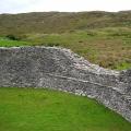
Black Tavricheskie slates easily exfoliate into thin tiles, but, unfortunately, small in size. Perhaps it will be possible to find an array of these rocks, in which the slates will not be so fragmented, and then large thin tiles can be used as roofing material. Thick sandstone tiles are widely used by the local population: fences and even walls, mainly of outbuildings, are laid out of them.
If you go around Mount Demerdzhi from the southeast and, reaching the village of Generalskoye, climb the Khopkhal gorge, then we will find ourselves in the area of distribution of other sedimentary rocks - limestones, lying on the Jurassic conglomerates.
In Crimea, limestones are widespread and belong to different geological ages. Limestones in the Hophal gorge are the most ancient limestones of Crimea, they are attributed to the Upper Jurassic time. They formed most of the peaks and plateaus of the mountainous part of the peninsula. These plateaus are called yayls in the Crimea.
Climbing the hard-to-pass Kophal gorge, we will come to the Tyrke ridge, which connects two large yayls: Demerdzhi-yayla in the south-west and Karabi-yayla in the northeast.
The surface of the yailas is devoid of woody vegetation and is a slightly hilly plain, in places covered with grasses, in places bare, rocky. Sometimes in the folds of the terrain, small groups of dwarf pines, twisted by continuous winds, grow. Being in the center of the yayla, you forget that you have risen to an altitude of more than 1000 meters above sea level and that below you, on the southern and northern slopes of the yayla, there is a typical mountain landscape and lush vegetation. This contrast is especially noticeable after the picturesque Hophal Gorge with its waterfalls and century-old forest.
We already know that limestones are in most cases of biological origin and less often formed as a chemical sediment.
The Yaylinsky limestones are also biogenic sediments with some admixture of sandy-clayey material, therefore they have a light gray color. There are also quite clean limestones of white or light yellow color. Minor admixtures of iron, manganese and other elements often create a beautiful pattern that can be clearly seen when polishing the stone.
Examining the limestone, you can see the organic remains enclosed in it in the form of shells and coral valves, indicating that this limestone is of marine and biological origin. But tens of millions of years that have elapsed since the burial of these calcareous organisms at the bottom of the sea, and tremendous pressure caused strong changes in calcareous sediments. They have turned into a dense rock in which the primary calcium carbonate has recrystallized, and therefore the shell valves and corals enclosed in the stone merge with the total mass of the stone and are sometimes difficult to distinguish.
Such dense recrystallized limestones, which are easy to polish, are called marbled.
An array of gray marble-like limestones, located not far from Yalta, is being developed, and the mined stone is used for the manufacture of various handicrafts: writing instruments, table decorations and other small things. Slabs for cladding buildings and some architectural decorations are also made from marbled limestone.
In Crimea, there is also real marble, the deposits of which are located near the town of Balaklava. The pattern of the Crimean marble is elegant and whimsical, thanks to the remains of shells and corals enclosed in it, and the combination of delicate yellowish tones with bright red and brown shades gives a special charm to the polished surface of this stone. Facing slabs were made of Crimean marble, which adorn some lobbies of the Moscow metro. Perhaps the first in the history of stone culture was the use of marble by man as a material for sculptures and architectural decorations. For these purposes, marble was used in ancient Greece.
In tsarist Russia, marble was almost never mined. This stone was imported mainly from Greece and was used almost exclusively to decorate the royal palaces and the dwellings of the rich.
Now, in our time of grandiose construction projects of communism and the flourishing of Soviet culture and art, marble, as never before in history, has found wide application in our country. At the same time, we use domestic marble, which is distinguished by the beauty of the pattern and the variety of colors. Our marble can be seen in the halls of the Moscow Palace of Science - the University. Lomonosov, in the wonderful palaces of the All-Union Agricultural Exhibition, on the structures of the Volga-Don Canal named after VI Lenin and on many other buildings in various cities of our country.
Marble is also widely used in industry. As an excellent insulating material, it is used for the manufacture of switchboards and various insulating parts. Marble-like and generally dense pure limestones are used in the metallurgical industry as fluxes.
Marble is easy to process: sawing, carving, grinding and polishing. However, although marble products are durable, they do not last forever. In this respect, marble is in many ways inferior to igneous rocks.
Academician A.E. Fersman calculated that, on average, a layer of marble 1 millimeter thick dissolves per century. On the scale of time of human life, this is an insignificant value, although it should not be neglected. On the scale of geological time, marble and limestone are considered as readily soluble rocks. Multiply, for example, a value of 1 millimeter by ten thousand times and you get a layer of 10 meters. A layer of such thickness will dissolve within one million years, and in the history of the earth this is a very small period of time, approximately one three thousandth of the time that has passed since the beginning of the formation of the earth's crust. It should be borne in mind that under appropriate natural conditions, limestone rocks can dissolve much more intensively than one millimeter per hundred years.
Especially quickly limestone dissolves in waters containing carbonic acid, which is secreted in large quantities by plant roots; it also dissolves with other natural acids.
Pay attention to the surface of the Crimean yailas. Here, in some places, funnel-shaped depressions and dips are encountered. Sometimes in the center of the hole there is a channel that goes deeper. The exposed limestones in the low places of the yayl have a peculiar hilly surface and from a distance resemble a herd of grazing sheep. All this is the result of the dissolution of limestone by surface waters, a phenomenon called karst.
Penetrating through cracks deep into the limestone massif, water continues to dissolve limestone, forming channels, through which underground rivers sometimes flow rapidly. Over time, galleries and huge caves form on their way. Sometimes water reappears on the surface in the form of powerful springs. Such springs, for example, include the well-known in Crimea spring Ayan, located on the northern spurs of Chatyrdag (Shater Mountain) and supplying water to the city of Simferopol.
We started our acquaintance with the limestones and marble of Crimea in the Hophal gorge. It would seem that it was not worth taking the reader 20 kilometers from the Alushta highway in order to show him the limestone and acquaint him with the marbles of the Crimea, which can be easily seen on Ai-Petri and in the vicinity of Yalta, without even getting off the bus. But in this little-known corner - the Hophal gorge - during one route we have the opportunity to observe almost all the main varieties of sedimentary rocks - conglomerates, sandstones, clays and limestones. In addition, in the Hophal gorge, we will see one of the most beautiful waterfalls in Crimea, fed by underground karst waters, which, upon reaching the surface, emit a huge amount of lime in the form of a light porous mass, called limestone tuff. And, finally, in 5-6 kilometers to the north-east of the gorge there is Karabi-Yaila, which has the most pronounced forms of karst processes.
We have characterized marble in detail and said little about limestone, from which, in fact, dense marbles are formed.
There is a lot of limestone in the Crimea, whole massifs in the mountains and huge strata of gently inclined strata in the steppe part of the peninsula are formed by it.
White, rather dense limestones dating back to the end of the Cretaceous period are widely known both in Crimea and beyond. They consist of the calcareous skeletons of microscopic corals - bryozoans with a slight admixture of sandy-clay material. More often these rocks are called the Inkerman stone, since it is mined in large quantities near Inkerman.
Durable Inkerman stone is widely used as wall and facing building material. The hero city of Sevastopol, revived from the ruins, has been turned into one of the most beautiful cities countries, and the buildings of this city largely owe their beauty to the snow-white or slightly yellowish Inkerman stone, with which the walls of all buildings in the city are faced.
In the region of Simferopol, Evpatoria, Kerch and in many other places of the foothill and steppe Crimea, shell rock is widespread, entirely consisting of calcite-cemented shells that once inhabited the shallow seas of the Tertiary period, covering the territory of the modern Crimean steppes and foothills.
The shell rock is a porous rock that can be easily cut into bars with an ordinary saw. It has incomparably less strength than the Inkerman stone, and therefore houses are erected from it in one, rarely two floors in height.
In Crimea, a brick building is as rare as a wooden one. All Crimean cities are built of stone, born at the bottom of the sea as a result of the centuries-old activity of marine organisms.
Although there are no brick buildings in Crimea, bricks are produced in significant quantities for ovens, factory pipes and other construction purposes. For the production of bricks, a rock is also used of sedimentary origin - clay. Clays formed at the beginning of the Cretaceous period are considered the best for the production of bricks, roof tiles, pipes and various pottery. The reserves of these clays are enormous, their layers extend, starting from Balaklava, along the foothills of the entire Crimea to Feodosia.
There are also huge reserves of marls - rocks of sedimentary origin, which is a cemented mixture of clay and calcareous particles. Margels are the main raw material for the manufacture of cement, which is not yet produced in Crimea.
Limestones and marls are not rich in minerals. Sometimes they contain crystals of calcite and gypsum, which, however, do not differ in beauty or size. In the clays, you can find many beautiful crystals of gypsum in the form of large roses or in the form of a dovetail. There are also rounded concretions of spherosiderite, accumulations and crusts of golden cubic pyrite crystals. However, all these minerals are not rare, we can find them everywhere and therefore will not be looking for them in these rocks.
Terrigenous and biogenic sediments, as a rule, are poor in minerals visible to the naked eye, but when examining these rocks under a microscope, the mineralogist finds here no less rich collection than in igneous rocks.
By studying sedimentary rocks under a microscope and identifying microscopic crystals and their fragments enclosed in them, geologists often manage to establish the land area from which these particles entered the ancient seas, and thus recreate the geography of the distant geological past.
Sedimentary rocks are of exceptional interest for those who wish to learn the history of Crimea and the development of living organisms that inhabited its seas and land. From the fossilized remains of animals and plants, it is possible to relatively completely and accurately reproduce the picture of life and landscapes that existed millions of years ago.
We do not intend to remain aloof from the geological history of Crimea and devote several pages to this issue at the end of the essay. Now let's get acquainted with the last and most interesting in the mineralogical respect group of sedimentary rocks - rocks of chemical origin.
We have already mentioned the processes of formation of various chemical precipitates, and now we will take a closer look at their variety - Kerch ores.
To do this, we will have to go to the Kerch Peninsula again, to the village of Arshintsevo, located on the steep bank of the Kerch Strait near the city of Kerch.
Arshintsevo is located in a large depression bounded by a chain of low hills.
If you climb to the top of one of the hills, it is easy to see that the ridge of these heights on all sides borders the basin with the village, mines and collective farm fields located in it; only in the east is it open towards the Kerch Strait.
The relief of the eastern and northern parts of the Kerch Peninsula is characterized by such hollows, surrounded by ring-shaped chains of hills, composed of very strong limestones.
These limestones are made up of tiny corals we already know, called bryozoans. You can see the leafy formations, dotted with the smallest cells and tubules, which served as a home for the microscopic organisms of these corals.
More than 10 million years ago, at the beginning of the Maeotic age of the Tertiary period, the Kerch Peninsula was flooded with a shallow sea, and although the territory of the peninsula is significantly removed from the mountainous Crimea, where powerful mountain-forming processes took place, the action of these forces also affected here. The terrestrial layers of the Kerch Peninsula are also folded, although very flat. And where the crest of the folds rose, the bottom of the Meotic sea became shallow, and in some places the uplift was so significant that islands were formed. Along these islands, in shallow water, bryozoan corals lived. Gradually more and more appeared and more islands, bryozoan reefs increased in size, and thus, over time, lagoons were formed, surrounded by a chain of bryozoan reefs.
In subsequent geological epochs, the lagoons were filled with more and more new sediments, consisting either of sandy-clay material, or of numerous shell valves. Thanks to small but incessant fluctuations of the land, the lagoons were shallow, sometimes deeper. The climate at that time was moderate, with little rainfall.
Several million years passed, and the hot subtropical humid climate of the Cimmerian age came. The lagoons by that time were shallow, slightly saline basins, separated from each other by a chain of islands and peninsulas.
The hot, humid climate caused a lush flourishing of vegetation and intense chemical decomposition of the land rocks surrounding the lagoons. The shores of the lagoons, overgrown with dense forests, teeming with swamps, saturated the streams and rivers flowing into the lagoons with organic and inorganic acids.
These waters leached iron, manganese and other elements from the surrounding rocks and soils and, in a dissolved state, carried them out to the lagoons. In lagoons, when fresh land waters mixed with brackish lagoon waters, dissolved salts of iron and other elements precipitated, mixing with silty and sandy particles brought in by the same streams. Various organic residues, brought by waters from land, decomposed at the bottom of the lagoons, providing abundant food for many microorganisms, which in turn served as food for molluscs. Therefore, mollusks in the Cimmerian age reproduced especially successfully, differed in a variety of species and reached large sizes. Besides shellfish, the lagoons were inhabited by fish and seals.
So, for millennia, there was an accumulation of silts saturated with iron at the bottom of the lagoons in the Cimmerian age.
Later, as a result of the general uplift of the land, the sea retreated from the lagoons, ferruginous sediments became denser, various minerals of iron, manganese, phosphorus, barium and other elements were formed in them, and they turned into iron ore of sedimentary chemical origin.
We will begin our acquaintance with the Kerch ores and their minerals from the coastal cliff of the Kerch Strait in Arshintsevo.
To do this, you need to go to the park of culture and rest and go down the iron stairs to the beach of the Kerch Strait. Taking the direction to the south, you will soon see a forty-meter cliff wall, in some places completely vertical, in some places broken into giant steps by landslides. On the wall, layers of sedimentary rocks are clearly traced: on light yellow limestone, consisting of the smallest shells and their fragments, mixed with some clay and fine sand, a dark brown ore layer lies, and above it there are gray layers of sands and clays, younger than ore deposits, and at the very top of the cliff, light-brown loams lie in a continuous cover.
We are interested in ore and its minerals, and we will deal with it.
The brown loose mass - iron ore - consists entirely of concentrically-shell-like brittle brown balls called oolites. These balls, like crystals, grew in ferrous ooze. Apparently, the silty particles interfered with the formation of real crystals, and the ferrous solutions, layer by layer, concentrated around various small particles, penetrating the clayey mass of silt.
These oolites are composed of a mixture of various iron hydroxides, called the mineral limonite, with an admixture of clayey matter.
Among the brown ooliths, sometimes black, shiny, as if varnished, are found. Their color suggests that in addition to iron, these oolites contain a significant amount of manganese.
Among the oolitic ore mass there are rounded, usually black on the surface, large nodules, sometimes reaching several tens of centimeters across.
Such formations are familiar to us from the Karadag - these are nodules, but, in contrast to the Karadag, of sedimentary origin. They arise in a dense ore mass, when solutions, which are slowly circulating in oolitic ore, saturated with various mineral substances, concentrate around some inclusions and deposit new minerals.
Some of the nodules are natural caskets that contain beautiful crystals. However, you will have to open a lot of such boxes in order to find one or two with rich content.
Use a light hammer to crack open the nodule. Sometimes a cavity of considerable size is found in it, as if lined with velvet with a black with a bluish tint, a delicate bloom that stains the fingers. Quite often on this layer, like diamonds on black velvet, small transparent plates sparkle; black bloom is the mineral wad (manganese hydroxide), and the sparkling plates are crystals of the calcite we know.
It happens that instead of a velvety coating, the concretion cavity is lined with a black, shiny, very dense crust; this is also manganese hydroxide - psilomelan.
Often in the cavities of nodules there are various phosphorus minerals - phosphates, which are compounds of iron, manganese, calcium, phosphorus, oxygen and water.
Just like the zeolites of Karadag, these phosphates are famous throughout the Union. Nowhere else is there such a variety, such beautiful and large crystals. Many of the phosphates were first discovered here and given local names. Most often, brown oxykerchenite crystals are found in nodules or in shell cavities, sometimes long, sometimes many short ones, directed in all directions, like the needles of a hedgehog. Dark blue, almost black flat crystals of gamma and beta-kerchenite are less common. Dull green crystals of alpha-kerchenite are relatively rare. Occasionally you can find small bright light green needles of anapaite.
In addition to clearly crystalline phosphates, there are often so-called earthy varieties, which are a powdery mass, often mixed with iron ore. These phosphates include accumulations of canary yellow mitridatite and green bosphorite occurring in the form of thin veins. In the cracks and voids of the ore, one can find thin deposits and nodules of bright blue earthy beta-kerchenite. In those areas of the ore that have been exposed to atmospheric oxygen for a long time, growths of the mineral picycite are found similar to carpentry glue.
All of these phosphorus-containing minerals are complementary to iron as a mineral in ore deposits. When steel is smelted from cast iron, the phosphorus contained in it passes into slag, which can be used as fertilizer in agriculture.
Most of the nodules have cavities and represent a dense grayish-green mass, consisting of clayey siderite, around which there is a concentration of manganese, phosphorus and some other minerals.
When raking loose ore, we may come across brown fossilized bones of some vertebrates - these are the remains of seals that once lived in the Cimmerian lagoons. The bone tissue of these remnants is completely replaced by phosphorus compounds and is a phosphorite mineral.
Less common are white bones and the remains of woody vegetation. Holding such a fossil in your hand, you will be surprised at its great weight. This is the mineral barite (barium sulfate), which completely replaces the tissue of organic residues. Such mineral formations are called metamorphoses.
There is little barite in the Kerch ores, and therefore it is of no practical importance here, but large deposits of this mineral are being developed to obtain barium, which is used in the chemical industry and medicine.
In the loose ore mass, individual crystals of gypsum of an exceptionally regular cut are often found, and although this mineral is not a rarity, one should nevertheless take this opportunity to collect here a collection of gypsum crystals.
Finishing the collection of minerals in the Kerch ores, it must be said that we did not get to know all the minerals they contain. There are a number of minerals that can only be found in the ore mass under a microscope, and there are such minerals and varieties of ores that are found in the deeper zones of the deposit; they can only be recovered by drilling or driving fairly deep mine workings.
The ores exposed in the cliff have not always been as we see them now. Long-term exposure to external forces has largely changed the mineralogical composition and physical properties of ores; some minerals disappeared and new ones appeared. Such changes can sometimes occur in a very short time. For example, during the exploration work carried out at the Kerch deposits, from the depths, where the layers of ore are saturated with groundwater and where the oxygen of the air did not penetrate, a very dense, greenish-brown color, the so-called "tobacco" ore was extracted. Some varieties of this ore after a few days changed their color and turned into a loose brown ore, like the one we saw in the coastal cliff.
This is how sometimes an unusually fast change in the mineralogical composition of a stone occurs in new conditions, for example, in an environment rich in oxygen in the air and deprived of water.
Having finished collecting minerals and ores in the coastal cliff, you should familiarize yourself with the mine, which is located 6 kilometers from the village (you can go by bus). We recommend, by agreement with the administration of the iron ore plant, to see the quarries where the ore is mined, as well as the factories where the ore is enriched and agglomerated (from loose it turns into lumpy by sintering at a high temperature), in a word, to get an idea of both of the whole process of preparing natural mineral raw materials for smelting metal from it.
Kerch iron ores have been known for a very long time. In ancient times, the inhabitants of the Crimea already knew about the ores. Crimean archaeologists tell us about this, who during excavations near Planernoye in the ancient burial grounds of Slavic tribes discovered pieces of blue paint, which turned out to be a beta-kerchenite mineral from Kerch ores. These ancient burials date back to the 8th century AD.
The first descriptions of Kerch ores belong to travelers XVIII centuries, but this information was fragmentary and did not give an idea of the reserves and quality of ores.
For many years, the Kerch ores did not find practical application. And only starting from 1894, various entrepreneurs, both Russian and foreign, tried to develop the Kerch deposits. However, due to extremely low technology and fierce competition, these capitalist enterprises often failed.
It was only after the October Revolution that it began to develop rapidly metallurgical industry on the basis of Kerch ores.
The Kdmyshburun mine and the metallurgical plant named after I. Voikova. Every year the extraction of ores grew and the production of pig iron and steel increased.
During the Great Patriotic War, the German fascist invaders destroyed the mine and the factory to the ground, completely destroyed the workers' settlements; the city of Kerch suffered no less.
After the war, the mine and its village were completely restored in a short time. now this whole city with many large houses, stadium, park, club. State-of-the-art machines are used at the mine, concentrator and sinter plant. Ore mining is fully mechanized.
Iron ores are not the only chemical sedimentary formations in Crimea. Even in our time, before our eyes, there is an accumulation of chemical precipitation.
There are many salt lakes in Crimea, many of them are of marine origin. In the recent geological past, these lakes were the gulfs of the Black and Azov Seas, which, over time, separated from the sea by sandbanks and spits, washed up by sea waves, and turned into coastal lakes.
However, these lakes have not lost contact with the sea. Sea water easily seeps through sandy narrow spits, replenishing the lake, the waters of which are constantly evaporating. Thus, the concentration of salts in the water of the lakes is gradually increasing.
In hot summers, when the water evaporating from the lakes does not have time to be compensated by the seeping through the spit sea water, - the concentration of salts in lake water increases so much that crystals of these salts are formed. Salt crystals are the first to precipitate, covering the bottom of the shallow lake and its coast with a white crust. In some Crimean lakes, self-deposited table salt has been mined for a long time.
In addition to table salt (sodium chloride), the lakes also contain other salts: magnesium chloride, sodium sulfate (Glauber's salt), calcium sulfate (gypsum) and some other valuable salts.
Especially rich in salts is the huge gulf of the Sea of Azov - Eastern Sivash. It communicates with the sea by only one narrow strait in the Genichesk area and therefore resembles a large coastal lake, separated from the sea by a narrow spit 120 kilometers long - the Arabat arrow.
The bottom silt of some lakes in Crimea has valuable medicinal properties and is widely used by many health resorts and mud baths in Crimea.
In Crimea, on the Kerch Peninsula, there is a deposit of fossil salts, for example, a fairly significant deposit of gypsum near the village of Marfovka. A layer of gypsum with a thickness of up to 4-5 meters is being developed, the extracted gypsum is transported to Kerch, where alabaster is produced from it, which is widely used in construction work and medicine. However, the gypsum layer of this deposit is heavily contaminated with an admixture of clay and consists of small crystals closely pressed against each other. It is quite difficult to find beautiful large transparent crystals, and therefore you will have to be content with samples of this mineral collected in ore deposits.
This is how we end our brief acquaintance with the main sedimentary rocks of the Crimea, their most interesting minerals and the processes of destruction and creation that created this group of rocks, most widespread in Crimea.
In the section on the question Where do the stones come from ?? given by the author Calculate the best answer is Some kind of undeveloped question !! ! What stones?
1. If we are talking about natural stones, then it all depends on the type of stones. Some stones were formed from liquid lava, some were obtained by pressing in the strata of geological deposits, such as granite or sandstone ... some are formed by crystallization.
2. If we are talking about stones formed in our body (in the kidneys, in the gall bladder ...), then this is a completely different story! These stones are formed by crystallization. A person prone to the formation of stones in bile or urine has high concentrations of various salts (urates, oxalates ...) and as soon as the center of crystallization appears (it can be some kind of microbial body, or a piece of epithelium, or some other grain of sand) around salt immediately begins to settle on it. Most of the growing grains of sand are washed out of the bile (urine) of the excretory tracts, and without having time to grow to a decent size. But some manage to get stuck in the bladder (gall or urinary) or in the renal ducts, pelvis, and grow. This is how stones in the kidneys and biliary tract are formed.
3. If your question is about stones in the garden, ask your neighbor. Most likely it was he who threw them over to you !!
Source: Read about the time to scatter and collect stones in "Ecclesiastes"
Vladislav Yun
Guru
(4005)
Yeah, that's what you mean !! Well, here I can not say anything except general phrases. In my opinion, it happens like this:
1. Rocks are crumbling, with mudflows boulders rush down into the valleys. In valleys, under the influence of temperature, humidity, etc., boulders are destroyed into smaller fragments. This is how stones appear in the surrounding areas.
2. Breaking down further into smaller fragments, they turn into sand and clay, which are very easily carried by water even deeper into the lowlands, where they settle. The lower layers are compressed, hard rocks are again formed, which again, as a result of tectonic shifts, one day end up on the surface. Or they are brought to the surface by all river waters by washing out !! And again the process is repeated. Again the boulders fall apart into cobblestones, pebbles, sand ... all in a circle.
3. A man transports gravel and sprinkles it on the ground
4. Animals can tolerate
5. Rains wash away the soil, exposing previously applied stones. There are no more free symbols !!
During the years of the Stalinist five-year plans, large-scale construction of port facilities began. In this regard, I had to deal with stone and sand streams more than once. It was their turn detailed study... It was necessary to solve a number of questions: what are the length and direction of the flows, where does the material of the flows come from, what is the power of these flows and how is it connected with the strength and direction of the waves, that is, with the wave regime.
A number of research organizations were engaged in solving these problems, but the most extensive studies were carried out by the Institute of Oceanology of the USSR Academy of Sciences. One such work was carried out on the Caucasian coast of the Black Sea.
The Black Sea coast is bordered here by an above-water strip of pebbles, which forms the material of the coastal stream. During the construction of three ports - Sochi, Gagrinsky and Ochamchirsky - it was found that the flow of sediments goes from the northwest to the southeast. Where does this stream begin and where does it end? In order to answer this question, we studied, on the one hand, the outline and structure of the coast, and on the other, the composition of the rocks that form pebbles.
The coast near the city of Tuapse and to the north of it has an uneven contour. Here, bare rocky capes alternate with open wide bays into which small rivers flow (Fig. 15). There are almost no debris near the capes, and those that lie there are not rounded at all.
The sharp corners and fresh fractures of these debris indicate that the stones have recently fallen from sheer cliffs.
In the bays, on the contrary, there is an abundance of pebbles. But the pebbles turned out to be completely different in each of the bays. Each river brings to the sea fragments of those rocks that are in its basin. One bay, for example, is full of diabases (a dark, hard rock of volcanic origin), while the neighboring bay has none at all. Hence, the conclusion suggests itself that adjacent bays do not exchange pebbles with each other and there is no constant flow here. Yes, this is understandable, since waves from the open sea can drive pebbles only into the bay, and not in any way move it from the top of the bay to the cape.
South of Tuapse, approximately from the mouth of the Ashe River, the picture is gradually changing (Fig. 15). The coast is getting smoother. The river sediments accumulated here move out almost in line with the former capes. It is here that one must look for the "sources" of the stone river.
Pebbles along the entire coast from Ashe to Cape Pitsunda turned out to be mixed. It was necessary to find such a breed that would be easily distinguished from all others, was on the beach in sufficient quantity and was carried out to the sea by only one single river. This breed has been found. She is carried out by the river Shahe. It is light muscovite granite; it is easy to distinguish it from all other stones on the shore by its white color and sparkles of mica, muscovite, interspersed with it.
Granite pebbles are found only south of the mouth of the Shakhe; already a kilometer to the north there is not a single granite pebble. Further, it was found that this wonderful pebble is on the beach everywhere, up to the Pitsunda Cape, at a distance of 130 kilometers from the mouth of the Shakhe. All the ego says that the stream begins a little north of the mouth of the Shahe and goes as far as Pitsunda.
The entire coast of the Black Sea from Tuapse to Gagra is composed of a monotonous rock called fli-shem. This is a thin interbedding of sandstones, shales and marls. However, there are many very different rocks on the beach. Where do they come from? - They are brought here by mountain rivers. Everything large rivers their upper reaches reach the watershed of the Caucasian ridge and cross limestone, phyllites, gneisses, porphyrites and other rocks along the way. In the sediments of these rivers, there are almost half of non-slick rocks. On the sea beach, that is, in the composition of the sediment flow, there are slightly more than one quarter of them. This means that more than half of the silt pebbles consists of river sediments.
Why couldn't the rivers of the Tuapse region and north of it create a stone stream?
In the direction from the northwest to the southeast, the Caucasian ridge becomes higher and higher and moves farther and farther from the sea. The basins of mountain rivers and the steepness of their fall are increasing. In addition, in the southeastern part of the ridge, it rains twice as often as in the northwest. And there are more rivers and more water in them. Consequently, more and more sediment flows to the sea coast. These quantitative changes, gradually accumulating from north to south, and led to an abrupt change in the nature of the sea coast. In the north, the coast is dissected, and a small amount of stones brought by the rivers remain entirely in the tops of the bays. Therefore, there is no sediment flow in the north. In the south, there was so much sediment that they leveled the coast and formed a constant stone stream.
The power of the flow, that is, the amount of sediment that it moves for certain time(over the year), turned out to be completely different in different places, despite the fact that the coast from Shakhe to Pitsunda is stretched in one direction and has approximately the same wave regime. In Sochi, for example, the capacity of a stone stream is 32 thousand cubic meters per year, and in Gagra - only 15-20 thousand cubic meters. This is due to the fact that the stones gradually wear out. Indeed, in order for a round "velvet" pebble to turn out of rough unrolled crushed stone, the corners of the crushed stone must be beaten off and all protruding edges must be erased. But once the rubble is rubbed off, then the pebble itself should be rubbed - only, perhaps, at a lower speed. Abrasion products - particles of silt and sand - are carried away from the coast to great depths.
How much stone is being worn out? This issue was resolved as follows.
Porous Ayrum basalt was brought from Armenia to Sochi. This breed is not found anywhere on the Black Sea coast and absorbs paint well. Many pieces of this basalt were soaked in the colored cement mortar so that the mortar went deep into the pores. Then the painted pieces were thrown onto the beach. The wreckage was roughly the same size and weight. A few months later, many of these stones were found near the coast. It turned out that they had significantly decreased in weight and became almost completely smooth, but had not yet turned into real pebbles. It has been estimated that about 7 percent of the basalt is crushed and abraded in a year. But basalt is very durable. The beach is dominated by pebbles from much less resistant rocks. Through complex calculations, it was possible to determine that about 20 percent of the total mass of pebbles is worn out annually. This means that if no new debris arrives at the beach, all the pebbles will disappear in 5 years.
Now it is clear that the flow rate should change depending on the distance that the pebbles had time to travel. Each river carries out a new portion of sediment and increases its power, but until the flow reaches the mouth of the next river, its power will decrease.
Then another interesting question arose. The study of the composition of the sediment, the structure of the coast itself and the changes that the construction of ports causes on the coast - all the ego says about the fact that the sediments are going along the coast to the southeast. And storms most often come here from the southeast, and they, it would seem, should drive the pebbles just in the opposite direction!
I had to remember that the amount and speed of sediment movement depend on the wave energy, and the energy of waves of different directions is far from the same. Western storms, although rare, are exceptional in strength. The energy of a nine-point storm that came from the west, from the vast expanses of the open sea, is twelve times higher than the energy of a seven-point southeastern storm, which, arising in Batumi, does not yet have time to disperse a particularly large wave. The energy of the waves of each storm for the year was calculated and their energy resultant was built. And so this new resultant lay down so that it showed the actually observed direction of the coastal flow. This work was carried out by the Soviet engineer A. M. Zhdanov.