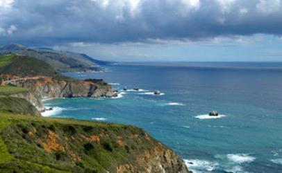
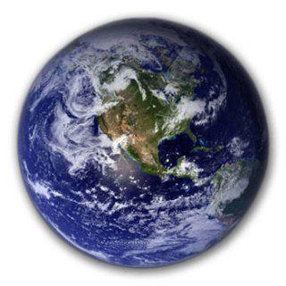
Looking at the physical map of the hemispheres, one can notice the uneven distribution of land and water on the surface of the planet. Huge continents are scattered in the vastness of the oceans like islands. In the Southern Hemisphere, land accounts for less than 20%, in the Northern Hemisphere - about 40%. What is called the World Ocean in geography, ecology and other Earth sciences? This is the most significant part of the hydrosphere - the water shell of our planet. How many oceans are there on Earth, which one is the largest and warmest? These and many other questions are answered in this article.
What is called the World Ocean (MO)?
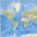
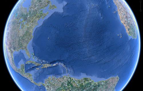
All water on Earth forms a single shell, parts of which are connected by the circulation of H 2 O molecules and other substances. MO is a continuous part of the hydrosphere, which accounts for over 94% of the total area of water on the planet (oceans, seas, bays, straits, rivers, lakes and ponds). Usually, Russian geographers distinguish 4 main parts of the World Ocean. We list them in descending order of surface area (million km 2): Pacific (179), Atlantic (92), Indian (76), Arctic (15).
How did people become aware of the interconnectedness between the oceans?
Since ancient times, people have been attracted by the vast expanses of the sea. Already in ancient times, on fragile boats, rafts and catamarans, fishermen set off on dangerous water journeys. The history of the World Ocean mentions ancient descriptions, legends, legends about overcoming huge distances on rafts, rowing and sailing ships. It is believed that the settlement of continents and islands in ancient times was due to the ability of people to overcome the oceans and seas.
The first known circumnavigation of the world was made by a Spanish squadron under the leadership of Ferdinand Magellan in 1519-1522. Moving from the Iberian Peninsula to the west, the ships crossed the Atlantic Ocean, circled South America, entered unknown waters. The weather was calm, so Magellan named the Pacific Ocean. In a skirmish with the natives in the Philippine Islands, many Spanish sailors, along with the head of the expedition, died. Magellan's companions continued their journey to the west in search of spices, gold, jewels for the Spanish crown.
One of the ships, led by Captain Juan Elcano, crossed the central part of the Indian Ocean, circled Africa from the south and returned to Europe. So the sphericity of the Earth was proved, the existence of another part of the oceans was established. The round-the-world voyage and other travels marked the beginning of a large-scale study of water spaces in the interests of trade, science, industry and fisheries.
MO - the main part of the hydrosphere
When studying the topic "World Ocean" (Grade 7), it is necessary to recall the previously studied material of Grade 6 ("Hydrosphere"). The single one consists of two parts of unequal size - MO and land water. They are interconnected by the circulation of substances and energy, moisture transfer, surface and underground runoff. What is called the World Ocean in modern science? The term itself has been used in relation to large bodies of water since the 17th century thanks to the work of the German-Dutch explorer Bernhard Varenius.
At the beginning of the 20th century, the Russian scientist Yu. M. Shokalsky introduced the term “World Ocean” into scientific use, identified 4 main parts of the MO. These are huge oceanic natural complexes, separated from each other by continents and archipelagos (chains of islands). Insignificant offshoots of the MO are bays, straits, seas (marginal and inland).
The traditional division of MO into parts
The boundaries are often conditional, since there is a single body of water - the World Ocean. The MO map gives an idea of the diversity of dividing lines. For example, the Pacific Ocean and the Arctic Ocean are separated from each other by peninsulas (Chukchi and Alaska), connected by a narrow border between the Atlantic and Indian Oceans south of Africa is drawn at 20 ° E. d.
In a number of countries, it is customary to divide the main body of the hydrosphere into 5 or even 7 separate regions. In these cases, the Southern Ocean and two parts of the Atlantic are added. Depending on the country of residence, the answer to the usual school curriculum question “What is called the World Ocean?” differs in the number of parts allocated in its composition (the oceans of the Earth).
The science of the oceans and its parts
The study of the bottom topography, temperature, salinity of waters, currents and other features of large bodies of water is carried out by oceanology (a branch of geography). Different parts of MO differ in the content of dissolved substances, density, which are measured using modern instruments at tens of thousands of points.
Determination of depths using echolocation made it possible to calculate the total amount of sea water on Earth and the compounds dissolved in it (chlorides, sulfates, iodides, which are of practical importance). The waters of the World Ocean have an average density of 1.024 g/cm 3 . Such a liquid freezes not at 0 ° C, but at -1 ... -3 ° C. The deeper, the less temperature indicators depend on geographic latitude.
Depth of the World Ocean
How to find out the largest and smallest distances to the bottom surface? What are the depths in which the oceans differ? The MO map contains information about the average and maximum depth. Sea areas are marked with different shades of blue. The dark coloring on the maps corresponds to the deepest places.
Light blue is used to represent shoals, mid-ocean ridges. The Pacific Ocean is considered the deepest, in its northwestern part it is over 11 km deep. The Peru Trench passes along the western coast of Chile (about 7 km). And the average depth of MO is 3.7 km.
Bottom relief
The continuation of the surface of the continents under water is a continental shelf, its depth in some places reaches 1 km. The world ocean along the entire perimeter has another transitional zone - the continental slope. Within the continental shelf, plains of various origins are distinguished, there are deeply subsided areas in the Sea of Okhotsk, the Barents Sea, and the Sea of Japan. The ocean floor covers the central parts of the bottom and represents basins and hills of various shapes and sizes. Deep-sea trenches arose in areas of collision of oceanic lithospheric plates with continental ones.
Among the mountain structures of the seabed, mid-ocean swells and ridges predominate, which are connected into a single continuous chain with a length of over 40 thousand km. In addition, blocky and volcanic ridges, massifs and single underwater peaks are distinguished on the ocean floor. Other bottoms are plateaus and uplands.
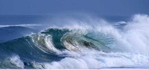
Water movements in MO
Various causes and natural phenomena cause the movement of water masses in the oceans:
On the maps of the Moscow Region in the atlases, the currents are indicated by red and blue arrows. Color conveys a feature such as a higher or lower temperature in a current compared to the ocean environment. The largest warm watercourses: the Gulf Stream in the northwestern part of the Atlantic, Kuroshio near the Japanese Islands, the North Atlantic Current. Cold water currents in Moscow Region: the course of the Western winds, Peruvian, Benguela.
MO water temperature
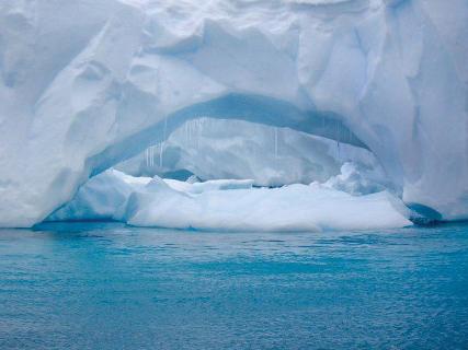
The polar and subpolar parts of MO are the coldest. A significant surface area of the Arctic Ocean is covered with long-term ice of great thickness. In the Arctic and Antarctic there are ice fields and blocks in the water - icebergs. The coldest ocean is the Arctic Ocean, a significant part of which is ice-bound all year round. As you move from the Arctic Circles to the temperate zones, the Northern and Southern tropics, the water is heated more by the Sun. The warmest is the Pacific Ocean, the widest in the hot zone of illumination.

Surface water temperature changes faster. As a rule, the main flow of solar energy does not penetrate to depth. Therefore, in summer in temperate and tropical latitudes, the surface water temperature is higher than in winter. At great depths, seasonal differences are almost not felt. When moving from the surface for the first hundreds of meters, a strong decrease in temperature is noticeable. Above 1 thousand meters, the changes are less pronounced, and below 3 thousand meters, the temperature is constantly in the range of +2 ° ... 0 ° С.
Influence of MO on the climate of the continents
The oceans are important for the formation of climate and weather on land. At the surface of the water, MO is 17.4 °C, while at the surface of the Earth this figure is 14.4 °C. The oceans can have a significant impact on the exchange of heat and moisture between the atmosphere and land. Water heats up and cools down more slowly than the continents and islands, due to the large specific heat capacity.
Currents move cold to warmer regions and vice versa. These processes have a great impact on the distribution of air pressure and temperature. In winter, MO is a kind of "stove" for heating the continents, and in summer - a "refrigerator". The existing problems of the World Ocean - melting ice, rising water levels - threaten to change climatic conditions and vegetation on the continents, natural disasters.
Salinity
Almost all the elements of the periodic table are present in sea water in different quantities. The average content of various salts is 3.5%. A special unit of measure is used - ppm - showing the amount of dissolved substances in grams per 1 liter of sea water (0 / 00). The average salinity index MO is 35 0/00. There is a connection between the geographical position, the distribution of surface currents, evaporation, salinity and other properties that distinguish the World Ocean. The water resources of the Moscow Region far exceed those on land. Evaporation is used to extract useful compounds, and special desalination plants are used to obtain drinking water on ships and in the coastal regions of many countries.
A significant amount of salt accumulates in the ocean waters, which are between 45 ° N. sh. and 10°S sh. The content of substances in sea water depends on the surface runoff from the mainland, the thickness of the ice and its melting. The most saline parts of MO are confined to tropical latitudes. This is the northwestern part of the Indian Ocean - the Red Sea and the Bab el-Mandeb Strait (41 and 42 ‰, respectively). is 39‰.
Natural resources MO
A pantry of valuable chemicals, fuels, a source of energy, fresh water, food, a home for many living organisms - all this is the World Ocean. The geography of mineral reserves is still insufficiently studied at great depths, and development on the shelf has been going on for many decades. The following natural resources of MO are of great value:
- fuel (extraction of oil, gas, coal);
- metallic and non-metallic minerals (table salt, iron, manganese, bromine, calcium, gold, diamonds, amber, titanium, tin);
- energy (tides, waves, hot springs);
- building materials (sand, gravel);
- water supplies for desalination;
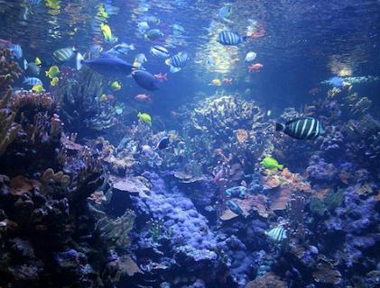
- fish, marine mammals, crustaceans, mollusks, sponges;
- vegetable;
- recreational.
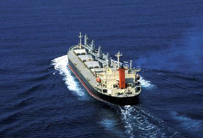
Since ancient times, the coastal zone has been used for shipping, marine fishing, cruise and beach holidays, and restoring the health of the population. Popular beaches are located on the warm sandy coasts of the Mediterranean, Red and Black Seas, Atlantic, Indian, Pacific Oceans in the subtropical and tropical climatic zones.
Environmental are largely associated with the growth of mining. When oil and oil products are spilled, an airtight film forms on the surface of the water. The exchange of oxygen and carbon dioxide between the atmosphere and the ocean is disturbed, aquatic animals and plants die.
"Fish Latitudes" of the World Ocean
The oceans and seas are areas of intensive fishing, coral and pearl mining. The share of sea fishing accounts for approximately 10% of food raw materials. Commercial fish of the oceans are sardines, anchovies, herring, tuna, salmon, hake, capelin, mackerel, notothenia, pollock, cod, halibut, sprat, flounder.
In those latitudes where there are conditions for the development of plankton, an abundance of fish is observed. For the reproduction of small organisms suspended in water, it is necessary that the so-called biogenic elements (nitrogen, silicon, phosphorus, calcium, and others) rise from the bottom. Nature has created similar conditions in many regions of the Moscow region:
- off the Pacific coast of South America south of the equator;
- in the region of the Labrador Peninsula, off East Greenland in the north;
- near the coasts of Europe and North America in the Atlantic Ocean, near 40°N. sh.;
- from the coast of Morocco in West Africa to the extreme point in the south of the hot continent;
- off the coast of Burma in the Indian Ocean, in the region of the islands of Indonesia.
The World Ocean, as the most significant part of the continuous water shell of the Earth, plays a huge role on the planet, and its wealth has been used by man since time immemorial. Parts of the MO differ in certain characteristics, but this is an integral natural complex on a planetary scale, which must be preserved for the well-being of present and future generations.