RELIEF AND GEOLOGICAL STRUCTURE
The main features of orography and their relationship with tectonics
Orography. The relief of the surface of Russia is extremely diverse and complex. The endless expanses of plains and plateaus give way to majestic mountain ranges, low ancient ridges, graceful volcanic cones, vast mountain ranges and large intermontane basins. On hypsometric and physical maps, as well as on images from Space, the orographic pattern of the territory of Russia is clearly visible, i.e. the relative position of various large landforms: low and raised plains, plateaus, highlands, mountain ranges and massifs.
When looking at the map, two features of the relief are striking: 1) the predominance of plains in the western and central parts of the country, and mountains along its eastern and partly southern outskirts; 2) lower altitude position of the western part compared to the eastern one. The border between them is clearly visible from the prevailing coloring of the map and clearly coincides with the Yenisei valley. The third feature can be traced upon a more detailed examination of the map: the greater height of the southern mountains in comparison with the eastern ones. Caucasus and Altai are among high mountains of Eurasia.
In general, the territory of Russia forms a huge amphitheater, open to the north and north-west, therefore, the largest rivers of the country - the Ob, Yenisei, Lena - carry their waters to the north.
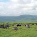
Plains occupy about 60% of the country's territory. They stretched from the western borders of Russia to the Lena, from the coast of the Arctic Ocean to the foothills of the Caucasus, Altai and Sayan Mountains. The two largest plains of Russia - East European and West Siberian - are among the greatest plains in the world.
The East European Plain stands out among other plains for the most diverse relief. There are large hills here, individual marks of which exceed 300 and even 400 m (the highest point of the Bugulma-Belebey Upland reaches 479 m), and extensive lowlands with small hills and ridges scattered along them (in the north) or rather uniform (Caspian Sea region). The lowest parts of the plain are located in the coastal strip of the Caspian Sea with a height of 26 m.The average height of the plain is 170 m.
In the extreme northwest of the country, within the Kola Peninsula, on the large intrusive massifs of the Khibiny, Lovozersky and Monchetundra, some peaks exceed 1100 m; the highest of them - Mount Chasnachorr (1191 m) in the Khibiny.
The West Siberian Plain is distinguished by an exceptionally uniform relief with insignificant fluctuations in altitude. Only some small areas in the marginal parts of the plain exceed 200 m. It reaches its maximum heights on the Severo-Sosvinskaya (290 m) and Verkhnetazovskaya (285 m) uplands. Almost half of the territory lies below 100 m above sea level. The average height of the plains is only 120 m.
The East European and West Siberian plains are separated by low and narrow (up to 150 km) Ural mountains, only some peaks of which exceed 1500 m. The highest point of the Urals is Mount Narodnaya (1895 m).
In the interfluve of the Yenisei and Lena rivers is located Central Siberian plateau- a plain raised to a considerable height (up to 400-600 m and higher) and deeply dissected by large river valleys. It reaches its highest heights within the Putorana plateau (1701 m). The average height of the plateau is 480 m.
To the east, the Central Siberian Plateau gradually passes into the Central Yakutsk Plain, and to the north it descends with a steep ledge to the North Siberian Lowland.
The mountain frame in the southwest is represented by mountains Greater Caucasus stretching from the Black Sea to the Caspian Sea. Here is the highest point of Russia - two-headed Elbrus(5642 m) and all other "five-thousanders". The southern mountain belt of Siberia begins from Altai. It is represented by high-mountain and mid-mountain ranges Altai(Belukha city - 4506 m) and Sayan(Mount Munku-Sardyk - 3491 m), mountain ranges and highlands of Tuva, the Baikal region and Transbaikalia. In Transbaikalia, the highest peaks reach Stan Highlands(highest point - 3073 m). Across Back ridge the mountains of southern Siberia are connected with the mountain structures of the eastern outskirts.
To the east of the Lena River and up to the shores of the Pacific Ocean, there are medium-altitude ridges and highlands: Verkhoyansk(2389 m), ridge Chersky(Pobeda town - 3003 m), Suntar-Hayata(2959 m), Dzhugdzhur(1906 m), Yano-Oymyakonskoe, Kolymskoe, Chukotskoe, Koryaksky(Ice Mountain - 2453 m). To the south, they pass into the low and medium-altitude ridges of the Amur Region, Primorye (Sikhote-Alin) and Sakhalin, the maximum marks of which do not reach 2500 m. The eastern outpost is represented by folded and volcanic mountains of Kamchatka and the Kuriles. Kamchatka has the highest point of the Asian territory of Russia - an active volcano Klyuchevskaya Sopka(4688 m). All the highest peaks of Kamchatka and the Kuriles are active or extinct volcanoes.
The territory of Russia is characterized by the predominance of low and medium-altitude mountains. Mountains with a height of more than 1500 m occupy less than 10% of the country's area.
Thus, the eastern and southeastern outskirts of Russia are represented by mountain structures. In the southwest, at the southern border of the East European Plain, the lonely Caucasus rises.
Tectonic structure and history of development. To understand the patterns of the distribution of mountains and plains on the territory of the country, it is enough to look at the position of the territory in relation to the large lithospheric plates of our planet. Most of the territory of Russia is located within the Eurasian plate - one of the largest lithospheric plates (see Fig. 4).
Rice. 4. Map of the boundaries of the lithospheric plates of Northern Eurasia
The East European and West Siberian Plains are located in its central part, while the Central Siberian Plateau is closer to the eastern outskirts. Mountains are located along the edges of the slab. Where the state border of Russia runs in the inner parts of the plate (western border, most of the border with Kazakhstan), there are no border mountains. In the same place, where its boundaries approach the boundaries of the plate (Caucasus, Altai and further to the southwestern outskirts of Lake Baikal), there are mountains.
In the east, the North American, Okhotsk Sea, and Amur plates, which recently adjoined or are now split off, border the Eurasian plate. These three mesoplites separate the Eurasian plate proper from the Pacific one with which it interacts. The mountain structures of the eastern part of Russia are confined to this marginal part, which is part of the planetary compression zone. However, here, along the strike of the ridges, one can clearly define the boundaries of the plates; for example, Dzhugdzhur, Sette-Daban, Suntar-Khayata, the ranges of Kamchatka and Sakhalin border the Okhotsk plate.
The current position of the lithospheric plates, their structure, outlines and boundaries are the result of a long and complex geological development over hundreds of millions of years.
Let's compare the physical map with the tectonic one. The large plains of our country correspond to platforms, and mountain structures correspond to folded areas of various ages. As a matter of fact, there are no areas on the territory of Russia that would not have undergone folding processes. In some places, folding ended long ago, in the Archean or Proterozoic. Since the beginning of the Paleozoic, such territories have existed in the form of rigid, stable platforms, or cratons. In other places, folding proceeded much later, already in the Phanerozoic, in its different periods, in still others it has not ended even now. These areas, according to the geosynclinal theory of the development of the earth's crust, are called geosynclines.
Geosyncline is a linear area of high mobility and permeability of the earth's crust. The geosyncline is characterized by a significant amplitude of the velocity and contrast of vertical and horizontal movements, strong magmatic activity, the predominance of subsidence and the accumulation of thick strata of marine, and sometimes partly continental sedimentary and volcanogenic rocks. From the standpoint of tectonics of lithospheric plates, a geosyncline corresponds to an active continental margin (eugeosyncline) or its passive margin (myogeosyncline).
All continents at one time or another have passed the stage of geosyncline in their development. Various territories of our country also passed it. At the final stage of geosyncline development, folding occurs, which is accompanied by vertical uplifts, intrusion intrusion, and often intense manifestation of volcanism (all this occurs when lithospheric plates collide). Mineralization and the formation of ore deposits are associated with magmatic processes. So, as a result of the completion of the development of geosynclines, folded areas(belts).
The most ancient folded regions were formed on the territory of Russia in the Archean and Proterozoic (2600-500 million years ago). They are composed of pre-Paleozoic rocks. They form the lower structural layer of the platforms - their folded foundation.
Platforms are stable areas of the earth's crust with relatively little mobility. They are characterized by weak dissection into areas of uplifts and subsidences, significantly smaller than in geosynclines, the amplitudes of oscillatory movements, a lesser and qualitatively different development of magmatic processes.
On the territory of Russia there are two ancient platforms - East European and Siberian. Both of them have a two-tiered structure: a folded basement of crystalline and igneous rocks of the Archean-Proterozoic age and a Paleozoic-Cenozoic sedimentary cover. The sedimentary rocks of the cover lie calmly, usually subhorizontal. Sedimentation was interrupted during periods of uplift and was replaced by drift processes.
The East European Platform is bounded in the east by the Ural folded structures, in the south by the young Scythian plate, adjacent to the folded structures of the Caucasus, in the north it continues under the waters of the Barents Sea, and in the west it extends far beyond the borders of Russia. Within it there are two shields, one of which - Baltic- enters the territory of the Kola Peninsula and Karelia, the second - Ukrainian - is completely outside Russia. Rest of platform space: takes up Russian plate.
Shallow foundation is typical for Voronezh anteclise(first hundreds of meters) and some positive structures Volga-Ural vault... In the syneclises ( Moscow, Pechora, Baltic) the foundation is lowered by 2-4 km. The greatest depth of the foundation is typical for Caspian syneclise(15-20 km).
The Siberian platform is completely located within Russia and within its borders almost corresponds to the Central Siberian plateau *. In terms of its structure, it is in many ways similar to the East European. Its Archean-Proterozoic basement also forms a vast shield ( Aldan) on the outskirts of the platform and much smaller ( Anabar), surrounded on all sides by a sedimentary cover. The rest of the platform is represented by Leno-Yenisei plate with a sedimentary cover reaching maximum thickness (8-12 km) in the deepest depressions of vast Tunguska and Vilyui syneclise... The average thickness of the earth's crust (35-45 km) is approximately the same within both platforms.
At the same time, the Siberian platform differs in many respects from the East European one. If the East European platform is a single isometric block, then the Siberian one consists of two unequal parts - Angarsk-Anabar and Aldan, which, in all likelihood, were independent ancient platforms and were connected by a strip of Baikal-Caledonian folding. In this case, the Siberian Platform as a single tectonic structure has existed only since the Middle Paleozoic (E.E. Milanovsky, 1987).
Another significant difference is that platform trap magmatism manifested itself in the Permian-Triassic within the Siberian platform. Formations of the trap formation, represented by thick lava sheets, bedded and intersecting intrusions, compose the upper part of the section of the huge Tunguska syneclise and adjacent territories.
There have been eras of folding in the history of the Earth, when folding processes proceeded especially vigorously and ended with the emergence of large folded regions in place of geosynclines: Baikal, Caledonian (Salairian and Caledonian proper), Hercynian (Varissian), Mesozoic (Cimmerian and Laramian), Cenozoic Pacific (Alpine) ).
Baikal folding occurred in the Late Proterozoic - Lower Cambrian. The structures she created partly became part of the basement of the platforms, consolidating the more ancient blocks, and also adjoin the margins of the ancient platforms. They outline from the north, west and south the Siberian platform (Taimyr-Severozemelskaya, Baikal-Vitimskaya and Yenisei-East Sayan regions). The Timan-Pechora-Barents Sea region is located on the northeastern edge of the East European Platform. Apparently, at the same time, the Irtysh-Nadym block was formed, which occupies a central position within the West Siberian Plain. Areas of Baikal folding E.E. Milanovsky (1983, 1987) refers to metaplatform scopes.
In the Phanerozoic, along with ancient platforms and adjoining metaplatform areas, there are so-called mobile belts, three of which enter the territory of Russia: the Ural-Mongolian, Pacific and Mediterranean. In their development, the mobile belts go through two main stages: geosynclinal and postgeosynclinal, or epigeosynclinal fold belt, the change of which in different belts and even in different areas of a single belt occurred at different times and lasted until the end of the Phanerozoic.
The features of the first stage have already been discussed when characterizing geosynclines. The tectonic regime of the second stage is significantly inferior in its activity to the geosynclinal one, but at the same time surpasses the tectonic regime of ancient platforms.
Paleozoic Ural-Mongolian belt located between the ancient East European and Siberian platforms and forms the southern framing of the latter **. Sagging within this belt began in the Late Proterozoic, and in the Lower Paleozoic, caledonian folding. The main phases of folding fall on the end of the Cambrian - the beginning of the Ordovician (Salair), the middle - the Upper Ordovician, the end of the Silurian - the beginning of the Devonian. As a result of the Caledonian folding, mountain structures were created in the Western Sayan, Kuznetsk Alatau, Salair, in the eastern regions of Altai, in Tuva, in a significant part of Transbaikalia, in the southern regions of Western Siberia, adjacent to the western part of the Kazakh Upland, where the Caledonian folding was also final. In all these areas, the Lower Paleozoic deposits are intensely folded and metamorphosed. The Precambrian basement is often visible through their cover.
In the Upper Paleozoic (Late Devonian - Early Carboniferous and Late Carboniferous - Permian) Hercynian(varissian) folding. It was the final one in the vast area of Western Siberia, consolidating the previously existing blocks, in the Ural-Novaya Zemlya region, in the western regions of Altai, in the Tom-Kolyvan zone. It also manifested itself in the Mongol-Okhotsk zone.
Thus, by the end of the Paleozoic, an intracontinental folding zone was formed within the Ural-Mongolian mobile belt, which welded two ancient platforms into a single large structure, a rigid block, which became the core of the Eurasian lithospheric plate. There was also an increase in the area of platforms due to the emergence of folded structures along their southern outskirts.
Later (in the Mesozoic), within the Ural-Mongolian belt, young Epipaleozoic plates (quasi-cratons), including West Siberian, almost entirely located on the territory of Russia. They are confined to areas that experienced general immersion in the Meso-Cenozoic.
Usually, plates are formed over those areas of mobile belts, in the structural plan of which blocks of ancient consolidation - the middle massifs - play a significant role. Young slabs do not always strictly "fit" into the contours of the moving belt. They can also overlap with areas of ancient platforms adjacent to the mobile belt (metaplatform areas), as is the case on the eastern edge of the West Siberian plate. The cover of young platforms is composed of sedimentary strata of the Meso-Cenozoic age. The thickness of the cover ranges from several hundred meters - a kilometer in the marginal parts to 8-12 km in the deepest northern part of the West Siberian plate.
The Pacific mobile belt occupies a marginal position between the ancient Siberian platform and the oceanic lithospheric plate of the Pacific Ocean (see Fig. 5). It includes folded structures of the North-East and the Far East.
Rice. 5. The main tectonic structures of Russia (according to V.M. Muratov)

Designations in Figure 5: I - ancient platforms (a - shields, b - slabs); II - Ural-Mongolian belt (c - Baikalids, d - Salairids, e - Caledonides, f - Hercynides, g - marginal troughs, h - young plates); III - Mediterranean belt (and - alpine folded areas, k - marginal troughs, l - young plates); IV - Pacific belt (m - Mesozoic folded areas, n - middle massifs, o - marginal troughs, n - Laramian folded areas, p - marginal volcanic belt, c - Cenozoic folded areas). Figures on the map: I - ancient platforms. East European platform - 1 - Baltic shield, 2 - Russian plate; Siberian platform - 3 - Anabar shield, 4 - Aldan shield, 5 - Taimyr shield, 6 - Central Siberian plate. II - Ural-Mongolian belt. Baikal folded areas - 7 - Baikal-Patom, 8 - Sayano-Yenisei; Salair folded areas - 9 - Barguzino-Vitimskaya, 10 - East Sayan, Tuvinskaya, Kuznetsk-Alatauskaya; Caledonian folded areas - 11 - West Sayan and Gorno-Altai; Hercynian folded regions - 12 - Ural, 13 - Tom-Kolyvan and Salair, 14 - Mongol-Okhotsk; Hercynian foredeeps - 15 - Pre-Ural, 16 - Kuznetsk; young plates - 17 - West Siberian, 18 - Timan-Pechora, III - Mediterranean belt. Alpine folded structures - 19 - Caucasus; foredeeps - 20 - Indolo-Kuban, 21 - Tersko-Caspian; young slabs - 22 - Scythian. IV - Pacific belt. Mesozoic fold areas - 23 - Verkhoyansk-Chukotka fold system; middle massifs - 24 - Kolymsky, 25 - Smolensky, 26 - Okhotsk, 27 - Chukotka-Yukonsky; Mesozoic foredeep - 28 - Predverkhoyanskiy; Laramian fold areas - 29 - Sikhote-Alin fold system, 30 - Koryak; marginal volcanic belt - 31 - Okhotsk-Chukotka, 32 - Sikhote-Alin; Cenozoic fold area - 33 - Kamchatka-Olyutorskaya, 34 - Sakhalin, 35 - Kuril Islands, 36 - Commander Islands
Some parts of this belt completed the period of geosynclinal development in the Precambrian or Paleozoic and form middle massifs, the largest of which are Kolymsky and Bureinsky(a kind of "microplatforms" with a shield and a slab); others experienced folding in the Mesozoic, and still others in the Cenozoic.
The Verkhoyansk-Chukotka fold area was created Cimmerian folding(late Cimmerian, or Kolyma, late Jurassic - middle chalk). The Okhotsk-Chukotka volcanogenic belt stretches along the southeastern margin of this area, which in the southern part of the Far East passes into the Primorskii volcanogenic belt, which separates the mesozoids of this region from the Pacific folding. Here, the Early and Late Cimmerian folding appeared, which created the Mesozoic structures of the Amur region and the central part of the Sikhote-Alin, and Laram searched (the end of the Cretaceous - the beginning of the Paleogene), culminating in the formation of folded structures in the Sikhote-Alin. The Laramiya folding also created the Koryak region.
Mountain structures of Sakhalin and Kamchatka arose as a result of pacific folding, which manifested itself in the Oligocene and mainly in the Neogene-Quaternary time, i.e. are at the orogenic stage of development. These are the youngest folded and volcanic mountains in Russia. The Kuril Islands have not yet completed their geosynclinal development; These are modern island arcs with a deep-sea trench located next to them, clearly identifying the subduction zone of the Pacific lithospheric plate. The vast areas here are occupied by the oceanic crust. The island arcs themselves are characterized by the early stages of the formation of the continental crust.
The continuing tectonic activity, especially along the eastern margin of this belt, is evidenced by intense volcanic activity, a large amplitude of Quaternary uplifts and a high seismicity of the region.
The Mediterranean mobile belt stretches along the southwestern margin of the Eurasian plate. Like the Ural-Mongolian belt, during the period of its geosynclinal development, it occupied an interplatform position, and in the postgeosynclinal one - an intracontinental and partially intercontinental position. It was formed when the Eurasian plate approached the African-Arabian and Indo-Australian plates. It approaches the borders of Russia only in the region of the Greater Caucasus.
This belt was laid down in the Riphean. Its different parts (segments) completed geosynclinal development at different times. The central part, which includes the Caucasus, closed at the end of the Pliocene and belongs to the Alpine folded region. Moreover, the Caucasus is the most typical link in the Alpine folded structures.
The outer zone of this belt is represented by Scythian plate, the folded base of which was created by the Hercynian folding and in the foredeeps is lowered by 6-8 km (maximum up to 12 km), and the inner - folded region of the Caucasus. The Greater Caucasus belongs to the outer anticlinoria of the Alpine-Himalayan folded region. Beneath it there is a "granite root" of mountains with a crustal thickness of up to 60 km (MN Smirnova, 1984). Both the Early Cimmerian and Laramian folding occurred within the belt, but the Cenozoic folding in the Pliocene was the final one.
Although the formation of the fold belt has been completed here, the territory still retains significant mobility.
The presence of high ridges and Transcaucasian intermontane depressions, earthquakes, and cases of volcanism in the recent past testify to the continuing orogenic development. The continental crust has been forming for a long geological time and, probably, its formation is not yet complete.
The relationship of minerals with geological structure and tectonics. Mineral resources reveal an even closer connection than the relief with the history of the geological development of the territory. Ore minerals were formed from magma that penetrated the earth's crust as a result of its differentiation. Magmatic activity is most actively manifested in geosynclines at the final stage of their development; therefore, ore minerals are confined to folded areas.
Features of the geological development of one or another folded belt and its individual parts are reflected in the wealth of minerals and their diversity. Where magmatic activity manifested itself already in the early stages of the development of the mobile belt (intense subsidence and formation of island arcs), basic and ultrabasic igneous rocks predominate. Copper pyrite, copper-nickel, chromium and titanomagnetite ores, deposits of cobalt and platinum are associated with them. At the final orogenic stage, granitoid magmatism develops. Granite magma in different regions is geochemically heterogeneous, therefore, in some cases, this magmatism is associated with polymetallic mineralization (lead-zinc ores), gold, silver, in others - rare metal(tungsten-molybdenum, tin, tungsten ores, etc.). Mercury-ore belts are connected with deep faults.
The more active magmatic activity is manifested within the mobile belt, the richer it is in minerals. The more varied was the composition of magma, the more varied the set of minerals. The fold areas of the Ural-Mongolian mobile belt are the richest in various minerals, the Urals especially stands out. The metallogeny of the Pacific belt is characterized by the predominance of tin, tungsten, and gold. In the Caucasus, which is part of the Mediterranean belt, there are deposits of copper-zinc and tungsten-molybdenum ores.
Within the platforms, ore fossils are confined to a folded base, which for the most part is buried under a thick sedimentary cover. Iron ores and gold associated with Archean-Proterozoic and Baikal folded structures (Aldan shield, Yenisei massif, Voronezh anteclise, Baltic shield) are mined only on shields and massifs, as well as within some anteclises.
The main mineral resources of the platforms are associated with their sedimentary cover. First of all, these are fossil fuels. At the bottom of seas, lakes and in swamps, organic remains accumulated, which later turned into vast oil and gas deposits, deposits of coal and brown coal, and oil shale. All platforms have these deposits, but the Siberian platform is distinguished primarily by coal reserves, and the young West Siberian plate - by oil and gas. Rock and potash salts, phosphorites, bauxites, leguminous iron ores, and cuprous sandstones are also associated with the sedimentary cover.
There are certain patterns in the distribution of certain minerals in the sedimentary cover, depending on the tectonic and climatic conditions in which these strata accumulated. During the period of marine transgressions, deposits of sedimentary iron, manganese ores and phosphorites were formed; with a stable position of the sea, there was an accumulation of organic-rich sandy-clayey strata (from which oil and gas deposits subsequently arose), opokas or limestones; During regressions, salts and cuprous sandstones accumulated in the lagoons of arid regions, and coals accumulated on swampy coasts in humid conditions.
Individual geological periods are characterized by their own combinations of conditions that are most favorable for the formation of one or another mineral or a group of them: redox conditions, hot or cold, dry or humid climates, the predominance of certain groups of organisms, etc. So, coal deposits are associated with carbonic deposits, with Permian - salts, with Cretaceous - brown coal, oil and gas, and with Oligocene - manganese.
In folded areas, minerals confined to the sedimentary cover are found only in the marginal troughs and in the cover of intermontane depressions.
The variety of geological structure and the enormous size of the territory of Russia have led to the presence of a wide variety of minerals in our country. In terms of the reserves of many of them, our Motherland occupies one of the leading places in the world. So, for coal, natural gas, iron ores, rock salts, Russia takes the first place, for oil - the second (after Saudi Arabia), etc. In general, Russia has huge reserves of almost all types of minerals and can provide all industries associated with the use of mineral raw materials.
"of our site.
Read the descriptions nature of the world can be found in the "Physical geography of continents" section of our website.
See also " Dictionary of Physical Geography", which has the following sections: