The relief of Russia is characterized by heterogeneity and contrast: high mountain ranges are adjacent to vast plains and lowlands. Almost 2/3 of the country's territory is occupied by endless plains of various shapes and heights. The variety of landscapes in Russia is explained by the large occupied area and the peculiarities of geological development.
Features of the relief of Russia
The relief is a complex of all the irregularities of the earth's surface, which can be both convex and concave. Based on these features, the relief is conventionally divided into two large groups: mountains and plains.
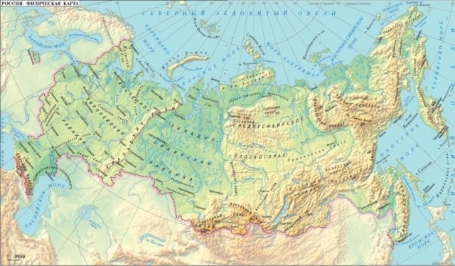
Rice. 1. Relief map of Russia
The relief of the Russian Federation is very diverse. The country is dominated by flat land areas rich in minerals: oil, natural gas, coal, shale, iron ores, gold and many other mineral resources.
The plains alternate with the heights of the mountain ranges. The highest point not only in the country, but throughout Europe is the famous Mount Elbrus (5642 m.), Located in the Caucasus. There are also other five-thousanders: Kazbek, Dykhtau, Shkhara, Pushkin Peak.
The Caucasus Mountains, located between the Caspian and Black Seas, are divided into two mountain systems: the Lesser Caucasus and the Greater Caucasus. All the highest peaks are located in the latter, where glaciers and eternal snow reign at high altitudes.
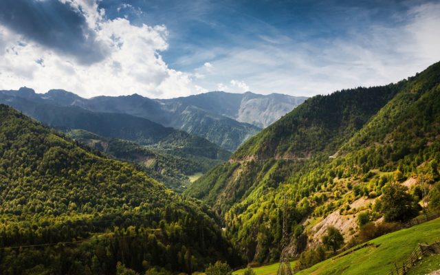
Fig. 2. Caucasus mountains
The Caspian lowland is located 28 m below sea level. Such fluctuations in altitude - about 5700 m - in the territory of one state are very impressive.
TOP-4 articleswho read along with this
Position of Russia in relation to large landforms
The variety of landforms and their location is closely related to the geological features of the territory. On the surface of young and ancient platforms of Russia, large plains lie at different heights, occupying the main part of the country's area:
- East European (also called Russian);
- West Siberian;
- Central Siberian plateau.
The central part of Russia is located on the East European Plain, which is considered one of the largest in the world.
The Russian and West Siberian plains are separated by the ridges of the Ural Mountains, the total length of which is more than 2.5 thousand km. In the southeast, the Russian Plain is bounded by the Altai mountain system.
Average altitudes of the Central Siberian Plateau range from 500-700 m above the level of the World Ocean.
In the northeast of the Russian Federation, there is the Pacific folding belt, which includes Kamchatka, the Kuril Islands and Sakhalin Island.
All of the above islands are the peaks of ancient sea mountains, the growth of which continues to this day. It is for this reason that frequent and intense earthquakes are characteristic of this region.
In the northwest, the country's territory is located on the Baltic Crystalline Shield. This region is characterized by lacustrine and sea plains, low mountains and marshy lowlands.
Mountain systems of the Russian Federation
Mountains in Russia occupy almost 1/3 of the entire territory.
- On the border of the Asian and European parts of the state, the Ural Mountains are located - the oldest and longest. They are not very tall, and are currently badly destroyed. On average, the height of the Ural Mountains does not exceed 400 m, and the highest point is Mount Narodnaya (1895 m).
- In the south of the Russian Federation, there is a young mountain system called the Greater Caucasus, which serves as a natural border between Georgia and Azerbaijan. Mount Elbrus (5642 m.) - the highest point.
- Altai Mountains are located in the south of Siberia. They are relatively low, but their growth is still ongoing. The highest point is Mount Belukha (4506 m.).
- Kamchatka has high mountain ranges with volcanic peaks. It is there that the world's largest active volcano - Klyuchevskaya Sopka (4850 m.) Is located.

Average rating: 4.7. Total ratings received: 362.